A Diver's Guide to Michigan Underwater Preserves · A Diver’s Guide to ... dear friends who both...
64
A Diver’s Guide to ALSO AVAILABLE AT WWW.MICHIGANPRESERVES.ORG
Transcript of A Diver's Guide to Michigan Underwater Preserves · A Diver’s Guide to ... dear friends who both...

A Diver’s Guide to
ALSO AVAILABLE AT WWW.MICHIGANPRESERVES.ORG


A Diver’s Guide to
Michigan Underwater Preserve Council, Inc.A Michigan Non-profit Corporation
560 N. State StreetSt. Ignace, MI 49781
Copies available: 1-800-970-8717
Edited by Larry Sanders
Published byJ.R. Underhill Communications
www.jrunderhill.com
Front cover photo: Diver surveys a site at Haserot Beach in the Grand Traverse Bay Underwater Preserve,
courtesy of Chris Doyal
©2011 Michigan Underwater Preserve Council, Inc. All rights reserved.
Dive Shop and Charter information updated September 2017

Dedicatedto the memory
of Jim Montcalm(1949-2006)
andMark Kistner(1955-2009)

Table of ContentsForeword . . . . . . . . . . . . . . . . . . . . . . . . . . . . 4 Michigan Underwater Preserve Council . . . . 5
Michigan’s Underwater Preserve System . . . . . 6
Alger Underwater Preserve . . . . . . . . . . . 8
DeTour Passage Underwater Preserve . . . . . . 11
Grand Traverse Bay Underwater Preserve . . . 14
Isle Royale National Park . . . . . . . . . . . . . . . 17
Keweenaw Underwater Preserve . . . . . . . . . 20
Manitou Passage Underwater Preserve . . . . . 22
Marquette Underwater Preserve . . . . . . . . . 25
Sanilac Shores Underwater Preserve . . . . . . 28
Southwest Michigan Underwater Preserve . . . 34
Straits of Mackinac Shipwreck Preserve . . . . 39
Thumb Area Bottomland Preserve . . . . . . . . 44
Thunder Bay Underwater Preserve . . . . . . 48
West Michigan Underwater Preserve . . . . . . 52
Whitefish Point Underwater Preserve . . . . . 55
Michigan Charter Operators and Dive Shops . . 59
A note concerning the use of this book:The maps used for illustration are not intended for navigation. Our best efforts have been
used to compile accurate coordinates, however, errors may occur. Indicated water depths may vary from year to year and season to season. Always evaluate weather conditions and diver
abilities before diving any site. Caution: Diving is a potentially dangerous activity. Some dive sites may be outside recreational diving depth limits. Use common sense and dive within
your training, skill and experience limits.

4
Since its inception in the 1980s, the Michigan Underwater Preserve Council, Inc. has existed as a totally volunteer-run organization made up
of representatives from Michigan’s 13 underwater preserves. Each preserve committee is essentially a “friends of ” organization in their respective area and also made up of those same volunteers. In such volunteer-run organizations, people give of the time, talents and financial help as their daily lives, interest and pocket-books allow. It is that collective group of time, talent and funding that makes the many things we do happen, (as in the old adage of the total being greater than the sum of its parts). Most of the projects we do, espe-cially this Divers Guide would not be possible without the gracious support of our volunteers, sponsors and advertisers.
On behalf of the MUPC, I would like to thank the many preserve representa-tives for their help in gathering the data, proofing the text, sending us adver-tiser leads, offering suggestions and giving us the support needed to publish this updated Divers Guide. We would especially like to acknowledge Larry Sanders, MUPC Vice President, for his hard work and dedication as editor and coordinator of this project. Thank you, also to Jan Underhill for her help and guidance that went well above and beyond just her publishing expertise. Peggy Kurpinski is due our thanks for her support and help to revitalize the ad and sponsorship campaign. Finally, a big thank-you to Karen Johnson, Debbie Chase, John Hanson, Chris Doyal, Gordon Chapman, Mark Kistner and Janet Peterson (MUPC Treasurer), who all helped with various parts of the fundraising process.
This final print edition of the Divers Guide to Michigan Underwater Preserves is dedicated in memory of Jim Montcalm and Mark Kistner, two dear friends who both contributed immensely to the preservation and promo-tion of Michigan’s Underwater Preserves.
Safe Diving,
Ron Bloomfield
President, MUPC
Foreword
5
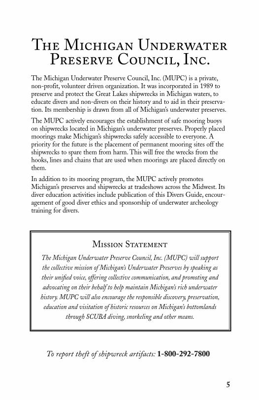
The Michigan UnderwaterPreserve Council, Inc.
The Michigan Underwater Preserve Council, Inc. (MUPC) is a private, non-profit, volunteer driven organization. It was incorporated in 1989 to preserve and protect the Great Lakes shipwrecks in Michigan waters, to educate divers and non-divers on their history and to aid in their preserva-tion. Its membership is drawn from all of Michigan’s underwater preserves.
The MUPC actively encourages the establishment of safe mooring buoys on shipwrecks located in Michigan’s underwater preserves. Properly placed moorings make Michigan’s shipwrecks safely accessible to everyone. A priority for the future is the placement of permanent mooring sites off the shipwrecks to spare them from harm. This will free the wrecks from the hooks, lines and chains that are used when moorings are placed directly on them.
In addition to its mooring program, the MUPC actively promotes Michigan’s preserves and shipwrecks at tradeshows across the Midwest. Its diver education activities include publication of this Divers Guide, encour-agement of good diver ethics and sponsorship of underwater archeology training for divers.
Mission StatementThe Michigan Underwater Preserve Council, Inc. (MUPC) will support the collective mission of Michigan’s Underwater Preserves by speaking as their unified voice, offering collective communication, and promoting and advocating on their behalf to help maintain Michigan’s rich underwater
history. MUPC will also encourage the responsible discovery, preservation, education and visitation of historic resources on Michigan’s bottomlands
through SCUBA diving, snorkeling and other means.
To report theft of shipwreck artifacts: 1-800-292-7800

6
In the early years of the United States, the Great Lakes were a natural highway to its interior. The vast inland waterway provided convenient but dangerous
transportation. Sudden storms, fog, heavy traffic, and shipping companies demanding that schedules be kept regardless of weather, all resulted in the loss of thousands of schooners, steamers and barges. The bottomland of the Great Lakes is littered with these lost ships that are time capsules from another era. They have been preserved by the cold, freshwater of the Great Lakes.
The Michigan underwater preserve system was created in 1980 by legislation supported and largely drafted by Michigan sport divers. They took action to preserve Michigan’s shipwrecks for later generations. The legislation imposes stiff penalties for disturbing shipwrecks and their artifacts. It is a felony to remove or disturb artifacts in Michigan’s Great Lakes. Those caught removing portholes, anchors, chain, deadeyes, blocks or other “souvenirs” will have their boat, car and equipment confiscated and will face up to two years imprisonment and large fines. Divers who have information about the theft of artifacts can report violations to the Michigan Department of Natural Resources at (800) 292-7800.
Since 1980, Michigan’s underwater preserve system has grown to occupy more than 2300 square miles of Great Lakes bottomland in thirteen distinct underwater preserves. They protect some of the region’s most sensitive and historic underwater resources.
Thanks to the strict legal regulations forbidding the removal of artifacts and the conscientious adherence by divers to the law, shipwreck diving in Michigan’s Great Lakes is some of the best in the world. Divers unfamiliar with Michigan’s underwater preserve system are surprised to find well-preserved, pristine shipwrecks. Even small items such as cups, silverware, tools, machinery ornaments and other relics remain where they were discovered by the first divers many years before.
Well-stocked dive shops, knowledgeable sales staff, experienced instructors and friendly service are the standard in Michigan. Most dive shops, whether they are located near an underwater preserve or not, can provide expert advice on preserves and diving in the state.
Dive charter operators can be found in most of the underwater preserves. If divers bring their own boat, they will find convenient boat launches, marinas and other facilities. Most of the popular dive sites are buoyed during the dive season by members and volunteers of the Michigan Underwater Preserve Council, Inc., a non-profit organization dedicated to development of the preserves. Many preserves also offer exceptional shore access diving.
A word of caution is in order whenever venturing out on the Great Lakes. These massive inland seas are as unpredictable as they are beautiful. Storms and heavy seas can arise suddenly with little warning. Do not head out onto the Great Lakes unless you have proper safety equipment, an appropriate vessel and experience. Never leave your dive boat unattended. If trouble arises, the U. S. Coast Guard monitors
Michigan’s UnderwaterPreserve System
7
VHF channel 16 and search and rescue service is available. But it is best to avoid such situations with proper preparation and the exercise of caution.
When you go diving, be ready for cool water temperatures. Although surface water temperatures may reach 65 degrees or more in midsummer, temperatures below 40 degrees are common at depth. Most Great Lakes divers use full wetsuits or drysuits. Diving in the Great Lakes may be colder, but it is worth the extra effort to see such perfectly preserved shipwrecks.
Visitors will find communities near underwater preserves friendly and accommodating. Lodging is convenient and comfortable. Restaurants offer a variety of tasty regional cuisine. Campgrounds are nestled in scenic surroundings and there are many attractions for the entire family.
After diving in any of Michigan’s underwater preserves, you may find yourself wanting to try them all. Each offers a unique experience, both underwater and on land.
So, try diving in Michigan and tell your friends and family. Michigan is good to sport divers and is a great place for families seeking a fun vacation that is sure to create fond memories for many years.
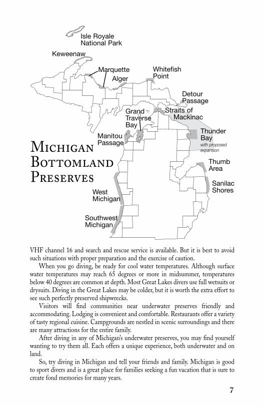
MichiganBottomlandPreserves
WhitefishPoint
MarquetteAlger
SouthwestMichigan
ManitouPassage
Keweenaw
Isle RoyaleNational Park
DetourPassage
Straits of Mackinac
ThunderBay with proposed expansion
ThumbArea
SanilacShoresWest
Michigan
Grand Traverse Bay

8
For ships in trouble on the long southern coast of Lake Superior, harbors of refuge are few. Munising is one of them. The waters off Munising are sheltered by Grand Island and have been the final destination of many ships seeking safe harbor from the fury of the big lake.
The area stretching from just west of Munising to Au Sable Point and including the Pictured Rocks National Lakeshore is the
home of the Alger Underwater Preserve. Several major shipwrecks lying within recreational diving limits are found inside its boundaries.
Among the best shipwreck dives in the Alger Underwater Preserve are:Smith Moore. This early wooden steam barge launched in 1880 is perhaps
the best known shipwreck in the Preserve. She was damaged in a collision on July 13, 1889 on Lake Superior and lost while in tow next to Grand Island. She rests now in 70 to 105 feet of water although the deck is reached at 80 feet. Exploring divers will find much machinery as well as game fish on the wreck. Open deck hatches afford access to the interior.
Bermuda. Also known as the Murray Bay wreck, the Bermuda was a 130 foot long wooden schooner that sank in the Bay off Grand Island on October 15, 1870. She is popular with sport divers because of her depth and condition. The wreck is upright in shallow water and the top deck is reached at just 12 feet. Three large hatches open to the cargo hold and two companionways. A large cabin trunk, where the cabin blew off while sinking is near the stern. Schools of rock bass and other colorful game fish are common.
Kiowa. Launched in 1920, the Kiowa was a steel bulk freight steamer 251 feet long that was driven ashore in a gale on November 30, 1929. The remains are in shallow water about 40 feet deep. Huge sections of her hull are visible from the surface on clear days. The stern lies on her port side exposing the steamer’s steering quadrant and emergency steering gear. A short distance forward, an enclosed ladder way leads down toward the propeller shaft tunnel. At the end of the tunnel, the propeller shaft and massive thrust bearing can be seen.
Herman H. Hettler. The Hettler was a wooden steamer launched in 1890. A severe storm forced the Hettler to seek refuge in Munising Harbor on November 23, 1926. She was lost when she slammed into a rock reef. The wreck now rests broken up in 30 to 40 feet of water. On the inner edge of the shoal where the Hettler struck, her boiler can be found in about 25 feet of water along with parts of the hull and a large debris field with a variety of mechanical parts, tanks, piping and even a bath tub.
Manhattan. Like many other ships, the 252 foot wooden steamer Manhattan was seeking refuge in October 1903 from a Lake Superior storm. She reached safe harbor but when she departed the next day, October 26, 1903, her steering
Alger Underwater Preserve
Munising,Mi

9
failed causing her to strike a reef and a fire broke out. She burned to the waterline and was later partially salvaged. What remains today lies in 20 to 40 feet of water. Divers can see the steamer’s hull framing as well as her enormous rudder with its depth markings still visible.
Steven Selvick. The Selvick is an intentionally sunk shipwreck placed for sport diving in 1996. She is a 70 foot long tug sunk in 30 to 60 feet of water. She lies on her port side at about a 40 degree angle pointing north. The Selvick was originally christened the Lorain when she was built at Cleveland in 1915. She was later renamed the Cabot and was used in the construction of the Mackinac Bridge. The Selvick Marine and Towing Company purchased and renamed her in 1988. She was donated to the Alger Preserve in 1994 and sunk two years later. Visiting divers can reach the pilothouse at about 40 feet. All areas of the wreck are accessible to divers. The pilothouse, galley, mess room, engine room and crew quarters can all be visited. Divers will find lights necessary and the crew quarters
WilliamsIsland
GrandIsland
Au SablePoint
Lake Superior
Pictured Rocks National Lakeshore
Munising
Kiowa
George
Herman H. HettlerManhattan
Smith MooreBermuda
Stephen M. Selvick Superior 5
ShipwreckBoat LaunchCampgroundMarina
Wreck Name Depth GPS/LAT/LON Level Date SankBermuda 12’ to 30’ 46 27.89’N 086 38.81’W Novice 1870George 15’ 46 30.96’N 086 31.25’W Novice 1893Herman H. Hettler 30’ to 40’ 46 29.03’N 086 35.98’W Novice 1926Kiowa 25’ to 40’ 46 38.71’N 086 13.21’W Novice 1929Manhattan 20’ to 40’ 46 28.02’N 086 36.56’W Novice 1903Smith Moore 70’ to 105’ 46 27.33’N 086 37.06’W Advanced 1880Steven M. Selvick 30’ to 60’ 46 29.53’N 086 35.87’W All levels 1996Superior 5 35’ 46.33.45N 086 24.91’W All levels 1856
should only be accessed by experienced divers because there is only one way in and out. This is a great dive for photography.
All the major shipwrecks are buoyed by the local preserve organization with supplies donated by the Glass Bottom Boat Tours Company. Most of the shipwrecks lie in sheltered water.
Besides diving shipwrecks, divers can visit sea caves. These caves were formed by wave action hollowing out the sandstone cliffs underwater. Although the caves are shallow, at water level down to 10 feet, they offer spectacular snorkeling and underwater photography.
The Munising area affords many recreational activities that supplement diving. The Pictured Rocks National Lakeshore is one of the most beautiful scenic areas in the country for hiking and backpacking. There are five water falls in the Munising area to visit. Also popular are “glass bottom boat” tours that take tourists on non-diving excursions to see the many remains of ships visible from the surface. More activities and events can be found at the websites for the Munising Visitors Bureau, www.munising.org., Munising Chamber of Commerce, www.munising.com., and Alger County Chamber of Commerce, www.algercounty.org.
10
DIVER SERVICES:Shipwreck Tours Inc.1204 Commercial St.Munising, MI 49862(906) 387-4477 www.shipwrecktours.com

DeTour Passage Underwater Preserve
Narrow points between land masses create natural “choke points” for naviga-tors. The DeTour Passage is just such a natural point channeling ships bound from Lake Huron to the locks at Sault Ste. Marie into a narrow strait between the eastern tip of Michigan’s Upper Peninsula and Drummond Island.
Storms, heavy seas and navigation errors have all contributed to shipping loss-es in and near the Passage. The remains of lost ships rest there in fairly shallow waters easily accessible to divers.
Among the best shipwreck dives in or near the DeTour Passage Underwater Preserve are:
John B. Merrill. The John B. Merrill was a three masted schooner built at Milwaukee in 1873. She measured 189 feet and was a fine example of classic sail-ing ships of her era. She was known for carrying a large cargo and fast sailing. In 1886, she defeated two other schooners in a race from Buffalo to Milwaukee. On October 14, 1893, she was carrying a load of coal in tow of the steamer F. E. Spin-ner. The boats encountered a violent storm and the steamer cut her tow loose. The captain of the Merrill tried to seek the safety of False Detour Passage but ran up on a shoal south of Drummond Island near the entry to the DeTour Passage. She now lies broken in approximately 35 to 85 feet of water. Her scattered remains rest in an area about 100 feet by 200 feet. Although broken, her remnants still show the graceful lines that distinguished her. Her beautiful nameboard still adorns the stern wreckage. Divers can see many small artifacts like tools, ship’s hardware and personal effects in addition to the capstan and windlass.
J. C. Ford. This 172 foot package steamer was built in 1889. She caught fire, burned to the waterline and exploded on November 26, 1924 leaving her badly broken up. The wreck is very accessible in just 5 to 15 feet of water off the westerly shore of Little Trout Island. The site is popular because much of her remains can be easily examined including a large 8 foot diameter propeller.
General. The General was a 97 foot tugboat built in 1889 and lost to a fire on April 7, 1930 off Frying Pan Island. She lies today in shallow water about 15 to 25 feet deep. The engine, boiler and major machinery were salvaged. What remains are the hull and some portions of the cabins. Near the stern is a very large steer-ing quadrant that was connected to the vessel’s steering wheel. This site is usually sheltered from inclement weather.
Agnes W. At the time of her launching in 1887 at Milwaukee, this bulk freighter was christened the Roswell P. Flower. At 264 feet long and 38 feet in beam, she was the largest wooden vessel on the Great Lakes for a brief period. In 1915 she was renamed the Agnes W. after the daughter of her new owner. On July 2, 1918 she was carrying a cargo of grain when she was caught in a severe summer storm. She stranded near Traverse Point and was pounded to pieces in the storm. Today, her remains are spread out in about 15 feet of water and accessible to divers
11

Wreck Name Depth GPS/LAT/LON Level Date SankAgnes W. 5’ to 15’ 45 55.741’ N 83 42.859’ W Novice 1918Alice C. 5’ to 10’ 45 59.978’ N 83 53.959’ W Novice —Delaware 5’ to 15’ 45 59.920’ N 83 49.500’ W Novice —E.J. LaWay 50’ 46 06.314’ N 83 44.706’ W Novice 1929General 15’ to 25’ 45 59.232’ N 83 53.832’ W Novice 1930George H. Ely 15’ to 20’ 45 57.582’ N 83 54.333’ W Novice 1882J. C. Ford 5 to 15’ 46 02.664’ N 83 50.280’ W Novice 1924John B. Merrill 35’ to 85’ 45 59.232’ N 83 44.109’ W Advanced 1893John W. Cullen 5’ to 40’ 45 59.351’ N 83 53.792’ W Novice 1930sLarge Construction Crane 70’ 45 55.163’ N 83 49.463’ W Advanced 2005Monarch 30’ to 40’ 45 57.653’ N 83 53.002’ W Advanced 1874“Mystery Barge” 50’ 46 06.983’ N 83 49.450’ W Advanced —Rome 15’ 46 05.212’ N 84 00.763’ W Novice 1909Sainte Marie 0’ to 10’ 45 59.351’ N 83 53.792’ W Novice 1928Silver Spray 5’ to 10’ 45 56.923’ N 83 37.922’ W Novice —Superior 0’ to 15’ 45 59.699’ N 83 53.911’ W Novice 1929Troy 5’ to 10’ 45 57.039’ N 83 37.500’ W Novice 1920Two Myrtles 5’ to 10’ 45 59.955’ N 83 53.936’ W Novice —Detour Reef Varies to 50’ Adjacent to Detour Reef Lighthouse, entrance to St. Mary’s River
Canada
DrummondIsland
InternationalBoundary
Lake Huron
Alice C./Two Myrtles
Sainte Marie
John B. MerrillAgnes W.
General
Superior
Troy
J.C. Ford
Silver Spray
Rome
John W. Cullen
Shipwreck
12
George H. Ely Monarch
Large Construction Crane
Mystery Barge
E. J. LaWay

and snorkelers. Only the lower hull portions remain intact. Around the wreckage lies an assortment of small artifacts.
Mystery Barge. This unknown barge sits upright in 50 feet of water. She mea-sures 64 feet in length with a beam of 14 feet. She has a nameboard but it is illeg-ible and nothing is known about the circumstances of her loss – hence her status as a “mystery”. The forward cargo hold is full of coal. Visiting divers will find her largely intact with a steam winch on the aft deck.
E. J. LaWay. The small steamer E. J. LaWay was built at Cheboygan, Michi-gan in 1914. The “E.J.” measured 73 feet long and 20 feet in beam. On April 19, 1929, she was transporting a load of coal when she was cut by ice. Her captain tried to beach her on a nearby island but failed to make it and she settled into about 50 feet of water. Today, she sits on the bottom listing slightly to port with the stern being higher than the bow. The forward section of the vessel has col-lapsed and split open, but from the cargo hatch rearward the hull is largely intact. The pilot house and rear upper decks and cabins have fallen forward and to port. Most of the upper decks, cabins and their contents lie in a large debris field on the bottom off the port side of the hull. A large steam windlass is situated on the main deck. The boiler and steam engine can be found intact with gauges and a steam condenser. This is a very impressive shipwreck for divers of all experience levels.
The local preserve group and Drummond Island Tourism Association have plans to buoy the major shipwrecks in the next couple of years. Until then, divers should be prepared to locate the various shipwrecks themselves for diving. Divers and boat captains should take care to avoid anchoring into the wrecks and doing unnecessary damage until moorings are provided.
Shore accessible dive sites are frequent along the coast of the Upper Peninsula and Drummond Island. These include the hulls of abandoned wooden ships. A portion of one of these, the Sainte Marie, can be seen above the water. The steel paddlewheel of another shipwreck can be found nearby. Divers can also explore the old dock ruins near the Detour Village Municipal Marina. That area houses the remains of abandoned ships and various relics left from fueling operations. Divers should be aware of private property rights when accessing shore locations. Permission of property owners should be obtained when appropriate before cross-ing or accessing private property.
The continuing importance of this area to maritime shipping can be seen in the passing of modern freighters traveling through the area. Visitors can spend an enjoyable time watching the freighter traffic. Drummond Island is also an invit-ing tourist destination for divers and non-divers. It offers hiking, birdwatching, fishing and hunting as well as a local historical museum. For more details, visit the websites for the Drummond Island Tourism Association, www.drummondisland-chamber.com., and the Detour Village Chamber of Commerce, www.detourvil-lage.com.
Endnote: Portions of the factual information provided by www.drummondis-landchamber.com copyright 2009 Mike Spears and Drummond Island Tourism Association.
13

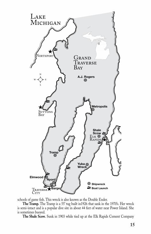
Grand Traverse Bay Underwater Preserve
Wreck Name Depth GPS/LAT/LON Level Date SankA.J. Rogers 45’ to 53’ 45 03.165N 85.28.816W Novice 1898Barge 80’ 44 47.062N 85.37.826W Advanced —Elmwood 20’ to 40’ 44 47.249N 85.38.103W Novice —Metropolis (shallow) starts 6’ 44 58.227N 85.27.945W Novice 1886Metropolis (deep) to 120’ 44 58.339N 85.27.832W Advanced 1886Nyord 54’ 44 46.400N 85.36.004W Novice 1970sTramp 44’ 44 51.025N 85.36.072W Novice 1970sShale Scow 12’ 44 53.582N 85.25.678W Novice 1903Yuba Wreck 15’ 44 49.616N 85.27.968W Novice 1894
Grand Traverse Bay is strategically located for maritime transportation. Its water resources made it a wise and natural choice for early lumbering and manufacturing industries that built up along the shoreline. The shelter of the Bay encouraged the subsequent growth of maritime commerce. These activities left remains of both sunken ships and commercial activity.
Today the Bay holds the remains of several lost ships as well as near shore sites with evidence of businesses that once flourished along the waterfront. The local Preserve support organization has an ambitious program underway to locate and identify shipwrecks in the Bay.
Among the best shipwreck dives in the Grand Traverse Bay Underwater Preserve are:Metropolis. The 125’ schooner Metropolis became lost in a snow storm in November
1886 and ran aground south of Old Mission Point. Her cargo of pig iron and lumber was salvaged. However, the ship was abandoned to the weather. The remains of the Metropolis are divided into a shallow debris field just offshore in only about 8 feet of water and a deeper portion of the hull in 120 feet of water.
A. J. Rogers. The schooner A. J. Rogers was built in 1862. She sailed from Elk Rapids for Sandusky with a cargo of 585 tons of pig iron, on October 8, 1898. Leaking badly, she turned back near Cat Head Point the following day. Realizing that he could not make port, Capt. Frank Conlin attempted to beach the vessel on Old Mission Point, but sank before reaching land. Much of the cargo was salvaged by the firm of Dexter & Noble, of Elk Rapids. Today the remains of the 138 foot schooner rest in 53 feet of water.
Yuba Wreck. This shallow wreck shore dive site is in approximately 15 feet of water. It is the remains of a schooner sunk in 1894. Not much is known about this wreck. She is also known as the Ada, the Brick, or possibly the Morning Star. The remains of the ship are, surprisingly, mostly free of zebra mussel encrustation.
Elmwood Wreck. Divers will find this partially intact wood fish tug in 20 to 40 feet of water. She reportedly became tangled in a net from a fisheries research vessel owned by the Michigan Department of Natural Resources, and was dragged from 80 feet of water to her present location. This is a site for many open water training dives due to its proximity to shore and the ease of entry.
Nyord. This site in 54 feet of water features the intact remains of a sloop sunk in the 1970’s. She sank in southern West Bay due to neglect. The wreckage often holds large
14
ShipwreckBoat LaunchTraverse
City
ElkRapids
SuttonsBay
Nyord
A.J. Rogers
Northport
LakeMichigan
GrandTraverse Bay
Metropolis
Tramp
Elmwood
Barge
schools of game fish. This wreck is also known as the Double Ender.The Tramp. The Tramp is a 55’ tug built in1926 that sank in the 1970’s. Her wreck
is semi-intact and is a popular dive site in about 44 feet of water near Power Island. She is sometimes buoyed.
The Shale Scow. Sunk in 1903 while tied up at the Elk Rapids Cement Company
15
ShaleScow
YubaWreck
dock, the remains of this 100’ scow can be found just south of the Elk Rapids harbor in 12 feet of water. This is an ideal site for snorkelers.
None of the dive sites are officially moored. Area divers sometimes informally mark some of the dive sites. However, divers should be prepared to locate any particular one when planning a dive.
The Grand Traverse Bay region contains numerous shore diving sites in addition to shipwrecks. Among them are the “Clinch Park Woodpile” containing the remains of lumbering activities and “The Pipeline” consisting of the remains of piping from the power plant.
There is also an area known as “The Junk Pile”. Located near Haserot Beach at the tip of Old Mission Peninsula, this interesting site was created by teenagers in the 1950’s who tried to create their own artificial island. The remains of several small boats, a refrigerator, and even a Ford Pinto can be found in just 20 feet of water and are easily accessed from shore. There is also a large amount of old pier timbers at the site creating fish habitat.
Grand Traverse Bay is a very popular tourist destination with many festivities. Traverse City hosts its annual Cherry Festival in July and communities all around the Bay sponsor many activities and special events throughout the year. It is also a very scenic area to tour.
For more information on the Preserve and things to do and see in the area, consult the websites for the Grand Traverse Bay Underwater Preserve, www.gtbup.org., Traverse City Convention and Visitor’s Bureau, www.visittraversecity.com., or the Traverse City Chamber of Commerce, www.tcchamber.org., as well as those of similar organizations in the communities bordering Grand Traverse Bay.
Come dive the beautiful watersof the Traverse City area!
Online dive guide available at www.gtbup.org
Discovery • Preservation • Research
The Grand Traverse Bay Underwater Preserve
Shipwrecks,Historical Sites,
& More!
The GTBUP is a fund of the Grand Traverse Regional Community Foundation.Join us on Facebook!
16
DIVER SERVICES:Scuba North833 S. Garfield Ave. Traverse City, MI 49686(231) 947-2520www.scubanorth.com
Divers Central, Inc251 Clay DriveCadillac, MI 49601(231) 876-3483www.diverscentral.com

17
Isle Royale National ParkExisting outside of Michigan’s system of underwater preserves, Isle Royale holds a special
place in Michigan’s inventory of diving resources as a National Park administered by the National Park Service. It is more than 45 miles long and 9 miles wide and the largest island in Lake Superior. Geologically, it is formed by rock formations lying on edge creating a complex tangle of island outcroppings and rocky shoals that have formed traps for passing ships.
Among the best shipwreck dives in the Isle Royale National Park are:Emperor. This steel freighter was built in 1910 and was lost in June 1947 when she
ran aground on a rocky reef off Isle Royale. She was a 525 footer owned by the Canadian Steamships Line. She sank quickly with the bow resting in 25 to 60 feet of water and the stern settling into deeper water. Most divers approach her as two dives with less experienced divers focusing on the shallower bow area. More experienced divers can explore the stern at 100 to 170 feet. The ice has damaged the shallow portions of the wreck and the pilothouse is gone. However, anchors and much of her deck equipment remain to be explored in her forward section. Her stern includes her rudder and propeller, engine room and numerous cabins.
Congdon Bow. The Congdon was launched in 1907 and ran afoul of rocks on Isle Royale during a November storm in 1918. She was off course when she ran up on Canoe Rocks at the North end of the island. The 532 foot steel bulk freighter broke apart as the storm continued. The bow portion including the pilothouse broke off cleanly and now resides upright in 70 to 110 feet of water. The remainder of the ship settled into much deeper water on the opposite side of the reef. This is an excellent dive for intermediate divers who can explore the decks, open pilothouse and mast.
Cumberland. Lost near the Rock of Ages Lighthouse, the Cumberland was 204 feet long and built in 1871. She sank in 1877 and her remains lie in 20 - 80 feet of water. The wreckage is broken and scattered with portions of her wooden hull, side-wheel and boiler in the debris field.
America. Launched in 1898, the America was a 182 foot long passenger and package freighter that spent her life servicing the Isle Royale community by providing transportation to the mainland, mail and provisions. On her first run of the 1928 season, she was under the command of an inexperienced first mate when she struck a rocky reef off Port Washington at the south end of Isle Royale. In an attempt to intentionally ground her, she was run hard aground just offshore. Subsequent efforts to salvage the wreck failed for technical or financial reasons. Starting in the 1950’s, the wreck became popular with sport divers because of her close proximity to Port Washington and her depth ranging from the bow nearly at the surface to the stern at 80 feet. Ice damage is evident to a depth of 30 feet but much of the America’s deck gear including her windlass remains. The engine room is remarkably intact with its piping, engine and other equipment. The boilers did not explode in the sinking and are intact. Crew quarters and numerous cabins can be reached and examined.
Glynlyon. This shallow wreck lies in 15 to 60 feet of water. The Glenlyon was a bulk freighter built in 1893 and lost in 1924 by grounding on rocky shoals. Because of its shallow depth, the wreck’s remains lie scattered about the reef. Some larger pieces including the propeller, engine and boilers are open for inspection.
George M. Cox. The passenger steamer George M. Cox was lost when she ran aground at Rock of Ages Lighthouse in 1933. A very dramatic photo exists showing her run up hard

aground and bow first. Built in 1901 and 259 feet long, she was not salvaged and eventually the weather and rocks claimed her. Today she rests in water 40 to 100 feet deep with her wreckage scattered. Her machinery, equipment, propeller, and steel plates are visible on the bottom.
Kamloops. This Canadian package freighter went missing in 1927 and her loss remains somewhat clouded in mystery. It is believed that at least one of her lifeboats reached shore. Bodies of crew members were found on Isle Royale the following year leading to the conclusion that she was lost somewhere near the island. This led to years of searching for the wreck in the vicinity of Isle Royale. Her hull was finally located in 1977 by sport divers searching for her. She was a fairly new freighter when lost having been launched in 1924 as a canaller at 250 feet long. The ship now lies on its side in deep water ranging from 180 – 260 feet well outside the limits for recreational divers. The reason for her loss is unclear. Based on a survey using a submersible, a report by the National Park Service suggested that the ship’s engine may have broken down and was being repaired. According to this theory, snow or ice may have built up on her topside and, coupled with a strong northwestern storm, caused her to capsize. Because of the circumstances of her loss and her extreme depth, the wreck is a very well preserved time capsule with much for qualified divers to explore.
Most of Isle Royale’s dive sites are only accessible by boat. The National Park Service places buoys on many of the wreck sites. Several dive charters provide services to the island. There are no dive shops or air stations on the island. The use of portable dive compressors is restricted as to hours. You should familiarize yourself with National Park Service rules before planning a dive trip or use a dive charter licensed by the National Park Service.
Because it is a national park, divers planning to dive at Isle Royale will need to register with the National Park Service. Details can be found at the Isle Royale section of NPS.gov, www.nps.gov/isro/index.htm. In addition to registration information, lists of licensed dive charters and descriptions of dive sites can be found there.
In addition to scuba diving, Isle Royale offers abundant outdoor opportunities for camping, sightseeing, wildlife observation, hiking and the like. More details on those activities can also be found at NPS.gov.
18
DIVER SERVICES:Isle Royale ChartersLake Superior Diver docks atGrand Portage, MN(855) 348-3472www.isleroyalecharters.com

19
Wreck Name Depth GPS/LAT/LON Level Date SankAlgoma 10’ to 80’ 48 06.431’N 88 32.335’W Advanced 1885America 2’ to 80’ 47 53.628’N 89 13.345’W Advanced 1928Chester A. Congdon (Bow) 70’ to 110’ 48 11.559’N 88 30.815’W Advanced 1918 Chester A. Congdon (Stern) 20’ to 220’ 48 11.620’N 88 30.881’W Technical 1918 Chisholm (Engine) 115’ to 155’ 47 51.450’N 89 19.796’W Technical 1898Chisholm (Hull) 20’ to 60’ 47 51.459’N 89 19.679’W Advanced 1898George M. Cox 40’ to 100’ 47 51.462’N 89 19.385’W Advanced 1933Cumberland 20’ to 80’ 47 51.465’N 89 19.650’W Advanced 1877Emperor (Stern) 100’ to 170’ 48 12.018’N 88 29.606’W Advanced 1947Emperor (Bow) 25’ to 60’ 48 12.003’N 88 29.525’W Advanced 1947Glenlyon 15’ to 60’ 47 57.178’N 88 44.824’W Advanced 1924Kamloops (Stern) 180’ to 260’ 48 05.118’N 88 46.000’W Technical 1927Kamloops (Bow) 240’ to 260’ 48 05.121’N 88 46.031’W Technical 1927Monarch 10’ to 80’ 48 11.334’N 88 25.957’W Advanced 1906Tug in Five Finger Bay 10’ to 17’ 48 09.325’N 88 31.303’W Novice —
SiskiwitBay
Lake Superior
Shipwreck
IsleRoyale
CumberlandChisholm
Cox
America
Kamloops
Chester A. CongdonEmperor Monarch
Algoma
Glenlyon
Tug
WindigoRanger Station
Lying adjacent to Michigan’s “Copper Country”, the Keweenaw Underwater Preserve stretches along the Keweenaw Peninsula’s shore on Lake Superior. Due to its location on the Lake’s south shore, it has often been a “catcher’s mitt” for lost ships.
Because of its location and extensive mining and settlement activities, shipwrecks and artifacts are scattered along the coast. Eagle River, Eagle Harbor and Copper Harbor all host a variety of shipwrecks dating to the 1800’s. Many of the wrecks are in fairly shallow water where they have been broken up by ice and storm action. What is left is an inviting resource for beginner to intermediate divers who can explore boilers, machinery and broken hulls.
Among the best shipwreck dives in the Keweenaw Underwater Preserve are:Mesquite. The wreck of the U. S. Coast Guard Cutter Mesquite is the premier dive
destination in the Preserve. On December 4, 1989, the Mesquite was retrieving buoys when she ran aground off the tip of the Keweenaw Peninsula. Because of the time of year, she could not be removed before winter. The harsh winter weather pounded the 47 year old vessel against the rocky shoal damaging her beyond repair. Because she was a total loss, the Coast Guard cooperated in the intentional sinking of the Mesquite as a dive site. Divers find the wreck in excellent condition with most of her equipment still on deck. Part of the pilot house was removed during the sinking and is now located near the hull. Very experienced divers can penetrate the interior. Water depths on the wreck vary from 82 to 112 feet.
Tioga. The 285 foot steel package freighter Tioga was launched at Buffalo, New York in 1884. She ran aground on Sawtooth Reef on November 26, 1919 during a winter storm. A gale followed shortly after the stranding and she went to pieces. Today, the ship’s debris including her boilers and engine can be examined in 28 to 35 feet of water.
City of St. Joseph. The City of St. Joseph was a 254 foot steel barge lost on September 21, 1942 when she struck a reef during a violent gale near Eagle Harbor. A companion barge, the Transport, also sank in the gale and is located about 110 yards inshore from the St. Joseph. Both wrecks lie broken and flattened out in shallow water ranging from 25 to 35 feet.
John Jacob Astor. Claim to being the oldest known shipwreck on Lake Superior belongs to the John Jacob Astor lost September 21, 1844 near the dock of old Fort Wilkins. Built at Black River, Ohio in 1835, the Astor was the first commercial vessel on Lake Superior. After stranding, she encountered a fate similar to the Mesquite’s. When she could not be refloated before winter, she broke up in the severe winter weather conditions. Her rigging and portable equipment were salvaged. Today, the remains sit in up to 35 feet of water.
Langham. The wooden steamer Langham was built in 1888 and lost to fire on October 23, 1910. Loaded with coal, the Langham anchored in the lee of the Keweenaw Peninsula off Bete Grise Bay. She burned to the waterline and settled in 105 feet of water. While her decks burned away, the hull remains intact with two boilers, her engine and a variety of equipment.
Wasaga. The wooden steamer Wasaga burned to a total loss on November 7, 1910.
Keweenaw Underwater Preserve
20

John L. Gross
Maplehurst Calumet
Houghton
William C.Moreland James Pickands Tioga
Langham Mesquite
CopperHarbor
City of Superior
KeweenawPoint
John Jacob Astor WasagaCity of St. Joseph
Transport
Lake Superior
Hancock
EagleHarbor
EagleRiver
ShipwreckBoat Launch
Wreck Name Depth GPS/LAT/LON Level Date SankJohn Jacob Astor 20’ to 35’ 47.28.34’N 087.51.88’W Novice 1844City of St. Joseph 25’ to 35’ 47 28.20’N 088 06.75’W Novice 1942City of Superior 15’ to 35’ 47.28.30’N 087.51.40’W Novice 1857John L. Gross 20’ to 30’ 47.27.59’N 088.09.31’W Novice 1873 Langham 90’ to 105’ 47’ 22.37’N 087 55.53’W Advanced 1910 Maplehurst 15’ to 20’ 47.13.91’N 088.38.05’W Novice 1922Mesquite 82’ to 112’ 47.23.44’N 087.44.53’W Advanced 1989William C. Moreland shallow 47.25.07’N 088.19.60’W Novice 1910James Pickands 10’ to 30’ 47.25.71’N 088.17.93’W Novice 1894Tioga 28’ to 35’ 47.26.26’N 088.16.22’W Novice 1919Transport 25’ to 35’ 47.28.20’N 088.06.75’W Novice 1942Wasaga 35’ 47.28.17’N 087.53.15’W Novice 1910
She went down with a cargo of farm equipment. Much of the cargo can still be found at this site just off the Harbor House Restaurant. Water depths range to 35 feet.
The dive sites are not generally buoyed. Visiting divers should be prepared to locate them.
The Keweenaw Peninsula is also home to unique geological formations that supplement shipwreck diving. One good area to visit is Esrey Park located about halfway between Copper Harbor and Eagle Harbor. This roadside park is an easy shore dive and a great place to look for agates, copper and other unique Copper Country treasures. For more details on the Keweenaw Underwater Preserve, visit www.ship-wrecks.net/shipwreck/keweenaw. It has more information on the shipwrecks in the Preserve.
When not diving, visitors can enjoy the historical sites in the region like restored Fort Wilkins and the beautiful nature trails of the Keweenaw Peninsula and Copper Country State Forest. You can learn more about attractions and events by visiting the websites of the Keweenaw Convention and Visitors Bureau, www.keweenaw.info, or the Keweenaw Peninisula Chamber of Commerce, www.keweenaw.org.
21

Manitou Passage Underwater Preserve
One of the richest areas in Michigan for shipwreck diving is the Manitou Passage Underwater Preserve. It surrounds the North and South Manitou Islands in Lake Michigan and lies next to Michigan’s Sleeping Bear Dunes National Lakeshore.
During the heyday of Michigan lumbering, this was a booming shipping area. It is also an area where ships have sought safety by attempting to ride out storms in the lee of the Islands. These activities have produced a substantial inventory of known and unknown shipwrecks.
Among the best shipwreck dives in the Manitou Passage Underwater Preserve are:Francisco Morazan. The ocean going freighter Morazon was built in 1922 and
was lost in a snowstorm on November 29, 1960. This 247 foot package freighter ran aground on rocks off the south end of South Manitou Island. The broken hull now rests in very shallow water a few hundred yards from the shore. This novice level site permits easy access to the hull and associated debris.
Walter L. Frost. The 235 foot long wooden steamer Walter L. Frost was lost when she ran aground on November 4, 1903 on South Manitou Island. She is now broken up largely because the Morazan ran aground on top of her. The Frost, being in shallow water of about 12 feet offers explorers an ideal view of her remaining hull, boilers and related artifacts.
Alva Bradley. The Alva Bradley was a three masted schooner, 192 feet long, launched at Cleveland, Ohio in 1870. She was lost in a gale on October 13, 1894. The wreck of the schooner was discovered in 1990 in about 20 to 27 feet of water between North and South Manitou Islands. This largely intact wreck affords access to her cargo of steel billets and many maritime artifacts. Remains of her rigging and more artifacts lie about 200 yards northeast of the hull.
Three Brothers. First launched in 1888 as the May Durr, the Three Brothers was a 162 foot long wooden steamer. She beached on September 27, 1911 on the lee side of South Manitou Island. She was abandoned to the weather and the combination of winter storms and shifting sand quickly buried her. In 1996 the weather shifted the sands revealing a nearly perfect shipwreck easily accessible from the beach. While her bow is broken, the stern is intact. The hull is filled with sand. The site is a very desirable novice site with depths from 5 to 45 feet.
Congress. The 265 foot wooden steamer Congress, built in 1867, caught fire at South Manitou Island on October 4, 1904. Most of the stern was engulfed in flames when she sank in about 165 feet of water. The ship’s superstructure can be reached at about 135 feet. The bow portion is largely intact and some cabins can be penetrated. Her engines, boilers and deck equipment are present.
Montauk. The Montauk stranded on North Manitou Island on November 23, 1882. The remains of the 137 foot schooner rest in about 35 feet of water.
Supply. This 132 foot brig rigged vessel was built in 1855 at Buffalo, New York. In November, 1869 she stranded on North Manitou Island. The debris of the ship and her cargo of bricks now lie in 8 to 10 feet of water.
H. D. Moore. The Moore was a 103 foot schooner that stranded at Gull Point, South Manitou Island on September 10, 1907. Her wreckage is scattered in shallow water, 10 to 12 feet deep.
James McBride. The 121 foot brig James McBride ran aground during a storm on
22

LakeMichigan
SouthManitou Light
SouthManitouIsland
Pickard’s Landing
Leland
Golden HarborDock
Sleeping Bear DunesNational Lakeshore
Glen Haven
PlatteBay
Empire
ShipwreckBoat LaunchCampgroundMarinaWreckageLighthouse
Montauk
Stormer Dock
Alva Bradley
Shoal Light
Rising Sun
Park Headquarters
EmpireDock
Aral Dock
James McBride
Walter L.Frost
H. D. Moore
CrescentCity Dock
Pyramid Point
SleepingBear Point
GrandHavenDock
Francisco Morazan
Congress
PointOnleda Dock
Flying Cloud
Three Brothers
NorthManitouIsland
Wreck Name Depth GPS/LAT/LON Level Date SankAlva Bradley 20’ to 27’ 45 02.27’N 085 59.26’W Novice 1894Congress 165’ 45 01.49’N 086 05.45’W Technical 1904Flying Cloud 4’ to 14’ 44 56.19’N 086 57.39’W Novice 1892Walter L. Frost 10’ to 12’ 44 59.66’N 086 08.69’W Novice 1903 James McBride 5’ to 15’ 44 53.69’N 086 04.55’W Novice 1857Montauk 35’ 45 09.54’N 085 59.51’W Novice 1882H. D. Moore 10’ to 12’ 45 02.02’N 086 04.44 W Novice 1907Francisco Morazan to 20’ 44 59.07’N 086 08.09’W Novice 1960Rising Sun 6’ to 12’ 44 58.23’N 085 55.97’W Novice 1917Three Brothers 5’ to 45’ 45 00.54’N 086 05.58’W Novice 1911Supply 8’ to 10’ 44 58.22’N 085 58.48’W Novice 1869
23

24
October 19, 1857. Her remains lie in 5 to 15 feet of water near Sleeping Bear Point.Rising Sun. This 133 foot long wooden steamer stranded just north of Pyramid
Point on October 29, 1917. She went to pieces and her wreckage now rests in 6 to 12 feet of water.
The dive sites are not usually buoyed although most of the near shore sites are readily identified. Divers should be prepared to locate and appropriately moor to them.
The Manitou Passage Underwater Preserve is also home to a large number of docks and wharfs built during the boom times of lumbering. The towns of Empire and Glen Haven, among several others, have notable areas where divers can explore dock ruins and associated artifacts.
To learn more about the Preserve, visit the website for the Manitou Passage Underwater Preserve, www.manitoupreserve.org.
In addition to diving, the Manitou Passage Underwater Preserve affords visitors convenient access to the Sleeping Bear Dunes National Lakeshore – a great place for camping, hiking and sightseeing. It is also in close proximity to the many resort activi-ties at nearby Traverse City. Visit the websites for the Sleeping Bear Dunes Visitors Bureau, www.sleepingbeardunes.com., or Michigan’s travel site, www.michigan.org., for more information.
Historical Museum of Bay County321 Washington Avenue
Bay City, MI 48708(989) 893-5733
Interactive Exhibits
Movie Theatre
Research Library
The Museum Store
Maritime Art
Books and Videos
www.bchsmuseum.org
DIVER SERVICES:Scuba North833 S. Garfield Ave. Traverse City, MI 49686(231) 947-2520www.scubanorth.com
Divers Central, Inc251 Clay DriveCadillac, MI 49601(231) 876-3483www.diverscentral.com
25
Being Michigan’s largest city in its Upper Peninsula and having an ideal natural harbor, the Marquette area has played an important role in Michigan’s maritime his-tory. It developed rapidly as a commercial center after the discovery of iron ore in 1844. Many ships have visited the Marquette coast and more than a few were lost to weather and storms there.
The Marquette Underwater Preserve is unique in that it is comprised of two “Units”. The Marquette Unit borders 24 miles of Upper Peninsula coastline extending out into Lake Superior to a depth of 200 feet. The Huron Islands Unit embraces the clear waters surrounding the Huron Islands west of the Marquette Unit– a group of granite upcroppings rising from the bottom of Lake Superior.
The Huron Islands Unit has some of the most impressive coastline in Michigan. The shore ranges from sandy beaches to towering cliffs backed by the scenic Huron Mountains. Boaters can reach the Huron Islands from the Big Bay Harbor of Refuge at Big Bay or from Wirtz’s Marina at Skanee in Baraga County. In either case, it is a cruise of over 12 miles to the Islands, so boaters must take appropriate precautions.
Among the best shipwreck dives in the Marquette Underwater Preserve Huron Islands Unit are:
Southwest. The Southwest, launched in 1866, is the most popular dive site of the Huron Islands Unit. This 137 foot sailing vessel ran aground one and one half miles southeast of the largest of the Huron Islands. She was running in a heavy fog on September 18, 1898 when the disaster occurred. Today, divers will find the remains of the Southwest scattered in 100 feet of water. Many small artifacts remain in clear water which makes an especially appealing dive.
Arctic. The Arctic was caught in fog and lost near Huron Island on May 28, 1860. The remains of the 237 foot long sidewheel steamer rest on a steep incline with depths varying from 5 to 105 feet of water.
George Nestor. Located near Huron Island’s lighthouse is the wreckage of the 207 foot long George Nestor. She stranded there in a storm on April 30, 1909 and seven of her crew died. The schooner-barge has water depths ranging from 20 to more than 100 feet.
Among the best shipwreck dives in the Marquette Underwater Preserve Marquette Unit are:
Charles J. Kershaw. The Kershaw foundered in a storm while towing two schoo-ner- barges on September 29, 1895. The 223 foot long wooden steamer lost power and her crew was rescued by the Marquette Life Saving Service. The Kershaw went to pieces in shallow water. Today she lies scattered and broken in about 25 feet of water. Her substantial boiler is a dive highlight.
D. Leuty. This ship was lost while struggling to enter Marquette harbor on October 31, 1911 with a cargo of logs. The Leuty came to rest about 800 feet off Lighthouse Point near downtown Marquette. Despite her proximity to shore, this is a boat dive because the nearest public access site is about ¼ mile away. The ship is
Marquette Underwater Preserve

Wreck Name Depth GPS/LAT/LON Level Date SankArctic 5’ to 105’ 46°57.74’N 087°59.85’W Advanced 1860 DeSoto 8’ to 10’ 46°32.07’N 087°23.55’W Novice 1869F-106B Fighter Plane 20’ to 22’ 46°31.71’N 087°23.75’W Novice 1974Florida 10’ to 15’ 46°32.11’N 087°23.53’W Novice 1886“Gold Mine” Pinnacle 12’ to 150’ 46°35.38’N 087°21.75’W Advanced —“Iron Man” & J.H. Sheadle 15’ 46°34.08’N 087°23.17’W Novice 1920Charles J. Kershaw 25’ 46°30.56’N 087°21.81’W Novice 1895D. Leuty 40’ 46°32.76’N 087°22.44’W Novice 1911George Nestor 20’ to 100’ 46°57.99’N 088°00.20’W Advanced 1909Queen City 10’ to 13’ 46°29.42’N 087°18.64’W Novice 1864George Sherman 10’ to 12’ 46°29.89’N 087°09.63’W Novice 1887Southwest 100’ 46°56.42’N 087°56.11’W Advanced 1898Superior & Marion L. 20’ 46°32.50’N 087°23.35’W Novice —
Chocolay River
Cinder PondMarina
D. Leuty
Charles J. Kershaw
George Nestor
ArcticSouthwest
Big BayMarina
Black Rocks
Gold Mine Pinnacle
PresqueIsle Marina
Marquette
Lake Superior
George Sherman
Lake SuperiorHuronRiverPoint
Huron Island
Shot PointMarquette Unit
Huron Islands Unit
ShipwreckBoat LaunchMarina
26
FloridaDeSoto

broken up and her engine, boiler and machinery were salvaged. Three large parts of the hull and her large rudder remain in about 40 feet of water. Divers will also see tools, fasteners and piping scattered in more shallow water.
Florida. The Florida was a two masted schooner built at Oswego, New York in 1868. She met her fate in a blizzard on November 17, 1886. She was crushed against the Marquette docks with the loss of one life. The ship’s remains are now in shallow water and covered with shifting sand. Her framing and planking are just outside the cribs of an old dock.
DeSoto. This schooner was launched April 10, 1856. She stranded and broke up on December 4, 1869. Her framing and planking are in about 10 feet of water and make an easy novice dive or snorkeling opportunity.
The shipwrecks Charles J. Kershaw and D. Leuty are buoyed during the dive season by Diver Down Scuba Shop in Marquette. Divers should be prepared and ready to locate other sites on their own.
In addition to shipwrecks, the Marquette Underwater Preserve has many docks and cribs for divers to explore along with unique geology to examine. Presque Isle offers excellent shore diving and boasts some interesting geologic formations. It is a popular local dive site.
The “Gold Mine Pinnacle” is a boat dive that is also popular. It is just offshore from Presque Isle. Depths vary widely from ten feet to depths outside recreational limits. This variance makes it an advanced dive.
Visitors can tour the Marquette Maritime Museum located at 300 Lakeshore Boulevard in Marquette to learn more about the history of the area. It keeps sea-sonal hours so check before you go: www.mqtmaritimemuseum.com.
The Marquette area hosts a variety of seasonal activities that will be of inter-est to divers and non-divers alike. More information is available at the websites for the Marquette Convention and Visitor’s Bureau, www.marquettecountry.org., and Marquette Chamber of Commerce, www.marquette.org.
27

The Sanilac Shores Underwater Preserve stretches along Lake Huron’s long western shore from near Lexington in the south to just north of Forestville. This was a perilous journey for ships proceeding along Michigan’s eastern shoreline and safe harbors are hard to find. Storms, rough seas, accidents and collisions all have combined to produce losses.
The Sanilac Shores Underwater Preserve is popu-lar with sport divers because of the large number of shipwrecks within recreational diving limits. At least 16 shipwrecks lie above 120 feet.
Among the best shipwreck dives in or near the Sanilac Shores Underwater Preserve are:
Regina. Built in 1907, the 250 foot long steel freighter Regina fell prey to the “The Great Storm” of November 9, 1913 and went missing with all hands. She was undiscovered until 1986. Since she was located, she has become a very popular dive site. The ship rests upside down on the bottom in about 80 feet of water. The bottom of the hull can be reached at 25 feet. There is a 56 foot hole in the hull that permits entry to the hold area by qualified divers. Some of her cargo can be found scattered on the lake floor.
Sport. This small tugboat is a favorite among divers. She was built in 1873 and is important as the first steel tug on the Great Lakes. She had a long career as a working tug on the Lakes, but at 57 feet she was no match for a severe gale on December 13, 1920. Her steel hull rests upright with a slight list to starboard. The depth of water is 45 feet although the Sport rises up about 20 feet off the bottom. Divers find her intact with an abundance of tools and relics scat-tered about the wreck site. The Sport has received the distinction of being the first Michigan shipwreck with her own Michigan Historical Marker placed on her.
Checotah. The Checotah was built in 1870 as a schooner and actually sank two times. The first was in 1882. She was raised and converted to a scow in 1888. While in tow on October 30, 1906, she began to founder and sank off Forestville. Today, she resides in 117 feet of water with her stern broken and scattered. The bow is intact with much equipment present as well as artifacts distributed about the wreck.
New York. This wooden steamer was launched at Buffalo in 1856 and was lost to heavy seas on October 14, 1876. She lies physically close to the Checotah at a similar depth of 117 feet and is upright but very broken up. Her unique oscillating steam engines are exposed to view and are of special interest to maritime specialists and divers. Part of a wooden “hogging arch” is still in place. She has many tools and much gear present.
Mary Alice B. The Mary Alice B was built at Duluth, Minnesota in 1931 for the Corps of Engineers as the “Quintus”. In 1962 she passed into private ownership and her name was changed. She was a fair sized working tugboat at 62 feet in length. She foundered off Port Sanilac September 5, 1975. She is upright and intact in 92 feet of water. Her wheelhouse with her wheel still in place can be penetrated. Other areas of the interior can be entered but silt can be easily disturbed and only well trained divers should attempt it.
North Star. The North Star was lost after a collision in the fog with her sister ship, the Northern Queen. A steel hulled, 300 foot long package freighter, she was launched in 1889. On November 25, 1908 she was bound for Duluth with a load of grain and shingles when she was
Sanilac ShoresUnderwater Preserve
28

Forestville
Wreck Name Depth GPS/LAT/LON Level Date SankCharles A. Street 10’ 43.35.50’ N 082.27.50’ W Novice 1908Charles S. Price 47’ to 64’ 43.09.174’N 082.21.174’W Advanced 1913Checotah 117’ 43.36.107’N 082.28.170’W Advanced 1906City of Genoa 64’ 43.08.78’ N 082.22.31’ W Intermediate 1911Col. A.B. Williams 84’ 43.36.235’N 082.30.805’W Advanced 1864Eliza H. Strong 28’ 43.15.709’N 082.30.581’W Novice 1904F.B. Gardner 55’ 43.31.63’ N 082.31.77’ W Intermediate 1904John Breeden 45’ 43.12.640’N 082.26.240’W Novice 1899Mary Alice B. 92’ 43.22.309’N 082.26.301’W Advanced 1975Canisteo 98’ 43.14.142’N 082.18.292’W Advanced 1920New York 117’ 43.36.23’ N 082.28.272’W Advanced 1876North Star 100’ 43.23.954’N 082.26.524’W Advanced 1908Queen City 45’ 43.09.124’N 082.25.711’W Novice 1863Regina 25’ to 80’ 43.20.434’N 082.26.787’W Advanced 1913Sport 25’ to 45’ 43.16.008’N 082.27.892’W Novice 1920Sweetheart 20’ 43.02.45’ N 082.23.15’ W Novice —
LakeHuron
Port Sanilac
LexingtonEliza Strong
Sport
Regina
Mary Alice B.
North Star
F.B. Gardner
Forester Old dock
Charles Street
Col. A. B. WilliamsChecotah
New York
For shallow draft (small boats) only.
ShipwreckBoat LaunchCampgroundMarina
29(continued on Page 32)
struck and sank southeast of Port Sanilac. She rests in about 100 feet of water in two pieces. Her pilothouse is intact and her engine and boilers are in place.

30
Wisconsin’s Largest Scuba & Maritime Trade Show
Devoted to the Great Lakes
Wreck Photo by Warren Lo
FREE Exhibit Hall Workshops & SeminarsRaffle & Silent AuctionDiveHeart Discover Scuba
Wyndham Hotel & Convention CenterMilwaukee, WisconsinMarch 25 & 26, 2011March 24 & 25, 2012 www.GhostShips.org

31
Contact your local PADI Dive Center
or visit padi.com/MichTec.
PADI’s SeeingNew Depths
Find out about the changes to the
PADI
TecRecprogram.

32
Charles S. Price. The 504 foot long steel freighter Charles S. Price was built in 1910. She was lost in “The Great Storm” of November 9, 1913 that also claimed the Regina. After the storm cleared, she was found floating upside down with her entire crew lost. She eventually sank in 64 feet of water. Today she rests upside down on the bottom with the hull collapsing. Her propeller can be reached at about 47 feet.
Colonel A. B. Williams. The Williams was carrying a cargo of coal when the 110 foot schooner was lost in 1864. She was discovered in 1957. Some of her equipment like a large stock anchor was removed before the law was changed to prohibit the removal of artifacts. She sits upright with her hull mostly intact. The exception is the stern that has collapsed. Divers can visit her in about 84 feet of water and see her hatches, a stove, bilge pump, two winches and a large windlass.
Eliza H. Strong. The Strong was a 205 foot wooden steamer built in 1874. During her life she sank three times. On the first two occasions she was raised and placed back in service. The final time came on October 26, 1904 when she caught fire off Lexington and burned to the waterline. Her machinery was salvaged and the Corps of Engineers used explosives in 1909 to clear a channel for navigation. Because of these events, wreckage is scattered about the site near the Lexington dock. What remains is upright with the keel and some decking still intact in about 28 feet of water.
The local charter boat operators place moorings on the major dive sites during the dive season and provide the buoys, rope and other supplies to do so. Voluntary donations from div-ers are accepted to help defray the cost of supplies. Donors should contact Rec & Tec Dive Charters at 586-263-6606.
In addition to excellent shipwreck diving, there are historic attractions in the area of the Sanilac Shores Preserve. They include the Port Sanilac Lighthouse, Sanilac Petroglyphs, and the Sanilac County Historical Museum at Port Sanilac.
For more to do and see, visit the website for the Bluewater Area Convention and Visitors Bureau, www.bluewater.org., and the website for the Croswell-Lexington Chamber of Commerce, www.cros-lex-chamber.com.
DIVER SERVICES:Anchor Bay Scuba, Inc.8655 Dixie HighwayFair Haven, MI 48023(586) 725-1991www.anchorbayscuba.com
Capital City Scuba515 E. Grand River Ave.Lansing, MI 48906(517) 853-9500www.capitalcityscuba.com
Divers Incorporated3380 Washtenaw AvenueAnn Arbor, MI 48104(734) 971-7770www.diversinc.com
(continued from Page 29)

33
DIVER SERVICES: Bruno’s Dive Shop, Inc.21655 VermanderClinton Township, MI 48305(586) 792-2040www.thegreatlakesdiver.com
34
UNDERWATER PRE
SERVE
SOUT
HWEST MICHIG
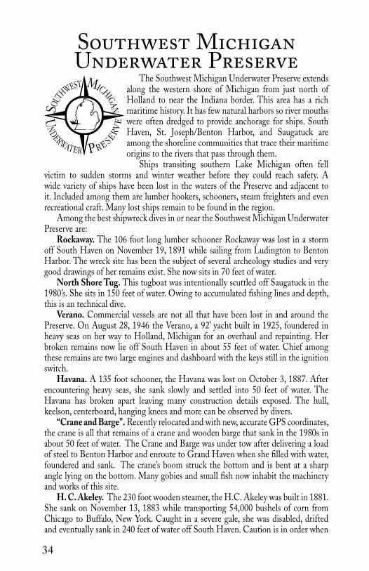
AN�Southwest MichiganUnderwater Preserve
The Southwest Michigan Underwater Preserve extends along the western shore of Michigan from just north of Holland to near the Indiana border. This area has a rich maritime history. It has few natural harbors so river mouths were often dredged to provide anchorage for ships. South Haven, St. Joseph/Benton Harbor, and Saugatuck are among the shoreline communities that trace their maritime origins to the rivers that pass through them.
Ships transiting southern Lake Michigan often fell victim to sudden storms and winter weather before they could reach safety. A wide variety of ships have been lost in the waters of the Preserve and adjacent to it. Included among them are lumber hookers, schooners, steam freighters and even recreational craft. Many lost ships remain to be found in the region.
Among the best shipwreck dives in or near the Southwest Michigan Underwater Preserve are:
Rockaway. The 106 foot long lumber schooner Rockaway was lost in a storm off South Haven on November 19, 1891 while sailing from Ludington to Benton Harbor. The wreck site has been the subject of several archeology studies and very good drawings of her remains exist. She now sits in 70 feet of water.
North Shore Tug. This tugboat was intentionally scuttled off Saugatuck in the 1980’s. She sits in 150 feet of water. Owing to accumulated fishing lines and depth, this is an technical dive.
Verano. Commercial vessels are not all that have been lost in and around the Preserve. On August 28, 1946 the Verano, a 92’ yacht built in 1925, foundered in heavy seas on her way to Holland, Michigan for an overhaul and repainting. Her broken remains now lie off South Haven in about 55 feet of water. Chief among these remains are two large engines and dashboard with the keys still in the ignition switch.
Havana. A 135 foot schooner, the Havana was lost on October 3, 1887. After encountering heavy seas, she sank slowly and settled into 50 feet of water. The Havana has broken apart leaving many construction details exposed. The hull, keelson, centerboard, hanging knees and more can be observed by divers.
“Crane and Barge”. Recently relocated and with new, accurate GPS coordinates, the crane is all that remains of a crane and wooden barge that sank in the 1980s in about 50 feet of water. The Crane and Barge was under tow after delivering a load of steel to Benton Harbor and enroute to Grand Haven when she filled with water, foundered and sank. The crane’s boom struck the bottom and is bent at a sharp angle lying on the bottom. Many gobies and small fish now inhabit the machinery and works of this site.
H. C. Akeley. The 230 foot wooden steamer, the H.C. Akeley was built in 1881. She sank on November 13, 1883 while transporting 54,000 bushels of corn from Chicago to Buffalo, New York. Caught in a severe gale, she was disabled, drifted and eventually sank in 240 feet of water off South Haven. Caution is in order when

35
Wreck Name Depth GPS/LAT/LON Level Date SankRockaway 60’-70’ 42 26.536’N 086 18.403’W Intermediate 1891Havana 50’ 42 11.690’N 086 25.631’W Novice 1887Verano 55’ 42 30.412’N 086 15.832’W Intermediate 1946Francie 102’ 42 41.350’N 086 16.932’W Advanced 1980sCommercial Barge 250’ 42 46.802’N 086 24.025’W Technical —Crane & Barge 50’ 42 42.71’ N 086 13.92’ W Intermediate 1980sPotter’s Barge 200’ 42 53.655’N 086 22.209’W Technical —Clay Banks 40’ 1000’ north of the Verano IntermediateJohn Butler Johnson II clay banks 42 34.885’N 086 15.436’W Beginner — Fireboat 75’ 42 38.144’N 086 15.840’W Advanced —Ann Arbor No. 5 160’ 42 22.760’N 086 27.427’W Technical 1969 North Shore tug 150’ 42 40.153’N 086 19.551’W Technical 1980sH.C. Akeley 240’ 42 39.524’N 086 31.637’W Technical 1883
LakeMichigan
Muskegon
GrandHaven
PortSheldonHolland
SaugatuckDouglas
SouthHaven
Benton HarborSt. Joseph
New Buffalo MichiganMichigan City
Indiana
John Butler Johnson II Clay Banks
North Shore Tug
Crane/BargeFrancie
VeranoPier Cove
Rockaway
Havana
Grand Mere Rocks
ShipwreckBoat LaunchOther Features
Ann Arbor 5
CommercialBarge
Fireboat
Potter’s Barge
H.C. Akeley
diving the Akeley. Due to the depth of this shipwreck, this is a highly technical dive. Only properly trained and experienced divers should attempt to dive this site.

36
DIVER SERVICES:American Dive Zone3089 BroadmoorGrand Rapids, MI 49512 (616) 949-9577www.americandivezone.com
Great Lakes Dive Locker49009 S. DivisionWyoming, MI 49548(616) 531-9440www.gldl.com
Just Add H2O17911 IN-23South Bend, IN 46635(574) 217-7724www.justaddh2o.us.com
Lakeshore Scuba1101 Jackson Ave.Grand Haven, MI 49417(616) 847-4444www.gldl.com
Moby’s Dive Shop5300 Northland Dr. N.E.Grand Rapids, MI 49525(616) 364-5991www.mobysdive.com
Scuba Emporium16336 S. 104th AvenueOrland Park, IL 60467(800) 778-DIVEwww.scubaemporium.com
Scuba Zoo5576 Holton Rd.Twin Lake, MI 49457(231) 828-4400www.scubazoo.net
Shipwreck Explorers, LLC1849A E Hillcrest Ave.Milwaukee, WI 53207(414) [email protected]
The Southwest Michigan Underwater Preserve Committee buoys the major shipwrecks during the diving season.
In addition to shipwreck dives, the Southwest Preserve is also home to some unique geology that makes for interesting diving:
Clay Banks. This is a unique formation of clay banks that lie about 1000 feet north of the Verano. These banks are about 40 feet deep and are a good intermediate level dive. Features include small grottos, trenches and structures rising as high as 15 feet above the lake bed.
Grand Mere Rock Outcropping. This site is off shore from the Grand Mere State Park. It features an unusual rock bottom and ledges in this normally sandy area of Lake Michigan. Many lost personal items from boaters and swimmers are often found here. Also, this is a nice second dive after the Havana. As a relatively shallow site, divers should tow a diver down flag and stay well away from buoys marking the protected zone of a nearby power plant water intake.
Most all of the lakeshore communities have areas where piers were built into rivers and into Lake Michigan. These areas hold artifacts and remains from shipping activities.
A major maritime museum is located at South Haven. The Michigan Maritime Museum there features a replica Great Lakes sloop, the Friends Goodwill, a restored U.S Life Saving Service surf boat and a working early 20th century tugboat. You can visit it online at www.michiganmaritime museum.org. Saugatuck/Douglas is home to the Keewatin, the last remaining Great Lakes passenger vessel from the age of coal powered steam. You can learn more about it at www.keewatinmaritimemuseum.com.
Visitors to Michigan’s southwest will find an abundance of seasonal activities and celebrations including the Holland Tulip Time Festival each year in May. For more events, activities and attractions please consult the website for the Southwest Michigan Underwater Preserve, www.diveswmup.com., and the websites for the visitors bureaus and chambers of commerce of the various lakeshore communities adjoining the Preserve.
Sub-Aquatic Sports & Service347 North Helmer RoadBattle Creek, MI 49037(269) 968-8551www.sassdive.com
DIVER SERVICES: The Michigan Underwater Divers’ ClubMeetings: Andrews UniversityBerrien Springs [email protected]
37
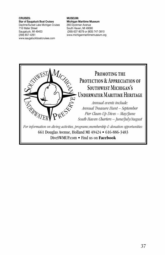
UNDERWATER PRE
SERVE
SOUT
HWEST MICHIG
AN�Promoting the
Protection & Appreciation of Southwest Michigan’s
Underwater Maritime HeritageAnnual events include:
Annual Treasure Hunt – SeptemberPier Clean-Up Dives – May/June
South Haven Charters – June/July/August
For information on diving activities, programs,membership & donation opportunities:
661 Douglas Avenue, Holland MI 49424 • 616-886-3483DiveSWMUP.com • Find us on Facebook
CRUISES:Star of Saugatuck Boat CruisesDaytime/Sunset Lake Michigan Cruises716 Water StreetSaugatuck, MI 49453(269) 857-4261 www.saugatuckboatcruises.com
MUSEUM:Michigan Maritime Museum260 Dyckman AvenueSouth Haven, MI 49090 (269) 637-8078 or (800) 747-3810 www.michiganmaritimemuseum.org
38
Midwest’s Oldest Vocational School— No one can match our experience
Change your life and become a PADI Instructor!• 2 Platinum Course Directors
• Class Flexibility
• PADI Certified Resort Training CourseCourses Offered: Illinois, Arizona, Jamaica, St. Lucia, Turks & Caicos, Belize
Need Financial Assistance for an IDC? Ask about recieving a Grant through REEF: Ralph Erickson Educational Foundation
16336 S. 104th Ave.Orland Park, IL 60467
www.scubaemporium.com
This publication made possible in part by a donation from Shape Corporation

39
Straits of MackinacShipwreck Preserve
The Straits of Mackinac Underwater Pre-serve lies at the northern tip of Lakes Michi-gan and Huron. The five mile long Mackinac Bridge links Michigan’s two peninsulas and marks the dividing point of the two lakes.
The Straits has a well-deserved reputation as a dangerous area to navigate. The region is populated with rocky shoals and shallows that place ships in peril. Perhaps even worse are the storms that can enter the narrow Straits and quickly magnify wind and waves. Over the
years large numbers of ships have foundered in the Straits. Many have yet to be discovered.
Among the best shipwreck dives in the Straits of Mackinac Underwater Preserve are:
Cedarville. Built in 1927, the Cedarville is the third largest freighter lost on the Great Lakes (after the Edmund Fitzgerald and the Carl Bradley). This 600 foot ship sank in a tragic accident on May 7, 1965 in Lake Huron. An ocean-going Norwegian freighter collided midships with the Cedarville in foggy weather. Ten men died when she rolled and sank in 37 degree water. The Cedarville lies on her starboard side broken nearly in two in 105 feet of water. Because she is partly inverted, divers can become disoriented on her. The hull can be reached at about 40 feet. The bow and stern sections are generally both buoyed. Divers can visit the pilothouse and large holds. The unloader arm lies extended on the bottom. The stern features the galley and crew quarters.
Eber Ward. The 213 foot long Eber Ward was built in 1888. She was cut by ice and sank on April 9, 1909 in Lake Michigan. She is upright and mostly intact and is an excellent example of a classic wooden bulk freighter. Her deck can be reached at 105 feet and the bottom at 150 feet. Her engines and boilers provide items of interest for divers. The holds can be fairly easily penetrated by experienced divers. Her port bow has a large and unique “mushroom” anchor. A conventional woodstock anchor rests on her starboard bow. One of her life-boats is overturned on the bottom off her starboard stern.
Sandusky. This small, 110 foot brig, built in 1848, was lost in a storm in Lake Michigan with all hands on September 20, 1856. She sits upright with a figurehead still gracing her prow. Over the years before it was made illegal, many of her artifacts were removed by divers. Still, she is an imposing site to visit and is very popular with less experienced divers since she sits in 80 feet of water and her deck can be reached at 70 feet.
Maitland. The graceful, 141 foot schooner Maitland was built in Canada and launched in 1861. She was converted to American ownership in 1867 and

40
St. HelenaIsland
LakeMichigan
Sturgeon Bay
St. Ignace
MackinawCity
McGulpin Point
LakeHuron
Round Island
MackinacIsland
WaugoshancePoint
Bois BlancIsland
Cayuga St. Andrew
William H. Barnum
CedarvilleMinneapolis
FredMcBrier
ColonelEllsworth Sandusky
Maitland
Northwest
Eber Ward
Wreck Name Depth GPS/LAT/LON Level Date SankCayuga 100’ 45 43.239’N 085 11.401’W Advanced 1895Cedarville (bow) 40’ to 105’ 45 47.235’N 084 40.248’W Advanced 1965Cedarville (stern) 40’ to 105’ 45 47.322’N 084 40.324’W Advanced 1965Colonel Ellsworth 70’ to 85’ 45 48.743’N 085 01.056’W Advanced 1896Eber Ward (bow) 105’ to 150’ 45 48.728’N 084 49.133’W Advanced 1909 Eber Ward (engine) 105’ to 150’ 45 48.763’N 084 49.133’W Advanced 1909 Fred McBrier 89’ to 104’ 45 48.342’N 084 55.301’W Advanced 1890Maitland 70’ to 85’ 45 48.249’N 084 52.555’W Advanced 1871M. Stalker 85’ to 92’ 45 47.620’N 084 41.062’W Advanced 1886Minneapolis 60’ to 124’ 45 48.511’N 084 43.904’W Advanced 1894Northwest (bow) 52’ to 73’ 45 47.436’N 084 51.516’W Advanced 1898Northwest (stern) 52’ to 73’ 45 47.449’N 084 51.462’W Advanced 1898St. Andrew 52’ to 60’ 45 42.051’N 084 31.795’W Advanced 1878Sandusky 70’ to 80’ 45 47.959’N 084 50.249’W Advanced 1856William H. Barnum 50’ to 75’ 45 44.708’N 084 37.866’W Advanced 1894William Young 100’ to 120’ 45 48.777’N 084 41.923’W Advanced 1891
M. Stalker
ShipwreckBoat LaunchCampgroundMarinaWreckageLighthouse
Wm. Young

41
was carrying a load of corn when she collided with two ships on June 11, 1871. She survived a glancing blow by the first but was struck hard on her starboard bow by the second and she sank quickly in Lake Michigan in 85 feet of water. Her masts are gone but her hull is intact except for the impact site. Visiting div-ers can see her windlass and many deck fittings. The remains of her deck cabin rest on the bottom at her starboard stern.
Minneapolis. The steamer Minneapolis began life as a passenger and pack-age freight steamer. First placed in service in 1873, she was converted to a freight only steamer in 1888 by the removal of her upper deck cabins. On April 4, 1894 she was cut by ice and foundered in Lake Michigan. The location is just southwest of the Mackinac Bridge’s south tower in 124 feet of water. Her deck and engines can be reached at about 60 feet. Her bow is broken open and her stern has begun to come apart. Most of her main deck is collapsing downward. Divers can explore her engine and boiler and her deck equipment like her windlass. The rudder has detached from the hull and rests on the bot-tom. Game fish frequently inhabit the site. Currents can be very strong near the shipwreck.
William Young. This shipwreck was discovered in 2002 off South Gra-ham Shoal in Lake Huron. She was built in 1863 and had been converted to a schooner-barge when she foundered and was lost on October 5, 1891. Sitting upright in 120 feet of water, the William Young has all of her fittings and gear intact. Her bow split open when she hit the bottom and her chains and anchors are spilled onto the lake floor. Her deck cabin was swept away when she sank. She was carrying a cargo of coal that still fills her holds. Her wheel, deadeyes, pulleys, and other equipment are scattered about the wreck.
William H. Barnum. The wooden steamer William H. Barnum was built in 1873. She was lost on April 3, 1894 – the day before the Minneapolis. She too was cut by ice and then foundered in about 75 feet of water in Lake Huron
YOUR UNDERWATER ADVENTURE STARTS HERE
SCUBAORTH
SCUBAORTH
833 S. Garfield Ave. n Traverse City, MI 49686 ■ scubanorth.com
• Sales
• Rentals
• Service
• Training
• Dive Charters
• Travel
• Air/EAN/Trimix fills
• Rebreather Friendly
Voice: 231•947•2520 Fax: (231) 947-2899 [email protected]

42
DIVER SERVICES:Blackdog Diving, LLCSummer: P.O. Box 122, Presque Isle, MI 49777 Winter: 854 21st Ct. South, Naples, FL 34102 (507) 236-2280 www.blackdogdivecharters.com [email protected]
Great Lakes Divers400 Cedar St. Alpena, MI 49707(989) 916-9990www.Greatlakesdivers.com
Northern Michigan Dive Center107 W. State St.Cheboygan, MI 49721(231) [email protected]
Scuba North833 S. Garfield Ave. Traverse City, MI 49686(231) 947-2520www.scubanorth.com
Shipwreck Adventures, LLC1611 Washington St.Two Rivers, WI 54241(815) 378-8152, (920) [email protected]
Straits Scuba587 N. State StreetSt. Ignace, MI 49781(810) 240-4320www.straitsscuba.com
close to the Lower Peninsula. When she sank, her boilers apparently exploded leaving the engine area a mixture of debris from the deck and boilers. What remains of her deck and engine can be reached at about 50 feet. The bow is intact and the chain locker area is sufficiently open to permit fairly easy pen-etration. Except for the stern, the hull itself is intact. The stern has collapsed around a very large propeller. The rudder was removed and is on display in a park in St. Ignace.
During the dive season, the Straits of Mackinac Shipwreck Preserve As-sociation places buoys on the major dive sites in the region. More details on the area’s shipwrecks can be found at its website, www.straitspreserve.com.
In addition to shipwreck diving, divers can also explore shore sites. One of them is located at American Legion Park at the south end of Moran Bay off State Street. It has a dock designed to make it easy for divers to enter and exit the water. This area was used to dock ships for many years and divers will see a variety of relics left behind including pottery, tools, machinery and the like.
Divers will find the Straits a friendly and active tourist destination. St. Ig-nace, Mackinaw City and Mackinac Island all host a variety of lodging, restau-rants and activities year round to complement your dive trip. For more informa-tion on activities and events in the area, consult the websites for the St. Ignace Convention and Visitors Bureau, www.stignace.com., St. Ignace Chamber of Commerce, www.stignace.org., Mackinaw City Visitors Bureau, www.macki-nawcity.com., Mackinaw City Chamber of Commerce, www.mackinawcham-ber.com., and the Mackinac Island Tourism Bureau, www.mackinacisland.org.

43
For more information, contact:
St. Ignace Chamber of Commerce
560 N. State StreetSt. Ignace, MI 49781
906-643-8717 • 800-970-8717 [email protected]
www.saintignace.org
Dive the Straits of MackinacThe story of European
settlement of the continent is captured in time and rests on the bottom of the Straits of Mackinac Underwater Preserve. Here schooners, steamers, and artifacts are perfectly preserved and waiting for divers to discover and explore.
Sports Bar & Motel906.643.7744~906.643.9133 ~ 590 N. State St., St. Ignace
Located directly across the street from the Scuba Center and Star Line Main Dock.
Come and unwind in the Sports Bar after your dive and then relax in affordable comfort in our motel!
Open year-round, serving breakfast, lunch, and dinner.
Great DivingFacilities
i n S t . I g n a c ei n S t . I g n a c eBoat Launch • Public Marina
• Ramps for 4 Boats • Protected Breakwall• Large Paved Parking Area
• Restroom Facilities• Showers and Laundry • Picnic Facilities
• Easy Access • 24-Hour Security• Reservations by Phone (800) 447-2757
• Close to Shopping, Dining, and Boardwalk• Slips 30’ to 150’ • 136 Slips• Gas & Diesel • Pumpouts• 30 and 200 Amp Service
• 80 Ton Liftout & Mechanic Service• General Utility Airport with Instrument Approach
Marina Information(906) 643-8131
Located at Star Line Main Dock
Larry McElroy
www.straitsscuba.com810-240-4320 (cell)

44
Many vessels transiting Lake Huron pass near Michigan’s “Thumb”. A scarcity of good harbors has left shipping exposed to bad weather and the concentration of shipping has led to frequent accidents.
At least 22 major shipwrecks lie in and around the Thumb Area Underwater Preserve. The entire area has been the focus of wreck hunting for decades with new discoveries every year.
Among the best shipwreck dives in or near the Thumb Area Underwater Preserve are:
Dunderburg. The schooner Dunderburg was launched in 1867. She sank off Harbor Beach after a collision on August 13, 1868. She rests fully intact in 155 feet of water. A unique, extremely well preserved figurehead adorns her bow and her cargo of grain is still sitting in her holds.
Chicamauga. A large 322-foot double deck schooner, the Chicamauga foundered on September 12, 1919. She sits in about 32 feet of water just east of Harbor Beach and is very accessible to novice divers.
Goliath. The oldest known wreck in the Preserve is the Goliath, a package and bulk freighter. She exploded and burned on September 13, 1848. Her main features are an upright engine, boiler, stove and unique early propellers. They can be examined in about 104 feet of water.
Philadelphia. The 236-foot steamer Philadelphia was built in 1868. She was lost in a collision with the steamer Albany on November 7, 1893. She is upright in 120 feet of water. The wreck is mostly intact with her cargo of heating and cooking stoves resting on the deck and scattered on the lake floor next to the hull.
Albany. The 267 foot steel steamer Albany was launched in 1846. She survived the collision with the Philadelphia on November 7, 1893 and was taken in tow. However, she foundered while undertow and came to rest close by the Philadelphia in 140 feet of water. She lies broken with her stern upright and her bow resting on its starboard side.
John McGean. The “The Great Storm” of November 9, 1913 claimed the large steel freighter John McGean. She was lost with all hands and now rests upside down in 195 feet of water.
Glenorchy. The steel steamer Glenorchy collided with another ship on October 29, 1924. She is a large wreck at 365 feet. She sits in 120 feet of water and can be penetrated by experienced divers.
Troy. This early steamer foundered in a storm in 1859 and is broken up in 94 feet of water. Divers can view her large steeple engine, boiler, unique propeller and “hogging” arches.
Iron Chief. This wooden steamer was lost in a storm on October 4, 1904. She lies broken in 129 feet of water. Whitefish are frequent visitors to this wreck, swimming around her large piles of coal.
Dump Barge. This 1880’s era barge was located in 74 feet of water, just outside of Grindstone City. The wreck is frequently visited by many game fish and usually has
Thumb AreaBottomland Preserve

45
HarborBeach
Mystery Schooner
McGean
Dunderburg
Chickamauga
GlenorchyGoliath
Arctic
Philadelphia
Iron Chief
Daniel J. Morrell
Albany
GrindstonesCaves
Detroit
Port Hope
LakeHuron
Wreck Name Depth GPS/LAT/LON Level Date SankAlbany 140’ 44 06.351’N 082 42.016’W Advanced 1893 Arctic 131’ 43 41.462’N 082 28.712’W Advanced 1893 Jacob Bertchy 6’ 900’ SE of Grindstone City Pier ¼ mile offshore 1879 Chickamauga 32’ 43 50.950’N 082 37.430’W Novice 1919Detroit 200’ 44 13.611’N 082 45.435’W Technical 1854 Dump Barge 74’ 44 07.401’N 082 51.276’W Advanced 1880s Dunderburg 155’ 43 55.641’N 082 33.391’W Advanced 1868Glenorchy 120’ 43 48.580’N 082 31.792’W Advanced 1924Goliath 104’ 43 47.008’N 082 32.721’W Advanced 1848 Iron Chief 129’ 44 05.632’N 082 42.588’W Advanced 1904John McGean 195’ 43 57.196’N 082 31.717’W Advanced 1913Mystery Schooner 145’ 43 57.851’N 082 35.018’W Advanced —Daniel J. Morrell stern 218’ 44 15.478’N 082 50.088’W Technical 1966Daniel J. Morrell bow 205’ 44 18.320’N 082 45.161’W Technical 1966Philadelphia 120’ 44 04.120’N 082 42.992’W Advanced 1893Gov. Smith 175’ 44 09.333’N 082 42.001’W Technical 1906Troy 94’ 44 08.655’N 083 01.939’W Advanced 1859
PortAustin Grindstone
City
PointeAux Barques
ShipwreckBoat LaunchMarinaOther featuresLighthouse
PointeAux Barques light

46
excellent visibility. The chain and winch mechanism for opening the large dump doors are still present.
Jacob Bertschy. Lost in a storm on September 3, 1879, the 139 foot long steamer Bertschy sits in 6 feet of water southeast of the Grindstone City Harbor. This is a great shore dive for beginning divers and snorkelers, with many game fish usually seen.
Daniel J. Morrell. This large freighter was lost in a storm on November 29, 1966. The Morrell is famous for having broken into two sections with her bow coming to rest in 200 feet of water. Her stern remained under power after the loss of the bow and continued on for another 6 miles before settling into 218 feet of water. The wreck’s portions lie just north of the Preserve boundary.
Gov. Smith. This 240 foot long wooden steamer foundered after colliding with the steamer Uranus, on August 19, 1906. She is up right and mostly intact in 175 feet of water.
Throughout the season, most of these shipwrecks are buoyed, at one time or another, by private groups of divers. However, it is always best to have a backup plan, in case the wreck you plan to dive is not buoyed at the time you go out.
In addition to shipwrecks, other diving opportunities exist in the Thumb Area Underwater Preserve. Limestone ledges, walls and sunken islands are located along the Port Austin reef, near the Lighthouse. The reef is covered with remnants of numerous shipwrecks, lost over the decades. Evidence of grindstone manufacture can be found off Grindstone City. Offshore from Kinch Road, in 30 feet of water, is a large woodstock anchor with 300 feet of chain.
Most of the Thumb area is a rural resort area with many state and local campgrounds and parks. No trip to the area is complete without visiting the Pte. Aux Barques Lighthouse and Shipwreck Museum at Lighthouse County Park, www.pointeauxbarqueslighthouse.org. The area also hosts numerous activities and events throughout the dive season. To learn more, consult the websites for Harbor Beach Chamber of Commerce, www.harborbeachchamber.com., the Huron County Visitor Bureau, www.huroncounty.com., Port Hope Chamber of Commerce, www.porthopemich.com., and the Greater Port Austin Chamber of Commerce, www.portaustinarea.com.
DIVER SERVICES:Capital City Scuba515 E. Grand River Ave.Lansing, MI 48906(517) 853-9500www.capitalcityscuba.com
Dive & Glide707 Washington Ave.Bay City, MI 48708(989) [email protected]
Explorer Charters5176 Port Austin RoadCaseville, MI 48725(989) 550-1234Fax [email protected]

47

48
Unique among Michigan’s Underwater Preserves, Thunder Bay is home to both a National Marine Sanctuary and an Underwater Preserve. As such, it benefits from joint NOAA and State management. It is significant as the first Great Lakes national marine sanctuary. A proposal to substantially increase the size of the Sanctuary and Underwater Preserve is currently under review by federal and state authorities. When approved, the Sanctuary and Preserve will stretch from the
northern Presque Isle county line to the southern Alcona county line and extend from the shore to the international boundary in Lake Huron.
Thunder Bay has acquired the nickname “Shipwreck Alley” for good reason. It is estimated that over 100 shipwrecks may lie inside the current boundaries of the Sanctuary and Preserve. Known wrecks date from 1849 to 1966. Many other lost ships have been documented but await discovery.
Among the best shipwreck dives in and near the Thunder Bay National Marine Sanctuary and Underwater Preserve are:
Grecian. The 296 foot long steel steamer Grecian was launched in 1891 and had the misfortune of sinking twice. She collided with another ship in June 1906 and sank. She was raised but sank again while in tow. The second time she came to rest in about 105 feet of water. Her deck can be reached at 75 feet and divers can explore her triple expansion engine, boiler, decks and cargo holds. The middle portion of the ship is collapsing and can be disorienting. Consequently, mooring buoys are often placed on both the bow and stern. The bow is an excellent dive with good photo opportunities because it is intact and upright.
E. B. Allen. This small, 112 foot wooden schooner was struck by another vessel on November 18, 1871 and sank. The Allen came to rest intact on a sandy bottom in about 95 feet of water. Divers can witness evidence of the collision on her port side. Among other artifacts, divers can see her windlass, anchor chains and rudder.
Montana. The Montana was launched in 1872. The 235 foot sidewheel steamer caught fire and burned to the waterline on September 7, 1914. The wreck lies in 70 feet of water although the double steeple compound engine rises 30 feet from the bottom. This is a good wreck for photographers who can capture dramatic pictures of the wreck as well as the game fish that inhabit her.
Pewabic. The Pewabic was lost after a night time collision with her sister ship, the Meteor, on August 9, 1865. 125 people died in the sinking and it ranks as the seventh worst loss of life on the Great Lakes. Today the shipwreck is upright and largely intact. However, she sits at a depth outside recreational limits at 148 to 168 feet. Many of her relics have been removed and are displayed at the Jesse Besser Museum and at the Great Lakes Maritime Heritage Center in Alpena.
Monrovia. This 430 foot ocean going freighter was lost in a collision on June 25, 1959. She was transporting a cargo of steel at the time. Her hull now rests in 80 to 130 feet of water. Unlike the typical laker, she is built along the lines of a “Liberty ship” with her cabins located mid-deck. She was heavily salvaged and her bow has been twisted to one side to permit access to her holds.
John J. Audubon. The Audubon was lost in a collision the same year she was launched – 1854. Today she sits upright outside recreational dive limits in about 161
Thunder Bay National Marine Sanctuary
& Underwater Preserve

49
feet of water. Her deck can be reached at 145 feet. This two masted brig lies with her hull still intact. Her masts are snapped and lie across the deck. Her cargo of railroad iron rails is scattered on and off the wreck and also inside the hull. Divers will see her wheel, windlass and both anchors in addition to the small minutiae of daily life aboard a sailing ship like pottery and china. Her holds can be penetrated but caution should be exercised at this depth.
As part of its mission to preserve and manage the underwater assets of the Sanctuary and Underwater Preserve, NOAA annually installs mooring buoys on about 35 wreck sites.
The Sanctuary and Underwater Preserve is also home to some unique geological formations that make good diving. Limestone walls and reefs can be found on the southeast side of Thunder Bay Island and on the north side of South Point. The Misery Bay Sinkholes are in shallow water and are deep fissures in the natural limestone. Diving there is similar to cave diving and requires special skills and equipment.
The Sanctuary and Underwater Preserve area also affords visitors interesting non-diving activities. The Great Lakes Maritime Heritage Center at Alpena boasts a replica of a 19th century schooner in a dramatic, recreated Great Lakes storm in addition to interpretive displays and exhibits. The Jesse Besser Museum in Alpena also houses an extensive collection of maritime artifacts.
For more information on things to do and see in the area of the Sanctuary and Preserve, consult the websites for the Thunder Bay National Marine Sanctuary, www.thanderbay.noaa.gov., the Thunder Bay Underwater Preserve, www.divealpena.com., the Alpena Area Convention and Visitors Bureau, www.alpenacvb.com., and the Alpena Chamber of Commerce, www.alpenachamber.com.
The Great Lakes Maritime Heritage Center
FREE ADMISSION Great Lakes Maritime Heritage Center 500 West Fletcher Street n Alpena, MI 49707Please call 989.356.8805 for more information
SUMMER HOURS Monday - Saturday 10 - 5Sunday 12 - 5
WINTER HOURS Monday - Saturday 10 - 5
National Marine Sanctuaries National Oceanic & Atmospheric Administration
Thunder Bay National Marine Sanctuary
thunderbay.noaa.gov
n KAYAK n SNORKEL n DIVE n GLASS-BOTTOM BOAT TOURS n EXHIBITS n THEATER n BOAT BUILDING WORKSHOP n GIFT SHOP n HERITAGE TRAIL

50
LakeHuron
Portsmouth
Middle Island
Nordmeer
Alpena
Bissell
D.R. Hanna
Lucinda Van Valkenburg
Isaac M. Scott
W.P. Thew
Monrovia
Viator
Pewabic
William Stephens
South Point
Ossineke
PartridgePoint Sulphur
IslandGrecian
BargeOgarita
Scanlon’sBarge
New Orleans (1)
William P. Rend
Montana
Monohansett
E. B. Allen
Oscar T.Flint
ShipwreckBoat LaunchCampgroundMarina
Shamrock
Wreck Name Depth GPS/LAT/LON Level Date SankE.B. Allen 95’ 45 00.983’N 083 09.883’W Advanced 1871John J. Audubon 145’ to 161’ 44 59.496’N 083 02.277’W Advanced 1854Bay City 12’ 45 03.333’N 083 25.651’W Novice 1902Bissel 12’ 45 03.369’N 083 25.605’W Novice 1905City of Alpena 12’ 44 47.301’N 083 17.447’W Novice —Oscar T. Flint 33’ 45 01.450’N 083 20.670’W Novice 1919Grecian 75’ to 105’ 44 58.118’N 083 12.057’W Advanced 1906D. R. Hanna 120’ 45 04.995’N 083 05.087’W Advanced 1919Mackinaw 6’ 44 48.890’N 083 16.960’W Novice 1890Monohansett 18’ 45 02.019’N 083 12.048’W Novice 1907Monrovia 80’ to 130’ 44 59.012’N 082 55.400’W Advanced 1959Montana 70’ 44 59.046’N 083 16.038’W Intermediate 1914New Orleans (1) 14’ 45 02.950’N 083 14.667’W Novice 1849New Orleans (2) 135’ 45 10.073’N 083 13.076’W Advanced 1906M.V. Nordmeer 35’ 45 08.198’N 083 09.526’W Novice 1966Barge Ogarita 28’ 45 06.326’N 083 13.072’W Novice 1905Pewabic 148’ to 168’ 44 57.908’N 083 06.128’W Technical 1865Portsmouth 12’ 45 11.841’N 083 20.133’W Novice 1867
Venus
Warner
Mackinaw
Audubon
Bay City
City of Alpena
New Orleans (2)

51
Wm. Rend 18’ 45 03.737’N 083 23.567’W Novice 1917Scanlon’s Barge 15’ 45 02.149’N 083 19.627’W Novice —Isaac M. Scott 180’ 45 03.092’N 083 02.353’W Technical 1913Shamrock 12’ 45 03.077’N 083 26.043’W Novice 1905William Stephens 15’ to 20’ 44 53.773’N 083 19.653’W Novice 1849 W. P. Thew 94’ 45 02.705’N 083 09.205’W Advanced 1909L. VanValkenburg 60’ 45 03.390’N 083 10.210’W Advanced 1887Venus 12’ 44 48.588’N 083 16.650’W Novice 1887Viator 165’ 44 59.496’N 083 02.277’W Technical 1935Warner 12’ 45 03.050’N 083 26.128’W Novice 1890
DIVER SERVICES: Blackdog Diving, LLCSummer: P.O. Box 122, Presque Isle, MI 49777 Winter: 854 21st Ct. South, Naples, FL 34102 (507) 236-2280 www.blackdogdivecharters.com [email protected]
Great Lakes Divers400 Cedar St. Alpena, MI 49707(989) 916-9990www.Greatlakesdivers.com
Shipwreck Adventures, LLC2004 Washington St.Two Rivers, WI 54241(815) 378-8152, (920) [email protected]
Thunder Bay Scuba413 S. Ripley Blvd.Alpena, MI 49707(989) 356-6228www.tbscuba.com
MUSEUMS:Great Lakes Lore Maritime Museum367 North 3rd StreetRogers City, MI 49779(989) 734-0706emai: [email protected] www.gllmm.com
The Great Lakes Maritime Heritage Center500 West Fletcher StreetAlpena, MI 49707(989) 356-8805thunderbay.noaa.com
52
The Proposed West Michigan Underwater Preserve extends along the western shore of Lake Michigan from the northern boundary of the Southwest Michigan Underwater Preserve to a point near Pentwater on the north. Its waters adjoin the lakeshore communities of Grand Haven, Muskegon, Whitehall and Pentwater.
The Proposed Preserve is home to several ships lost in storms on Lake Michigan. The shoreline is similar to the Southwest Preserve in that there are limited safe harbors and the area was and remains the home of active shipping traffic. Consequently, many ships foundered before they could reach safety.
Among the best shipwreck dives in or near the Proposed West Michigan Underwater Preserve are:
Ironsides. The Ironsides was a very sturdy vessel built in 1864 to haul iron ore on Lake Superior during the Civil War. She had twin engines and her 231 foot length was braced by dual “hogging” arches on her sides. The demand for ore declined after the Civil War and she was converted to use as a freight and passenger vessel. On September 15, 1873 she was carrying a general freight cargo when she foundered off Grand Haven in about 120 feet of water. This can be a challenging dive because of depth, limited visibility and accumulated fishing tackle. The wreck has begun to settle and collapse into the sand. Still, the engines and some of the hull provide an interesting dive for qualified divers.
Anna C. Minch. This 380 foot steel bulk freighter was lost in the notorious “Armistice Day” storm of November 11, 1940. She now lies broken into two parts in about 36 to 45 feet of water near Pentwater.
State of Michigan. The State of Michigan is believed to have foundered after losing power when a piston rod was thrown. Built in 1875, she was a 165 foot wooden passenger and package freight steamer. She sank on October 18, 1901. Her boiler and outer hull are exposed for divers to inspect in 60 to 75 feet of water off Whitehall.
Salvor. Built in 1896 in England, the Salvor was a 253 foot wooden pseudo-whaleback steamer converted to a steel bulk freight barge. She foundered in a storm on September 26, 1930, between Muskegon and Whitehall. The hull with her cargo of stone now rests in 25 to 30 feet of water. Sand covers the midsection of the hull.
Brightie. A classic lumber schooner-barge, the Brightie was 182 feet long. She was built in 1868 and was lost in August 1928 when she foundered carrying a load of pulpwood. Her cargo and broken remains are in about 70 feet of water north of Whitehall.
Novadoc. This 252 foot steel bulk freighter was built in 1928 in England. The “Armistice Day” storm of 1940 claimed her as well as the Minch. Her broken remains now lie in 12 to 15 feet of water off Pentwater.
Henry Cort. The Henry Cort was a 320 foot whaleback built in 1892. She stranded at the entrance to Muskegon Harbor on November 30, 1934. Her wreckage is broken and twisted lying in about 15 feet of water next to the north break wall of the Muskegon Channel.
Local divers buoy some of the wrecks in the area. However, divers should be prepared to locate shipwrecks they plan to dive.
The Proposed West Michigan Preserve is also home to the Hamilton Reef, also known as “The Rock Pile” near Muskegon. It is a snake-like formation of broken cement rubble just south of the Muskegon Channel in about 30 feet of water. It provides a home for interesting game fish. Near Port Sheldon, divers frequent the “bubbler” near the piping for the Port Sheldon power plant. It too provides a home for game fish. Divers also salvage anchors and other artifacts left by fishermen and boaters.
The communities bordering the proposed Preserve house many museums of interest to divers. Muskegon is home to the Great Lakes Naval Memorial and Museum that includes the WWII submarine Silversides and 125 foot WWII era Coast Guard cutter the USCGC McLane, www.silversides.org. Muskegon also has a WWII LST open for tours, www.lst393.org.
West Michigan Underwater Preserve

53
Wreck Name Depth GPS/LAT/LON Level Date SankBrightie 70’ 43 29.89’N 086 29.89’W Advanced 1928Commanche 90’ 43 50.25’N 086 29.02’W Intermediate —William B. Davock/Bow 215’ to 240’ (Loran: 32402.2/49054.9) Technical 1940William B. Davock/Stern 215’ to 240’ (Loran: 32402.6/49066.1) Technical 1940 Hamilton Reef 30’ 43 12.99’N 086 20.49’W Novice —Helen 14’ 1 mi. N of Muskegon Channel Novice 1886Henry Cort 15’ Off N Muskegon breakwall Novice 1934Interlaken 15’ 43 27.05’N 086 27.49’W Novice 1903Ironsides 120’ 43 02.93’N 086 19.15’W Advanced 1873Anna C. Minch/Bow 36’ to 45’ 43 45.78’N 086 27.77’W Novice 1940Anna C. Minch/Stern 36’ to 45’ 43 45.70’N 086 27.84’W Novice 1940Novadoc 12’ to 15’ 43 41.61’N 086 31.08’W Novice 1940State of Michigan 60’ to 75’ 43 27.33’N 086 27.85’W Intermediate 1901Salvor 25’ to 30’ 43 15.61’N 086 22.11’W Novice 1930
ShipwreckBoat LaunchOther FeaturesMuskegon
GrandRapids
Pentwater
GrandHaven
Ironsides
PortSheldonHolland
Whitehall
Commanche
Minch
Novadoc
BrightieInterlaken
State of Michigan
SalvorHelen
Henry Cort
Hamilton Reef
Ludington
LakeMichigan
Davock
The region has many summer time festivals and events like the Grand Haven Coast Guard Festival, Muskegon Summer Celebration and Rothbury Music Festival.
For more information on the proposed Preserve, visit the website for the Proposed West Michigan Underwater Preserve, www.wmup.org. For more activities and events in the

54
region, consult the White Lake Area Chamber of Commerce and Visitors Bureau, www.whitelake.org., Muskegon County Convention and Visitors Bureau, www.visitmuskegon.org., Muskegon Chamber of Commerce, www.muskegon.org., Grand Haven Area Convention and Visitors Bureau, www.visitgrandhaven.com., and Grand Haven Chamber of Commerce, www.grandhavenchamber.org.
DIVER SERVICES:Dive and Travel AdventuresIndividual and Group Dive VacationsHeather Bloom, Owner, Dive Travel Specialist(231) 855-1353www.diveandtraveladventures.com
Grand Valley Scuba DiversGrand Rapids, MISupporting safe diving since 1967Hope you enjoy diving as much as we doAdvocates of a West Michigan Preservewww.GrandValleyScubaDivers.comgary@GrandValleyScubaDivers.com
Restaurant and Bakery620 E. Colby St.
Whitehall MI 49461
231-894-2999
THE DIVE
Lakeshore Scuba1101 Jackson Ave. Grand Haven, MI 49417(616) 847-4444www.gldl.com
Scuba Zoo5576 Holton Rd.Twin Lake, MI 49457(231) 828-4400www.scubazoo.net
1101 Jackson Ave. • Grand Haven, MI 49417 • (616) 847-4444 • www.gldl.com
55
Virtually every ship traversing Lake Superior passes by Whitefish Point. This peninsula creates the natural harbor of Whitefish Bay. Many ships have been lost trying to reach its shelter.
The Whitefish Point Underwater Preserve embraces Lake Superior’s southern coastline west of Whitefish Point and includes a major portion of Whitefish Bay. It is in these areas that storms and heavy marine traffic have combined to create a long list of historical shipwreck sites. Several shipwreck sites are still eluding search efforts.
Among the best shipwreck dives in or near the Whitefish Point Underwater Preserve are:M. M. Drake. Built in 1882, the M. M. Drake was a 201 foot wooden hull steamer. She
foundered off Vermilion Point in a heavy gale on October 2, 1901. The Drake lost the line to her sinking consort Michigan, and then collided with her while trying to take off her crew. The Northern Wave and Crescent City rescued the crews of both vessels. The Drake was located in 1978 in 40 to 50 feet of water.
Miztec. The Miztec was built at Marine City, Michigan in 1890. On May 15, 1921, the 194 foot, three masted schooner was carrying a load of salt in tow of the steamer Zillah. A storm arose suddenly and her line parted and she disappeared from sight. Her crew of seven was lost. The Miztec is now spread across the bottom in 45 to 55 feet of water.
Myron. The 186 foot lumber hooker Myron was built in 1888. On November 22, 1919, she began to leak in a terrific northwest gale. Her crew cut a barge in tow loose and prepared to abandon ship, but the seas were too high. Despite the steamer Adriatic trying to block the weather and three attempts by the Lifesaving Service, the Myron sank with seventeen on board. The captain survived by standing on the pilothouse when it floated free. Located in 1972, the Myron lies broken into scattered debris in about 50 feet of water.
Indiana. The Indiana was built in 1848. The wooden steamer measured 147 feet in length. On June 6, 1858, the Indiana sank in 100 to 115 feet of water due to mechanical failure ten miles off Crisp Point. Bound for the Soo, she blew a propeller seal, split her stern post, filled with water and foundered quickly. Her cabin was blown off by the pressure and floated about for a while with its lights still burning. The crew and four passengers, including Frank Perew, the ship’s owner, made it to shore in her boats, camped out overnight and then sailed one of her boats to Whitefish Point, where the schooner St. Paul brought them to the Soo. Her machinery was recovered in 1978-79 and now resides at the Smithsonian Museum in Washington, D.C. It is reputedly the oldest marine engine existing that was built in North America.
Niagara. The three masted wooden schooner-barge Niagara was built in 1873 and measured 204 feet in length. In 1887 the Niagara was coming from Wisconsin with a cargo of iron ore in tow of the steamer Australasia. During a severe gale on September 7, 1887, the tow line broke. The Niagara slipped into the wave-troughs, capsized and sank. Her iron ore, which was usually a stable cargo, shifted in the big waves. She was reportedly overloaded by about 250 tons. The nine member crew escaped the boat but was lost when her lifeboat capsized. The Niagara was located in 1972 in 90 to 100 feet of water.
Panther. The 237 foot wooden steamer Panther was built in 1890. On June 26, 1916, she was heading toward Sault Ste. Marie with a cargo of grain. As she was proceeding across
Whitefish PointUnderwater Preserve

56
Lake Superior
Osborn
Indiana
Eureka
Nimick
Mitchell
Niagara
Little Lake
TahquamenonFalls
Whitefish Bay
Shelldrake River
Paradise
Crisp Point
Whitefish Point
John B. Cowle
Drake
MiztecMyron
Vienna Zillah
CometSadieThompson
Superior City
Panther
Samuel Mather
Sagamore
ShipwreckBoat LaunchCampgroundLighthouse
Wreck Name Depth GPS/LAT/LON Level Date SankAllegheny 30’ 46 46.016’N 085 10.601’W Novice 1913Cleveland 15’ 46 42.235’N 085 24.326’W Novice 1864 Comet 200’ to 230’ 46 42.988’N 084 52.012’W Technical 1875John B. Cowle 170’ to 220’ 46 48.271’N 084 57.846’W Technical 1909Crosthwaite 15’ 46 28.126’N 084 52.346’W Novice 1904 Drake 40’ to 50’ 46 46.588’N 085 05.933’W Intermediate 1901Eureka 50’ to 55’ 46 50.029’N 085 10.808’W Intermediate 1886Endress 10’ 46 46.395’N 084 58.657’W Novice 1914 Indiana 100’ to 115’ 46 48’574’N 085 17.184’W Advanced 1858Jupiter 10’ 46 43.898’N 085 19.812’W Novice 1872 Marsh 15’ 46 43.516’N 085 20.746’W Novice 1896 Samuel Mather 140’ to 170’ 46 34.271’N 084 42.334’W Technical 1891Mitchell 120’ to 150’ 46 49.911’N 085 04.880’W Technical 1907Miztec 45’ to 55’ 46 48.085’N 085 04.502’W Intermediate 1921Myron 45’ to 55’ 46 48.460’N 085 01.643’W Intermediate 1919Niagara 90’ to 100’ 46 49.169’N 085 07.532’W Advanced 1887Nimick 30’ 46 45.743’N 085 12.982’W Novice 1907 Osborn 145’ to 165’ 46 51.974’N 085 05.210’W Technical 1911Pacific 15’ 46 40.770’N 085 37.500’W Novice 1887 Panther 90’ to 110’ 46 38.291’N 084 48.358’W Advanced 1916Sadie Thompson 80’ to 114’ 46 42.512’N 084 59.856’W Advanced 1950sSaturn 20’ 46 45.952’N 085 01.547’W Novice 1872 Sagamore 45’ to 65’ 46 31.085’N 084 37.935’W Intermediate 1901Starucca 15’ 46 41.106’N 085 48.510’W Novice 1887 Superior City 190’ to 270’ 46 43.477’N 084 52.434’W Technical 1920Vienna 120’ to 148’ 46 44.416’N 084 57.927’W Advanced 1892Yosemite 10’ 46 31.274’N 085 02.341’W Novice 1892Zillah 230’ to 250’ 46 43.697’N 084 54.951’W Technical 1926Pendle Creek Site 10’ 46 26.714’N 084 49.255’W Novice UnidentifiedGrand Marais Site Shore Line 46 41.414’N 085 50.555’W — Unidentified
IsleParisienne
Yosemite
EndressSaturn
Marsh Jupiter
Allegheny
Cleveland
fToPacificStaruccaGrand Marais Site
ToiCrosthwaite Pendle Creek Sitei

57
a fog covered Whitefish Bay, she was rammed by the steamer James J. Hill. The Hill kept running into the hole until the Panther’s crew clambered aboard. She sank quickly when the Hill backed away. The Panther was found in 1975 in 90 to 110 feet of water. Divers can see two anchors in the bow area, grain cargo, and tools in the stern.
Vienna. The wooden steamer Vienna, built in 1873, measured 191 feet in length. She sank on September 17, 1892 following a collision with the propeller Nipigon about four miles below Whitefish Point. The Vienna was carrying a cargo of iron ore with the schooner Mattie C. Bell in tow. Following the collision, the Nipigon towed the Vienna for about an hour, but the vessel went down in deep water. No lives were lost. Her stern rises majestically from a depth of 145 feet, the bow portion has collapsed. Divers can find a mix of tools and artifacts scattered around the wreck.
Whitefish Point is widely known for its deeper shipwrecks sites. Highly trained technical divers plan intricate profiles which incorporate mixed breathing gasses and decompression schedules. Those seeking to explore shipwrecks beyond recreational diving limits will find several extraordinary sites to explore. The deep cold waters of Lake Superior yield underwater visibility ranging from 20 to 150 feet and the shipwrecks are free of zebra mussels.
Since the publication of the last MUPC Diver’s Guide, several previously undiscovered shipwreck sites were located in 2006 and 2007 by the Whitefish Point Underwater Preserve Volunteers and Diving Team. The group is very excited to release these new locations where you can experience history while exploring these shipwreck sites. Most of the locations have been surveyed, identified, photographed and extensively video recorded. These recent discoveries are located in water generally 10 to 30 feet in depth. Shifting sands have uncovered these wrecks to give insight to their location and condition. With each year and changing weather conditions, these wrecks may become completely covered with moving sand. As an example, currently, the Nimick’s bow is covering up again, while the stern is more exposed.
The local preserve organization places mooring buoys on the major shipwrecks. Most of the shipwreck sites are located in current shipping channels. It is common to lose buoy lines. For current conditions you may call Mike Cook at 906-420-0439 or email [email protected].
Divers visiting the Whitefish Point area will want to include a visit to the Great Lakes Shipwreck Museum at Whitefish Point. It has many displays, models, and artifacts on loan from the State of Michigan that were recovered from shipwrecks in the area. Today, the removal of artifacts from shipwreck sites is illegal.
Besides diving, the area abounds with nature activities including the Tahquamenon Falls State Park. Located by the Tahquamenon upper falls is the Camp 33 Tahquamenon Brewery and Pub. The upper falls is the largest waterfall east of the Mississippi River. Whitefish Point is also a premier site for viewing migrating waterfowl, raptors and songbirds and is a must-see in spring and fall.
For additional information on the Whitefish Point area please visit the Whitefish Point Underwater Preserve website at www.whitefishpoint.net, the Paradise Michigan Chamber of Commerce website at www.paradisemichigan.org, and the Paradise Michigan Tourism Council website at www.paradisemi.org.
DIVER SERVICES:Curley’s Paradise MotelLodging & Air FillsP.O. Box 57Paradise, MI 49768(906) 492-3445 1-800 2 FOR FUN
MUSEUM:Great Lakes Shipwreck MuseumWhitefish Point, Michigan(877) SHIPWRECKwww.shipwreckmuseum.com
58
Over 35 years of supporting diving in and aroundthe Whitefish Point Underwater Preserve.
Cottages & Houses to 4 bedrooms with fireplaces & up to 36” Color TVs
700 ft. “sugar sand” beach
(906) 492-34451-800 2 FOR FUN(Reservations only)
P.O. Box 57Paradise, MI 49768
Curley’s Paradise Motel
Tahquamenon Falls Brewery and Pub
Camp 33Forest Primeval • Tahquamenon • Upper Falls
Welcome DiversEnjoy Fine Family Dining &
Handcrafted Beerand Root Beer
Open year round except April & Nov.Serving 11:00 a.m. - 8:30 p.m.(9:00 on Sat.)
(906) 492-3300

59
Dive Charter Operators
Diver Services Directory
Abyss Dive Charters3980 Dursum Ave. NEAda, MI 49301616-295-6542www.abyssdivecharters.comEmail: [email protected]
Great Lakes DiversCapt. Nick Myers400 Cedar St.Alpena, MI 49707989-916-9990www.greatlakesdivers.comEmail: [email protected]
Thunder Bay ScubaCapt. Joe Sobczak413 S. Ripley BlvdAlpena, MI 49707Store: 989-356-6228Cell: 989-657-2822www.tbscuba.comEmail: [email protected]
Up North ChartersCapt. Paul LeBlanc 2018?2961 Werth RdAlpena, MI 49707989-464-7241Email: Upnorth165@!yahoo.com
Paradise Bay Dive ShopMike WeedeW 25995 Main StreetBeaver Island, MI 49782231-448-2708231-448-3195www.paradisebaydiveshop.comsalty_dog_50@yahoo.comcharters and rental gear
Northern Michigan Dive CenterCheboygan, MI [email protected]
A Superior Divers Center12811 State Hwy M-26Eagle Harbor, MI 49950906-289-4259AIR STATION ONLY !
Isle Royale Charters Boat docks at Grand Portage, MN 855-348-3472 269-270-8334 www.isleroyalecharters.comEmail: [email protected]
M & M Diving1901 10th StreetMenominee, MI 49858906-863-7330www.mmdiving.comEmail: [email protected]
Shipwreck Explorers, LLC 1849A E. Hillcrest Ave. Milwaukee, WI 53207 414-807-8233 www.shipwreckexplorers.comEmail: [email protected]
Shipwreck Tours, Inc. 1204 Commercial Street Munising, MI 49862 906-387-4477 www.shipwrecktours.comEmail: [email protected]
Motor City Scuba40001 Grand RiverNovi, MI 48375248-615-3483www.motorcityscuba.comEmail: [email protected]
Explorer Charters Capt. Tom Carriveau 9156 Sue Drive Pigeon, MI 48756 Home: 989-856-3182 Cell: 989-550-1234 www.explorercharters.comEmail: [email protected]
Elixir Dive ChartersCapt. Sean WilliamsPentwater MI616-308-0127www.elixirdivecharters.comEmail: [email protected]
Four Fathoms Diving, LLC 7320 Main Street Port Sanilac, MI 48469 www.fourfathomsdiving.comEmail: [email protected]
Blackdog Diving, LLCSummer: PO Box 122,Presque Isle, MI 49777Winter: 854 21st Ct. South,Naples, FL 34102Phone: 507-236-2280www.blackdogdivecharters.comEmail: [email protected]
Straits Scuba Center Larry McElroy 587 N. State Street Saint Ignace, MI 49781 Cell: 810-240-4320 www.straitsscuba.comEmail: [email protected]
Mackinac Straits Island & Diving Charters601 N. State StreetSaint Ignace, MI 49781906-298-0369
Shipwreck Adventures, LLC Capt. Greg Such 2004 Washington St. Two Rivers, WI 54241 Store: 920-482-0725 Cell: 815-378-8152 www.shipwreckadventures.com Email: [email protected]

Sea the World Scuba Center 29480 West Ten Mile Road Farmington Hills, MI 48336 248-478-6400 www.seatheworld.us
The Dive Shop G-4020 Corunna Road Flint, MI 48532 810-732-3900 www.diveshopmi.com
Lakeshore Scuba1101 Jackson Ave.Grand Haven, MI 49417616-847-4444www.gldl.com
American Dive Zone 3089 Broadmoor Avenue SE Grand Rapids, MI 49512 616-949-9577 www.americandivezone.com
Moby’s Dive Shop 5300 Northland Drive NE Grand Rapids, MI 49525 616-364-5991 www.mobysdive.com
Ocean Sands Scuba 780 Columbia Avenue Holland, MI 49423 616-396-0068 www.oceansandsscuba.com
Divers Mast 2900 Lansing Avenue Jackson, MI 49202 517-784-5862 www.diversmast.com
Divers Den 604 South Lapeer Road Lake Orion, MI 48362 248-693-9801 www.diving101.com
Capital City Scuba 515 E. Grand River Ave. Lansing, MI 48906 517-853-9500 www.capitalcityscuba.com
Scuba Centers of Michigan 3280 Fort Street Lincoln Park, MI 48146 313-388-3483 www.scubacenters.com
M&M Diving 1901 Tenth Street Menominee, MI 49858 906-863-7330 www.mmdiving.com
Seaquatics 4021 Isabella Road Midland, MI 48640 989-835-6391 www.seaquatics.com
Underwater Antics639 West Isabella RoadMidland, MI 48640989-832-4149www.uwantics.com
Michigan Adventure Diving & Dive Shop 17 East Main Street Milan, MI 48160 734-439-3483 www.michiganadventurediving.com
Motor City Scuba 40001 Grand River Road Novi, MI 48375 248-615-3483 www.motorcityscuba.com
Day’s Divers 5346 Ivanhoe Ct. Portage, MI 49002 269-762-3871 www.dddivers.com [email protected]
Four Fathoms Diving 7320 Main Street Port Sanilac, MI 48469 810-622-3483 www.fourfathomsdiving.com
US Scuba Center 515 South Rochester Road Rochester Hills, MI 48307 248-650-9500www.usscuba.com
Recreational Diving Systems 32552 Woodward Ave Royal Oak, MI 48073 248-549-0303 www.recdiving.com
Great Lakes Divecenter, Inc. 47450 Van Dyke Avenue Shelby Township, MI 48317 586-254-7670 www.greatlakesdivecenter.com
Just Add H2O 17911 IN-23South Bend, IN 46635 574-217-7724 www.justaddh2o.us.com
Michigan Diving Center 18171 174th Street Spring Lake, MI 49456 616-844-1817 www.michigandivecenter.com
Advanced Aquatics Diving, Inc. 25020 Jefferson Avenue St. Clair Shores, MI 48080 586-779-8777 www.advancedaquaticsdiving.com
Sea-Side Dive Shop 28162 Harper Avenue St. Clair Shores, MI 48081 586-772-7676 www.divessds.com
Scuba North, Inc. 833 S. Garfield Ave. Traverse City, MI 49686 231-947-2520 www.scubanorth.com
Scuba Zoo 5576 Holton Rd (M-120) Twin Lake, MI 49457 231-828-4400 www.scubazoo.net
Great Lakes Dive Locker 4909 South Division Ave. Wyoming, MI 49507 616-531-9440 www.gldl.com
Scuba Emporium16336 S. 104th AvenueOrland Park, IL 60437708-226-1614www.scubaemporium.com
Diver’s Lair4405 Calumet AvenueValparaiso, IN219-465-3483www.diverslair.com
Benthic Scuba Center2825 Lauzon Parkway #213Windsor, ON N8T [email protected]
Aquanuts Scuba ClubMichigan Tech UniversityEmail: [email protected]://aquanaut.students.mtu.edu/index.php
Hart City Scuba, Inc.21807 State Road 120Elkhart, IN [email protected]
Michigan Area Dive Shops
60
Great Lakes Divers400 Cedar St.Alpena, MI 49707989-916-9990www.greatlakesdiver.com
Thunder Bay Scuba 413 S. Ripley Blvd. Alpena, MI 49707 989-356-6228 www.tbscuba.com
Divers IncorporatedScuba and Snorkeling 3380 Washtenaw Avenue Ann Arbor, MI 48104 734-971-7770 www.diversinc.com
Huron Scuba 4816 Jackson Road Suite D Ann Arbor, MI 48103 734-994-3483 www.huronscuba.com
Sub-Aquatic Sports & Service 347 Helmer Road North Battle Creek, MI 49037 269-968-8551 www.sassdive.com
Dive and Glide 807 E. Midland St. Bay City, MI 48706 989-892-5771 www.diveandglideinc.com
Aquatic Adventures of Michigan, LLC 10049 E. Grand River Ave #200 Brighton, MI 48116 810-225-9868 www.aquaticadventuresofmi.com
Wolf’s Divers Supply, Inc. 250 W. Main Street Benton Harbor, MI 49022 269-926-1068 www.wolfsmarine.com
Divers Central, Inc. 251 Clay Drive Cadillac, MI 49601 231-876-3483 www.diverscentral.com
Bruno’s Dive Shop, Inc. 34740 Gratiot Ave. Clinton Township, MI 48305 586-792-2040 www.greatlakesdiveshop.com
Northwest Scuba 205 S. Lake Street East Jordan, MI 49727 231-536-0235
Anchor Bay Scuba Training Center 8655 Dixie Highway Fair Haven, MI 48023 586-725-1991 www.anchorbayscuba.com

Visit the official website of theMichigan Underwater Preserve Council, Inc.
For online access to the information made available in the Diver’s Guide, plus all future updates. Then support the MUPC, improve your visibility, and connect with the larger
world of shipwreck diving and conservation with the purchase of a web ad:
www.michiganpreserves.org

![[miles] immensely - in-Elis](https://static.fdocuments.in/doc/165x107/618ba435205f8e76a45a9550/miles-immensely-in-elis.jpg)