A Decision Support System for Monitoring, Reporting and Forecasting Ecological Conditions of the...
16
A Decision Support System for Monitoring, Reporting and Forecasting Ecological Conditions of the Appalachian Trail YQ Wang Department of Natural Resources Science University of Rhode Island Kingston, Rhode Island
-
Upload
egbert-alexander -
Category
Documents
-
view
215 -
download
0
Transcript of A Decision Support System for Monitoring, Reporting and Forecasting Ecological Conditions of the...

A Decision Support System for Monitoring, Reporting and
Forecasting Ecological Conditions of the Appalachian
Trail
YQ Wang
Department of Natural Resources Science University of Rhode Island
Kingston, Rhode Island

Y.Q. Wang (URI)Rama Nemani (NASA/Ames)Fred Dieffenbach (NPS/NETN)Ken Stolte (USDA FS)Glenn Holcomb (USGS)Matt Robinson (ATC, NPS/ATPO)Casey Reese (NPS/ATPO)Marcia McNiff (USGS/NBII)Brian Mitchell (NPS/NETN)Roland Duhaime (URI) Forrest Melton (NASA/Ames)Sam Haitt (NASA/Ames)Hiro Hashimoto (NASA/Ames)Chris Damon (URI)Pete August (URI)John Clark (URI)Fu Luo (URI)Chuck LaBash (URI)Peter Paton (URI)Geri Tierney (SUNY)… … …Jim Coleman (USGS)Karen Jenni and Tim Niemann

Appalachian Trail (A.T.)
• 2,175 miles (3,500 km) long and crosses 14 states in the Eastern U.S.
• Intersecting 8 National Forests; 6 units of the National Park System, more than 70 State Park, Forest, and Game Management units, and 287 local jurisdictions
• 250,000 acres of protected lands harbor rare, threatened, endangered species
• Encompass important water resources

• Millions of people from around the world enjoy the footpath
• More than 6,000 volunteers contribute about 200,000 hours to the A.T. every year.
• More than 10,000 people have reported hiking the length of the A.T.

The north-south alignment of the A.T. represents a cross-section MEGA-Transect of the eastern U.S. forests and alpine areas, and offers a setting for collecting data on the health of the ecosystems.
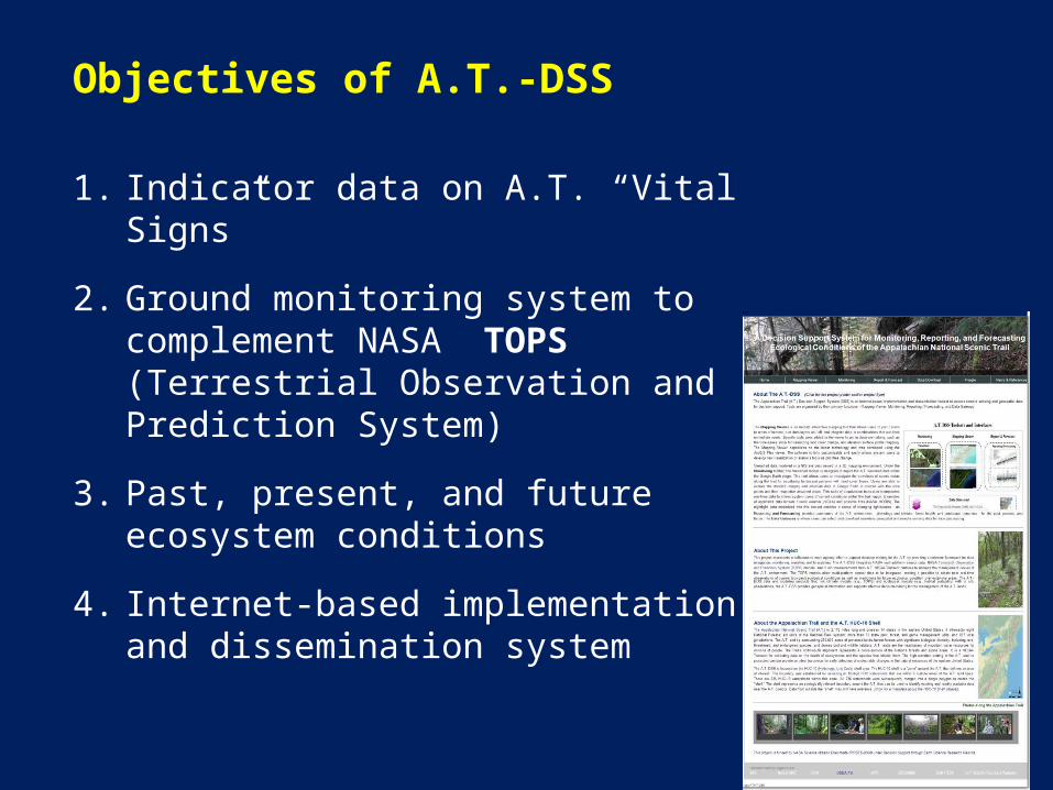
Objectives of A.T.-DSS
1. Indicator data on A.T. “Vital Signs”
2. Ground monitoring system to complement NASA TOPS (Terrestrial Observation and Prediction System)
3. Past, present, and future ecosystem conditions
4. Internet-based implementation and dissemination system

Appalachian Trail Vital Signs
1. Ozone 2. Visibility3. Atmospheric Deposition4. Migratory Breeding Birds5. Mountain Birds6. Forest Vegetation7. R.T.E. Species8. Invasive Species9. Visitor Usage10. Alpine and High Ele.
Vegetation11. Landscape Dynamics12. Phenology 13. Water Resources.

• MODIS Data Products - Landcover Dynamics (MOD12Q2): 2001-2011 - Snow Cover 8-days (MOD10A2): 2000 - 2011 - Land Cover Type (MOD12Q1): 2001 - 2004 - Vegetation Indices (MOD13A2): 2000 - 2011 - Leaf Area Index FPAR (MOD15A2): 2000-2011 - NDVI (MOD13Q1): 2000 – 2009 - Land Surface Temperature (MOD11A2): 2000-2011
• GIMMS (Global Inventory Modeling & Mapping Studies) NDVI (8-km): 1981-2009• NACP (North American Carbon Program) Modeled Carbon Flux (1-km): 1982-2006• SOGS (Surface Observation and Gridding System) Metrological Data (1-km) from 1976-2008
TOPS Data for the A.T. Shell

In situ Data and Observations
• Using existing USDA Forest Service’s FIA data (>4,000 plots)
• Field observations of selected segments• Field observation of ecotone plots
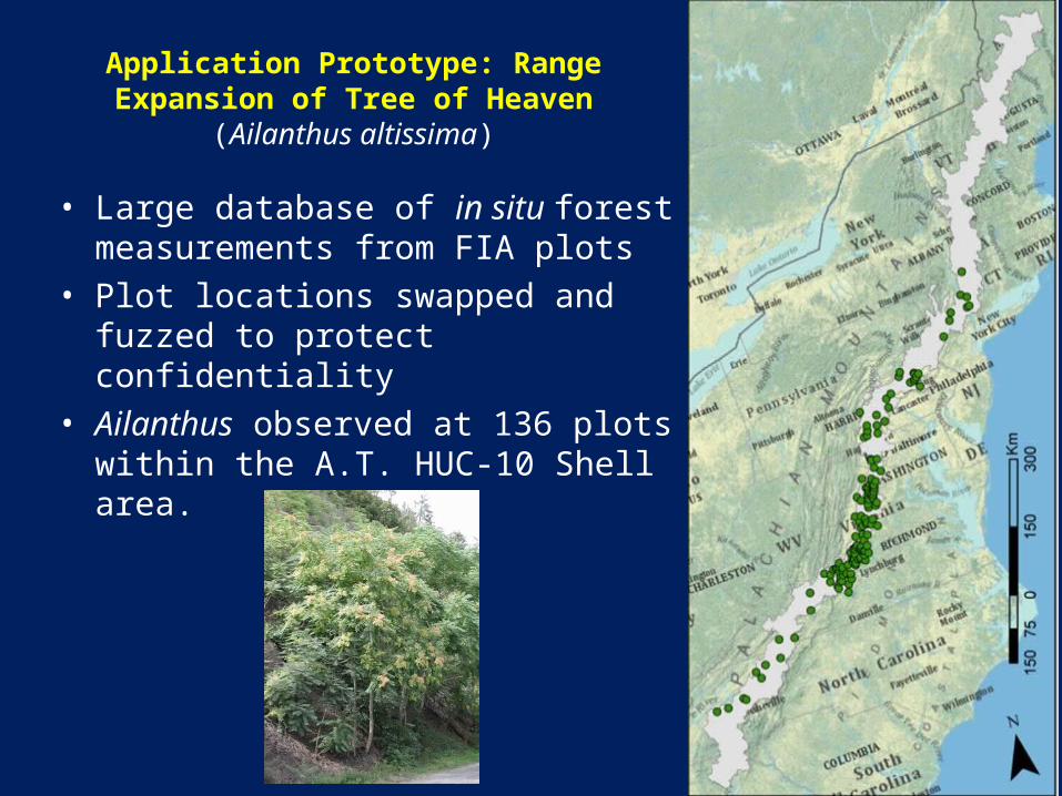
• Large database of in situ forest measurements from FIA plots
• Plot locations swapped and fuzzed to protect confidentiality
• Ailanthus observed at 136 plots within the A.T. HUC-10 Shell area.
Application Prototype: Range Expansion of Tree of Heaven
(Ailanthus altissima)

Objectives
1.Relate the observed distribution of Ailanthus to a set of ecogeographical variables.
2.Map the current distribution of suitable habitats and identify high-risk regions.
3.Model distribution of future Ailanthus habitats.


A.T. DSS Web Site
http://www.edc.uri.edu/ATMT-DSS/
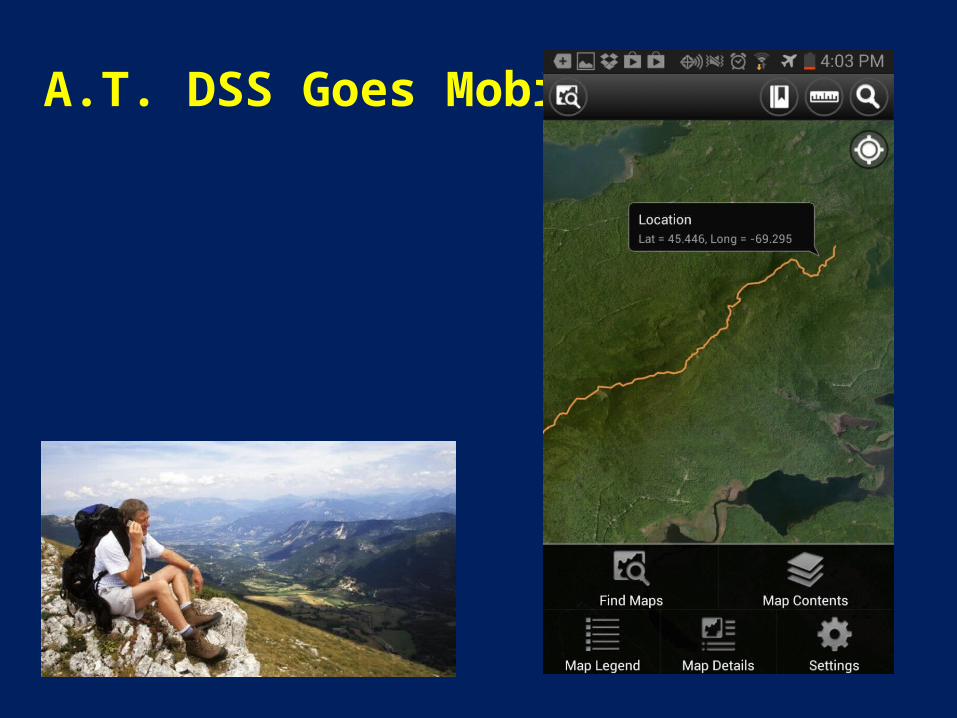
A.T. DSS Goes Mobile