A BIOLOGICAL STRATEGY TO PROTECT AND RESTORE …Habitat Restoration The highest priority for...
53
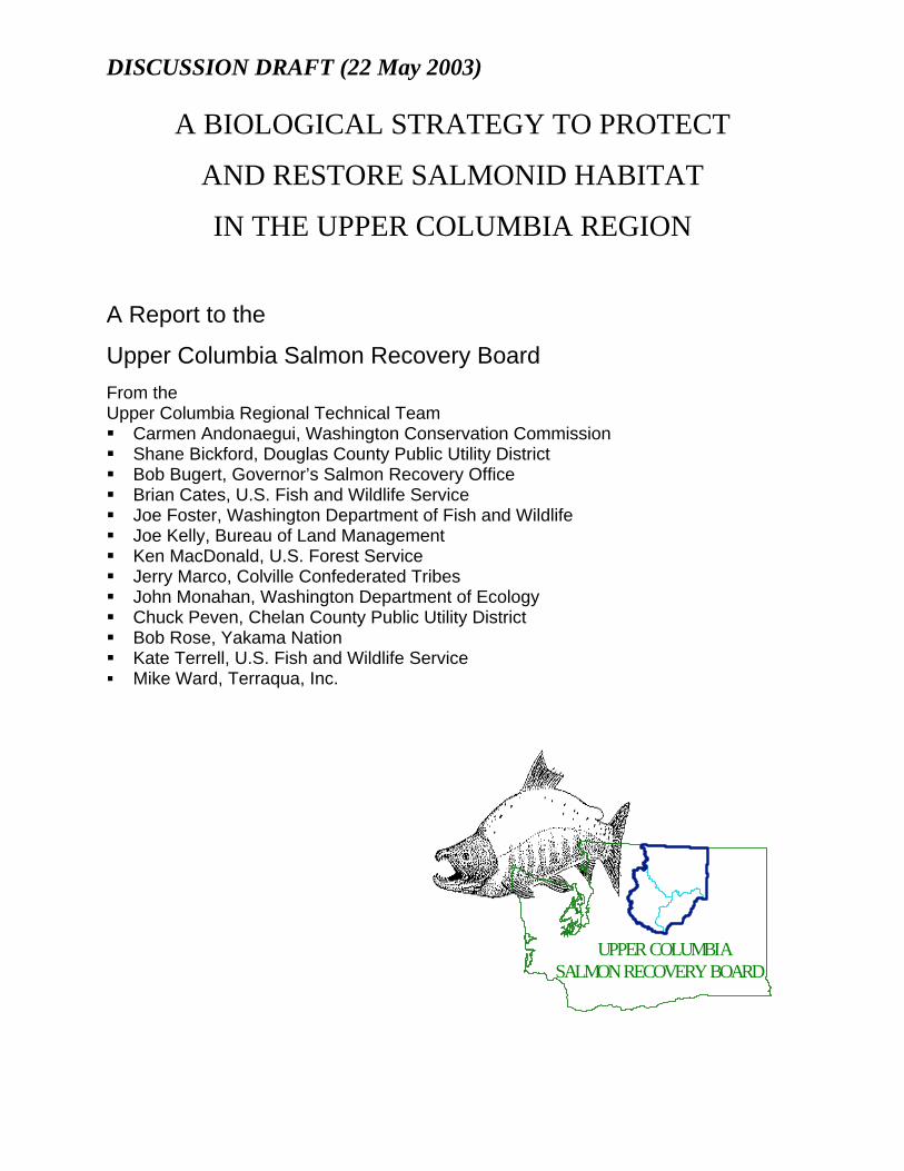
DISCUSSION DRAFT (22 May 2003) A BIOLOGICAL STRATEGY TO PROTECT AND RESTORE SALMONID HABITAT IN THE UPPER COLUMBIA REGION A Report to the Upper Columbia Salmon Recovery Board From the Upper Columbia Regional Technical Team Carmen Andonaegui, Washington Conservation Commission Shane Bickford, Douglas County Public Utility District Bob Bugert, Governor’s Salmon Recovery Office Brian Cates, U.S. Fish and Wildlife Service Joe Foster, Washington Department of Fish and Wildlife Joe Kelly, Bureau of Land Management Ken MacDonald, U.S. Forest Service Jerry Marco, Colville Confederated Tribes John Monahan, Washington Department of Ecology Chuck Peven, Chelan County Public Utility District Bob Rose, Yakama Nation Kate Terrell, U.S. Fish and Wildlife Service Mike Ward, Terraqua, Inc. UPPER COLUMBIA SALMON RECOVERY BOARD
Transcript of A BIOLOGICAL STRATEGY TO PROTECT AND RESTORE …Habitat Restoration The highest priority for...
DISCUSSION DRAFT (22 May 2003)
A BIOLOGICAL STRATEGY TO PROTECT
AND RESTORE SALMONID HABITAT
IN THE UPPER COLUMBIA REGION
A Report to the
Upper Columbia Salmon Recovery Board
From the Upper Columbia Regional Technical Team Carmen Andonaegui, Washington Conservation Commission Shane Bickford, Douglas County Public Utility District Bob Bugert, Governor’s Salmon Recovery Office Brian Cates, U.S. Fish and Wildlife Service Joe Foster, Washington Department of Fish and Wildlife Joe Kelly, Bureau of Land Management Ken MacDonald, U.S. Forest Service Jerry Marco, Colville Confederated Tribes John Monahan, Washington Department of Ecology Chuck Peven, Chelan County Public Utility District Bob Rose, Yakama Nation Kate Terrell, U.S. Fish and Wildlife Service Mike Ward, Terraqua, Inc.
UPPER COLUMBIA SALMON RECOVERY BOARD

DISCUSSION DRAFT (22 May 2003)
Upper Columbia Biological Strategy 2003.doc 2
A BIOLOGICAL STRATEGY TO PROTECT
AND RESTORE SALMONID HABITAT
IN THE UPPER COLUMBIA REGION
Introduction
Purpose
This document outlines a biological strategy to protect and restore salmonid habitat in the Upper
Columbia Region. The intent of the document is to provide a technical foundation to set regional
priorities for habitat protection and restoration, based on available information and the professional
judgement of fisheries biologists familiar with the region. This report was developed by a Regional
Technical Team (RTT), which was established by the Upper Columbia Salmon Recovery Board
(UCSRB). This report is an update to initial documents provided to the UCSRB (RTT 2000, 2002a).
Further updates may be provided as new information becomes available Recommendations contained
herein may be used by decision-makers to more effectively allocate resources to contribute to the
recovery of salmonids listed under the federal Endangered Species Act (ESA). This strategy identifies the
WRIA 44 – Moses
WRIA 49 - Okanogan
WRIA 48 - Methow
WRIA 50 - Foster
State WRIA boundaries
WRIA 45 - Wenatchee
WRIA 46 - Entiat
WRIA 47 - Lake Chelan
Douglas County Okanogan County Chelan County

DISCUSSION DRAFT (22 May 2003)
Upper Columbia Biological Strategy 2003.doc 3
key biological considerations in protecting and restoring habitat, yet does not provide recommendations
on the means to accomplish these issues, as they generally entail important policy considerations on
natural resource management. Project sponsors are encouraged to use this strategy to identify the
locations and types of projects that would provide a high likelihood of benefit to salmonids, yet should
work closely with the UCSRB in identifying appropriate means to implement the projects.
The UCSRB is a partnership among Chelan, Douglas, and Okanogan counties, the Yakama Nation, and
Colville Confederated Tribes in cooperation with local, state, and federal partners. The mission of the
UCSRB is to restore viable and sustainable populations of salmon, steelhead, and other at-risk species
through the collaborative, economically sensitive efforts, combined resources, and wise resource
management of the Upper Columbia Region. To better meet its mission, the UCSRB wishes to ensure
that actions taken to protect and restore salmonid habitat in the region are based on sound scientific
principles. The UCSRB may use these principles to develop strategies that address the needs of salmon in
an economically viable manner.
One function of the RTT is to review the technical merits of projects to be submitted by project sponsors
in the Upper Columbia Region for funding by the Washington State Salmon Recovery Funding Board
(SRFB). The UCSRB directed the RTT to establish a scientific framework for this process, with the
premise that it will enable them to identify projects that will best contribute to the recovery of salmonids
listed under the ESA. This report is a technical guide to help the Lead Entities, Citizens’ Committees,
and project sponsors to develop and identify habitat protection and restoration projects.
Scope
The species included in this overview include chinook salmon (Oncorhynchus tshawytscha), sockeye
salmon (O. nerka), steelhead (O. mykiss), westslope cutthroat trout (O. clarki) and bull trout (Salvelinus
confluentus), although other species will benefit from the recommended priorities in this report. The
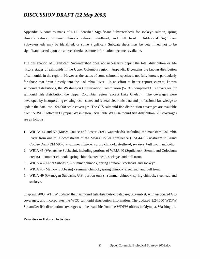
Upper Columbia Region (Figure 1) is comprised of the mainstem Columbia River and its tributaries
upstream of Rock Island Dam to the tailrace of Chief Joseph Dam. Within this region there are seven
Water Resource Inventory Areas (WRIAs): Moses Coulee (44), Wenatchee (45), Entiat (46), Chelan (47),
Methow (48), Okanogan (49), and Foster Creek (50), and the northernmost tip of Alkali-Squilchuck (40).
These WRIAs are referred to as “subbasins” in this document, and are composed of “watersheds”
(Hydraulic Unit Code 5). This report provides specific recommendations for each of the 31 watersheds
(and the mainstem Columbia River) in the region.

DISCUSSION DRAFT (22 May 2003)
Upper Columbia Biological Strategy 2003.doc 4
The RTT considers this report to be iterative. New and more refined biological priorities could be
developed when key policy directives are made, or when new biological data are gathered. The priorities
suggested in this report are consistent with the 2000 and 2002 reports released by the RTT.
Relation to Other Assessments
This document complements the Habitat Limiting Factors Analyses (HLFA) conducted by the
Washington Conservation Commission. It uses the information in the completed HLFA reports for the
Wenatchee, Entiat, Foster Creek/Moses Coulee, Methow and Okanogan WRIAs to establish a common
framework throughout the region, rather than on an individual WRIA basis. As this strategy develops, it
will incorporate findings of individual WRIAs under the state’s Watershed Planning Act (RCW 90.82).
This strategy considers the biological priorities set in the Spirit of the Salmon Recovery Plan by the
Columbia River Intertribal Fish Commission and the Tributary Assessment of the Mid-Columbia
Mainstem Conservation Plan, and is intended to complement the Subbasin Summaries under the
Northwest Power and Conservation Council’s Provincial Rolling Review. The integration of tribal, local,
state, and federal watershed planning and salmon recovery efforts into this strategy illustrates the
coordinated and comprehensive approach of the Upper Columbia Salmon Recovery Board.
Priorities in Species Distribution
Threatened, endangered and unlisted salmonids are found in most, but not all watersheds in the Upper
Columbia Region. In order to help guide protection and restoration programs, the RTT adapted the work
of MacDonald et al. (1996) who identified Significant Subwatersheds (HUC-6 level) for spring chinook
salmon, summer chinook salmon, sockeye salmon, summer steelhead, bull trout, and westslope cutthroat
trout. Based on the framework established by MacDonald et al. (1996), we considered a subwatershed to
be significant if any one of the following criteria was met:
1. The subwatershed was identified as a stronghold for the species in the Interior Columbia Basin
Assessment (ICBEMP 1997).
2. The subwatershed provides the primary spawning and/or rearing habitat within the watershed.
3. The subwatershed represents the only known occupied habitat within a watershed and is fairly
isolated from populations in other watersheds, and thus is significant from a distribution standpoint.
4. The subwatershed contributes toward the genetic integrity of a species. One of the problems facing
many native fish populations is genetic introgression. Relatively pure populations, which may be
very important to the evolutionary legacy of a species, may be limited. Recently genetic information
has become available for some populations in the Upper Columbia Region. Populations judged to be
“pure,” “essentially pure,” or “good” based upon genetic analysis were considered to be significant.
5. The subwatershed is known or strongly suspected to support a stable, strong population of a species.
DISCUSSION DRAFT (22 May 2003)
Upper Columbia Biological Strategy 2003.doc 5
Appendix A contains maps of RTT identified Significant Subwatersheds for sockeye salmon, spring
chinook salmon, summer chinook salmon, steelhead, and bull trout. Additional Significant
Subwatersheds may be identified, or some Significant Subwatersheds may be determined not to be
significant, based upon the above criteria, as more information becomes available.
The designation of Significant Subwatershed does not necessarily depict the total distribution or life
history stages of salmonids in the Upper Columbia region. Appendix B contains the known distribution
of salmonids in the region. However, the status of some salmonid species is not fully known, particularly
for those that drain directly into the Columbia River. In an effort to better capture current, known
salmonid distributions, the Washington Conservation Commission (WCC) completed GIS coverages for
salmonid fish distribution the Upper Columbia region (except Lake Chelan). The coverages were
developed by incorporating existing local, state, and federal electronic data and professional knowledge to
update the data into 1:24,000 scale coverages. The GIS salmonid fish distribution coverages are available
from the WCC office in Olympia, Washington. Available WCC salmonid fish distribution GIS coverages
are as follows:
1. WRIAs 44 and 50 (Moses Coulee and Foster Creek watersheds), including the mainstem Columbia
River from one mile downstream of the Moses Coulee confluence (RM 447.9) upstream to Grand
Coulee Dam (RM 596.6) - summer chinook, spring chinook, steelhead, sockeye, bull trout, and coho.
2. WRIA 45 (Wenatchee Subbasin), including portions of WRIA 40 (Squilchuck, Stemilt and Colockum
creeks) - summer chinook, spring chinook, steelhead, sockeye, and bull trout.
3. WRIA 46 (Entiat Subbasin) – summer chinook, spring chinook, steelhead, and sockeye.
4. WRIA 48 (Methow Subbasin) - summer chinook, spring chinook, steelhead, and bull trout.
5. WRIA 49 (Okanogan Subbasin, U.S. portion only) - summer chinook, spring chinook, steelhead and
sockeye.
In spring 2003, WDFW updated their salmonid fish distribution database, StreamNet, with associated GIS
coverages, and incorporates the WCC salmonid distribution information. The updated 1:24,000 WDFW
StreamNet fish distribution coverages will be available from the WDFW offices in Olympia, Washington.
Priorities in Habitat Activities

DISCUSSION DRAFT (22 May 2003)
Upper Columbia Biological Strategy 2003.doc 6
Habitat Protection
The highest priority for protecting biological productivity should be to allow unrestricted stream channel
migration, complexity, and flood plain function. The principal means to meet this objective is to protect
riparian habitat--in Category 1 and 2 subwatersheds. Predetermined riparian protection measures (i.e.,
buffer strip widths) for each site may not be biologically effective. Riparian function depends on site-
specific considerations including channel type, floodplain character, presence of wetlands or off-channel
features, and the potential for channel migration. Obviously, some areas have more acute needs, because
they may be within significant population areas, or may be at risk to habitat degradation, and should be
given greater emphasis. These efforts will likely occur throughout the subbasins where properly
functioning habitat remains.
Protection of existing stream flows in virtually all subbasins in the Upper Columbia Region is important
to maintaining biological productivity. Currently, the primary means to protect existing flows are
regulatory in nature. Additionally, some Upper Columbia streams need increased flows to address
chronic sources of mortality to salmonids; inadequate flows may be natural or human-caused. Diversion
of water for out-of-stream uses (principally for irrigation and municipalities) is the most tangible impact
to instream flow needs for fish. In addition, degradation of floodplain (and some upland) habitats
exacerbates the peak and nadir of seasonal flows in all Upper Columbia subbasins; this strongly reduces
the productivity and expression of diverse life histories in the region. The full effects of upland habitat
degradation on peak flows in the Upper Columbia Region are not understood and should be assessed.
The means to increase flows are discussed in the section on habitat restoration.
DISCUSSION DRAFT (22 May 2003)
Upper Columbia Biological Strategy 2003.doc 7
Habitat Restoration
The highest priority for increasing biological productivity is to restore the complexity of the stream
channel and floodplain. The RTT recommends a range of strategies for habitat restoration in the Upper
Columbia Region, based on a fundamental emphasis of promoting habitat diversity, instream flows, and
water quality throughout the watershed. Most of these efforts will likely be on the lower stream reaches
and aggradation zones (typically areas of low stream gradient where deposition of substrate materials
occurs). Restoration in these areas would benefit a broad range of species and populations. Examples of
restoration measures would include, but not be limited to:
1. provide fish access to disconnected stream sections or oxbows,
2. remove dikes (or similar structures) that prevent stream channel migration,
3. change the points of origin for problematic water withdrawals to less sensitive site(s),
4. screen water intakes to prevent impingement or stranding of juvenile fish,
5. manipulate stream flows at critical periods through various means,
6. provide alternative sources of irrigation and domestic water to mitigate impacts of problematic
surface water diversions,
7. remove passage barriers,
8. use mechanical means to encourage natural development of riparian areas,
9. implement upland management practices that reduce sediment delivery to streams, and
10. use engineering techniques to increase complexity of permanently altered habitats.
We strongly recommend that structural manipulation of the stream channel (such as boulder or log
placements) not be used unless (1) they are designed at the reach level or context and (2) those factors
that are causing the habitat degradation cannot be corrected within a reasonable time. Remedial measures
to rectify the effects of improper land use practices can have more benefits to biological productivity, may
be economically more efficient, and be more permanent than measures that require active management of
the stream channel. The simple alteration of physical features in the stream channel does not necessarily
restore biological productivity when improper riparian or upland management practices continue to exert
their effects on the aquatic ecosystem. Attempts to restore habitat are likely to fail if structures are placed
in the stream channel without addressing those activities that are causing habitat degradation. For
example, some short-term habitat benefits might be achieved by adding large woody debris (LWD) to
streams, but the benefits can only be temporary from an ecological perspective unless riparian
management practices ensure the long-term recruitment of LWD from the riparian zone.

DISCUSSION DRAFT (22 May 2003)
Upper Columbia Biological Strategy 2003.doc 8
In some isolated situations, restoration projects may be accomplished with both short-term and long-term
objectives. For example, LWD may be secured to stabilize erosive banks, allowing interim streambank
protection and salmonid habitat, while passive restoration and revegetation will ensure proper functioning
riparian conditions for the long term. We feel these projects are biologically effective when the initiation
of the short-term strategy has been integrated with the long-term strategy. Each active restoration project
should be reviewed on a case-by-case basis.
Priorities Across Varied Landscapes
The consensus of the RTT is that protection and restoration should focus first on maintaining the best
remaining examples of biological integrity, connectivity, and diversity. This strategy will allow the
populations to stabilize in abundance and productivity over the long term. It may be likely however, that
current core populations have inadequate diversity and spatial distribution to ensure population resiliency.
To provide a framework to set priorities consistent with this strategy, the RTT classified each watershed
(HUC-5 level) in the Upper Columbia Region into four categories, based on the functionality of the
aquatic ecosystems in those watersheds, and the capability of the ecosystem to protect against ecological
catastrophe for endemic populations. We also designated the mainstem Columbia River as separate
(Category 5) because of its unique features. We adapted the classification system used by Quigley and
Arbelbide (1997) for this report. In general, Category 1 watersheds should receive priority allocation of
financial and management resources. Subsequent allocation of resources should be given to Categories 2
and 3, in that order, once refuge habitats (Category 1) for the target species are protected and secure. This
does not mean however, that specific actions should not occur in Category 2 and 3 watersheds until all
activities in Category 1 watersheds are completed. Any project within those watersheds that increase the
range, life history diversity, or age cohorts of one or more species would contribute to the overall strategy
of making them more robust to disturbances within and outside the region. As salmon recovery
progresses, founder populations from core areas would colonize many watersheds that are suitable, yet
unoccupied. Restoration of Category 4 watersheds should be considered in the regional recovery planning
process, but immediate actions there would not be a priority.
Category 1:
These watersheds represent systems that most closely resemble natural, fully functional aquatic
ecosystems (Table 1). In general, they comprise large, often continuous blocks of high-quality habitat
and subwatersheds supporting multiple populations. Connectivity among subwatersheds and through the

DISCUSSION DRAFT (22 May 2003)
Upper Columbia Biological Strategy 2003.doc 9
mainstem river corridor is good, and more than two species of federally listed fish are known to occur.
Exotic species may be present but are not dominant. Protecting the functioning ecosystems in these
watersheds is a priority.
Category 2:
These watersheds support important aquatic resources, often with subwatersheds classified as strongholds
(Appendix A), for one or more populations throughout. The most important difference between Category
1 and Category 2 is an increased level of fragmentation that has resulted from habitat disturbance or loss
(Table 1). These watersheds have a substantial number of subwatersheds where native populations have
been lost or are at risk for a variety of reasons. At least one federally listed fish species can be found
within the watershed. Connectivity among subwatersheds may still exist or could be restored within the
watershed so that it is possible to maintain or rehabilitate life history patterns and dispersal. Restoring
ecosystem functions and connectivity within these watersheds are priorities.
Category 3:
These watersheds may still contain subwatersheds that support salmonids (Table 1). In general, however,
these watersheds have experienced substantial degradation and are strongly fragmented by extensive
habitat loss, most notably through loss of connectivity with the mainstem corridor. At this time, there are
limited opportunities for restoring full expression of life histories for multiple populations found within
the watershed. The priority for funding in these watersheds should be to rectify the primary factor that is
causing the habitat degradation.
Category 4:
These watersheds contain both functional and non-functional habitats that historically supported
populations of one or more federally listed species (Table 1). Exotic species may now be dominant in one
or more subwatersheds; native species are typically not present in sustainable numbers.
Category 5:
The Upper Columbia River is a migration and movement corridor for anadromous and inland species, and
has documented spawning, rearing, and overwinter habitat for several species (Table 1). Hydroelectric
dams primarily effect habitat quality and use in the mainstem, but shoreline management also influences
salmonid habitat use. Protection of shoreline areas should be a priority. Restoration should be
considered, if it can be shown to cause sustainable and reasonable improvements to productivity of
salmonids in the Upper Columbia Region.

DISCUSSION DRAFT (22 May 2003)
Upper Columbia Biological Strategy 2003.doc 10
Table 1. Comparison of key indicators for watershed categories used to identify priority actions for protection and
restoration of salmonid habitat in the Upper Columbia Region. The mainstem Columbia River is a separate
category, and is treated separately in this analysis.
Significant Principle Habitat Exotic Listed
Category subwatersheds actions fragmentation species species
1 Yes Protection Low Low Two or more
2 Yes Protection/ Medium Medium One or more
restoration
3 Possible Restoration High High Possible
4 No Restoration High High Possible
Interim Objectives by Subbasin and Watershed
The following narratives for each subbasin (HUC-4) provide interim (five-year) objectives for protection
and restoration of salmonid habitats. In these assessments, we identify priorities within and across the
subbasins. The tables in Appendix B provide greater detail: they outline the status of each watershed
(HUC-5), classify them by the above categories, identify Significant Subwatersheds (HUC-6),
recommend priority approaches, and lay the foundation for a region-wide effectiveness monitoring
program (discussed in Section 7).
The Wenatchee Subbasin (WRIA 45)
The Wenatchee River is unique among subbasins in the Upper Columbia Region in that it supports the
greatest diversity of populations and overall abundance of salmonids, yet is facing the greatest risk of
habitat loss and degradation. State highways, railroads, and housing development have substantially
diminished the overall function of the stream channel and floodplain. This has impaired stream
complexity, wood and gravel recruitment, floodwater desynchronization and retention, late summer
flows, and water quality.

DISCUSSION DRAFT (22 May 2003)
Upper Columbia Biological Strategy 2003.doc 11
There are core populations of sockeye salmon, steelhead, bull trout and both spring and summer chinook
salmon in the upper Wenatchee Subbasin that are relatively strong, when compared to other populations
in the Columbia Basin. The highest regional priority should be the protection of this salmonid
community. The immediate strategy should be to protect the watersheds that contain these core
populations so that they are robust to normal environmental disturbances, and then to expand their range
to adjacent watersheds. Priority (Category 1) watersheds within the Wenatchee Subbasin are White
River, Chiwawa River, and the upper and middle mainstem Wenatchee River (including Lake Wenatchee,
Table 2). These watersheds are well connected and support a diverse assemblage of native species.
Efforts should be made to connect Category 1 and 2 watersheds (Nason Creek, Middle Mainstem
Wenatchee River, and Icicle Creek) to these strongholds, which would enable a fuller expression of life
history strategies and increase population resilience.
Recent research indicates that the mainstem Wenatchee River provides important habitat for many life
stages of spring and summer chinook salmon, steelhead, and bull trout. The mainstem at this time is most
vulnerable to riparian and instream habitat degradation. All remaining intact areas on the mainstem
should be protected, and flood plain function should be restored, particularly from the Mission Creek
confluence downstream to the Columbia River confluence. This could primarily be done with passive
restoration. Since this reach has the highest discharge in the subbasin, the extent of riparian vegetation
needed to restore flood plain function would be larger than the tributaries. Benefits of this action would
be numerous to anadromous and inland salmonids, as well as a myriad of wildlife species.

DISCUSSION DRAFT (22 May 2003)
Upper Columbia Biological Strategy 2003.doc 12
The Entiat Subbasin (WRIA 46)
The Entiat River has been affected by upland management activities throughout the subbasin and
construction of flood control dikes in the lower mainstem. To encourage properly functioning and stable
habitats in the subbasin, four actions should be approached simultaneously:
1. protect core subwatersheds in the upper subbasin and upper Mad River (Category 1 watersheds),
2. continue restoration of highly erosive upland areas in Fox, McCree, Brenegan, Preston, and Mud
creeks, Crum Canyon, and the mainstem Entiat between Fox and Stormy creeks (Category 1 and 2
subwatersheds),
3. restore habitat diversity and channel function in the lower Entiat River (a Category 2 watershed), and
4. increase late summer instream flows in the lower Entiat and lower Mad rivers (Category 2
watersheds).
Upland erosion is a severe chronic problem in the Entiat Watershed, yet substantial restoration efforts are
underway in the Wenatchee National Forest to address this problem. Erosion on private lands contributes
little to the overall problem of sediment delivery to the stream.
Low stream channel complexity is the primary limitation to productivity of salmonids on the lower 20-km
of the mainstem Entiat River (downstream of the terminal moraine: Category 2). Stream sinuosity is low,
with very few point bars for gravel accumulation. Instream habitat diversity is also low, with few pools,
glides, pocket waters or LWD accumulations. As a result, there are very few resting areas for both adult
and juvenile salmon through this important migration corridor. Efforts to improve stream sinuosity and
channel forming processes in the lower reach should be considered.
Based on the work of NRCS, we believe the most feasible means to restore habitat in the lower Entiat
River is primarily in structure placement as an immediate improvement, and floodplain restoration as the
long-term solution. This short term/long term approach is the most pragmatic restoration practice
available for the lower Entiat River. Initially, managers should actively restore the lower Entiat River to
increase stream habitat complexity, encourage thalweg development, and deposition of spawning gravels.
The long-term approach should be to restore riparian and floodplain habitat in the lower Entiat River.
Such measures would also be feasible in the lower Mad River (a Category 2 subwatershed).
A multi disciplinary team of fishery biologists, hydrologists, and fluvial geomorphologists should provide
specific recommendations on the types of structures that would work best, based upon channel
configuration. Active restoration projects should be reviewed on a case-by-case basis. We caution that
DISCUSSION DRAFT (22 May 2003)
Upper Columbia Biological Strategy 2003.doc 13
these approaches to increase productivity are short-term, and will likely require maintenance. The lower
Entiat River is one of the few watersheds in the Upper Columbia Region where active manipulation of the
stream channel is appropriate, and should only be done with a strategy in place to restore floodplain
function on a permanent basis.
The most pressing needs on the lower Entiat River are the lack of instream complexity and riparian cover,
yet there are other factors that adversely affect salmonids. It is our opinion that instream flows limit
salmonid production in the lower Entiat River, but not to the chronic and severe extent seen in other
subbasins of the Upper Columbia Region. This is partly a result of the natural characteristics of the
watershed, upland slope condition, irrigation water withdrawals, and stream channel modifications in
lower Entiat River. Projects that increase late summer flows in the lower Entiat River should be a
subbasin priority.
The Methow Subbasin (WRIA 48)
The Methow River has a high proportion of pristine habitats, relative to other subbasins in the region.
However, late summer and winter instream flow conditions often reduce migration, spawning, and rearing
habitat for stream-type chinook salmon. This problem is partly natural (a result of watershed-specific
weather and geologic conditions) but is exacerbated by irrigation, particularly at the points of surface
water withdrawals. The immediate strategy to protect and restore the Methow Subbasin has two factors:
1. Protect riparian habitats in the mainstem Methow River and in the lower reaches of some of the key
tributaries: Lost River, Early Winters Creek, Gold Creek, Libby Creek, Wolf Creek, Chewuch River,
and Twisp River, (Category 1 and 2 watersheds). Protection of riparian and floodplain habitats
should benefit instream flow conditions.
2. Increase late summer and winter instream flows in these streams.
Both of these factors will serve to stabilize and improve winter and late summer flows, and should be
considered a regional priority. Within the Methow Subbasin, three other factors are of secondary, yet still
critical importance, and should be addressed as subbasin priorities:
1. passage barriers created by irrigation diversion dams (primarily push up dams) and road culverts
should be corrected,
2. improper irrigation screens should be modified to meet current standards, or points of diversions
changed to minimize impacts to salmonids, and
3. dikes and hardened banks should be corrected to allow less restricted stream channel migration.

DISCUSSION DRAFT (22 May 2003)
Upper Columbia Biological Strategy 2003.doc 14
The Okanogan Subbasin (WRIA 49)
The Okanogan/Similkameen is the largest and most complex subbasin in the region, and has a relatively
high proportion of land in private ownership. Poor water quality and low late summer instream flows
strongly limit the survival, distribution, and productivity of both anadromous and inland salmonids. More
than half of the subbasin is within British Columbia and many of the causes for water pollution begin
there, making an acute need for a coordinated transboundary process. There is an effort underway to
convene all tribal, local, state, provincial, and federal governments to begin a comprehensive water
planning and management process in the subbasin.
Water temperatures often exceed lethal tolerance levels for salmonids in United States portion of the
Okanogan Subbasin. This exceedence is partly a result of natural phenomena (low gradient and solar
radiation on the upstream lakes), but is exacerbated by sedimentation and summer low flows caused by
dam operations, irrigation, and highly erosive uplands. High water temperatures and low flows in
summer and fall effectively exclude juvenile salmon from rearing in most tributaries of the basin.
In addition to the thermal barrier on the mainstem Okanogan River, there are three structural barriers to
upstream migration in the Okanogan Subbasin: (1) Enloe Dam on the Similkameen River (There is debate
within the region whether anadromous salmonids historically passed the natural waterfalls that existed
prior to construction of the dam on the lower Similkameen River.), (2) McIntyre Dam on the mainstem
Okanagan River in British Columbia, and (3) low flows on Salmon Creek caused by the Okanogan
Irrigation District diversion dam. Each of these substantially reduces the distribution and abundance of
anadromous salmonids. Correction of these barriers would have lasting and important increases in
salmon productivity, and would enable colonization and expansion from core populations.
Sedimentation is a major water quality concern in the Okanogan Subbasin. Naturally erosive soils
coupled with improper land use management have resulted in accelerated sediment delivery to the stream
system. The effects of sedimentation include channel widening, loss of pool habitat, shallower, broader
channels, elevated water temperatures, and substrate embeddedness. Soil erosion is most severe in the
Similkameen watershed, but is also a concern in Bonaparte, Antoine, and Omak creeks. Overall, the
Similkameen, Bonaparte, and the Okanogan mainstem itself contribute the most sediment to the
Okanogan River.

DISCUSSION DRAFT (22 May 2003)
Upper Columbia Biological Strategy 2003.doc 15
The immediate strategy should be to protect the remaining sockeye and summer chinook spawning and
rearing habitat that remains within this watershed. In particular, the summer chinook spawning habitat
located in the lower Similkameen (Category 2) and in the mainstem Okanogan River between Ellisford
and Riverside (Category 2) and the remaining sockeye spawning habitat that remains downstream of
McIntyre Dam (Category 2). Strategies should also be explored to reconnect smaller tributary streams
with the mainstem Okanogan River. Many of the smaller tributaries once provided thermal refuge for
summer and fall migrating adults and for rearing of stream-type juvenile salmonids. These actions would
allow recolonization of summer chinook, sockeye and summer steelhead into historical areas. Any effort
to establish a normative hydrograph, decrease the width: depth ratio, increase riparian coverage, and
decrease sediment input will improve water quality, quantity and would provide for improved upstream
migration and over-summer rearing conditions. Late-summer instream flows of tributary streams should
be increased.
The Foster Creek/Moses Coulee Subbasin (WRIAs 50 and 44)
Relative to other subbasins in the region, the habitats in these streams have limited capability to sustain
natural populations of salmonids (Category 4). This limitation is mostly a result of very low levels of
precipitation and resultant stream flows, and the topography near the streams as they enter the Columbia
River. Some human activities may have reduced survival and distribution of salmonids—particularly
steelhead/rainbow trout. There is evidence that juvenile salmon and steelhead rear and overwinter in the
mouths of Foster Creekand Rock Island Creek. Steelhead have spawned in high escapement years in
Foster Creek. Sediment from upland activities may affect spawning and rearing conditions; agricultural
practices that reduce upland erosion would have sustainable benefits. Conversion of upland, riparian, and
wetland habitats into arable land probably reduced water storage and runoff patterns.
The immediate strategy should be to monitor the presence of salmonids (at several life stages) in streams
suspected to support natural populations (Foster Creek and Rock Island Creek). For these streams that
support salmonids, assess habitat condition and evaluate barriers to upstream passage, and develop a
strategy to increase productivity.
North Alkali/Squilchuck (Partial WRIA 40)
Colockum, Stemilt, and Squilchuck creeks support small numbers of spring chinook salmon and
steelhead, yet little is known about their abundance and productivity. We speculate that passage barriers
and intermittent stream flows limit the distribution of anadromous salmonids, and likely isolate
populations of inland trout. The immediate strategy for these Category 4 streams would be twofold: 1)

DISCUSSION DRAFT (22 May 2003)
Upper Columbia Biological Strategy 2003.doc 16
Increase late summer instream flows, if it can be shown to contribute to sustainable habitat conditions,
and
2) Develop and implement an approach to correct passage barriers, if it can be shown that sufficient flows
will be available for sustainable spawning and rearing in the newly accessible habitats.
Both these actions require a fundamental information base on habitat conditions and the current (and
potential) distribution of anadromous and resident salmonids. These data should be collected before any
restoration projects begin. A survey should be done on the population and genetic structure of inland
trout, as it is likely that fragmented populations of redband trout (O. mykiss gairdneri) may persist in
these streams.

DISCUSSION DRAFT (22 May 2003)
Upper Columbia Biological Strategy 2003.doc 17
Table 2. Categories of watersheds (HUC-5 level) and number of Significant Subwatersheds (HUC-6 level) within those watersheds in the Upper Columbia Salmon Recovery Region. Definitions of watershed categories and Significant Subwatersheds are provided in text. Significant Subbasin Watershed Category subwatersheds Wenatchee Mainstem Upper Wenatchee 1 2 Mainstem Middle Wenatchee 1 2 Mainstem Lower Wenatchee 2 1 White River 1 5 Little Wenatchee River 1 5 Lake Wenatchee 1 - -a Nason Creek 2 3 Chiwawa River 1 6 Icicle Creek 2 4 Chumstick Creek 3 0 Peshastin Creek 2 3 Mission Creek 3 3 Entiat Mainstem Upper Entiat 1 2 Mainstem Lower Entiat 2 0 Mad River 1 3 Methow Mainstem Upper Methow 2 6 Mainstem Middle Methow 2 0 Mainstem Lower Methow 2 0 Early Winters Creek 1 1 Lost River 1 2 Chewuch River 2 3 Twisp River 2 4 Okanogan Mainstem Upper Okanogan 2 -- Mainstem Lower Okanogan 2 3 Similkameen River 3 1 Bonaparte Creek 4 0 Omak Creek 2 0 Salmon Creek 3 0 Foster Foster Creek 4 0 Moses Coulee Moses Coulee 4 0 Squilchuck Squilchuck 4 0
Stemilt 4 0 Colockum 4 --b
Columbia Mainstem Columbia 5 --
a The criteria for designation of significance does not apply to Lake Wenatchee, Upper Okanogan, and mainstem Columbia River, yet each contain important habitats. b There is insufficient information to designate the significance of Colockum Creek.

DISCUSSION DRAFT (22 May 2003)
Upper Columbia Biological Strategy 2003.doc 18
Information Needs
The RTT is concerned that some active restoration projects in the Upper Columbia Region may be
undertaken without a solid understanding of the geomorphic and hydrologic processes in the watersheds.
This may result in projects that are not biologically effective—or potentially counter-productive. We
recommend that the following assessments be undertaken to improve our understanding of salmonid
habitat and productivity. All assessments should address the levels of certainty within one or more
watersheds (Appendix C) and should lead to projects or management decisions within a reasonable time
frame. We have not assigned priorities to these information needs.
Fluvial processes in many Upper Columbia streams are not fully understood, particularly in the lower
Wenatchee, middle Methow, and lower Entiat rivers. Stream channels in these reaches are constrained by
railroads, highways, dikes, and development, causing reduced channel sinuosity, flood attenuation, gravel
recruitment, large woody debris recruitment, and connection to side channels. Information needs include
historical and current channel migration rates, factors affecting migration rates, means to restore
floodplain function, and the appropriate types and locations of restoration.
More information is needed on the water balance and the relation of surface and groundwater in Upper
Columbia streams, particularly in the Methow Subbasin. A hydrologic assessment should identify critical
ground water recharge areas and determine locations where groundwater contributes to surface water.
This assessment should include measuring interactions between groundwater management and surface
water flows during critical periods. The role of upslope forest and range management on water balance
and hyporheic flows needs to be further understood.
The Okanogan and Foster Creek subbasins require an inventory and assessment of fish passage barrier
and screens. A comprehensive inventory would include identification and prioritization of both artificial
and natural barriers (culverts, diversions, diversion dams, gradients, etc.), and the locations of water
diversions (both gravity and pump). Inventories are now completed in the Wenatchee, Entiat, and
Methow subbasins, yet full assessments of these structures may be required to correct the barriers in a
systematic and strategic order. We recommend that the UCSRB develop a comprehensive strategy to
address barriers in the region using the information garnered from the completed surveys.
An understanding of habitat/productivity relations in Upper Columbia streams would help guide land and
water management decisions contributing to recovery of salmonids in the region. Upstream/downstream
salmonid migrant trapping, parr production surveys, and spawning ground surveys in selected index

DISCUSSION DRAFT (22 May 2003)
Upper Columbia Biological Strategy 2003.doc 19
streams (such as the Chiwawa River) would greatly contribute to our knowledge base, and lead to more
appropriate resource allocation decisions. Indicator streams should be established.
The extent of salmonid rearing in small-order tributaries to the Columbia River is not known. Many
streams (such as Douglas, Sand, Rock Island, Colockum, Stemilt, and Squilchuck creeks) may be rearing
or overwinter refuges when flows are present, which could be important to the population structure and
dispersal patterns of salmonids in the region. The presence of redband trout in these streams should be
determined.
Implementation and Effectiveness Monitoring
All projects undertaken to protect and restore salmonid habitat in the Upper Columbia Region must be
monitored for implementation. However, not all projects should be monitored for effectiveness. A series
of standardized indicators of habitat condition (with data quality guidelines) should be set for selected
watersheds within each subbasin. Collection of indicator data for these watersheds should be coordinated
at the regional level and based on state and federal guidelines. The RTT will submit a companion
document in late 2003 to set the foundation for an effectiveness monitoring strategy for the Upper
Columbia Region. This report will build upon our previous outline (RTT 2002b) and will be consistent
with standards and guidelines established through the State Comprehensive Monitoring Strategy.

DISCUSSION DRAFT (22 May 2003)
Upper Columbia Biological Strategy 2003.doc 20
REFERENCES
ICBEMP 1997. Interior Columbia Basin Ecosystem Management Project. Available from U.S. Forest
Service, Walla Walla, Washington.
MacDonald, K., Noble, S., Haskins J. 1996. An assessment of aquatic resources on the Wenatchee
National Forest. Available from the Supervisor’s Office, Wenatchee/ Okanogan National Forest,
Wenatchee, Washington.
Quigley, T. M., and S. J. Arbelbide, tech. Editors. 1997. An assessment of ecosystem components in the
interior Columbia Basin and portions of the Klamath and Great Basins. Volume 3. Gen. Tech.
Rep., PNW-GTR-405. Portland, Oregon.
RTT 2000. Priority considerations for protection and restoration of salmonid habitat in the Upper
Columbia Region. Available from the Upper Columbia Salmon Recovery Board, Chelan,
Washington.
RTT 2002a. A biological strategy to protect and restore salmonid habitat in the Upper Columbia Region.
Available from the Upper Columbia Salmon Recovery Board, Chelan, Washington.
RTT 2002b. An outline to assess salmonid productivity and habitat in the Upper Columbia Evolutionarily
Significant Unit. Available from the Upper Columbia Salmon Recovery Board, Chelan,
Washington.
SSRS 1999. Statewide Strategy to Recover Salmon: Extinction is Not an Option. Available from
Governor’s Salmon Recovery Office, Olympia, Washington.

DISCUSSION DRAFT (22 May 2003)
Upper Columbia Biological Strategy 2003.doc 21
APPENDIX
Appendix A. Maps of Significant Subwatersheds for spring chinook salmon, summer chinook salmon,
sockeye salmon, steelhead, and bull trout in the Upper Columbia Region. These maps are based
on the most current information and will be continuously updated.
Appendix B. Maps of known distribution of spring chinook salmon, summer chinook salmon, sockeye
salmon, steelhead, and bull trout in the Upper Columbia Region. These maps are based on the
most current information and will be continuously updated.
Appendix C. Population and habitat status of each watershed and recommended priority approaches for
protection and restoration of habitat.

DISCUSSION DRAFT (22 May 2003)
Upper Columbia Biological Strategy 2003.doc 22
Appendix C.1: Wenatchee River Subbasin
MAINSTEM UPPER WENATCHEE RIVER (LAKE WENATCHEE TO TUMWATER CANYON) ASSESSMENT AND INTERIM STRATEGY Native species: Sockeye salmon, spring and summer chinook salmon, steelhead, bull trout.
Drainage area:
STATUS: Category 1 Important passage corridor for many species. Important spawning habitat for summer chinook salmon and steelhead. The mainstem from Lake Wenatchee to the Chiwawa River confluence is designated as a Key
Watershed in the Northwest Forest Plan (NWFP). SIGNIFICANT SUBWATERSHEDS: Upper Wenatchee, Lake Wenatchee FACTORS AFFECTING HABITAT CONDITION: The state highway, railroad, and private land development affect woody debris recruitment, channel
migration, and gravel recruitment. The state highway cut off a large oxbow near Nason Creek confluence. Historical log drives and resultant loss of wood recruitment has reduced channel complexity. Fecal coliform and water temperatures are slightly elevated.
LEVEL OF CERTAINTY: Extensive field surveys and analysis of aerial photographs provide strong evidence of impacts to
stream channel function. There is some uncertainty about the most appropriate means to restore floodplain function, given the
existing constraints. There is some uncertainty of the extent to which oxbows are disconnected, and what efforts should
be done to provide access to the mainstem. There is a high level of concern about impacts of land development on this stream reach, which leads
to a strong consensus among RTT members on the priority of this watershed in the region. RECOMMENDATIONS (IN PRIORITY): 1. Protect remaining floodplain and riparian habitat. 2. Restore channel migration to resemble historical function. 3. If restoration is not possible, improve fish access to oxbows and historical side channels that have
been cut off from main channel. 4. Initiate public information efforts to discourage harassment of spawning summer chinook salmon. 5. Reduce nonpoint pollution from septic tanks and livestock. 6. Initiate public information efforts to encourage protection of riparian habitat.

DISCUSSION DRAFT (22 May 2003)
Upper Columbia Biological Strategy 2003.doc 23
MAINSTEM MIDDLE WENATCHEE (TUMWATER CANYON) ASSESSMENT AND INTERIM STRATEGY Native species: Sockeye salmon, spring and summer chinook salmon, steelhead, bull trout.
Drainage area:
STATUS: Category 1 Important passage corridor. Important spawning habitat for summer chinook salmon and steelhead.
SIGNIFICANT SUBWATERSHEDS: Tumwater Canyon, Chiwaukum Creek FACTORS AFFECTING HABITAT CONDITION: Coarse sedimentation impacts from fire. The state highway negatively affects gravel and LWD recruitment.
LEVEL OF CERTAINTY: Recent USFWS bull trout surveys provide higher level of certainty.
RECOMMENDATIONS (IN PRIORITY): 1. Protect existing riparian habitat 2. Address passage barriers at Skinney Creek near mouth

DISCUSSION DRAFT (22 May 2003)
Upper Columbia Biological Strategy 2003.doc 24
MAINSTEM LOWER WENATCHEE RIVER (TUMWATER TO MOUTH) ASSESSMENT AND INTERIM STRATEGY Native species: Sockeye salmon, spring and summer chinook salmon, steelhead, bull trout.
Drainage area:
STATUS: Category 2 Important passage corridor for many species. Spawning and rearing habitat for summer chinook salmon and steelhead.
SIGNIFICANT SUBWATERSHEDS: Lower Wenatchee FACTORS AFFECTING HABITAT CONDITION: Land development, state highway and railroad affect channel migration, woody debris recruitment,
and gravel recruitment. Riparian habitat and off-channel habitat have been significantly lost or degraded in this reach. Late summer instream flows are often critically low throughout this reach. Floodplain function has been impaired by development, causing extremes in the peaks and nadir of
the hydrograph. Stream temperatures often exceed standards, which is contributed to by riparian habitat loss and low
instream flows. There is a high level of concern about impacts of land development on this stream reach, which leads
to a strong consensus among RTT members on the priority of this watershed in the region. LEVEL OF CERTAINTY: Field and aerial surveys give strong indication of channel constriction and riparian habitat loss.
Historical photos indicate loss of floodplains. The relation of fish habitat and instream flow in this reach was studied in 1980s; this assessment
needs to be refined. The relative extent to which irrigation withdrawal and riparian loss affect water temperature is not
known. RECOMMENDATIONS (IN PRIORITY): 1. Protect existing riparian habitat and channel migration floodplain function. 2. Restore channel migration to normative function. 3. If restoration is not possible, improve fish access to oxbows and historical side channels 4. Increase late summer flows.
DISCUSSION DRAFT (22 May 2003)
Upper Columbia Biological Strategy 2003.doc 25
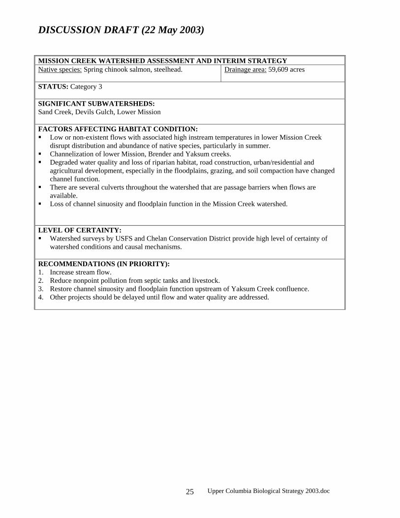
MISSION CREEK WATERSHED ASSESSMENT AND INTERIM STRATEGY Native species: Spring chinook salmon, steelhead. Drainage area: 59,609 acres
STATUS: Category 3 SIGNIFICANT SUBWATERSHEDS: Sand Creek, Devils Gulch, Lower Mission FACTORS AFFECTING HABITAT CONDITION: Low or non-existent flows with associated high instream temperatures in lower Mission Creek
disrupt distribution and abundance of native species, particularly in summer. Channelization of lower Mission, Brender and Yaksum creeks. Degraded water quality and loss of riparian habitat, road construction, urban/residential and
agricultural development, especially in the floodplains, grazing, and soil compaction have changed channel function.
There are several culverts throughout the watershed that are passage barriers when flows are available.
Loss of channel sinuosity and floodplain function in the Mission Creek watershed. LEVEL OF CERTAINTY: Watershed surveys by USFS and Chelan Conservation District provide high level of certainty of
watershed conditions and causal mechanisms. RECOMMENDATIONS (IN PRIORITY): 1. Increase stream flow. 2. Reduce nonpoint pollution from septic tanks and livestock. 3. Restore channel sinuosity and floodplain function upstream of Yaksum Creek confluence. 4. Other projects should be delayed until flow and water quality are addressed.

DISCUSSION DRAFT (22 May 2003)
Upper Columbia Biological Strategy 2003.doc 26
PESHASTIN CREEK WATERSHED ASSESSMENT AND INTERIM STRATEGY Native species: Spring chinook salmon, steelhead, bull trout.
Drainage area: 78,780 acres
STATUS: Category 2 Important steelhead spawning and rearing habitat, both in the mainstem and subwatersheds.
SIGNIFICANT SUBWATERSHEDS: Upper Peshastin, Lower Peshastin, Ingalls Creek FACTORS AFFECTING HABITAT CONDITION: Channel migration, riparian habitat, floodplain function, stream sinuosity, and gravel recruitment are
severely impacted by state highway. Low instream flows in lower Peshastin Creek impede upstream migration, reduce rearing habitat,
and likely contribute to elevated water temperature. Loss of riparian habitat resulting from land development and state highway reduces quantity and
quality of spawning and rearing habitat. .
LEVEL OF CERTAINTY: Cumulative effects of current gold mining in tributaries on sediment delivery, water quality, and
channel conditions are not fully understood, but are of concern. Cumulative effects of past timber harvest in tributaries on sediment delivery and water quality are
not fully understood, but are of concern. There is uncertainty on the status of Ingalls Creek bull trout.
RECOMMENDATIONS (IN PRIORITY): 1. Increase stream sinuosity and floodplain function from Ingalls Creek to mouth. 2. Restore flow from Camas Creek to mouth. 3. Other projects should be delayed until stream sinuosity and flows are addressed.

DISCUSSION DRAFT (22 May 2003)
Upper Columbia Biological Strategy 2003.doc 27
ICICLE CREEK WATERSHED ASSESSMENT AND INTERIM STRATEGY Native species: Steelhead, bull trout, cutthroat trout, redband trout
Drainage area: 136,960 acres
STATUS: Category 2 Relatively good habitat Inland fish are present and of concern. Designated as Key Watershed in Northwest Forest Plan.
SIGNIFICANT SUBWATERSHEDS: Upper Icicle Creek, Jack Creek, French Creek, Headwaters Icicle Creek. FACTORS AFFECTING HABITAT CONDITION: Land development downstream of Leavenworth Hatchery has affected stream channel migration,
recruitment of large woody debris, and off channel habitat. There are barriers to migration on Icicle Creek at Leavenworth Hatchery and possibly in the boulder
field near Snow Creek Water withdrawals in Icicle Creek (primarily between Rat Creek and the hatchery) likely contribute
to low flows and high summer temperatures in lower Icicle Creek. The Icicle Road upstream of Chatter Creek at places may confine the stream channel and affect
floodplain function. The 1994 Rat Creek fire caused increased sedimentation and water temperature in the middle and
lower Icicle drainage. LEVEL OF CERTAINTY: Field and aerial reconnaissance of lower Icicle Creek provide strong certainty of need for stream
channel protection and restoration. The adult passage conditions at boulder field near Snow Creek is not known.
RECOMMENDATIONS (IN PRIORITY): 1. Protect remaining floodplain and riparian habitat downstream of Chatter Creek. Emphasis should be
placed on habitat downstream of Leavenworth Hatchery. 2. Rectify human-made passage barriers. 3. Restore flow conditions on Icicle Creek downstream of Rat Creek. 4. Investigate the role of surface and well water withdrawals on instream flows and habitat use.
Develop strategies with water users to reduce effects, if any. 5. Initiate public information efforts to discourage harassment of spawning salmonids. 6. Manage recreation areas to reduce impacts to riparian cover.

DISCUSSION DRAFT (22 May 2003)
Upper Columbia Biological Strategy 2003.doc 28
CHUMSTICK CREEK WATERSHED ASSESSMENT AND INTERIM STRATEGY Native species: Steelhead.
Drainage area: 47,000 acres
STATUS: Category 3 Chumstick Creek was historical steelhead habitat. Likely, it was very important coho salmon habitat, although few records exist.
SIGNIFICANT SUBWATERSHEDS: None FACTORS AFFECTING HABITAT CONDITION: Private land development and high road density affects sediment delivery. Channel migration affected by state highway, the railroad, multiple water crossing structures, and
private land development. Fecal coliform and water temperature levels are elevated, mostly a result of livestock and improper
septic tanks. Passage is impeded at the North Road and numerous smaller culverts upstream. Riparian habitat has been degraded or lost from Little Chumstick Creek to mouth.
LEVEL OF CERTAINTY: This watershed is only accessible to steelhead at this time, yet it is unknown whether it is accessible
to other species. The loss of riparian vegetation in Chumstick Creek is readily observable, yet cumulative effects on
instream habitat, channel function, and water quality are not quantified. Constraint of the stream channel by human-made structures is readily observable; the means to
address these effects are not established. Field inventory and assessment of passage barriers enable a high level of certainty regarding habitat
degradation. Consistent yearly water quality monitoring provides certainty on fecal coliform and temperature. The extent of the effect of private and public roads on stream channel function and sediment delivery
is not fully assessed, but of concern. The potential for impacts from unscreened water diversions is not known. An inventory and
assessment are required. The cumulative effects of surface water diversions and ground water withdrawal from wells on low
flows is not known, but of concern. RECOMMENDATIONS (IN PRIORITY): 1. Restore passage for anadromous and inland fish. This should be done in a comprehensive,
coordinated strategy, rather than a piecemeal approach. 2. Protect remaining floodplain and riparian habitat 3. Increase stream flow. 4. Restore riparian habitat, primarily from Eagle Creek to Suntisch Canyon. 5. Reduce road densities. 6. Restore stream channel migration. 7. Reduce nonpoint pollution from septic tanks and livestock. 8. Reduce fine sediment input from roads and some land management activities.

DISCUSSION DRAFT (22 May 2003)
Upper Columbia Biological Strategy 2003.doc 29
CHIWAWA RIVER WATERSHED ASSESSMENT AND INTERIM STRATEGY Native species: Spring chinook salmon, steelhead, and migratory bull trout.
Drainage area: 117,000 acres
STATUS: Category 1 Designated as Key Watershed in Northwest Forest Plan. Critical spawning and rearing habitat for multiple species.
SIGNIFICANT SUBWATERSHEDS: Headwaters Chiwawa, Upper Chiwawa, Middle Chiwawa, Lower Chiwawa, Rock Creek, Chikamin Creek FACTORS AFFECTING HABITAT CONDITION: Most of this watershed is in public ownership and protected as Wilderness Area or under the
Northwest Forest Plan. Habitat within these areas is essentially pristine. There is limited housing development in private parcels on the lower Chiwawa River. Loss of
riparian vegetation in these reaches may influence water temperatures and hiding cover. Water withdrawals in the lower Chiwawa River may affect rearing habitat in low flow years.
LEVEL OF CERTAINTY: The effect of water withdrawals on lower Chiwawa River salmonid habitat is not known. There is concern over the potential impacts of development in Chikamin Creek on salmonid
productivity and water temperatures. RECOMMENDATIONS (IN PRIORITY): 1. Protect remaining floodplain and riparian habitat, particularly around Chikamin Flats. 2. Investigate the role of surface and well water withdrawals on instream flows and habitat use.
Develop strategies with water users to reduce effects, if any. 3. Initiate public information efforts to discourage harassment of spawning spring chinook salmon and
bull trout. 4. Manage recreation areas to reduce or avoid impacts to riparian habitats.

DISCUSSION DRAFT (22 May 2003)
Upper Columbia Biological Strategy 2003.doc 30
NASON CREEK WATERSHED ASSESSMENT AND INTERIM STRATEGY Native species: Spring chinook salmon, steelhead, bull trout. Drainage area: 69,000 acres
STATUS: Category 2 SIGNIFICANT SUBWATERSHEDS: Headwaters Nason, Upper Nason, Lower Nason FACTORS AFFECTING HABITAT CONDITION: The state highway, railroad, and private land development affect woody debris recruitment, channel
migration, and gravel recruitment. Lower Nason Creek is on the state 303(d) list for water temperature.
LEVEL OF CERTAINTY: Extensive field surveys and analysis of aerial photographs provide strong evidence of impacts to
stream channel function. There is some uncertainty about the most appropriate means to restore floodplain function, given the existing constraints. The recently funded channel migration study should assist in this assessment.
There is some uncertainty of the extent to which oxbows are disconnected, and what efforts should be done to provide access to Nason Creek.
The cumulative effects of timber harvest, development, and road densities on stream channel function and sediment delivery is not fully known, but of concern.
RECOMMENDATIONS (IN PRIORITY): 1. Protect remaining floodplain and riparian habitat. 2. Restore channel migration to historical function. 3. If restoration is not possible, improve fish access to oxbows and historical side channels. 4. Initiate public information efforts to discourage harassment of spawning salmonids.

DISCUSSION DRAFT (22 May 2003)
Upper Columbia Biological Strategy 2003.doc 31
WHITE RIVER WATERSHED ASSESSMENT AND INTERIM STRATEGY Native species: Sockeye salmon, spring chinook salmon, steelhead, bull trout.
Drainage area: 99,956 acres
STATUS: Category 1. Designated as Key Watershed in Northwest Forest Plan. Critical spawning and rearing habitat for many species.
SIGNIFICANT SUBWATERSHEDS: Headwaters White, Upper White, Lower White, Napeequa Creek, Panther Creek FACTORS AFFECTING HABITAT CONDITION: Past riparian harvest and log drives have altered woody debris accumulations and channel
morphometry. Habitat is intact and contiguous, but development pressures place a critical need to protect and
maintain stream channel and floodplain integrity LEVEL OF CERTAINTY: Field habitat analysis has been completed on public lands, enabling high confidence in assessment. Field analyses are incomplete on private lands, yet reviews of aerial photographs in combination
with field reviews have allowed strong inferences on habitat needs. There is a high level of concern about impacts of land development on this stream, which leads to a
strong consensus among RTT members on the priority of this watershed in the region. RECOMMENDATIONS (IN PRIORITY): 1. Protect stream channel, riparian and floodplain function: focus on Panther Creek downstream to
mouth. 2. Restore wetland complexes that connect to stream channel 3. Protect shorelines along Lake Wenatchee near White River mouth 4. Initiate public information efforts to discourage harassment of spawning spring chinook, sockeye
salmon, and bull trout. 5. Manage recreation areas to reduce impacts to riparian cover.

DISCUSSION DRAFT (22 May 2003)
Upper Columbia Biological Strategy 2003.doc 32
LITTLE WENATCHEE WATERSHED ASSESSMENT AND INTERIM STRATEGY Native species: Sockeye salmon, spring chinook salmon, steelhead, bull trout.
Drainage area: 75,329 acres
STATUS: Category 1 Designated as Key Watershed in Northwest Forest Plan. Critical spawning and rearing habitat for many species. Bull trout numbers above the waterfalls are extremely low.
SIGNIFICANT SUBWATERSHEDS: Headwaters Little Wenatchee, Upper Little Wenatchee, Lower Little Wenatchee, Rainy Creek, Lake Creek FACTORS AFFECTING HABITAT CONDITION: Past riparian harvest and log drives below the waterfalls may have affected stream channel
morphometry and function. Habitat above the waterfalls is intact and relatively pristine: essentially need to protect and maintain
stream channel and floodplain integrity. The lower Little Wenatchee is on the state 303(d) list for water temperature.
LEVEL OF CERTAINTY: Field habitat analysis has been completed on public lands, enabling high confidence in assessment. Field analyses are incomplete on private lands, yet reviews of aerial photographs in combination
with field reviews have allowed strong inferences on habitat needs. Some uncertainty exists on effects of logging and road management on stream channel function,
water temperature, flow, and possible input of large woody debris. RECOMMENDATIONS (IN PRIORITY): 1. Protect stream channel, riparian and floodplain function: focus on Little Wenatchee River falls
downstream to mouth. 2. Address road impacts in the drainage, emphasis on Rainy Creek and Little Wenatchee between
Hidden Creek and Fir Creek. 3. Restore wetland complexes that connect to stream channel. 4. Manage recreation areas to reduce impacts to riparian cover. 5. Initiate public information efforts to discourage harassment of spawning salmonids.

DISCUSSION DRAFT (22 May 2003)
Upper Columbia Biological Strategy 2003.doc 33
LAKE WENATCHEE ASSESSMENT AND INTERIM STRATEGY Native species: Sockeye salmon, spring chinook salmon, steelhead, bull trout.
Drainage area:
STATUS: Category 1. Necessary adult holding and juvenile rearing area for sockeye salmon and bull trout.
SIGNIFICANT SUBWATERSHEDS: Not applicable. FACTORS AFFECTING HABITAT CONDITION: Shoreline development. Bulkheads change dynamics of near shore wave action, affecting
invertebrate production, gravel deposition, and habitat use. LEVEL OF CERTAINTY: Quantified field analyses have not been conducted, yet reviews of aerial photographs in combination
with field reviews have allowed strong inferences on habitat needs. RECOMMENDATION: Protect remaining near shore habitat, and develop a means to reduce impacts of bulkheads.

DISCUSSION DRAFT (22 May 2003)
Upper Columbia Biological Strategy 2003.doc 34
Appendix C.2: Entiat River Subbasin MAINSTEM ENTIAT FROM ENTIAT FALLS TO POTATO MORAINE ASSESSMENT AND INTERIM STRATEGY Native species: Critical habitat for spring chinook salmon, steelhead, bull trout.
Drainage area:
STATUS: Category 1 Designated as Key Watershed in Northwest Forest Plan
SIGNIFICANT SUBWATERSHEDS: Upper Mid-Entiat, Lower Mid-Entiat FACTORS AFFECTING HABITAT CONDITION: Surface erosion and sediment delivery hazard is high. Fluvial processes are now good within this reach, but they are at risk from development pressure in
bottomlands. Past stream clean-outs and salvage logging activities after major fire events have affected stream
channel complexity. LEVEL OF CERTAINTY: Field habitat analysis has been completed on most areas, providing a high confidence in assessment. The status of bull trout in the upper Entiat is not well understood. There is a high level of concern about the impact of land development on this reach. There is a
strong consensus among RTT members on the need to protect stream channel function. RECOMMENDATIONS (IN PRIORITY): 1. Protect fluvial processes and floodplain function from the falls to the moraine. 2. Continue road closure and reforestation in highly erosive uplands, particularly Fox, McCree,
Brenegan, Preston, and Mud creeks, and the mainstem Entiat between Fox and Stormy creeks. 3. Initiate public information efforts to discourage harassment of spawning salmonids.

DISCUSSION DRAFT (22 May 2003)
Upper Columbia Biological Strategy 2003.doc 35
MAD RIVER WATERSHED ASSESSMENT AND INTERIM STRATEGY Native species: Spring chinook salmon, steelhead, bull trout, cutthroat trout.
Drainage area:
STATUS: Category 1 Designated as Key Watershed in Northwest Forest Plan
SIGNIFICANT SUBWATERSHEDS: Upper Mad River, Middle Mad River, Lower Mad River FACTORS AFFECTING HABITAT CONDITION: Historical sheep grazing and timber harvest practices have increased upland erosion and sediment
delivery to the stream, and has impacted snow melt runoff and resultant streamflow. Road constricts channel on mainstem from Pine Flat campground downstream to mouth. Anchor ice formations associated with loss of riparian cover and changes in channel.
LEVEL OF CERTAINTY: Field habitat analysis has been completed on most areas, providing a high confidence in assessment. Mad River is considered a stronghold for bull trout, but their habitat use outside the watershed is not
well understood. RECOMMENDATIONS (IN PRIORITY): 1. Protect fluvial processes and floodplain function. 2. Continue reforestation in highly erosive uplands. 3. Initiate public information efforts to discourage harassment of bull trout. 4. Reduce impacts from roads in floodplains, and relocate where appropriate. Restore riparian areas in
lower Mad River.

DISCUSSION DRAFT (22 May 2003)
Upper Columbia Biological Strategy 2003.doc 36
LOWER ENTIAT (FROM MORAINE DOWNSTREAM TO MOUTH) ASSESSMENT AND INTERIM STRATEGY Native species: Spring and summer chinook salmon, steelhead, bull trout.
Drainage area:
STATUS: Category 2 Migration corridor for spring chinook salmon, steelhead and bull trout. Spawning and rearing
habitat for steelhead and summer chinook salmon. SIGNIFICANT SUBWATERSHEDS: None FACTORS AFFECTING HABITAT CONDITION: Loss of channel complexity and lateral migration Loss of riparian habitats and floodplain connectivity Loss of gravel recruitment Sediment delivery from Potato Creek and Mud Creek
LEVEL OF CERTAINTY: Extent of irrigation water withdrawal on instream flows and temperature is not known. Extent of riparian cover and channel shape on anchor ice formation is not known.
RECOMMENDATIONS (IN PRIORITY): 1. Restore stream channel complexity and lateral migration. 2. Protect existing riparian and floodplain habitats. 3. Restore degraded riparian habitats.

DISCUSSION DRAFT (22 May 2003)
Upper Columbia Biological Strategy 2003.doc 37
Appendix C.3: Methow River Subbasin EARLY WINTERS CREEK ASSESSMENT AND INTERIM STRATEGY Native species: Spring chinook salmon, steelhead, bull trout. Drainage area: 51,925 acres
STATUS: Category 1 Designated as a Key Watershed in Northwest Forest Plan
SIGNIFICANT SUBWATERSHEDS: Early Winters Creek FACTORS AFFECTING HABITAT CONDITION: Channel constriction by state highway precludes natural flood plain function, reduces the number of
side channels, and increases water velocities and resultant scour. Riparian areas have been degraded at campgrounds, resulting in loss of cover and woody debris
recruitment. Fine sediment and chemical runoff from highway may impact water quality.
LEVEL OF CERTAINTY: Field assessment of stream channel function provides strong indication of high water velocities and
resultant bedload, channel scour, and riparian degradation in lower Early Winters Creek. Low flows are readily measurable, but groundwater/surface water interaction is complex and not
fully understood. RECOMMENDATIONS (IN PRIORITY): 1. Restore natural stream channel functions within the alluvial fan. 2. Improve riparian conditions in the lower reach. 3. Manage recreation areas to reduce or avoid impacts to riparian areas.

DISCUSSION DRAFT (22 May 2003)
Upper Columbia Biological Strategy 2003.doc 38
LOST RIVER ASSESSMENT AND INTERIM STRATEGY Native species: Spring chinook salmon, steelhead, bull trout.
Drainage area: 107,400 acres
STATUS: Category 1 Designated as a Key Watershed in Northwest Forest Plan.
SIGNIFICANT SUBWATERSHEDS: Upper Lost River, Lost River FACTORS AFFECTING HABITAT CONDITION: A dike on the Methow River at the confluence of the lower Lost River constrains floodplain
function. Residential construction on the alluvial fan may lead to a constrained channel in the future. Large woody debris levels in the lower Lost River are currently low, due to removal for flood
control and firewood. The potential for recruitment of woody debris is at natural levels however. LEVEL OF CERTAINTY: Watershed surveys by USFS provide high level of certainty.
RECOMMENDATIONS (IN PRIORITY): 1. Develop a flood hazard protection plan that is compatible with natural channel maintaining processes
and flood plain function. 2. Allow for woody debris recruitment.

DISCUSSION DRAFT (22 May 2003)
Upper Columbia Biological Strategy 2003.doc 39
CHEWUCH RIVER ASSESSMENT AND INTERIM STRATEGY Native species: Spring chinook salmon, steelhead, bull trout, westslope cutthroat trout.
Drainage area: 340,000 acres
STATUS: Category 2 Designated as a Key Watershed in NWFP.
SIGNIFICANT SUBWATERSHEDS: Perrygin Creek, Lake Creek, Lower Chewuch River FACTORS AFFECTING HABITAT CONDITION: Channel clearing and LWD removal reduced channel complexity in the Chewuch River from RM 0
to 20. Road placement and bank hardening have isolated sections of the main channel from its floodplain
and side channels in a few places from the mouth to Boulder Creek. Skid roads in riparian areas upstream of Boulder Creek increase dispersed recreation use impacts to
the stream. Low flows in late summer through winter reduce quantity of rearing habitat in the lower Chewuch
River. High water temperatures in the lower river may at times cause a migration barrier. Livestock grazing may have potential impacts on riparian areas of mainstem Chewuch and
tributaries. High road densities in Cub, Eightmile, and Boulder creeks combined with highly erosive soils create
sediment and bank erosion problems. LEVEL OF CERTAINTY: Field habitat analyses have been conducted on both private and public lands, allowing a high
confidence in assessment. The relation of instream flows and fish habitat in the lower Chewuch River are not fully understood,
yet some studies provide a strong level of inference. RECOMMENDATIONS (IN PRIORITY): 1. Restore habitat-forming processes and channel complexity of the Chewuch River from RM 0 to 28. 2. Increase LWD recruitment and retention in the mainstem Chewuch River from RM 0 to 30. 3. Increase stream flows on the lower mainstem Chewuch River. 4. Reduce road densities, particularly in highly erosive areas (such as mid-slope areas) and riparian
areas. 5. Manage recreation activities in riparian areas; include an educational component. 6. Assess the condition of roads in the Chewuch Watershed and their contribution to sediment delivery
to the surface water network. 7. Monitor summer and winter thermal refugia in the lower mainstem Chewuch River. Protect and
restore key thermal refuges. 8. Assess grazing effects on riparian areas in upper mainstem Chewuch River, and in Eightmile,
Boulder, Falls and Cub creeks on sediment delivery and channel stability.
DISCUSSION DRAFT (22 May 2003)
Upper Columbia Biological Strategy 2003.doc 40
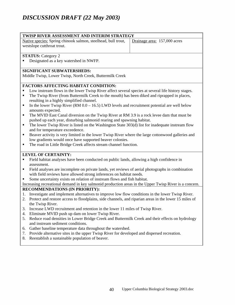
TWISP RIVER ASSESSMENT AND INTERIM STRATEGY Native species: Spring chinook salmon, steelhead, bull trout, westslope cutthroat trout.
Drainage area: 157,000 acres
STATUS: Category 2 Designated as a key watershed in NWFP.
SIGNIFICANT SUBWATERSHEDS: Middle Twisp, Lower Twisp, North Creek, Buttermilk Creek FACTORS AFFECTING HABITAT CONDITION: Low instream flows in the lower Twisp River affect several species at several life history stages. The Twisp River (from Buttermilk Creek to the mouth) has been diked and riprapped in places,
resulting in a highly simplified channel. In the lower Twisp River (RM 0.0 – 16.5) LWD levels and recruitment potential are well below
amounts expected. The MVID East Canal diversion on the Twisp River at RM 3.9 is a rock levee dam that must be
pushed up each year, disturbing salmonid rearing and spawning habitat. The lower Twisp River is listed on the Washington State 303(d) list for inadequate instream flow
and for temperature exceedence. Beaver activity is very limited in the lower Twisp River where the large cottonwood galleries and
low gradients would once have supported beaver colonies. The road in Little Bridge Creek affects stream channel function.
LEVEL OF CERTAINTY: Field habitat analyses have been conducted on public lands, allowing a high confidence in
assessment. Field analyses are incomplete on private lands, yet reviews of aerial photographs in combination
with field reviews have allowed strong inferences on habitat needs. Some uncertainty exists on relation of instream flows and fish habitat.
Increasing recreational demand in key salmonid production areas in the Upper Twisp River is a concern. RECOMMENDATIONS (IN PRIORITY): 1. Investigate and implement alternatives to improve low flow conditions in the lower Twisp River. 2. Protect and restore access to floodplains, side channels, and riparian areas in the lower 15 miles of
the Twisp River. 3. Increase LWD recruitment and retention in the lower 11 miles of Twisp River. 4. Eliminate MVID push up dam on lower Twisp River. 5. Reduce road densities in Lower Bridge Creek and Buttermilk Creek and their effects on hydrology
and instream sediment conditions. 6. Gather baseline temperature data throughout the watershed. 7. Provide alternative sites in the upper Twisp River for developed and dispersed recreation. 8. Reestablish a sustainable population of beaver.

DISCUSSION DRAFT (22 May 2003)
Upper Columbia Biological Strategy 2003.doc 41
UPPER MAINSTEM METHOW (HEADWATERS TO CHEWUCH CONFLUENCE) ASSESSMENT AND INTERIM STRATEGY Native species: spring chinook salmon, steelhead, bull trout.
Drainage area: 322,385 acres
STATUS: Category 2 SIGNIFICANT SUBWATERSHEDS: Upper Methow, Mainstem West Fork Methow, Upper Goat Creek, Lower Goat Creek, Little Boulder Creek, Hancock Creek TRIBUTATIES WITHIN THIS REACH: Brush Creek, Trout Creek, Rattlesnake Creek, Robinson Creek, Gate Creek, Goat Creek, Little Boulder Creek, Fawn Creek, Hancock Creek, Little Falls Creek, and Wolf Creek. FACTORS AFFECTING HABITAT CONDITION: The mainstem Methow River between RM 59 and 74 goes dry in low flow years. All reaches of the mainstem upper Methow River have LWD levels below USFS standards. Timber
harvest and stream cleaning have reduced LWD recruitment in Goat Creek. Several small dikes cut off important side channel habitats.
Residential construction in flood prone areas has resulted in clearing of riparian habitat. LEVEL OF CERTAINTY: Watershed and stream analyses by USFS and USGS provide high level of certainty on habitat
conditions. The effect of surface water and groundwater withdrawal on the dewatered reach is not fully understood. The role of riparian condition and channel morphometry on stream flows in this reach is not understood.
The contribution of tributaries and mainstem bank erosion to sediment levels in the mainstem Methow River is not understood.
There is concern about the effect of snowmobiles in the main channel Methow River on habitat and water quality.
RECOMMENDATIONS (IN PRIORITY): 1. Protect functioning floodplain, riparian habitat, and side channels in the upper Methow River. 2. Protect LWD accumulations in the channel. 3. Protect habitat within this reach that sustains flows through the winter, and stream channel sections
where ground water is recharged. 4. Improve late summer and winter instream flows through several means: restore drained wetlands,
restore cut off side channels, rehabilitate riparian areas, and remove constrictions and constraints within the channel migration zone.
5. Restore access to habitat blocked by dikes and restore the channel function of the reach upstream of the dikes.
6. Increase recruitment and retention of LWD within the mainstem Methow River. 7. Reduce streambank erosion on mainstem Methow River from Goat Creek to Mazama. Evaluate the
location of these eroding sites relative to the channel migration zone. 8. Manage dispersed recreation use in riparian areas throughout the watershed. 9. Develop and implement a snowmobile management plan.

DISCUSSION DRAFT (22 May 2003)
Upper Columbia Biological Strategy 2003.doc 42
MIDDLE MAINSTEM METHOW RIVER (CHEWUCH RIVER CONFLUENCE TO TEXAS CREEK CONFLUENCE) ASSESSMENT AND INTERIM STRATEGY Native species: Spring and summer chinook salmon, steelhead, bull trout.
Drainage area: 15,600 acres
STATUS: Category 2 The mainstem Methow River is an important migration corridor for spring chinook salmon,
steelhead and bull trout. Spawning and rearing habitat for summer chinook salmon and steelhead. SIGNIFICANT SUBWATERSHEDS: TRIBUTARIES WITHIN THIS REACH: Alder Creek, Bear Creek, Beaver Creek and Benson Creek FACTORS AFFECTING HABITAT CONDITION: Residential development is affecting riparian and floodplain condition. The Methow Valley Irrigation District fish screens and diversion structures do not meet state and
federal standards. Low flows in late summer and winter may affect juvenile survival. Structures in tributaries are passage barriers for adult and juvenile salmonids. The mainstem Methow is on the state 303(d) list for temperatures.
LEVEL OF CERTAINTY: Habitat in the Middle Mainstem Methow River and lower reaches of its tributaries has not been
surveyed. Some recommendations are based on professional judgement. Habitat in upper reaches of the tributaries has been assessed by USFS.
The effects of irrigation water withdrawal on stream flows are not fully understood. Passage barriers have been inventoried, but not fully assessed.
RECOMMENDATIONS (IN PRIORITY): 1. Protect functioning floodplain, riparian habitat, and side channels in the middle Methow River. 2. Restore access by the mainstem channel to floodplains and side channels disconnected by dikes. 3. Correct the MVID screens and diversion. 4. Modify existing bank hardening projects to incorporate design elements to reduce water velocity and
increase instream complexity. 5. Increase recruitment and retention of LWD within the mainstem Methow River.

DISCUSSION DRAFT (22 May 2003)
Upper Columbia Biological Strategy 2003.doc 43
LOWER METHOW (TEXAS CREEK CONFLUENCE TO MOUTH) ASSESSMENT AND INTERIM STRATEGY Native species: Summer and spring chinook salmon, steelhead, bull trout.
Drainage area: 200,000 acres
STATUS: Category 2 The mainstem Methow River is an important migration corridor for spring chinook salmon,
steelhead and bull trout. Spawning and rearing habitat for summer chinook salmon and steelhead.
SIGNIFICANT SUBWATERSHEDS: None. IMPORTANT TRIBUTARIES: Texas Creek, Libby Creek, Gold Creek, McFarland Creek, French Creek, Squaw Creek and Black Canyon Creek. FACTORS AFFECTING HABITAT CONDITION: Culverts, roads, and irrigation diversion structures impede salmonid passage on several tributaries. Roads on several tributaries contribute to sedimentation and riparian degradation. Low instream flows in Libby and Gold creeks likely impact salmonid distribution and abundance.
LEVEL OF CERTAINTY: Habitat in the mainstem lower Methow River and lower reaches of its tributaries has not been
surveyed. Some recommendations are based on professional judgement. Habitat in upper reaches of the tributaries has been assessed by USFS.
Spawning and rearing of salmonids in the mainstem and tributaries are regularly surveyed, providing a higher level of certainty.
RECOMMENDATIONS (IN PRIORITY): 1. Develop and implement a plan to correct fish passage barriers on tributaries. 2. Evaluate habitat conditions in the lower mainstem Methow River. 3. Address sedimentation in the drainage by identifying roads for closure, relocation, obliteration, and
drainage improvements. 4. Protect and restore riparian habitats in Gold and Libby creeks. 5. Irrigation diversions in Gold and Libby creeks should be assessed and screened according to
standards 6. Increase instream flows in Gold Creek.
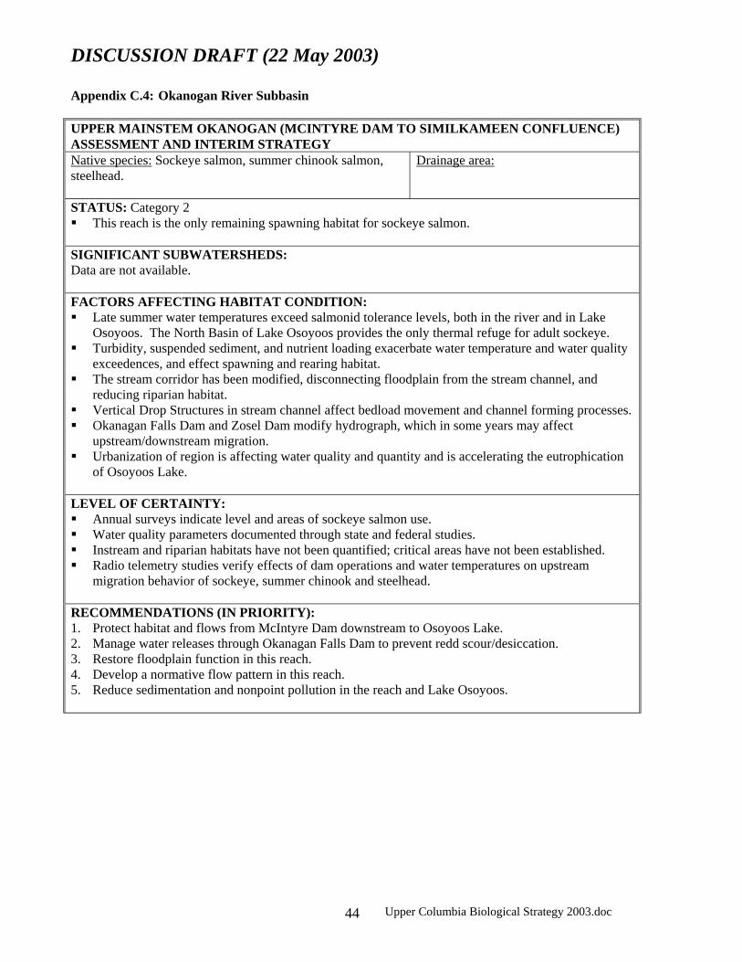
DISCUSSION DRAFT (22 May 2003)
Upper Columbia Biological Strategy 2003.doc 44
Appendix C.4: Okanogan River Subbasin UPPER MAINSTEM OKANOGAN (MCINTYRE DAM TO SIMILKAMEEN CONFLUENCE) ASSESSMENT AND INTERIM STRATEGY Native species: Sockeye salmon, summer chinook salmon, steelhead.
Drainage area:
STATUS: Category 2 This reach is the only remaining spawning habitat for sockeye salmon.
SIGNIFICANT SUBWATERSHEDS: Data are not available. FACTORS AFFECTING HABITAT CONDITION: Late summer water temperatures exceed salmonid tolerance levels, both in the river and in Lake
Osoyoos. The North Basin of Lake Osoyoos provides the only thermal refuge for adult sockeye. Turbidity, suspended sediment, and nutrient loading exacerbate water temperature and water quality
exceedences, and effect spawning and rearing habitat. The stream corridor has been modified, disconnecting floodplain from the stream channel, and
reducing riparian habitat. Vertical Drop Structures in stream channel affect bedload movement and channel forming processes. Okanagan Falls Dam and Zosel Dam modify hydrograph, which in some years may affect
upstream/downstream migration. Urbanization of region is affecting water quality and quantity and is accelerating the eutrophication
of Osoyoos Lake. LEVEL OF CERTAINTY: Annual surveys indicate level and areas of sockeye salmon use. Water quality parameters documented through state and federal studies. Instream and riparian habitats have not been quantified; critical areas have not been established. Radio telemetry studies verify effects of dam operations and water temperatures on upstream
migration behavior of sockeye, summer chinook and steelhead. RECOMMENDATIONS (IN PRIORITY): 1. Protect habitat and flows from McIntyre Dam downstream to Osoyoos Lake. 2. Manage water releases through Okanagan Falls Dam to prevent redd scour/desiccation. 3. Restore floodplain function in this reach. 4. Develop a normative flow pattern in this reach. 5. Reduce sedimentation and nonpoint pollution in the reach and Lake Osoyoos.

DISCUSSION DRAFT (22 May 2003)
Upper Columbia Biological Strategy 2003.doc 45
MAINSTEM OKANOGAN RIVER (SIMILKAMEEN CONFLUENCE TO MOUTH) ASSESSMENT AND INTERIM STRATEGY Native species: Sockeye salmon, summer chinook salmon, bull trout, cutthroat trout, and steelhead.
Drainage area:
STATUS: Category 2 Important migration corridor for sockeye salmon and steelhead. Spawning and rearing habitat for
summer chinook salmon. SIGNIFICANT SUBWATERSHEDS: Upper Okanogan River, Middle Okanogan River, Lower Okanogan River, North Fork Salmon Creek. FACTORS AFFECTING HABITAT CONDITION: Late summer water temperatures exceed salmonid tolerance levels. Turbidity, suspended sediment, and nutrient loading exacerbate water temperature exceedences, and
effect spawning and rearing habitat. Extensive riparian habitat loss and degradation throughout the mainstem Okanogan River, causing
very high width:depth ratios, low woody debris levels, sedimentation, and embedded spawning gravels.
Upstream dams modify hydrograph, which in some years may affect upstream/downstream migration.
LEVEL OF CERTAINTY: Annual surveys indicate level and areas of summer chinook salmon use. Water quality parameters documented through state and federal studies. Instream and riparian habitats have not been quantified; critical areas have not been established. Radio telemetry studies verify effects of dam operations on upstream migration behavior of sockeye,
summer chinook and steelhead. RECOMMENDATIONS (IN PRIORITY): 1. Release water from upstream dams at critical periods to aid adult sockeye salmon migration. 2. Increase seasonal flows in small tributary streams to mainstem Okanogan River. 3. Protect and passively restore riparian habitat on the mainstem, with upstream reaches having
priority. 4. Implement agricultural practices that reduce sediment delivery to the river.

DISCUSSION DRAFT (22 May 2003)
Upper Columbia Biological Strategy 2003.doc 46
SIMILKAMEEN RIVER ASSESSMENT AND INTERIM STRATEGY Native species: Summer chinook salmon, steelhead.
Drainage area:
STATUS: Category 3 Highly used summer chinook salmon spawning downstream of Enloe Dam (at RK 14), which is a
barrier to migration. SIGNIFICANT SUBWATERSHEDS: Similkameen River FACTORS AFFECTING HABITAT CONDITION: Grazing, mining, irrigation, and road building have caused extensive upland erosion and floodplain
degradation, which has deteriorated several water quality parameters and both riparian and instream habitat.
Enloe Dam blocks upstream migration of summer chinook salmon, although a natural waterfall may have historically blocked migration.
LEVEL OF CERTAINTY: Sedimentation impacts from most significant sources are well documented. There is uncertainty over historical distribution of anadromous salmonids in this watershed.
RECOMMENDATIONS (IN PRIORITY): 1. Protect riparian and instream habitats from Enloe Dam to the Okanogan confluence. 2. Reduce impacts from roads in floodplains, and relocate where appropriate. 3. Implement agricultural practices that reduce sediment delivery to the river. 4. Increase knowledge base on heat loading processes in this reach. 5. Clean up mine tailings in riparian areas that have connectivity to the river.

DISCUSSION DRAFT (22 May 2003)
Upper Columbia Biological Strategy 2003.doc 47
BONAPARTE CREEK ASSESSMENT AND INTERIM STRATEGY Native species: Steelhead.
Drainage area:
STATUS: Category 4 SIGNIFICANT SUBWATERSHEDS: None FACTORS AFFECTING HABITAT CONDITION: Channel cutting and bank erosion, loss of channel sinuosity and riparian habitat. High levels of sheet and rill erosion.
LEVEL OF CERTAINTY: NRCS studies provide high level of certainty.
RECOMMENDATIONS (IN PRIORITY): 1. Reduce impacts from roads in floodplains, and relocate where appropriate. 2. Implement agricultural practices that reduce sediment delivery to the river.

DISCUSSION DRAFT (22 May 2003)
Upper Columbia Biological Strategy 2003.doc 48
OMAK CREEK ASSESSMENT AND INTERIM STRATEGY Native species: Steelhead.
Drainage area: 90,684 acres
STATUS: Category 2 SIGNIFICANT SUBWATERSHEDS: None FACTORS AFFECTING HABITAT CONDITION: Poor upslope condition in rangeland and forested areas contribute to water quality and quantity
concerns. Loss of riparian habitat and floodplain due to increased channel incision.
LEVEL OF CERTAINTY: Range and forest conditions assessed through federal and tribal surveys. Water quality information derived from periodic sampling.
RECOMMENDATIONS (IN PRIORITY): 1. Implement forest and agricultural practices that reduce sediment delivery to the river. 2. Increase stream flow. 3. Protect and restore riparian habitat in middle and lower reaches.

DISCUSSION DRAFT (22 May 2003)
Upper Columbia Biological Strategy 2003.doc 49
SALMON CREEK ASSESSMENT AND INTERIM STRATEGY Native species: Steelhead, redband trout.
Drainage area: 675,849 acres
STATUS: Category 3 Historical spring chinook salmon and bull trout habitat.
SIGNIFICANT SUBWATERSHEDS: None FACTORS AFFECTING HABITAT CONDITION: Dewatered reach downstream of irrigation diversion dam prevents upstream migration to entire
watershed, and all life histories in lower reach. Dam operations have substantially modified stream channel morphology and function. Some reaches upstream of dam have high width: depth ratios, and lack streambank vegetation and
woody debris. LEVEL OF CERTAINTY: Habitat conditions well documented through joint studies of Colville Tribe and Okanogan Irrigation
District. RECOMMENDATIONS (IN PRIORITY): 1. Provide suitable instream flows for lower Salmon Creek. 2. Create a stream channel morphology in lower Salmon Creek that is consistent with the historical
stable stream type, and raise the water table to support riparian vegetation by developing a small but effective floodplain.
3. Use passive restoration for riparian areas between Conconully Reservoir and diversion dam.

DISCUSSION DRAFT (22 May 2003)
Upper Columbia Biological Strategy 2003.doc 50
Appendix C.5: Foster Creek and Moses Coulee Subbasin FOSTER CREEK ASSESSMENT AND INTERIM STRATEGY Native species: Steelhead
Drainage area: 213,639 acres
STATUS: Category 4
FACTORS AFFECTING HABITAT CONDITION: Low flows, intermittent flows and seasonal flows. Fish passage barriers likely limit distribution in some streams. Flood events and human activities have altered instream and riparian habitats. Distribution of anadromous fish is affected by natural variations in stream flow and escapement
levels. LEVEL OF CERTAINTY: Distribution of fish is based on professional judgement and intermittent surveys Data on habitat conditions, flow conditions, and fish passage barriers are limited.
RECOMMENDATIONS (IN PRIORITY): 1. Determine life history of salmonids in Foster Creek. 2. Collect baseline habitat data in Foster Creek. 3. Evaluate surface and groundwater conditions.

DISCUSSION DRAFT (22 May 2003)
Upper Columbia Biological Strategy 2003.doc 51
MOSES COULEE ASSESSMENT AND INTERIM STRATEGY Native species: Steelhead Drainage area: 776,222 acres STATUS: Category 4 SIGNIFICANT SUBWATERSHEDS: None FACTORS AFFECTING HABITAT CONDITION: All streams have low seasonal stream flows. Fish passage barriers limit distribution in some streams. Flood events and human activities have altered instream and riparian habitats.
LEVEL OF CERTAINTY: Distribution of fish is based on professional judgement and intermittent surveys.
RECOMMENDATIONS (IN PRIORITY): 1. Determine life history of salmonids in, Rock Island Creek. 2. Continue to collect baseline habitat data in Rock Island Creek. 3. Evaluate surface and groundwater conditions in Moses Coulee.

DISCUSSION DRAFT (22 May 2003)
Upper Columbia Biological Strategy 2003.doc 52
Appendix C.5: Squilchuck Watershed SQUILCHUCK ASSESSMENT AND INTERIM STRATEGY Native species: steelhead.
Drainage area:
STATUS: Category 4 FACTORS AFFECTING HABITAT CONDITION: Low stream flows and passage barriers limit distribution and abundance of salmonids. Upstream populations are likely isolated by fragmented habitats in lower reaches.
LEVEL OF CERTAINTY: Distribution and status of salmonids in streams are not well known. Low flows and passage barriers are readily apparent, but no formal surveys have been made to assess
benefits of restoration practices in these streams. There is likelihood that there are isolated populations of redband trout in these streams.
RECOMMENDATIONS (IN PRIORITY): Assess the distribution, abundance, and genetic structure of salmonids in these streams. Identify habitat conditions that limit their productivity, and develop a protection and restoration plan
accordingly.

DISCUSSION DRAFT (22 May 2003)
Upper Columbia Biological Strategy 2003.doc 53
Appendix C.6. Mainstem Columbia River MAINSTEM COLUMBIA RIVER ASSESSMENT AND INTERIM STRATEGY Native species: spring, summer, and fall chinook salmon, steelhead, sockeye salmon, coho salmon, bull trout. STATUS: Category 5 Upstream and downstream migration corridor, and a documented spawning habitat in some areas for
summer and fall chinook salmon. Likely overwinter habitat for many species and age groups. FACTORS AFFECTING HABITAT CONDITION: Hydroelectric dams inundated habitats and impaired passage conditions. Habitat degradation and loss on shorelines from land development and road construction may affect
salmonids at some life history stages. Stormwater and agricultural runoff contribute to water quality degradation.
LEVEL OF CERTAINTY: Hydropower impacts are well studied. Impacts to salmonids from Columbia River shoreline management are inferred from studies on
smaller-order streams. RECOMMENDATIONS (IN PRIORITY): 1. Hydropower impacts are an obvious concern, but are not addressed in this assessment. 2. Protect any remaining riparian habitat. 3. Evaluate potential for impacts to salmonids from shoreline management: develop recommendations
to lessen impacts, as appropriate.