97-32 VEHICLE ACCIDENT REDUCTION PLAN · 97-32 vehicle accident reduction plan bannister road and...
46
97-32 VEHICLE ACCIDENT REDUCTION PLAN BANNISTER ROAD AND INTERSTATE 4 3 5 MARCH, 1997 TRAFFIC ENFORCEMENT UNIT KANSAS CITY, MISSOURI POLICE DEPARTMENT
Transcript of 97-32 VEHICLE ACCIDENT REDUCTION PLAN · 97-32 vehicle accident reduction plan bannister road and...

97-32
VEHICLEACCIDENT
REDUCTIONPLAN
BANNISTER ROADAND
INTERSTATE 435
MARCH, 1997
TRAFFIC ENFORCEMENT UNITKANSAS CITY, MISSOURI
POLICE DEPARTMENT

The Kansas City, Missouri Police
Departments
Nomination
For The
1997 Herman
Goldstein Award for
Excellence
in
Problem-Oriented
Policing

AGENCY AND OFFICER INFORMAHON:
Name:
Sergeant Paul BassOfficer Thomas Frisby
Agency:
Kansas City Missouri Police DepartmentTraffic Unit1328 Agnes
Kansas City, Missouri 64127
Telephone:
816-482-8180
Fax:
816-482-8179

Recommendation For the 1997 Herman Goldstein Award For Excellence
Abstract
Scanning
This project deals with an area of Kansas City, Missouri that has consistentlyplaced in the top five of the twenty most hazardous locations within the City, for the pasttwelve months. Analysis found that the area experienced 688 accidents in 1996 of whichfive were fatalities, and 124 were injuries.
Analysis
Analysis of this project was done using computer stored data from accidentsreported, physical review of reports for factors causing the accidents. Interviews wereconducted with field officers, accident investigators, community groups, and a physicalstudy of the effected area was undertaken. During the analysis phase it was found thatseveral factors including operator error and physical roadway flaws contributed to theaccident rate. Discussions concluded that to have an affect on the problem, multipleapproaches would be necessary.
Response
P.O. Thomas Frisby, finding no specific models to deal with this type of trafficproblem, developed what is termed Vehicle Accident Reduction System (VARS), as amodel to attack this problem. Alternatives looked at were, strict enforcement, howeverthis approach had, had little effect on the problem in the past, and a multi facetedapproach of enforcement, roadway improvements, speed changes, sign upgrade, andeducation. The later was the selected method.
Assessment
Using an initial approach of static police presence and selected enforcement for16 hours per day Monday through Friday, accidents were reduced in selected areas ofthe project area by 36.3%. This approach being used until roadway changes were inplace. Initial assessment found that in a specific area where a majority of roadwayimprovements would be made, a 0% increase was experienced.
Recommendation For The 1997 Herman Goldstein Award For Excellence
Scanning
Bannister Road at I-435 during 1996 had a totai of 317 vehicular accidents of
which 2 were fatalities, 55 were injuries, and 260 resulted in property damage. In
addition I-435 between 87th street and the triangle of I-435, I-470, and U.S. 71 Highway
experienced a total of 531 vehicular accidents of these 5 were fatalities, 124 were injuries
and 405 resulted in property damage. Further it was determined that the two mile span
of I-435 mentioned and one mile of roadway on Bannister Road from the intersection of
Bannister Road and I-435 experienced a total of 688 vehicular accidents.
This problem was identified by P.O. Thomas Frisby after recognizing that there
were a significant number of fatal, injury, and property damage accidents in the area,
even after significant enforcement action was taken throughout a twelve month period.
This area both on Bannister Road and 1-435 repeatedly appeared on the twenty most
hazardous locations within the City of Kansas City. The initial level of diagnosis was
derived from the hazardous location lists and personal observations of P.O. Frisby. At
the same time the Kansas City, Missouri Police Department as a whole implemented
Community Oriented Policing (COP) within the department at all levels. In the spirit of
embracing this philosophy, P.O. Frisby took it upon himself to tackle this problem. Noted
was a peculiar problem to the project, in that the area examined was split between the
Missouri Department of Transportation and the engineering department of the City of
Kansas City.
"11 page two
Analysis
An analysis of the problem was done using a model developed by P.O. Frisby, and
termed Vehicle Accident Reduction System (VARS) which incorporates five stages,
identified as, 1) Identification and Research, 2) Plan of Action, 3) Education, 4.)
Enforcement, and 5.) Assessment. The VARS study was done using vehicular accident
reports statistics, contained in the department computer system, examination of each
accident report, interviews with citizens, and police officers both district and accident
investigation specialists, and physical observation and study of the affected roadway.
The study revealed several factors that were reoccurring or a constant contributor to the
accidents. The most prominent factor found was that 99% of the accidents involved a
violation of the city traffic code, by one or more of the drivers involved. The four most
prominent violations were, 1.) speeding, 2.) following to closely to another vehicle, 3.)
violation of the sign/signal, and 4.) failing to yield the right of way. The study also
revealed that the dynamics of the involved roadway contribute to the reoccurring accident
problem. It was found that on the span of Bannister Road controlled by the City of
Kansas City and the State of Missouri there were no posted speed limit signs. Signs that
designate entrance turn lanes onto the interstate were small, posted to high for drivers
to notice, and or posted in such a way that they are concealed by traffic control devices
or other signs. Lane designation striping, turn arrows on the road surface, and orange
warning striping were faded, or non existent. It was also determined, in the opinion of law
enforcement, that the designated speed limit was to high for conditions on Bannister
Road, in that not all lanes were through lanes and to negotiate the changes necessary

page three
to enter turn lanes or through lanes could not be done safely at existing speed limits.
Found on the interstate was that signs indicating lane position, for successful negotiation
of the three highway interchange were positioned in such a way that did not allow drivers
sufficient time to maneuver for the proper lanes.
As stated, the identified area remained a problem area for the prior twelve month
period. Examination revealed that for a number of years prior 1996 the targeted area
continued to increase in the number of accidents each year.
Involved in this problem were the innocent families of the 7 fatality victims, and
the 179 injury victims. Additionally, affected are the law enforcement resources expended
to handle the 688 total accidents for 1996, the loss of property and life that will without
doubt effect the auto insurance and health insurance industry, and the citizens of Kansas
City, and State of Missouri who bear the financial burden for property loss to those
entities. In Addition the citizens of the city who lose the service of their police officer
while attending to this preventable problem.
Prior to this study the problem was being dealt with through enforcement action
only. The results were significant numbers of citations being issued with little change in
the number of accidents. The analysis revealed that the problem existed due to not only
violations of the traffic code, but engineering problems. The information needed for this
project was, 1.) what traffic violation contributed to the accidents, 2.) what were the
predominate time of the occurrences, and 3.) what physical conditions contributed to the
accident occurrence. Discussions were held with the community groups in the effected
area, and due to a large portion of the targeted area being around the largest retail
page four
shopping mall in the city, meeting were held with the operational staff of the mall and the
merchants association.
Response
Possible response alternatives considered to deal with the problem were to
continue with 1.) just traffic enforcement, 2.) traffic enforcement and speed changes, and
the program selected 3.) enforcement, speed limit, roadway , sign, and signal timing
changes, coupled with education of the motoring public. In addition the concept of an
Accident Reduction Zone was developed by P.O. Frisby. Whereby the targeted area can
be labeled through signs which remind drivers they are entering a high accident area and
extra caution should be exercised. The response that was selected was done so after
careful consideration of all factors. Believed by all participants in the analysis, the only
true way to reduce accidents in the targeted area and maintain a reduction, was to
approach the problem from all contributing factors. The most important criteria to the
police department, before implementation of response alternatives, was the reduction of
accidents in this area, which in turn would bring about a greater level of safety and
satisfaction to the citizens of the city. Resources made available from the police
department in the accomplishment of the project was unlimited use of computer
resources, all necessary manpower and equipment, graphic arts, and printing and
publication. The intended goal after full implementation of the plan is to reduce total
accidents 75%, reduce fatal accidents by 90% and raise the level of confidence and
safety to citizens who use these roadways, that they can safely traverse the area without
fear of becoming involved in a traffic accident. These goals would be measured by

page five
comparison of prior year statistics of accidents, meeting with community groups,
merchants, and conducting random sampling of motorists who use the targeted roadways.
Prior to implementation of the plan, static display of marked police vehicles were
introduced into selected areas of the targeted zone. Selected enforcement activities were
also conducted. Levels of marked police units passing through the area were increased
as much as possible. It should be stated, that during prior enforcement action, officers
were in the area for short periods of time, under one hour, and would patrol the area in
a random manner. Static displays were placed in the area as an initial presence for 16
hours per day, Monday through Fridays. The greatest difficulty encountered during the
implementation phase of the plan was funding for the changes that were recommended,
and agreed upon to the physical roadway, also, visual sign changes and placement.
Necessary funding would come from the operating budget of the State Transportation
Department, and the Engineering Department of the City of Kansas City. In addition, to
affect a change in speed limits in the city controlled portion of the project area, it would
be necessary to seek a change in the traffic ordinance from the City Council. Further,
due to traffic control signals in the area being operated by electronic programming it
would necessitate a programming change on the part of the city. With summer being
a high demand time for transportation workers it was recognized and accepted that
delays would come about. Those involved in the response to this plan were the State of
Missouri, Department of Transportation, Mr. Steve Worley, P.E., Traffic Engineer, Mr
Garland K. Wong, P.E., District Traffic Studies Engineer, and Mr. Hank Kruli, P.E., Field
Liaison Engineer, the City of Kansas City, Public Works Department, Street and Traffic

page six
Division, Mr. Jerry Nelson, P.E., Traffic Engineer, Mr. Kerri Kanatzer, P.E., Traffic
Engineer and, those in the police department from the Board of Police Commissioners
to the police officer on the street, community groups, merchants, and the news media.
Assessment
Due to ongoing implementation of agreed upon changes in the plan, an
assessment was done to evaluate the effect of the static display of marked police
vehicles, selective enforcement, and increased presence of police vehicles in the area,
prior to the beginning of changes. It was thought that during this change an overall
reduction of 10% in accidents would be realized in the target area. Using accidents
reported for the first five months of 1997 compared to the same period in 1996, it was
found that our initial approach, reduced accidents in selected area of the target zone by
36.3%. Fatal accidents were reduced by 100%. Of particular note however, was an area
of the targeted zone that would encompass the most significant changes to the roadway.
This area was found to have a 0% change in that accidents were exactly the same for
both years. Involved in the evaluation was law enforcement compiling the data, with
findings disseminated to prior participants. Problems implementing the response plan as
were previously stated, delays in engineering work scheduling, traffic control
programming, new speed ordinance, and procurement of signs, were and are being
experienced. Initial response goals were exceeded for the initial phase of the project.
The response could have been more effective if three or more of the recommended
changes could have been accomplished prior to initial assessment. No concern was
made about displacement due to the uniqueness of this problem. The response will

page seven
require continued monitoring after all responses are in place. Recognized by all
participants that adjustments may be necessary to the response to achieve the desired
goals and to maintain or increase result. It is firmly believed after review of initial analysis
that original program goals are attainable.
Agency and Officer Information
This project has been adopted by all levels of the Kansas City, Missouri Police
Department. Prior to implementation of this plan participants had received in prior years
introductory training in problem oriented policing. No formal training has been conducted,
to this point, during the plans execution. No additional incentives have been given to
officers that are involved in this plan. To the contrary, this plan began as an initial
response to the concept of Community Oriented Policing (COP) which was adopted by
the Kansas City, Missouri Police Department and it's Commissioners in January 1997.
The written SARA model was used to initiate the problem solving in this plan, and was
enhanced by P.O Frisby into the Vehicle Accident Reduction (VARS) model. No existing
information was found to address this type of traffic problem that the VARS plan
confronts. No problems were found with the basic problem-oriented policing, or problem-
solving model. What was difficult was defining how the basic models could be adapted
to accomplish a traffic related problem of reducing accidents. Resources used by the
department was the expenditure of approximately 1,200 man hours for static presence,
data collecting and analysis, planning sessions with outside agencies, computer time
for data collection, and graphic design for project area warning signs. Resource areas

page eighti
outside the department are being expended by the State of Missouri, and the City of
Kansas City. These include speed limit sign changes, directional sign changes, roadway
enhancement markings, and programming of traffic signals.
The project contact person is as follows
Name: Thomas Frisby
Position/Rank: Police Officer, Traffic Enforcement Unit
Address: 1125 S. Locust Street
City/State: Kansas City, Missouri 64106
Phone: 816-482-8180
Fax: 816-482-8179
e-Mail: None

EXECUTIVE SUMMARY
Accident Reduction - interstate 435 and Bannister Road
02-26-97
Problem
The intersection of Interstate 435 and Bannister Road has been at the top ofthe high accident location list for the past several years. In 1996 alone there were160 accident reports generated from this intersection. A study revealed that withina one and half mile radius the number of accidents more than doubles. (AnnexOne) The shear amount of man-hours expended by emergency response personnelresponding to these locations, because of recurring accidents, is astonishing.This does not include the time and resources lost by the State Highway Departmentand the City Public Works Department who must respond and repair damagedproperty caused by these recurring accidents. The funds spent on continuousrepairs there could be better spent on new construction or general roadwaymaintenance. The amount of personal injury, death and property inflicted at thisone location is unacceptable and unnecessary. The thought of an incidentoccurring at this location, which have resulted in death, injuries and damagedproperty, which is currently at a rate of approximately one per day should bereason enough to address the problem. If the amount of economic developmentthat has been occurring in this area is to continue, then citizens should have areasonable expectation that a safe passage through the area is not only possiblebut probable.
Factors Bearing on the Problem
An extensive study utilizing the "Vehicular Accident Reduction System",V.A.R.S., (Annex 2), was conducted on Bannister Road from Hillcrest Road toMarion Park Drive. Also involved in the study was Interstate 435 from 87th Streetto Hickman Mills Drive. The V.A.R.S. study revealed numerous factors which eitherkeep reoccurring or are a constant contributor to these accidents. The mostprominent contributing factor revealed, was that ninety-nine percent (99%) of theaccidents involved a violation of the city traffic code, by one or more of theoperators involved. The four most prominent violations rated were: 1) speeding,2) following to closely to another vehicle, 3) violation of the sign/signal, and 4)failing to yield the right-of-way. The V.A.R.S. study also revealed that the dynamicsof the involved roadways contribute to the recurring accident problem. (Annex 3)
When traveling westbound on Bannister Road, beginning at Hillcrest Road, thestreet widens from two (2) traffic lanes to four (4) and sometimes five (5) trafficlanes. At various locations throughout this stretch of road, through traffic lanessuddenly become turn only lanes. This forces traffic to make rash and suddenstops and or sudden lane changes. The same type of incidents occur whiletraveling eastbound on Bannister Road from Marion Park Drive.. The study foundthat signs which would properly warn motorist about these changes in the trafficflow are lacking or inadequate. This factor results in irrational and unsafeoperation of vehicles. Next, the study revealed the posted speed limit of forty-five(45)MPH through this stretch of Bannister Road is unreasonably high and unsafe.Between Hillcrest Road and Marion Park Drive, there exists eighteen (18) privatebusiness drives, city streets and interstate ramps which access Bannister Road,two of which are major exiting points for Bannister Mali. When you couple thiswith the sixteen (16) traffic signal controlled intersections, including ten (10) for leftturns only, you have created an unreasonable challenge for the driving public tosafely negotiate this at forty-five (45)mph. With regard to speed in general, severalstudies have been conducted which reveal that normal, safe drivers comfortablydrive five (5) to seven (7)mph over the posted speed limit and expect to do sowithout repercussions. In reality then, this is a fifty (50) to fifty-five (55)mph zonethrough this heavily utilized stretch of road.
The stretch of Interstate 435 from 87th Street to the Grand view triangleintersection of 1-435, 1-470 and 71 Hwy is a major contributor to the recurringaccident problem in this area. The change in the state law in April of 1996 allowingthe speed limit to be raised to sixty-five (65)mph from fifty-five (55)mph has had amajor impact on this stretch of road. In reality, motorist are driving seventy (70)to seventy-five (75) mph while attempting to position themselves to negotiate theupcoming triangle. This, coupled with inadequate signage indicating upcomingtraffic flow directions, and increased speed results in even more drastic andirrational driving behavior, when motorist realize they are not in the lane they needto be in. Adding to this problem is traffic entering onto Interstate 435 fromBannister Road. This traffic is traveling at a reduced speed and attempting toposition themselves to also negotiate the triangle, this mix of high and low speedvehicles converging in this location to accomplish the same thing is extremelydangerous and contributes to ninety-nine percent (99%) of the accidents occurringon this stretch of Interstate 435.
Discussion
Interviews were conducted with several officers who are familiar with theproblem location. These included District officers who have worked primarily inthis area, Traffic Enforcement officers who work this area on a regular basis andAccident Investigation officers who have worked numerous accidents at locationswithin this area. Each of these officers acknowledged the inherent dangers oftraveling through this location. They have cited the problems of excessive speed,improper lane usage and vehicles following to closely as contributing factors.

They also pointed out that the lack of signage, ill-timed signal lights and the sheardensity of traffic through the area contribute to the recurring traffic accidentproblem in the area.
As a result of these interviews, a comprehensive analysis of the roadwaysin question was conducted as outlined in the V.A.R.S. system, stage one, part two(Annex 2), the detailed conclusions of this study are included in Annex 3.
Conclusion
The overwhelming conclusion derived from the discussions and studiesconducted on the area of concern, is that driving habits through the area andcertain aspects of the roadways themselves, need to be changed. Theserecommended changes are outlined in Annex 4.
The practice of throwing more traffic enforcement resources at the problemhas failed to work in the past as a long term solution to this problem. Highvisibility enforcement has an affect only as long as it Is happening. Once theenforcement stops, the problem returns.
Recommendation
The final course of action should be to forge a working partnership with theState Highway Department and the City Public Works Department to implementwhere feasible, the recommended changes as outlined in Annex 4. Where therecommended changes are found not to be viable, other solutions can be found byworking closely with these Departments. Once the changes that can be made, aremade, the area will be designated as an "Accident Reduction Zone", as outlined inthe second stage of the V.A.R.S. system (Annex 2). Once the "Accident ReductionZone" (Annex 5) is in place, the most important phase in the whole process willbegin. This will involve a heavy media campaign publicizing the creation of the"Accident Reduction Zone" and the reasons behind it. This is outlined in theV.A.R.S. system, stage three (Annex 2). Once the media blitz has commenced andthe public becomes aware and familiar with the "Accident Reduction Zone"concept, then stage four of the V.A.R.S. system (Annex 2) will commence. This isthe enforcement stage. The phrase "zero tolerance" would be utilized whenconducting enforcement within the "Accident Reduction Zone", with the mostattention being focused on those violations Identified as prominent contributingfactors causing the recurring accidents.
A well organized media campaign and highly visible enforcement activity inthis area should make a lasting impression upon the driving public that a reductionin vehicular accidents at this location is a very high priority and their compliancewill be expected.

No amount of education or changes will effect the driver who willfully failsto obey traffic laws. The best that we can expect is that by making the necessaryroadway changes and providing a better opportunity for safe passage through thearea, it will be incumbent on the driving publics part to abide by the posted limitsand heed the additional warnings to reduce the accidents throughout the area.

Statistical Analysis

ANNEX 1
Accident Reduction - Interstate 435 and Bannister Road
Accidents that required police response or were handled by walk-in reportmethod on Bannister Road, including I-435, between HNIcrest Road and MarionPark Drive in 1996:
317 Total
2 Fatalities 55 Injury 260 Property Damage
Accidents that required police response or were handled by walk-in reportmethod on Interstate 435 from and including 87th Street through the Grandviewtriangle intersection of I-435, I-470 and 71 HWY in 1996:
531 Total
5 Fatalities 124 injury 405 Property Damage
A two mile stretch of Interstate 435 from 87th Street through the triangle anda one mile stretch of Bannister Road from Hillcrest Road to Marion Park Driveproduced the following number of accidents in 1996:
688 Total

Vehicular Accident Reduction System
V.A.R.S.
ANNEX 2
Accident Reduction - Interstate 435 and Bannister Road
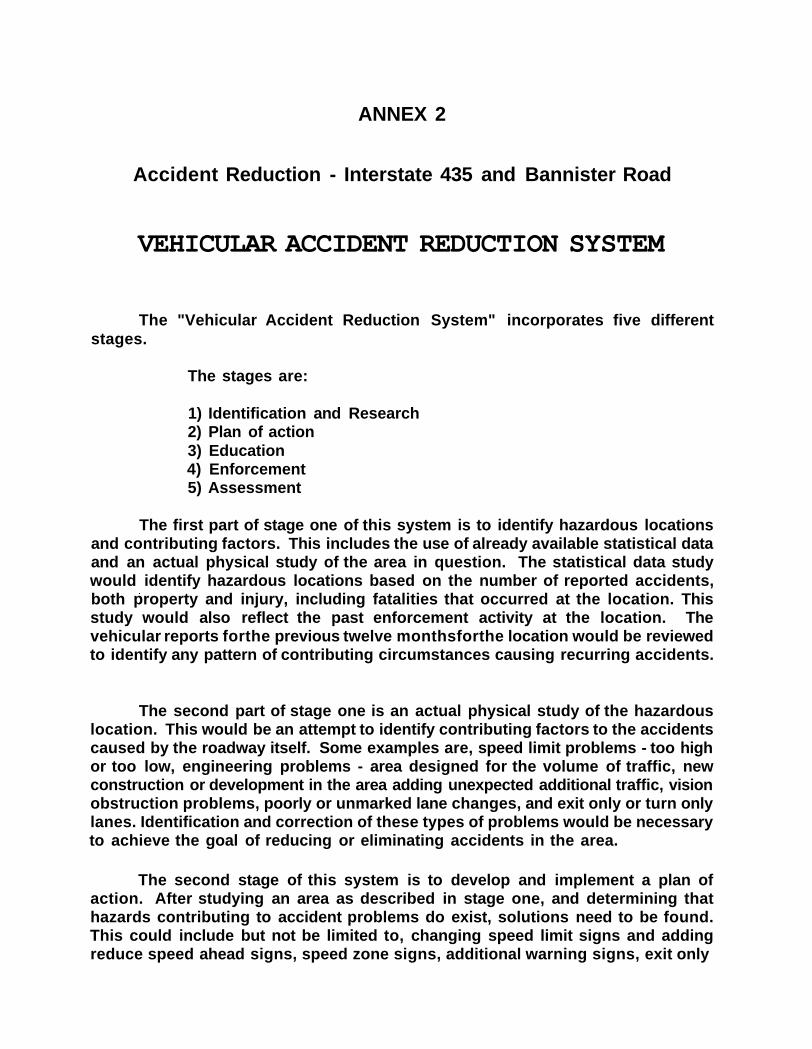
VEHICULAR ACCIDENT REDUCTION SYSTEM
The "Vehicular Accident Reduction System" incorporates five differentstages.
The stages are:
1) Identification and Research2) Plan of action3) Education4) Enforcement5) Assessment
The first part of stage one of this system is to identify hazardous locationsand contributing factors. This includes the use of already available statistical dataand an actual physical study of the area in question. The statistical data studywould identify hazardous locations based on the number of reported accidents,both property and injury, including fatalities that occurred at the location. Thisstudy would also reflect the past enforcement activity at the location. Thevehicular reports forthe previous twelve monthsforthe location would be reviewedto identify any pattern of contributing circumstances causing recurring accidents.
The second part of stage one is an actual physical study of the hazardouslocation. This would be an attempt to identify contributing factors to the accidentscaused by the roadway itself. Some examples are, speed limit problems - too highor too low, engineering problems - area designed for the volume of traffic, newconstruction or development in the area adding unexpected additional traffic, visionobstruction problems, poorly or unmarked lane changes, and exit only or turn onlylanes. Identification and correction of these types of problems would be necessaryto achieve the goal of reducing or eliminating accidents in the area.
The second stage of this system is to develop and implement a plan ofaction. After studying an area as described in stage one, and determining thathazards contributing to accident problems do exist, solutions need to be found.This could include but not be limited to, changing speed limit signs and addingreduce speed ahead signs, speed zone signs, additional warning signs, exit only

page 2
signs, merge signs, and lane ends or through lanes signs. Some problems, suchas an outdated engineering problem, where the traffic density and volume haveoutgrown the original roadway design, would be nearly impossible to solve at ourdepartment level. However, a complete analytical study of a hazardous location,as done in stage one, showing the inherent dangers caused by a flawed orovertaxed roadway design could be forwarded to the appropriate departments. Inorder to accomplish any changes deemed necessary, the assistance andcooperation of the Missouri State Highway Department and the Kansas City PublicWorks Department would be required. Once the necessary changes are made, theentire area would be designated an "Accident Reduction Zone". The zone wouldencompass an adequate stretch of roadway leading into the hazardous location toallow drivers the time to make necessary adjustments to any changed or addedroadway signs. A sign marked "Accident Reduction Zone" would be placed at thebeginning of each entrance into the affected area, thus notifying motorists thatadditional caution should be used on this portion of the roadway. This would bemost important on interstate locations due to the high number of out-of-towntravelers utilizing these roadways while passing through our city.
The first part of the third stage of this system is to educate the generalpublic about the established "Accident Reduction Zones". This could include butnot be limited to, using the local news media, newsprint, radio and TV, the citygovernment cable channel, public service announcements and state or cityrecorded information stations. In addition, brochures could be developed andplaced at tourist information centers and rest areas leading into the city. It wouldbe important to highly publicize the locations and the reasons for the hazardousdesignation. Hopefully, by educating motorists about the reasons for thehazardous location designation, they will voluntarily comply with any changesmade there. Education should also minimize any inconvenience perceived by themotorists because of the changes.
The second phase of stage three is to educate city and state prosecutors andthe Municipal and Circuit Court Judiciary. It will be necessary to have thecooperation of these offices when the enforcement stage begins. When a UniformTraffic Ticket that has been marked as issued to a motorist within an "AccidentReduction Zone", comes before them, they will have knowledge of the program andthe reasons behind it. They can then take this into consideration when passingjudgement on cases. An additional educational and enforcement tool would be tocreate a system like that of the Kansas State Highway Department, "Give Yourselfa Brake" campaign, designed to slow motorist down through construction zones.Any citation received in a construction zone should be subject to fines double theoriginal amount. Legislation would need to be passed by the Missouri Legislatureand the Kansas City, City Council authorizing the same latitude within a clearlymarked "Accident Reduction Zone".

page 3
The fourth stage of this system is the enforcement stage. After the initialchanges to a location have been made and publicized for an adequate amount oftime, strict enforcement should be conducted within the "Accident ReductionZone". All traffic violations observed should be addressed with special emphasisbeing placed on those identified as prominent contributing factor violations.Enforcement tolerance of each officer should be reduced while working within an"Accident Reduction Zone". For example, if an officer normally allows ten (10) totwelve (12)mph over the posted speed limit before he initiates enforcement action,this tolerance should be lowered to a seven (7) to nine (9)mph range within the"Accident Reduction Zone". Any and all types of enforcement activities should beconducted within the "Accident Reduction Zone". This could include but not belimited to, stationary and moving radar, flagging and call-downs, and rovingpatrols. After an initial phase of highly visible, highly publicized enforcementactions within an "Accident Reduction Zone", it should become clear to the drivingpublic that a very serious attempt is being make to curb violations and accidentsin the area and hopefully they will drive accordingly.
The fifth and final stage of this system is the assessment stage. In this stageimplemented changes will be assessed for there effectiveness. Depending on thedesired result that was sought, this will be accomplished in numerous ways. If theoriginal analysis was based on statistical data only, then a simple re-counting ofthe numbers at the same location,using the same time frame.would suffice, if theanalysis recommended actual physical changes to the dynamics of the roadway,other means in addition to the number counting will need to be employed to realizethe impact made. These will include, but not be limited to, re-interviewing theoriginal people involved in the initial study, contacting victims involved inaccidents after the changes have been made, and studying the new accidentreports generated at the location. From the final assessment, a determination canbe made as to the effectiveness of the Implemented solutions. If the desiredobjective has not been achieved, then the additional information gathered duringthe assessment stage, can be applied towards the development of alternativesolutions.
This system is designed to be flexible and has the ability to be tailored toany given circumstance. It also relies on the cooperation of various departmentsand agencies both inside and outside the police department. Various methodshave been utilized in the past in an attempt to curb vehiculars including, heavyenforcement, zero tolerance enforcement and no enforcement, all with minimalsuccess. This approach of reactive enforcement, of saturating an area withenforcement after it appears on the monthly hazardous location report, has notprovided a long term solution to accidents in the affected area. This "VehicularAccident Reduction System" is a proactive approach with the emphasis oneducation and change not enforcement.

page 4
Although enforcement action will be needed in orderto maintain compliance,it should be at a reduced level in both intensity and man-hours once neededchanges are made to the area. In regard to accident reduction, the "VehicularAccident Reduction System" is a drastic departure from anything previouslyimplemented by the police department. The goal of the system is to provide a safeand expedient trip to the driving public through the most hazardous locationswithin our city.

Physical Analysis
ANNEX 3
Accident Reduction - Interstate 435 and Bannister Road
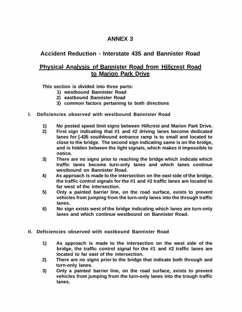
Physical Analysis of Bannister Road from Hillcrest Roadto Marion Park Drive
This section is divided into three parts:1) westbound Bannister Road2) eastbound Bannister Road3) common factors pertaining to both directions
I. Deficiencies observed with westbound Bannister Road
1) No posted speed limit signs between Hillcrest and Marion Park Drive.2) First sign indicating that #1 and #2 driving lanes become dedicated
lanes for [-435 southbound entrance ramp is to small and located toclose to the bridge. The second sign indicating same is on the bridge,and is hidden between the light signals, which makes it impossible tonotice.
3) There are no signs prior to reaching the bridge which indicate whichtraffic lanes become turn-only lanes and which lanes continuewestbound on Bannister Road.
4) As approach is made to the intersection on the east side of the bridge,the traffic control signals for the #1 and #2 traffic lanes are located tofar west of the intersection.
5) Only a painted barrier line, on the road surface, exists to preventvehicles from jumping from the turn-only lanes into the through trafficlanes.
6) No sign exists west of the bridge indicating which lanes are turn-onlylanes and which continue westbound on Bannister Road.
II. Deficiencies observed with eastbound Bannister Road
1) As approach is made to the intersection on the west side of thebridge, the traffic control signal for the #1 and #2 traffic lanes arelocated to far east of the intersection.
2) There are no signs prior to the bridge that indicate both through andturn-only lanes.
3) Only a painted barrier line, on the road surface, exists to preventvehicles from jumping from the turn-only lanes into the trough trafficlanes.

4) No posted speed limit signs between Marion Park Drive and HillcrestRoad.
III. Deficiencies observed that apply to both directions
1) Posted speed limit of forty-five (45)mph to high.2) Timing of left turn arrows, throughout entire stretch, are too short.3) Not enough delay in timing of the signal turning green for through
traffic after turn arrow turns red.
Physical Analysis of Interstate 435 from 87th Street to thetriangle intersection of I-435, I-470, and 71 Hwv
This section is divided into two parts:1) northbound Interstate 4352) southbound Interstate 435
I. Deficiencies observed with northbound I-435
1) Posted speed limit of sixty-five (65)mph to high.
II. Deficiencies observed with southbound I-435
1) Posted speed limit of sixty-five (65)mph to high.2) No early warning signs indicating which lanes lead to the three
different exit ramps for 71 HWY, 1-470 and I-435 triangle.

Recommended Improvements

ANNEX 4
Accident Reduction - Interstate 435 and Bannister Road
Recommended road improvements resulting from analysis
This section is divided into two parts:1) recommendations for Bannister Road2) recommendations for Interstate 435
I. Recommended road improvements for Bannister Road
This subsection is divided into three partsA) recommendations for westbound Bannister RoadB) recommendations for eastbound Bannister RoadC) recommendations pertaining to both directions
A. Recommended road improvements for westbound Bannister Road
1) On Bannister Road, west side of Marion Ridge intersection,place larger reflective lane direction indicator sign showing that#1 and #2 driving lanes become dedicated lanes for southboundentrance ramp for 1-435, that #3 and #4 driving lanes are throughdriving lanes for westbound Bannister Road and that the #5driving lane is a dedicated lane for the entrance ramp tonorthbound I-435.
Reasoning: As approach is made to the I-435 overpass,it is nearly impossible to distinguish what direction thelanes continue to allow traffic to flow. The signs that arenow posted lack definition, size, readability, and areposted too late. Motorist are driving in the #1 and #2driving lanes onto the overpass, then after realizing thatthey are in a turn-only lane, they are making sudden anderratic lane changes into the #3 and #4 driving lanes tocontinue westbound on Bannister Road. This causesnumerous accidents to occur.
2) Post new speed zone signs every two blocks between HillcrestRoad and Elmwood Avenue.
Reasoning: With eight (8) city streets or private businessdrives accessing Bannister Road through this location,

motorist might be more inclined to drive the postedspeed limit if they saw it more often .
3) Add highly reflective painted left turn arrows on the roadsurface in the #1 and #2 driving lanes from Marion Ridge to theoverpass.
Reasoning: Would serve as another reminder to motoristthat the #1 and #2 driving lanes become designated leftturn lanes.
4) Replace small sign that is located on the center median post,hanging between the traffic signal lights, that indicates the #1and #2 driving lanes are designated to the entrance ramp forsouthbound [-435, with a larger model utilizing yellow warningmarkings.
Reasoning: This would signal to the motorist that theyare now dedicated to the turn lanes and must turn onto1-435.
5) Add large reflective overhead lane direction indicator sign justwest of overpass.
Reasoning: This would allow motorist ample opportunityto make safe lane changes if they wished to exit onBannister Road.
B. Recommended road improvements for eastbound Bannister Road
1) Add a lane direction indicator signs that show through trafficlanes for Bannister Road to compliment already posted signswhich show lane dedicated to Bannister Mall entrance, westside of overpass.
Reasoning: To reduce confusion of motorist wishing tocontinue eastbound on Bannister Road.
2} Post new speed zone signs every two blocks from Marion ParkDrive to Hillcrest Road.
Reasoning: With nine (9) city streets and private drivesaccessing Bannister Road through this location,motorists might be more inclined to drive the postedspeed limit if they were reminded more often.
C. Recommended road improvements that apply to both directions
1) Post new speed zone of thirty-five (35)mph
Reasoning: With the shear density of traffic volume,large number of intersecting private drives and citystreets, and the number of turn and exit only laneslocated within this one (1) mile stretch of roadway, it is animpossibility to travel it safely at forty-five (45)mph.Speed is the number one contributing factor toaccidents within this stretch of road. The following Is anillustration of the difference a ten (10) mph difference inthe speed limit can make when trying to avoid anaccident.
Dry pavement:45mph 35mph139.4 feet Total Stopping Distance 92.8 feet
Wet pavement:45mph 35mph184.4 feet Total Stopping Distance 120.0 feet
As you can see, a ten (10)mph reduction in speed reduces yourtotal stopping distance on dry pavement by over forty-six (46)feet. On wet pavement by over sixty-four (64) feet. Thesefactors can increase drastically depending on driver skill andvehicle condition. That means you would have an additionaltwo and a half car links space in which to get your vehiclestopped to avoid an accident, on dry pavement.
Reasoning: A speed reduction alone would allow saferlane changes and prevent numerous rear-end collisionsdue to the increased reaction time allotted each motorist.
2) Lengthen the amount of time allotted to green left turn arrowsat signal controlled intersections.
Reasoning: Lengthening the green arrow by a fewseconds would allow a few additional vehicles to proceedon their way and reduce the frustration level. This shouldreduce the amount of signal violations and eliminate theirattempting to justify this violation with the reasoning of"the light is to short".

3) Add an additional one to two seconds delay to the beginning ofthe green light cycle, at signal controlled intersections whichinclude a left turn signal, for east and west bound traffic oncethe left turn signal turns to red.
Reasoning: This delay would allow motorists driving inthe #3 and #4 traffic lanes the opportunity to ensure theleft turn traffic had cleared the intersection beforeproceeding through.
4) On overpass, install concrete lane dividers isolating the #1 and#2 turn only lanes from the through traffic lanes.
Reasoning: This would serve two purposes:
a) It would prevent motorists from exiting these lanesinto the flow of oncoming traffic.b) It would ensure that traffic accessing BannisterRoad from I-435 would make the turn into the proper laneto continue on Bannister Road.
5) On overpass, re-paint and re-mark all traffic lane markings.
Reasoning: This would reinforce proper lane selectionand increase motorist visibility of the lanes at night.
6) On overpass, re-paint and add reflectors to the curbing andmedian islands.
Reasoning: This would increase motorist awareness thatthe islands exist and help prevent them from hittingthem.
7) Move traffic control signals, that regulate traffic entering theoverpass, from the center median on the overpass, to the centermedian on either side of the overpass.
Reasoning: With the positioning of the signals the waythey currently are, this requires the motorist to assessnot only the timing of the signal but also the requiredplace to stop,in a fraction of a second. With the distancebetween the painted stop block and the actual signalplacement. This assessment is virtually impossible tomake causing the motorist to either stop in theintersection or continue through the intersection againstthe red signal. If the choice Is to continue through the

intersection, this causes the motorist to increase hisspeed "to beat the red light". This increase in speedthrows the vehicle on the overpass, which is full of traffic,stopped for the traffic signals at the opposite end,causing numerous rear-end collisions. By moving thesignals off the overpass and onto the adjacent island, andmoving the painted stopping blocks back accordingly,you will have created a mental barrier for the motorist,reinforcing that the intention of the traffic signal is forthem to stop when it is red. It would also reduce thenumber of rear-end collisions.
II. Recommended road improvements for Interstate 435
This section is divided into two part:1) northbound Interstate 4352) southbound Interstate 435
A) Recommended road improvements for northbound Interstate 435
1) Reduce speed to fifty-five (55)mph at Hickman Mills Road.
Reasoning: With the density and volume of trafficattempting to exit onto Bannister Road and attempting toenter I-435 form Bannister Road, sixty-five (65)mph is toofast. A reduced speed allows for greater stoppingdistance if needed and allows better control of thevehicle. When traffic attempting to enter I-435northbound from Bannister Road, which is traveling at areduced speed, attempts to merge with traffic that istraveling in excess of seventy (70) mph, already on I-435,erratic and irrational driving occurs, resulting in seriousaccidents.
B) Recommended road improvements for southbound Interstate 435
1) Reduce speed limit to fifty-five (55)mph at a point between 87thStreet and Bannister Road. Post on both sides of roadway.
Reasoning: A posted speed limit of sixty-five (65)mph, inreality, allows a seventy (70) to seventy-five (75)mph rundown the hill from 87th Street through the Bannister Roadinterchange, and into the triangle intersection of [-435,1-470 and 71 Hwy. Speed is a contributing factor to all ofthe accidents which occur on this stretch of interstate.

A reduced speed zone to fifty-five (55)mph would allowsafer merging of traffic from Bannister Road and a saferopportunity for motorists to change lanes to positionthemselves for entry into the triangle. A slower speedwould also give the motorist a better opportunity to stoptheir vehicle in the event traffic stops suddenly in front ofthem, which occurs frequently during rush hours.
2) Post flashing "You Are Driving To Fast" signs (like on 1-70 atJackson Avenue) on the Bannister Road overpass.
Reasoning: This type of sign is a real attention getter andreinforces the need for the reduced speed.
3) Post an additional warning signs indication lane selection forthe triangle prior to Bannister Road.
Reasoning: The sooner motorists realize that they mustmake a lane selection up ahead, the sooner and saferthey can make that decision and complete the change.

Accident Reduction Zone
A.R.Z.
ANNEX 5
ACCIDENT REDUCTION- Interstate 435 and Bannister Road
Creating the Accident Reduction Zone(A.R.Z.)
I. Boundaries of the A.R.Z.
1. Bannister Road- westbound at Hillcrest Road2. Bannister Road - eastbound at Marion Park Drive3. Interstate 435 - northbound at Hickman Mills Drive4. Interstate 435 - southbound in the 9000 block
II. Marking of the A.R.Z.
A. Bannister Road - westbound at Hillcrest
1. On the eastside of Hillcrest place a large reflective signindicating the beginning of the A.R.Z.
2. At various intervals through-out the established A.R.Z., placesigns with the initials A.R.Z. that have been designed to matchthe original entry signs, only on a smaller scale.
3. At the exiting point of the established A.R.Z., place small signstating " Exiting A.R.Z., Please Drive Safely".
B. Bannister Road - eastbound at Marion Park Drive
1. On the westside of Marion Park Drive, place a large, reflectivesign indicating the beginning of the A.R.Z.
2. At various intervals through-out the established A.R.Z., placesigns with the initials A.R.Z. that have been designed to matchthe original entry signs, only on a smaller scale.
3. At the exiting point of the established A.R.Z., place a small signstating "Exiting A.R.Z., Please Drive Safely".
C. Interstate 435 - northbound at Hickman Mills Drive
1. On the south end of the Hickman Mills Drive overpass, place alarge, reflective sign indicating the beginning of the A.R.Z.
2. At various intervals through-out the established A.R.Z., placesigns with the initials A.R.Z. that have been designed to matchthe original entry signs, only on a smaller scale.
3. At the exiting point of the established A.R.Z., place a small signstating " Exiting A.R.Z., Please Drive Safely".

D. Interstate 435 - southbound in the 9000 Block
1. In the 9000 block of Interstate 435, on both sides of theinterstate, place large, reflective signs indicating the beginningof the A.R.Z.
2. At various intervals through-out the established A.R.Z., placesmall signs, on both sides of the interstate, with the initialsA.R.Z. that have been designed to match the original entrysigns, only on a smaller scale.
3. At the exiting point of the established A.R.Z., place a small signstating " Exiting A.R.Z., Please Drive Safely".
The concept of a working " Accident Reduction Zone"
The advantages of creating a designated A.R.Z., are numerous. The specialmarkings associated with an A.R.Z. serve as a reminder to the public that thisstretch of road requires their un-divided attention while operating a motor vehiclethrough it. it also allows enforcement activity to be focused in a certain area fora specific purpose. The specifically defined parameters associated with the A.R.Z.,will expand the possibility of creating an awareness with the judaical body whosejuistiction the A.R.Z. falls under. With the cooperation of the judicial body, ie; strictjudgement on citations received with-in A.R.Z., the focus of pro-active enforcement,and the awareness campaign, the A.R.Z. will serve the purpose for which it wasdesigned, Accident Reduction.
The following sign is the proto-type copy from which the actual roadside
signs for the Accident Reduction Zone designation were manufactured. Once
the V.A.R.S. system is utilized on a specific spance of roadway, and it is
designated an Accident Reduction Zone, signs matching this design will be
placed in the proper locations to serve as a permanent reminder to the
driving public.

Photographs of Project Area

Presented
to
the
KANSAS CITY POLICE DEPARTMENT
Interstate 1-435 at Route W
On April 30, 1997, the MoDOT Traffic staff evaluated the interchangeof I-435 and Bannister Road (Route W). The following is a list of thepotential or proposed improvements that will be made on this stretchof road as a result of the concerns addressed by the Kansas CityPolice Department.
Most of the comments addressed were in•i
ANNEX 3 - Physical Analysis of Bannister Road fromHillcrest Road to Elmwood Avenue.
1. Reference 2.3 - Rather than using a concrete median, whichwould require making the entire width of the roadway wider - LongLife pavement markings would be placed on the bridge with an 8inch separation (painted barrier) between the through and left turnlanes. Normally widths are 4 inches. The long life pavementmarkings (3M Tape) are warranted for 4 years provided they arenot damaged by snow plows.
Another possibility is the use of a double white line to designatethat this lane you are not to pass. The gives moreemphasis on the specific goal of the traffic control device,specifically "do not pass".
2. Reference 3.1 - A speed study was conducted on the west sidebetween the Venture entrance and the west signal of theinterchange. The speed study was shown to have an 85th
percentile of 40 mph. As a result MoDOT will post the speed 40mph from 1000 foot west of the 71 interchange. The City ofKansas City may consider changing the speed limit to 40 mph toallow for consistency on their jurisdiction. In addition, the city willhave to pass an ordinance for us to change the speed limit.
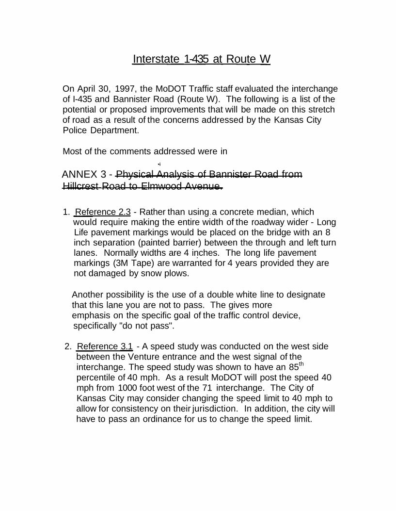
3. We will be adding a North 1-435 double arrow down between thesignal heads on the west side of the bridge for eastbound trafficfor the dual left turns. This will mirror the other side in order toprovide consistency and uniformity.
4. Remove the post that remained from the arm that had failed forthe west side of the interchange. Its sight is competing with theexisting signal posts. Add left turn signs to the left turnindications at Route W and 1-435 for eastbound and westboundtraffic. Presently we have a single sign mounted between left-turn signal heads and their positioning is somewhat confusing tothe public.
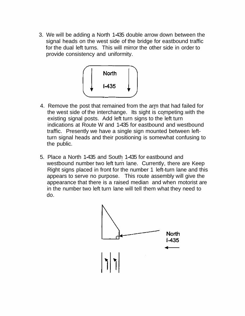
5. Place a North 1-435 and South 1-435 for eastbound andwestbound number two left turn lane. Currently, there are KeepRight signs placed in front for the number 1 left-turn lane and thisappears to serve no purpose. This route assembly will give theappearance that there is a raised median and when motorist arein the number two left turn lane will tell them what they need todo.


No budgetary constraints add additional diagrammatic to the existing1 MILE location and relocate the existing 1 MILE sign to the 2 MILElocation at 87th Street.
This should give more than adequate time for motorists to make adecision on the exit at Southbound I-435 to Route 71.
Provided that these changes do not prove to be completelyineffective the possibility of adding a "congestion ahead" or similarworded sign may be available with semi low technology equipment.Loops could be placed dn the pavement to detect congestion and thesigns could begin flashing dependent on the amount of traffic.
8. For the northbound entrance ramp to I-435 from Route W, we willbe adding a "Right Lane Ends" sign and a "Lane Transition" sign
9. Miscellaneous Items - Speed Limit on I-435 cannot be modified asdiscussed in the last meeting. Signs on Bannister Roaddesignating the A/B Entrance near the eastbound cantilever signwill be removed. By the time motorist see this sign it is alreadytoo late for them to make a maneuver. Also competing with othermore important signage. MoDOT supports the ACCIDENTREDUCTION ZONE upon further discussion and additionalspecifics.
Public Works Street and Traffic
DATE: July 2, 1997
TO: Captain McHale, KCPD
FROM: Kerry Kanatzar, District Traffic Engineer-Street & Tra
SUBJECT: KCPD Vehicle Accident Reduction Plan; Bannister Road & 1-435
The Division has received and reviewed the subject study dated March 1997, and in conjunctionwith the Missouri Department of Transportation, will implement the following items in support ofthe subject plan. As these items are implemented, the plan will be referred to for consistency andcoordination.
• Install backpiates on all mast arm signal heads
• Reduce the existing 45mph speed limit, from Bales Drive to Stark Avenue, to 40mph
• Additional speed limit signing will be installed when the new limit has been established
• Modeling has been completed to optimize the pm routine bandwidth for eastboundprogression. Additional time-based coordination with MoDOT signals at the 1-435interchange will also be implemented. Further modeling to optimize the am routine willproceed. Left-turn, all red clearance intervals will be incorporated into the signal phasing
• Appropriate and effective lane use signing and/or marking will be installed, contingent uponavailable funding.