5– future-proof the geodetic system
18
Transcript of 5– future-proof the geodetic system


Cover: Five Rivers lookout, Wyndham Western Australia. Photo by Landgate Surveyor Doug Hardman
© Western Australian Land Information Authority, 2015
“Triangulation once completed stands for ever; it is the framework (as has been said by a higher authority) on which a survey on any scale whatever may be laid down, and if accurately carried out forms the basis for geodesical measurements, no pains, therefore, should be spared to do it thoroughly, once and for all.”
Malcolm Fraser, Surveyor General of Western Australia, 1872-1883 in ‘CROWN LANDS AND SURVEYS REPORT FOR THE YEAR 1875’

the foundation of location Page 2 of 17
CONTENTS
CONTENTS .................................................................................................................................. 2
EXECUTIVE SUMMARY ............................................................................................................. 3
STRATEGIC CONTEXT .............................................................................................................. 4 AUSTRALIAN SPATIAL GOVERNANCE ............................................................................. 4 WESTERN AUSTRALIA’S STATUTORY FRAMEWORK .................................................... 5 WESTERN AUSTRALIA’S GEODETIC SYSTEM AS AN ASSET ....................................... 5
2020 VISION ................................................................................................................................ 6
FIVE YEAR PRIORITIES ............................................................................................................. 8 1 – DELIVER A FIT FOR PURPOSE DATUM ........................................................................... 8
National priority to improve the accuracy of the geodetic system ........................................ 8 2 – BUILD ON CORS ................................................................................................................ 9
CORS is critical infrastructure to improve positional accuracy ............................................. 9
3 – SUPPORT GROUND MARKS USERS ............................................................................ 10 Ground marks are vital until the transition to GNSS is complete ........................................ 10
4 – MAINTAIN STANDARDS .................................................................................................. 11 Standards are the key to geodetic system integrity ............................................................ 11
5 – FUTURE-PROOF THE GEODETIC SYSTEM .................................................................. 12 Research and innovation is the path to the future .............................................................. 12
APPENDICES ............................................................................................................................ 13 ACRONYMS AND GLOSSARY OF TERMS .......................................................................... 13 SUPPORTING INFORMATION ............................................................................................. 15
What is a geodetic system? ................................................................................................ 15
the foundation of location Page 3 of 17
EXECUTIVE SUMMARY WA is a vast state with a significant reliance on location information to support the confident, open and consistent management and development of land and the interests of landholders. Our geodetic system provides the reliable base for this information, and is therefore critical to the economic, environmental and social development of WA. Since WA’s 2007 Geodetic Strategy, which paved the way for change, there have been significant advances in technology, most notably evidenced by the shift from traditional terrestrial survey practices to the universal uptake of space based surveying and positioning techniques. A reduction in surveying equipment costs and increased research investment is resulting in instantaneous, accurate positioning becoming ubiquitous and affordable. This in turn is driving increased demand for investment in the geodetic system which must stay at least one order of magnitude better than the spatial systems it supports. Meeting this demand in the face of shrinking budgets and industry downturns will require ongoing collaborative effort between government and private industry. This strategy to 2020, builds on recent achievements and harnesses opportunities presented by new innovations to deliver a reliable geodetic system that provides users with the positioning solutions they need anytime, anywhere in WA. The strategy identifies five priorities for Landgate. 1. Deliver a fit for purpose datum by: implementing a new datum to support user expectations for greater positional accuracy; ensuring a suitable density of accurately heighted ground marks while improving the geoid model to support the evolution of satellite navigation technology to replace traditional terrestrial methods. 2. Build on CORS by: maintaining and improving Landgate’s CORS infrastructure; encouraging private industry to adopt nationally consistent coordinates, contribute CORS data and invest in CORS infrastructure; and actively representing WA’s interests in national CORS augmentation discussions. 3. Support ground marks users by: maintaining an appropriate network of geodetic ground marks with the support of stakeholders; developing a portal for efficient submission and integration of geodetic data; improving geodetic information delivery; and improving the fidelity of the State’s digital cadastral map. 4. Maintain standards by: providing standards and guidelines to support the integrity of the geodetic system and reviewing the appropriateness of calibration services. 5. Future-proof the geodetic system by: supporting collaborative programs and geodetic research; participating in national committees and monitoring global developments to build capacity for future needs. Universally the geodetic system is the reference framework that is the foundation of location. Within WA our issues and goals are mirrored around the world and due to the sustained energy of government and the private sector, our system is in very good shape. The priorities provide a direction for the concentration of effort over the next five years to reap the full benefits of exciting new technology and meet the needs of a connected consumer base. The implementation of this strategy requires the collective ownership of government and industry to ensure an accurate, accessible and sustainable geodetic system is available to all users.

the foundation of location Page 4 of 17
STRATEGIC CONTEXT
The WA geodetic system forms an integral part of Australia’s national geodetic infrastructure by its connection through the CORS network, and to the world through the international network of ground stations. Surveyors are the primary users of the physical geodetic network. Their surveys locate, map and direct the construction of infrastructure such as roads, railways, mines, bridges, dams and pipelines. Engineering and mining companies, government agencies and utilities consider this data, derived from the geodetic system, as essential inputs for their design, construction and maintenance of infrastructure projects. Other stakeholders use the spatial intelligence of the geodetic system in Geographic Information Systems (GIS) to align their datasets to a nationally consistent geodetic reference frame. The geodetic system also supports scientific studies for the benefit of the State. Examples include the ongoing monitoring of the South-West Seismic Zone and the measurement of variations in sea level related to climate change. With the ubiquitous integration of Global Navigation Satellite System (GNSS) technology into portable devices such as smartphones, cameras and tracking gadgets all consumers now have an unacknowledged stakeholding in the geodetic system. Currently the positioning accuracy delivered by these devices is around 2-3m, however in the near future that accuracy will be 2-3cm and this will drive consumer expectations that the geodetic system will support their addiction to accuracy.
AUSTRALIAN SPATIAL GOVERNANCE The WA geodetic system complies with Australian national standards that have been developed by the Commonwealth and State and Territory government agencies. This overarching governance is provided by the Foundation Spatial Data Framework (FSDF) which is the cornerstone of the Spatial Information Council. Positioning is one of the ten datasets identified in the FSDF to ‘deliver a national coverage of the best available, most current, authoritative source of foundation spatial data which is standardised and quality controlled’.
Figure 1 The Geodetic System - diagram courtesy of AuScope Ltd
the foundation of location Page 5 of 17
WESTERN AUSTRALIA’S STATUTORY FRAMEWORK The State geodetic system is designated as fundamental land information under the Land Information Authority Regulations 2007. Under the Land Information Authority Act 2006 Landgate performs the function of custodian of geodetic control marks which carries obligations to administer, store and provide access to the information systems covering WA including Christmas and Cocos Keeling Islands.
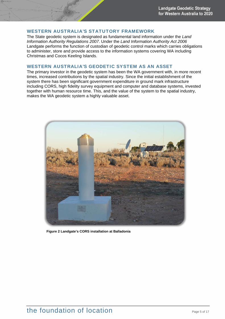
WESTERN AUSTRALIA’S GEODETIC SYSTEM AS AN ASSET The primary investor in the geodetic system has been the WA government with, in more recent times, increased contributions by the spatial industry. Since the initial establishment of the system there has been significant government expenditure in ground mark infrastructure including CORS, high fidelity survey equipment and computer and database systems, invested together with human resource time. This, and the value of the system to the spatial industry, makes the WA geodetic system a highly valuable asset.
Figure 2 Landgate’s CORS installation at Balladonia

the foundation of location Page 6 of 17
2020 VISION Whilst this strategy is focused on the next five years, imagine a world beyond 2020 where: Accurate real time positioning is truly ubiquitous – indoors and out. Users don’t need to understand datum as technology enables any dataset, any datum, any
time. Four-dimensional (4D) spatial datasets are accurate and routinely updated by the masses. A pure geoid based height datum is adopted and the Australian Height Datum (AHD) is no
longer maintained. Geodetic ground marks are no longer used as real time positioning technology is proven as
reliable and trusted. Geodesy in Australia is federated – technology enables updates and services to be provided
nationally including management of CORS or other ground infrastructure. Landgate will be engaged in policy representing the needs of the WA community, and will no
longer have a State-based geodetic maintenance and service delivery function. A paradigm shift in the management of geodetic systems is inevitable as it will no longer be appropriate or sustainable for jurisdictions to maintain insular positional databases. A principal driver will be the centralised management of future national datums, which need to consider continental deformation and coordinate dynamics. Concurrently, technologies such as InSAR (a satellite based system for accurately measuring surface deformation) will effectively blur the boundaries between the earth observation sciences. Geodesy will continue to facilitate the accurate registration of systems that monitor and model the dynamics of the planet, especially: stability of the earth, climate change, sea level change, tectonic movement and gravity. The geodetic surveying tools of 2020 will likely be capable of detecting change by an order of magnitude better than in 2015. There are caveats to any predictions of the future, especially in such a technology dependent environment which include: Drivers for change – a problem needs solving, or a community expectation for better
services. Geopolitical support – nothing will happen, no resources assigned, if the community leaders
are not convinced of the value of initiatives. Availability of technical hardware and software support systems – requires high fidelity
technology (reliability, accuracy, sensitivity), communication systems and appropriate support.
Resourcing – the money, the people, the supporting infrastructure. The basic assumption for the 2020 Vision is that most of these caveats are satisfied. The 2020 Vision predicts the following global, national and state initiatives have reached or will be approaching maturity by 2020. Global Globalisation of reference frames to monitor and model the earth’s dynamic systems, for
example the Global Geodetic Observing System (GGOS) 2020. A United Nations mandate supports international cooperation to achieve sustained
improvement in global reference frames for environmental, social and economic benefits. Multi GNSS provides a significant improvement to real time positioning accuracies – with
GPS, GLONASS, China’s Beidou and Europe’s Galileo all at full operational capacity. Global gravity model improvements provide a new level of accuracy for geoid models – the
critical link between the height delivered by GNSS and the real world surface. Surveying and GIS software are capable of supporting coordinate dynamics.

the foundation of location Page 7 of 17
National The National Positioning Infrastructure (NPI) or other ubiquitous high accuracy real time
positioning capability supports the huge consumer demand for accurate location particularly for Intelligent Transport Systems (ITS).
The new geodetic datum provides a significant accuracy improvement and the tools to choose any datum epoch (time stamp).
The geoid model has been significantly improved and users are able to derive accurate heights using GNSS. A pure gravity based height datum is under consideration.
Satellite altimetry and gravity provide new tools to improve productivity.
State Multi GNSS provides a significant improvement to real time positioning accuracies and WA
achieves further benefits from being in the zone where Regional Satellite Navigations Systems – Japan’s QZSS, India’s GAGAN provide even more satellite signals. The tyranny of delivering ubiquitous accurate real time positioning services statewide has also moved from a reliance on the terrestrial mobile phone network to satellite delivery.
Datum maintenance is automated – the State’s CORS network is the foundation of datum definition and all survey observations are processed and integrated into a National network adjustment automatically via a web portal.
With a reduced reliance on ground marks as GNSS technology is proven as reliable and trusted, Landgate will no longer be installing or maintaining marks.
WA is internationally recognised as the centre of excellence for spatial science education programs in the southern hemisphere.
Spatial datasets have improved significantly to support the capability of accurate real time GNSS e.g. keeping ITS equipped vehicles in the correct lane!
4D cadastre is the natural extension of the old 2D cadastre with the inclusion of height and time.
Landgate will still have oversight of datum maintenance, CORS operations, data dissemination, standards and technical support.
Whilst this may be the outcome by 2020, there is considerable work to be done in the next five years to ensure that the opportunities presented by technology can be fully realised. To this end five priorities have been identified to ensure WA retains a robust geodetic system that is capable of meeting future user needs.
the foundation of location Page 8 of 17
FIVE YEAR PRIORITIES Landgate will provide the leadership and long-term certainty required by all stakeholders and users of positioning technology to afford spatial context to their land information. Five priorities have been identified that will direct activity to modernise and enhance the geodetic system over the next five years.
1 – DELIVER A FIT FOR PURPOSE DATUM National priority to improve the accuracy of the geodetic system A new geodetic datum is being developed for Australia which will be implemented and refined over the next five years. The new datum will account for continental drift and align to the current realisation of the International Terrestrial Reference Frame (ITRF). It will deliver an improved level of accuracy for the entire geodetic system through the inclusion of CORS, new measurements and a contiguous national network adjustment. The new geodetic datum will also serve the growing group of users who require true three dimensional coordinates that are compatible with the GNSS reference surface, that is, heights based on propagation from CORS stations and not mean sea level. The delivery of the new geodetic datum will require a significant focus of Landgate’s geodetic effort to compile a single statewide network adjustment of all geodetic survey observations. Integral to the process of delivering the new datum, new tools will be developed to automate the data flow from field survey and encourage donated survey observations from industry. Landgate will also provide technical support for the implementation of the new datum into spatial datasets across WA. A core component of the ground mark network is its capacity to deliver the AHD, which approximates mean sea level. This height datum is based on terrestrial techniques rather than GNSS and provides a ‘real world’ surface that all engineering and infrastructure developments require. GNSS techniques need to use a correction (geoid) model to estimate the AHD and cannot provide the accuracy required for many applications. Landgate will continue to monitor the importance of AHD as the accuracy of GNSS technology improves and/or adoption of a pure geoid based height datum becomes more palatable. In the meantime, the geoid model will be continually improved and the density of ground marks with accurate AHD will be preserved as required.

the foundation of location Page 9 of 17
2 – BUILD ON CORS CORS is critical infrastructure to improve positional accuracy
From 2008-13 Landgate, with additional funding from the Commonwealth Government through AuScope, established 26 CORS across WA. Whilst the primary focus of this substantial investment is to provide infrastructure for research, this CORS network also provides the foundation framework for a significant improvement to the positional accuracy of the Australian geodetic datum. Geodetic system users directly benefit from the CORS network through access to the data generated from the sites and a vast improvement in the Geoscience Australia (GA) AUSPOS service resulting in reduced occupation times. Indirectly, users also benefit through the research being conducted using data from the CORS network. Landgate will maintain this CORS network to ensure continuous data flow and also upgrade the equipment to enable multi GNSS. A 2013 NPI plan, compiled by the Australian Government in consultation with State/Territory Governments and industry, articulates a vision for a denser
national network of standardised CORS and associated processing infrastructure to enable a real time positioning service in Australia with an accuracy of 0.05m or better. The NPI would include a delivery mechanism that is truly ubiquitous and not restricted by terrestrial mobile phone network coverage. Subject to funding, there is an expectation that this initiative will be developed within the next five years and Landgate is actively participating in NPI discussions to ensure WA’s interests are properly represented. Private industry CORS also play an integral role in the geodetic system by expanding the network of high fidelity marks across WA. Landgate will encourage private CORS operators to use coordinates certified by GA and contribute suitable CORS data streams into the national network. Opportunities to support private industry investment in new CORS where the Landgate network is deficient will also be explored.
Figure 3 Map showing Landgate and other high fidelity CORS which are used for datum definition
the foundation of location Page 10 of 17
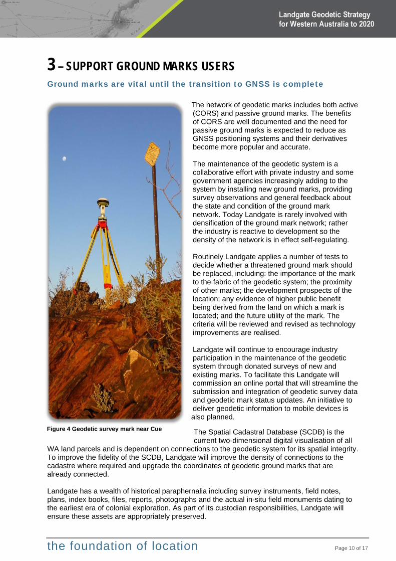
3 – SUPPORT GROUND MARKS USERS Ground marks are vital until the transition to GNSS is complete
The network of geodetic marks includes both active (CORS) and passive ground marks. The benefits of CORS are well documented and the need for passive ground marks is expected to reduce as GNSS positioning systems and their derivatives become more popular and accurate. The maintenance of the geodetic system is a collaborative effort with private industry and some government agencies increasingly adding to the system by installing new ground marks, providing survey observations and general feedback about the state and condition of the ground mark network. Today Landgate is rarely involved with densification of the ground mark network; rather the industry is reactive to development so the density of the network is in effect self-regulating. Routinely Landgate applies a number of tests to decide whether a threatened ground mark should be replaced, including: the importance of the mark to the fabric of the geodetic system; the proximity of other marks; the development prospects of the location; any evidence of higher public benefit being derived from the land on which a mark is located; and the future utility of the mark. The criteria will be reviewed and revised as technology improvements are realised. Landgate will continue to encourage industry participation in the maintenance of the geodetic system through donated surveys of new and existing marks. To facilitate this Landgate will commission an online portal that will streamline the submission and integration of geodetic survey data and geodetic mark status updates. An initiative to deliver geodetic information to mobile devices is also planned.
The Spatial Cadastral Database (SCDB) is the current two-dimensional digital visualisation of all
WA land parcels and is dependent on connections to the geodetic system for its spatial integrity. To improve the fidelity of the SCDB, Landgate will improve the density of connections to the cadastre where required and upgrade the coordinates of geodetic ground marks that are already connected. Landgate has a wealth of historical paraphernalia including survey instruments, field notes, plans, index books, files, reports, photographs and the actual in-situ field monuments dating to the earliest era of colonial exploration. As part of its custodian responsibilities, Landgate will ensure these assets are appropriately preserved.
Figure 4 Geodetic survey mark near Cue
the foundation of location Page 11 of 17
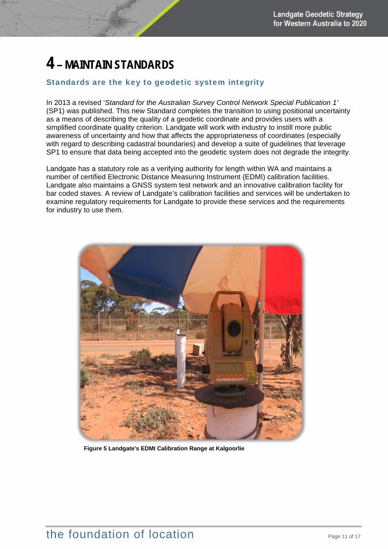
4 – MAINTAIN STANDARDS Standards are the key to geodetic system integrity In 2013 a revised ‘Standard for the Australian Survey Control Network Special Publication 1’ (SP1) was published. This new Standard completes the transition to using positional uncertainty as a means of describing the quality of a geodetic coordinate and provides users with a simplified coordinate quality criterion. Landgate will work with industry to instill more public awareness of uncertainty and how that affects the appropriateness of coordinates (especially with regard to describing cadastral boundaries) and develop a suite of guidelines that leverage SP1 to ensure that data being accepted into the geodetic system does not degrade the integrity. Landgate has a statutory role as a verifying authority for length within WA and maintains a number of certified Electronic Distance Measuring Instrument (EDMI) calibration facilities. Landgate also maintains a GNSS system test network and an innovative calibration facility for bar coded staves. A review of Landgate’s calibration facilities and services will be undertaken to examine regulatory requirements for Landgate to provide these services and the requirements for industry to use them.
Figure 5 Landgate's EDMI Calibration Range at Kalgoorlie

the foundation of location Page 12 of 17
5 – FUTURE-PROOF THE GEODETIC SYSTEM Research and innovation is the path to the future Landgate provides support for national projects and is involved in a number of research initiatives that will leverage the technology advances and provide efficiencies for both government and industry. At the international level Landgate provides specialist advice and services typically for countries that are at an early stage of development of national surveying and land information systems. Involvement in national forums is also crucial to ensure that the needs of WA with our unique challenges, as a large and resource-rich State with a small population, are appropriately represented. Interaction with other state jurisdictions, both formally and informally, ensures a consistent interchange of ideas that align with national agendas. Landgate needs to continue monitoring global developments and trends to understand consumer demands for greater accessibility and functionality. This will ensure that the geodetic system evolves to effectively meet the challenges of 2020 and beyond. The current geodetic system adequately caters for the majority of users however there is a consumer demand for faster, smaller, more accurate devices. Initiatives such as the NPI combined with private industry CORS developments will potentially evolve to meet this demand. It could logically be expected that a user pays approach may emerge to service customers who have more demanding positioning requirements. Government is also likely to require innovative funding arrangements to reduce the draw on the public budget.
the foundation of location Page 13 of 17
APPENDICES
ACRONYMS AND GLOSSARY OF TERMS Accuracy Accuracy refers to the degree of certainty, conformity or closeness of a
measurement or position to the "true" value. See also “precision”. AHD / AHD71
Australian Height Datum 1971. (Often referred to as height above sea level) The normal orthometric height system based on spirit levelling linked to 30 tide gauges around mainland Australia and realised through a network of BMs and SSMs. The datum is based on 1966-1968 tide gauge observations and was adopted in 1971. It is the current height datum for Australia and is not likely to be updated but may in the future be superseded by a pure geoid based height datum.
AUSPOS Australian Online GPS Processing Service Geoscience Australia’s free automated web-based positioning service, providing global users with the facility for submitting dual frequency geodetic quality GPS, static mode data from a single receiver. Precise coordinates, based on the nearest 15 CORS, are emailed back usually within 15 minutes.
BM Bench Mark A ground mark for which only the vertical height, referenced to AHD71, has been established. Horizontal positional coordinates are often inaccurate.
CORS Continuously Operating Reference Station A CORS consists of a permanent installation of a GNSS receiver and antenna, a power supply and modem that transmits the GNSS data 24x7 to a central processing centre. CORS data is used for geodetic reference frame development; scientific studies – tectonic motion and crustal deformation, atmospheric modelling, monitoring sea level change. CORS data can also be used to provide real time positioning services.
Datum An official, fully-defined, spatial reference system or surface to which measurements and/or coordinates upon the Earth may be defined and related.
EDMI Electronic Distance Measuring Instrument Measurement of distances using the transmission and reflection of electromagnetic waves. Typically using infra-red light along the ground and radar through the atmosphere.
GAGAN GPS Aided Geo Augmented Navigation An Indian regional navigation satellite system.
GDA94 Geocentric Datum of Australia 1994 The current geodetic datum used in Australia for all official spatial referencing systems, unless otherwise specified. Currently being refined to introduce improved accuracy provided by the increased number of CORS.
Geoid A model of the global sea level surface as it would extend across the land mass and is the basis of the AHD.
GLONASS Global Navigation Satellite System The Russian global navigation satellite system (GNSS) equivalent to the US Department of Defense GPS.
GNSS Global Navigation Satellite Systems A generic term for satellite navigation systems (e.g. GPS) or combination of multiple systems (GPS+GLONASS) that provide autonomous geo-spatial positioning with global coverage and now commonly available on consumer devices e.g. Smartphones and cameras.
GPS Global Positioning System The US Department of Defense global navigation satellite system (GNSS). As the first fully operational global positioning satellite constellation system GPS is often used in popular vernacular synonymously with GNSS.
the foundation of location Page 14 of 17
InSAR Interferometric Synthetic Aperture Radar
A remote sensing technique that can be used to accurately measure ground displacement.
ITRF International Terrestrial Reference Framework A dynamic datum derived from a network of over 200 fiducial sites worldwide that move as a result of tectonic instability.
ITS Intelligent Transport Systems Technology applied to transport systems to improve safety, productivity and environmental performance. Includes traffic management systems, in-vehicle systems, vehicle to vehicle and vehicle to infrastructure communications.
NGRS National Geospatial Reference System Australia’s authoritative, reliable, high accuracy spatial referencing system. It includes the GDA94 and AHD71 datums.
NPI National Positioning Infrastructure An Australian Government initiative to ‘assure instantaneous, reliable and fit-for-purpose positioning, navigation and timing (PNT) services anywhere and anytime across the Australian landscape and beyond’, including coordinated development and implementation of CORS; communications; data processing, analysis and monitoring facilities and delivery mechanisms.
Precision Precision refers to the degree of certainty, conformity or closeness that repeated measurements of the same quantity are to each other; See also “accuracy”. The result may or may not be ‘accurate’
QZSS Quasi Zenith Satellite System A Japanese regional navigation satellite system.
SCDB Spatial Cadastral Data Base Landgate’s database system for storing and disseminating spatially defined cadastral boundaries, lodged cadastral boundaries, control marks, easements, topographic features reference boundaries, surveyed mining tenement boundaries and administrative boundaries. All data is referenced to the national geospatial reference system based on the Geocentric Datum of Australia (GDA94).
SLIP Shared Location Information Platform The Shared Location Information Platform is a shared information delivery service that is designed to provide fast and easy access to the state's land information. SLIP facilitates improvement of business processes and systems that use land information across government.
SSM Standard Survey Mark Physical ground mark for which accurate horizontal coordinates (and usually height) have been established.

the foundation of location Page 15 of 17
SUPPORTING INFORMATION What is a geodetic system? Fundamentally the geodetic system is a global framework that allows the ‘location’ to be defined for every person and feature in proximity to the surface of the earth. The ‘system’ is made up of components: the network of ground marks; the survey observations, the business processes that integrate and create; the databases that store; the dissemination process that delivers; the guidelines and regulatory controls; and the resources that are required to ensure the system functions to meet user needs.
At a global level: The United Nations Committee of Experts on Global Geospatial Information Management recognises the growing demand for more precise positioning services and the economic and societal importance of the Global Geodetic Reference Frame (GGRF). It cites real benefits for natural hazard and disaster management; climate change and sea level monitoring; geospatial information for mapping and navigation; and the orderly management of property rights. To improve global cooperation, the committee has a UN mandate in support of the GGRF which is maintained on a best effort basis by participating countries. At the regional and local level: Within Australia (and NZ) ANZLIC is the high-level governance mechanism that develops national standards via the ICSM with each state jurisdiction having responsibility for maintaining their own state geodetic system. The amalgamation of the parts of the system ensures the whole is a unified data-set that allows accurate transition between states. Today, globalisation is a common theme, and with location specific data this can only be accomplished if the foundation geodetic system is accurate and the datum current. Australia’s geodetic system or National Geospatial Reference System (NGRS) includes two datums, GDA94 providing the horizontal datum, and AHD71 providing the vertical datum. During the life of this strategy it is planned that the horizontal datum, at least, will be modernised and
the foundation of location Page 16 of 17
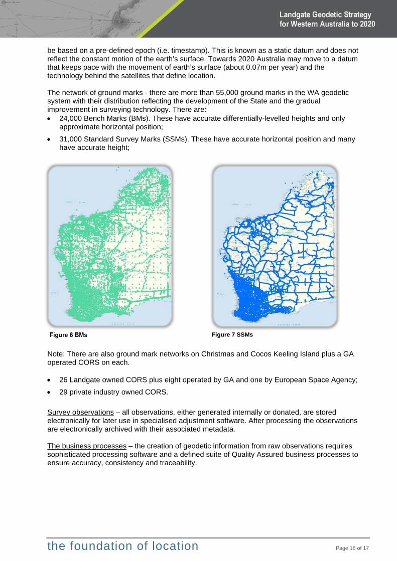
Figure 6 BMs
be based on a pre-defined epoch (i.e. timestamp). This is known as a static datum and does not reflect the constant motion of the earth’s surface. Towards 2020 Australia may move to a datum that keeps pace with the movement of earth’s surface (about 0.07m per year) and the technology behind the satellites that define location. The network of ground marks - there are more than 55,000 ground marks in the WA geodetic system with their distribution reflecting the development of the State and the gradual improvement in surveying technology. There are: 24,000 Bench Marks (BMs). These have accurate differentially-levelled heights and only
approximate horizontal position;
31,000 Standard Survey Marks (SSMs). These have accurate horizontal position and many have accurate height;
Note: There are also ground mark networks on Christmas and Cocos Keeling Island plus a GA operated CORS on each. 26 Landgate owned CORS plus eight operated by GA and one by European Space Agency;
29 private industry owned CORS.
Survey observations – all observations, either generated internally or donated, are stored electronically for later use in specialised adjustment software. After processing the observations are electronically archived with their associated metadata. The business processes – the creation of geodetic information from raw observations requires sophisticated processing software and a defined suite of Quality Assured business processes to ensure accuracy, consistency and traceability.
Figure 7 SSMs
the foundation of location Page 17 of 17
The database – all survey observations and adjusted coordinates and associated metadata are stored in a comprehensive database. The information includes:
o Geodetic mark information – type, location, status, accessibility o Coordinates and height and their associated quality indicators – positional
uncertainty, method of survey, relative accuracy o Field observations and metadata o Field book references o System parameters
The dissemination process – Geodetic data/information is currently disseminated to users through My Landgate Survey Channel, Geodetic On-Line Access (GOLA) and Shared Location Information Platform (SLIP). Work is underway for delivery to mobile devices. The guidelines and regulatory controls – the geodetic system is maintained in accordance with the ICSM ‘Standard for the Australian Survey Control Network Special Publication 1’ (SP1) and associated guidelines. http://www.icsm.gov.au/geodesy/sp1.html The resources that are required to ensure the system works – Landgate, as custodian of the geodetic system, has a task-dedicated team of about ten including: a Principal Consultant, Chief Geodetic Surveyor, surveyors, geodetic analysts and technicians. A growing number of industry surveyors compliment the team resources and provide very useful additional information, especially in remote areas infrequently visited by Landgate.
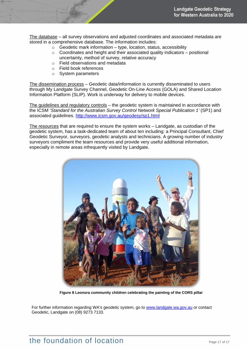
Figure 8 Leonora community children celebrating the painting of the CORS pillar
For further information regarding WA’s geodetic system, go to www.landgate.wa.gov.au or contact Geodetic, Landgate on (08) 9273 7133.