2016 Annual Water Report - City of Parksville of 9,000,000 m3 and is operated and maintained by City...
47
1 2016 Annual Water Report 1116 Herring Gull Way Parksville, BC V9P 1R2 Phone: 250-248-5412 Fax: 250-248-6140
Transcript of 2016 Annual Water Report - City of Parksville of 9,000,000 m3 and is operated and maintained by City...
1
2016 Annual Water Report
1116 Herring Gull Way
Parksville, BC
V9P 1R2
Phone: 250-248-5412
Fax: 250-248-6140

2
Table of Contents
1.0 INTRODUCTION ................................................................................... 3
2.0 PARKSVILLE WATER SYSTEM ........................................................ 3
3.0 DISTRIBUTION SYSTEM ................................................................... 6
4.0 SCADA ............................................................................................... 10
5.0 WATER SAMPLING AND TESTING .................................................. 11
6.0 WATER QUALITY COMPLAINTS & INCIDENTS.......................... 12
7.0 ENGLISHMAN RIVER WATER SERVICE JOINT VENTURE AGREEMENT ………………..……………………………….….…13 8.0 ROUTINE MAINTENANCE PROGRAM …………………….……14 9.0 2016 IMPROVEMENTS .................................................................... 15
10.0 2016 CAPITAL PROJECTS ............................................................... 15
11.0 2017 CAPITAL PROJECTS & IMPROVEMENTS ............................ 15 12.0 CROSS CONNECTION ....................................................................... 16 13.0 EMERGENCY RESPONSE PLAN………………………....………...16 14.0 WATERSHED PROTECTION PROGRAM…………………………..17 APPENDIX A - WELL LOCATION MAP APPENDIX B - ARROWSMITH DAM LAKE LEVELS APPENDIX C - MAP OF PRESSURE ZONES APPENDIX D - BACTERIOLOGICAL TEST RESULTS APPENDIX E - FULL SPECTRUM ANALYSIS APPENDIX F - TRIHALOMETHANES (THM) ANALYSIS APPENDIX G - WATER SYSTEM OPERATING CONDITIONS

3
Springwood
Well #8
1.0 Introduction
Water suppliers, under their Operating Permit and condi-
tions, are required to provide an annual report to their users
with information such as explanation of water source, water
test results, maintenance programs and improvements to the
water system. The following document summarizes these
requirements. City of Parksville operating conditions are
shown in Appendix G.
This report has been submitted to Island Health and it can be
found on the City of Parksville Website. www.Parksville.ca.
2.0 Parksville Water System
The City of Parksville has approximately 4,500 water
connections serving over 11,000 permanent and seasonal
residents as well as supplying water to the Regional District
of Nanaimo (Nanoose Bay Peninsula system) in the summer
months.
These users get their drinking water from three sources.
Englishman River
Springwood Well Field
Railway Well Field
The water is treated using either liquid or gaseous chlorine
and stored in four reservoirs at both ends of the City.

4
2.1 Groundwater Wells
The City's groundwater is pumped from a confined quadra sands aquifer that runs underground
alongside the railway tracks from Trill Drive to the City's boundary in the southwest. The City
currently has 16 production wells ranging from 2.0 l/s (25.23 IGPM) to 8.6 l/s (113.5 IGPM). See
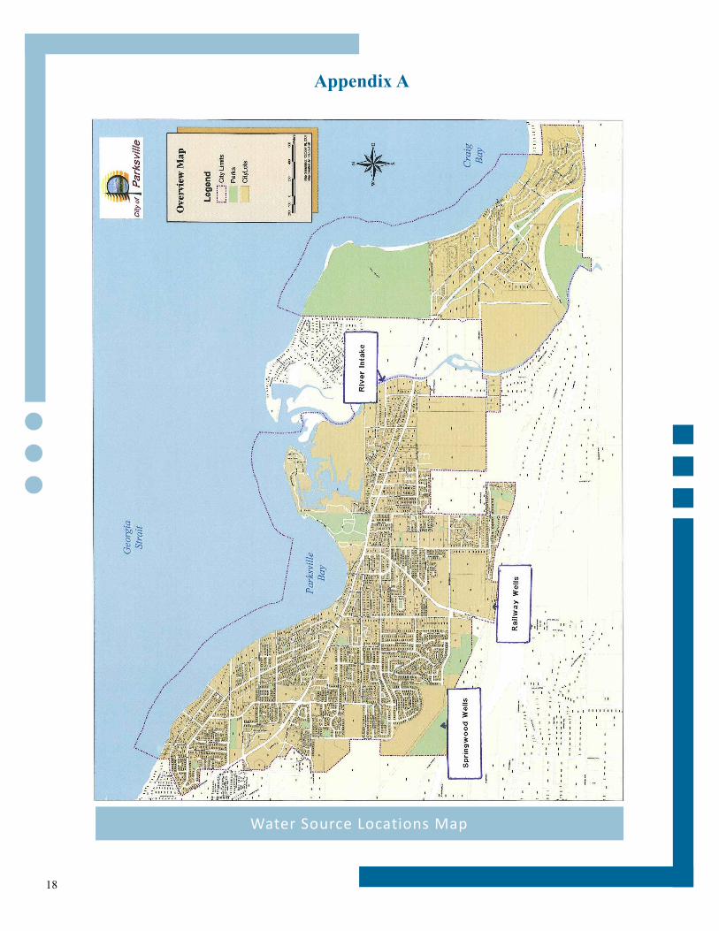
Appendix A for Well locations.
Well Name Pump intake (m) Production (l/s)
Springwood Well #1 22.8 2.0
Springwood Well #3 30.36 3.4
Springwood Well #5 30.52 4.8
Springwood Well #6 31.8 2.5
Springwood Well #7 22.35 8.9
Springwood Well #8 23.71 9.3
Springwood Well #9 Under construction Under construction
Springwood Well #10 32.18 5.1
Springwood Well #11 30.42 5.2
Railway Well#1 35 3.4
Railway Well#2 34.15 4.9
Railway Well#3 38.46 0.7
Railway Well#4 35.67 2.2
Railway Well#5 36 4.7
Railway Well#6 35 5.9
Railway Well#7 35 2.3
Railway Well #8 35.68 3.2
Industrial Well#8 - -
Pump Depth and Production Information

5
2.2 River Intake
Between the end of April to the beginning of October the City pumps water from the Englishman
River at a maximum rate of 105 l/s (1390 IGPM) to keep up with summer demands. The water in
the Englishman river is partially supplied from the Arrowsmith Dam. The Ministry of Environment,
Fisheries and the Arrowsmith Water Service (AWS) developed an operating rule curve in an effort
to conserve reservoir storage water for critical fisheries rearing periods. A minimum flow is released
into the river based on this curve between June 1st and October 31st.
2.3 Arrowsmith Dam
The City of Parksville, the Regional District of Nanaimo, and the Town of Qualicum are partners in
the Arrowsmith Water Service (AWS). A concrete gravity dam is located at Arrowsmith Lake ap-
proximately 19km south of Parksville. It was commissioned in September of 2000. The dam has a
capacity of 9,000,000 m3 and is operated and maintained by City of Parksville staff. Water is
released to the Englishman river through two pipes, a 900 mm and a 600 mm with flows and lake
levels monitored by the City's Supervisory Control and Data Acquisition (SCADA) system.
See Appendix B for Arrowsmith Dam Lakes Levels 2016.
2.4 Reservoirs
Water that has been pumped either from the ground or from the river is stored in four reservoirs.
Reservoirs numbers 1, 2 and 4 are located in the Springwood Water Complex on Despard Road.
These three are concrete with two being partially below ground and one above. Storage capacities
are:
Reservoir #1 - 616 m3 (135,500 Imp. gal).
Reservoir #2 - 2023 m3 (445,000 Imp. gal)
Reservoir #4 - 4559 m3 (1,000,000 Imp. gal).
There are two additional reservoirs at the Top Bridge Park area, numbers 3 and 5. Reservoir #5 is a
glass fused steel tank, Reservoir #3 is a steel tank although currently not in use. Storage capacities
are:
Reservoir #3 - 671m3 (148,000 Imp. gal.)
Reservoir #5 - 4300 m3 (950,000 Imp. gal).

6
3.0 Distribution System
The distribution system consists of 64.6 km of PVC (plastic) pipe, 9.1 km of Ductile Iron pipe and
33.16 km of AC (Asbestos Cement) pipe. Sizes range from 100mm (4") to 400mm (16").
There are 564 fire hydrants and one Pressure Reducing Valve (PRV).
Like all municipalities, the infrastructure is aging and water mains are being replaced through capital
improvements and development. The following shows the size, age and material of the mains in the
Parksville Water System in 2015. Some of these pipes have been replaced since 2015 but newer
data has not yet been updated by the Engineering department.
2016 Watermain Diameter Proportions
Diameter No Pipes Distance
(km) Percentage Type
150 mm or less 704 41.9 41.34% Distribution Mains 66.26%
200 mm 510 25.3 24.92%
250 mm 261 15.8 15.56%
Supply Mains 33.74% 300 mm 200 11 10.89%
350 mm and greater 109 7.4 7.29%
Total: 1784 =101.38 km
41.3%
24.9%
15.6%
10.9%7.3%
2016 Watermain Diameter Proportions
150mm or less
200mm
250mm
300mm
350mm and greater

7
2016 Watermain Material Proportions
Material Types Distance (km) Percentage
Asbestos Cement 27.4 27%
Ductile Iron 9.1 9%
PVC 63.6 62.7%
Steel 0.45 0.5%
Others 0.84 0.8%
Total: 101.4 km
27.0%
9.0%62.7%
0.5%0.8%
2016 Watermain Material Proportions
Asbestos Cement
Ductile Iron
PVC
Steel
Others

8
2016 Watermain Age Proportions
Age No Pipes Distance
(km) Percentage
Under 25 Years (≥1991) 1059 48.5 47.9%
25 - 50 Years (1966 - 1991) 802 49.6 48.9%
Over 50 Years ( <1966) 62 3.3 3.3%
Total: 1923 101.4 km
47.9%
48.9%
3.3%
2016 Watermain Age Proportions
Under 25 years
25-50 years
Over 50 years

9
3.1 Pressure Zones
The City is divided into two pressure zones. A low pressure and a high pressure. The low pressure
is a gravity fed system based on the elevation of Reservoir #4 and Reservoir #5. A top water level
of 73.74m above sea level (geodetic) gives a range of 55 psi to 85 psi throughout the system,
depending on the geographic location.
The high pressure system initially was developed for higher elevation regions of the city that didn't
have sufficient pressures or flows to meet fire fighting flows. This high pressure zone has been
expanded to areas furthest from the pump stations that lose pressure and flow due to line losses. In
order to maintain a balance between high and low pressures but still keep a safe pressure in the
lower areas, a PRV was installed to drop the pressure from 80psi to 60psi.
The high pressure water in this zone is supplied from four pumps, a 15 hp, 2-40 hp and a 100 hp.
These pumps are controlled through the SCADA system that automatically watches flows and
switches on however many pumps it needs to meet the flow requirements.
See Appendix C for Map of Pressure Zone Boundaries.
Springwood Pump Station

10
4.0 SCADA (Supervisory Control and Data Acquisition)
The water system and sewer pump stations are controlled by a computerized control system called
SCADA. This system allows the Operators to monitor reservoir levels, the status and flows of
pumps, and monitor chlorine residuals. The operator can change set points and monitor the system
remotely. Alarms are automatically called out to City staff that monitors the system 24 hours a day,
7 days a week.
SCADA system

11
5.0 Water Sampling and Testing
5.1 Bacteriological
As required by the Island Health, City staff take weekly bacteriological samples to be tested for
Total Coliforms and e-Coli Bacteria. There are 17 dedicated sampling sites throughout the city.
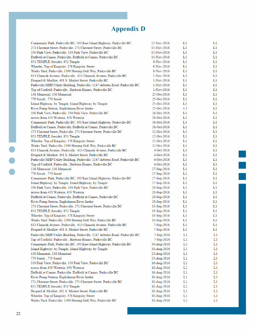
See Appendix D for 2016 test results (L1 means Less than 1 - no detectable bacteria - Acceptable).
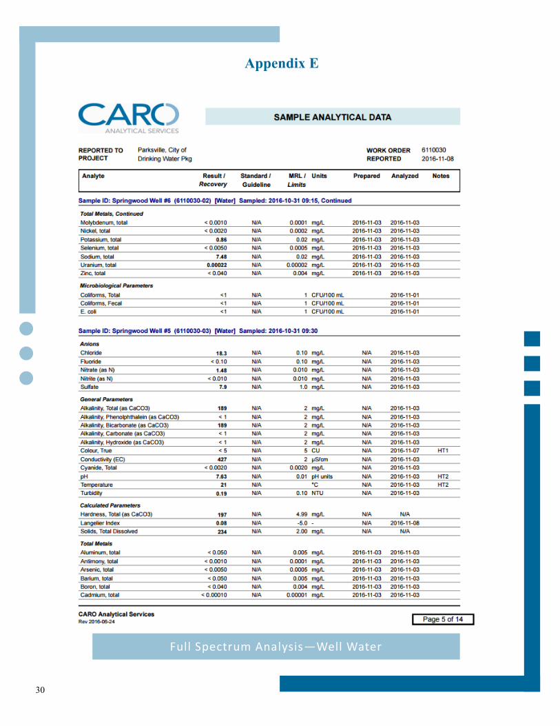
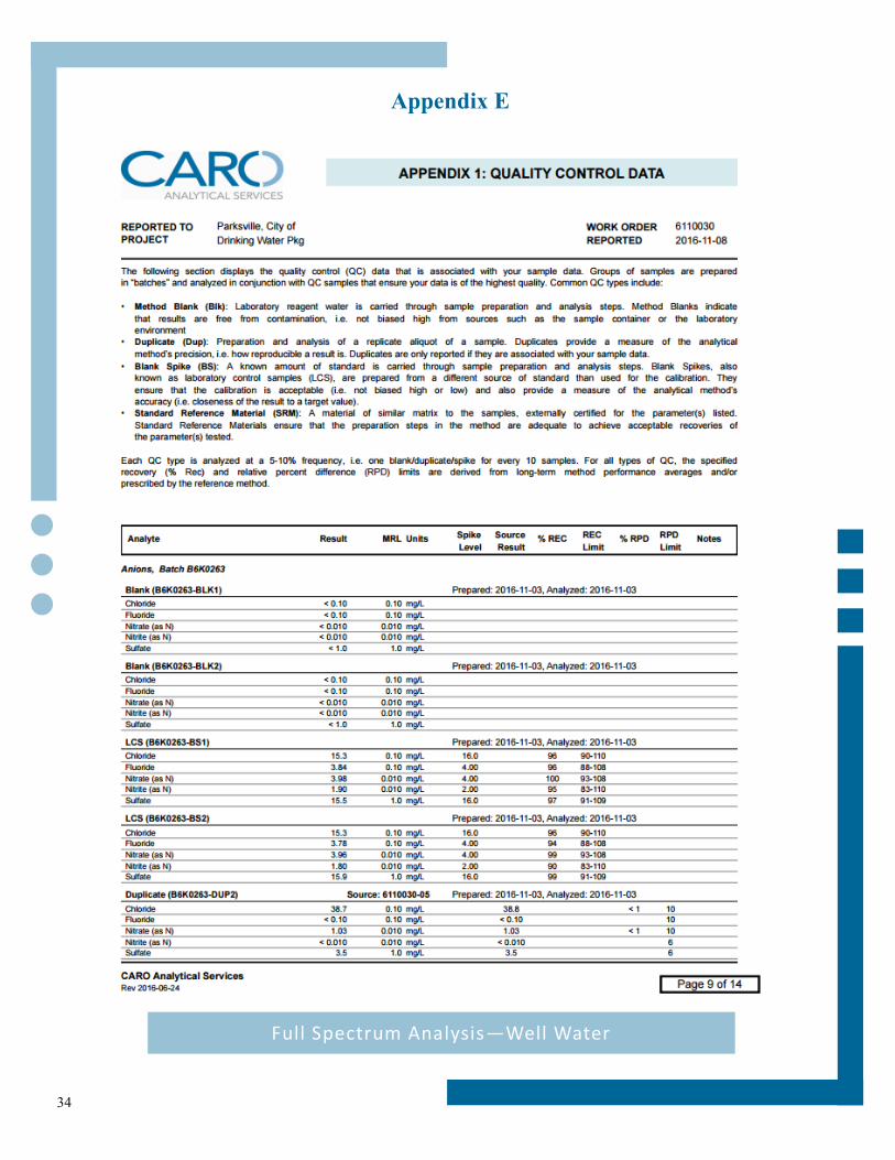
5.2 Full Spectrum Analysis
In addition to weekly sampling throughout the distribution system, the City also sends samples from
the source waters once per year, in the Fall, for a full spectrum analysis. As seen in Appendix E,
parameters such as metals (iron, manganese) conventional parameters (pH, Turbidity, Hardness) and
disinfection byproducts (Trihalomethane) are tested.
The source water is aesthetically acceptable as set by the "Guidelines for Canadian Drinking Water
Summary Table". Aesthetic qualities apply to certain substances or characteristics such as high Iron
content which will stain fixtures red or Manganese which will stain black.
Hardness in the water comes from calcium carbonate (CaCO3).
The river water is considered "Soft" under the guidelines and the
Well water is "Moderate". Hardness levels above 500 mg/l are
normally considered unacceptable.
All parameters meet the Canadian Drinking Water Guidelines.
See Appendix E for the 2016 Full Spectrum Analysis of the
Parksville Water System Source Water. Note: The water tested is
in it’s Raw form before any type of treatment.
5.3 Trihalomethane Analyses
The City also take Trihalomethanes (THMs) samples four times
per year. THMs are disinfection by-products that form when chlo-
rine is added to water that contains elevated levels of natural
organic matter.
See Appendix F for the Trihalomethane results. 1116 Herring Gull
Way sampling site

12
6.0 Water Quality Complaints & Incidents
The Operations Department had few water quality complaints throughout 2016. During water
main flushing and fire hydrant maintenance there were a few calls related to “brown or dirty”
water. City of Parksville crews would either re-flush the mains through a hydrant or flushout at a
location closest to the dead end or advise the homeowner that running an outside tap for a few
minutes would clear up the problem.
There was one complaint about the taste of chlorine in the water. Chlorine residuals are tested
weekly throughout the system and are kept at a safe level. Besides recommending a filter to re-
move the chlorine within the home, not much can be done about it.
There were a few hardness related complaints mostly contributed to new homeowners from other
municipalities who are used to different water composition. There were also a few calls concerning
build up in washing machines and toilet bowl although the water is only considered “Moderately
Hard” on the Hardness Scale. This rating drops throughout the summer when the river supply (soft
water) is mixed with the well supply.
Many of the complaints in 2016 were related to pressure drop. The cause for most of the pressure
drop complaints were from a faulty PRV (responsibility of the home owner). There was the odd
occasion where staff had to flush the line in order to clear debris (from construction) or where the
setter needed to be replaced.
Many calls were related to water leaks. Most were regarding leaky services or water meters. There
were no main breaks in 2016.
Clay Bank at Englishman River

13
7.0 Englishman River Water Service
The ERWS is a joint venture between the City of Parksville and the Regional District of Nanaimo,
formed to secure a bulk water supply from the Englishman River. This regional partnership supple-
ments existing well supply sources owned and operated by the City of Parksville and Nanoose Bay Pen-
insula Water Service Area.
Englishman River Water Service joint venture agreement (percentages of interest).
City of Parksville 74%
Regional District of Nanaimo 26%
ERWS project
The City of Parksville and the Regional District of Nanaimo (Nanoose Bay Peninsula) are moving for-ward with an expansion to the drinking water supply which will ensure a safe and secure water system for the community. The projects includes:
In-river water supply intake designed/located to consider the needs of river users and to protect aquatic habitat;
Water treatment plant with a minimum of 16 million litres per day of membrane filtration capacity to comply with new water regulatory treatment standards; and
Transmission supply main between plant and reservoirs. This project is necessary to ensure a safe and secure water system is available for now and the future. Island Health has mandated the improvement of water quality standards for surface water (river water) and the plant is schedule to be operational in 2018.
The benefits of the water treatment plant include:
Reduced health risk;
Improved water quality;
Ensures customers receive best quality water year round; and
Will meet Canadian Drinking Water Guidelines.
For more information visit
www.arrowsmithwaterservice.ca

14
8.0 Routine Maintenance Program
8.1 Distribution
Water mains are flushed using a unidirectional flushing program
Air relief valves are cleaned
Fireline meters are cleaned
Fire Hydrants are completely disassembled and inspected on a two year rotation
Paint and brush out around hydrants as needed
All irrigation backflow prevention devices tested and repaired if needed
8.2 Wells
Daily security check of all wells
Rehabilitation of 1-2 wells per year
Pumps and motors replaced as necessary
Filling chlorine tank on Springwood Well #1 as needed
Annual water sampling
8.3 River Intake
Winter maintenance of chlorination system while off line
Weekly blowing of air lines through intake screens
Daily checks of pump flows and chlorine levels
Monthly calibration of turbidity analyzers
8.4 Reservoirs
Daily security check of tanks and compounds
Yearly cleaning of Reservoir #1 and 2.
Clean Reservoir #4 and 5 using divers every 5 years.
Sustaining valves cleaned monthly
8.5 Pump Stations
Daily checks of pumps and chlorination system
Security checks of compounds
Bi-Annual calibration of chlorine analyzers and turbidimeters

15
9.0 2016 Projects & Improvements
Updated the Dam O&M manual and the Dam Emergency Re-
sponse Plan.
Springwood well #1 and Railway well #4 were updated (pipes
replaced).
Railways #6 and Springwood #6 had their motor and pump
replaced.
Finished the water meter replacement for the 1 1/2” and the 1”.
Started the replacement of the 3/4” .
Continued to update the water meter route maps and completed
the Arrowsmith Dam Emergency Response Plan.
Developments that included water main replacement for 823
Stanhope Road, 330 Church Road, 780 Stanhope and 577 Pym.
Ran the pilot program to demonstrate the UF membrane sys-
tem performance.
10.0 2016 Capital Projects
Replacement of aging water mains (Temple Street from Bay to
Chinook, Banks Avenue and Forsyth)
Continued to update the unidirectional flushing maps.
11.0 2017 Projects & Improvements
Start construction of water intake and treatment plant.
Rehabilitate Springwood and Railways Wells #6.
Continuing to replace aging water mains for better distribution
(Corfield Street from Highway 19A to Stanford, Wallis and
McKinnon.
Developments that may have substantial completion in 2017
include 770 Hirst Avenue, 511 Soriel Road, Ceder Ridge phase
2 & 3, 705 & 677 Pym Street, Cider Ridge phase 4, Shelly
Place and 312 Hirst.
Continue working on the Cross Connection Control Program.
Finish updating the unidirectional flushing maps.
Continue to register all City Wells.
Railway well #1 well rehabilitation.
Springwood well #9 chemical rehab.
Continue with water meter replacement program.
Pilot Plant—UF
membrane system

16
12.0 Cross Connection Control Program
In 2006 the City of Parksville drafted a cross connection control
program. Due to shortage of staff, the program was not able to be
properly conducted until 2014. The Utilities Technician (Cross Con-
nection Control Coordinator) is constantly working on the
implementation of this program.
The Cross Connection program is currently addressing medium and
high hazard water use. These include Industrial, Commercial and In-
stitutional (ICI) users. Each ICI user will be assessed as to the potential risk to the water system.
Any costs associated with installation, replacement and testing of an approved backflow device will
have to be covered by the property owner.
A tracking program called FAST is used to track devices around the City (both City owned and
privately owned devices). Property owners are required to send the annual test to the Utilities Tech-
nician at the City of Parksville.
All City owned facilities were assessed and the appropriate backflow preventer were installed. Cur-
rently staff is assessing privately owned devices. Due to the large number of ICI users, this assess-
ment may take a couple of years. City staff remains watchful of potential cross connections around
the City, and problems are reported to the Utilities Technician.
13.0 Emergency Response Plan
The City of Parksville has an Emergency Response Plan (ERP) pertaining to the water system. This
document is not available online as it has private contact information for City Staff. This document
outlines the strategies to deal with events such as contamination of water supply, pump failures and
turbidity events. This plan was updated in 2015 and a separate ERP exists for the Arrowsmith Dam.
Irrigation cross
connection
Englishman River
High Water Level, January 2016

17
14.0 Watershed Protection Program
The City of Parksville is part of the Regional District of Nanaimo’s regional Drinking Water and
Watershed Protection Program.
The Drinking Water and Watershed Protection (DWWP) program helps protect the Region’s water
resources. Through the DWWP program, more is being learned about water in the Region, this infor-
mation is used to make better land use decisions, and help communities protect the environment.
Parksville is part of the Englishman River watershed. The Englishman River flows in an easterly
direction from Mount Arrowsmith at 1819 m above sea level and discharges into the Strait of Geor-
gia, north of Craig Bay. The main Englishman and South Englishman rivers originate in Arrowsmith,
Hidden and Fishtail lakes.
The total drainage area is approximately 324 sq. km.
For more information visit http://www.rdn.bc.ca/cms.asp?wpID=1749
18
Appendix A
Water Source Locations Map

19
Appendix B
Arrowsmith Dam Lake Levels

20
Appendix C
Map of Pressure Zone Boundaries

21
Appendix D
2015 Bacteriological Results
22
Appendix D
2015 Bacteriological Results

23
Appendix D
2015 Bacteriological Results

24
Appendix D
2015 Bacteriological Results

25
Appendix D
2015 Bacteriological Results
Information taken from: http://www.viha.ca/mho/water/water_sampling_results.htm

26
Appendix E
Full Spectrum Analysis—Well Water

27
Appendix E
Full Spectrum Analysis—Well Water

28
Appendix E
Full Spectrum Analysis—Well Water

29
Appendix E
Full Spectrum Analysis—Well Water
30
Appendix E
Full Spectrum Analysis—Well Water

31
Appendix E
Full Spectrum Analysis—Well Water

32
Appendix E
Full Spectrum Analysis—Well Water

33
Appendix E
Full Spectrum Analysis—Well Water
34
Appendix E
Full Spectrum Analysis—Well Water

35
Appendix E
Full Spectrum Analysis—Well Water

36
Appendix E
Full Spectrum Analysis—Well Water

37
Appendix E
Full Spectrum Analysis—Well Water

38
Appendix E
Full Spectrum Analysis—Well Water

39
Appendix E
Full Spectrum Analysis—Well Water

40
Appendix F
THM Analysis

41
Appendix F
THM Analysis

42
Appendix F
THM Analysis

43
Appendix F
THM Analysis

44
Appendix G
Water System Operating Conditions

45
Appendix G
Water System Operating Conditions

46
Appendix G
Water System Operating Conditions

47
Appendix G
Water System Operating Conditions