2012 FPL Task Force Revised Specifications for 2012 FPL in EUR Region Andrew Hill, Eurocontrol
EXHIBIT 1 TO FPL MOTION TO STRIKE
generators have access to disposal for Class Band C so-called "low-level "radioactive wastes.
The Studsvik waste can be stored for one year at the WCS site in TX but waste stored longer
than that violates the TX WCS storage license. The WCS commercial disposal site is A) not
operating and B) limited to TX and VT waste-not TN or Florida- generated waste. Although any
compact can consider accepting out-of-compact waste, they have all rejected it. Importantly, the
licensed capacity of the storage and disposal sites at WCS TX are too limited to take Florida's or
Tennessee's generated nuclear waste. (See declaration of Diane D'Arrigo in support of this
contention). Finally, there are still unresolved conditions and a question as to whether the WCS
will operate. Texans have raised concerns with the whole licensing of the WCS site with federal
agencies.
It is fair to say that FPL has an aspiration to hand-off the so-called "low-level" waste
Turkey Point 6 & 7a would generate as quickly as possible, but it has not demonstrated
conclusively that this is going to be possible.
CASE is concerned that authorizing the production of this waste (by granting the COL)
when there is no disposal site or assured other option, will result in the Turkey Point site
becoming a long-term so-called radioactive storage site. It is reasonable to protect CASE
members to require a plan that addresses this circumstance in such a way to protect their health
and safety, as well as workers at TP 6 and 7, as well as the older existing units.
CONTENTION: EIGHT
Limited Work Authorization
CASE adds to our petition a request that NRC deny the request from FPL to begin construction
of the non-nuclear portions of this project (limited work authorization, LWA). As was the case in
the Levy County COL that Progress Energy filed in 2008, the damage that could be done to the
Turkey Point site under a LWA is considerable. While the Levy site is "Greenfield" the
construction in the location of the Turkey Point units 6 and 7 would negatively impact wetlands,
-45-
coastal estuary and other sensitive areas. We offer a letter from the South Florida Water
Management District (SWFMD exhibit) and the issues raised in it as the basis for this contention.
We further invoke the expertise of the local water authority, though we make no claim that it is
working on behalf of CASE. Please do not allow any type of construction on Turkey Point without
first granting the full COL authority.
CONCLUSION
The Petitioner requests that this petition to intervene and request for hearing be
granted. The foregoing contentions should be admitted because they clearly satisfy all
of the Commission's requirements in 10 C.F.R. § 2.309.
Respectfully submitted this the 1 yth day of August 2010.
-46-
____ ./s/----, ______ _ Barry White Citizens Allied for Safe Energy 10001 SW 129 Terrace Miami, FL 33176
coastal estuary and other sensitive areas. We offer a letter from the South Florida Water
Management District (SWFMD exhibit) and the issues raised in it as the basis for this contention.
We further invoke the expertise of the local water authority, though we make no claim that it is
working on behalf of CASE. Please do not allow any type of construction on Turkey Point without
first granting the full COL authority.
CONCLUSION
The Petitioner requests that this petition to intervene and request for hearing be
granted. The foregoing contentions should be admitted because they clearly satisfy all
of the Commission's requirements in 10 C.F.R. § 2.309.
Respectfully submitted this the 1 yth day of August 2010.
-46-
___ --:Is/----, ______ _ Barry White Citizens Allied for Safe Energy 10001 SW 129 Terrace Miami, FL 33176
SOUTH FLORIDA WATER MANAGEMENT DISTRICT
August 16, 2()10
Chief Rules, Announcements, and Directives Branch Division of Administrative Services Mail Stop TWB'-05-B01 M U.S. Nuclear Regulatory Commission Washington, DC 20555.:0001
Dear Siror Madame:
Subject: FPL Turkey Point Units 6 & 7 ("Proposed Project") Combined License Application RevieW Seoping Comments
This letter is in response to your June 24,2010 letterrequesting the South Florida'WatEir Management District's (SFWMD's)partic::ipation in the .$Cdpingprocess 'for the Proposed Project The SFWMD is ~. r(3gl00al gov(3rnmental ~genQythatov~rs~es the water resources in the $.outhern half of Florida; including 16 counties from Orlando to the Florida Keys with a population of more than 7.5 million. The SFWMD is the oldest and largest of the stale's five water management .districts.
Charged with safeguarding the region's water resources" tile SFWMD is responsible for managing and protecting water quality, flood control, natural systems and. water.supply. The SFWMDoperatesand maintains the Central a.nd Southern Florida (C&SF) Project, one of the world's largest water managementsystems. The C&SF Project cbnsistsdf many mil'es of canals, levees, water storage areas, pUrrip ·stationsj and other water control structures.
The SFWMD is also the lead state agency in the Federa.I-Stateinitiative to restore America's Everglades through the Comprehensive Everglades Re~toration Plan (CERP), the largest environmental project in North America. The CERP i$ a framework for restoring, protecting and preserving the water resources of central and southern Florida. The CERP is a30,..year, 50-50 partnership between the State. of Florida and the Federal government. The State of Florida and the SFWMD have invested approximately $2.4 billion toward this effort, including approximately $300 million in construction,as of June 30, 2010. .
TheSFWMD is currently reviewing a Site Certification Application (SCA) for this project; pursuant to the State of Florida's Power Plant and EleCtrical Transmission Line Siting Act (Sections 403.501-403.539, Florida Statutes). DLlring the SCA revi~w proc~ss, the
;3301 G!1Il <:!.ub Roaq,Wesf P.il.1rn Be"c11, FJorida 33409 • (591).()86~8800 ~FI, WAT5J.c~00~432,-20',l~ Mailing Address: p,o', Box 24680, West Palm Beac:ll, FL~::l4164680 • www.sfvxmd.gov
i{
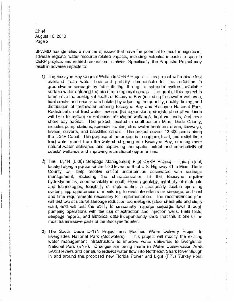
Chief August 16, 2010 Page 2
SFWMD has identified a humber of issues that have the potential to result in significant adverse regional water resource-related impacts, including potential impacts to specific CERP projects and related restoration initiatives. Specifically, the Proposed Project may result in adverse impac~s to:
1) The Biscayne Bay Coastal Wetlands CERP Project - This project will replace lost overland fresh waterflow and partially compensate for the reduction i'n groundwater seepage by redistributing, through a spreader system, available surface water entering the area from regional canals. 1"he goal of this project is to improve the ecological health of Biscayne Bay (including freshwater wetlands, tidal creeks and near- shore habitat) by adjusting the quantity; quality, timing, and distributi.on of freshwater .entering Biscayne Bay and Biscayne National Park. Redistribution .of freshwater floW and the expansion and restoration of wetlands will help to. restore or enhance freshwc:\ter wetlands, tidc:\1 wetlc:\nds, cmd near shore bay habitat The project, located in southeastern Miami-Dade County, includes pump stations, spreader swales, stormwater treatment areas, flowways, levees, culvert·s,and backfilled canals. The project covers 13,600 acres along the L.;31E Canal. The purpose of the proJect is to capture, treat,and redistribute freshwater runoff from the watershed going into Biscayne Bay, creating more naturai water deliveries and expanding the spatial extent and connectiviWof .coastal wetlands and improving re.creationalopportunities~
2) The L31 N (L..:30) Seepage Management Pilot CERP Project - This project, . located along a pOrtion of the L.;30 levee north of u.S. Highway 41 in Miami-Dade·
County, will. help resolve critical uncertainties associated with seepage management, including the characterization of the Biscayne aquifer hydrodynamics, construetability in south Florida geology, reliability of materials and technologies, feasibility of implementing c:\ seasonallyflexib[e operating system, appropriateness of monitoring to evaluate effects on seepage, and cost and time requirements necessary for implementation. The recommended plan will test two structural seepage reduction technologies (steel sheet pile and slurry wall), and will test the ability to seasonally manage seepage flows through pumping operatior1s With the use of extraction and injection wells. Field tests; seepage reports, Clnd historical data independently show that this is one of the most trClnsmissive parts of the Biscayneaquifet.
3) The South Dade C-111 Project and Modified Water Delivery Project to Everglades National Park (Modwaters) - This project will modify the existing water management infrastructure to improve water deliveries to Everglades National Park (ENP). Changes are being made to Water Conservation Area 3A13B levees and canals to redirect waterflow into. Northeast Shark River Slough in and around the. proposed new Florida Power arid Light (FPL) Turkey Point
i{
Chief August 16, 2010 Page 2
SFWMD has identified a humber of issues that have the potential to result in significant adverse regional water resource-related impacts, including potential impacts to specific CERP projects and related restoration initiatives. Specifically, the Proposed Project may result in adverse impac~s to:
1) The Biscayne Bay Coastal Wetlands CERP Project - This project will replace lost overland fresh waterflow and partially compensate for the reduction i'n groundwater seepage by redistributing, through a spreader system, available surface water entering the area from regional canals. 1"he goal of this project is to improve the ecological health of Biscayne Bay (including freshwater wetlands, tidal creeks and near- shore habitat) by adjusting the quantity; quality, timing, and distributi.on of freshwater .entering Biscayne Bay and Biscayne National Park. Redistribution .of freshwater floW and the expansion and restoration of wetlands will help to. restore or enhance freshwc:\ter wetlands, tidc:\1 wetlc:\nds, cmd near shore bay habitat The project, located in southeastern Miami-Dade County, includes pump stations, spreader swales, stormwater treatment areas, flowways, levees, culvert·s,and backfilled canals. The project covers 13,600 acres along the L.;31E Canal. The purpose of the proJect is to capture, treat,and redistribute freshwater runoff from the watershed going into Biscayne Bay, creating more naturai water deliveries and expanding the spatial extent and connectiviWof .coastal wetlands and improving re.creationalopportunities~
2) The L31 N (L..:30) Seepage Management Pilot CERP Project - This project, . located along a pOrtion of the L.;30 levee north of u.S. Highway 41 in Miami-Dade·
County, will. help resolve critical uncertainties associated with seepage management, including the characterization of the Biscayne aquifer hydrodynamics, construetability in south Florida geology, reliability of materials and technologies, feasibility of implementing c:\ seasonallyflexib[e operating system, appropriateness of monitoring to evaluate effects on seepage, and cost and time requirements necessary for implementation. The recommended plan will test two structural seepage reduction technologies (steel sheet pile and slurry wall), and will test the ability to seasonally manage seepage flows through pumping operatior1s With the use of extraction and injection wells. Field tests; seepage reports, Clnd historical data independently show that this is one of the most trClnsmissive parts of the Biscayneaquifet.
3) The South Dade C-111 Project and Modified Water Delivery Project to Everglades National Park (Modwaters) - This project will modify the existing water management infrastructure to improve water deliveries to Everglades National Park (ENP). Changes are being made to Water Conservation Area 3A13B levees and canals to redirect waterflow into. Northeast Shark River Slough in and around the. proposed new Florida Power arid Light (FPL) Turkey Point

Chief August 16, 2010 Page 3
Units 6 & 7 transmission line corridors. Gurrentwater management actions focus ort re-establishing sheet flow into ENP by removing barriers such as the Tamiami Trail road and replacing it with a bridge. Future water management changes Will increase the volume of water introduced and distributed into Northeast Shark River Slough.
Additional changes are being implemented along the LowerC-111 Canal to promote rehydration of Taylor Slough and northern Florida Bay in the south.ern limits of ENP. A series of detention areqS are being constructed west of the L., 31 N Cana.1 to provide storm water detention and create a hydrologic barrier betWeen the managed canal levels and the Everglades marsh. Water levels will be managed at higher leve.ls within the detention ·areas to create a positive hydrologic head and reduce seepage from ENP.
4). Decompartmentalization of Water Conservation Area3A138- This is a CERP proJect arid a com pan ion to the South Dade C.,.111/Modwaters Project promoting removal of existing levees and canals impacting sheet flow into ENP. Futur-e changes include. removal of existing canals, leveE;ls, and structutesseparating WCA 3A/3B arid ENP, such as removal of the Miami Canal within WCA 3A, removal of the L-67A1C levee segments,and additiona!bridging of Tamiami Trail togetherwith the· removal of the L-29 containmeritJevee.
In addition to the potential forsignific(;lnt a.dverSe impacts to sPecific restoration projects, the SFWMD is <;:oncerned about·the potential for Sigilificant adverse 'impacts that relate to' its overall mission to manage the water resources of the State located within the' SFWI\;1D'sgeograPhic bo.undaries .. The. SFWMD recommends that .the following issues be addressed in the EnVironmental Impact, Statement:
Radial Well and Construction Dewatering Withdrawals at Power Plant ,Site
• The .adequacy of!the groundwater modeling sl.lbmTtted by FPL.
Note:: Asummar:y of the District's concerns regarding FPL1s ground water modeHngis -attache.d.
• The potential for the proposed withdrawals to eXacerbate saline water intrusion and ground water contamination due to the existence .of preferential flow patbs within the Biscayneaquifec .
• The potential for the proposed withdrawals to adversely impact th~ ecology o.f Biscayne Bay.
Chief August 16, 2010 Page 4
• The potential for the proposed withdrawals to adversely impact the CERP Biscayne, Bay Coastal Wetlands project.
• The potential for adverse impacts, to regional water resources, inCluding public water supply wellfields, Biscayne National Park, the Biscayne Bay Aquatic Preserve, and the Florida Keys National Marine Sanctuary from induced seep'age from the Turkey Point cooling canal system as a result of cumulative impacts, including additional loading from construction dewatering/wastewater discharges and runoff from stored muck,and .reduced head in'the vicinity of the power bloc,k construction dewatering withdrawals and the radial well withdrawals. The unlined cooling canal system contains hypersaline water overlying the highly permeable Biscayne Aquifer. The salinity of cooling canal system water is, significantly greater than natural groundwater salinity in the, area and the waters within adjacerit Biscayne Bay;theref()re; the presence ,of density driven seepage upgradient(to the west) and downgradi€mt (to the east and south) is likely. MOnitor:ing weHs up to approximately three miles west of the cooling canal system have encountered groundwater with chemicalconstituentsindicaliveof cooling canal system water, including hypersalinity and/or tritium. Constituents within the cooling canal system that have or may'have the potential to degrade water' resoLlrces incluclehypersaline water, radiological isotopes, nutrients, or other compounds that may be discharged into the cooling canal system from plant operations and/or muck storage adjacent to the cooling ca/laJ system.
Additional Construction ImpactsatPowerPlanfSite
• The potential 'for adverse impacts t6 wetl$ridsarid:lisled:species.
•• The potential foradverseitrtpacts to Biscayne BaY ~ssociat¢dwiththe pr()PQsed barg~ canal dredging. '
Temporary Roadway Improvements for Construction of Units 6 & 7
• The potential for adverse impacts to wetlands>andlistedspeCies.
• The potential for adverse impacts to the CERP Biscayne Bay Coastal Wetlands Project.
• The potential for adverse impacts to environmental\yseositive lands within the Model Land, Basin.
Note: A copy of ,the SFWMD's letter to the Flqrid;:t DepaH:ment of Community Affairs concerning FPL'sproposed roadway text amendments to Miami:.Uade
Chief August 16, 2010 Page 5
County's comprehensiv~ plan is attached. Please note that the letter includes comments on an alternate roadway proposal recommended by Miami-Dade ,County staff.
Reclaimed Water Pipeline
• The potential for adverse impacts to wetlands and listed species.
• The potential for adverse impacts to the CERP Biscayne Bay GoastalWetlands Project. . . .
Electrical Transmission Lines
• The potential for adverse impacts to wetlands and listed species.
• The potential for adverse impacts to the construction scheduleforthe U.S. Army Corps of Engineers (USAGE) Seepage' Management Pilot Project, which is a component of the CERP Project. The work 011 the USACE project will take· place within the westemlevees of the SFWMD's L-3.0 andL-31 N Canals, which are located within the West Preferred Corridor. The SFWMD isa participating p(;lrtner with the USACE in this project Work is scheduled to begin soon arid may still be ongoing When FPL commencesconstruCtibri. of the proposed transmission lines.
!Ii The poteritialfor adverse impacts to the SFWMD's L-30 and L-31 N Can(;llievees, which are located within the West Preferred Corridor. FPLis proposing u.se the existing access roads on the canal levees for construction and maintenance purposes; hqwever; PQrtionsof thel.eve.es h(;lvenot been designed .. to accommodate the heavy eqUipment proposed to be :used by FPL; therefore, the levees will need to be enhanced and widened. The SFWMDadvised FPL th(;lt any proposed levee enhancements will need to meetOSACE' design specificatioris, comp.actiQHi' and side slopest(;lbiIization (grass/sod) requirements.
.• The potential for the Preferred Corridors to adversely impact SFWMD-owned communications towers and radio matrix sites. In particular, the West Preferred Gorridoris located very close to various SFWMD communications towers and radio matrix sites. AlthoughFPL has indicated that they will Work with the SFWMD to resolve any unlikely interference issues, they have not provided the SFWMD with adequateinfotrnation to determine if or to wh(;ltextent critical SFWMD,..owned communications facilities may be impacted by the proposed transmission .line facilities. The ·SFWMDadvised FPL that it is unacceptable to wait until impacts have occurred to identify, design, permit, construct,and
Chief August 16, 2010 Page 6
implement solutions, sinc.e this could substantially impact the SFWMO'sability to use these facilities to meet SFWMD flood protection and other critical emergency management responsibilities. .
• The. potential for adverse impacts to eXisting wetland slough systems, located within the Vicinity of U.S. Highway 1, from newand/or improved fill roads as.sociated with the West Preferred Corridor. East of U.S. 1, under theCERP Biscayne Bay Coastal Wetlands Project, additional surface water flows are to be diverted southward, through existing wetland slough systems in this area, to hydrate wetlands to the south,including wetlands intheSFWMO's Model Lands Basin area, and possibly the SFWMD's Southern Glades Basin area. The SFWMO is a partner with the USACE in this project. Even if culverts are installed; they are very poor at maintaining low head flows (Le., sheetfloW). West of U.S. 1, the .corridor crosses the SFWMO's Southern Glades Save· Our Rivers Parcel GR701-025.
• The potential for adverse impacts to wetlands thal are part of northeastern Shark River Slough, within tbe boundaries of Everglades National Park,and wetlands within Water Conservation Area 3B, ass.ociated with the West Secondary Corridor. Both of these areas are part of the Everglades Protection Area as defined in the Everglades Forever Act and are targetsfot restoration. .undef CERP. FPL has not provided adequateinfbrtilcitibn onp6tential impacts from the construction, operation,and maintenance of the proposed transmission lines and related access· (fill) roads through these areas. Currently, there are no eXisting access roads in this area other than the L,-30and L-31 N levee roads. Newroad construction would result in long-term impacts to wetland habitat, disrupt existing hydrologic flows, and impact Water quality. New road construction would potentially cOrlflictw.ithfuture CERP project restoration efforts related to the relocation of the S,-356 pump station and the promotiQnof wetland sheet flow~ Vehicle.s (other than airboats) moving over the wetlands (without roads) would also result.in major disturbance to eXisting wetlands by compacting soils, disrupting existing hydrologic fIOw$,and impacting habitat for listed species. Another .area of concern is speCific to tree islands, which are commonly used as, bird rookeries. Islands in or adjacent to this corridor have been Wood Stork rookeries in recent years. Given that Wood Storks are an ehdangeredspecies and that restofatiohof the Wood Stork populatiQIi, along With other EV!3rglades wading bird populations, is a primary CERp target, the construction and presence of electrical transmission lines that could impact these tree islands and their fauna should be avoided. Please note. that there may also be potential adverse impacts to the Wood Stork population and other Everglades wading bird populations from the west Preferred Corridor.
Chief August 16,2010 Page 7
Regarding Water Conservation Area 3B, there are potential impacts related to the construction, operation, and maintenance of the proposed transmission line with respect to the SFWMD's legally mandated responsibilities for managing its lands within Water Conservation Area 3B.These lands were specifically acquireq for water management-related purp~oses (Le., flood control, water supply, conservation, reclamation, 'and other allied purposes) and are managed by the SFWMD and other agencies,incluqing the U.S. Fish and Wildlife Service and th'e Florida Fish and' Wildlife ConservaHon Commission, through special agreements for thosepui"Poses.
Wetland Mitigation Proposals
• The potential benefits and/or ,adverse impacts related to FPL's wetland mitigation proposals. Limited information has been provided to date by FPL regarding potential wetland mitigation options
Hurricanes/Climate Change/Sea Level Rise
• The potential for adverse impacts related to the siting and design of the proposed plant and Clssociated facilities directly on the ,coast in an area subJect to the direct effects of hurricane tidal surge, climate chang,e,andsealev$1 rise,
Additional details concerning the above ,are contained within the completeness letters that the SFWMD sent to the Florida Department of Environmental Protection (DEP)as part of theSCA re'liew process. Those letters are available, on the DEP Siting Office \Neb page at: http://www;dep.state.fl.us/Sitinglapps.htm. Plea'se note thatthe SFWMD's letters are included with the letters from the other reVieWing agellcies.
If you have any questions co r'lcerni ng the above; pJease give me a call at(561) 682-6862.
. (. Sincerely, i' Vl' , ~f'/''-·· James J.. Golden; AICP Lead Planner Intergovernmental Policy and Planning Division
/jjg
Enclosures
Ground Water Modeling Summary
The ground water model (built using MODFLOW and the Visual MODFLOW tool) is a steady state, constant density modeL It has no water quality features active andqo~s not purport to simulate density dependent flow or salinity changes resulting from any proposed operations or actions. FPL has indicated that this tool is limited in use and scope to two specific narroW questions:
1 ) What is the pumping rate required to dewater the poWer block area, as described in the application?; and
2) What is the origin ofthe water pulled into the radial collector well system?
In both cases, according toFPL, the focus of the modeling analyses is on pump induced drawdown, which FPL contends is the basis of the SFWMD's completeness questions. FPL has made no claim to have addressed flows resulting from water with different temperature or densi~y,bothof which are factors associated with the proposed project.
The SFWMD has identified the following issues associated with the modeling:
Conceptualization and Configuration
The entire model domain is assurnedto be constant density and saline. Both of these, assumptionsareincOhSistentwith other submitted documentati.on. The simulation bounds Df the. model are neithera.ll saline nor are they of the same density. FPL has asserted tharthe assumption is valid for the type of analyses (pumpihduced dtaWdown ·of flux)c.ondu.cted. While this may be possible in the narrowest interpretatioo, itis likely that impacts of densitydependentflow or temperature induced bUDyanCy may dominate, in some areas; however, thernodelihgprQYlded does riotafford the SFV'lMD or FPL the opportunity to examine, these situations. Also, it is unusual for a system that is made tIP o(fresh, brackish, salt am:! hyper-saline water to be generically represented as sea wati:!r.While we understand an equivalent fresh water head was used, the impacts of this representation on gradients, stage (heads),simulateq drawdOINo,andflows,as well as conclusions derived from these, neeq to befurthe'r explored and justified.
Boundary Cone/itlons
By utilizing a steady state simulatiOn, the impact of selected boundary conditions will propagate over the . entire model. By definition, a steady state is reached when all hydrologic drivers, including those specified ,at the boundaries, reach equilibrium. This' assumption makes the specification of the model boundaries, such as head in the constant head cells that represent Biscayne Bay, very crucial. It is understood that for permitting purposes, non-exact Siml.llatiOns· may beacceptable,if they are conservatively estimated; however, a non-conservative estimate (e.g., the water level in Biscayne Bay) could re$ult in und.er-estimationorover-estimation ·of pumping rate necessary to achieve necessarydrawdown during deWatering. Similarly,8 nQn-
conservatively selected stage in Biscayne Bay could overestimate the contribution of this boundary (source) to the radial collection well system, It is typical in these scenarios for extensive sensitivity analyses to be performed to establish the sensitivity of the outcome or conclusions; to erroneous or non-conservatively specified boundary conditions. FPL has applied an average value to the boundary representing Biscayne Bay. This may mask tidal or seasonal trends and is unlikely to represent the. critical condition for deWatering or assessing the impacts of dewatering. .
Parameterization
In selecting model parameters and applying them to the model cells; FPL has used a homogeneous representation of aquifer parameters in a highly heterogeneous aquifer system. This representation is, along with some unusual layering in the moelal construct, suspect; and must .be tested to ensure that it does not negate conclusions drawn from the model. Specific concerns inclUde the representatiori of the vertIcal hydraulic conductivity .of th.e top two layers in the model (1 to 1 ratio for Kh to Kv), the representations of those layers in locations where canals and oth.ersurface features intersect the conceptual (or physical) tops of the model layers, as we.! I as the, representation of the vertical connectivity in layers that were split for predictive simUlations following the calibratIon. It isimpbrt~rit for FPL to demonstrate that the condusions anddeterminatfons based on modeling remain unchanged, with more correct representation of model parameters.
Calibration
The model was calibrated to the results ofon,.site pump tests (quantitative) and to regional groundwater gradients and ·flow directions (qualitative). Both calibrations were based on steady state simulations. FPL justifiedthesesimu.lations by the rapid response ofthesystemto the Vblumes eXtrC'.!cted during the pump test. Thiswa.sfurther justified by the intent to. apply the tools<also in steady state. While these justifications: are understood, the ca.libration remains 'ins.uffic.ient and does not represent stresses to the, system similar in magnitude to the intended applications. In addition, the conditions used for calibration do not demon'strate the impact of the effect of bouO<:lary conditions on the simulation results. Lastly, the mO<:leldoes not inc.lude important on.,sile operatibns or features present during the pl.1mp test that could contribute to the: observed data to which the model Is calibrated. The foregoing notwithstanding,a review of the calibration results presented show a number .bfsituations where multipl~ monitoring wells show exactly the 'same response in the model while they vary in the measured data. This may be sLiggestiveofimpacts of a specified boundary or inadequately tuned model parameter. If the variability that is missing is important to the required outcome from the model, then the model may nol be adequately calibrated for use.
SOUTH FLORIDA WATER.MAN.AGBMENT DISTRiCT
. February 11, 2010
Ray Eubanks, Administrator Plan Reviewaiid DRI'Processing Depadment of Community Affairs 2555 Shumard Oak B.oulevard Tallahassee" FL32399~2100
Dear Mr. Eubanks:
Subject: Miami-bade CountyDCA#10-1 Comment!:; 0'11. pr9P9.~~d c.'omprehellsivePlan AmEHld,ment Pa;ck'clge
The.8oulh Florida Water N1anag~rne[1t Oistript (Distric;t) has reviewed the propose(j 81nendmenJs from Miami.,.Qade CQun1y(County}., Th.epackage ii:)cludessbc.al1'lendrnents of which two present w~ter resources issues of cOf7lcern tbthe Distrcict; Application Five revises the Miami"Dade Cornprehensive DEN~lopmentMaster P1ari'-s Qpen Land bEiteg6tyto allow an anciliarYlJseof-commercial vehiciestotagein Open LandSupareoa 1. Application Si~." whic.h!$ related .to the Florida Power ahd Lig~l '(FP~) Turkey PointUn'its 6& 7 SiteCertificcition, pJQPpsesamendmentsto the roadwaynetwork on the Future Land, Use Map andamendmel'its to. the TransportatrQnCirculationSqb-el~ment fbrriew/ternp'QrgFY ro!'\dways,Webaite. t.he. follqwing recoinmendations .concerning: Applicatibns. Five ahdSix .which we request yOu .incorporateihto your response to the County,
Applicatibn Five: • lnc().rporcjtespe~ific .envir()nnwntal c().l'Itrql~'lllto the amE)i1:dmentto protect:the water
r~s9urces .of Jhe area from potential risks sucJ:la~le~l<.ing fJuiqsand washQbWn w~ter. . '
• IdentifYi., 'the teXt the entity resppnsiblefor to:e propose41 fi'miironmerital monitoring,
elll,c;Tude apO!icyfot'co.ordina.tionWjth tff~o.Js1:r.icfj:e;gatClI!l,g,:~n'lil'onrnenta:lrnonjt()rin'g alld repWtln,g, 'e$peciaUyfo~ the;Comp'r~hensive;[Ev~'tglades Restoration Plan (:CERP;) SJudyArea. ,'"
Applic!:ltionSix: • 1l1dic'ateWhich .roadwayimprovemeritswilfbe'iernPo.rary.ariaVilhiehwillbe ,permanent
andf?Pec'ify the .time-Jram'e$ when e.ach tempqraryroi:\dWayimproveme:nl Will be restored to its pteVious, or better,.C:<:>rid.iJiOrii ,Alth.ough fHe~ applicant. FPL, indlcafes, that aJI qf the roadwayimpfovemehfsWJn be temporarY.theGouhty~s Supplement to the InitiaL R(:!.GPrrIlTieridations R~Pbrt for Applicatior;16 stafE~s.i"Tht;l,[Mlfir:pi-pade. County Planping] D$partn1ehtfavors the dedicatl6'h' o.rthe proposed. roadWay improvementsaspennanent facjl'ities". Withoutcleariden~ifi¢ation6ftempora(y andPerrnaMnt roadway iinprovements. the Disttictcannot identify all·P9tent,iaLimpacts.
, Provide assuran.ce: that the: proposed 'roadwayimpJoverile:nts will be designed to be compatible: With CERP Biscayne Bay Coa'stal Wetlands Project Alternative "0'\ The amendment does not demonstrate how the proposed rbadwaY.iinproveinentswill be designed to be .compatible with CgRP Biscayne BayCoastalWetli:ihds ProjectAltemative "0". Under Alterna:tiv8, "0",. additional surtace water flow (slleetflow) is<tb be divert.ed southward, through existing wetland slough systems, lo~b.enviCQbiJ1entally sensit.ive lands
3301 CUI) Club Itoad,'I-'I'cst.Palm Be~dij FJoric1i133406 '(56~)686'8800 "FLWATS 1-800-432-20'15 M'Jili,lg f\:~l(:1I~~ss: 1'.0, 'Bpx 24680i 'WestJ'ilhn 'Beach, RL 33416'f1680 .wlhv.sfwl1)ctgo\'
Mr. Ray Eubanks, Administrator February 11, 2010 Page2
10G<3ted $outh of Palm Drive (S.w.. 344lh Street), generally between the District's L-31 E Canal and U.S. Highway 1. Under this amendment, several new roadway improvements are proposed that. could interfere· with the proposed sheetflow. Prior to adoption, the amendment should be revised to include policies, strategies, and commitments to ensure that the appropriate engineering analyses are conducted and any proposed drainage features, including culverts, be designed, sized, and .spaced to handle existing and proposed flows;.
II Eliminate or reduce the direct and secondary wetland impacts and impacts to wetland-dependent listed species. The amendment does not demonstrateeliminatiollor reduction of direct and secondary wetland impacts and impacts to wetland-dependent listed species. Please prOvide alternative analyses to document elimination or reduction of direct and secondary wetland impacts for ail potential roadway corridors. Potential secondary impacts inClude habitat fragmentation, other induced development, and habitat alteration related to opportunistic undesirable (or exotic) vegetation. .
• Revise the FPL T£";keyPoint {Jnlts .6 &7 MitigatioriPlan to addresslhefollowing:
a ReVise the habitat assessment to belter ·reflect the actual habitat values. a Provide mitigation Cldequate topffset the proposed wetlandimpacis. a I.liclude the additional roadway irnprovements.proposed under the "Additional
Access, Option" iii the plan. The plan only addresses .the roadway improvements proposed by FPL. It should be modified to include the additional roadway inlprovements undei' consideration. that are referred t6in the County's SUpplement to the Initial Re~ornmendations Report as the "Additional Access Option".
• Identify specific measures that will be adopted to protect the environmentally sensitive lands south of Palm Drive (S.W~344th Street) from illegal access and activities such as dumping; lise of all-terrain Vehicles, arid poaching. The new roadways proposed south of Palm Drive will increase opportunities Tor illegal access to environmentally sensitive lands, inciudingthose in the Model L.ands Basin area.
We look forv:vard to continuing this collaboration with the County and the Department of Community Affairs in developing sound, sustainablesoluiibns to protect the region's water resources, For .assistance or adOitionalinforrnatioi'l.;pleasecontact Rod Braun, Director, l'ntl3rgovernmenfarPolicy and Planning Division, at (56:1) 682~2925. or [email protected].
SincerelY,
\.) - Cfq; :i-J:c,r ~ -~a~
KimShugar Director, Intergovernmental Programs Department South Florida Water Management District
c: Bob Dennis, DCA Marc C. LaFerrier, Miami~DadePlannlngandZoning Department Rachel Kalin, SFRPC Jim Quinn, DEP Kim Shugar. SFWMD Steven D. Scroggl>, FPL