2- Methodology
28
2- Methodology 1 - Basic methodology The night before the Land Based survey the leader should make sure to check if enough blank data sheets are present in the folder with 2 black pens and print off new ones (back and front) if needed. In the morning he should get all binoculars ad equipment ready and make sure nothing misses. At the start of every scan the Land Based leader should assign roles: ● At least two people on scanning: both should be having access to high magnification binoculars and low magnification binoculars ● One person on notes taking, preferably with a low magnification binocular ● Everyone should be communicating throughout the sightings working as a team to make sure every sighting is successfully identified in species and group size, and all behaviours recorded ● Instruction on how to use the Land base datasheet can be found on the ‘RIB data sheet Instructions’ document It is important to make sure at least one of the scanners is experienced with Land Based survey methodology and that they can have access to high range binoculars, for consistency data gathering 2 - Scanning methodology Start scanning at the left side of the field of view and scan left to right alternating a line with the horizon in view, and one on the more low range part of the sea. Each scan should last 45 minutes, to be followed by 15 minutes of break for scanners and note taker. To maintain consistency between scans it is strongly suggested not intersecting different hours of the day: organize the excursion so that the first scan can start with the beginning of the hour (Example: SCAN (9.00-9.45) / Break (9.45-10.00) / SCAN (10.00-10.45)) Breaks are important to rest eyes, drink water and stretch legs! At the beginning of every scan, it is responsibility of the Note taker to compile both WEATHER and VESSEL Log: one of the scanners can help by listing all boats present in the bay using a low magnification binocular. Once both Weather and Vessel Log are compiled, it is time for animals sighting: SIGHTING LOG The data for cetacean sighting are collected through SURVEY METHOD. This means that we collect data about the activity budget of species sighted for an amount of time that will be assumed the scan time (45m). Although suffering from lack of detail when gathering data, this method result more effective for Land based observations than other methods (Ex. Focal follow) due to the lack of consistency in certainty between observations. When a species is sighted the sighting will be connected to the Scan CODE and numbered: this will give later the possibility to extrapolate information about environmental variabilities and with possible interaction variabilities
Transcript of 2- Methodology

2-Methodology1-BasicmethodologyThenightbeforetheLandBasedsurveytheleadershouldmakesuretocheckifenoughblankdatasheetsarepresentinthefolderwith2blackpensandprintoffnewones(backandfront)ifneeded.Inthemorningheshouldgetallbinocularsadequipmentreadyandmakesurenothingmisses.AtthestartofeveryscantheLandBasedleadershouldassignroles:
● Atleasttwopeopleonscanning:bothshouldbehavingaccesstohighmagnificationbinocularsandlowmagnificationbinoculars
● Onepersononnotestaking,preferablywithalowmagnificationbinocular● Everyoneshouldbecommunicatingthroughoutthesightingsworkingasateamtomakesure
everysightingissuccessfullyidentifiedinspeciesandgroupsize,andallbehavioursrecorded● InstructiononhowtousetheLandbasedatasheetcanbefoundonthe‘RIBdatasheet
Instructions’documentItisimportanttomakesureatleastoneofthescannersisexperiencedwithLandBasedsurveymethodologyandthattheycanhaveaccesstohighrangebinoculars,forconsistencydatagathering2-ScanningmethodologyStartscanningattheleftsideofthefieldofviewandscanlefttorightalternatingalinewiththehorizoninview,andoneonthemorelowrangepartofthesea.Eachscanshouldlast45minutes,tobefollowedby15minutesofbreakforscannersandnotetaker.Tomaintainconsistencybetweenscansitisstronglysuggestednotintersectingdifferenthoursoftheday:organizetheexcursionsothatthefirstscancanstartwiththebeginningofthehour(Example:SCAN(9.00-9.45)/Break(9.45-10.00)/SCAN(10.00-10.45))Breaksareimportanttoresteyes,drinkwaterandstretchlegs!Atthebeginningofeveryscan,itisresponsibilityoftheNotetakertocompilebothWEATHERandVESSELLog:oneofthescannerscanhelpbylistingallboatspresentinthebayusingalowmagnificationbinocular.OncebothWeatherandVesselLogarecompiled,itistimeforanimalssighting:SIGHTINGLOGThedataforcetaceansightingarecollectedthroughSURVEYMETHOD.Thismeansthatwecollectdataabouttheactivitybudgetofspeciessightedforanamountoftimethatwillbeassumedthescantime(45m).Althoughsufferingfromlackofdetailwhengatheringdata,thismethodresultmoreeffectiveforLandbasedobservationsthanothermethods(Ex.Focalfollow)duetothelackofconsistencyincertaintybetweenobservations.WhenaspeciesissightedthesightingwillbeconnectedtotheScanCODEandnumbered:thiswillgivelaterthepossibilitytoextrapolateinformationaboutenvironmentalvariabilitiesandwithpossibleinteractionvariabilities

Species
Group Size
Direction of travel
Position of sighting:
To determine the location of the cetacean in your field of view there are three data points that need recording. The Bearing of the telescope, the horizontal angle using the degrees on the compass.
The distance can be extrapolated by the inclination from the horizon, which can be calculated with the inclinometer attached to the binocular, and from the height of the location, which can be calculated by a GPS. The formula is Distance: (Height/ Sin (verticle angle)) Using trigonometry is possible to extrapolate the coordinates of the sighted individuals once in possession of distance, bearing and the station coordinates.
Group Behaviour: Group behaviour describes the general activity displayed by the group. Ethogram may differ between different species but usually they can be sumed up in
1 = Traveling: animals showing traveling displays
2 = Bow Riding: animals traveling through bow waves caused by vessel
3 = Logging: animals showing resting behaviour on the surface of the water
4 = Milling: animals showing social displays and short dives without exiting the area
5 = Surfing: animals traveling through waves
6 = Wake Riding: animals traveling through rear waves caused by vessel
7 = Feeding: animals showing foraging displays
8 = Diving: animals spending more than 1 minute underwater
Group Formation: Group formation describes the orientation of individuals in relation to the group. Record the group formation on a scale from 1-4 described below:
1 = Tight: group of individuals less than 5 body lengths apart
2 = Loose: group of individuals more than 5 body lengths apart
3 = Groups Tight: multiple groups that are in tight formation.
4 = Groups Loose: multiple groups that are spread out from each other.

INTERACTIONLOG.ThedataforcetaceaninteractionswithboatsarecollectethroughFOCALFOLLOWmethod.Thismeansthatwecollectdataindifferentstatesoftime,accordingtothevesselstate:Beforeinteraction,Duringinteraction,Afterinteraction.Boat Approach: This describes the direction in which the boat approaches the animal and is recorded as A-B-C. Refer to the diagram on the right. The best approach for a boat is from B. The boat should never approach from A or C. they should approach slowly from B and 400m away, never get closer then 60m unless the animal approaches the boat. The boat should not stay longer then 30 minutes. The maximum number of boats at one sighting is 3. Boat Speed: Boat Speed:DataenteringandscanningOncereturnedfromthesurveylocationtheteamshouldgointotheresearchroom.ItisresponsibilityoftheLandBasedleadertomakesurethattheequipmentissafelystoredandingoodconditionforfurtherdays.Thefirststepistoenterthedataontothedatabaseviatheonlinedataentryform,instructionsonhowtodothiscanbefoundonthe‘Howtousethedataentryform’cheatsheet.Thefinalstepistoscanthedatasheetusingthe‘Howtoscandatasheets’cheatsheet.

8.INVENTORY
● 1xCelestron20x80skymasterBinocular● 1xBushnell7x15MarineBinocular● 1xTelescope● 1xLenseGL20● 1xLenseGL60● 1xCamera● 1xSdcard● 1xTring● 1xCameraadaptator● 3xTripods● 5xfoldablechairs● 1xFolderfordatasheet● 2xblackpen● 1xGPS● 1xCompass● 1xMeasuringtape● 1xInclinometer● 2xsuncoverage● 1xFirstaidkit
9.EQUIPMENT:HOWTOUSE1–Tripod
• Setupthetripodinastablecondition.Mosttripodshaveaninclusivebubblelevertohelpadjustingthelegsaccordingtoanytypeofground
• Payattentiontobothverticalandhorizontalmovementlevers:keepthemshutwheneverarenotinuse
• Attachaweighttothegroundhook:Itwillprotectthetripodfromwindgusts
2–HighmagnificationBinoculars
• Makesurethatthetripodissetupandstable• Carefullyremovethebinocularsfromitsbagandgentlymountitonthetripod• Removecapsandstorethemsafely• Adjusttheeyedistanceandfocusaccordingtoyoureyesandobjectrange• Foryourscan,beginattheleftsideofthefieldofviewandscanlefttorighttwice,one
withthehorizoninview,andonejustbelow
3–Lowmagnificationbinoculars
• Carefullyremovethebinocularsfromitsbag• Removecapsandstorethemsafely• Adjusttheeyedistanceandfocusaccordingtoyoureyesandobjectrange• Foryourscan,beginattheleftsideofthefieldofviewandscanlefttorighttwice,one
withthehorizoninview,andonejustbelow
4–Telescope
• Makesurethatthetripodissetupandstable• Carefullyremovethetelescopefromitsbagandgentlymountitonthetripod• Removecapsonthetelescopeandstoresafely• Attachlensetothetelescope• Adjustthefocusaccordingtoyoureyesandobjectrange
5–Camera
• Makesurethatthetripodandtelescopearesetupandstable• Focusthetelescopeonnearbyobject• Removecamerabodyfromcase• AttachT-ring,andcameraadapter• Attachcameratotelescope• CarefullyfixT-ringandcameraadapteruntilinposition• Refocustelescopeonnearbyobject(aprox1.kmaway)• Aligntelescopetobinocularstofindindividual• Focusonindividualandstarttakingpictures• Aftergoodphotostaken,attemptrecording


FERRY DEPARTING
4 Minutes 8 minutes 12 minutes 16 minutes 20 minutes
CODE Ferry Name Departure
time Bearing Inclination Bearing Inclination Bearing Inclination Bearing Inclination Bearing Inclination

INTERACTION LOG
CODE Start End Boat Proxi
mity Speed
Behaviour Formation Present
upon
departure
Boat
Approach Comments
Before During After Before During After

SIGHTINGS LOG
CODE Time Species Certainty Group Size
Adults
Calves
Bearing Inclination Behaviour Formation Other
Animals
present
Vessel
interaction Comments
±
±
±
±
±
±
±
±
±
±
±
±
±
±
±
±
±
±
±


VESSELS RECORD START TOTAL Ferry Cruise
Ship
Recreational
Fishing Boat
Commercial
Fishing Boat
Motor boat Sail
sailing
Sail
motor
Jet
ski
RIB WW
Catamaran
Anchor Other Indisting.
START TOTAL Ferry Cruise
Ship Recreational
Fishing Commercial
Fishing Motor boat Sail
up Sail
motor Jet
ski RIB WW
Catamaran Anchored
vessel
Other Indisting.

WEATHER LOG CODE START END Observers Note Taker
Precipi
tation
Wind
dir
Wind
State
Sea
State
Cloud
Cover
Visibility
% Interaction Codes Comments
CODE START End Observers Note Taker Precipi
tation Wind
dir Wind
State
Sea
State Cloud
Cover Visibility
% Interaction Codes Comments

LAND-BASED SURVEY RESEARCH

What is a Land-based survey?
u Daily consistent data collection through binoculars, from a fixed station on the land
u What kind of data? - Environmental variables - Cetacean presence - Cetacean position - Cetacean behaviour - Boats presence - Boats position - Boats ‘behaviour’

Why are Land-based surveys important for Conservation?
• Limitedtosmallerdetectionarea
• Noindividualidentification
• Lessaccuratebehaviouridentification
• Zeroselfanthropicimpactonanimals
• Lessaffectedbyweather
• Costefficient• Canincludeandreachmorepeople
Great help in studying animals when combined with sea-based surveys
Great help in whale-watching activities
management and definition of rules of
conduct

LOCATIONS Location 1: LOS CRISTIANOS Hill (height 103m) 28°03'14.1"N 16°43'11.8"W Location 2: LOS GIGANTES LOOK OUT (height 131m) 28°14'25.3"N 16°50'13.5"W

Protocol Routine:
• Arrive at drop off and hike to station.
• Set up the equipment and base.
• 45m scans with binoculars, left to right. 15m of break during scans
• Record all information on weather and vessels presence
• When a sighting occurs, follow individual with telescope, recording data about its position, behaviour, group size and formation. Take pictures and videos if possible.
• At the end of the shift, pack equipment and hike back to pick up spot. (Make sure to pick any trash!!)

Health and Safety Rules
• Please wear appropiate footwear, as you may have to hike to get the stations.
• Suncream, food and plenty of water. • Bring a hat with you as you may be standing in the sun. • Keep clear of standing near the cliffs. • Stay together, as a team. • Never leave the equipment unattended. • Always carry the first aid kit. • Do Not Look into the Sun.

EQUIPMENT
• Long range Binoculars 20x80 • Low range Binoculars 7x15 • Compass • Tripods x3 • Chairs x3 • Folder with Datasheet • Water bottle • Food (Snacks) • Microfiber cloth and Spray • First Aid Kit
• Telescope • Lense GL20 • Lense GL60
• Camera • SD card • Battery • T-ring • Camera adaptor G

How to use the equipment: LONG RANGE BINOCULARS (20x80)
High magnification binoculars: you’re gonna see the image 20 times bigger ATTENTION: LOWER FIELD OF VIEW! It may be more difficult to orientate to find animals the lower the field of view
• Set up the tripod. • Place binoculars on the tripod. • Remove the caps and place safely in
case. • Adjust to your eyes, focus on a nearby
object and start spotting! • For your scan, begin at the left side of
the field of view and scan left to right twice, one with the horizon in view, and one just below.

How to use the equipment: LOW RANGE BINOCULARS (7x15)
LOW magnification binoculars: you’re gonna see the image only times bigger but with higher field of view. ATTENTION: LOWER MAGNIFICATION! It may be more hard to find animals in the distance the lower the magnification
• Remove the caps and place safely in case. • Adjust to your eyes, focus on a nearby object and
start spotting!
• For your scan, begin at the left side of the field of view and scan left to right twice, one with the horizon in view, and one just below.
• In case of bearing and inclination data gathering, use the tripod for consistency reference

DATA GATHERING
WEATHER LOG VESSELS LOG SIGHTING 1
SIGHTING 2
SIGHTING 3
INTERACTION LOG
INTERACTION LOG
INTERACTION LOG

DATA SHEET: WEATHER LOG
CODE is formed by the date of scanning (ex, 01/01/2021) + shift (am/pm) + LC (Los Cristianos)
Precipitation values:
u 1 - Extremely dry
u 2 - Dry
u 3 - Light Rain
u 4 - Heavy Rain
Wind state values:
u 1 - Calm
u 2 - Light Breeze
u 3 - Moderate Breeze
u 4 - Strong gust
Sea state values:
u 1 – Ripples on the surface
u 2 – Small wavelets: some foam and spray
u 3 – Large wavelets: some foam crests
u 4 – Waves: foam crests and spray

DATA SHEET: VESSEL LOG

DATA SHEET: SIGHTING and INTERACTION LOG

What can you get from this activity?
u Knowledge and experience about cetacean biology, ethology and conservation
u Experience in successfully identify different species even at great distance
u Experience in the use of binoculars and research instruments for measuring distances and angles
u Experience in collecting data about cetacean, boats and environment from a Land-based station
u Experience in Land-based methodology, understanding its limits and advantages
u Experience in data management and data analysis
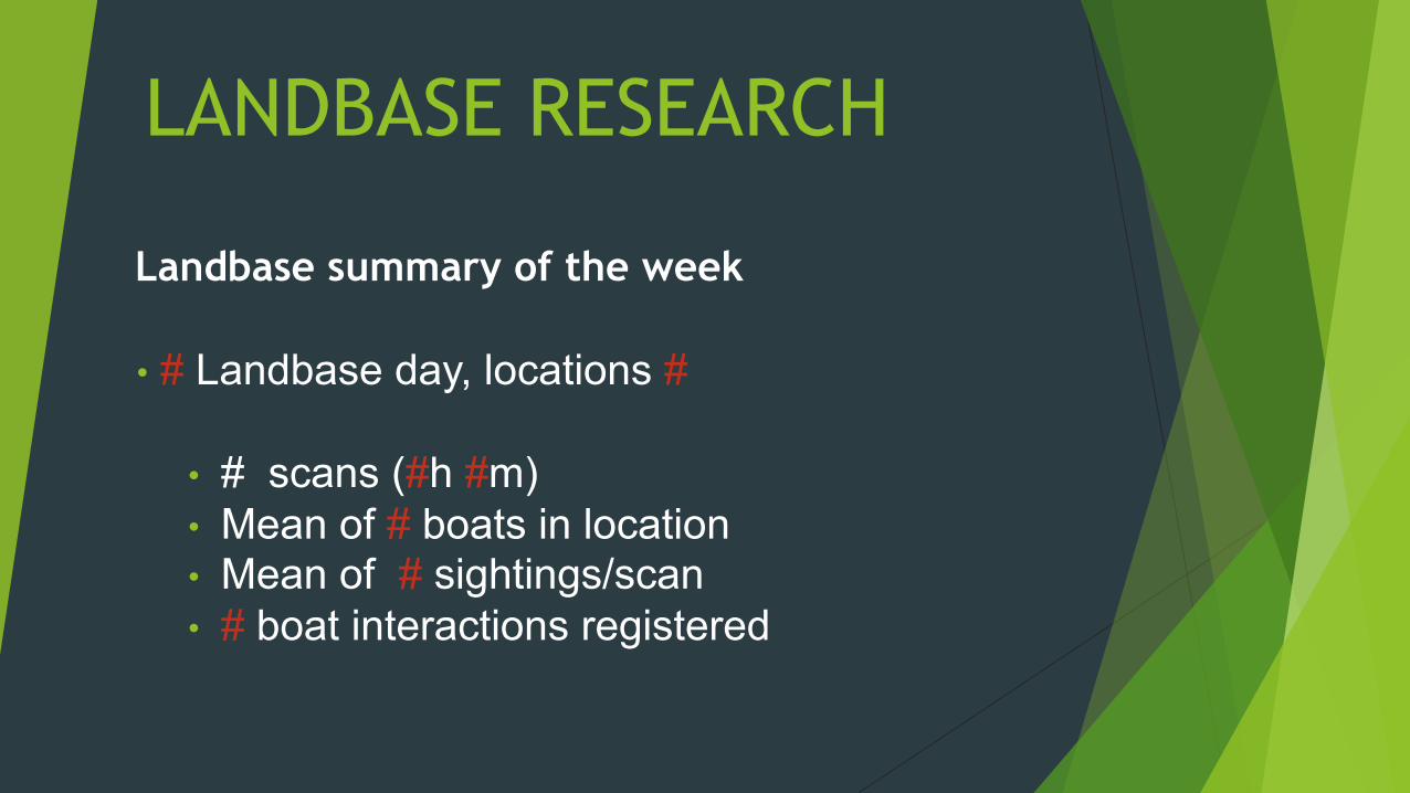
LANDBASE RESEARCH
Landbase summary of the week
• # Landbase day, locations #
• # scans (#h #m) • Mean of # boats in location • Mean of # sightings/scan • # boat interactions registered
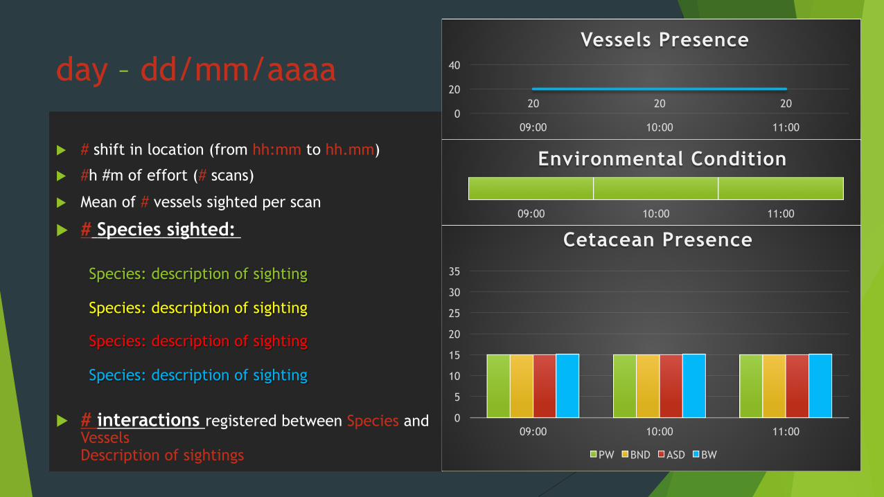
day – dd/mm/aaaa
u # shift in location (from hh:mm to hh.mm)
u #h #m of effort (# scans)
u Mean of # vessels sighted per scan
u # Species sighted:
Species: description of sighting
Species: description of sighting
Species: description of sighting
Species: description of sighting
u # interactions registered between Species and Vessels Description of sightings
20 20 20 0
20
40
09:00 10:00 11:00
Vessels Presence
0
5
10
15
20
25
30
35
09:00 10:00 11:00
Cetacean Presence
PW BND ASD BW
09:00 10:00 11:00
Environmental Condition