10 - Avon · 3 CHAPTER 30 ZONING ARTICLE I TITLE AND DEFINITIONS ~ 30.1 Title This chapter shall be...
114
1 ZONING DISTRICTS ............................................................................................................................................ 10 ~ 30.21 ESTABLISHMENT OF ZONING DISTRICTS .............................................................................................. 10 30.22 (ZONING MAP ..................................................................................................................................... 24 ~ 30.23 INTERPRETATION OF DISTRICT BOUNDARIES........................................................................................ 24 ~ 30.24 ZONING DISTRICT REGULATIONS ......................................................................................................... 24 ~ 30.25 ZONING SCHEDULE ............................................................................................................................. 25 ~ 30.26 FLOOD PLAIN ZONE............................................................................................................................. 25 ZONING DISTRICT REGULATIONS ................................................................................................................ 27 ~ 30.31 AGRICULTURAL DISTRICT, A ............................................................................................................. 27 ~ 30.32 ONE-FAMILY RESIDENTIAL DISTRICT, R-1......................................................................................... 28 ~ 30.33 MULTIPLE-FAMILY RESIDENTIAL DISTRICT, R-2 ............................................................................... 28 ~ 30.35 GENERAL BUSINESS DISTRICT, B-2 .................................................................................................... 30 ~ 30.36 CENTRAL BUSINESS DISTRICT, B-1 .................................................................................................... 31 ~ 30.37 LIGHT INDUSTRIAL DISTRICT, I-1 ....................................................................................................... 32 30.37-1 SPECIAL LIGHT INDUSTRIAL DISTRICT, I-2 ........................................................................................ 34 ~ 30.38 INDIVIDUAL MOBILE HOMES PROHIBITED............................................................................................ 35 ~ 30.39 GENERAL BUSINESS DISTRICT, B-2-1................................................................................................. 35 ~ 30.40 COMBINATION MULTIPLE-FAMILY/LIGHT INDUSTRIAL DISTRICT, C-1 .............................................. 36 30.40 (1) COMBINATION CENTRAL BUSINESS/LIGHT INDUSTRIAL DISTRICT C-2............................................... 37 ~ 30.41 REGULATIONS FOR PRESERVATION OF NATURAL FEATURES ............................................................... 38 ~ 30.42 SIGN REGULATIONS .......................................................................................................................... 39 ~ 30.43 OTHER REGULATIONS APPLICABLE TO ALL DISTRICTS ....................................................................... 49 ~ 30.44 REGULATIONS APPLICABLE TO RESIDENTIAL DISTRICTS (R-1, R-2) ................................................... 51 ~ 30.45 REGULATIONS APPLICABLE TO ALL BUSINESS AND INDUSTRIAL DISTRICTS (B-1, B-2, I-1) ............... 52 ~ 30.46 SATELLITE ANTENNAS......................................................................................................................... 52 PERMITTED MODIFICATIONS ........................................................................................................................ 53 ~ 30.51 HEIGHT MODIFICATIONS ..................................................................................................................... 53 ~ 30.52 SUBSTANDARD LOT ............................................................................................................................ 54 ~ 30.53 TRANSITIONAL FRONT YARD REQUIREMENTS....................................................................................... 54 ~ 30.54 FRONT YARD SETBACK IN DEVELOPED STREETS .................................................................................. 54 ~ 30.55 TRANSITIONAL YARD WIDTHS AND DEPTH IN ABUTTING DISTRICTS .................................................... 54 ~ 30.56 CORNER LOT TRANSITION ................................................................................................................... 54 SPECIAL USE PERMITS ...................................................................................................................................... 55 ~ 30.61 USES REQUIRING SPECIAL USE PERMITS .............................................................................................. 55 D. BED AND BREAKFAST INNS. ........................................................................................................................ 64 TELECOMMUNICATIONS TOWER – .............................................................................................................. 70 PARKING AND LOADING SPACE .................................................................................................................... 77 ~ 30.71 REQUIREMENTS BY USAGE ........................................................................................................................ 78 ~ 30.72 REQUIREMENTS OF OFF-STREET PARKING SPACES............................................................................... 79 ~ 30.73 OFF-STREET LOADING SPACES ............................................................................................................ 80 NONCONFORMING USES AND BUILDINGS.................................................................................................. 80 ~ 30.81 NONCONFORMING USES ...................................................................................................................... 81 ~ 30.82 NONCONFORMING BUILDINGS............................................................................................................. 84 ADMINISTRATION............................................................................................................................................... 84 ~ 30.91 ENFORCEMENT ................................................................................................................................... 84 ~ 30.92 DUTIES OF ZONING ENFORCEMENT OFFICER ...................................................................................... 84 ~ 30.93 CERTIFICATE AND PERMITS................................................................................................................. 85 ~ 30.94 APPLICATION PROCEDURES ................................................................................................................ 86
Transcript of 10 - Avon · 3 CHAPTER 30 ZONING ARTICLE I TITLE AND DEFINITIONS ~ 30.1 Title This chapter shall be...
1
ZONING DISTRICTS ............................................................................................................................................10
~ 30.21 ESTABLISHMENT OF ZONING DISTRICTS ..............................................................................................10 30.22 (ZONING MAP .....................................................................................................................................24 ~ 30.23 INTERPRETATION OF DISTRICT BOUNDARIES........................................................................................24 ~ 30.24 ZONING DISTRICT REGULATIONS .........................................................................................................24 ~ 30.25 ZONING SCHEDULE .............................................................................................................................25 ~ 30.26 FLOOD PLAIN ZONE.............................................................................................................................25
ZONING DISTRICT REGULATIONS ................................................................................................................27 ~ 30.31 AGRICULTURAL DISTRICT, A .............................................................................................................27 ~ 30.32 ONE-FAMILY RESIDENTIAL DISTRICT, R-1.........................................................................................28 ~ 30.33 MULTIPLE-FAMILY RESIDENTIAL DISTRICT, R-2 ...............................................................................28 ~ 30.35 GENERAL BUSINESS DISTRICT, B-2....................................................................................................30 ~ 30.36 CENTRAL BUSINESS DISTRICT, B-1 ....................................................................................................31 ~ 30.37 LIGHT INDUSTRIAL DISTRICT, I-1.......................................................................................................32 30.37-1 SPECIAL LIGHT INDUSTRIAL DISTRICT, I-2 ........................................................................................34 ~ 30.38 INDIVIDUAL MOBILE HOMES PROHIBITED............................................................................................35 ~ 30.39 GENERAL BUSINESS DISTRICT, B-2-1.................................................................................................35 ~ 30.40 COMBINATION MULTIPLE-FAMILY/LIGHT INDUSTRIAL DISTRICT, C-1 ..............................................36 30.40 (1) COMBINATION CENTRAL BUSINESS/LIGHT INDUSTRIAL DISTRICT C-2...............................................37 ~ 30.41 REGULATIONS FOR PRESERVATION OF NATURAL FEATURES ...............................................................38 ~ 30.42 SIGN REGULATIONS ..........................................................................................................................39 ~ 30.43 OTHER REGULATIONS APPLICABLE TO ALL DISTRICTS .......................................................................49 ~ 30.44 REGULATIONS APPLICABLE TO RESIDENTIAL DISTRICTS (R-1, R-2)...................................................51 ~ 30.45 REGULATIONS APPLICABLE TO ALL BUSINESS AND INDUSTRIAL DISTRICTS (B-1, B-2, I-1)...............52 ~ 30.46 SATELLITE ANTENNAS.........................................................................................................................52
PERMITTED MODIFICATIONS ........................................................................................................................53 ~ 30.51 HEIGHT MODIFICATIONS .....................................................................................................................53 ~ 30.52 SUBSTANDARD LOT ............................................................................................................................54 ~ 30.53 TRANSITIONAL FRONT YARD REQUIREMENTS.......................................................................................54 ~ 30.54 FRONT YARD SETBACK IN DEVELOPED STREETS ..................................................................................54 ~ 30.55 TRANSITIONAL YARD WIDTHS AND DEPTH IN ABUTTING DISTRICTS ....................................................54 ~ 30.56 CORNER LOT TRANSITION ...................................................................................................................54
SPECIAL USE PERMITS......................................................................................................................................55 ~ 30.61 USES REQUIRING SPECIAL USE PERMITS ..............................................................................................55 D. BED AND BREAKFAST INNS. ........................................................................................................................64
TELECOMMUNICATIONS TOWER – ..............................................................................................................70
PARKING AND LOADING SPACE ....................................................................................................................77 ~ 30.71 REQUIREMENTS BY USAGE ........................................................................................................................78 ~ 30.72 REQUIREMENTS OF OFF-STREET PARKING SPACES...............................................................................79 ~ 30.73 OFF-STREET LOADING SPACES ............................................................................................................80
NONCONFORMING USES AND BUILDINGS..................................................................................................80 ~ 30.81 NONCONFORMING USES......................................................................................................................81 ~ 30.82 NONCONFORMING BUILDINGS.............................................................................................................84
ADMINISTRATION...............................................................................................................................................84 ~ 30.91 ENFORCEMENT ...................................................................................................................................84 ~ 30.92 DUTIES OF ZONING ENFORCEMENT OFFICER ......................................................................................84 ~ 30.93 CERTIFICATE AND PERMITS.................................................................................................................85 ~ 30.94 APPLICATION PROCEDURES ................................................................................................................86

2
~ 30.95 APPLICATION DETAILS........................................................................................................................87 ~ 30.96 APPLICATION FEES..............................................................................................................................87
ZONING BOARD OF APPEALS..........................................................................................................................88 ~ 30.101 CREATION, APPOINTMENT AND ORGANIZATION OF THE ZONING BOARD OF APPEALS ........................88 ~ 30.102 POWERS AND DUTIES ..........................................................................................................................88
VIOLATIONS..........................................................................................................................................................89 ~ 30.111 ENFORCEMENT ...................................................................................................................................89 ~ 30.112 PENALTIES..........................................................................................................................................89
SITE PLAN REVIEW ............................................................................................................................................89 ~ 30.121 SITE PLAN REVIEW REQUIRED FOR CERTAIN USES ...............................................................................89 ~ 30.122 SKETCH PLAN .....................................................................................................................................89 ~ 30.123 APPLICATION FOR PRELIMINARY SITE PLAN APPROVAL ......................................................................90 ~ 30.124 VILLAGE BOARD OF TRUSTEES' REVIEW OF PRELIMINARY SITE PLAN .................................................91 ~ 30.125 BOARD OF TRUSTEES' ACTION ON PRELIMINARY SITE PLAN................................................................93 ~ 30.126 PROCEDURE FOR FINAL DETAILED SITE PLAN APPROVAL ....................................................................93 ~ 30.127 BOARD OF TRUSTEES' ACTION ON FINAL DETAILED SITE PLAN............................................................94 ~ 30.128 COSTS - GUARANTEE ..........................................................................................................................94 ~ 30.129 INSPECTION OF IMPROVEMENTS..........................................................................................................94 ~ 30.130 INTEGRATION OF PROCEDURES ...........................................................................................................95 ~ 30.130-A3 USE OF IMPROVEMENTS ..............................................................................................................95 ~ 30.130-B3 FAILURE TO COMPLY WITH SITE PLAN.........................................................................................95 ~ 30.130-C3 AMENDMENT OF FINAL SITE PLAN...............................................................................................95
PLANNED RESIDENTIAL DEVELOPMENT DISTRICT...............................................................................95 ~ 30.131 STATEMENT OF INTENT.......................................................................................................................96 ~ 30.132 OBJECTIVES........................................................................................................................................96 ~ 30.133 GENERAL REQUIREMENTS...................................................................................................................96 ~ 30.134 APPLICATION PROCEDURES ................................................................................................................97
PLANNED INDUSTRIAL PARK (PIP) DISTRICT .........................................................................................100 ~ 30.141 STATEMENT OF INTENT.....................................................................................................................100 ~ 30.142 GENERAL REQUIREMENTS FOR REZONING.........................................................................................100 ~ 30.143 APPLICATION PROCEDURE FOR REZONING ........................................................................................101 ~ 30.144 PERMITTED USES IN PIP DISTRICT....................................................................................................102 ~ 30.145 PERMITTED ACCESSORY USES IN PIP DISTRICTS...............................................................................103 ~ 30.146 PROHIBITED USES AND ACTIVITIES IN PIP DISTRICTS .......................................................................103 ~ 30.147 OTHER REQUIREMENTS IN PIP DISTRICTS.........................................................................................104 ~ 30.148 AREA, LOT AND BULK REQUIREMENTS IN PIP DISTRICTS .................................................................104 ~ 30.149 SITE PLAN REVIEW AND APPROVAL...................................................................................................106 ~ 30.150 SITE DESIGN AND IMPROVEMENT STANDARDS FOR SITE PLAN REVIEW..............................................106

3
CHAPTER 30
ZONING
ARTICLE I
TITLE AND DEFINITIONS ~ 30.1 Title This chapter shall be known as the "Zoning Ordinance of the Village of Avon." ~ 30.2 Purpose and intent The purpose of this chapter is to encourage the most appropriate use of land throughout the Village and to conserve the value of property, with due consideration for the character of the districts and their peculiar suitability for particular uses; all in accordance with a comprehensive plan designed to lessen congestion in the streets; to secure safety from fire, flood, panic and other dangers; to promote health and the general welfare; to provide adequate light and air; to prevent the overcrowding of land, to avoid undue concentration of population and to that end to regulate the height, design appearance, number of stories and size of buildings and other structures; the percentage of the area of the lot that may be occupied; the size of yards, courts and other open spaces; the density of population and the location and use of buildings, structures and land for trade, industry, residence or other purposes; and the height, size and location of these uses within the limits of the Village. ~ 30.3 Use of certain words For the purpose of this chapter, all words used in the present tense include the future tense. All words in the plural number include the singular, and all words in the singular number include the plural number, unless the natural construction of the word indicates otherwise. The word "shall" is mandatory and directory. The word "may" is permissive. The word "used" includes "designed, intended or arranged to be used." ~ 30.4 Definitions When used in this chapter, unless otherwise expressly stated or the content otherwise requires: 1. "Accessory building" shall mean a subordinate building located on the same lot with the main building, occupied by or devoted to an accessory use. Where an accessory building is attached to the main building in a substantial manner, as by a wall or roof, such accessory building shall be considered part of the main building.

4
2. "Accessory use" shall mean a use incidental and subordinate to the main use or building and located on the same lot therewith. In no case shall such accessory use dominate, in area, extent or purpose the principal lawful use or building. 3. "Alley" shall mean a public or privately owned service way less than twenty-four (24) feet in width providing a secondary means of access to abutting properties. 4. "Alterations" as applied to a building or structure shall mean a change or rearrangement in the structural parts or in the exit facilities; or an enlargement, whether by extending on a side or by increasing in height; or the moving from one (1) location or position to another. 5. "Alterations, structural" shall mean any change in the supporting members of a building or structure, such as bearing walls, columns, beams or girders. 6. "Apartment" shall mean any structure housing three (3) or more families or dwelling units. 7. "Basement" shall mean a story partly underground and having more than one-half (1/2) of its height above the average level of the finished grade at the front of the building. 8. "Building" shall mean any structure having a roof supported by columns or walls and intended for the shelter, housing or enclosure of persons, animals or property. 9. "Building area" shall mean the aggregate of the areas of all enclosed and roofed spaces of the principal building and all accessory buildings. Such areas shall be computed by using outside building dimensions measured on a horizontal plane at ground level. 10. "Building height" shall mean the vertical dimension measured from the average elevation of the finished lot grade at the front of the building to the highest point of the roof for flat roofs; to the deckline of a mansard roof and to the average height between the plate and ridge of a gable, hip or gambrel roof. 11. "Building line" shall mean a line formed by the intersection of a horizontal plane at average grade level and a vertical plane that coincides with the exterior surface of the building on any side. In case of a cantilevered section of a building or projected roof or porch, the vertical plane will coincide with the most projected surface. All yard requirements are measured to the building line. 12. "Cellar" shall mean a story partly underground and having more than one-half (1/2) of its clear height below the average level of the finished grade at the front of the building. 13. Certificate of occupancy" shall mean a certificate issued by the Zoning Enforcement Officer upon completion of construction, alteration or change in occupancy or use of a building. Said certificate shall acknowledge compliance with all the requirements of this chapter and such adjustments thereto granted by the Zoning Board of Appeals.1 14. "Club, private" shall mean a non-profit social organization whose premises are restricted to its members and their guests.

5
15. "Commercial or business" shall mean and include the purchase, sale or transaction involving the disposition of any article, substance, commodity or service, the maintenance or conduct of offices, professions or recreational or amusement enterprises conducted for profit and also includes the renting of rooms, business offices and sales display rooms and premises. 16. "Curb level" shall mean the mean street grade established by the Village or, in the absence of an established grade, the mean level of the existing curb or of the lot at the street line. 17. "Dwelling" shall mean a building or portion thereof used exclusively as the residence or sleeping place of one (1) or more persons. 18. "Dwelling unit" shall mean one (1) or more rooms providing living facilities for one (1) family including equipment for cooking, living and sleeping purposes and provisions for the same. 19. "Dwelling, one-family" shall mean a building or dwelling unit designed for or occupied exclusively by a single family as hereinafter defined. 20. "Dwelling, two-family" shall mean a building containing two (2) dwelling units and used exclusively for occupancy by two (2) families living independently of each other; or two (2) one-family dwellings having a party wall in common. 21. "Dwelling, multi-family" shall mean a building or portion thereof containing three (3) or more families living independently of each other. 22. "Dwelling, row" shall mean a row of attached or semi-attached dwellings containing a total of three (3) or more dwelling units; or a building in such a row. 23. "Dwelling, detached" shall mean a dwelling having no party wall in common with another building. 24. "Family" shall mean one (1) or more persons, related by birth, marriage or other domestic bond, or not to exceed five (5) unrelated persons, occupying a dwelling unit and living as a single, non-profit housekeeping unit. 25. "Farm" shall mean any parcel containing five (5) acres or more of land which is used for gain in the raising of agricultural products, including crops, livestock, poultry or dairy products. 26. "Farm building" shall mean any building used for the housing of agricultural equipment, produce, livestock or poultry, or for the incidental or customary processing of farm products, and provided that such building is located on, operated in conjunction with, and necessary to the operation of the farm as defined by this article. The term "farm building" shall not include "farm dwelling." 27. "Fence" shall mean an artificially constructed barrier of wood, masonry, stone, wire, metal or any other manufactured material or combination of materials erected for the enclosure of yard areas. 28. "Flammable liquids" shall mean liquids having a flash point below two hundred (200) degrees Fahrenheit, closed cuptester. Class I flammable liquids (e.g. gasoline, ether, liquid

6
petroleum gas) are those having a flash point below twenty-five (25) degrees Fahrenheit. Class II flammable liquids are those having a flash point below seventy (70) degrees Fahrenheit but not below twenty-five (25) degrees Fahrenheit. 29. "Floor area total" shall mean the sum of the gross horizontal areas of the floor or floors of a building which are enclosed and usable for human occupancy or the conduct of business. Said areas shall be measured between the inside face of exterior walls or from the center line of walls separating two (2) uses. Said areas shall not include areas below the average level of the adjoining ground, garage space or accessory building space. 30. "Front yard" shall mean an open space extending the full width of the lot between a main building and the front lot line, unoccupied and unobstructed by buildings or structures from the ground upward, the depth of which shall be the least distance between the front lot line and the front of such main building. 31. "Garage, private" shall mean a secondary building used in conjunction with a primary building which provides for the storage of motor vehicles and in which no occupation, business or services for profit are carried on. 32. "Garage, commercial" shall mean a building or structure used for display, storage, repair, rental, sale, inspection and servicing of new and used motor vehicles and for the retail sales of parts, accessories, lubrication, oils and supplies for such vehicles, but not the sale of fuel. [Amended by Local Law 5 of 1982] 33. "Industry or industrial" shall mean and include the manufacture, processing, assembly or storage of any item, article or commodity and the conduct of manufacturing as it is usually understood as opposed to the casual preparation, processing or repair of items, articles or commodities in retail businesses. 34. "Junk yard" shall mean land, building or structure used for the collecting, storage or sale of waste paper, rags, scrap metal or discarded material; or for the collecting, wrecking, dismantling, storage, salvaging and sale of machinery parts or vehicles not in running condition. 35. "Lot" shall mean a parcel of land considered as a unit devoted to a certain use or occupied by a building or a group of buildings that are united by a common interest or use, and the customary accessories and open spaces belonging to the same. A lot within the meaning of this chapter may or may not be a lot as shown on a subdivision plat or assessment record. 36. "Lot area" shall mean an area of land which is determined by the limits of the lot lines bounding that area and expressed in terms of square feet or acres. Any portion of a lot included in a public street right-of-way shall not be included in calculating lot area. 37. "Lot, corner" shall mean a parcel of land at the junction of and fronting on two (2) or more intersecting streets. 38. "Lot, interior" shall mean a lot other than a corner lot.
7
39. "Lot lines" shall mean the property lines bounding the lot. In the case of a lot abutting on more than one (1) street, the owner may determine which street shall be the front lot line. The rear line shall be the lot line most distant from the front lot line. 40. "Lot, through" shall mean an interior lot having frontage on two (2) parallel or approximately parallel streets. 41. "Lot depth" shall mean the horizontal distance between the front and rear lot lines, measured at right angles to the front lot line. 42. "Lot width" shall mean the horizontal distance between the side lot lines measured at right angles to its depth at the front building line. 43. "Mobile home" shall mean and include any "trailer," "mobile dwelling" or other unit so constructed and so designed that it can be used, or moved with attachments, as a separate entity as a vehicle whether the same be standing on wheels, rollers, skids, rigid supports or a permanent foundation and which is used, designed for or capable of being used for living quarters and having all facilities needed for a permanent abode specifically excluding, however, campers and other similar vehicles designed for being stored in garages or similar structures. 44. "Modular home" shall mean a home not capable of being transported as a single unit, but is designed to be transported to the site in two (2) or more sections or parts which when assembled constitute a conventional home. 45. "Motor vehicle service station" shall mean any building, structure or land used primarily for the dispersing, sale or offering for sale of automotive fuels, oils or accessories, including lubrication of automobiles and replacement or installation of minor parts and accessories; but not including major repair work such as motor replacement or rebuilding, body and fender repair or painting. 46. "Non-conforming use" shall mean any use of a building, structure or land existing at the time of enactment of this chapter which does not conform to the use regulations of the district in which it is situated. 47. "Non-conforming building" shall mean a building which in its design or location upon a lot does not conform to the regulation of this chapter for the district in which it is located. 48. "Non-conforming lot" shall mean a lot of record existing at the date of the passage of this chapter which does not have the minimum width or contain the minimum area for the district in which it is located. 49. "Nursing and convalescent home" shall mean a building, structure or premises having accommodations for hire and where limited medical care is provided for invalid, infirm, aged, convalescent or physically disabled or injured persons. 50. "Planning board" shall mean the Village of Avon Planning Board. 51. "Plat" shall mean a map, plan or layout of a section or subdivision indicating the location and boundaries of individual properties.

8
52. "Principal building" shall mean a building or buildings in which is conducted the main or principal use of the lot on which said building is located 53. "Principal use" shall mean the main use to which a building or lot is to be used. 54. "Rear yard" shall mean an open space extending the full width of a lot between the rearmost main building and the rear lot line, unoccupied and unobstructed by buildings or structures from the ground upward except as hereinafter specified, the depth of which shall be the least distance between the rear lot line and the rear of such main building. 55. "Restaurant" shall mean any establishment, however designated, at which food is sold for consumption on the premises to patrons seated within an enclosed building or elsewhere on the premises. However, a snack bar or refreshment stand at a public, semi-public or community swimming pool, playground, playfield or park operated by the agency or group or an approved vendor operating the recreational facilities and for the convenience of the patrons of the facility shall not be deemed to be a restaurant. 56. "Retirement or custodial home" shall mean a building, structure or premises having accommodations for elderly persons not requiring nursing or medical care and where home care is provided to the inhabitants thereof for profit. 57. "Right-of-way" shall mean the line determining the street or highway public limit or ownership. 58. "Side yard" shall mean an open space extending from the front yard to the rear yard between any building and the side lot line, unoccupied and unobstructed by buildings or structures from the ground upward. The required width of side yard shall be measured horizontally from the nearest point of the side lot line to the nearest part of any building. 59. "Sign, on-premises advertising" shall mean a sign that shall be deemed to be any advertising display on which is shown the products sold, the name of the enterprise located on that lot or parcel of land or any other wording which reflects directly upon any on site business or other usage thereof. 60. "Signboard, billboard, off-premises advertising" shall mean any advertising display on which is shown any advertisement for products or businesses other than which are sold or have occupancy on that lot or parcel of land. 61. "Sign area" shall mean the area defined by the frame or edge of a sign. Where there is no geometric frame or edge of the sign, the area shall be defined by a projected, enclosed, four-sided (straight sides) geometric shape which most closely outlines the said sign. 62. "Site plan" shall mean a plan of a lot or subdivision on which is shown topography, location of all buildings, structures, roads, right-of-way, boundaries, all essential dimensions and bearings and any other information deemed necessary by the Planning Board. 63. "Special replacement residence" shall mean any building or premises occupied by three (3) or more persons not related to the owner, lessee or operator by blood, marriage or adoption,
9
who upon their release as patients from any recognized mental institution, treatment center for alcoholism, narcotic addiction or as an inmate of any correctional or penal institution, use such building or premises as living facilities in order to secure non-institutionalized care in their attempt to reenter society as healthy, well-adjusted and useful human beings. The operator must reside at such premises. 64. "Story" shall mean that portion of a building between the surface of any floor and the surface of the floor next above; also any portion of a building used for human occupancy between topmost floor and the roof. For purposes of height measurement, in determining the permissible number of stories, a basement shall be counted but a cellar shall not be counted. 65. "Story, half" shall mean a story under a gable, hip or gambrel roof, the wall plates of which on at least two (2) opposite exterior walls are not more than two (2) feet above the floor of such story. 66. "Street" shall mean a public or private thoroughfare which affords the principal means of access to abutting property. 67. "Street line" shall mean the lateral line of the street or other public right-of-way. 68. "Structure" shall mean anything constructed or erected which requires permanent location on the ground or attachment to something having such location. 69. "Swimming pool, private" shall mean a swimming pool operated as a secondary use to a residential dwelling unit or units and located on an individual residential lot. 70. "Swimming pool, public" shall mean a public or privately owned pool open to the general public or on a membership basis and having appropriate dressing room facilities, recreation facilities and off-street parking area. 71. "Temporary use" shall mean an activity conducted for a specific limited period of time which may not otherwise be permitted by the provisions of this chapter. Examples of such uses are buildings incidental to new construction which are removed after the completion of the construction work. 72. "True value" shall mean the value of a property determined by the Zoning Enforcement Officer or any board or official of the Village required to make a determination in accordance with any generally accepted appraisal method of the construction trade or real estate appraisers. 73. "Use" shall mean the specific purposes for which land or a building is designed, arranged, intended or for which it is or may be occupied or maintained. 74. "Zoning Board" shall mean the officially established Zoning Board of Appeals of the Village of Avon. 75. "Zoning permit" shall mean a permit issued by the Zoning Enforcement Officer stating that the purpose for which a building or land is to be used is in conformity with the uses permitted and complies with all other requirements under this chapter for the district in which it is located or is to be located.

10
ARTICLE II
ZONING DISTRICTS
~ 30.21 Establishment of zoning districts The Village of Avon shall be divided into the following types of districts which shall be differentiated according to use and area, and for the purpose of which they shall be hereafter used and developed:
A - Agricultural District R-1 - One-Family Residential District R-2 - Multiple-Family Residential District B-1 - Central Business District B-2 - General Business District I-1 - Light Industrial District
B-2-1 - General Business District C-1 - Combination Multiple-Family/Light Industrial District PRDD - Planned Residential Development District PIP - Planned Industrial Park District
C-2 – Combination Central Business/Light Industrial District (Local Law #1-2003 1/6/03) ~ 30.22 Zoning map The above districts shall be located, bounded and described as shown by the zoning map of the Village of Avon of 1974, which has been designated the official zoning map of the Village, now on file in the office of the Village Clerk together with the boundaries and designation therein is made a part of this chapter. The zoning map was amended by Local Law 1 of the year 1977. "SECTION 1. AMENDING ZONING MAP" 1. The following described areas, each of which is presently located in an "Agricultural District" be and the same hereby are reclassified and changed as follows: A. The following described area is reclassified and changed to "Light Industrial District" I-1:

11
ALL THAT TRACT OR PARCEL OF LAND located on the northerly side of Routes 5 and 20 bounded and described as follows: Beginning at the point of intersection of the east line of lands of Niagara Mohawk Power Corporation and the south line of lands (now or formerly) of the Erie Lackawanna Railroad; Thence along the east line of lands of Niagara Mohawk Power Corporation southerly to the north line of Routes 5 and 20; Thence westerly along the north line of Routes 5 and 20 to the west corporation line of the Village of Avon;
Thence northerly along the west line of the corporation line of the Village of Avon to the southerly line of lands (nor or formerly) of the Erie Lackawanna Railroad; Thence easterly along the southerly line of said Railroad lands to the point or place of beginning. All those plots of land known and designated on the official tax map of Avon described as follows: 24.17-01-2.000;34.05-01-13.000; 34.05-01-14.000;34.05-01-68.000; 34.06-01-70.000; 24.17-01-3.000; 34.06-01-61.000. LL#3 2002 B. The following described area is reclassified and changed to "General Business District" B-2: ALL THAT TRACT OR PARCEL OF LAND located on the northerly side of Routes 5 and 20 (East Main Street) bounded and described as follows: On the north, east and west by lands of Case, and on the south by the northerly line of Routes 5 and 20, being the premises now owned or occupied by Hetelekides, Cerame, et al. 2. That in accordance herewith, the Village Clerk is hereby directed to make or cause to be made the necessary changes on the said zoning map of the Village of Avon. The zoning map was further amended by Local Law 2 of the year 1982, by changing the zoning of 0.673 acres of land on the east side of Wadsworth Avenue in the Village of Avon owned by the Niagara Mohawk Power Corporation from R-1 One-Family Residential District to I-1 Light Industrial District. The legal description of the property rezoned is as follows: ALL THAT TRACT OR PARCEL OF LAND, situate in the Village of Avon, County of Livingston and State of New York, being part of Township 10, Range 7, more particularly described as follows: PARCEL "A" Beginning at a point in the center line of Wadsworth Avenue at the northeast corner of land conveyed to Livingston, Niagara Power Company by Deed dated September 1, 1921, recorded in the Livingston County Clerk's Office in Liber 211 at page 225; thence southeasterly along said conveyance 215.54 feet, more or less, to a point in a line which is parallel with and northwesterly of the northwesterly line of the Erie Railroad, said point being also the northwesterly corner of land conveyed to Niagara, Lockport and Ontario Power Company, by Deed dated September 9, 1927, recorded in said Clerk's Office in Liber 224 of Deeds at page 549; thence northeasterly along said
12
parallel line 100 feet, more or less, to a point in a line which is parallel with and 100 feet distant northeasterly measured at right angles from the first hereinabove described course; thence northwesterly along the last mentioned parallel line 215.49 feet, more or less, to a point in the center line of said Wadsworth Avenue; thence southwesterly along said center line 100.00 feet, more or less, to the point of beginning. Containing 0.495 of an acre, more or less. PARCEL "B" Beginning at the southeast corner of the hereinabove described Parcel "A," said point being also in the northwesterly line of land conveyed to Niagara, Lockport and Ontario Power Company, by Deed dated September 9, 1927, recorded in the Livingston County Clerk's Office in Liber 224 of Deeds at page 549; thence northeasterly thereon and being parallel with the northwesterly line of the Erie Railroad a distance of 119.61 feet, more or less, to a point in the northerly line of the lands of the party of the first part, being also the northeasterly corner of land conveyed to said Niagara, Lockport and Ontario Power Company by the above mentioned conveyance; thence westerly along said party of the first part northerly line 70.46 feet to a point in a line which is parallel with the first above described 119.61 feet course; thence southwesterly along the last mentioned parallel line 105.73 feet, more or less, to a point in the northeast line of the above described Parcel "A;" thence southeasterly thereon 68.98 feet to the point of beginning. Containing 0.178 of an acre, more or less. The zoning map of the Village of Avon, New York was further amended and changed by Local Law 3 of the year 1984 so that the property on West Main Street, Bronson Avenue, Wadsworth Avenue and Railroad Avenue formerly located in the B-2 General Business Zone was reclassified and changed to the B-2-1 General Business District. The zoning map of the Village of Avon, New York was further amended and changed by Local Law 15 of the year 1985 so that the following described area presently located in the I-1 Light Industrial Zone was reclassified and changed to the C-1 Combination Zone which permits I-1 light industrial and R-2 multiple family residential uses: The parcel of land is located west of Rochester Street and east of Conrail property from West Main Street north to the south boundary of the lands owned by DuBois Plastics Products, Inc., tax map no. 24.14-1-5.1 and the north boundary of the property owned by Peter W. and Barbara Dougherty, tax map no. 24.14-1-.4.2. The zoning map of the Village of Avon, New York was further amended by Local Law 9 of the year 1986. Said local law amends the zoning map to change an approximately 9 acre parcel of land which is part of land owned by Joseph S. Tuchrello located on the north side of East Main Street in the Village of Avon from A-Agricultural and R-1 One-Family Residential District to B-2 General Business District. Said 9 acre parcel has 166.97 feet of frontage west of Peppermints (formerly Star Diner) and 330 feet of frontage east of Peppermints on East Main Street. The parcel is approximately 684 feet deep. The legal description of the property is as follows: ALL THAT TRACT OR PARCEL OF LAND, situate in the Village of Avon, County of Livingston and State of New York, bounded and described as follows: Beginning at the intersection of the division line between the property of Savas Hetelekides on the east and the property of Joseph S. Tuchrello on the west with the northerly line of East Main Street; thence 1. Westerly along the street line 166.97 feet to a point in the west line of property of Joseph S. Tuchrello; thence

13
2. Northerly at an interior angle of 86o 02' 40" along said west line its northerly extension through the property of Joseph S. Tuchrello, 684.75 feet to a point; thence 3. Easterly, at an interior angle of 93o 57' 20" 662.55 feet, continuing through the property of Joseph S. Tuchrello to a point; thence 4. Southerly, at an interior angle of 90o 00' 00" continuing through said property 683.12 feet to a point on the northerly line of East Main Street; thence 5. Westerly at an interior angle of 90o 00' 00" along said street line, 330.00 feet to its intersection with the division line between the property of Joseph S. Tuchrello on the east and the property of Savas Hetelekides on the west; thence 6. Northerly at an interior angle of 86o 45' 40" along said division line and its northerly extension through the property of Joseph S. Tuchrello, 340.54 feet to a point; thence 7. Westerly at an interior angle of 273o 14' 20" continuing through the property of Joseph S. Tuchrello, 232.06 feet to a point; thence 8. Southerly at an interior angle of 270o 00' 00" continuing through said property and thence along the beforementioned division line between the property of Savas Heteledides on the east and the property of Joseph S. Tuchrello on the west, 340.00 feet to the place of beginning. The zoning map of the Village of Avon, New York was further amended and changed by Local Law 4 of 1989 so that the following described area presently located in the R-1 One-Family Residential District is reclassified and changed to the Planned Residential Development District (PRDD): 34.6262 acres owed by Frank Csapo located on the north side of Lake Road in the Village of Avon bounded and described as follows: ALL THAT TRACT OR PARCEL OF LAND situate in the Village and Town of Avon, County of Livingston and State of New York bounded and described as follows: Commencing at a point at the northwest corner of lands now or formerly of James Wilber; thence south 20o 03' 44" west 224.75' to a point in the center of Lake Road; thence north 69o 56' 16" west along the center of Lake Road 258.15' to a point; thence north 69o 14' 40" west 347.41 feet continuing along the center of said Lake Road; thence north 19o 30' 58" east 272.27 feet to a point; thence north 19o 55' 41" east 360.48 feet to a point; thence north 22o 27' 12" east 100.11 feet to a point; thence north 19o 35' 39" east 343.64 feet to a point; thence north 19o 08' 12" east 657.97 feet to a point; thence north 19o 22' 23" east 331.71 feet to a point; thence south 59o 43' 15" east 392.11 feet to a point; thence north 19o 37' 37" east 6.61 feet to a point; thence south 61o 30' 05" east 390.72 feet to a point; thence south 19o 24' 07" west 1725.38 feet to a point; thence north 69o 56' 16" north 160.00 feet to the point and place of beginning. Containing 34.6262 acres. The zoning map of the Village of Avon, New York was further amended and changed by Local Law 5 of 1989 so that the following described area presently located in the A-Agricultural District is reclassified and changed to the Planned Residential Development District (PRDD): ALL THAT TRACT OR PARCEL OF LAND, situate in the Village of Avon, County of Livingston and State of New York described as follows: Beginning at a point in the westerly right-of-way line of

14
Pole Bridge Road (66.00 feet right-of-way) said point being 493.81 feet northerly, measured in said westerly right-of-way line, from the northeasterly corner of lands of Joseph Montesano as recorded in the Livingston County Clerk's Office in Liber 674 of Deeds at page 277; thence 1) north 77o 27' 02" west 81.39 feet to a point; thence 2) north 35o 12' 59" west 121.00 feet to a point; thence 3) north 65o 02' 30" west 296.00 feet to a point; thence 4) north 49o 08' 04" east 130.97 feet to a point; thence 5) north 40o 51' 56" west 144.76 feet to a point; thence 6) north 61o 15' 16" west 100.82 feet to a point; thence 7) north 79o 21' 14" west 215.00 feet to a point; thence 8) south 85o 02' 37" west 425.00 feet to a point; thence 9) north 05o 55' 06" west 118.00 feet to a point; thence 10) north 07o 54' 48" east 24.85 feet to a point; thence 11) south 82o 05' 12" east 22.64 feet to a point; thence 12) north 00o 06' 21" west approximately 10.21 feet to a point; thence 13) north 00o 06' 21" west 630.92 feet to a point; thence 14) north 52o 53' 39" west 338.35 feet to a point; thence 15) north 73o 21' 34" east 60.00 feet to a point; thence 16) southeasterly and easterly on a curve to the left having a radius of 270.00 feet, an arc distance of 425.63 feet to a point of tangency; thence 17) north 73o 02' 14" east 276.53 feet to a point; thence 18) easterly on a curve to the right having a radius of 330.00 feet an arc distance of 97.42 feet to a point of tangency; thence 19) north 89o 57' 09" east 67.39 feet to a point; thence 20) northeasterly on a curve to the left having a radius of 30.00 feet an arc distance of 47.12 feet to a point of tangency in the westerly right-of-way line of the aforesaid Pole Bridge Road; thence 21) south 00o 02' 51" east in said westerly right-of-way line, a distance of 1434.16 feet to the point of beginning. Being 23.813+ acres, as shown on sheet 3 entitled "Subdivision Plat-Block 1" of the plans prepared by Lozier Architects/Engineers bearing file no. 30,782 filed in the Office of the Village of Avon. The zoning map of the Village of Avon, New York was further amended and changed by Local Law 1 of 1992 reclassifying and changing the following described real property from A-1 Agricultural District to Planned Industrial Park District (PIP): ALL THAT TRACT OR PARCEL OF LAND consisting of two parcels, containing a total of 44.8 acres, more or less, being part of the Bridge Farm and situated in the Village of Avon, Livingston County, New York, more particularly bounded and described as follows: Parcel No. 1 Commencing at a point on the northeasterly right-of-way line of West Main Street, (New York State Routes 5 & 20), said point being 267 feet, more or less, southeasterly from the intersection of the aforesaid northeasterly right-of-way line of West Main Street and the easterly right-of-way line of Williams Road; thence A. Northeasterly along the southeasterly property line of lands, now or formerly, owned by Niagara Mohawk Power Corporation, a distance of 310 feet, more or less, to a point; thence

15
B. Northerly along a portion of the easterly property line of lands, now or formerly, owned by Niagara Mohawk Power Corporation, a distance of 480 feet, more or less, to the true point of beginning; thence 1. Continuing along the aforesaid easterly property line of lands, now or formerly, owned by Niagara Mohawk Power Corporation, a distance of 969 feet, more or less, to a point, said point being a southwesterly right-of-way line of lands formerly owned by Erie Railroad Company (Attica Branch); thence The following ten courses along the southerly right-of-way line and northerly right-of-way line of lands formerly owned by Erie Railroad Company (Attica Branch): 2. Northwesterly a distance of 120 feet, more or less, to an angle point on said southerly right-of-way line; thence 3. Northwesterly a distance of 104 feet, more or less, to an angle point on said southerly right-of-way line; thence 4. Northwesterly a distance of 602 feet, more or less, to a point; thence 5. Northerly, a distance of 35 feet, more or less, to a point; thence 6. Northwesterly a distance of 165 feet, more or less, to a point; thence 7. Northerly a distance of 16 feet, more or less, to a point; thence 8. Southeasterly a distance of 165 feet, more or less, to a point; thence 9. Northerly a distance of 31 feet, more or less, to a point; thence 10. Southeasterly along a northerly right-of-way line of the aforesaid Erie Railroad Company a distance of 1535 feet, more or less, to a point of curvature; thence 11. Continuing southeasterly along the aforesaid northerly right-of-way line and along a curve to the right an arc distance of 545 feet, more or less, to a point on said curve, said point also being a northwesterly property corner of lands, now or formerly, owned by Conrail; thence 12. Southwesterly along a westerly property line of the aforesaid Conrail a distance of 103 feet, more or less, to a point, said point being on a curve; thence 13. Southeasterly along a southerly right-of-way line of lands, now or formerly, owned by Conrail and along a curve to the right an arc distance of 777 feet, more or less, to a point of compound curvature; thence 14. Continuing southeasterly along the aforesaid southerly right-of-way line of Conrail and along a curve to the right, an arc distance of 202 feet, more or less, to a point; thence 15. Southeasterly continuing along the aforesaid southerly right-of-way line of Conrail a distance of 227 feet, more or less, to a point, said point being on a curve; thence 16. Continuing southeasterly along the aforesaid southerly right-of-way line of Conrail and along a curve to the right an arc distance of 73 feet, more or less, to a point, said point being on the northerly property line of land, now or formerly, owned by Allen H. Van and wife; thence 17. Northwesterly along the aforesaid northerly property line of lands of Van, a distance of 210 feet, more or less, to the northwesterly property corner of the aforesaid lands of Van; thence 18. Southwesterly along the westerly property line of the aforesaid lands of Van a distance of 401 feet, more or less, to a point, said point being on a northerly property line of lands, now or formerly, owned by Kenneth and Barbara Schafer; thence 19. Northwesterly along the aforesaid northerly property line of lands of Schafer a distance of 126 feet, more or less, to the northwesterly property corner of the aforesaid lands of Schafer; thence 20. Southwesterly along the westerly property line of the aforesaid lands of Schafer a distance of 171 feet, more or less, to a point; thence

16
21. Northwesterly through lands, now or formerly, owned by Henry Hansen and others a distance of 1482 feet, more or less, to a point, thence 22. Continuing westerly through lands, nor or formerly, owned by Henry Hansen and others a distance of 71 feet, more or less, to the point of beginning. Parcel No. 2 Beginning at a point on an easterly right-of-way line of Williams Road, said point being 402 feet, more or less, northwesterly from the northerly right-of-way line of West Main Street (New York State Routes 5 & 20); thence 1. Northwesterly continuing along the easterly right-of-way line of Williams Road a distance of 61 feet, more or less, to a point, said point being the southeasterly property corner of lands, now or formerly, owned by the Village of Avon; thence 2. Easterly along the aforesaid southerly property line of lands, now or formerly, owned by the Village of Avon, a distance of 505 feet, more or less, to a point, said point being on a westerly property line of lands, now or formerly, owned by Niagara Mohawk Power Corporation; thence 3. Southerly along the aforesaid westerly property line of land, now or formerly, owned by Niagara Mohawk Power Corporation a distance of 60 feet, more or less, to a point, said point being the northeasterly property corner of lands, now or formerly, owned by Livingston County Industrial; thence 4. Westerly along the aforesaid northerly property line of lands, now or formerly, owned by the Livingston County Industrial and continuing along the northerly property line of lands, now or formerly, owned by Eric Guttman and others a distance of 493 feet, more or less, to the point of beginning. The zoning map of the Village of Avon, New York was further amended and changed by Local Law 2 of 1992 reclassifying and changing the following described real property from A-1 Agricultural District and R-1 One-Family Residential District to B-1 General Business District: ALL THAT TRACT OR PARCEL OF LAND containing 10.2 acres, more or less, being part of the Bridge Farm situated in the Village of Avon, County of Livingston, State of New York, all as shown on a map entitled, "Map Showing Lands to be Rezoned," prepared by Cornwall Consultants, P.C., Engineers and Surveyors, dated December 17, 1990, and having Drawing No. 245-03, more particularly bounded and described as follows: Beginning at a point on the northeasterly right-of-way line of West Main Street, NYS Routes 5 & 20, said point also being the southwesterly property corner of lands, now or formerly, owned by Patrick H. and Ann Driscoll; thence 1. Northwesterly along the aforesaid northeasterly right-of-way line of West Main Street a distance of 573 feet, more or less, to a point on said northeasterly right-of-way line, said point also being the southeasterly property corner of lands, now or formerly, owned by Samuel L. and Mildred Least; thence 2. Northeasterly along the easterly property line of the aforesaid lands of Least a distance of 150 feet, more or less, to the northeasterly property corner of Least; thence 3. Northeasterly through lands, now or formerly, owned by Henry Hansen and others a distance of 525 feet, more or less, to a point; thence

17
4. Southeasterly continuing through lands of Henry Hansen and others a distance of 662 feet, more or less, to a point, said point being on the westerly terminus of Maple Street; thence 5. Southerly along the aforesaid westerly terminus of Maple Street a distance of 30 feet, more or less, to a point; thence 6. Southeasterly along a southerly right-of-way line of the aforesaid Maple Street a distance of 70 feet, more or less, to a point, said point being the northwesterly property corner of lands, now or formerly, owned by Leo E. and Francis F. Frew; thence 7. Southwesterly along the westerly property line of the aforesaid lands of Frew a distance of 328 feet, more or less, to a point, said point being the northeasterly property corner of lands, now or formerly, owned by Patrick H. and Ann Driscoll; thence 8. Northwesterly along the aforesaid northerly property line of lands of Driscoll a distance of 293 feet, more or less, to a point, said point being the northwesterly property corner of Driscoll; thence 9. Southwesterly along the westerly property line of the aforesaid lands of Driscoll a distance of 331 feet, more or less, to a point, said point being on the northeasterly right-of-way line of West Main Street, said point also being the point of beginning. ALL THAT TRACT OR PARCEL OF LAND containing 10.2 acres, more or less, being part of the Bridge Farm situated in the Village of Avon, County of Livingston, State of New York, all as shown on a map entitled, "Map Showing Lands to be Rezoned," prepared by Cornwall Consultants, P.C., Engineers and Surveyors, dated December 17, 1990, and having Drawing No. 245-03, more particularly bounded and described as follows: Beginning at a point on the northeasterly right-of-way line of West Main Street, NYS Routes 5 & 20, said point being the southwesterly property corner of lands, now or formerly, owned by Samuel and Mildred Least; thence 1. Northwesterly along the aforesaid northeasterly right-of-way line of West Main Street a distance of 382 feet, more or less, to an angle point on said right-of-way line; thence 2. Continuing northwesterly along the aforesaid northeasterly right-of-way line of West Main Street a distance of 216 feet, more or less, to a point, said point also being a southeasterly corner of lands, now or formerly, owned by Niagara Mohawk Power Corporation; thence 3. Northeasterly along the southeasterly property line of the aforesaid lands of Niagara Mohawk Power Corporation a distance of 310 feet, more or less, to a point; thence 4. Northerly continuing along an easterly property line of lands, now or formerly, owned by Niagara Mohawk Power Corporation a distance of 480 feet, more or less, to a point; thence 5. Easterly through lands, now or formerly, owned by Henry Hansen and others a distance of 71 feet, more or less, to a point; thence

18
6. Southeasterly continuing through lands of Henry Hansen and others a distance of 820 feet, more or less, to a point; thence 7. Southwesterly continuing through lands of Henry Hansen and others a distance of 525 feet, more or less, to a point, said point being the northeasterly property corner of lands, now or formerly, owned by Samuel and Mildred Least; thence 8. Northwesterly along the northerly property line of lands of Least a distance of 182 feet, more or less, to a point, said point being the northwesterly property corner of Least; thence 9. Southwesterly along the westerly property line of the aforesaid lands of Least a distance of 150 feet, more or less, to a point, said point being on the aforesaid northeasterly right-of-way line of West Main Street, said point also being the point of beginning. The zoning map of the Village of Avon, New York was further amended and changed by Local Law 3 of 1992 reclassifying and changing the following described real property from B-1 Central Business District to R-1 One-Family Residential District: ALL THAT TRACT OR PARCEL OF LAND commencing at the southeast corner of lands conveyed to Robert B. Hayes and Marcia C. Hayes by deed recorded in the Livingston County Clerk's Office in Liber 393 of Deeds at page 186, said point being 193'+- from the point where the south highway line of East Main Street (NYS 5 and US 20) intersects with the east line of Temple Street; thence south along the west highway line of Temple Street 135.5'+- to the southeast corner of the property conveyed to Candice J. Deming and Andrew Woodruff recorded in the Livingston County Clerk's Office in Liber 804 of Deeds at page 174; thence westerly along the south line of Deming and Woodruff, said line also being the northern line of the R-1 One-Family Residential District 132'+- to the southwest corner of Deming and Woodruff; thence northerly 135.51'+- to the southwest corner of Hayes and northwest corner of the premises conveyed to James K. Schillinger by deed recorded in the Livingston County Clerk's Office in Liber 705 of Deeds at page 90; thence easterly 132'+- along the north line of Schillinger and south line of Hayes to the point and place of beginning. The zoning map of the Village of Avon, New York was further amended and changed by Local Law 5 of 1993 changing Parcel 1 and Parcel 2 of the General Business Zone as follows: Parcel 1 ALL THAT TRACT OR PARCEL OF LAND situate at 81 and being on the south side of West Main Street in the Village of Avon, County of Livingston and State of New York, bounded and described as follows: Commencing in the south line of West Main Street at the intersection of the east line of premises now or formerly owned and occupied by the Erie Railroad Company; thence south 45o 27' east along the southerly line of West Main Street, 86.61 feet to a stake set in the northwest corner of premises now or formerly owned and occupied by Louis Thompson, commonly known as the Thompson Brothers property; thence the following courses and distances along the Thompson Brothers property; south 43o 46' west, 57.78 feet; south 28o 57' west, 92.21 feet and south 44o 43' east, 42.50 feet to the west line of premises formerly of Jacob Kroener, now or formerly owned and occupied by Frederick Farrell; thence south 33o 23' west along Farrell's west line, 59.77 feet to Farrell's southwest corner; thence south 58o 27' east along Farrell's south line, 84.58 feet to South Avenue; thence south 28o 53' west along South Avenue, 73.00 feet to the northeast corner of premises formerly of James Eagan, now or formerly owned and occupied by Mary Morrissey; thence the following courses and distances along the Morrissey property; north 58o 27' west, 70.00
19
feet; south 28° 53' west, 16.5 feet and north 60° 05' west, 109.16 feet to a stake set in the east line of the Erie Railroad Company property; thence north 27° 00' east, 331.00 feet to the place of beginning, according to a survey made by John V. Stark, P.E., and L.S., June 1, 1959, the map of which survey is on file in the Livingston County Clerk's Office. Parcel 2 ALL THAT TRACT OR PARCEL OF LAND situate in the Village of Avon, County of Livingston, State of New York, bounded and described as follows: Beginning in the south line of West Main Street at the northwest corner of premises conveyed by Francis N. Isham and wife to Jacob Kroener by deed dated December 19, 1901, said point being marked by an iron pipe and being 45 feet easterly along the south marked by an iron pipe and being 45 feet easterly along the south line of West Main Street from the northeast corner of lands conveyed to Clark Chevrolet Sales Corp. by deed recorded in the Livingston County Clerk's Office in Liber 278 of Deeds at page 211; thence (1) south 41° 58' 43" west, a distance of 146.73 feet to a set iron pipe; thence (2) north 44° 43' west, a distance of 26 feet to a found iron pipe; thence (3) north 28° 57' east, a distance of 92.21 feet to a found nail; thence (4) north 43° 46' east, a distance of 57.61 feet to a found nail in the south line of West Main Street, said point also being the northeast corner of lands of Clark Chevrolet Sales Corp. as aforesaid; thence (5) south 45° 14' east, and along the south line of West Main Street, a distance of 45 feet to the point or place of beginning. Being the same property conveyed to Lanz Chevrolet-Oldsmobile, Inc. by Clark Chevrolet-Oldsmobile Sales Corp. by warranty deed dated August 14, 1989 and recorded in the Livingston County Clerk's Office in Liber 759 of Deeds, at page 307 on August 16, 1989. Also being the same property conveyed to Wyoming County Bank by a referee's deed in foreclosure dated June 25, 1992 and recorded in the Livingston County Clerk's Office in Liber 0817 at page 327 on June 30, 1992. The Zoning Map of the Village of Avon, New York was further amended and changed by Local Law #9 of 1993 changing the following described area presently located in the R-1 One-Family Residential District to B-1 General Business District: ALL THAT TRACT OR PARCEL OF LAND situate in the Village and Town of Avon, County of Livingston and State of New York, bounded and described as follows: Commencing at a point marking the intersection of the southwesterly street of NY Route 5 and US Route 20 and the center line of Pole Bridge Road; thence northwesterly along the southwesterly street line of said Routes 5 and 20 344.00 feet to a point marked by an iron stake at the northeast corner of lands conveyed to Profitable Restaurants, Ltd. by deed recorded in the Livingston County Clerk's Office in Book 688 of Deeds at page 199; thence southerly along the east line of said Profitable Restaurants, Ltd. a distance of 75 feet to a point marked by an iron stake; thence easterly and parallel with the southwesterly street line of Routes 5 and 20 to the center line of Pole Bridge Road; thence northerly along the center line of Pole Bridge Road to the point and place of beginning.

20
The Zoning Map of the Village of Avon, New York was further amended and changed by Local Law #2 of 1994, enacted March 27, 1995, by dividing lot 6 of the Anderson Meadows Planned Residential Development District on Chamber Drive into two lots for single-family dwellings. The Zoning Map of the Village of Avon, New York was further amended and changed by Local Law #2 of 1996, enacted July 16, 1996, to change the zoning classification of the following described parcel from A Agricultural District and R-1 One Family Residential District to B-2 General Business District: ALL THAT TRACT OR PARCEL OF LAND, situate in the Village and Town of Avon, County of Livingston, State of New York, being a portion of the same premises conveyed to Joseph S. Tuchrello by deed recorded in the Livingston County Clerk's office in Liber 612 of Deeds at Page 117, shown on a map dated December 27, 1988, by John S. MacLeod, N.Y.S.L.S. No. 40520 filed as Cabinet Map No. 1565 on March 23, 1989, Microfilm No. A06697 and described as follows: beginning at a point on the northerly line of the existing East Main Street (N.Y.S. Route 5, U.S. Route 20), a distance of 709.79 feet easterly, measured along said street line, from the southeasterly corner of property formerly owned by Cora Range and also being 1,810 plus or minus feet from its intersection with the easterly line of the existing High Street, said point of beginning being the southeasterly corner of lands conveyed to Antonio M. Gabriel by deed recorded in Liber 753 of Deeds at Page 238; running thence northerly at an angle of 90° 00' 00" and along the east line of lands conveyed to Antonio M. Gabriel by last above described mentioned deed, 683.12 feet to the northeast corner thereof; thence easterly at an interior angle of 90° 00' 00" and parallel with the northerly line of East Main Street, 760.00 feet to a point; thence southerly at an interior angle of 90° 00' 00" and parallel with the east line of lands conveyed to Antonio M. Gabriel as aforesaid, 683.11 feet to a point on the north line of East Main Street; thence westerly along the northerly line of East Main Street 760.00 feet to the point or place of beginning. The Zoning Map of the Village of Avon, New York was further amended and changed by Local Law #3 of 2001, enacted August 28, 2001, so that the following described area presently located in the A Agricultural District and One Family Residential District is reclassified and changed to the PRDD Planned Residential Development District to be known as the "Avon Commons PRDD": All that tract or parcel of land situated in Great Lots 161, 162, 163 and 164, Township 11, Range 6, Village of Avon, County of Livingston, State of New York, and described as follows: Beginning at a point in the north right-of-way line of East Main Street, at the southwest comer of a parcel of land conveyed to the parties of the first part at Liber 834 of Deeds, page 317 (Parcel VI); said point being 1,098+ feet east of the east right-of-way line of High Street: Thence north 13° 31' 35" East, a distance of 148.50 feet to the point and place of beginning. 1. Thence north 80° 25' 45" west, a distance of 273.47 feet to a point; 2. Thence north 13° 35' 37" east, a distance of 8.05 feet; 3. Thence north 79° 06' 53" west, a distance of 90.63 feet to a point; 4. Thence north 13° 35' 37" east, a distance of 4.35 feet to a point;
21
5. Thence north 80° 25' 45" west, a distance of 130.00 feet to a point; 6. Thence north 13° 35' 37" east, a distance of 821.54 feet to a point; 7. Thence north 75° 44' 48" west, a distance of 288.10 feet to a point; 8. Thence north 14° 12' 00" east, a distance of 539.06 feet to a point; 9. Thence south 75° 48' 00" east, a distance of 1145.48 feet to a point in the east line of said Parcel VIII; 10. Thence south 13° 37' 15" west, a distance of 769.30 feet to a point; 11. Thence north 77° 46' 45" west, a distance of 370.42 feet to a point; 12. Thence south 13° 31' 35" west, a distance of 553.41 feet to the point of beginning. Containing 25.391 acres. The Zoning Map of the Village of Avon is further amended by Local Law #3-2006 by creating ALEXANDER CROSSING PLANNED RESIDENTIAL DISTRICT.
WHEREAS, Local Law #3 of 2006 is created to establish a planned residential district known as Alexander Crossing PRDD, and NOW, THEREFORE, be it resolved that Local Law #3-2006 be added as follows:
The Alexander Crossing Planned Residential Development District (PRDD) is described and defined as follows: All that tract or parcel of land situate in the Village of Avon, Town of Avon, County of Livingston, State of New York, being part of Village Lot 153, Township 10, Range 7, Phelps and Gorham Purchase, and more particularly described as follows: Beginning at a point in the westerly right of way line of Pole Bridge Road (66.00’ feet wide right of way), said westerly right of way line of Pole Bridge Road also being the division line between the Village of Avon on the west and the Town of Avon on the east, at the northeasterly corner of lands conveyed to Jeffrey Yunker, by deed recorded in the Livingston County Clerk’s Office at Liber 708 of Deeds, Page 257, said point also being 200.00’ feet northerly, as measured in said westerly right of way line of Pole Bridge Road, from the northerly right of way line of Lake Road (49.50’ feet wide right of way line), said northerly right of way line of Lake Road also being the division line between the Village of Avon on the north and the Town of Avon on the south, thence; 1. North 89°-45’-56” West, and along the northerly boundary lines of lands conveyed to said Yunker, lands conveyed to Kyle and Geriann Krick, by deed recorded in the Livingston County Clerk’s Office at Liber 986 of Deeds, Page 225, lands conveyed to John E. Maid, by deed recorded in the Livingston County Clerk’s Office at Liber 1128 of Deeds, Page 201, lands
22
conveyed to Jerald and Anne Lattuca, by deed recorded in the Livingston County Clerk’s Office at Liber 1093 of Deeds, Page 368, lands conveyed to Joan M. and Steven D. Banach, by deed recorded in the Livingston County Clerk’s Office at Liber 986 of Deeds, Page 134, lands of now or formerly Jon D. Harvey, lands conveyed to Mark A. Gingher, by deed recorded in the Livingston County Clerk’s Office at Liber 1070 of Deeds, Page 250, lands conveyed to Robert and Ronita Hooper, by deed recorded in the Livingston County Clerk’s Office at Liber 1134 of Deeds, Page 139, lands conveyed to Richard G. and Teresa M. Nenno, by deed recorded in the Livingston County Clerk’s Office at Liber 953 of Deeds, Page 124, lands conveyed to Reta Carrick and Diane Scott, by deed recorded in the Livingston County Clerk’s Office at Liber 1013 of Deeds, Page 23, lands conveyed to Jeffrey J. Cousins and Martha Shipee, by deed recorded in the Livingston County Clerk’s Office at Liber 978 of Deeds, Page 7, lands conveyed to Sheila French, by deed recorded in the Livingston County Clerk’s Office at Liber 828 of Deeds, Page 284, lands of now or formerly Thomas E. and Veronica Eisenhart, lands of now or formerly James J. and Carol A. Corcoran, and lands conveyed to John S. Mike, by deed recorded in the Livingston County Clerk’s Office at Liber 1135 of Deeds, Page 389, a distance of 1630.89’ feet to the northwesterly corner of said lands of Mike, thence; 2. South 00°-04’-38” West, and along the westerly boundary line of said lands of Mike, a distance of 200.00’ feet to the northerly right of way line of said Lake Road, thence; 3. North 89°-45’-56” West, and along the northerly right of way line of said Lake Road, a distance of 200.00’ feet to the southeasterly corner of lands conveyed to Avon Central School District, by deed recorded in the Livingston County Clerk’s Office at Liber 958 of Deeds, Page 371, thence; 4. North 00°-04’-38” East, and along the easterly boundary line of said lands of Avon Central School District, a distance of 200.00’ feet to the northeasterly corner of said lands of Avon Central School District, thence; 5. South 89°-45’-56” East, and along the southerly boundary line of lands conveyed to Avon Central School District #1, by deed recorded in the Livingston County Clerk’s Office at Liber 395 of Deeds, Page 387, a distance of 129.29’ feet, thence; 6. North 00°-04’-32” West, and along the easterly boundary line of said lands of Avon Central School District #1, a distance of 1091.57’ feet, thence; 7. North 89°-53’-39” East, and along the southerly boundary line of said lands of Avon Central School District #1, a distance of 579.99’ feet, thence; 8. North 00°-06’-21” West, and along the easterly boundary line of said lands of Avon Central School District #1, a distance of 31.97’ feet to the southwesterly corner of Lot 51 of Avon Village View Subdivision, as shown on a map recorded in the Livingston County Clerk’s Office on January 14, 1988, Cabinet Map #1432, Map #AO6564, thence; 9. North 89°-53’-39” East, and along the southerly boundary line of said Lot 51, a distance of 90.00’ feet, thence; 10. South 70°-40’-49” East, and along the southerly boundary line of said Lot 51 and the southerly boundary line of Lot 52 of said Avon Village View Subdivision, a distance of 212.30’ feet to the southeasterly corner of said Lot 52, thence;
23
11. South 79°-21’-14” East, and along the southerly boundary lines of Lot 53 and Lot 54 of said Avon Village View Subdivision and along the southerly terminus of the right of way of Five Lot Lane (60.00’ feet wide right of way), as shown on said map of Avon Village View Subdivision, a distance of 343.44’ feet to the southeasterly terminus of the right of way of said Five Lot Lane, thence; 12. South 61°-15’-16” East, and along the southerly boundary line of Lot 55 of said Avon Village View Subdivision, a distance of 107.70’ feet to the southeasterly corner of said Lot 55, thence; 13. South 40°-51’-56” East, and along the southwesterly boundary lines of Lot 56, Lot 57, Lot 58, Lot 59 and Lot 60 of said Avon Village View Subdivision, a distance of 481.91’ feet to the southwesterly corner of said Lot 60, thence; 14. North 89°-57’-09” East, and along the southerly boundary line of said Lot 60, a distance of 85.00’ feet to the westerly right of way line of said Pole Bridge Road, thence; 15. South 00°-02’-51” East, and along the westerly right of way line of said Pole Bridge Road, a distance of 581.88’ feet to the Point of Beginning. Parcel contains 1,722,089± square feet or 39.534± acres. Hereby intending to describe the same premises conveyed to Avon Development Company by deed recorded in the Livingston County Clerk’s Office at Liber 971 of Deeds, Page 143. The Alexander Crossing Planned Residential Development District shall have the following lot areas, setbacks and other dimensional requirements: Minimum lot size: 14,400 sq. ft.
Minimum lot frontage: 90 ft. except for lots on a curve. Frontage on lots located on a curve shall be measured at the front setback line.
Minimum lot depth: 160 ft. Minimum yard setbacks: Front 40 ft.
Side 10 ft. Rear 30 ft.
Maximum building height: 40 ft.
Maximum lot coverage: 25%
Minimum intersection separation: The distance between the centerline of Lake Road
and the centerline of Jacob’s Landing (as measured along the centerline of Pole Bridge Road) shall be 454.75 ft.
24
The Zoning map of the Village of Avon shall be further amended and changed by Local Law #1, 2003, chaning the zoning district of the 4+ acres south of the B-2-1 zone on West Main Street owned by King Cole Bean Co., Inc., from the Light Industrial district to a Combination Central Business/Light Industrial District. (Local Law #1-2003 1/6/03) 30.22 (Zoning Map) of the Village Code is amended to change the Zoning District of tax map parcels 024.017-0001-0002 and 024.017-0001-0003 from Light Industrial (I-1) to Special Light Industrial (I-2). Local Law #1-2006. The Zoning map of the Village of Avon shall be further amended and changed by Local Law #2-2007 annexing tax parcel 24-2-2 into the Village and designating that parcel as an area governed by the light industrial district zoning laws (I-2) of the Village of Avon containing 52.9 acres
~ 30.23 Interpretation of district boundaries A. Where district boundaries are indicated as approximately following the center lines of streets or highways, street lines or highway right-of-way lines, such center lines, street lines or highway right-of-way lines shall be construed to be such boundaries. B. Where district boundaries are so indicated that they approximately follow the lot lines, such lot lines shall be construed to be said boundaries. C. Where district boundaries are so indicated that they are approximately parallel to the center lines or street lines of streets, or the center lines or right-of-way lines of highways, such district boundaries shall be construed as being parallel thereto and at such distance therefrom as indicated on the Zoning Map. If no distance is given, such dimension shall be determined by the use of the scale as shown on said Zoning Map. D. Where the boundary of a district follows a railroad line, such boundary shall be deemed to be located in the middle of the main tracks of said railroad line. E. Where the boundary of a district follows a stream, lake or other body of water, said boundary line shall be deemed to be at the limit of the jurisdiction of the Village of Avon unless otherwise indicated.
~ 30.24 Zoning district regulations Except as herein provided no building or land shall hereafter be used or occupied and no building or part thereof shall be erected, moved or altered unless in conformity with the uses listed as permitted uses in each zoning district by this chapter and in conformity with the requirements set forth in the following Schedule A; nor shall any open space contiguous to any building be encroached upon or
25
reduced in any manner, except in conformity to the area and bulk requirements, off-street parking requirements and all other regulations designated in the schedule and this chapter for the zoning district in which such building or space is located. In the event of any such unlawful encroachment or reduction, such building or use shall be deemed to be in violation of this chapter and the certificate of occupancy shall become void.
~ 30.25 Zoning schedule The regulations included in Schedule A are hereby established as the minimum requirements of this chapter. The minimum lot size (area) for townhouses in the Avon Commons PRDD zone is changed from 5,000 square feet to 4,750 square feet. Local Law #4-2002 Section 2 of Local Law #3 of 2001 is amended by Local Law #2-2006. See Schedule A The permissible maximum building height of accessory buildings to single family dwellings in the R-1 one family residential district shall be 17 feet. Local Law #4-2003 30-25 (Zoning Schedule) is amended to permit bulk storage or other accessory facilities in I-2 districts a maximum height of 170 feet, provided such facilities do not occupy more than 25% of the total building coverage and further comply with setbacks set forth in Section 30l37-I.B-3. All other Area, Lot and Bulk regulations for the I-2 District shall be the same as in the I-l District. Local Law #1-2006.
~ 30.26 Flood plain zone A. Purpose. A flood plain zone is hereby established to allow the Genesee River to carry abnormal flows of water in times of flood; to prevent encroachments into the flood plains of this waterway which will unduly increase flood heights and damage, and to prevent excessive property damage as well as a potential threat to the health and safety in the area of greatest flood hazard. The "flood plain zone" is not restricted to any particular zoning district as established under ~ 30.21 of this chapter, but instead is superimposed over any district which lies within the flood plains of the Genesee River. B. Extent of flood plain. For the purposes of this chapter land subject to flooding shall be defined as follows: Flood plain areas as designated on the zoning map of the Village of Avon as described in ~ 30.22 of this chapter. C. Permitted uses. Subject to those uses permitted in the designated zoning district covered by the flood plain zone.
26
1. Open uses: a. Raising of agricultural crops. b. Roads, railroads, electric and other utility transmission lines. c. Open type public or private recreation facilities such as public parks, golf courses, drive-in theaters and boating or fishing lakes. d. Temporary or transit uses such as carnival, circus or similar amusement enterprises. e. Storage yards for equipment and materials not subject to movement by flood, provided such use is accessory to uses legally permitted in an adjoining area, but not including the storing of inflammables such as gasoline, fuel oil, etc. f. No change in the channel location or capacity of the stream will be allowed except after approval by the appropriate state agencies and the Village Engineer or the Village Board. 2. Buildings. No building permit shall be issued within the area designated as "flood plain zone" unless approved by the Zoning Enforcement Officer. The Zoning Enforcement Officer, in his review, shall be guided by the following standards, keeping in mind that the purpose of the "flood plain zone" is to prevent encroachment into the floodway which will unduly increase flood heights and endanger life and property. a. Any structure permitted shall be designed, constructed and placed on the lot so as to offer minimum obstruction to the flow of water. b. Any structure permitted shall be firmly anchored to prevent the structure from floating away and thus threatening to further restrict bridge openings or other restricted sections of the stream. c. Any use permitted shall be constructed so as to not be subject to appreciable damage by flood waters. d. Where in the opinion of the Zoning Enforcement Officer topographical data, engineering and other studies are needed to determine the effects of flooding on a proposed structure and/or effect of the structure on the flow of water, the Zoning Enforcement Officer may require the applicant to submit such data prepared by competent engineers or other technical person. e. The granting of approval of any use or structure shall not constitute a representation, guarantee or warranty of any kind or nature of the Village of Avon, or by any officer or employee, of the practicality or safety of any use or structure proposed and shall create no liability upon, or cause action against, any such public body, officer or employee for any damage that may result pursuant thereto. ARTICLE III

27
ZONING DISTRICT REGULATIONS
~ 30.31 Agricultural District, A A. Permitted principal uses. 1. Single-family dwellings. 2. Churches and other similar places of worship, parish houses, convents and other such facilities of recognized religious groups. 3. Municipal parks, playgrounds and recreation areas deemed necessary and appropriate by the Village Board. 4. Farms and related farming activities provided that no storage of manure or odor or dust-producing substance shall be permitted within one hundred (100) feet of an adjoining lot line. 5. Public buildings, library, museums, public and non-profit private schools accredited by the State Education Department. 6. Nursing and retirement homes and special placement residences in accordance with the regulations of Subdivision D herein. B. Permitted accessory uses. 1. Private garages. 2. Customary residential storage structures. 3. Animal shelters for domestic pets of the household. 4. Other customary residential structures such as private swimming pools, fireplaces, trellises, lamp posts and the like. 5. Customary farm buildings for the storage of products or equipment located on the same parcel as the principal use. 6. Signs in accordance with Article IV. 7. Parking in accordance with Article VII. C. Uses permitted with a special use permit subject to requirements of Article VI. 1. Public utility uses. 2. Mobile home courts or parks.2

28
3. Bed and breakfast inns. [Added by Local Law 2 of 1993, filed 2/17/93] D. Special regulations for nursing, convalescent, retirement, custodial and foster homes for four (4) or more children and special placement residence. Before approval of any of the above uses, the Zoning Enforcement Officer shall refer the proposed application to the Planning Board for study and recommendation. The Planning Board shall review the conformity of the application with the goals, objectives and content of the comprehensive plan and with recognized principles of community development, land use planning and civic design. The Planning Board may approve the application as submitted or, before approval, may require that the applicant modify, alter, adjust or amend the application as the Board deems necessary to the end that it preserve the intent and purpose of this chapter to promote public health, safety and general welfare or disapprove same. The application as approved or disapproved by the Planning Board shall then be reported to the Village Board, whereupon the Village Board may, after notice and public hearing, approve or disapprove said application in accordance with the intent and purpose of this chapter.
~ 30.32 One-Family Residential District, R-1 A. Permitted principal uses. 1. Includes all uses permitted in Subdivision A of ~ 30.31 including paragraph 6 in accordance with the regulations of Subdivision D of ~ 30.31. B. Permitted accessory uses. Includes all uses permitted in Subdivision B of ~ 30.31. C. Uses permitted with a special use permit subject to requirements of Article VI. 1. Public utility uses, exclusive of office buildings and maintenance and storage yards. 2. Bed and breakfast inns. [Added by Local Law 2 of 1993, filed 2/17/93]
~ 30.33 Multiple-Family Residential District, R-2 A. Permitted uses. 1. Includes all uses permitted in Subdivision A of ~ 30.31 except paragraph 4 thereof. 2. Two-family dwellings. 3. Apartments subject to the requirements of Subdivision D of this section. B. Permitted accessory uses. Includes all uses permitted in Subdivision B of ~ 30.31 except paragraph 5 thereof.

29
C. Uses permitted with a special use permit subject to the requirements of Article VI. 1. Public utility uses, exclusive of office buildings and maintenance and storage yards. 2. Bed and breakfast inns. [Added by Local Law 2 of 1993, filed 2/17/93] D. Additional requirements applicable to apartment projects. 1. Apartment structures shall not exceed a density of ten (10) dwelling units per net acre of lot area minus street area. 2. Driveways for ingress and egress for apartment developments shall connect with other than minor streets, wherever possible, shall not be located within two hundred (200) feet of an existing street intersection and shall have a pavement width of at least twenty-two (22) feet except where they are within a parking area in which case they shall be not less than twenty-five (25) feet in width. 3. The minimum yard requirements of the schedule apply only to the entire tract and no buildings shall be located within such yard areas. The minimum distance between buildings in an apartment development shall be twenty-five (25) feet except that no wall containing an entrance to an apartment shall be closer to another apartment building than fifty (50) feet. No apartment building shall be closer to a pre-existing single family or two-family lot than fifty (50) feet. 4. Parking areas may be located in any yard other than the required front yard but not closer than twenty (20) feet to any property line and shall comply with all other requirements of the regulations applicable to all districts in this chapter. 5. Every apartment building shall have a minimum setback of ten (10) feet from all interior roads, driveways and parking areas. 6. Every apartment development shall be provided with proper garbage disposal units, together with refuse storage and collection area well maintained and screened from view and away from the fronts of apartment buildings. 7. In addition to any storage area within individual apartment dwelling units, two hundred (200) cubic feet of storage area shall be provided for each dwelling unit in a convenient, centrally located area in the basement or ground floor or elsewhere, where personal belongings and effects may be stored under lock and separate from the belongings and effects of other occupants. 8. A wall of an apartment structure or parallel walls of adjacent apartment structures shall not continue in the same plane for a length of more than seventy-five (75) feet without an offset of at least four (4) feet. 9. Each apartment development shall provide a recreation area or areas at a standard of five thousand (5,000) square feet for each ten (10) dwelling units. Outdoor recreation equipment shall be installed in each recreation area, in sufficient amount and variety to service the occupants of the development.

30
10. The entire area of an apartment development not improved for driveways, parking area or covered by building or walkways shall be attractively landscaped and seeded and properly maintained at all times. 11. In each case where a building or use is proposed for multiple residence pursuant to the provisions hereof, the Zoning Enforcement Officer shall refer the plans, the description of proposed use and the site plan to the Planning Board, which Board shall determine: a. Whether all of the requirements of this chapter have been met, and b. Whether said plans should be approved as submitted or approved subject to such conditions, restrictions and safeguards as may be deemed necessary by such Board, or disapproved.
~ 30.35 General Business District, B-2 A. Permitted uses. 1. Retail business establishments which are clearly of a community service character, such as, but not limited to the following: a. Stores selling groceries, meats, baked goods and other such food items. b. Drugstores. c. Stationery, tobacco, newspaper stores, luncheonettes and confectionery stores. d. Hardware, radio and television stores. e. Clothing, accessory, and jewelry stores. f. Restaurants and drinking places. g. Automotive supply store, automotive equipment and the sales and service of such equipment. 2. Personal service establishments as follows: a. Barber and beauty shops. b. Shoe repair shops. c. Tailor shops, dry cleaning pickup stations and self-service laundries. d. Business and professional offices, banks and financial institutions. e. Funeral homes. f. Establishments servicing goods such as those permitted under paragraph 1 of this subdivision.

31
3. Other business uses including commercial recreation areas, which upon application to the Zoning Board of Appeals is determined to be similar in nature and scale to those permitted above. B. Permitted accessory uses. 1. Private garage space for the storage of commercial vehicles used in conjunction with a permitted business use. 2. Dwelling units, accessory to the principal business use, provided said units are: a. Located in the principal building. b. In compliance with the area and yard requirements of the R-2 district, except side yard requirements which shall be waived when the dwelling unit is above the first floor and the first floor is used commercially. 3. Signs in accordance with Article IV. 4. Parking in accordance with Article VII. C. Uses permitted only with a special use permit subject to requirements of Article VI. 1. Public utility uses, except maintenance and storage yards. 2. Farm equipment sales. 3. Motor vehicle service stations and commercial garages. 4. Bed and breakfast inns. [Added by Local Law 2 of 1193, filed 2/17/93]
~ 30.36 Central Business District, B-1 A. Permitted principal uses. 1. Includes all uses permitted in paragraphs 1 and 2 of Subdivision A of ~ 30.35. 2. Retail establishments as herein listed: a. Department and general merchandising stores. b. Automotive equipment and supply stores. c. Hotels and motels. d. Dry cleaning and laundry service shops providing only items of customer supply shall be serviced on the premises. Service to any product or item from collection points or pickup stations (other than retail customer route trucks) shall be prohibited.

32
e. Furniture and appliance stores. f. Paint stores. g. Restaurants and drinking establishments, excluding drive-in eating establishments. h. Indoor theaters and assembly halls. i. Other business uses, including commercial recreational areas, which upon application to the Zoning Board of Appeals is determined to be similar in nature and scale to those permitted above. B. Permitted accessory uses. 1. Includes all uses permitted in Subdivision B of ~ 30.35. C. Uses permitted with a special use permit subject to requirements of Article VI. 1. Public utility uses, except maintenance and storage yards. 2. pertaining to motor vehicle service stations repealed by Local Law 1 of 84, 1/3/84] D. Prohibited uses. 1. Sale, pumping or storage or gasoline or other fuels is prohibited. [Added by Local Law 1 of 1984, 1/3/84; amended by Local Law 7 of 1985, 6/18/85] E. Conversion of single-family dwellings. Notwithstanding any other provision of this chapter, any existing single-family dwelling in this district may be converted to a two-family dwelling. [Added by Local Law 6, 6/18/85]
~ 30.37 Light Industrial District, I-1 A. Permitted principal uses. 1. Any use of a light industrial nature is permitted which involves only the processing, assembly, packaging or storage of previously refined materials, provided that at no time will such use result in or cause: a. Dissemination of noise, vibration, odor, dust, smoke, observable gas or fumes or other atmospheric pollutant beyond the boundaries of the immediate site of the building in which such use is conducted. b. Hazard of fire or explosion or other physical hazard, to any person, building or vegetation. c. Radiation or interference with radio or television reception beyond the boundaries of the immediate site of the building in which such use is conducted or scientific testing of instruments which required the flying of aircraft in the vicinity in such manner as to constitute a public nuisance.

33
d. A harmful discharge of waster materials. e. Unusual traffic hazards or congestion due to type or vehicles required. No radio or television towers or radar screen shall be erected without specific approval of the Planning Board which shall give due regard to the effect of any installation upon public safety or health and the harmonious relations of such installation with regard to the surrounding land and buildings. 2. The following uses are permissible in a Planned Light Industrial District (I-1). a. Bakers and baked goods manufacturing provided that adequate safeguards against the dissemination of odor are provided. Bookbinders, engravers, lithographers. Clock and watch manufacturing. Electrical small parts manufacturing. Furniture repair, finishing and upholstering. Jewelry manufacturing. Machine shops for small parts. Optical goods manufacturing. b. Fabrication of paper products such as, but not limited to: packaging material, office and household supplies, stationery, toys, etc. c. Fabrication of wood and/or metal products such as, but not limited to: boats, boxes, homes, cabinets and woodworking, furniture and toys, etc. d. Food and associated industries such as, but not limited to: bakeries, bottling of food and beverages, food and cereal mixing and milling, food processing, food sundry manufacturing, etc. e. The manufacturing and processing of pharmaceutical and cosmetic products. f. The manufacturing and processing of plastics and chemical products. 3. Office buildings for executive, engineering and administrative purposes. 4. Scientific or research laboratories for research, design and/or experimentation and processing and fabricating incidental thereto. 5. The warehousing or storage of goods and products such as building materials, farm supplies and the like which may be sold from the premises to the general public. The bulk storage of fuel for resale is specifically excluded from the intent of the above. B. Permitted accessory uses. 1. Private garage and storage buildings which are necessary to store any vehicles, equipment or materials on the premises. 2. Signs in accordance with Article IV. 3. Parking in accordance with Article VII. C. Uses permitted with a special use permit subject to requirements of Article VI. 1. Public utility uses.
34
2. Other industrial uses. Before approval of any other industrial use, the Zoning Enforcement Officer shall refer the proposed application to the Planning Board for study and recommendation. The Planning Board shall review the conformity of the application with the goals, objectives and content of the comprehensive plan and with recognized principles of community development, land use planning, and civic design. The Planning Board may approve the application as submitted, or, before approval, may require that the applicant modify, alter, adjust or amend the application as the Planning Board deems necessary to preserve the intent and purpose of this chapter to promote public health, safety and general welfare or disapprove same. The application as approved or disapproved shall then be reported to the Village Board, whereupon the Village Board, after public notice and public hearing, may approve or disapprove said application in accordance with the intent and purpose of this chapter. D. Other provisions and requirements. 1. Each use established in this district shall set aside a minimum of fifteen (15) percent of the tract for seeding and landscaping and use this area for no other purpose.
2. All industrial processes shall take place within an enclosed building. Incidental storage of materials out-of-doors shall be permitted. Industrial use shall be located so as to be a minimum of fifty (50) feet from any property line abutting a non-industrial district. This fifty (50) foot buffer strip shall be perpetually maintained with landscape plantings to provide a visual screen between the industrial use and the adjoining non-industrial use.
30.37-1 Special Light Industrial District, I-2
A. Permitted principal uses, accessory uses and uses with Special Use Permits.
1. All principal uses permitted under Section30.37A; all accessory uses under 30.37B as well as loading and bulk storage facilities; all uses permited with a Special Use Permit subject to the requirements of Article VI, under Section 30.37C.
B. Other provisions and requirements.
1. Each use established in this district shall set aside a minimum of fifteen (15)
percent of the tract for seeding and landscaping and use this area for no other purposes.
2. All industrial processes shall take place within an enclosed building.
Incidental storage of materials out-of-doors shall be permitted. Industrial use shall be located so as to be a minimum of fifty (50) feet from any property line abutting a non-industrial district. This fifty (50) foot buffer strip shall be perpetually maintained with landscape plantings to provide a visual screen between the industrial use and the adjoining non-industrial use.
3. Setbacks for front, side and rear yards for each accessory building which has a
height in excess of 35 feet shall be as follows:
35
North: 320 feet East: 320 feet West: 320 feet South: all area south of tax parcel 024.017.001-003 Local Law #1-2006
~ 30.38 Individual mobile homes prohibited No mobile homes are permitted in the Village of Avon except within the confines of a licensed mobile home park or court.
~ 30.39 General Business District, B-2-1 A. Permitted principal uses. 1. Retail business establishments which are clearly of a community service character, such as, but not limited to the following: a. Stores selling groceries, meats, baked goods and other such food items. b. Drugstores. c. Stationery, tobacco, newspaper stores, luncheonettes and confectionery stores. d. Hardware, radio and television stores. e. Clothing, accessory and jewelry stores. f. Restaurants and drinking places. g. Automotive supply store, automotive equipment and the sales and service of such equipment. 2. Personal service establishments as follows: a. Barber and beauty shops. b. Shoe repair shops. c. Tailor shops, dry cleaning pickup stations and self-service laundries. d. Business and professional offices, banks and financial institutions. e. Funeral homes. f. Establishments servicing goods such as those permitted under paragraph 1 of this subdivision.

36
3. Other business uses including commercial recreation areas, which upon application of the Zoning Board of Appeals is determined to be similar in nature and scale to those permitted above. 4. Two-family dwellings in compliance with the area and yard requirements of the R-2 district. B. Permitted accessory uses. 1. Private garage space for the storage of commercial vehicles used in conjunction with a permitted business use. 2. Dwelling units, accessory to the principal business use, provided such units are: a. Located in the principal building. b. In compliance with the area and yard requirements which shall be waived when the dwelling unit is above the first floor and the first floor is used commercially. 3. Signs in accordance with Article IV. 4. Parking in accordance with Article VII. 5. Private garages. 6. Customary residential storage structures. 7. Other customary residential structures such as private swimming pools, fireplaces, trellises, lamp posts and the like. C. Uses permitted only with a special use permit subject to requirements of Article VI. 1. Public utility uses, except maintenance and storage yards. 2. Farm equipment sales. 3. Motor vehicle service stations and commercial garages. [~ 30.39 added by Local Law 3 of 1983; 8/16/83]
~ 30.40 Combination Multiple-Family/Light Industrial District, C-1 A. Permitted principal uses. 1. Includes all uses permitted in ~ 30.33 and ~ 30.37. B. Permitted accessory uses, includes all uses permitted in Subdivision B of ~ 30.31 except paragraphs 4 and 5 thereof. C. Uses permitted with a special use permit subject to the requirements of Article VI. 1. Public utility uses and maintenance and storage yards.

37
2. Other industrial uses. 3. Bed and breakfast inns. [Added by Local Law 2 of 1993, filed 2/17/93] Before approval of any other industrial use, the Zoning Enforcement Officer shall refer the proposed application to the Planning Board for study and recommendation. The Planning Board shall review the conformity of the application with the goals, objectives and contents of the comprehensive plan and with reorganized principles of community development, land use planning and civic design. The Planning Board may approve the application as submitted or, before approval, may require that the applicant modify, alter, adjust or amend the application as the Planning Board deems necessary to preserve the intent and purpose of this chapter to promote public health, safety and general welfare or disapprove same. The application as approved or disapproved shall then be reported to the Village Board, whereupon the Village Board may, after public notices and public hearing, approve or disapprove said application in accordance with the intent and purpose of this chapter. D. Special regulations for nursing, convalescent, retirement, custodial and foster homes for four (4) or more children and special placement residence. Before approval of any of the above uses, the Zoning Enforcement Officer shall refer the proposed application to the Planning Board for study and recommendation. The Planning Board shall review the conformity of the application with the goals, objectives and contents of the comprehensive plan, and with reorganized principles of community development, land use planning and civic design. The Planning Board may approve the application as submitted or, before approval, may require that the applicant modify, alter, adjust or amend the application as the Planning Board deems necessary to preserve the intent and purpose of this chapter to promote public health, safety and general welfare or disapprove same. The application as approved or disapproved shall then be reported to the Village Board, whereupon the Village Board may, after public notices and public hearing, approve or disapprove said application in accordance with the intent and purpose of this chapter. E. Other provisions and requirements. Each light industrial use established in this district shall set aside a minimum of fifteen (15) percent of the tract for seeding and landscaping and use this area for no other purpose. All industrial processes shall take place within an enclosed building. Incidental storage of materials out-of-doors shall be permitted. Industrial use shall be located so as to be a minimum of fifty (50) feet from any property line abutting a non-industrial district. This fifty (50) foot buffer strip shall be perpetually maintained with landscape plantings to provide a visual screen between the industrial use and the adjoining non-industrial use. [~ 30.40 added by Local Law #8 of 1985, 6/18/85]
30.40 (1) Combination Central Business/Light Industrial District C-2
A. Permitted principal uses (1) Includes all uses in Section 30.36 and 30.37
B. Permitted accessory uses, included all uses permitted in Section 30.36B and 30.37 B. C. Uses permitted with a special use permit subject to the requirements of Article VI.
(1) Public utility uses.
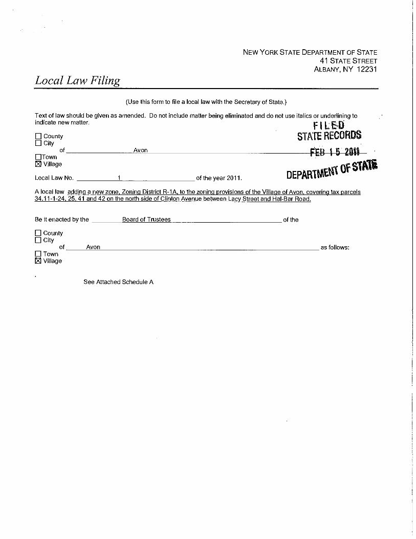
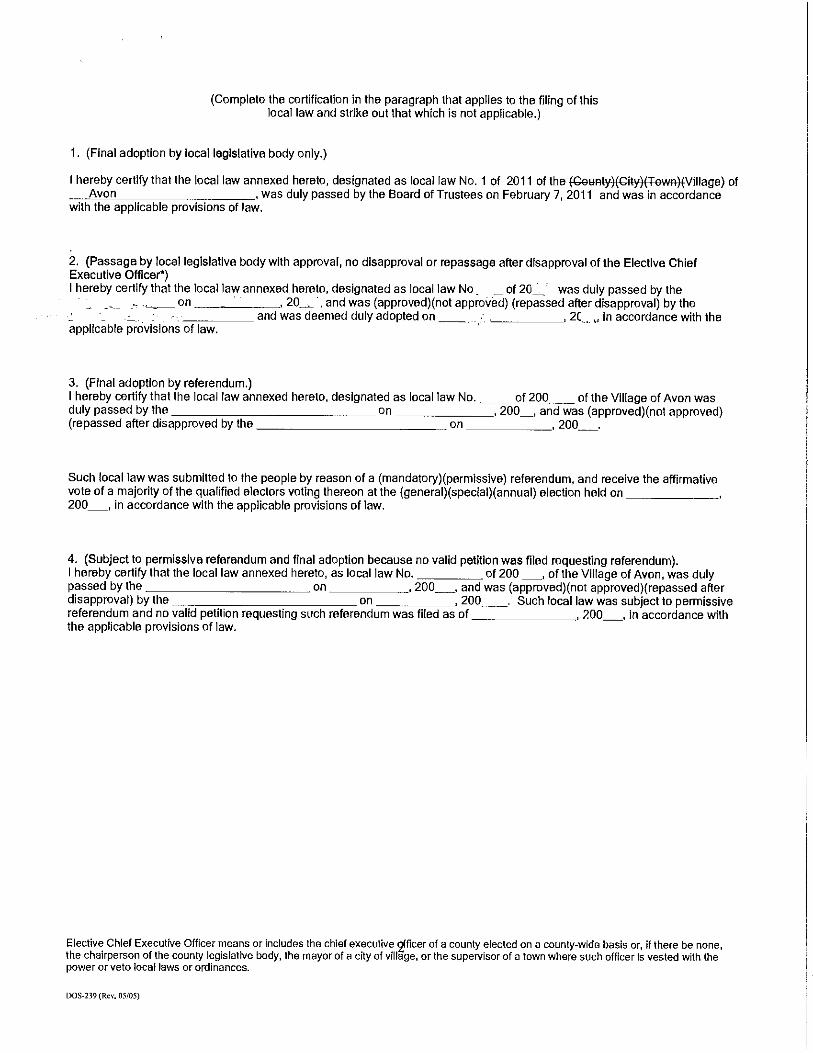

38
(2) Other industrial uses
Before approval of any other industrial use, the Zoning Enforcement Officer shall refer the proposed application to the Planning Board for study and recommendation. The Planning Board shall review the conformity of the application with the goals, objectives and content of the comprehensive plan and with recognized principles of community development, land use planning, and civic design. The Planning Board may approve the application as submitted, or, before approval, may require that the applicant modify, alter, adjust or amend the application as the Planning Board deems necessary to preserve the intent and purpose of this chapter to promote public health, safety and general welfare or disapprove same. The application as approved or disapproved shall then be reported to the Village Board, whereupon the Village Board, after public notice and public hearing, may approve or disapprove said application in accordance with the intent and purpose of this chapter. D. Other provisions and requirements.
(1) Each use established in this disrict shall set aside a minimum of fifteen (15) percent of the tract for seeding and landscaping and use this area for no other purpose.
(2) All industrial processes shall take place within an enclosed building. Incidental storage of materials out-of-doors shall be permitted. Industrial use shall be located so as to be a minimum of fifty (50) feet from any property line abutting a non-industrial district. This fifty (50) foot buffer strip shall be perpetually maintained with landscape plantings to provide a visual screen between the industrial use and the adjoining non-industrial use.
E. Prohibited Uses. (1) Sale, pumping or storage of gasoline or other fuels is prohibited. (Local Law #1-
2003 1/6/03)
ARTICLE IV
GENERAL PROVISIONS
~ 30.41 Regulations for preservation of natural features A. No structure shall be built within one hundred (100) feet of the bed of a stream carrying water on an average of six (6) months of the year or on land subject to periodic overflow. B. No person shall strip, excavate or otherwise remove top soil for sale or other use other than on the premises from which taken, except in connection with the construction or alteration of a building on such premises and excavating or grading incidental thereto, except as herein specified. C. Existing natural features such as trees, brooks, drainage channels and views shall be retained to the fullest extent practicable and desirable. Whenever such features interfere with the proposed use of such property, a retention of the maximum amount of such features consistent with the use of the property shall be required.

39
~ 30.42 Sign regulations [Amended by L.L. No. 1-1991; 2-1993; 7-16-1999 by L.L. No. 3-1996] (Amended by LL #3-2005)(Amended by LL #1-2006) A. Purpose. 1. The purpose of this section is to promote and protect the public health, welfare and safety by regulating existing and proposed advertising signs and outdoor signs of all types. This section is intended to support a more positive economic and business climate, and enhance and protect the physical appearance of the community. It is further intended hereby to reduce sign or advertising distractions and obstructions that may contribute to traffic accidents and reduce hazards that may be caused by signs overhanging or projecting over public rights-of-way. 2. This section is intended to promote attractive signs which clearly present the visual message in a manner that are compatible with their surroundings. The appearance of a community is affected by the location, size, construction and graphic design of its signs. Signs should convey their messages clearly and simply to enhance their surroundings. B. Sign standards. Professionally prepared, aesthetically pleasing and properly placed and maintained signs will enhance the business climate in the Village of Avon and are encouraged. Except as otherwise provided, all signs erected and maintained in the Village of Avon shall be in accordance with the following sign standards: 1. Design Standards. a. Commercial signs and their supporting structures shall be aesthetically in harmony, style and scale with the architectural features of the building on which they are placed or to which they relate. Sign panels and graphics should relate with and not cover architectural features, and should be in proportion to them. b. Signs and their layout shall be appropriate to the types of activities they represent. c. No more than two (2) typefaces or styles of type shall be used on any sign or group of signs indicating one (1) message. d. The number of colors used shall be the minimum to be consistent with the design. e. Balloons, pennants, ribbons, streamers, spinners or similar attention-getting devices shall not be part of any sign. f. Signs and their supporting structures shall be made of weather- and wind-resistant materials and shall be designed to withstand seventy-five (75) mph winds. g. Signs and their supporting structures shall be designed to withstand seasonal snow and ice loads.
40
h. Illumination should be appropriate to the character of the sign and surroundings. i. Groups of related signs should express uniformity and create a sense of harmonious appearance. j. Signs shall be constructed of materials that resist fading, peeling or other deterioration. k. If exterior sign lighting is provided, it shall be arranged so the light source is not visible from off the premises where the sign is erected. The intensity of the light source shall not exceed that necessary to illuminate and make legible a sign from the public ways. 2. Maintenance standards. a. Signs shall be neatly painted and shall be kept clean and free of mud, grease and rust. b. Any damage, peeling, fading, or deterioration of any sign shall be repaired within thirty (30) days of receipt of written notification thereof from the Zoning Enforcement Officer. 3. Safety standards. a. Signs shall not be erected at a location which will impede sight lines of pedestrians or vehicles, obstruct the visibility of any pedestrian or vehicle from any public street; or which may otherwise be hazardous to vehicles or pedestrians. b. Signs shall not be erected within ten (10) feet of any power line or tree branch. No sign shall be erected at any location which may be dangerous to pedestrians or vehicles. c. Signs shall not interfere with the flow of vehicular or pedestrian traffic or vehicular parking. d. Signs shall be kept free of all hazards which may be detrimental to the public health and safety, including, but not limited to, faulty wiring and loose fastenings. e. All internally illuminated signs shall be constructed in conformance with the "Standards for Electric Signs (U.L. 48) of Underwriters Laboratories, Inc.," and bear the seal of Underwriters Laboratories, Inc. f. If such sign does not bear the Underwriters Laboratories Label, the sign shall be inspected and certified by the New York Board of Fire Underwriters. All transformers, wires and similar items shall be concealed. All wiring to freestanding signs shall be underground. g. All signs, including wall-mounted and projecting signs, shall be securely anchored and shall not swing or move in any manner. h. All projecting, freestanding or wall signs shall employ acceptable safety material.

41
i. All freestanding signs shall be designed and constructed to withstand a wind pressure of not less than thirty (30) pounds per square foot of surface. C. Definition of terms and phrases. As used in this section, the following terms shall have the meanings indicated: AREA OF A SIGN -- The surface devoted to the conveying of the message exclusive of supports or framing devices. In the case of open sign structures not having a solid surface or a sign not otherwise inscribed in a definitive area, the area of the sign shall be taken as the area required to circumscribe all letters and devices, exclusive of supports. ATTENTION-GETTING DEVICE -- Any streamer, spinner, light, balloon or similar device or ornamentation used for the purpose of attracting attention for promotion of commercial speech. AWNING SIGNS -- Include displays, illustrations or insignias composed of lettered or pictorial matter on an awning attached to a building but shall not include the entire area of the awning. No awning sign shall be less that eight (8) feet above ground level. BANNER -- Cloth or other nonrigid material bearing a design or lettering attached to the exterior of a building. No banner shall be erected for more than 30 consecutive days. No more than one banner per business is permitted. BUILDING -- A roofed and walled structure built for permanent use. BUSINESS - A commercial or industrial establishment operated separately from any other commercial or industrial establishment. CONSTRUCTION SIGN -- A temporary sign not exceeding six (6) square feet per side erected on premises on which construction is taking place, during the period of such construction, indicating the names of architects, engineers, contractors and similar artisans and the owners, financial supporters, sponsors and similar persons or firms having a role or interest with respect to the structure of a project. Construction signs shall not be required to meet the design standards of ~ 30.42B(1)(f), (g) or (h). DIRECTIONAL SIGN -- A sign commonly associated with information and directions necessary and convenient for persons. Directional signs shall include signs marking entrances, parking areas, one-way drives, rest rooms, pick-up and delivery areas and the like. No directional signs shall exceed nine (9) square feet in area per side or a total area of eighteen (18) square feet. DIRECTORY SIGN -- Any sign capable of advertising all the occupations or businesses of a building, shopping plaza or mall. ERECT -- To build, construct, alter, repair, display, relocate, attach, hand, place, suspend, affix or maintain any sign, and shall also include the painting of exterior wall signs. FASCIA SIGN -- A single-faced sign, mounted generally parallel to its supporting wall on building. No fascia sign shall project more than four (4) feet from its supporting wall.

42
FLAG -- Cloth or other nonrigid material with colors, patterns, etc. used as a symbol or for advertising purposes. No flag shall be erected for more than 30 consecutive days. Not more than one flag per business is permitted. FRONT, FRONTAGE OR FACE OF A BUSINESS OR BUILDING -- The width of a building facing a street or public parking lot. In the case of a corner lot, it may be either frontage at the option of the applicant. For a shopping plaza or mall, the front, frontage or face shall mean that portion of the building perimeter facing a street or designated parking area and shall include the width of the main entrance of any business not facing a street or designated parking area. In the case of two such perimeters, it may be either frontage at the option of the applicant. GOVERNMENTAL SIGN -- A sign erected and maintained pursuant to and in discharge of any governmental function or required by any law or governmental regulation. GROUND SIGN or FREESTANDING SIGN -- A self-supported sign connected to the ground, not attached to any building. This shall include pole, pylon, pedestal and masonry wall-type signs. ILLUMINATED SIGN -- Any sign illuminated by electricity, gas or other artificial light, including reflective or phosphorescent light. LIGHTING DEVICE -- Any light or group of lights located or arranged so as to cast illumination on a sign that shall not be hazardous to the public right-of-way. OFF-PREMISES SIGN -- A sign unrelated to a business or profession conducted, or to a commodity or service sold or offered upon the premises where such sign is located. POLITICAL SIGN -- Signs that by their content promote or support a candidate or candidates for any public office or which advocate a position on an upcoming ballot proposition. Political signs shall be nonilluminated signs, which shall not exceed six (6) square feet in size per side, twelve (12) square feet total and shall not measure more than six (6) feet in height above grade level. Such political signs may be erected for not more than thirty (30) days prior to any general election or fifteen (15) days prior to any primary or caucus to which they relate and shall be removed by the owner or occupant of the property not later than seven (7) days after the election or voting date. Political signs shall not be required to meet the design standards of ~ 30.42B(1)(f), (g) or (h). PORTABLE SIGN -- A sign, whether on its own trailer, wheels or otherwise, designed to be movable and not structurally attached or leaning against the ground, a building or anything else and shall include signs commonly known as "A-frame signs." Portable signs shall not exceed twenty-five (25) square feet per side and fifty (50) square feet total. No portable sign shall be erected for more than thirty (30) consecutive days. PROJECTING SIGN -- Any sign which is attached to a building wall or structure and which extends horizontally more than 24 inches from the plane of such wall or a sign which is perpendicular to the face of such wall or structure. No projecting sign shall exceed twelve (12) square feet per side and twenty-four (24) square feet total, project more than four (4) feet from the front of a building or be less than eight (8) feet above ground level. REAL ESTATE SIGN -- Any sign, not to exceed six (6) square feet per side or a total of twelve (12) square feet, advertising the sale or lease of real property.
43
SHOPPING PLAZA or MALL -- Two (2) or more businesses in a single building or in connected buildings with separate entrances. SIGN -- Any material, structure or device, or any part thereof, including but not limited to sign frame, billboards, sign boards, painted wall signs, hanging signs, illuminated signs, pennants, flags, banners, fluttering devices, declarations, demonstrations, displays, illustrations or insignias composed of lettered or pictorial matter located out-of-doors, on the exterior of any building, used to advertise or promote any interest when the same is placed in view of the general public or for the display of any advertisement, announcement, notice, directional matter or name. TEMPORARY SIGN -- A sign, not to exceed twenty-five (25) square feet per side and a total of fifty (50) square feet, related to a single activity or event having a duration of not more than thirty (30) days. No temporary sign shall be erected for more than thirty (30) consecutive days or more than once per calendar year. No temporary sign shall be attached to any tree, fence, utility pole, rocks or other parts of the natural landscape or be erected in the right-of-way of any public street nor be placed in a position that will obstruct or impair traffic or in any manner create a hazard or disturbance to the health, safety and welfare of the general public. Temporary signs shall not be required to meet the design standards of ~ 30.42B(1)(f), (g) or (j). WINDOW SIGN -- A sign painted or affixed on glass or other window material or located inside a building within four (4) feet of a window. Not more than two (2) lighted or neon-type signs covering not more than 50% of any windows are permitted. D. Signs permitted in Agricultural Districts, Residential and Planned Residential Development Districts (A, R-1, R-2 and PRDD) and for apartments in Combination Districts (C-1): 1. One (1) nameplate sign not exceeding one (1) square foot in area which may be illuminated by any light whose source is not visible from the street or adjoining premises. 2. Signs identifying a church may be illuminated and shall be situated on the property when the church is located not less than twenty-five (25) feet from the sidewalk or pavement edge, if no sidewalk exists. Such signs shall not be more than twenty (20) square feet in area per side and forty (40) square feet total. 3. In R-2 Districts and C-1 Districts, apartment buildings containing four (4) or more units or apartments may have one (1) sign no larger than twenty (20) square feet in area per side and forty (40) square feet total, for each building which may be indirectly illuminated with nonflashing white light, identifying the apartment. 4. Signs not exceeding twenty (20) square feet per side, forty (40) square feet total, identifying subdivisions. 5. Temporary signs. 6. Portable signs. 7. Real estate signs.

44
8. Real estate signs shall be removed immediately upon consummation of sale. One (1) off-premises "open house" real estate sign may be allowed for just such an event only on the day of the open house and shall be removed that day at the conclusion of the open house. 9. Political signs. 10. Construction signs. 11. Flags E. Signs permitted in Business Districts (B-1, B-2 and B-2-1): 1. Fascia signs. 2. Awning signs. 3. Projecting signs. 4. Window signs. 5. Directional signs. 6. Construction signs. 7. Real estate signs. 8. Political signs. 9. Temporary signs. 10. Portable signs. 11. Banners. 12. Flags. 13. Governmental signs. F. Signs permitted only in General Business Districts (B-2 and B-2-1): 1. One (1) freestanding or ground sign, which may be indirectly or internally illuminated, shall be permitted for each building for the purposes of identifying the business located on the premises. Such sign shall not exceed one hundred (100) square feet in area on either of two (2) faces to a maximum of two hundred (200) square feet. G. Limitations on total area of signs in Business Districts. 1. The combined area of all signs for each building shall not exceed two square feet for each lineal foot of the building frontage.
45
H. Directory signs for a shopping plaza or mall in the General Business Districts. 1. For any shopping plaza or mall, which is defined as two or more businesses in a single building or in connected buildings with separate entrances, the following sign is permitted: a. One directory sign which shall not exceed one hundred fifty (150) square feet on either side for a maximum of three hundred (300) square feet. The percentage of the capacity of a directory sign allocated for advertising any business shall not exceed the percentage of the total lineal foot frontage of the business in the shopping mall or plaza. This percentage shall be calculated based on the square footage remaining after the identification of the plaza or mall (i.e., A building with 150 lineal feet of frontage containing 5 businesses is entitled to a directory sign with a maximum of 100 square feet. Plaza owner uses 10% of the sign square footage for plaza identification. Business A has 20% of the total linear frontage of the building. Therefore, they would have 20% of the remaining 90 square feet of signage for a total of 18 square feet on either side of the directory sign.). I. Directory signs for a shopping plaza or mall more than 50 feet from the paved surface of any public street in the Central Business District. 1. In any shopping plaza or mall where the front or face of any building is more than fifty (50) feet from the paved surface of any state, county or Village street or road, the following sign is permitted: a. One directory sign which shall not exceed one hundred (100) square feet on either side for a maximum of two hundred (200) square feet. The percentage of the capacity of a directory sign allocated for advertising any business, shall not exceed the percentage of the total lineal foot frontage of that business in the shopping mall or plaza. This percentage shall be calculated based on the square footage remaining after the identification of the plaza or mall (i.e., A building with 150 lineal feet of frontage containing 5 businesses is entitled to a directory sign with a maximum of 100 square feet. Plaza owner uses 10% of the sign square footage for plaza identification. Business A has 20% of the total linear frontage of the building. Therefore, they would have 20 % of the remaining 90 square feet of signage for a total of 18 square feet on either side of the directory sign.). J. Signs permitted in Light Industrial and Planned Industrial Park Districts: 1. One freestanding or ground sign not to exceed twenty (20) square feet on each side for a total of forty (40) square feet. 2. One directory sign for each planned industrial park, not to exceed thirty-two (32) square feet per side for a total of sixty-four (64) square feet. 3. Directional signs. 4. Construction signs. 5. Governmental signs. 6. In the I-2 District, fascia signs as permitted by site plan review and approval. (Local Law #1-2006)

46
K. Signs permitted in the Combination Zone (C-1): 1. One fascia sign not to exceed forty (40) square feet for each light industrial use. 2. One freestanding or ground sign per building, not to exceed twenty (20) square feet per side, total of forty (40) square feet for each light industrial use. L. Signs permitted in Planned Residential Development Districts (PRDD): 1. All signs permitted in ~ 30.42(D). 2. Signs approved by the Board of Trustees in any PRDD rezoning pursuant to Article XIII of Chapter 30. M. Governmental signs. 1. None of the provisions of this section shall be construed as preventing or limiting any sign or directional device erected by the federal, state, county, or local government or agency thereof. N. Sign permit. 1. No sign, advertising structure or devise which advertises shall be erected without a written permit, except for the following signs for which no permits shall be required: a. Window signs. b. Real estate signs. c. Construction signs. d. Political signs. e. Temporary signs. f. Portable signs. g. Governmental signs. h. Banners. i. Flags. j. Historical markers, tablets and statues, memorial signs and plaques; names of buildings and dates of erection when cut into any masonry surface or when constructed of bronze, stainless steel, or similar material; and emblems installed by governmental agencies, religious or nonprofit organizations; not exceeding six (6) square feet. k. Nonilluminated warning, private drive, posted or no trespassing signs, not exceeding two (2) square feet per face.
47
l. Number and name plates identifying residents, mounted on house, apartment or mailbox, not exceeding one (1) square foot in area. m. Lawn signs identifying residents, not exceeding one (1) square foot, or two (2) square feet if double-faced. Such signs are to be nonilluminated except by a light which is an integral part of a lamp post if used as a support, with no advertising message thereon. n. Christmas holiday decorations, including lighting, are exempt from the provisions of this section and may be displayed in any district without a permit for the period from three (3) days before Thanksgiving until the first week in the following year. o. At gasoline stations, integral graphics or attached price signs on gasoline pumps. O. Illegal signs. 1. Signs containing flashing, intermittent, rotating, or moving light or lights. Intermittent signs shall include any sign or message on a sign which changes at intervals of less than five minutes. (See LL#3-2005) 2. Signs containing luminous material, fluorescent paint or sequins. 3. Advertising devices. No sign or part thereof shall contain or consist of ribbons, streamers, spinners, or other similar moving, fluttering, or revolving devices. Said devices, as well as strings of lights, shall not be used for the purposes of advertising or attracting attention when not part of a sign. 4. Signs on rocks, trees, etc., signs affixed to or painted upon rocks, trees, utility poles, or other such structures. 5. Parking of advertising motorized vehicles is prohibited. No person shall park any vehicle on a public right-of-way or public property or on private property so as to be intended to be viewed from a motorized vehicular public right-of-way, which has attached hereto or located thereon any sign or advertising device for the basic purpose of providing advertisement of products or directing people to a business or activity located on the same or nearby property of any other premises. This section is not intended to prohibit any form of vehicular signage, such as a sign attached to a bus or lettered on a motor vehicle or signs that are part of a vehicle such as a construction trailer, whose primary purpose is not advertising to the public right-of-way. (See Safety Standards.) 6. Signs that move, or contain visible parts that move or simulate movement. 7. Off-premises signs, except for open house real estate signs as provided by ~ 30.42D(8). P. Procedure for obtaining a sign permit. Application for permit: Application for the permit shall be made in writing in duplicate, upon forms available at the Village of Avon office, and shall contain the following information: 1. Name, address, and telephone number of the applicant. 2. Location of building, structure, or land to which or upon which the sign is to be erected.
48
3. A detailed drawing or blueprint showing the appearances of the proposed sign and a description of the construction details of the sign drawn to scale showing the lettering and/or pictorial matter composing the sign; method of illumination and the position of lighting or other extraneous devices; a location plan showing the position of the sign on any building or land, and its position in relation to nearby trees, power lines, buildings, structures, or existing signs, and to any private or public street or highway. 4. Written consent of the owner of the building, structure or land to which or upon which the sign is to be erected, in the event the applicant is not the owner thereof. 5. A copy of any required electrical permit issued for any sign. Q. Application fees. 1. The fees to be paid to the Village of Avon for applying for a sign permit shall be in accordance with a schedule adopted by the Village Board. 2. Issuance of permit. It shall be the duty of the Zoning Enforcement Officer, upon the filing of a complete application for a sign permit together with the required plans, specifications and other data submitted to him with the application, to, within ten (10) days thereof, either issue a permit or a written statement of all reasons for permit denial. In the event of permit denial, the Zoning Enforcement Officer must also include information outlining the appeal or variance process. If the sign authorized under such permit has not been erected within six (6) months from the date of issuance of such permit, the permit shall become null and void, but may be renewed within ten (10) days from the expiration thereof, for good cause upon payment of an additional fee in accordance with the schedule adopted by the Village Board and on file in the Village Clerk's office. R. Signs existing on September 1, 1995. 1. All signs existing on September 1, 1995, may be repaired, remodeled or re-lettered, provided the size of the sign is not increased and the sign complies with the sign standards of ~ 30.42B. 2. No sign shall be enlarged or relocated except in accordance with the provisions of this section. S. Removal of signs. Any sign which no longer advertises an existing business conducted or product sold on the premises upon which a sign is located, is abandoned, unsafe or insecure or is a menace to the public shall be removed or repaired. The Enforcement Office, after determining that any such sign exists, shall notify the owner of the premises in writing to remove or repair said sign within thirty (30) days from the date of such notice. Upon failure to comply with such notice within the prescribed time, the Zoning Enforcement Officer is hereby authorized to remove or repair such sign, and the Village Board of Trustees shall assess all costs and expenses incurred in said removal or repair against the land or building upon which such sign is located. The Zoning Enforcement Officer may cause any sign which is a source of immediate peril to persons or property to be removed immediately without notice. T. Annual report.

49
Each year the Zoning Enforcement Officer shall perform an inspection of every sign in the Village of Avon. He shall prepare and submit an annual sign report to the Village Board in March of each year. U. Violations and penalties. 1. Any person, firm or corporation, whether as owner, lessee, agent or employee, who proceeds to erect, reerect, construct or structurally alter any sign without first applying for and obtaining the necessary permit, or who in any other way violates any provision of this section, shall be guilty of an offense and receive punishment as established in the Penal Code. Each week's continuous violation shall constitute a separate additional violation. 2. In case of a violation of this section, the municipality and its officers may, in addition to any other remedies specifically conferred by law, institute any appropriate proceedings to prevent unlawful erection, construction, reconstruction, alteration or use of any sign not in compliance with this section.
~ 30.43 Other regulations applicable to all districts A. No lot shall have erected upon it more than one (1) principal building. No yard or other open space provided about any building for the purpose of complying with the provisions of this chapter shall be considered to provide a yard or open space for any other building. B. An accessory building attached to a principal building shall comply in all respects with the yard requirements of this chapter for the principal building. Detached accessory buildings shall be located to the rear of the front building line of the principal building, and if located in a side yard area shall conform to side yard requirements of this chapter. C. In all zoning districts, except the B-2 General Business District, every principal building shall be built upon a lot with one hundred (100) feet of frontage upon a public or dedicated street. A public street is hereby defined as a street owned by a municipality, county or the State of New York or is a public street by prescription. [Amended 8-3-1987 by L.L. No. 5-1987] D. At the intersection of two (2) or more streets, no hedge, fence or wall other than a single post or tree, which is higher than three (3) feet above curb level, nor any obstructions to vision shall be permitted in the triangular area formed by the intersecting street lines and a line joining each, thirty (30) feet from said intersections along said street line. E. Where a building lot has frontage on a street which is proposed for right-of-way widening, the required front yard area shall be measured from such proposed right-of-way. F. All yards, open space, off-street parking and required landscaping must be contained within the district which the use is permitted. G. For the purpose of regulating the locations of accessory buildings on corner lots and on lots extending through between two (2) parallel streets, all portions of a corner lot or a through lot
50
which fronts on a public street shall be subject to the front yard requirements of the district in which said corner lot or through lot is located. H. When a new lot is formed so as to include within its boundaries any part of a former lot on which there is an existing building or use, the subdivision must be carried out in such a manner so that all regulations and requirements of this chapter are complied with. I. Any fences erected in the Village shall adhere to the following: 1. Before a fence shall be erected, a building permit must be obtained from the Zoning Enforcement Officer. A request for a permit shall be accompanied by a site plan which shall show the height and location of the fence in relation to all other structures and buildings, and in relation to all streets, lot property lines and yards. 2. Fences may be erected, altered or reconstructed to a height not to exceed three (3) feet above ground level when located within twenty-five (25) feet of the right-of-way line. 3. Fences may be erected, altered or reconstructed to a height not to exceed six (6) feet above ground level when located more than twenty-five (25) feet from the right-of-way line. 4. These restrictions shall not be applied so as to restrict the erection of a wall for the purpose of retaining earth. 5. These restrictions shall not be applied so as to restrict the erection, alteration or reconstruction of fences used in connection with farms nor shall it affect fences the Zoning Enforcement Officer shall deem necessary to protect the public. J. Storage of flammable liquid or gas. No storage of any flammable liquid or gas in quantities exceeding two hundred eighty (280) gallons shall be allowed except with the prior approval of the Zoning Enforcement Officer and in conformance with the Fire Prevention Code as adopted by Chapter 55 of this Municipal Code. K. Lots in two (2) districts. Where a district boundary line divides a lot in single or joint ownership of record at the time such line is adopted, the regulations for the less restricted portion of such lot shall extend not more than thirty (30) feet into the more restricted portion, provided the lot has frontage on a street in the less restricted district. L. The permitted accessory uses in any district shall not include any use first specified in a less restricted district. In the interpretation of this provision, an "I-1" District shall be considered the least restricted and an "A" District the most restricted. M. Stands selling fruit, vegetables, flowers and other agricultural and horticultural products are permitted and shall adhere to the following: 1. Only fruit, vegetables, flowers and other agricultural and horticultural products may be sold at a stand.

51
2. Stands may be jointly operated by adjoining landowners. 3. The fruit, vegetables, flowers and other agricultural and horticultural products offered for sale shall be actually grown on the real property where the stand is located or on an adjoining property if the stand is operated jointly by adjoining landowners. 4. Stands shall not be open for business prior to 9:00 a.m. and shall close prior to 9:00 p.m. or sunset whichever first occurs. 5. Stands may be operated only between May 15th and November 1st. No stand may be set up in preparation for the opening of business prior to May 10th. All stands shall be removed prior to November 3rd. 6. No signs are permitted in connection with any stand. However, price tags identifying the prices of the fruit, vegetables, flowers and other agricultural and horticultural products offered for sale on the stand are permitted. 7. Stands shall be no larger than six (6) feet in height, eight (8) feet in length and forty (40) inches in width. 8. The area in which fruit, vegetables, flowers and other agricultural and horticultural products are offered for sale shall not exceed sixty-four (64) square feet. 9. No stand shall be located within twenty (20) feet of any side property boundary. 10. Stands are permitted in the public right-of-way provided they do not interfere with vehicular or pedestrian traffic or vehicular parking. 11. This local law shall take effect upon filing in the office of the Secretary of State. [¶M added by Local Law 5 of 1990, filed 10/29/90]
~ 30.44 Regulations applicable to Residential Districts (R-1, R-2) A. In any Residential District the permitted uses shall not include any use which is noxious or offensive by reason of refuse, matter, dust, odor, smoke, gas, fumes, noise, vibration, unreasonable use of lights or night time operation. B. No accessory structure exceeding twelve (12) feet in height, except farm structures or others specifically stated in the zoning schedule shall be permitted. C. No accessory structure shall be located within ten (10) feet of a principal building or other accessory building. D. No front yard shall be used for the open storage of boats, camping trailers, utility trailers, motorized camping vans or similar vehicles.

52
E. Not more than one (1) commercial vehicle shall be parked out-of-doors overnight or on Sunday in conjunction with a residential property in a Residential District. No vehicles for commercial display purposes shall be stored in any Residential District any time. F. In any Residential District, an accessory building may be erected in a rear yard provided it does not occupy more than twenty (20) percent of said rear yard.
~ 30.45 Regulations applicable to all Business and Industrial Districts (B-1, B-2, I-1) A. "B" District manufacture or repair. The number of persons engaged in the manufacture of articles or the fabrication or repair of goods or articles shall not exceed five (5) in any establishment in a "B" District. The total horsepower of machinery used for such purposes in any such establishment shall not exceed ten (10) H. P. Manufacture shall be limited to that incidental to retail sale on the premises, and repair shall be limited to custom repair service. B. Enclosure required. Certain used specified in the list of permitted uses as being subject to one (1) or more provisions of this section are hereby restricted as follows: 1. The principal use shall be conducted only within a completely enclosed building except in case of sales of nursery stock. 2. Such building shall have no opening other than stationary windows, or self-closing fire exit doors required by the law, within fifty (50) feet of the nearest property line of a lot in any Agricultural or Residential District. C. All garages and filling station pumps, lubricating or other automobile devices shall be located at least twenty (20) feet from any street line or highway right-of-way. All fuel, oil or other flammable substances shall be stored at least thirty-five (35) feet distant from any street or lot line. No public garage for more than five (5) motor vehicles shall have any entrance or exit for such vehicles within fifty (50) feet of any Agricultural or Residential District, any school, any church, or any institution for the residence, training or treatment of children or handicapped persons. D. Business structures or uses shall not display goods for sale purposes or coin-operated vending machines of any type in any location which would infringe upon the required yard areas specified in this chapter.
~ 30.46 Satellite antennas [Added by L.L. No. 1-1990; amended 1-23-1997 by L.L. No. 1-1997] A. A special permit shall be obtained from the Village Planning Board for satellite antennas greater that 39.37 inches (1 meter) in diameter in all residential zones and 78.74 inches (2 meters) in

53
diameter in all commercial, industrial or mixed zones. All applications for a special permit for a satellite dish shall be made to the Zoning Enforcement Officer who, after determining that an application is in the proper form, shall transmit one (1) copy of the application and all supporting documents to the Secretary of the Planning Board for action thereon. The Planning Board shall conduct a public hearing on applications referred to it. Within sixty-two (62) days from the date of such public hearing, the Planning Board shall by resolution either approve or disapprove the application so heard. In approving an application the Planning Board may impose modifications or conditions to protect the health, safety, general welfare and aesthetics of the public and the area. If an application is approved by the Planning Board, the Zoning Enforcement Officer shall be furnished with a copy of the approving resolution of the Board and shall issue the permit applied for in accordance with the conditions imposed by the Planning Board. If an application is disapproved by the Planning Board, the reasons for such denial shall be set forth in the Board's resolution and a copy of such resolution shall be transmitted to the Zoning Enforcement Officer, who shall deny the application accordingly by providing the applicant with a copy of the Board's reason for disapproval. B. In A, R-1, R-2 and PRDD Zones, satellite antennas requiring permits shall not exceed twelve (12) feet in height, width or depth and shall not be more than fourteen (14) feet above ground level. C. All wiring and connection lines for ground-mounted satellite antennas requiring permits shall be underground. D. In A, R-1, R-2 and PRDD Zones, satellite antennas requiring permits shall be installed in rear yards only and shall not be erected within ten (10) feet of any property line. E. In A, R-1, R-2 and PRDD Zones, the Planning Board shall have the power to designate the exact location in the rear yard for a satellite antenna requiring a permit no nearer than ten (10) feet to any property line and to require landscaping and/or screening to protect the aesthetic appearance of the area. F. For satellite antennas requiring permits in all zones except the A, R-1, R-2 and PRDD Zones, the Planning Board shall have the power to designate the height, location and size of satellite antennas and to require landscaping and/or screening to protect the aesthetic appearance of the area.
ARTICLE V
PERMITTED MODIFICATIONS
~ 30.51 Height modifications A. In the district any principal building may be erected to a height in excess of that specified for the district provided such front, side, and rear yard is increased one (1) foot for each one (1) foot of such additional height. B. Nothing herein contained shall be construed so as to limit the height of any belfry, bulkhead, chimney, church spire, clock tower, cupola, dome, skylight, ventilator, water tank, and other necessary mechanical appurtenances usually carried above the roof level. Such features,

54
however, shall be erected to accomplish the purpose they are required to serve and shall not occupy in the aggregate more than twenty-five (25) percent of the roof area of the main building.
~ 30.52 Substandard lot A. The Village Zoning Board of Appeals may permit the construction of a building on a lot which does not meet the minimum area requirements of this chapter, provided that the lot was held in single and separate ownership of record prior to the adoption of this chapter. No such permit shall be granted if the applicant is the owner of adjoining vacant property so that he or she could comply with the requirements of this chapter.
~ 30.53 Transitional front yard requirements Where the frontage on one (1) side of a street between two (2) intersecting streets is zoned partly as A, R-1 or R-2 and partly B-1, B-2 or I-1, the front yard depth in the B-1, B-2 or I-1 District in such block frontage shall be equal to the required front yard depth of the A, R-1 and R-2 District for a distance of fifty (50) feet into the B-1, B or I-1 District.
~ 30.54 Front yard setback in developed streets Front yards. In such cases in Residential Districts where the frontage on the same side of the street within three hundred (300) feet from either side of said lot is fifty (50) percent or more developed, then the required front yard for a new structure shall be modified to a minimum setback equal to the average for such existing development. Otherwise, the requirements of the Schedule A in ~ 30.25 shall apply.
~ 30.55 Transitional yard widths and depth in abutting districts Where a lot in a B-1, B-2 or I-1 District abuts a lot in an A, R-1 or R-2 District, there shall be provided along such abutting lines a yard equal in width or depth to that required in said A, R-1, R-2 or R-3 District.
~ 30.56 Corner lot transition On every corner lot in an R-1, R-2 or I-1 District there shall be provided on the side street a yard equal in depth to the required front yard depth on said side street. On such lot where two (2) "front" yards are provided, the other yards may be considered side yards and no rear yard shall be required providing an open yard area of at least four thousand eight hundred (4,800) square feet in any R-1 District and two thousand four hundred (2,400) square feet in any R-2 District is maintained.

55
ARTICLE VI
SPECIAL USE PERMITS
~ 30.61 Uses requiring special use permits The following uses may be permitted provided a special use permit is obtained from the Zoning Board of Appeals under the terms and specifications herein. Whereas the necessity for certain specific uses is recognized and at the same time appreciating the fact that they or any one (1) of them may be, or become, inimical to the public health, safety, and general welfare of the community if located without consideration to the existing conditions and surrounding the following standards and proceedings are hereby established which are intended to provide the Zoning Board of Appeals with a guide for the purpose of reviewing certain uses not otherwise permitted in this chapter. The Zoning Board of Appeals shall review and administer applications for the following uses according to procedures spelled out for the Zoning Board of Appeals under Article X of this chapter. A. Public utilities. Public utility uses, such as dial equipment centers, and substations but no service or storage yards, may be permitted in any district with a special use permit. No special use permit shall be issued unless the Board of Appeals shall determine that: 1. The proposed installation in specific location is necessary and convenient for the efficiency of the public utility system or the satisfactory and convenient provision of service by the utility to the neighborhood or area in which the particular use is to be located. 2. The design of any building in connection with such facility conforms to the general character of the area and will not adversely affect the safe and comfortable enjoyment of property rights of the district in which it is located. 3. Adequate and attractive fences and other safety devices will be provided. 4. A buffer strip ten (10) feet in width shall be provided around the perimeter of the property. 5. Adequate off-street parking shall be provided. 6. All of the area, yard and building coverage requirements of the respective district will be met. B. Motor vehicle service stations and commercial garages. Motor vehicle service stations and commercial garages may be permitted only in such districts as specified in Article III of this chapter provided that the following standards are observed: 1. All fuel storage tanks shall be new and certified by the manufacturer to be safe and proper. 2. In addition to the information required in the special permit application and enumerated in ~ 30.94 of this chapter, the site plan submitted shall also show the number and location of fuel tanks

56
to be installed, the dimensions and capacity of each storage tank, the depth the tanks will be placed below the ground, the number and location of pumps to be installed and the type of structure and accessory buildings to be constructed. 3. The area and yard specifications for motor vehicle service stations are identified in Schedule A of ~ 30.25 of this chapter. 4. The entire area of the site traveled by motor vehicles shall be hard surfaced. 5. Any repair of motor vehicles shall be performed in a fully enclosed building. No motor vehicles shall be offered for sale on the site of a motor vehicle service station. No motor vehicle parts or partially dismantled motor vehicles shall be stored outside of an enclosed building. [¶5 amended by Local Law 5 of 1982] 6. No vehicles shall be permitted to be standing or parked on the premises of a motor vehicle service station other than those used by the employees in the indirect or direct operations of the establishment and those being serviced. 7. Accessory goods for sale may be displayed on the pump island and the building only. The outdoor display of oil cans and/or antifreeze and similar products may be displayed on the respective island if provided for in a suitable stand or rack. 8. No motor vehicle service station or commercial garage shall be located within five hundred (500) feet of any public entrance to a church, school, library, hospital, charitable institution or place of public assembly. Such distance shall be measured in a straight line from said public entrance to the lot line nearest said entrance along the street line. 9. Where a motor vehicle service station abuts a Residential District, it shall be screened by a buffer area no less than ten (10) feet in depth composed of densely planted evergreen shrubbery, solid fencing or a combination of both which in the opinion of the Zoning Board of Appeals, will be adequate to prevent the transmission of headlight glare across the district boundary line. Such buffer screen shall have a minimum height of six (6) feet above finished grade at the highest point of the station. The materials used shall be in keeping with the character of the adjacent residential area. If a shrubbery becomes decayed and fails to provide the adequate screen, the Zoning Enforcement Officer may direct the property owner to replace said shrubs. 10. All fuel pumps shall be located at least twenty (20) feet from any street or property line and shall be attendant-operated. 11. Each motor vehicle service station or commercial garage shall be permitted to have one (1) free-standing or pylon sign setting forth the name of the station and for the principal products sold on the premises, including special company or brand name, insignia, or emblem, provided that such sign shall not exceed twenty (20) square feet in area on either of two (2) sides, and the construction, height and location shall be subject to the approval of the Planning Board. 12. For a period of thirty (30) days only, not to exceed two (2) times in any one (1) year, commercial garages and service stations may also exhibit one (1) temporary sign located no less than ten (10) feet inside the property line and specifically setting forth special seasonal servicing of automobiles, provided that such sign does not exceed seven (7) square feet in area.
57
13. No used car sales shall be permitted except in connection with the operation of a commercial garage. C. Mobile homes and mobile home parks or courts. Mobile homes shall be permitted only in licensed mobile home parks which are operated by a duly licensed mobile home park operator. Mobile home courts or parks shall be permitted in Agricultural District A subject to the following regulations and licensing provisions. 1. Procedures for application for license. a. An application for license must be obtained from and filed with the Zoning Enforcement Officer. A filing fee based upon the following schedule and nonrefundable will be retained by said Zoning Enforcement Officer. b. Minimum fee Twenty-Five Dollars ($25.00) or Five Dollars ($5.00) per lot, whichever is greater up to a maximum fee of Two Hundred Dollars ($200.00) will be charged. The application must contain: (1) A legal description of property on which the proposed park will be located. (2) A sketch map must be enclosed with said application and must contain: (a) General sketch plan of proposed park including number of lots, lot size locations, recreation areas, accessory building, service buildings and also showing on sketch plan. (b) Abutting property owners and present use of this property. (c) Proposed access and egress routes. (d) Present and proposed sewer, water and other utility lines. (e) Any unusual special land features; such as, streams, creeks, areas subject to flooding and areas of steep slopes in excess of one hundred fifty (150) degrees. (3) Said application, when completed, filed and fee deposited with Zoning Enforcement Officer will be forwarded to the Planning Board for review within ten (10) days before or at next regularly scheduled Planning Board meeting. c. Planning Board action. The Planning Board having received said application will study the application and make recommendations thereto. The applicant or representative of same may be requested to attend Planning Board meetings for further clarification of the plot plan. The Planning Board will report to the Zoning Board of Appeals any recommendations within thirty (30) days. 2. Minimum site. a. Thirty (30) acres.

58
b. Size of lots and yards. Every lot shall meet the following minimum requirements: (1) Lot area per mobile home, minimum six thousand (6,000) square feet. (2) Front yard setback depth from mobile home development street, twenty (20) feet. (3) Front yard setback depth from mobile home development right-of-way, five (5) feet. (4) Front yard setback from mobile home lot line, fifteen (15) feet. (5) Side yard setback depth from mobile home lot line, ten (10) feet. (6) Rear yard setback depth from mobile home lot line, ten (10) feet. (7) Minimum width, fifty (50) feet. (8) No mobile home shall be located closer than one hundred (100) feet to any highway line and shall be no closer than fifty (50) feet to any adjoining property line. c. Minimum size of individual mobile homes. The minimum size of any individual mobile home in a park will not be less than five hundred (500) square feet. d. Accessory buildings on individual lots or stands. One (1) accessory building not exceeding one hundred (100) square feet is permitted. This building must be of a building material that is approved by the Planning Board. This building may be of a preconstructed material. Application for license must show detailed plan of proposed construction and location of accessory buildings showing compliance with terms of this chapter. e. Entrance platform. Each mobile home shall be provided with an entrance platform of concrete, asphalt or equivalent at least eight (8) feet by twenty (20) feet and four (4) inches in depth. This platform will be located at the main entrance to the mobile home and may act as base for railings and steps for mobile homes. This platform may also be called the patio area. f. Skirts. Each mobile home owner shall be required to enclose the bottom portion of the mobile home with either a metal or wood skirt or enclosure within thirty (30) days after arrival in park.

59
g. Parking areas. Each mobile home lot must have two (2) parking spaces, preferably off-street. Parking facilities may be provided so that each mobile home lot would have one (1) off-street parking area. A common parking area may be utilized for second vehicle parking area and guest parking and for delivery and service vehicles. Each parking space must have a minimum of two hundred fifty (250) square feet. No on-street parking shall be permitted. Parking spaces shall be provided for all park service buildings and meet the provisions of this chapter. At least two (2) permanent parking spaces shall be furnished for each park service. No boats, camp haulers, trailers or motor vehicles not designed for passengers shall be parked or stored at any place within the mobile home park or parts thereof or junks of any nature or description shall be parked or stored within the mobile home park. h. Sidewalks. Sidewalks will only be required from street to entrance of mobile home. Said sidewalk must be of concrete, macadam or hard surface. i. Screen fences and walls. Fences and walls shall be provided in lieu of screening shrubbery. These items shall be provided around areas which because of height or other factors, constitute a hazard to the public or to property. j. Landscaping. Proper landscaping including trees and shrubs shall be by mutual agreement with Planning Board and Park Developer. As a minimum there shall be one (1) tree per lot. 3. Roadway. Access entrance road connecting the mobile home park streets with a public road shall have a minimum road width and right-of-way as established in the street regulations of the Village. It is recommended that a separate access and egress be provided where appropriate. The road shall be constructed of blacktop or equivalent. a. Internal streets. (1) The width of all internal streets must be at least twenty (20) feet, with an additional five (5) foot right-of-way provided for on each side. (2) All streets shall be constructed of blacktop or equivalent of same and shall be designed, graded and leveled as to permit the safe passage of emergency and other vehicles at a speed of fifteen (15) miles per hour. (3) Each street shall be named and each mobile home lot therein will be given a permanent number which shall be affixed to a numbering post and shall be visible from the street. b. Lighting. Streets and parking areas should be illuminated from dusk to dawn with such lighting meeting the recommendations of utility company.
60
4. Sanitary facilities. a. Water. General requirements. An adequate supply of water shall be provided for mobile homes, service buildings and other accessory buildings as required by this chapter. Where public water is available, connection shall be used exclusively, unless local authorities deem otherwise. If a public water supply system is not available, the development of a private water supply system shall be approved by the health authority or other authorities having jurisdiction thereof. b. Specific regulations. (1) Supply of water must be free from any source of underground or surface contamination. (2) Water supply treatment, if necessary, shall be in accordance with the requirements of the health authority or other authorities having jurisdiction. (3) All water piping, fixtures, equipment and appurtenances shall be constructed and maintained in accordance with state and local regulations. All water connections shall be no farther than twelve (12) inches from the mobile home. c. Sewage. (1) General requirements. An adequate and approved system shall be provided in all parks for conveying and disposing of sewage from mobile homes, service buildings and other accessory facilities. (2) Approval by the State Department of Health is required before any permit or license may be issued. (3) Sewage treatment and/or discharge where the sewer lines of the mobile home park are not connected to a public sewer, all proposed sewage disposal facilities shall be approved by the State Department of Health prior to construction. All sewage connections shall be no more than twelve (12) inches from the mobile home. (4) Storm drainage pipes, ditches, etc. may be required with the request of the Planning Board. (5) Garbage and refuse. Each mobile home park shall provide evenly distributed and centrally located sanitary disposal centers preventing litter of ground and premises with rubbish, garbage and refuse. Each mobile home shall deliver to these disposal centers all rubbish, garbage and refuse in disposable containers. Collection of rubbish, garbage and refuse shall be provided every two (2) days or more often if necessary.

61
(6) Burning. No garbage or refuse of any kind shall be burned. 5. Electrical distribution systems and individual electrical general requirements. Every park shall contain an electrical wiring system consisting of wiring fixtures, equipment and appurtenances which shall be installed and maintained in accordance with local electric power company's specifications and regulations. All wiring fixtures and connections must have the New York State Fire Underwriter's approval. a. Specific regulations. (1) Each mobile home shall be supplied with not less than a one hundred (100) amp service. If the mobile home is to be heated electrically, then a two hundred (200) amp service is recommended for each unit. (2) Whenever possible, electrical lines should be placed below ground. (3) All grounding wiring in mobile homes must be retained. 6. Fuel supply and storage. General requirements for fuel oil supply system. All fuel oil supply systems provided for mobile homes, service buildings and other structures shall be installed and maintained in conformity with the rules and regulations of the authority having jurisdiction when provided. a. Specific requirements. (1) All fuel oil tanks shall be placed at rear of mobile home and located not less than five (5) feet from any exit. (2) It is recommended all fuel oil tanks shall be buried. (3) It is recommended that a central fuel supply system be provided. (4) Supports or standards for fuel storage tanks are to be of a noncombustible material. b. Gas supply. Natural. (1) Natural gas piping systems installed in mobile home parks shall be maintained in conformity with accepted engineering practices.
62
(2) Each mobile home lot provided with piped gas shall have an approved shutoff valve and cap to prevent accidental discharge of gas. (3) Proper planning and early communication with utility company is recommended to provide necessary easements by utility companies, i.e. gas, electricity and telephone. c. Liquefied gas. (1) Such system shall be provided with safety devices to relieve excessive pressures and shall be arranged so that the discharge terminates at a safe location. (2) Systems shall have at least one (1) accessible means for shutting off gas. This means shall be located outside of individual mobile home. (3) All liquid propane gas piping shall be well supported and protected against mechanical injury. (4) Storage tanks shall be not less than twenty (20) pounds and must be located at rear of mobile home or side away from street and no closer than five (5) feet from any exit. (5) It is recommended that a central underground gas storage system be furnished. 7. Recreational areas and open spaces. a. Every mobile home park shall have a minimum of five thousand (5,000) square feet of recreation area for the public use of persons living in the park and no less than two hundred (200) square feet per mobile home. b. The Planning Board, as a condition of approval, may establish such conditions on the ownership, use and maintenance of open spaces as it deems necessary to assure the preservation of such open spaces for their intended purposes. c. It is recommended that this recreation area be centrally located, but other areas may be better utilized for this purpose, depending on topography and location of mobile home park. d. Design of such areas shall be appropriate for intended use and location. 8. Service buildings shall be consolidated so that essential services and management operations are located in one (1) building. 9. Sales. a. Sales of lots in mobile home park. No mobile home lot shall be sold within a mobile home park. b. Mobile home sales.
63
New mobile homes may not be offered for sale within a mobile home park. 10. License for operation and maintenance of mobile home park. Only a person duly licensed in accordance with this chapter shall be allowed to operate a mobile home park. After such time that all rules, regulations and codes have been met and approved by the Zoning Board of Appeals, the Zoning Enforcement Officer will issue a license for operation and maintenance of a mobile home park. Said applicant will file a licensing fee of Two Hundred Dollars ($200.00). Said license is for a twelve (12) month period. a. Renewal fee. Within forty (40) days of expiration of said license, applicant must file for renewal of license. At this time the Zoning Enforcement Officer and/or other authorities may make inspections of said mobile home park to determine if compliance with provisions of this chapter and all other rules, regulations and codes have been met. After proper examination and notification, a renewal license will be issued by the Zoning Enforcement Officer. The renewal fee will be Five Dollars ($5.00) per unit with a minimum fee of Two Hundred Dollars ($200.00). b. Transfer of license. Every person holding a license shall not transfer said license until such time the Zoning Board of Appeals shall have an opportunity to examine such park to determine if compliance to this chapter and other rules and regulations have been complied with. If approved by the Zoning Board of Appeals, the Zoning Enforcement Officer then shall issue a license transfer upon payment of transfer fee. No license shall be transferred or assigned without written permission of the Zoning Board of Appeals. c. Transfer fee. The transfer fee will be determined by the Zoning Board of Appeals annually. d. Inspection of mobile home park. The Zoning Enforcement Officer may inspect a mobile home park at reasonable intervals and at reasonable times to determine compliance with this chapter. e. Suspension or revocation of license. Conviction of the offense of violation of this chapter and any section or part thereof may, in addition to other penalties herein provided, result in suspension of the license in the discretion of the Court. 11. Management and duties of licensees. a. Every mobile home park shall be under the direct management of the owner or licensee, or his agent or representative. Such person or persons shall: (1) Operate such park from an office located within the park.

64
(2) Maintain a bound book containing a record of the names of all persons accommodated at the park and their home address. (3) Maintain an accurate record of make, model number and year of each mobile home in park. (4) This record shall be available to any authorized person inspecting the park. b. The person or persons to whom a license has been issued shall operate the park in compliance with this chapter and shall provide adequate supervision to maintain the park and keep its facilities and equipment in good repair and in a clean, sanitary condition. c. The licensee will also: (1) Provide for adequate snow removal on all streets. (2) Provide for adequate garbage, rubbish and trash collection. (3) Provide with the tax assessor within fourteen (14) days following the arrival of any mobile home, the information called for by the tax assessor and shall also notify the assessor within fourteen (14) days following the departure of any mobile home from the mobile home court. d. The licensee of a mobile home park shall be bonded annually in an amount to be determined by the Zoning Board of Appeals.
D. Bed and breakfast inns. 1. Definitions. a. A bed and breakfast inn shall be defined as a residential dwelling occupied by an owner that makes available lodging for not more than ten (10) consecutive days with or without one (1) morning meal each day to transient paying guests. 2. Review of special use permit application by Zoning Board of Appeals. The Zoning Board of Appeals review of the special use permit application shall include, as appropriate, but is not limited to the following: a. Available and adequacy of water and sewer service. b. Location and dimensions of sidewalks, walkways and other areas established for pedestrian use. c. Location and arrangement of vehicular accessways and the location, size, capacity arrangement and sufficiency of all areas used for off-street parking, loading and unloading. d. Design and treatment of open areas, buffer areas and screening devises maintained, including dimensions of all areas devoted to lawns, trees and other landscaping devises.

65
e. Protection of adjacent or neighboring properties against noise, glare, unsightliness or other objectionable features. f. Fire safety. g. Location and design of outdoor lighting facilities. h. Adequacy and arrangement of vehicular traffic access and circulation. i. Location, design and construction materials of any proposed site improvements. j. Other elements integral to the proposed bed and breakfast inn considered necessary by the Zoning Board of Appeals. 3. Procedures for applying for a special use permit. a. The application for a special use permit must include: (1) A survey map of the property on which the proposed inn will be located indicating abutting property owners, proposed access and egress routes, unusual land features, buffer areas and screening, parking areas and exterior lighting. (2) A floor plan of the proposed inn including dimensions of all rooms, location of fire extinguishers, smoke detectors, and fire exits and routes. (3) The names and addresses of the owners of the property. (4) The maximum number of paying guests the inn would accommodate. b. Payment of an application fee of Thirty-Five Dollars ($35.00) or such other amount as set by the Board of Trustees by resolution must accompany an application for a special use permit and be filed with the Village Clerk. c. Planning Board action. The application, floor plan and survey map shall be forwarded to the Planning Board for study and recommendations. The applicant or representative of same may be requested to attend Planning Board meetings. The Planning Board will report its recommendations to the Zoning Board within thirty (30) days after receipt of the application, floor plan and survey map. d. Zoning Enforcement Officer report. The Zoning Enforcement Officer shall inspect the premises and inn and report to the Zoning Board within thirty (30) days after receipt of the application, floor plan and survey map. e. Fire Marshall report. The Fire Marshall shall inspect the inn and report to the Zoning Board within thirty (30) days after receipt of the application, floor plan and survey map.

66
4. Special use permit for operation and maintenance of a bed and breakfast inn. a. Special use permit. No bed and breakfast inn shall be operated without a special use permit issued by the Zoning Board of Appeals. b. A special use permit for a bed and breakfast inn shall expire three (3) years after date of issuance unless revoked prior thereto. c. Renewal. Not less than sixty (60) days prior to the date of expiration of a special use permit an applicant must file for the permit renewal. The Zoning Enforcement Officer may make an inspection of the bed and breakfast inn to determine if there is compliance with the terms of the original permit and all other rules, regulations and codes have been met. After proper examination and notification a renewal permit will be issued by the Zoning Enforcement Officer upon payment of a renewal fee of Thirty-Five Dollars ($35.00). d. Transfer of special use permit. A special use permit is transferable only upon written approval by the Zoning Enforcement Officer following an inspection of the bed and breakfast inn. e. Special use permit conditions. The Zoning Board of Appeals may impose such permit conditions as are deemed necessary to assure public safety, regulate traffic and promote public health. Every special use permit shall contain a condition prohibiting cooking facilities except in the main kitchen of the inn. f. Public hearing. A special use permit may be granted by the Zoning Board of Appeals only after a public hearing has been held. The applicant shall serve all owners of real property within two hundred (200) feet of the inn with a copy of the notice of public hearing and shall file affidavits of service of all such owners with the Zoning Board of Appeals. Failure to file such affidavits of service prior to the public hearing may result in adjournment of the hearing. g. The Zoning Enforcement Officer may revoke a special use permit for a bed and breakfast inn if he determines that the inn violates any terms of its permit or any code, rule, regulation or law. [¶D Added by Local Law 2 of 1993, filed 2/17/93] E. Senior citizen housing. [Added 3-8-1996 by L.L. No. 1-1996] Senior citizen housing is permitted in the B-1 Central Business District Zone with a special use permit. 1. Purpose. a. Attractive senior citizen housing which blends with the style and character of the historic buildings would enhance and protect the physical appearance of the Central Business District Zone and provide housing for senior citizens in close proximity to available commercial services. 2. Definitions. As used in this section, the following terms shall have the meanings indicated:

67
SENIOR CITIZEN HOUSING -- A residential dwelling occupied exclusively by ten or more senior citizens. SENIOR CITIZEN -- Any person fifty-five (55) years of age or older. 3. Review of special use permit by the Village Board of Trustees. a. All applications for special use permits for senior citizen housing shall be decided by the Village Board of Trustees after a public hearing thereon. Each application shall be referred to the Planning Board for an advisory opinion. Failure of the Planning Board to submit such advisory opinion to the Village Board of Trustees within thirty (30) days after receipt of the referral shall be deemed an approval of such application. 4. Standards for review. The Village Board of Trustees' review of the special use permit application shall include, as appropriate, but is not limited to the following: a. Availability and adequacy of water and sewer service. b. Location and dimensions of sidewalks, walkways and other areas established for pedestrian use. c. Location and arrangement of vehicular accessways and the location, size, capacity arrangement and sufficiency of all areas used for off-street parking, loading and unloading. d. Design and treatment of open areas, buffer areas and screening devices, including dimensions of all areas devoted to lawns, trees and other landscaping. e. Protection of adjacent or neighboring properties against noise, glare, unsightliness or other objectionable features. f. Fire safety. g. Location and design of outdoor lighting facilities. h. Adequacy and arrangement of vehicular traffic access and circulation. i. Location, design and construction materials of any proposed site improvements. j. Site grading and drainage. k. On-street parking. l. Provisions for pedestrian access. m. Location of outdoor storage, if any. n. Refuse disposal and outdoor placement of refuse containers. o. Location, size, design and construction materials of all proposed signs.
68
p. General landscaping plan and planting schedule. q. The style, scale, architectural features and exterior and roof design, color and materials of all proposed structures and their aesthetic compatibility with the historic buildings in the Central Business District Zone. r. Other elements integral to the proposed senior citizen housing as considered necessary by the Board of Trustees. 5. Permit requirements. a. Minimum site size: (1) One half acre. b. Minimum floor space of each dwelling unit: (1) Five hundred (500) square feet of living area with forty (40) square feet of available interior storage space per unit. c. Parking areas: (1) Not less than one (1) parking space of not less than one hundred eighty (180) square feet per dwelling unit. All parking spaces to be hard surfaced. d. Vehicular accessways. (1) All vehicular accessways shall be hard surfaced. e. Sidewalks. (1) Concrete sidewalks shall be provided from all entrances to parking areas and public sidewalks. f. Signs. (1) Each senior citizen housing facility shall have one sign not exceeding fifteen square feet per side for identification purposes. 6. Procedures for applying for a special use permit. a. The application for a special use permit must include: (1) A survey map of the property on which the proposed facility will be located indicating abutting property owners, proposed access and egress routes, unusual land features, buffer areas and screening, parking areas and exterior lighting. (2) A floor plan of the proposed facility, dimensions of all rooms, location of fire extinguishers, smoke detectors, and fire exits and routes.

69
(3) Preliminary construction plans. (4) The type and color of exterior materials and roofing. (5) The names and addresses of the owners of the property. (6) The maximum number of dwelling units and residents. b. Payment of an application fee of Thirty-Five Dollars ($35.00) or such other amount as set by the Board of Trustees by resolution must accompany an application for a special use permit and be filed with the Village Clerk. c. Planning Board action. The application, floor plan and survey map shall be forwarded to the Planning Board for study and recommendations. The applicant or representative of same may be requested to attend Planning Board meetings. The Planning Board will report its recommendations to the Zoning Board within thirty (30) days after receipt of the application, floor plan and survey map. d. Zoning Enforcement Officer report. The Zoning Enforcement Officer shall inspect the application and plans and report to the Board of Trustees within thirty (30) days after receipt thereof. e. Fire Marshall report. The Fire Marshall shall inspect the application and plans and report to the Board of Trustees within thirty (30) days after receipt thereof. 7. Special use permit for operation and maintenance of senior citizen housing. a. Special use permit. No senior citizen housing is permitted without a special use permit issued by the Village Board of Trustees. b. Transfer of special use permit. A special use permit is transferable only upon written approval by the Zoning Enforcement Officer following an inspection of the premises. c. Special use permit conditions. The Village Board of Trustees may impose such permit conditions as are deemed necessary to assure public safety, regulate traffic and promote public health. d. The Zoning Enforcement Officer may revoke a special use permit for the senior citizen housing if he determines that the premises are in violation of any terms of their special use permit or any code, rule, regulation or law and the violation is not corrected within sixty (60) days of the date written notice of such violation is mailed to the owner of the property by certified mail. F. Telecommunications towers. [Added 1-14-1998 by L.L. No. 2-1997] 1. Purpose: to provide standards for the safe provision of telecommunications consistent with applicable federal and state regulations; to minimize the total number of telecommunications towers in the community by encouraging shared use of existing and future towers, and the use of existing tall
70
buildings and other high structures; and to minimize adverse visual effects from telecommunications towers by requiring careful siting, visual impact assessment, and appropriate landscaping. 2. Definitions. As used in this section, the following terms shall have the meanings indicated: BOARD -- The Zoning Board of Appeals of the Village of Avon.
TELECOMMUNICATIONS TOWER –
Any structure greater than thirty-five (35) feet in height, which is capable of receiving and/or transmitting wireless signals for the purpose of communication. 3. Application of special permit regulations. a. No telecommunications tower, except those approved prior to the effective date of this section, shall be used unless in conformity with these regulations. No telecommunications tower shall hereafter be erected, moved, reconstructed, changed or altered unless in conformity with these regulations. No existing structure shall be modified to serve as a telecommunications tower unless in conformity with these regulations. b. Applicants proposing to collocate on a previously approved telecommunications tower do not require a special permit. They are, however, subject to site plan review in accordance with Article XII of Chapter 30. The Board of Trustees may require the applicant to submit any of the items under Subsection 4a below as part of the site plan review process. c. Telecommunications towers shall be permitted in the I-1 Light Industrial and A Agricultural Zones and on real property owned by the Village of Avon in any zone. Telecommunications towers shall be specifically excluded from all other zones. 4. Shared use of existing tall structures. At all times, shared use of existing tall structures (for example multistory buildings, farm silos, etc.), and existing or approved towers, shall be preferred to the construction of new towers. a. An applicant proposing to share use of an existing tall structure shall be required to submit: (1) A completed application for a special permit. (2) Documentation of intent from the owner of the existing facility to allow shared use. (3) A site plan. The site plan shall show all existing and proposed structures and improvements, including antennas, roads, buildings, guy wires and anchors, parking and landscaping, and shall include grading plans for new facilities and roads. Any methods used to conceal the modification of the existing facility shall be indicated on the site plan.

71
(4) An engineer's report certifying that the proposed shared use will not diminish the structural integrity and safety of the existing tall structure, and explaining what modifications, if any, will be required in order to certify to the above. (5) A completed short EAF and a completed visual EAF addendum. (6) A copy of its Federal Communications Commission (FCC) license. b. If an applicant proposing to share use of an existing tall structure submits complete and satisfactory documentation in accordance to Subsection 4a above, and if modifications indicated according to Subsection 4a are deemed insignificant by the Board, and after the Board conducts a public hearing and complies with all SEQRA provisions, the Board shall grant a special permit without further review under this section. If the Board determines that any modifications indicated according to Subsection 4a are significant, it may require further review according to Subsections 8 through 23 below. 5. New telecommunications tower. The Board may consider a new telecommunications tower when the applicant demonstrates that shared use of existing tall structures and existing or approved towers is impractical. An applicant shall be required to present an adequate report inventorying all existing tall structures and existing or approved towers within a reasonable distance of the proposed site. This distance shall be determined by the Board in consultation with the applicant. The report shall outline opportunities for shared use of these existing facilities as an alternative to a proposed new tower. The report shall demonstrate good faith efforts to secure shared use from the owner of each existing tall structure and existing or approved tower as well as documentation of the physical, technical and/or financial reasons why shared usage is not practical in each case. Written requests and responses for shared use shall be provided. 6. Shared usage of an existing tower site for placement of a new tower. Where shared use of existing tall structures, and existing or approved towers, is found to be impractical, the applicant shall investigate shared usage of an existing tower site for its ability to accommodate a new tower and accessory uses. Documentation and conditions shall be in accordance with Subsection 4 above. Any proposals for a new telecommunications tower on an existing tower site shall also be subject to the requirements of Subsections 8 through 23 below. 7. New tower at a new location. The Board may consider a new telecommunications tower on a site not previously developed with an existing tower when the applicant demonstrates that shared use of existing tall structures, and existing or approved towers, is impractical, and submits a report as described in Subsection 4 above; and when the Board determines that shared use of an existing tower site for a new tower is undesirable based upon the applicant's investigation in accordance with Subsection 6. Any proposal for a new telecommunications tower shall also be subject to the requirements of Subsections 8 through 23 below. 8. New towers: future shared use. The applicant shall design a proposed new telecommunications tower to accommodate future demand for reception and transmitting facilities. The applicant shall submit to the Board a letter of intent committing the owner of the proposed new tower, and his/her successors in interest, to negotiate in good faith for shared use of the proposed tower by other telecommunications providers in the future. This letter shall be filed with the Building Inspector prior to issuance of a building permit. Failure to abide by the conditions outlined in the letter may be grounds for revocation of the special permit. The letter shall commit the new tower owner and his/her successors in interest to:
72
a. Respond within 90 days to a request for information from a potential shared-use applicant. b. Negotiate in good faith concerning future requests for shared use of the new tower by other telecommunications providers. c. Allow shared use of the new tower if another telecommunications provider agrees in writing to pay reasonable charges. The charges may include but are not limited to a pro rata share of the cost of site selection, planning, project administration, land costs, site design, construction and maintenance financing, return on equity, and depreciation, and all of the costs of adapting the tower or equipment to accommodate a shared user without causing electromagnetic interference. d. Allow for shared use for all municipal emergency services without charge. 9. Site plan review: submission requirements. a. An applicant shall be required to submit a site plan in accordance with Article XII of this chapter. The site plan shall show all existing and proposed structures and improvements, including roads, buildings, tower, guy wire and anchors, anticlimb devices, antennas, parking and landscaping, grading plans for new facilities and roads, manufacturer's design data and installation instructions, and proposed maintenance procedures. b. Supporting documentation. The applicant shall submit a complete short EAF, a complete visual environmental assessment form (visual EAF addendum), and documentation on the proposed intent and capacity of use as well as a justification for the height of any tower and justification for any clearing required. The applicant shall also submit a copy of its Federal Communications Commission (FCC) license. 10. Lot size and setbacks. All proposed telecommunications towers and accessory structures shall be located on a single parcel and shall be set back from abutting parcels and street lines a distance sufficient to substantially contain on-site all ice-fall or debris from tower failure and preserve the privacy of any adjoining residential properties. a. Lot size of parcels containing a tower shall be determined by the amount of land required to meet the setback requirements. If the land is to be leased, the entire area required shall be leased from a single parcel unless the Board determines that this provision may be waived. b. Telecommunications towers shall comply with all existing setback requirements of the underlying zoning district, or shall be located with a minimum setback from any property line equal to one half (1/2) of the height of the tower, whichever is greater. Accessory structures shall comply with the minimum setback requirements in the underlying zoning district. 11. Visual impact assessment. The Board may require the applicant to undertake a visual impact assessment which may include: a. A "Zone of Visibility Map" shall be provided in order to determine locations where the tower may be seen.
73
b. Pictorial representations of "before" and "after" views from key viewpoints both inside and outside of the Village, including but not limited to: state highways and other major roads, and from any other location where the site is visible to a large number of visitors or travellers. The Board shall determine the appropriate key sites at a presubmission conference with the applicant. c. Assessment of alternative tower designs and color schemes, as described in Subsection 12 below. d. Assessment of the visual impact of the tower base, guy wires, accessory buildings and overhead utility lines from abutting properties and streets. 12. New tower design. Alternative designs shall be considered for new towers, including lattice and single-pole structures. The design of a proposed new tower shall comply with the following: a. Any new tower shall be designed to accommodated future shared use by other telecommunications providers and municipal emergency services. b. Unless specifically required by other regulations, a tower shall have a finish (either painted or unpainted) that minimizes its degree of visual impact. c. The maximum height of any new tower shall not exceed that which shall permit operation without artificial lighting of any kind or nature, in accordance with municipal, state, and/or federal law and/or regulation. The Board, at its discretion, may modify this requirement if the applicant can justify the need to exceed this height limitation. d. The Board may request a review of the application by a qualified engineer in order to evaluate the need for, and the design of, any new tower. e. Accessory structures shall maximize the use of building materials, colors and textures designed to blend with the natural surroundings. f. No portion of any tower or accessory structure shall be used for a sign or other advertising purpose, including but not limited to, company name, phone numbers, banners, and streamers. 13. Existing vegetation. Existing on-site vegetation shall be preserved to the maximum extent possible. No cutting of trees exceeding four (4) inches in diameter (measured at a height of four (4) feet off the ground) shall take place prior to the approval of the special use permit. 14. Screening. Deciduous or evergreen tree plantings may be required to screen portions of the tower and accessory structures from nearby residential property as well as from public sites. Where a site abuts a residential property or public property, including streets, screening shall be required. 15. Access. Adequate emergency and service access shall be provided. Maximum use of existing roads, public or private, shall be made. Road construction shall, at all times, minimize ground disturbance and vegetation cutting. Road grades shall closely follow natural contours to assure minimal visual disturbance and reduce soil erosion potential.
74
16. Parking. Parking shall be available to assure adequate emergency and service access. 17. Fencing. The tower and any accessory structures shall be adequately enclosed by a security fence, design of which shall be approved by the Board. This requirement may be waived by the Board if the applicant demonstrates that such measures are unnecessary to ensure the security of the facility. 18. Removal. The applicant shall submit to the Board a letter of intent committing the tower owner, and his/her successors in interest, to notify the Building Inspector within thirty (30) days of the discontinuance of use of the tower. This letter shall be filed with the Building Inspector prior to issuance of a building permit (assuming the telecommunications tower is approved according to this section). Obsolete or unused towers and accessory structures shall be removed from any site within four (4) months of such notification. Failure to notify and/or to remove the obsolete or unused tower in accordance with these regulations shall be a violation of this chapter and shall be punishable according to Article XI of this chapter. 19. Intermunicipal notification for new towers. In order to keep neighboring municipalities informed, and to facilitate the possibility of directing that an existing tall structure or existing telecommunications tower in a neighboring municipality be considered for shared use, and to assist in the continued development of County 911 services, the Board shall require that: a. An applicant who proposes a new telecommunications tower shall notify in writing the legislative body of each municipality that borders the Village of Avon and the Livingston County Planning Board. Notification shall include the exact location of the proposed tower, and a general description of the project, including, but not limited to, the height of the tower and its capacity for future shared use. b. Documentation of this notification shall be submitted to the Board at the time of application. 20. Notification of nearby landowners. The applicant shall be required to mail notice of the public hearing directly to all landowners whose property is located within five hundred (500) feet of the property line of the parcel on which a new tower is proposed. Notification, in all cases, shall be made by certified mail. Documentation of this notification shall be submitted to the Board prior to the public hearing. 21. Adequate provision shall be made such that all municipal emergency services may be located upon the tower and used without charge. 22. Review fees. In addition to the application fee, the applicant shall be responsible for any and all expert fees incurred by the Village in the review of the application, including engineering fees. No certificate of occupancy or certification of completion or compliance shall be issued until all fees are paid. 23. Emissions. Any signals or emissions from any tower or wireless telecommunications facilities attached thereto shall conform to all Federal Communications Commission standards on emissions. G. Multifamily dwellings. [Added 6-15-1998 by L.L. No. 7-1998]
75
Multifamily dwellings are permitted in the B-1 Central Business Zone upon the issuance of a special use permit by the Board of Trustees. 1. Purpose. a. Multifamily housing in close proximity to available commercial services is necessary to provide the productive use of real property in the central business zone. 2. Definitions. As used in this section, the following terms shall have the meanings indicated: MULTIFAMILY DWELLING -- A building or portion thereof containing two (2) or more families living independently of each other as nonprofit housekeeping units. 3. Review of special use permit by Village Board of Trustees. a. All applications for special use permits for multifamily dwellings shall be granted or denied by the Village Board of Trustees after a public hearing thereon. Each application shall be referred to the Planning Board for an advisory opinion. Failure of the Planning Board to submit an advisory opinion to the Village Board of Trustees within thirty (30) days after receipt of the referral shall be deemed an approval of such application. 4. Standards for review. The Village Board of Trustees' review of the special use permit application shall include, as appropriate, but not limited to the following: a. Availability and adequacy of water and sewer service. b. Location and dimensions of sidewalks, walkways and other areas established for pedestrian use. c. Location and arrangement of vehicular accessways and the location, size, capacity, arrangement and sufficiency of all areas used for off-street parking, loading and unloading. d. Design and treatment of open areas, buffer areas and screening devices, including dimensions of all areas devoted to lawns, trees and other landscaping. e. Protection of adjacent or neighboring properties against noise, glare, unsightliness or other objectionable features. f. Fire safety. g. Location and design of outdoor lighting facilities. h. Adequacy and arrangement of vehicular traffic access and circulation. i. Location, design and construction materials of any proposed site improvements. j. Site grading and drainage. k. On-street parking.
76
l. Provisions for pedestrian access. m. Location of outdoor storage, if any. n. Refuse disposal and outdoor placement of refuse containers. o. Location, size, design and construction materials of all proposed signs. p. General landscaping plan and planting schedule. q. The style, scale, architectural features and exterior and roof design, color and materials of all proposed structures and their aesthetic compatibility with the historic buildings in the Central Business District Zone. r. Other elements integral to the proposed multifamily dwelling as considered necessary by the Board of Trustees. 5. Permit requirements. a. Minimum site size: (1) 20,000 square feet. b. Minimum floor space for each dwelling unit: (1) Eight hundred (800) square feet of living area with forty (40) square feet of available interior storage space per unit. c. Parking areas: (1) Not less than one (1) off-street parking space of not less than one hundred eighty (180) square feet per dwelling unit, all parking spaces to be hard surfaced. d. Vehicular accessways. (1) All vehicular accessways shall be hard surfaced. e. Sidewalks. (1) Concrete sidewalks shall be provided from all entrances to parking areas and public sidewalks. f. Signs. (1) Each multifamily dwelling may have one sign not exceeding fifteen square feet per side for identification purposes. g. Landscaping.

77
(1) The entire area of the multifamily dwelling not improved for parking, driveways or covered by buildings and walkways shall be attractively landscaped and seeded and properly maintained at all times. 6. Procedures for applying for a special use permit. a. The application for a special use permit must include: (1) A survey map of the property indicating abutting property owners, proposed access and egress routes, unusual land features, buffer areas and screening, parking areas and exterior lighting. (2) A floor plan of the proposed multifamily dwelling, dimensions of all rooms, location of fire extinguishers, smoke detectors, and fire exits and routes. (3) Preliminary construction plans. (4) The type and color of exterior materials and roofing. (5) The names and addresses of the owners of the property. (6) The maximum number of dwelling units and residents. b. Payment of an application fee of Thirty-Five Dollars ($35.00) or such other amount as set by the Board of Trustees by resolution must accompany an application for a special use permit and be filed with the Village Clerk. c. Planning Board action. The application, floor plan and survey map shall be forwarded to the Planning Board for study and recommendations. The applicant or representative of same may be requested to attend Planning Board meetings. The Planning Board will report its recommendations to the Village Board of Trustees within thirty (30) days after receipt of the application, floor plan and survey map. d. Zoning Enforcement Officer report. The Zoning Enforcement Officer shall inspect the application, plans and premises and report to the Board of Trustees within thirty (30) days after receipt thereof. e. Fire Marshall report. The Fire Marshall shall inspect the application, plans and premises and report to the Board of Trustees within thirty (30) days after receipt thereof.
ARTICLE VII
PARKING AND LOADING SPACE

78
~ 30.71 Requirements by usage
A. In all districts except the Central Business District, every industrial, business, institutional, recreational, residential or any other use shall provide at the time any building or structure is erected, enlarged or increased in capacity, off-street parking for motor vehicles in accordance with the requirements of this and other applicable sections of this chapter. All such space shall be deemed to be required space on the lot on which it is situated and shall not be encroached upon or reduced in any manner. B. Whenever there is a change in use or an increase in floor area, or other unit of measurement and such change and such increase create a need for an increase of more than ten (10) percent in the number of required off-street parking spaces, as determined by the requirements in this section, additional off-street parking spaces shall be provided in accordance with this section for that addition or change in use. C. None of the off-street parking facilities as required in this chapter shall apply to any existing building or use, unless said building or use shall be enlarged. Off-street parking shall be required only for such enlargement. D. Access drives or walkways to any Business or Industrial District through any Residential District shall not be permitted. This shall constitute an illegal use of residentially zoned land. E. In stadiums, churches and other places of assembly in which patrons or spectators occupy benches, pews or other similar seating facilities, each twenty (20) inches of such seating facilities shall be counted as one (1) seat for purposes of the parking standards. F. The number of off-street parking facilities required shall be set forth in the following: 1. Auditorium 1 for each 5 seats 2. Automobile or Machine Sales and 1 for each 300 square feet Service of floor area 3. Banks, Business and Professional 1 for each 200 square feet Offices of floor area 4. Bowling Alleys 5 for each alley plus the necessary space as set forth in this section for affiliated uses such as bars, restaurants or other commercial uses 5. Churches 1 for each 5 seats in places of worship 6. Dance Halls and Assembly Halls 1 for each 100 square feet of without fixed seats; Exhibition floor area used for assembly or Halls, except church assembly dancing rooms in conjunction with auditorium 7. Dwellings 2 for each family or dwelling unit 8. Funeral Homes and Mortuaries 1 for each 100 square feet of floor area 9. Hospitals 1 for each 3 beds
79
10. Rooming Houses and Lodging Houses 1 for each bedroom 11. Libraries, Museums or Galleries 1 for each 600 square feet of floor area 12. Manufacturing Plants, Research or 1 for each 300 square feet of Testing Laboratories, Bottling floor area Plants 13. Medical and Dental Clinics or 1 for each 200 square feet of Offices floor area 14. Motels and Hotels 1 for each living or sleeping unit 15. Restaurants, Cafes and Night Area 1 for each 200 square feet of Clubs floor area 16. Retail Stores, Shops, etc. 1 for each 200 square feet of floor area 17. Sanitariums, Convalescent Homes, 1 for each 3 beds Homes for the Aged, Children's Homes 18. Theaters, Assembly Halls, other 1 for each 5 seats than schools 19. Wholesale Establishments or 1 for each 3,000 square feet of floor Warehouses area 20. In the case of a use not specifically mentioned above, the requirements for off-street parking facilities
above, the requirements for off-street parking facilities to which said use is similar shall be set forth by the Zoning Enforcement Officer.
21. Unless otherwise required by site plan review, the number of off-street parking spaces required in the District shall be one and one-half for each projected employee per work shift. (Local Law #1-2006)
~ 30.72 Requirements of off-street parking spaces a. The size of off-street parking space shall be ten (10) feet wide by twenty (20) feet long for all side parking or eight (8) feet wide by twenty-three (23) feet long for all parallel parking. B. Off-street parking facilities shall be located as hereinafter specified; where distance is specified, such distance shall be measured from the nearest point of the parking facility to the nearest point of the building or use such facility is required to serve. Off-street parking spaces shall be allowed in required yards except where specifically prohibited by this chapter. 1. Multi-unit dwellings; not more than two hundred (200) feet from the building they are required to serve. 2. For uses located in the B-1 District; and for hospitals, sanitariums, convalescent, nursing and rest homes; homes for the aged, retirement homes, private clubs, lodges and offices; not more than one hundred (100) feet from the building they are required to serve.

80
3. For uses other than those specified above, not more than three hundred (300) feet from the building they are intended to serve. C. Necessary passageways and driveways for entrance and exit to parking spaces shall be provided. D. All parking areas, passageways and driveways (except where provided in connection with one-family residences) shall be surfaced with a dustless, durable, all-weather pavement, clearly marked for car spaces and shall be adequately drained, all subject to the approval of the Zoning Enforcement Officer. E. The collective provisions of off-street parking areas by two (2) or more buildings or uses located on adjacent lots is permitted, provided that the total of such facilities shall not be less than the sum required of the various buildings or uses computed separately and further provided that the land upon which the collective facilities are located is owned or leased by one (1) or more of the collective users. F. All parking areas and appurtenant passageways and driveways serving commercial uses shall be illuminated adequately during the hours between sunset and sunrise when the use is in operation. Adequate shielding shall be provided by commercial users to protect adjacent Residential Districts from the glare of such illumination and from that of automobile headlights. G. Off-street parking areas located in Commercial Districts and which provide parking for twenty (20) or more vehicles shall be provided with shade trees of a type approved by the Zoning Enforcement Officer and located not greater than sixty (60) feet on center.
~ 30.73 Off-street loading spaces a. Loading spaces shall be provided and maintained on the same premises with every building, structure, or part thereof, erected, occupied, enlarged or intended to be used, involving the receipt or distribution by vehicles of material or merchandise. B. Such space shall be adequate for standing, loading and unloading services in order to avoid undue interference with the public. C. Loading and unloading space shall not be occupied or considered as any part of the required off-street parking. D. All Business Districts shall include a ten (10) foot by thirty-five (35) foot loading space with a fourteen (14) foot height clearance for every twenty-thousand (20,000) square feet or fraction thereof of building floor or land use for the above-mentioned purposes. ARTICLE VIII
NONCONFORMING USES AND BUILDINGS
81
~ 30.81 Nonconforming uses a. Except as otherwise provided in this chapter, the lawful use of land or buildings existing at the date of the adoption of this chapter may be continued although such use or building does not conform to the regulations specified by this chapter for the district in which such land or building is located, provided, however: 1. That no nonconforming lot shall be further reduced in size; except when joined with an adjoining lot to make a conforming lot. 2. That no nonconforming building shall be enlarged, extended or increased unless such enlargement would tend to reduce the degree of nonconformance. 3. That no nonconforming use shall be expanded. B. Discontinuance. In any district, whenever a nonconforming use of land, premises, building or structure, or any part or portion thereof, has been discontinued for a period of one (1) year, such nonconforming use shall not thereafter be reestablished, and all future uses shall be in conformity with the provisions of this chapter. Such discontinuance of the active and continuous operation of such nonconforming use, or a part or portion thereof, for such period of one (1) year, is hereby construed and considered to be an abandonment of such nonconforming use, regardless of any reservation of an intent not to abandon same or of an intent to resume active operations. If actual abandonment in fact is evidenced by the removal of buildings, structures, machinery, equipment and other evidences of such nonconforming use of the land and premises, the abandonment shall be construed and considered to be completed and all rights to reestablish or continue such nonconforming use shall thereupon terminate. C. Cessation of certain nonconforming uses. 1. Notwithstanding any other provisions of this chapter, any automobile wrecking or other junk yard and any billboard, advertising structure or nonconforming sign in existence in any district at the date of enactment of this chapter shall at the expiration of three (3) years from such date become a prohibited and unlawful use and shall be discontinued. 2. Provided, however, and notwithstanding the foregoing provisions, the owner or operator of any automobile wrecking yard or other junk yard shall have the right to make application to the Board of Trustees for the extension of the amortization period as stated in Paragraph 1 of this subdivision and to have a determination by the Board of Trustees before any action or proceeding may be commenced to terminate such nonconforming use or to prosecute any violation of this subdivision. 3. The Zoning Enforcement Officer shall serve or cause to be served by certified mail or personally a certified copy of this subdivision upon any such owner or operator together with a notice that such owner or operator shall file a verified petition addressed to the Board of Trustees in the Village Clerk's Office no later than sixty (60) days from the date of such notice if he wishes to obtain an extension of the amortization period.
82
4. Such verified petition shall contain the following information: a. Name and address of the applicant. b. Name and address of the owner of the premises. Attached to the petition shall be a legal description of the premises. c. The date that the business or operation was commenced. d. The amount or other consideration paid to purchase the premises or the rental and terms of any lease. e. The dates any improvements were made to said premises since the date such property was purchased or used for the nonconforming use and a description of same together with the cost of such improvements. f. The present market value of said premises together with the current assessed value. g. The period of time for which the applicant seeks an extension of the amortization period. h. An inventory of all personal property on hand used in the business and material held for processing or processed or held for sale or resale located on said premises taken not less than thirty (30) days before the date of the petition together with the estimated current market value of same shall be attached to the petition. i. An inventory of all other personal property located on said premises excluding household goods and other personal property held for personal use. j. Certified copies of federal income tax returns for the past three (3) fiscal years of the applicant shall be submitted with the application. Only that part of the returns applicable to the business or operation need to be submitted. k. Such other facts or information that the applicant feels should be brought to the attention of the Board of Trustees. 5. Upon receipt of the petition, the Village Clerk shall deliver the petition to the Board of Trustees at the next regularly scheduled meeting of the Board of Trustees. 6. The Board of Trustees shall schedule a public hearing on said petition no later than thirty (30) calendar days from the date of such meeting and shall give public notice at least ten (10) calendar days prior to the public hearing. 7. At the public hearing, all interested parties including the Zoning Enforcement Officer shall have the opportunity to present evidence and to be represented by counsel. 8. If necessary, the Board of Trustees may adjourn such public hearing from time to time in order to give all interested parties the opportunity to be heard.
83
9. After the close of the public hearing, the Board of Trustees shall render its decision no later than forty-five (45) calendar days thereafter. The Board of Trustees may affirm the three (3) year amortization period specified in Paragraph 1 or extend the amortization to any period of time that it may determine to be equitable and just. 10. Any decision of the Board of Trustees shall be subject to review as provided in Article Seventy-eight of the Civil Practice Law and Rules. Such appeal may be taken by any person aggrieved. 11. Failure to make an application within the sixty (60) day time period specified above shall conclusively bind the owner or operator of any such nonconforming use to the amortization period specified in Paragraph 1 of this subdivision. [Subdivision C amended by Local Law 2 of 1978] D. No building damaged by fire or other causes to the extent of more than seventy-five (75) percent of its actual value shall be repaired or rebuilt except in conformity with the regulations of this chapter. Nothing in this chapter shall prevent the strengthening or restoring to a safe condition any wall, floor or roof which has been declared unsafe by the Zoning Enforcement Officer. E. A nonconforming use shall not be extended, but the extension of a lawful use to any portion of a nonconforming building which existed prior to the enactment of this chapter shall not be deemed the extension of such nonconforming use. F. Unsafe structures. Any structure or portion thereof declared unsafe by a proper authority but not ordered to be demolished may be restored to a safe condition. G. Those uses existing at the date of the adoption of this chapter which would otherwise be permitted only with a special use permit may be required to meet certain regulations as set forth in Article VI, "Special Use Permits" for the particular use. H. A nonconforming building may not be reconstructed or structurally altered during its life to an extent exceeding in aggregate cost fifty (50) percent of the true value of the building unless said building is changed to conform to the requirements of this chapter. I. Changes. Once changed to a conforming use no building or land shall be permitted to revert to a nonconforming use. A nonconforming use may be changed to a use of the same classification upon approval of the Zoning Board of Appeals or to a use of more restricted classification and when so changed to a more restricted classification, such use thereafter shall not be changed to a less restricted classification. J. Amendments. Whenever the boundaries of a district shall be changed so as to transfer an area from one (1) district to another district of a different classification or whenever the text of this chapter shall be

84
changed with respect to the uses permitted in a district, the foregoing provisions shall also apply to any nonconforming uses existing therein.
~ 30.82 Nonconforming buildings Any building which is nonconforming due to insufficient yard distances or lot area shall not be considered a nonconforming use. Any alterations or structural changes may be accomplished within the existing frame of said building, but any additions shall conform to the specific setback and yard distance requirements of this chapter. The use of any such nonconforming building may be changed to any other permitted use so long as the yard or lot area requirements are no greater. ARTICLE IX
ADMINISTRATION
~ 30.91 Enforcement All provisions of this chapter shall be enforced by the Zoning Enforcement Officer. It shall be the duty of the Zoning Enforcement Officer to keep a record of all applications for permits and record of all permits issued with a notification of all special conditions relating thereto. He shall file copies submitted. The Zoning Enforcement Officer shall issue no permit for the use of any property not in conformity with the requirements of this chapter and all other provisions of the Village of Avon Municipal Code.
~ 30.92 Duties of Zoning Enforcement Officer
a. It shall be the duty of the Zoning Enforcement Officer, or his duly authorized assistants, to cause any plans, buildings or premises to be examined or inspected to determine that they are not in violation of the provisions of this chapter and all other provisions of the Village of Avon Municipal Code. B. Where the Zoning Enforcement Officer, in the course of his duties, determines that any plans, buildings or premises are in violation of the provisions of this chapter, he shall order the responsible party in writing to remedy such conditions. Said written order shall specify the nature of the violation found to exist, the remedy ordered and the time permitted for such action, the penalties and remedies which may be invoked by the Village and the violator's rights of appeal; all as provided for by this chapter. C. On the serving of notice by the Zoning Enforcement Officer to the owner of any violation of any of the provisions of this chapter, the certificate of occupancy for such building or use may be held null and void. A new certificate of occupancy may be required for any further use of such building or premises.

85
D. The Zoning Enforcement Officer shall maintain a permanent record of all matters considered and all action taken by him. Such records shall form a part of the records of his office and shall be available for the use of the Village Board and other officials of the Village. The records to be maintained shall include at least the following: 1. Application file. An individual permanent file for each application for a permit provided for by this chapter shall be established at the time the application is made. Said file shall contain one (1) copy of the application and all supporting documents, maps and plans; notations regarding pertinent dates and fees and the like; as appropriate, one (1) copy of the resolution of the Zoning Board of Appeals in acting on the application; and the date the permit applied for was issued or denied by the Zoning Enforcement Officer. 2. Monthly report. The Zoning Enforcement Officer shall prepare a monthly report for the Village Board. Said report shall cite all actions taken by the Zoning Enforcement Officer including all referrals made by him; all permits and certificates issued and denied; and all complaints of violations received and all violations found by him, and the action taken by him consequent thereupon. A copy of this monthly report shall also be transmitted by the Zoning Enforcement Officer to the Tax Assessor, Planning Board and Zoning Board of Appeals at the same time it is transmitted to the Village Board.
~ 30.93 Certificate and permits The certificate and permits enumerated herein are hereby established for the equitable enforcement and administration of the provisions of this chapter. A zoning permit or special use permit shall be a prerequisite to the issuance of a building permit as prescribed by Chapter 26 entitled "Building Code Enforcement" of this Municipal Code. a. Zoning permit. The Zoning Enforcement Officer is hereby empowered to issue a zoning permit for any plans regarding the construction or alteration of any building or part of any building, or the change in the use of any land or building or part thereof, where he shall determine that such plans are not in violation of the provisions of this chapter and the Municipal Code. B. Special use permit. Upon written direction of the Zoning Board of Appeals, the Zoning Enforcement Officer is hereby empowered to issue a special use permit provided for by this chapter. C. Certificate of occupancy.
86
The Zoning Enforcement Officer is hereby empowered to issue a certificate of occupancy which shall certify that all provisions of this chapter have been compiled with respect to the location and use of the building, structure or premises in question or in accordance with a variance duly granted by the Zoning Board of Appeals or by court order.
~ 30.94 Application procedures
a. Procedures for a zoning permit. All applications for zoning permits shall be made to the Zoning Enforcement Officer in the detail specified in ~ 30.95 of this chapter. B. Procedures for special use permits. All applications for special use permits shall be made to the Zoning Enforcement Officer. The Zoning Enforcement Officer, after determining that an application is in the proper form, shall transmit one (1) copy of the application and all supporting documents to the Secretary of the Zoning Board of Appeals for referral to the Board for action thereon. At the same time, the Zoning Enforcement Officer shall transmit one (1) copy of the application and all supporting documents to the Planning Board for review of the site plan and for an evaluation of the proposed use and its relationship and conformity to the goals and objectives and policies established by the Village Comprehensive Plan. 1. The Planning Board shall review the application and within thirty (30) days after the receipt of such application make a written report to the Zoning Board of Appeals setting forth its findings and recommendations concerning the application. In making its recommendations, the Planning Board may suggest any revision to the site plan or other plans as will, in its opinion, cause the proposed use to be in substantial conformance with the Comprehensive Plan and its principles of land use and development. 2. The Zoning Board of Appeals shall conduct a public hearing on applications referred to it by the Zoning Enforcement Officer in accordance with the procedures and requirements established elsewhere in this Chapter. Within sixty-two (62) days from the date of such public hearing, the Zoning Board of Appeals shall by resolution either approve or disapprove the application so heard. In approving the application, the Board may impose only those modifications or conditions specified in this Chapter to protect the health, safety or general welfare of the public. a. If an application is approved by the Zoning Board of Appeals, the Zoning Enforcement Officer shall be furnished with a copy of the approving resolution of the Board and he shall issue the permit applied for in accordance with the conditions imposed by the Zoning Board of Appeals. b. If any application is disapproved by the Zoning Board of Appeals, the reasons for such denial shall be set forth in the Board's resolution and a copy of such resolution shall be transmitted to the Zoning Enforcement Officer. The Zoning Enforcement Officer shall
87
deny the application accordingly by providing the applicant with a copy of the Board's reasons for disapproval. c. The Zoning Enforcement Officer shall transmit one (1) copy of all approved and denied applications to the Planning Board and one (1) copy of all approved applications to the Village Tax Assessor. C. Procedures for a certificate of occupancy. Following the completion of the construction, reconstruction or alteration of any building, or where a change in the use of a structure or land is proposed, the applicant shall make his application as provided in ~26.41 of this Code. All other provisions of Article IV of Chapter 26 entitled "Building Code Enforcement" shall apply. In cases of new construction or additions to a building, no certificate of occupancy shall be issued until the applicant furnishes a tape location map showing the building after completion and the distances from same to the front, side and rear lot lines.
~ 30.95 Application details Each application for a zoning or special use permit shall be made in triplicate. Any information or plans submitted for a building permit under ~26.31 of this Code need not be resubmitted for a zoning or special use permit. As a minimum, the application shall include the following information and plans for both "before" and "after" conditions: 1. The location, use, design and dimensions and height of each use and building. 2. The location and arrangement of vehicular accessways, and the location, size and capacity of all areas used for off-street parking, loading and unloading. 3. The location and dimensions of sidewalks, walkways and other areas established for pedestrian use. 4. The design and treatment of open areas, buffer areas and screening devices maintained, including dimensions of all areas devoted to lawns, trees and other landscaping devices. 5. Provision for water supply, sewage disposal, and storm drainage.
~ 30.96 Application fees No permits or certificates shall be issued unless the application therefor is accompanied by payment of the required fees as hereinbefore set forth and contains the approval of the Zoning Enforcement Officer. Permits for Construction. 1. Residential construction.

88
a. The fee for a permit shall be computed at the rate of Three and 00/100 Dollars ($3.00) for each one hundred (100) square feet or major fraction thereof of the area in the proposed construction. b. The minimum fee for a permit shall be Seventy-Five Dollars ($75.00). 2. Commercial and industrial construction.(including multi family dwellings of three units plus - $3.00 / 100 square feet of construction. Maximum fee of $500.00. 3. Certificate of occupancy. The fee for the issuance of a certificate of occupancy shall be Thirty - Five Dollars ($35.00) without a building permit. [~ 30.96 amended by Local Law 3 of 1982] 4. Applications for permits or certificates shall be accompanied by a nonrefundable application fee of Twenty-Five Dollars ($25.00). If an application is granted the application fee shall be credited toward payment of the required fee. No permit or certificate shall be issued until the application therefor has been approved by the Zoning Enforcement Officer and all required fees have been paid. [¶4 amended by Local Law 3 of 1991, 8/23/91] ARTICLE X
ZONING BOARD OF APPEALS
~ 30.101 Creation, appointment and organization of the Zoning Board of Appeals Creation, appointment and organization of the Zoning Board of Appeals shall be governed by the Village Law.
~ 30.102 Powers and duties The Zoning Board of Appeals shall have all the powers and duties prescribed in the Village Law and by this chapter. Prior to the publication for any notice of hearing for any appeal or application the Zoning Board of Appeals shall transmit a copy of said notice to the Planning Board with the request that the Planning Board submit to the Zoning Board of Appeals an advisory opinion on said application or appeal, and the Planning Board shall submit each advisory opinion to the Zoning Board of Appeals within thirty (30) days after receipt of such notice. Failure to submit such advisory opinion to the Zoning Board of Appeals within the time above set forth shall be deemed an approval of such application or appeal by the Planning Board.

89
ARTICLE XI
VIOLATIONS
~ 30.111 Enforcement It shall be the duty of the Zoning Enforcement Officer to enforce the provisions of this chapter or of any determination of the Zoning Board of Appeals or Planning Board.
~ 30.112 Penalties The violation of any of the provisions of this chapter is an offense and shall subject the person violating the same to a fine not exceeding Two Hundred Fifty Dollars ($250.00). When a violation of any of the provisions of this chapter is continuous, each week's continued violation shall constitute a separate and distinct violation. ARTICLE XII
SITE PLAN REVIEW
~ 30.121 Site plan review required for certain uses Prior to the issuance of a building permit for new development in any district, except for a one- or two-family dwelling and related accessory uses or a general farming or nursery use permitted by right, the Zoning Enforcement Officer shall require the preparation of a site plan. The Zoning Enforcement Officer shall refer the site plan to the Board of Trustees for its review and approval in accordance with the standards and procedures set forth in this article. Pursuant to Village Law ~7-725, the Planning Board is hereby authorized to review sketch plans and hold sketch plan conferences with applicants to review the basic site, design, concept and generally determine the information to be required in the preliminary site plan.
~ 30.122 Sketch plan A sketch plan conference shall be held between the Planning Board and applicant to review the basic site design concept and generally determine the information to be required on the preliminary site plan. At the sketch plan conference, the applicant should provide the data discussed below in addition to a statement or rough sketch describing what is proposed.

90
a. An area map showing the parcel under consideration for site plan review and all properties, subdivisions, streets and easements within two hundred (200) feet of the boundaries thereof. B. A map of site topography at no more than five (5) feet contour intervals. If general site grades exceed five (5) percent or portions of the site have susceptibility to erosion, flooding or ponding, a soils overlay and topographic map showing contour intervals of not more than two (2) feet of elevation should also be provided.
~ 30.123 Application for preliminary site plan approval An application for preliminary site plan approval shall be made in writing to the Zoning Enforcement Officer and shall be accompanied by information drawn from the following checklist, as determined necessary by the Planning Board at the sketch plan conference. a. Preliminary site plan checklist. The Zoning Enforcement Officer shall forward a copy of the preliminary site plan to the Planning Board with a request that a report be submitted to the Board of Trustees as provided on ~ 30.124(B). 1. Title of drawing, including name and address of applicant and person responsible for preparation of drawing; 2. North arrow, scale and date; 3. Boundaries of the property plotted to scale; 4. Existing watercourses; 5. Grading and drainage plan showing existing and proposed contours; 6. Location, proposed use and height of all buildings; 7. Location, design and construction materials of all parking and truck loading areas showing access and egress; 8. Provision for pedestrian access; 9. Location of outdoor storage, if any; 10. Location, design and construction materials of all existing or proposed site improvements, including drains, culverts, retaining walls and fences; 11. Description of the method of sewage disposal and location, design and construction materials of such facilities;

91
12. Description of the method of securing public water and location, design and construction materials of such facilities; 13. Location of fire and other emergency zones, including location of fire hydrants; 14. Location, design and construction materials of any energy distribution facilities; including electrical, gas and solar energy; 1 5. Location, size, design and construction materials of all proposed signs; 16. Location and proposed development of all buffer areas, including existing vegetative cover; 1 7. Location and design of outdoor lighting facilities; 18. Designation of the amount of building area proposed for retail sales or similar commercial activity; 19. General landscaping plan and planting schedule; and 20. Other elements integral to the proposed development as considered necessary by the Board of Trustees, including identification of any state or county permits required for the project's execution. B. Required fee. An application for preliminary site plan review and approval shall be accompanied by a fee. Fees should be determined by the Village Board of Trustees according to the fee schedule. No further fee is required at the final detailed site plan stage.
~ 30.124 Village Board of Trustees' review of preliminary site plan The Village Board of Trustees' review of a preliminary site plan shall include, as appropriate, but is not limited to, the following: a. General considerations. 1. The relation of the proposed project to the long range, comprehensive, master or general plan of development of the Village. 2. The need for the proposed project at the present time. 3. The compatibility of the proposed project with adjoining land uses and with other proposed development, having particular reference to is probable effect on the value of other land and to the adequacy of features intended to promote public health, safety and welfare and the general purposes of this chapter.

92
4. Adequacy and arrangement of vehicular traffic access and circulation, including intersections, road widths, pavement surfaces, dividers and traffic controls. 5. Adequacy and arrangement of pedestrian traffic access and circulation, walkway structures, control of intersections with vehicular traffic and overall pedestrian convenience. 6. Location, arrangement, appearance and sufficiency of off-street parking and loading. 7. Location, arrangement, size, design and general site compatibility of buildings, lighting and signs. 8. Adequacy of stormwater and drainage facilities. 9. Adequacy of water supply and sewage disposal facilities. 10. Adequacy, type and arrangement of trees, shrubs and other landscaping constituting a visual and/or noise buffer between the applicant's and adjoining lands, including the maximum retention of existing vegetation. 11. In the case of an apartment complex or other multiple dwelling, the adequacy of useable open space for play areas and informal recreation. 12. Protection of adjacent or neighboring properties against noise, glare, unsightliness or other objectionable features. 13. Adequacy of fire lands and other emergency zones and the provision of fire hydrants. 14. Special attention to the adequacy of structures, roadways and landscaping in areas with susceptibility to ponding, flooding and/or erosion. B. Consultant review. The Board of Trustees may consult with the Zoning Enforcement Officer, Planning Board, Superintendent of Highways and other local and county officials and its designated private consultants, in addition to representatives of federal and state agencies including, but not limited to, the Soil Conservation Service, the State Department of Transportation and the State Department of Environmental Conservation. The Planning Board shall submit a written report evaluating the preliminary site plan which may include recommendations of desirable modifications within forty-five (45) days of the receipt of the application for preliminary site plan approval. C. Public hearing. The Board of Trustees shall conduct a public hearing to the preliminary site plan. Such public hearing shall be within sixty (60) days of the receipt of the application for preliminary site plan approval and shall be advertised in a newspaper of general circulation in the Village at least five (5) days before the public hearing.
93
~ 30.125 Board of Trustees' action on preliminary site plan Within sixty (60) days of the date of the public hearing the Board of Trustees shall act on the application for preliminary site plan approval. If no decision is made within said sixty (60) day period, the preliminary site plan shall be considered approved. The Board of Trustees' action shall be in the form of a written statement stating whether or not the preliminary site plan is approved, disapproved or approved with modifications. The written decision of the Board of Trustees shall immediately be filed in the office of the Village Clerk and a copy thereof mailed to the applicant. The Board of Trustees' statement may include recommendations of desirable modifications to be incorporated in the final site plan, and conformance with said modifications shall be considered a condition of approval. If the preliminary site plan is disapproved, the Board of Trustees' statement will contain the reasons for such findings. In such case, the Board of Trustees may recommend further study of the site plan and resubmission to the Board of Trustees after it has been revised or redesigned.
~ 30.126 Procedure for final detailed site plan approval
a. Submission. After receiving approval, with or without modifications, from the Board of Trustees on a preliminary site plan, the applicant shall submit a final, detailed site plan to the Board of Trustees for approval. If more than six (6) months has elapsed since the time of the Board of Trustees action on the preliminary site plan and if the Board of Trustees finds that conditions may have changed significantly in the interim, the Board of Trustees may require a resubmission of the preliminary site plan for further review and possible revision prior to accepting the proposed final site plan for review. B. Conformance with preliminary site plan. The final site plan shall conform substantially to the approved preliminary site plan. It should incorporate any modifications that may have been recommended by the Board of Trustees in its preliminary review. All such compliances shall be clearly indicated by the applicant on the appropriate submission. C. Required additional information. The following additional information shall accompany an application for final site plan approval: 1. Record of application for and approval status of all necessary permits from state and county officials; 2. Detailed sizing and final material specification of all required improvements; and 3. An estimated project construction schedule.

94
D. Required referral. Prior to taking action on the final site development plan, the Board of Trustees shall refer the plan to the County Planning Board for advisory review and a report in accordance with Section 239-m of the General Municipal Law.
~ 30.127 Board of Trustees' action on final detailed site plan Within sixty (60) days of receipt of the application for final site plan approval, the Board of Trustees shall render a decision to the Zoning Enforcement Officer. If no decision is made within the sixty (60) day period, the final site plan shall be considered approved. a. Approval. Upon approval of the final site plan and payment by the applicant of all fees and reimbursable costs due to the Village, the Board of Trustees shall endorse its approval on a copy of the final site plan and shall forward such copy to the Zoning Enforcement Officer. B. Disapproval. Upon disapproval of the final site plan, the Board of Trustees shall so inform the Zoning Enforcement Officer and the Zoning Enforcement Officer shall deny a building permit to the applicant. The Board of Trustees shall also notify the applicant in writing of its reasons for disapproval.
~ 30.128 Costs - guarantee a. Reimbursable costs. Costs incurred by the Board of Trustees for consultation fees or other extraordinary expense in connection with the review of a proposed site plan shall be charged to the applicant, not to exceed Fifty Dollars ($50.00) per acre or fraction thereof. B. Performance guarantee. No certificate of occupancy shall be issued until all improvements shown on the site plan are installed or a sufficient performance guarantee has been posted for improvements not yet completed. The sufficiency of such performance guarantee shall be determined by the Board of Trustees after consultation with the Zoning Enforcement Officer, Superintendent of Highways or other competent authority.
~ 30.129 Inspection of improvements

95
The Zoning Enforcement Officer shall be responsible for the overall inspection of site improvements, including coordination with the Superintendent of Highways and other officials and agencies, as appropriate.
~ 30.130 Integration of procedures Whenever the particular circumstances of a proposed development require compliance with the special use procedure in this chapter, the requirements of the Village land subdivision regulations or environmental quality review, the Board of Trustees shall attempt to integrate, as appropriate, site plan review as required by this article with the procedural and submission requirements for such other compliance.
~ 30.130-a3 Use of improvements No improvements constructed pursuant to a building permit issued after final site plan approval has been granted shall be used or occupied until the Zoning Enforcement Officer issues a certificate of occupancy. [Added by Local Law 3 of 1987, filed 8/3/87]
~ 30.130-b3 Failure to comply with site plan The failure of the applicant to construct all required improvements in accordance with the final site plan within the time period and upon the terms and conditions stated in the decision of the Board of Trustees approval the final site plan, or to comply with any provision of this article shall constitute a violation pursuant to Article XI of this chapter and the applicant shall be subject to the penalties provided therein in addition to such other remedies as provided by law. [Added by Local Law 3 of 1987, filed 8/3/87]
~ 30.130-c3 Amendment of final site plan If the applicant can demonstrate good cause for the failure to construct all improvements in accordance with the final site plan or the necessity, based upon new evidence, to amend the final site plan, the Board of Trustees may permit the amendment of the final site plan. Prior to taking action on the amended final site plan, the Board of Trustees shall refer the amended plan to the County Planing Board for advisory review and a report in accordance with Section 239-m of the General Municipal Law and to the Village Planning Board. If approved, the Board of Trustees shall endorse its approval on the amended final site plan and shall forward such copy to the Zoning Enforcement Officer. If disapproved, the Board of Trustees shall so inform the applicant in writing of its reasons for disapproval. [Added by Local Law 1 of 1988, filed 1/25/88] ARTICLE XIII
PLANNED RESIDENTIAL DEVELOPMENT DISTRICT
96
~ 30.131 Statement of intent This article is designed to encourage innovations in residential development so that desirable suburban development can be accomplished. This article recognizes that while standard zoning function and subdivision function are appropriate for the regulation of land use in areas of neighborhoods that are already substantially developed, these controls represent a type of preregulation, regulatory rigidity and uniformity which will not permit the type of land development contained in the Planned Residential Development District (PRDD). Thus, where Planned Residential Development District techniques are deemed appropriate through the rezoning of land to a Planned Residential Development District by the Village Board, the set of use and dimensional specifications of Schedule A of ~ 30.25 of this chapter are herein replaced by the approval process in which an approved plan becomes the basis for continuing land use controls.
~ 30.132 Objectives To carry out the intent of this article, a Planned Residential Development District shall achieve the following objectives: 1. The proposed residential development will be in harmony with the general purpose, goals and objectives of the comprehensive plan of the Village and this Chapter. 2. The proposed residential development will comply with all applicable regulations of this chapter except as modified by the authority of this article. 3. The proposed residential development will not have a substantial or undue adverse effect upon adjacent property, utility facilities, traffic conditions and other matters affecting the public health, safety and general welfare. 4. The proposed residential development will be constructed, arranged and operated so as to not interfere with the development and use of neighboring property in accordance with the applicable district regulations. 5. The proposed residential development will be served adequately by essential public facilities and services, such as but not limited to sanitary sewers, public water supply, stormwater drainage facilities, highway capacity and other services essential to residential use. 6. The proposed residential development shall provide an effective and unified treatment of the development possibilities on the project site making appropriate provisions for the preservation of trees, streams, wetlands, natural topography and geological features and the prevention of soil erosion.
~ 30.133 General requirements 1. Residences may be of any variety of types. In developing a balanced community, the use of a variety of housing types and densities shall be deemed in keeping with the objectives of this article.
97
2. Accessory uses such as private garages, storage spaces, recreational and community activities shall also be permitted as appropriate to the planned residential development district. 3. Under normal circumstances, the minimum area requirement to qualify for a Planned Residential Development District shall be twenty (20) contiguous acres of land. Where the applicant can demonstrate that the characteristics of his holdings will meet the objectives of this article, projects with less acreage will be considered. 4. The Planned Residential Development District shall be applicable to any area in the Village of Avon where the applicant can demonstrate that the characteristics of his holdings will meet the objectives of this article. 5. Where common property exists satisfactory arrangements must be made for the improvement, operation and maintenance of such common property and facilities. For the purpose of this article the term "common property" shall be defined as parcel of land together with improvements thereon, the use and enjoyment of which is shared by the owners and occupants of the Planned Residential Development District. 6. Commercial, service or other non-residential uses may be permitted or required where such uses are scaled primarily to serve the residents of the Planned Residential Development District. 7. Because land is used more efficiently in a Planned Residential Development District, improved environmental quality can often be produced with a greater number of dwelling units per gross building area than permitted in this chapter. The Village Board shall determine in each case the appropriate dwelling unit density for individual projects. 8. Individual buildings shall be related to each other in design, mass, materials, placement and connections to provide a visually and physically integrated development. 9. Treatment of the sides and rear of all buildings within the Planned Residential Development District shall be comparable in amenity to provide a visually and physically integrated development. 10. All buildings shall be arranged so as to be accessible to emergency vehicles. 11. Each dwelling unit will be located, constructed and served by utilities in such fashion that such dwelling unit may be sold individually as a subdivision lot, condominium unit or in a similar fashion as approved by the Village Board. Dwelling units located in a building common to other dwelling units shall be separated from such dwelling units by a firewall. Such firewall shall extend from the foundation to the roof and shall be unpierced. 12. Utility lines providing electric, telephone, television or other services shall be installed underground.
~ 30.134 Application procedures

98
a. Application for the establishment of a Planned Residential Development District shall be made to the Village Board by filing an application with the Village Clerk. The Village Board shall refer the application to the Planning Board for consideration. B. In order for the Planning Board and the developer to reach an understanding on basic design requirements, the developer shall submit a plan of the proposal to the Planning Board. Such a plan shall be to scale and shall be supplied in such form and quantity as the Planning Board may require and shall include the following information in addition to any other information which the applicant deems necessary to support his application: 1. The principal physical characteristics of the site, including an analysis of the soils and sub-soils and the location of major stands of trees, streams, floodplains and rock outcropping. 2. The topography of the site with contour intervals of not more than five (5) feet of elevation; areas of the site where grades exceed three (3) percent; portions of the site with a moderate to high susceptibility to erosion, flooding or ponding; and preliminary grading plan with five (5) foot contour intervals. 3. An analysis of the relationship of the site to the surrounding community, including significant parcels of vacant land and the character of nearby built-up areas. 4. Principal ties to the community at large with respect to transportation, circulation, water supply, sewage disposal and other pertinent public utilities. 5. General description of the provisions of other community facilities such as schools, fire protection and cultural facilities, if any, and some indication of how these needs are to be accomplished. 6. The proposed land use plan indicating the location, number and types of dwelling units in each residential area; parks, playgrounds, recreational structures and facilities; open spaces; common property and all other uses; and the major and minor circulation pattern with all existing right-of-ways and easements, parking areas and pedestrian ways. 7. A generalized landscaping plan; the overall drainage system. 8. If the development is to be staged, an indication of how the staging is to proceed. 9. Any other information required by the Planning Board for the purpose of enabling it to evaluate the compliance of the proposed planned residential development with the general intent of this article. C. Review of development plan by Planning Board. The Planning Board shall review the development plan and its related documents and shall render its report within sixty (60) days of the date when all of the necessary application material has been presented. The Planning Board shall hold a public hearing on the development plan to assist it in the preparation of its report. If no report has been rendered within sixty (60) days, unless such time limit has been extended by formal action of the Planning Board, it may be assumed by the applicant that the report is favorable, and the Village Board shall be so informed.

99
1. A favorable report shall be based on the following findings which shall be included as part of the report: a. The proposal implements the goals and policies of the comprehensive plan of the Village of Avon better than can be accomplished with conventional zoning categories. b. The proposal meets all the general requirements and any of the specific requirements of this article. c. The proposal represents a creative approach to the use of land through innovation and flexibility. d. The proposal is conceptually sound in that it meets a community need and it conforms to accepted design standards in the proposed roadway system, land use configuration, open space system and drainage system. e. There are adequate services and utilities available or proposed to be made available in the construction of the development. 2. An unfavorable report shall state clearly to reasons therefor and, if appropriate, point out to the applicant what might be necessary to receive a favorable report. D. Application for planned residential development districting. Upon receipt of a report from the Planning Board, the Village Board may then consider the application for the Planned Residential Development District as any other application for amendment of the zoning map and may establish a date for and conduct a public hearing for such an amendment as provided by law. E. Zoning for planned residential development. If the Village Board grants the redistricting to planned residential development, the zoning map shall so be amended. When rezoning a parcel, the Village Board shall establish the maximum number of dwelling units therein and may, if it feels it necessary in order to fully protect the public health, safety and welfare of the community, attach to its zoning resolutions any additional requirements for the applicant to meet. Such requirements may include, but not be limited to, visual and acoustical screening, land use mixes, order of construction and/or occupancy, vehicular and pedestrian circulation systems, availability of sites within the area for necessary public services such as schools, fire houses and libraries, protection of natural and/or historic sites and other physical or social demands. Any application for planned residential development shall be subject to site plan review as provided in Article XII of this chapter. The Village Board shall further approve the final site plan prior to effectuation of the zoning map amendment and the issuance of a building permit by the Building Inspector. Such site plan may constitute the entire development or, if staged, only a portion thereof. If the project is to be constructed in stages, only that portion receiving site plan approval may be effectuated. F. The fact that an application complies with all of the specific requirements set forth herein shall not be deemed to create a presumption that the proposed development would result in a more efficient and desirable development that could be accomplished by the use of conventional zoning categories or that it would result in compatibility with the surrounding development; nor shall such compliance, by itself, be sufficient to require the approval of the
100
development plan, or the granting of the zoning amendment to create a planned residential development. Such a zone shall be recommended or rejected by the Planning Board on a finding that the application is or is not proper for the comprehensive and systematic development of the Village of Avon. G. The Village Board shall require the applicant to furnish a letter of credit or cash for the faithful performance of the plan and specifications as finally approved. The letter of credit or cash furnished for the installation of the required improvements shall be in the amount fixed by the Village Board and approved as to form, sufficiently and manner of execution. The letter of credit shall be issued in favor of the Village of Avon and shall assure the complete installation of the required improvements within such period, not longer than three (3) years, as shall be fixed by the Board. The Board, with the consent of all parties to the letter of credit, may extend such period upon written application of the developer filed with the Village Clerk prior to the date of expiration or upon its own motion at any time prior to a declaration of default in the letter of credit by the Village Board. The letter of credit shall be issued to the Village for an initial minimum period of one (1) year. H. The installation or improvements of any development shall be subject to observation at all stages by representatives of the Village of Avon and for such purposes, free access shall be accorded and requested information shall be promptly submitted. All costs of observation, including testing of materials, shall be paid for solely by the developer. A sufficient sum shall be provided by the developer in either a letter of credit or cash prior to project beginning. [Article XIII added by Local Law 1 of 1987, 4/27/87] ARTICLE XIV
PLANNED INDUSTRIAL PARK (PIP) DISTRICT
~ 30.141 Statement of intent The purpose of the Planned Industrial Park (PIP) District is to establish a zoning district for research and development oriented uses, office buildings, and other compatible light industrial, manufacturing and assembly uses which are in architectural harmony with one another in a campus style setting which is attractively landscaped and fitting to a Village environment.
~ 30.142 General requirements for rezoning The minimum land area to be considered for rezoning to a PIP District shall be twenty (20) contiguous acres. The rezoning of a smaller parcel to a PIP District may only be considered if the parcel is contiguous to an area already zoned as a PIP District.

101
~ 30.143 Application procedure for rezoning a. Request for a PIP District shall be made to the Village Board by filing an application, concept plan and environmental assessment form (EAF) with the Village Clerk. The Village Clerk shall refer the request to the Planning Board for consideration. B. The applicant shall meet with the Planning Board to discuss design and development objectives. At this meeting, the applicant shall describe how the proposed rezoning would be integrated with neighboring land uses, community features and public facilities and services. The concept plan shall be to scale and shall include the following information: 1. The principal physical characteristics of the site, including an analysis of the soils and subsoils and the location of major stands of trees, streams, flood plains and rock outcropping. 2. The topography of the site with contour intervals of not more than five (5) feet of elevation; areas of the site where grades exceed three (3) percent; portions of the site with a moderate to high susceptibility to erosion, flooding or ponding; and a preliminary grading plan with five (5) foot contour intervals. 3. An analysis of the relationship of the site to the surrounding community, including significant parcels of vacant land and the character of nearby built-up areas. 4. The proposed lotting pattern, including the number of and general sizing of individual lots; estimates of vehicular traffic volumes to be generated; a suggested internal street system; suggested sidewalks and circulation flows; a description of how the site will be tied to the existing street and pedestrian network; estimated demands for water and sewer services; a suggested layout of water, sanitary sewer and storm sewer facilities with proposed points of interconnection to existing systems; and the proposed storm water drainage system and its relation to existing systems. 5. A generalized description of how the site is to be buffered from adjacent areas. This shall include the manner in which retention of existing trees and new plantings will be used to accomplish this objective. 6. A description of the manner in which areas that are not proposed to become publicly owned are to be maintained, including but not limited to open space, streets and lighting. 7. If the development is expected to be phased, a general description of the phasing plan, including the anticipated time frames for development. 8. A description of any covenants, grants of easements or other restrictions proposed to be imposed upon the use of the land, buildings or structures, including proposed easements for public utilities. 9. A written statement by the applicant setting forth the reasons why the proposed zoning would be advantageous to and in the best interests of the Village of Avon. 10. Any other information or documentation which the applicant deems necessary to support his application.

102
C. Within sixty (60) days of the receipt of the concept plan, EAF and supporting documents the Planning Board shall submit a written report to the Village Board. The Planning Board shall hold a public hearing on the concept plan to assist it in the preparation of its report. If no report has been rendered within the sixty (60) day period, unless such time limit has been extended by formal action of the Planning Board, the applicant may proceed on the basis that the report is favorable. 1. A favorable report from the Planning Board shall be based on the following findings which shall be included as part of the report: a) The proposal implements the goals and policies of the comprehensive plan of the Village of Avon. b) The concept plan meets all of the requirements of this local law. c) The proposal is conceptually sound in that it meets a community need and conforms to accepted design standards for the proposed roadway system, land use configuration, open space and drainage systems. d) Adequate services and utilities are available or proposed to be made available in order to properly serve the proposed development. 2. An unfavorable report shall state clearly the reasons therefore and, if appropriate, point out to the applicant the conditions under which a favorable report may be issued. D. Upon receipt of a report from the Planning Board, the Village Board shall consider the application for the PIP District as any other application for amendment of the zoning map. E. If the Village Board approves the redistricting for the PIP District, the zoning map shall be amended. The Village Board may establish a maximum aggregate gross floor area for all buildings in the district and may place conditions on the rezoning to protect the public health, safety and welfare of the community. Such conditions may include, but are not limited to visual and acoustical screening; the order of construction and/or occupancy; vehicular and pedestrian circulation systems; protection of natural resources and other physical or community needs.
~ 30.144 Permitted uses in PIP District a. Scientific or engineering research and/or experimental development of materials, methods or products. B. Engineering design of products. C. The manufacture, processing and assembly of previously refined materials in the following industrial categories: 1. Communication equipment
103
2. Data processing equipment and software 3. Electronic systems, components and accessories 4. Professional, scientific and control instruments 5. Office systems and equipment 6. Photographic and imaging equipment and systems 7. Optics 8. Surgical, medical and dental instruments, appliances and products 9. Textiles 10. Plastics 11. Paper 12. Wood 13. Metal products 14. Machine shops 15. Pharmaceuticals 16. Precious stones 17. Glass 18. Ceramics
D. Office buildings for executive, engineering and administrative purposes. E. Day care centers provided that such uses do not occupy more than ten (10) percent of the total land area of any PIP District
~ 30.145 Permitted accessory uses in PIP Districts a. Prototype manufacturing incidental to research and development laboratories and corporate headquarters and offices. B. Warehousing and storage provided that such uses shall not occupy more than fifteen (15) percent of the total building floor area and shall be located within the principal building of the permitted use. C. Noncommercial recreational facilities. D. Restaurants provided that such uses are located entirely within the building to which they are accessory and do not have a direct outside entrance for customers. E. Day care centers provided that such uses are located entirely within the building to which they are accessory.
~ 30.146 Prohibited uses and activities in PIP Districts a. Research and testing laboratories for biotechnology, genetic or gene research.
104
B. Manufacture, storage, handling and use of radiological, chemical or biological warfare agents or of explosives or blasting agents. The use of explosives or blasting agents which may be necessary for construction purposes may be permitted. C. Uses which would create, in any manner, noxious or offensive noise, dust, refuse matter, odor, smoke, gas, fumes, vibration or glare. D. Uses which would create a menace to neighboring properties by reason of fire, explosion or other physical hazards to any person, building or vegetation. E. Uses which would create harmful discharge of waste materials, including both air and water borne wastes and refuse.
~ 30.147 Other requirements in PIP Districts a. If an existing use within a PIP District is proposed to be changed to a separate, different and distinct use, an application must be made for site plan approval to the Village Board. As part of the review of said application the Village Board may require changes in the development of the site. These changes may include, but shall not be limited to, off-street parking, loading areas, landscaping and screening, lighting, signage and access which would be necessary to accommodate the proposed new use. B. All uses, including equipment for the handling of processes, shall be conducted in a completely enclosed building. The actual loading and unloading of materials shall not be restricted to indoor locations. C. No materials, supplies or equipment shall be permitted to be stored outside any building overnight. Company vehicles may be parked out of doors overnight provided that they are stored on the property to which they are accessory to and adequately screened from public view. D. All waste, scrap, refuse, empty containers, dry bottles and cartons shall be stored in suitable containers.
~ 30.148 Area, lot and bulk requirements in PIP Districts a. No buildings or parking areas are permitted within one hundred (100) feet of a residential district or fifty (50) feet of any other district. B. No buildings are permitted within eighty (80) feet of any public or private street. No buildings are permitted within forty (40) feet of rear property lines or within twenty-five (25) feet of any side yard property line. C. No parking areas are permitted within fifty (50) feet of any public or private street. No parking areas are permitted within thirty (30) feet of any property line.

105
D. Notwithstanding paragraphs (A) and (B) and (C) above, no building or parking area setbacks shall be required from any street or right-of-way used only for emergency access. E. The maximum aggregate coverage of any lot by impervious surfaces including, but not limited to buildings, walks, drives, parking and loading areas, etc. shall not exceed sixty (60) percent of the total area of any lot. F. The maximum floor area ratio ("FAR") on any lot shall be: Building Size Maximum Allowable FAR 25,000 gross square feet or less 0.25 25,001 gross square feet to 75,000 gross square feet 0.30 75,000 gross square feet or more 0.35 Examples 1. A single story building with 25,000 square feet (250 x 100) would require a lot with a minimum area of 100,000 square feet or 2.30 acres. 2. A single story building with 40,000 square feet (200 x 200) would require a lot with a minimum area of 133,333 square feet or 3.06 acres. 3. A single story building with 60,000 square feet (250 x 240) would require a lot with a minimum area of 200,000 square feet or 4.59 acres. 4. A two story building with 80,000 square feet (200 x 200) would require a lot with a minimum area of 228,571 square feet or 5.25 acres. G. Lot width shall not be less than one hundred fifty (150) feet. H. Lot area shall not be less than one (1) acre. I. No building within a PIP District shall exceed thirty-five (35) feet in height as measured from the average finished grade at the perimeter of the building. The height limitation of this section, however, shall not apply to ventilators, skylights, water tanks, bulkheads, building chimneys, cooling towers, necessary mechanical appurtenances and similar features usually carried above the roof level, provided that: 1. The aggregate area covered by all such features shall not exceed twenty (20 percent of the area of the roof of the building on which they are located. 2. The height of such features shall not exceed fifteen (15) feet above the level of the roof to which they are attached. 3. Such features as water tanks, cooling towers, mechanical devises and accessory equipment and bulkheads shall be enclosed within walls of a material in harmony with that of the main walls of the building of which they are a part. Such material and design shall be subject to approval by the Village Board.
106
J. The minimum parking ratio for each lot in a PIP District shall be three (3) parking spaces per one thousand (1,000) square feet of gross building floor area. The Village Board may reduce the actual number of parking spaces to be provided based upon evidence supplied which would support the specific parking needs of individual uses. In granting such a reduction, the Village Board shall reserve the authority to require additional spaces to meet actual needs. K. The maximum parking ratio for each lot in a PIP District shall be four (4) parking spaces per one thousand (1,000) square feet of gross building floor area. L. The requirements of ~ 30.72 A and B shall regulate the size of individual parking spaces and the maximum distance that parking spaces may be located from the use they are intended to serve shall apply to parking areas in a PIP District. M. No parking area or other vehicular surface is permitted within ten (10) feet of any building, except in the case of an automobile drop-off, a loading area, vehicular entry into the building or emergency access. N. Parking lots with more than fifty (50) spaces shall contain islands. Parking lot islands shall be provided at the end of rows of parking spaces and shall be a minimum of ten (10) feet in width from curb to curb. O. Handicapped parking spaces shall be provided to the extent required by law.
~ 30.149 Site plan review and approval No building permit shall be issued for the construction of any building or structure, nor shall any site improvements, grading or alteration of the physical land form or change in use be undertaken within a PIP District until a site plan has been approved pursuant to Article XII of Chapter 30 of the Village of Avon Municipal Code.
~ 30.150 Site design and improvement standards for site plan review a. Following rezoning, the Village Board shall apply the site design and improvements standards described herein and the Development Regulations of the Village of Avon in the site plan review process to regulate development within PIP Districts to provide high quality development; achieve the campus style character intended for PIP Districts; and to ensure compatibility with surrounding uses. Each lot in a PIP District shall be designed and developed in a manner which respects the existing topography. Buildings, streets and parking areas should be located so as to minimize site disturbance and utilize existing contours of the terrain. B. All public and private streets, parking areas and driveways shall be paved with bituminous concrete pavement, concrete or unit pavers. C. All dedicated streets shall be curbed with granite.
107
D. Retaining or freestanding walls shall be finished with contemporary materials compatible with adjacent buildings. Retaining and freestanding walls shall be landscaped as part of the overall site landscaping plan. E. Sidewalks shall be constructed of concrete or unit pavers such as brick or stone. F. Access and service drives shall not be less than twenty-four (24) nor more than forty (40) feet in width. G. No lot shall have more than two (2) access drives from any public or private street. H. Sidewalks shall not be less than five (5) feet in width. I. All exterior service areas shall be located at the side or rear of buildings. Under no circumstances shall such exterior service areas be located between any building and a public or private street except for access drives to individual lots. J. All building service areas shall be sufficiently screened with plants to conceal the service area activity from off-lot view. K. Dumpsters shall comply with county and regional recycling initiatives and shall be located in service areas. L. The design, format and materials of all signs and graphic symbols shall be consistent with the architecture of the PIP District requirements of this chapter. Material specifications for signs shall be in accordance with the Development Regulations of the Village of Avon except when specific modifications are approved by the Village Board. M. One (1) free standing directory sign may be erected at each principal entrance to a PIP District. Directory signs shall be limited to information which identifies the name and address of the development and each business. N. One (1) business sign shall be permitted for each lot in a PIP District. Business signs shall be limited to information which identifies the address of the building and the name(s) of the businesses. O. The limitations on the number of signs shall not apply to parking lot markers, directional signs, entrance and exit signs and other such signs which are erected on the premises provided that such signs shall not exceed two (2) square feet in area on any one (1) side and do not contain any advertising material. The number and location of such signs shall be approved by the Village Board as part of the site plan review process. P. Business signs shall not exceed twenty (20) square feet. Q. Directory signs shall not exceed thirty-two (32) square feet. R. No sign or structure support for any sign shall be more than six (6) feet in height or within twenty (20) feet of any public or private street or fifteen (15) feet of any lot line.

108
S. Signs may be internally or externally illuminated provided that no direct light is directed toward or visible from any street or other lot. T. All areas on any lot not covered by buildings, parking areas or walkways shall be landscaped in accordance with this chapter. Materials specifications for landscaping shall be in accordance with the Development Regulations of the Village of Avon except where specific modifications are approved by the Village Board. U. A landscaping plan shall be submitted with each site development plan. The landscaping plan shall be designed to achieve the following: 1. The existing tree cover should be retained to the maximum extent feasible. Particular emphasis shall be given to retaining existing trees which are located along the perimeter of a PIP District. The maintenance of existing tree cover will serve to conceal proposed buildings and assist in maintaining a human scale in PIP Districts. 2. Proposed landscaping should consist of an appropriate mix and use of vegetation which is indigenous to this area of New York. Non-indigenous landscape materials should be limited to use for accent purposes only. 3. Plant materials shall serve to provide continuity between lots. 4. The use of evergreen plantings along the perimeter of a PIP District shall be encouraged in order to provide an effective year-round visual screen for adjacent uses. 5. New plantings should be selected and arranged to complement existing site vegetation. V. All developed lots which contain unbuilt areas shall be landscaped with a combination of trees, shrubs, perennial and turf grass. W. Landscaping along public or private streets in a PIP District should have an organized formal planting scheme. A formal planting scheme with trees lining the street in a definite sequence will define the edges of individual properties and the boundaries of functional space. New trees shall be planted fifty (50) feet on center along designated streets. Plantings should include deciduous shade trees approved by the Village Board. X. Plantings along streets which provide access to individual lots can have either a formal or informal planting scheme. Y. Planted areas shall be provided in parking areas to provide buffer screening to improve aesthetics and to soften the harshness of the paved parking areas. The following shall govern the size, location and characteristics of such parking areas: 1. Parking areas shall include islands and areas around the pavement, to a depth of fifteen (15) feet, except in areas between parking areas and buildings. 2. Not less than one (1) tree for six (6) parking spaces shall be provided in each parking area. Trees may be planted in irregular rows or normal groups as space permits.
109
3. The minimum distance from tree to curb shall be five (5) feet in islands and eight (8) feet at edges. 4. Surface treatment for all unpaved parking lot islands and edges shall be turf grass or ground cover. Z. Plantings for the space between buildings and parking areas and at buildings entrances should be selected and arranged with the intent of creating human scale outdoor space which recognizes the pedestrian activity in PIP zones and the need to identify building entrances. Although the Village Board shall approve the use of all plantings proposed, a wide range of groundcovers, shrubs, and trees are encouraged in PIP zones to create interest and a degree of landscape detail appropriate to the pedestrian use. AA. All buildings with exposed foundation shall have foundation plantings. The purpose of foundation plantings is to screen exposed foundations and to provide a soft transition between the walls of a building and the landscape. BB. All unpaved surfaces not planted with trees, shrubs or groundcovers shall be turf grass. CC. Lighting shall be placed in a logical manner and be appropriate in style and intensity to provide illumination and security for each lot. Lighting shall be provided in areas that would be dangerous if unlit such as stairs and ramps, intersections, abrupt changes in grade. A lighting plan shall be developed in a manner that contains and directs lighting into a PIP District and away from adjacent areas. DD. Lighting shall be provided along public and private streets, pedestrian walkways, parking lots, service areas and building exteriors. Materials specifications shall be in accordance with the Development Regulations of the Village of Avon except where specific modifications are approved by the Village Board. EE. The objective of setting building design standards is to obtain consistency and quality in architectural design to protect and enhance values in PIP Districts and to provide high quality industrial development that will contribute positively to land values and the environmental quality of the surrounding neighborhood. These standards are intended to achieve design compatibility and architectural harmony among the buildings in PIP Districts. FF. Exterior building walls shall be constructed of durable permanent materials such as concrete, metal panels, aluminum and glass materials or other architectural surfaces in a tasteful manner. The use of artificial or simulated exterior materials such as simulated bricks or plastics or temporary or inflammable materials shall not be permitted. GG. Colors should be selected to reflect exterior building materials and the material or media to which they are to be applied. Non-reflective earth tone colors which recede into the landscape such as tans, browns, reds and grays are preferred. The contrast between brick and mortar should be moderate to low. HH. Architectural designs shall integrate form, texture and color with the landscape and topographical characteristics of each lot. The Village Board shall approve the proposed

110
architectural style of individual buildings as part of the site plan review process. [Article XIV added by Local Law 9 of 1989, 1/8/90] Historical Note Chapter 30 was amended by the following local laws: 1 of 1977; 2 of 1978; 1 of 1981; 2, 3 and 5 of 1982; 3 of 1983; 1 and 3 of 1984; 7, 8 and 15 of 1985; 9 of 1986; 1, 3 and 5 of 1987; 1 of 1988; 4, 5 and 9 of 1989; 1 and 5 of 1990; 1 and 3 of 1991; 1, 2 and 3 of 1992; and 2, 5 and 9 of 1993. 1"Building Code Enforcement" sets forth detailed procedure in Article IV, ~26.41 et seq. for obtaining a certificate of occupancy. 2For other regulations pertaining to mobile homes see ~ 30.38 and ~ 30.61(C) which prohibit mobile homes outside mobile home courts or parks. License required to operate mobile home court or park, ~ 30.61(C); procedure to obtain license, ~ 30.61(C)[1]; required minimum site, ~ 30.61(C)[2]; roadways, ~ 30.61(C)[3]; sanitary facilities, ~ 30.61(C)[4]; electrical systems, ~ 30.61(C)[5]; fuel supply, ~ 30.61(C)[6]; recreational areas, ~ 30.61(C)[7]; service buildings, ~ 30.61(C)[8]; sales, ~ 30.61(C)[9]; licenses, ~ 30.61(C)[10]; management, ~ 30.61(C)[11]. 3Section numbers changed editorially from ~ 30.131 and ~ 30.132 since Art. XIII following begins with such numbers which was enacted by LL 1, 1987. Local Law #3 of 2002, enacted 10/02; Local Law #4 of 2002, enacted 10/02