

1 SEQR Revised Environmental Assessment Forms and the EAF Mapper January 14, 2015.
34
1 SEQR Revised Environmental Assessment Forms and the EAF Mapper January 14, 2015
-
Upload
franklin-gordon -
Category
Documents
-
view
213 -
download
0
Transcript of 1 SEQR Revised Environmental Assessment Forms and the EAF Mapper January 14, 2015.

1
SEQR
Revised Environmental Assessment Forms and the
EAF Mapper
January 14, 2015

2
Objectives
• History of the EAFs• Interactive Features• User Tips• EAF Mapper Demonstration• Questions

3
New Environmental Assessment Forms
• Forms were adopted by the Commissioner on January 25, 2012.
• Effective date for forms was changed to October 7, 2013 so that workbooks and EAF Mapper were available.

4
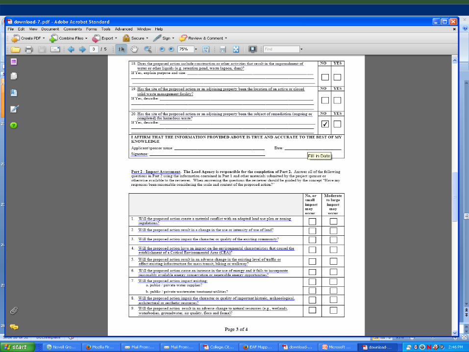
Revised EAFs
• EAFs, Workbooks & Mapper are on DECs website.
• Short EAF questions are now real assessments.
• Utilize Gate Keeper Questions

5
Revised EAFs
Short and Full EAFs Are:•Easy to find on our web site,•User Friendly, •Fill and Save PDFs, and•Take advantage of web-based tools.

6
Example of the Revised EAFSEAF, Part 1, Question 4
Check all land uses that occur, on, adjoining and near the proposed action?
Urban ? Rural (non-ag)? Industrial?
Commercial? Residential (Suburban)?
Forest? Agriculture?Aquatic?
Parkland? Other?
Workbook help in answering the questions!

7

8
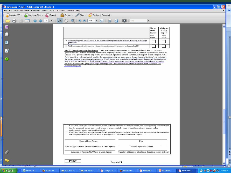
EAF Workbooks
• Workbooks are intended to:• Guide sponsors in preparing Part 1;• Guide lead agency in reviewing Parts 2 & 3.
• Workbooks provide links to spatial data (e.g., maps) and other sources of information.
• Workbooks make generous use of examples.

9
New EAF Mapper
• Provides public access to the DEC GIS• System will check over 50 spatial data sets and
fill in answers on the Short and Full EAFs• Serves as initial screening for resources,• EAFs can be saved and completed, and• System is designed to grow

10
New EAF Mapper
• 3 Step Process• Navigate to the project area by address or municipality• Locate specific site using ability to draw project or tax parcel • Select whether to use Short or Full EAF
• System will check spatial data sets and return populated, fill-able pdf including a data report.
• Save to local hard drive and complete rest of Part 1.

11
User Tips
• Recommended Browsers• IE 9 and above• Firefox, Safari & Chrome
• Allow “Pop-ups” on Browser
• Run EAF Mapper First• Save EAF to Local Drive

12
User Tips (Cont.)
• EAF Mapper Results are “Locked”.• Map Icon in Workbooks =
EAF Mapper Completed Questions.• EAF Mapper is not Designed for
Municipal-Wide Projects.• Expect Results in 3 Minutes or Less.

14

15

16

17

18

19

20

21

22

23

24
25
26

27

29

30

31
QUESTIONS?• Why were the SEQR Environmental Assessment Forms
(EAFs) changed?• Can the EAF Mapper be used for municipal wide projects
such as a comprehensive plan?• What if the Mapper report, which is “locked”, gives me
an answer I believe is not correct?• Is the EAF Mapper now the only way to initiate a SEQR
review?

32
QUESTIONS?• Some spatial data returns on the EAF Mapper were
discussed as being “buffered”. Why did DEC do this?• I entered my project onto the EAF Mapper, followed all
the instructions and requested a Short EAF report. It’s been over 10 minutes and I still don’t have a report. What might be the problem?

33
ADDITIONALQUESTIONS?

34
THANK YOU
Division of Environmental Permits625 Broadway
Albany, NY 12233-1750 (518) 402-9167
Agency Website: www.dec.ny.govDivision Email: [email protected]
Division SEQR Website: http://www.dec.ny.gov/permits/357.htmlEAFs and Mapper: http://www.dec.ny.gov/permits/6191.html