1. ELC and Landscape evaluationcityandeurope.unifi.it/upload/sub/voghera.pdf · 1. ELC and...
17
EVALUATION AND PLANNING By Angioletta Voghera 1. ELC and Landscape evaluation The landscape is a special focus of interest and innovation of spatial policies for the international community due to the strategies of the European Landscape Convention (ELC; CoE, 2000; CoE, 2008, CM/Rec(2008)3) in order to: - Analyse the landscape in an integrated and systemic perspective useful to outline the interrelation among ecological, natural, social-cultural, visual, economical and urban-settlements values; - Define methods to identify and assess the landscape aimed at guiding and verifying the territorial choices of conservation, restoration, enhancement and planning (Bailly, Raffestin, Reymond, 1980; Cosgrove, 1984; Oneto, 1987 and 1997) for reinforcing the identity (Coppola Pignatelli, 1992). The application of the ELC on the territory has produced a process of “Europeanization” of landscape policies (Börzel and Risse, 2000; Bulmer and Radaelli, 2004). This process is characterized by common characters and innovations that include establishing landscape as one of the foundations of identity and indicating landscape quality as the goal of spatial and sectorial planning on all governmental levels for physical, economic and social projects. The fundamental stages in this process leading to landscape action are (CoE, 2008, CM/Rec(2008)3): (i) Knowledge of the landscapes through identification, description and assessment; (ii) Definition of landscape quality objectives; (iii) Attainment of these objectives by protection, management and planning over a period of time (exceptional actions and measures and ordinary actions and measures); (iv) Monitoring of changes and evaluation of the effects of policies and possible redefinition of choices. In fact the promotion of landscape quality in plans and projects is based on evaluation for defining strategies and interventions. The landscape actions will concern the entire territory (excellent, ordinary or degraded) and will justify a gradation of policies (protection, management and planning and also creation of new landscapes). The evaluation activity is also strategic for integrating landscape dimension in all sectorial policies, considering effects and impacts and involving social actors (institutional and population) from the interpretation to the management and the implementation of landscape policies. In this activity a key role is played by the society directly related to the consideration of assessment as a learning process of the landscape as perceived by people, whose character is the result of the action and interaction of natural and/or human factors (ELC, art. 1). The evaluation of landscape identity values is based on populations (art.6c, ELC, 2000; Jones, 2007; Jones and Stenseke, 2011) aimed at valorizing and/or constructing new values, starting with participation of local municipalities (art.5 c, ELC, 2000). Local people and institutions are the ones that bring out the meanings attributed to places and are responsible for the intervention and management policies.
Transcript of 1. ELC and Landscape evaluationcityandeurope.unifi.it/upload/sub/voghera.pdf · 1. ELC and...

EVALUATION AND PLANNING
By Angioletta Voghera
1. ELC and Landscape evaluation
The landscape is a special focus of interest and innovation of spatial policies for the international community due to the strategies of the European Landscape Convention (ELC; CoE, 2000; CoE, 2008, CM/Rec(2008)3) in order to:
- Analyse the landscape in an integrated and systemic perspective useful to outline the interrelation among ecological, natural, social-cultural, visual, economical and urban-settlements values;
- Define methods to identify and assess the landscape aimed at guiding and verifying the territorial choices of conservation, restoration, enhancement and planning (Bailly, Raffestin, Reymond, 1980; Cosgrove, 1984; Oneto, 1987 and 1997) for reinforcing the identity (Coppola Pignatelli, 1992).
The application of the ELC on the territory has produced a process of “Europeanization” of landscape policies (Börzel and Risse, 2000; Bulmer and Radaelli, 2004). This process is characterized by common characters and innovations that include establishing landscape as one of the foundations of identity and indicating landscape quality as the goal of spatial and sectorial planning on all governmental levels for physical, economic and social projects.
The fundamental stages in this process leading to landscape action are (CoE, 2008, CM/Rec(2008)3):
(i) Knowledge of the landscapes through identification, description and assessment; (ii) Definition of landscape quality objectives; (iii) Attainment of these objectives by protection, management and planning over a period of time
(exceptional actions and measures and ordinary actions and measures); (iv) Monitoring of changes and evaluation of the effects of policies and possible redefinition of
choices.
In fact the promotion of landscape quality in plans and projects is based on evaluation for defining strategies and interventions. The landscape actions will concern the entire territory (excellent, ordinary or degraded) and will justify a gradation of policies (protection, management and planning and also creation of new landscapes). The evaluation activity is also strategic for integrating landscape dimension in all sectorial policies, considering effects and impacts and involving social actors (institutional and population) from the interpretation to the management and the implementation of landscape policies. In this activity a key role is played by the society directly related to the consideration of assessment as a learning process of the landscape as perceived by people, whose character is the result of the action and interaction of natural and/or human factors (ELC, art. 1).
The evaluation of landscape identity values is based on populations (art.6c, ELC, 2000; Jones, 2007; Jones and Stenseke, 2011) aimed at valorizing and/or constructing new values, starting with participation of local municipalities (art.5 c, ELC, 2000). Local people and institutions are the ones that bring out the meanings attributed to places and are responsible for the intervention and management policies.

2. Landscape Evaluation
The evaluation activity using formalized methods of assessment in its historical background is characterized by sectorial approaches. Since 1960s applicative experiences and qualitative and quantitative methods can be traced to landscape ecology, environmental psychology, humanistic tradition characterized by the reduction of the complexity of landscape to just one aspect (ecological, perceptive, historical, ...), judged by experts in a subjective way and rarely using indices.
Over the last decade many initiatives, international researches and policies have followed, stressing different aspects of European landscape (Antrop, 2006). Natural (Wascher, 2000), rural (Dramstad and Sogge 2003; Parris 2004; Claval 2004), multifunctional land use (Brandt and Vejre 2004; Mander and Antrop 2003), historical and archaeological (Fairclough and Rippon 2002; Van der Knaap, Van der Valk, 2006) issues has been addressed in many studies and researches, but a trans disciplinary consideration of landscape is caused by the ELC in order to evaluate and to define protection, management and planning policies for the heterogeneity and complexity changes and thus also processes and functions in the landscape.
In this direction the evaluation activity should be an argumentative and technical process within the decision making aimed at recognising values and selecting criteria for the landscape and spatial planning (Brunetta & Voghera, in Landscape Research, 33). In this view evaluation is a gradual learning process for policy making, useful as a form of communicative interaction between institutions and between institutions and citizens. Considering evaluation as a continuously evolving process, it is not only an exercise in analysis, but it is the “base” for the definition of shared policies and planning.
This activity of evaluation is the first step of ELC implementation and experimentations in international researches and in the different European countries. Many researches in Europe are developing methods for monitoring agricultural policies, urban landscape related to Agenda 21 or other initiatives referred to landscape observatories and atlases in the European countries, used to describe or to assess the landscape conditions of a certain environment.
This research activities evidences the different methods for evaluation and also for landscape planning. The relation among landscape description and definition of quality objectives and criteria for action is associated with the different landscape in Europe, the diverse landscape culture, the institutional and the regulatory systems of each country. In this different panorama of approaches the level of analysis and assessment offers interesting possibilities for cultural exchange and utilization also in the policies of international bodies, such as those in the agricultural sector.
Another aim for innovating evaluating approaches is the introduction, in a structural way, of assessment and monitoring activities. Dealing to European directives first introduced Environmental Impact Assessment (EIA, Directive 85/337/EEC) for interventions, and then Strategic Environmental Assessment (SEA, Directive 2001/42/EEC, EC 2001) for plans and programs with an effect on the environment and therefore for all territorial and landscape plans. They consider only some of the aspects of the landscape, such as the flora, the bio-climate, water, and its visual qualities. In fact in these assessment systems, the landscape is considered one of the environmental components subject to possible impacts and not a strategic element for social, economic and territorial development policies.
In the different ways for evaluating landscape for defining policies, interesting is the participative model referred to the Northern European approach that include society in landscape identification and evaluation
and in the definition of specific strategies and projects. Great Britain, Germany, Austria, The Netherlands have developed methods aimed at a systematic landscape knowledge for:
-Constructing uniform and stable databases and/or characterization maps about the national territory, using qualitative and quantitative approaches;
- Basing spatial planning and projects on evaluation activities for examining quality, condition and/or integrity of elements, processes, dynamics, pressures caused by development scenarios;
- Trying to include population to construct a common image of landscape and also shared strategies.
The “landscape, in other words the relation in terms of aesthetic sense and investment, does not exist unless the relation with natural space is perceived, interpreted and produced by a specific culture, which in turn is the recipient of an image” (Bonesio, 2007, page 24). The evaluation is a fundamental step for defining shared images of the landscape and also policies and interventions.
3. Experiences in Europe
The landscape identification and assessment are the first operations in the selection process to define landscape guidelines and projects.
Landscape assessment goes in this essential direction, and must be an argumentative process for the identification of positive and negative values for spatial planning and policies, to be created thanks to dialogue with the stakeholders and populations concerned (Brunetta and Voghera, 2008). The shared perception and representation of a landscape, through the social legitimation of values and criticalities, can only be guaranteed through a process of assessment. Despite the diffusion of good practices to identify landscapes (such as the International ECOVAST, and Austrian model), a clear methodology is required to define a structured program of actions for sustainability – starting from the legitimation of “values”.
The assessment of landscapes must become the tool on which decisions are made and for communicating quality goals of landscape and territorial planning (CoE, 2008, Recommendation for the implementation of the ELC). In this direction, the most consolidated experiences are represented by Landscape Atlases (Peano, 2009) or Landscape inventories set up years ago in many national contexts to identify landscapes on a vast scale (national or regional), through landscape units as in France, the Netherlands, Slovenia, France, Great Britain, Denmark and Germany. These methods of analysis attempt to integrate the objective and subjective descriptions associated with collective imagination and sensitivity for the places in question.
Jacobs (2002) on this subject mentions that there are two main approaches to research for the interpretation of landscape: “the descriptions in and of the landscape” (Tress B., Tress G., Fry, 2006, page 15). The first approach hails to the methods established by natural sciences from Descartes on, and makes a distinction between the subjective and objective dimension, separating the populations from the landscape as the context in which they live their daily life. The second “constructivist” approach is related to social sciences and acknowledges that landscape is constructed through daily interaction with society; this second approach puts greater focus on the values associated with the sphere of subjectivity such as sustainability, livability, beauty, utilization value and the potential value connected with possible future transformations.

The descriptive experiences, developed in European countries, are based too often on the first approach. In fact, we are still far from a real and effective involvement of the local social and economic stakeholders.
Furthermore, while these experiences appear to be effective in describing landscapes, they do not however represent the dynamics and trends associated with socioeconomic and territorial processes and are therefore all but ineffective for outlining prospects for action.
The most interesting methods have been developed in north European countries with a more consolidated landscape tradition. In Norway, Denmark, England and Wales there is widespread use of fact-finding GIS database systems to describe and distribute information on landscape as a “cultural environment”, which constitutes a spatially delimited area the characteristics of which depend on the society that created and continues to use and transform the same (Etting and Møller, 1997). These methods have a similar approach as they develop a repeatable system of analysis, consistent in the quantity of data and qualitative type assessments, characterized by the focus on the relations between the historical-cultural characters of the places and landscape from an ecological-environmental point of view (Møller, Stenak, 2006). There is need for greater integration with the planning tools used for the territory and landscape, and with those used to support the assessment processes (in particular the EIA).
Germany, Austria, Great Britain and the Netherlands base action for landscape on description and assessment. Guidelines and projects, coherent with the expectations for development of the socioeconomic stakeholders, are based on knowledge of the landscape. The result is landscape planning used as a concerted tool for the quality of landscapes. In these countries, the process of assessment is based on techniques that attribute judgments and degrees of value to the landscape units or ambits and – through the association of qualitative criteria and quantitative parameters – define strategies and interventions (Landscape and Historic Character Assessment in Great Britain, assessments on a Land scale for German landscape plans, Wardewolle Cultuurlandschap or the monitoring of perception and landscape appreciation in the Netherlands). Landscape guidelines are a strategic tool for the orientation of policies and projects in Great Britain, and are the source of the process of negotiations between public and private stakeholders to define common actions (such as the Village Design Statement, a community action used to interpret landscape with the eye of population and for the development of guidelines).
In Great Britain the evaluation subdivides the national territory into patterns (landscape units), recognizable and distinct in the colors and progressive numeration used. The patterns are then subject to further examination in the process of analysis (classification) at smaller scale (county or district) with character types being identified by combining the morphological, natural, perceptive, and economic and historic-settlement aspects, defined by experts direct survey and written description. The method used refers to national criteria: an initial phase of knowledge gathering and classification of the landscape unit known as landscape description, followed by a second phase of evaluation of the condition of the landscape and environmental structure known as landscape evaluation, and thirdly the knowledge acquired is used to define measures to safeguard, manage, and plan projects for the landscape known as landscape guidelines. The Landscape guidelines refer to planning at different scales and are a strategic instrument orienting the landscape transformations (Swanwick, 2002):
– conservation of areas of particular historic, landscape, or ecological importance in what is known as conservancy strategy;

– valorisation of degraded or abandoned landscapes in what is called enhancement strategy using restoration, reconstruction, and creation projects for new landscape forms that respond to functional and aesthetic needs.
Another interesting experimentation is the landscape appreciation index in the Netherlands that describes landscape values and quality considering the social actors and using the interpretation of the territorial quality for defining strategies. Developing a direct relation among evaluation and actions, the Landscape Agenda aims to enhance the landscape values and their appreciation (passing from the currently score of 7.3 out of 10 to 8.0 by 2020) and to achieve an attractive and varied landscape. Three tasks have been formulated in order to achieve this: careful use of space; a landscape of and for everyone; and sustainable funding of the landscape.
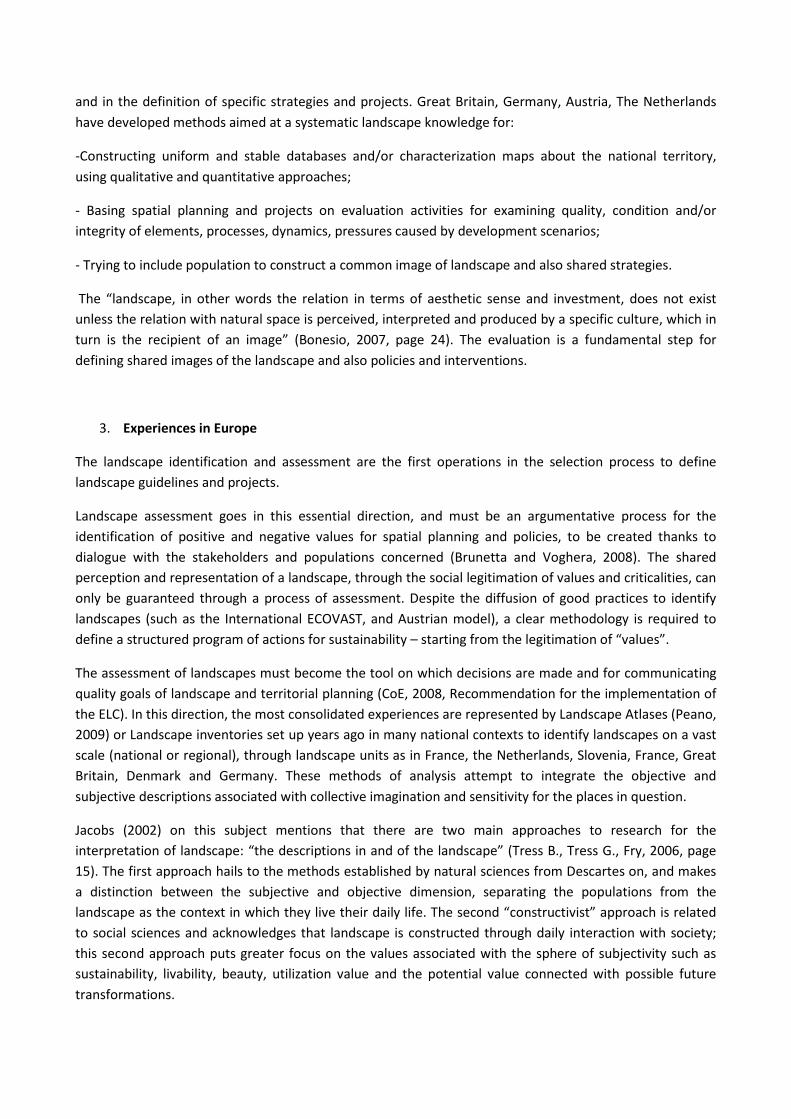
There are also interesting attempts at innovation in France. The Atlases and the Charte Paysagère interpret current landscapes characters, the dynamics of socio-economic and territorial transformation, the pressures to define operational indications, based on paysage directives (for the transformation of excellent landscapes) and the territory plans of government.
In Germany however, the contents of landscape planning, coordinated on all administrative levels with territorial programs and plans, are defined by a complex mechanism of inter-institutional cooperation and, on the local scale, with social participation. Landscape assessment at every level of planning develops in the following phases (Brunetta and Voghera, 2008): description of the characters and state of use; qualitative and quantitative definition of goals for protection and enhancement; assessment of the state of use in relation to the goals; establishing criteria for action.
From the construction of analytical and interpretative landscape tools, landscape planning provides a framework of planning, economic-managerial lines and indications for the enhancement of landscapes, which involve local subjects in actions of sustainability, defining a territory and landscape project for biodiversity, the use and mitigation of anthropic pressures.
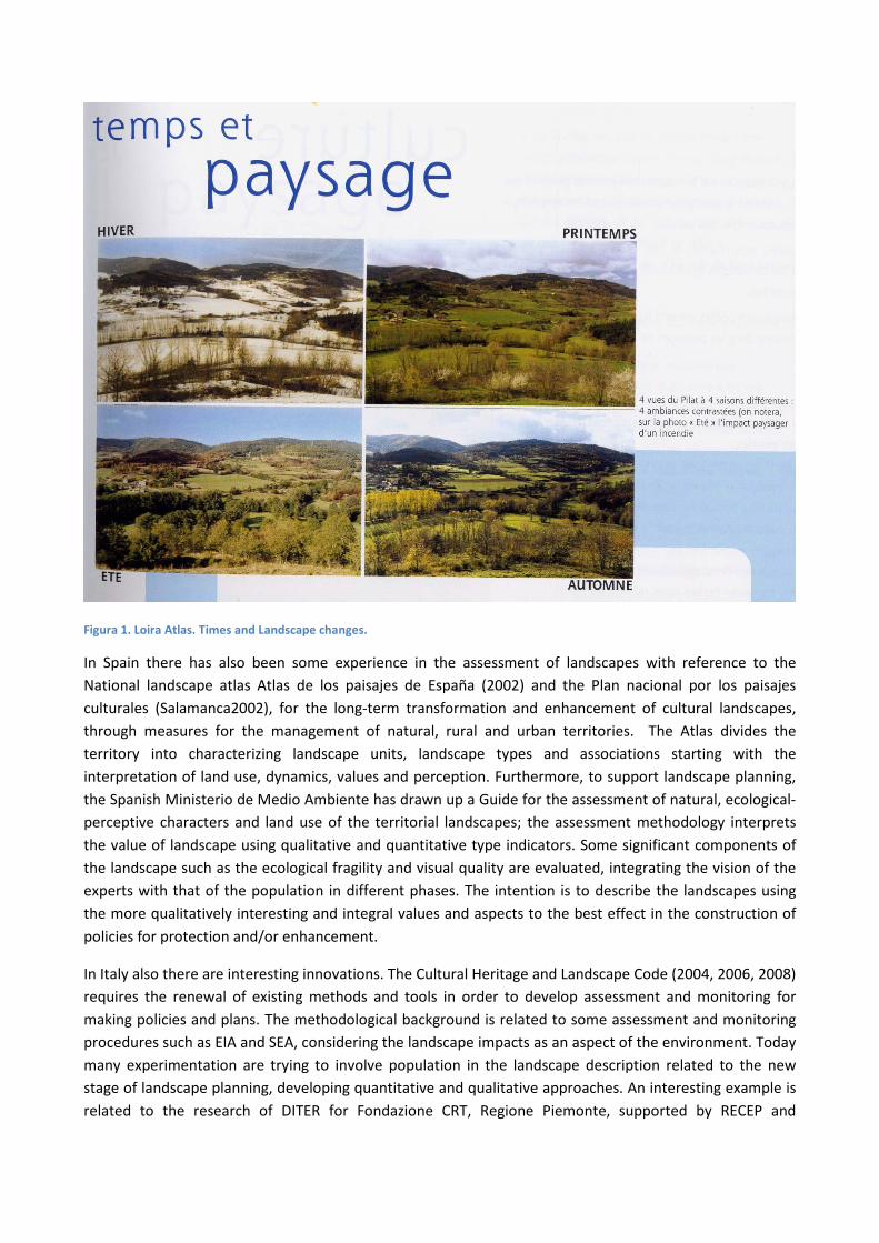
Figura 1. Loira Atlas. Times and Landscape changes.
In Spain there has also been some experience in the assessment of landscapes with reference to the National landscape atlas Atlas de los paisajes de España (2002) and the Plan nacional por los paisajes culturales (Salamanca2002), for the long-term transformation and enhancement of cultural landscapes, through measures for the management of natural, rural and urban territories. The Atlas divides the territory into characterizing landscape units, landscape types and associations starting with the interpretation of land use, dynamics, values and perception. Furthermore, to support landscape planning, the Spanish Ministerio de Medio Ambiente has drawn up a Guide for the assessment of natural, ecological-perceptive characters and land use of the territorial landscapes; the assessment methodology interprets the value of landscape using qualitative and quantitative type indicators. Some significant components of the landscape such as the ecological fragility and visual quality are evaluated, integrating the vision of the experts with that of the population in different phases. The intention is to describe the landscapes using the more qualitatively interesting and integral values and aspects to the best effect in the construction of policies for protection and/or enhancement.
In Italy also there are interesting innovations. The Cultural Heritage and Landscape Code (2004, 2006, 2008) requires the renewal of existing methods and tools in order to develop assessment and monitoring for making policies and plans. The methodological background is related to some assessment and monitoring procedures such as EIA and SEA, considering the landscape impacts as an aspect of the environment. Today many experimentation are trying to involve population in the landscape description related to the new stage of landscape planning, developing quantitative and qualitative approaches. An interesting example is related to the research of DITER for Fondazione CRT, Regione Piemonte, supported by RECEP and

coordinated by Attilia Peano, for defining tools and indicators for evaluating landscape quality aimed at policy making.

Figura 2. Landscape Character Assessment in United Kingdom.

4. Indicators for monitoring landscape quality related to land uses
An interesting Italian experience is the definition of landscape indicators for assessment and monitoring landscape quality (Cassatella, Peano, 2011). This research defines landscape indicators, recently used in the field of analysis and for the assessment of territorial transformation. These indicators, which derive from environmental more consolidated models, are a parameter associated with an environmental phenomenon, which can provide information on the state, or the variation in the state of a phenomenon which cannot be measured directly. Inspired by the European Landscape Convention, the research considers and analyses the landscape indicators on the basis of these profiles of interpretation: landscape ecology; historical-cultural heritage; visual and social perception; land use; territorial economy.
With important effects on landscape and spatial planning, a central function is played particularly by land use indicators, strategic to assess the condition of use and territorial processes, and the relevant landscape transformations, but also provide guidelines for strategies and programs aimed at the protection, management and innovation of landscape and interventions (Voghera, 2011). They are “denotative” indicators (Vallega, 2008) that let us interpret the forms and the tangible events of territorialization processes (Kušar and Černe 2006) in relation to the landscape for monitoring territorial and landscape conditions, with reference to the anthropic environment, assessing territorial policies and actions with repercussions on landscape, providing guidelines for territorial planning and sectorial actions.
Starting with the critical analysis of territorial use indicators and the study on the main national and international research methods for monitoring the sustainability of territory, environment and landscape. The following indicators have been defined in the critical review of European and national landscape policies, considering direct and indirect effects on the ecological and social-economic quality of the territory and environment:
1. land capacity to support transformations, establishes the capacity to support and respond to transformation processes on the long term for any kind of landscape, without significant effects or changes to the main characters and social-economic, cultural, ecological and perceptive values of the landscape;
2. land consumption, assesses and monitors the relationship between the artificial surfaces for types of land consumption and the total surfaces of reference in time, assessing the sustainability of territorial policies;
3. degraded landscapes and/or landscapes under pressure, interprets the negative values and the deficiencies in ecological and aesthetic quality, but also the pressures to which a certain territory is subject;
4. protected natural areas, calculates the surfaces of the territory classified in different national and international categories for the protection of nature and landscape, in relation to the surfaces of the territory subject to research to assess the ecological and aesthetic sustainability of the same, and interpret the awareness of institutions on the themes of nature and landscape;
5. rural areas, measures the number of rural areas in the territory, providing indications on sustainability, diversity and landscape attractiveness;
6. landscape protection, measures the relationship between the territory and the landscape subject to restrictions for the preservation of social-cultural, ecological, aesthetic and landscape values and the total surface of the territorial entity of reference;

7. ecological and landscape networks, assesses social and institutional awareness on sustainability, by measuring the amount of the territory used for interconnection between parks, Sites of Community Interest (SCI) and Special Protected Areas (SPA), and protected landscapes in relation to national/regional/provincial territory;
8. actions of valorisation, measures the number of landscape valorisation actions envisaged in planning documents on various territorial scales and implemented at a local scale;
9. effectiveness of the planning aims for the landscape, measures the operative effectiveness of the territorial planning and use policies with reference to landscape, assessing the number of specific actions envisaged and implemented by the plans on various scales;
10. sensibility of the planning aims for the landscape, assesses the focus on landscape of territorial planning and use policies, on the basis of the number of landscape valorisation actions envisaged in the plans on various scales.
As well as classifying the indicators—in relation to their role to highlight the basic factors that influence the territorial and landscape system, the direct cause of pressure, the current state, the effects of the impact, and the response of the social institutional system (Wascher 2004, 2005)—the critical analysis method considers the role of each indicator in the sustainability of territorial use and of the relevant transformations, expounding the ecological, aesthetic and social-economic components of the landscape quality it is related to.
INDICATORS SUSTAINABILITY ECOLOGICAL QUALITY AESTHETIC QUALITY
SOCIAL-ECONOMIC QUALITY
DRIVING FORCES land capability
X X X
PRESSURE
capacity to support transformations X X X X
land consumption X X X X
degraded landscapes – landscapes under pressure
X X X
STATE
protected natural areas X X X
rural area X X X X
landscape protection X X X X
ecological and landscape networks X X X X
IMPACT actions of valorisation X X X X
RESPONSE
effectiveness of the planning aims for the landscape
X X X X
sensibility of the planning aims for the landscape
X X X X
Figura 3. Land use indicators: DPSIR model and their contribution for sustainability.

Figura 4. Land use category of indicators (Voghera, 2011).
Of the indicators for monitoring and assessing landscape on the land use aspect, the following are proposed for applicative experimentation: land capability, the effectiveness of the planning aims for the landscape, the sensibility of the planning aims for the landscape, land consumption, degraded
landscapes—under pressure landscapes, protected natural areas, rural areas, landscape protection and
actions of valorisation. This choice is based on the following factors:
- the suitability of the indicator for monitoring and expressing elements, processes and values of interest in relation to the use of the territory and the effects of said use on landscape;
- the effectiveness of the indicator in the assessment of landscape, from a point of view of territorial use, identifying the modification of said use in space and time as a result of policies, interventions and projects for landscape transformation (state and process);
- the versatility of the indicator, which can be used to monitor and assess territorial and landscape transformations and processes in the implementation of the European Landscape Convention (regional and local), as well as in other fields of application such as technical-scientific analysis, environmental reporting, monitoring, strategic environmental evaluations or environmental impact, in territorial and landscape planning;

- the applicability of the indicator, which depends on the basic availability of source data in existing international and regional databases, and the possibility of presenting the information in thematic maps, geo-referenced maps and temporal diagrams, also for the non-expert public.
- the results obtained with the indicator in other national and international research and experimentation contexts on the field.
4. Assessing and monitoring landscape
Today it is needed a new vision in landscape evaluation, starting to the North European approaches, in order to overcome the actual consideration of landscape as one of the environmental components subject to possible impact (especially associated with urban or agricultural policies in EU).
Using quantitative or qualitative methods, evaluation must be in the form of an argumentative process as a learning support to the policy-making to make explicit the values and the selection criteria for identifying planning aims to develop landscape quality.
In this view landscape values depend on evaluation methods, which is not a neutral tool and participation and inter-institutional cooperation become the strategic part of a learning process through which the community comes to recognize local quality and collaborate to the definition of planning actions.
This evaluation process at every turn is starting with the choice of methods, tools and indicators. Ending with the definition of criteria and weighting of each indicator in relation to the others, political decisions must be taken. In this decision process and important role could also be played by social actors.
The assessment becomes crucial in order to direct and frame the debate over the choices to be made about landscape enhancement in public debates. The process of identification can constitute a frame of reference that can prompt the parties to exchange their opinions in order to clarify and organize the issues at stake and the choices of options for landscape enhancement and management.
Assessment should become a technical process that advances through the public arena, consolidating the sense of belonging, helping to outline scenarios of potential actions, protecting public institutions through broadening the opportunities of all the parties involved and through recognizing the crucial importance of the parties’ acknowledgement of their reasoning and identities.
The social construction of decisions would become the products of interactions among the various stakeholders, public and private. The inter-institutional participation and cooperation can become part of a learning process through which society can recognize landscape identity that give motivation and involvement to people for acting in landscape enhancement.
Acting in landscape with society from the evaluation of the quality and the identification of identity values is the aim of the European Landscape Convention.

References:
Alexander, E. R. (Ed.) (2006): Evaluation in planning: (Aldershot: Ashgate.
Antrop M. (2006) “From holistic landscape synthesis to transdisciplinary landscape management”.
Bailly, A., Raffestin, C., Reymond, H. (1980): ‘Les concepts du paysage : problématique et représentations’. L’Espace géographique, IX (4) : 277-286.
Berque A. (1995) Les raisons du paysage. De la Chine antique aux environnements de synthèse. Hazan, Paris.
Bonesio L. (2007) Paesaggio identità e comunità tra locale e globale. Edizioni Diabasis. Reggio Emilia.
Börzel T. and Risse T. (2000) “When Europe hits home: Europeanisation and Domestic Change”. European Integration online Papers (Eiop), 4(15), http://eiop.or.at/eiop/texte/2000-015a.htm.
Börzel T. and Risse T. (2000) “When Europe hits home: Europeanisation and Domestic Change”. European Integration online Papers (Eiop), 4(15), http://eiop.or.at/eiop/texte/2000-015a.htm.
Brandt, J. and Vejre H. (2004) “Multifunctional landscapes, motives, concepts and perceptions”.
Brandt, J. and Vejre, H. (eds.), Multifunctional landscapes. Vol. 1. Theory, values and history, WIT Book Press. Southamptom.
Brunetta G. and Voghera A. (2008) “Evaluating Landscape for Shared Values: Tools, Principles, and Methods”. Landscape Research, 33(1), 71 - 87.
Brunetta, G. & Voghera, A. (2007): 'Per una metodologia di valutazione dei paesaggi' [A methodology for the landscape evaluation]. Archivio di Studi Urbani e Regionali: 88 (XXXVIII): 15-33.
Brunetta, G. (2006): ‘Valutazione e pianificazione. Verso l’integrazione?’ [Evaluation and Planning. Towards the integration?]. Italian Journal of Regional Science, 5 (3): 119-126.
Brunetta, G. and Peano, A. (Eds.) (2003): Valutazione ambientale strategica. Aspetti metodologici, procedurali e criticità [Strategic Environmental Assessment in Spatial Planning. Methodologies, procedures and weaknesses]. Milan: IlSole24ore.
Brunetta, G. and Voghera, A. (2008): 'Evaluating Landscape for Shared Values: Tools, Principles, and Methods'. Landscape Research. 33:1:71 – 87.
Bulmer S.J. and Radaelli C. M. (2004) The Europeanisation of National Policy?. Institute of European Studies. Queen’s University of Belfast. Belfast.
Bulmer S.J. and Radaelli C. M. (2004) The Europeanisation of National Policy?. Institute of European Studies. Queen’s University of Belfast. Belfast.
Cassatella C., Peano A. (2011) (eds), Landscape Indicators. Assessing and Monitoring Landscape Quality, Springer, pp. 141-165.
CoE (1985) European Charter of Local Self-Governament, Strasbourg.
CoE (2000) European Landscape Convention. Florence.

CoE (2000): European Landscape Convention. Florence.
CoE (2006) Landscape and sustainable development: challenges of the European Landscape Convention. Editions du Conseil de l’Europe. Strasbourg.
CoE (2008) Recommendation No R (2008) 3 on the guidelines for the implementation of the European Landscape Convention adopted by the Committee of Ministers on 6 February 2008, Strasbourg.
CoE (2008): Recommendation CM/Rec(2008)3 of the Committee of Ministers to member states on the guidelines for the implementation of the European Landscape Convention.
CoE (2010) Synthesis of The Received Information Concerning Summary Descriptive Note on The Landscape Policies Pursued in the Council of Europe Member States.
Coeterier J.F. (2000) Landschapsbeleving; toepassing van de meetmethoden landschapsbeleving in vier gebieden in Nederland. Wageningen University & Research Centre.
Communication Com (2001) Sixth Environment Action Programme of the European Community, “Environment 2010: Our future, Our choice”. n. 31 final.
Communication Com (2007) Mid-term review of the Sixth Community Environment Action Programme. n. 225 final.
Coppola Pignatelli, P. (1992) L’identità come processo [Identity as a process]. Rome: Officina.
Cosgrove, D. (1984): Social Formation and Symbolic Landscape. London: Croom Helm.
Countryside Commission (1987) Landscape Assessment – a Countryside Commission Approach. CCD 18. Countryside Commission, Cheltenham.
Countryside Commission (1996) Village Design. Making local character count in new development. CCP 501. Countryside Commission, Cheltenham.
Etting V. e Møller P. G. (eds.) (1997) De kulturhistoriske interesser I landskabet. The Danish Forest and nature Agency, Ministry of Environment.
Fairclough G. and Rippon S. (eds.) (2002) Europe’s cultural landscape: archaeologists and the management of changes, EAC Occasional Paper no. 2, EAC, Brussels.
Farjon H. (2007) “Monitoring Program of perception and valuation of landscape changes in the Netherlands”. Landscape Indicators. Challenges and Perspectives, Barcellona, 29-30 november.
Gangemi Editore.Swanwick C. (coord.) (2002) “Judging Capacity and Sensitivity”, in Landscape Character Assessment Guidance for England and Scotland, The Countryside Agency.
Gorgeu, Y., Jenkins, C. (edit.) (1995) : La charte paysagère outil d’aménagement de l’espace intercommunal. Paris : La Documentation Francaise.
Habermas J. (1984) The theory of communicative action I: reason and the rationalization of society, Heinemann, London.
Higuchi, T. (1989): The visual and spatial structure of landscapes. Cambridge (USA): The MIT Press.

Innes J., Booher D. (1999) “Consensus Building and Complex Adaptive Systems A Framework for Evaluating Collaborative Planning”. Journal of the American Planning Association, 65(4) December 1999, pp. 412 - 423.
Jackson J.B. (2003) A’ la découverte du paysage vernaculaire. Actes Sud, Arles.
Jacobs M.H. (2002) Landschap 3: het ware, juiste en waarachtige landschap. Alterra, Wageningen.
Jacobs M.H. (2006) The production of mindscapes: a comprehensive theory of landscape experience. PhD Thesis published at Wageningen University.
Jakle J. (1987) The visual elements of landscape, The University of Massachusetts Press, Amherst.
Jones M and Stenseke M, (2011) The European Landscape Convention. The Issue of Public Participation in the European Landscape Convention, Landscape Series, Volume 13.
Jones M, Howard P, Olwig KR, Primdahl O. & Sarlöv Herlin I. (2007) Multiple interfaces of the European Landscape Convention. Norsk Geografisk Tidsskrift - Norwegian Journal of Geography. Volume 61/4.
Jones M. (2007) The European Landscape Convention and the question of public participation, Landscape Research, n.32/5.
Jones M., Howard P., Olwig K. R., Primdahl J. & Sarlöv Herlin I. (2007) “Multiple interfaces of the European Landscape Convention”. Norsk Geografisk Tidsskrift - Norwegian Journal of Geography, 61(4), pp. 207-216.
Kaplan R., Kaplan S., Brown T. (1989), “Environmental Preferences. a Comparison of Four Domains of Predictors", in Environment & Behavior, 5 (XXI): 509-530.
Knill C., Lehmkuhl D. (1999) “How Europe Matters. Different Mechanisms of Europeanization”. European Integration Online Papers (EioP), Vol. 3, n. 7, http://eiop.or.at/eiop/texte/1999-007a.htm.
Kušar S, Černe A (2006) Regional, spatial and environment.al indicators for an assessment of regional development, structure and potentials. Razprave, Dela, 26
LNV (2006) Agenda for a living countryside 2007-2013, Den Haag.
Lovell, S. T. and D. M. Johnston. (2009) Designing landscapes for performance based on emerging principles in landscape ecology. Ecology and Society 14(1).
Mander Ü. and Antrop M. (2003) Multifunctional landscapes, vol. 3. Continuity and change, Advances in ecological sciences. vol. 16, WIT, Southampton.
Møller P. G., Stenak M. (2006) “Mapping Historical Landscapes and Environments – Morfology or Function?”. Van der Knaap, Van der Valk A., Multiple Landscape. Merging Past and Present (eds.). Ponsen & Looijen, Wageningen.
Nadin Y. (2007) The emergence of the spatial planning approach in England. Planning Practice and Research, 22(1), 2007.
Oneto, G. (1987): Valutazione di impatto sul paesaggio [Landscape Impact Evaluation]. Milan: Ed. Pirola.
Oneto, G. (1997): Manuale di pianificazione del paesaggio [Landscape Planning Handbook]. Milan: Il Sole 24 Ore.

Parris, K. (2004) “Measuring changes in agricultural landscapes as a tool for policy makers”. Brandt, J. and Vejre, H. (eds.). Multifunctional landscapes, vol. 1. Theory, values and history, pp. 193-218. Advances in ecological sciences, vol. 14, WIT, Southampton.
Peano A. (2009) “Atlanti del paesaggio in Europa”. Urbanistica, vol. 138, pp. 7-9.
Pedrazzini L. (2005) Applying the ESDP through interreg IIIB: a southern perspective, European Planning Studies, Volume 13, Issue 2, 2005.
Pesci E. (2004) La terra parlante. Dai paesaggi originari ai non-luoghi alpestri. CDA&Vivalda Editore, Torino.
Porter R., & Teich M. (Ed.), (1988). Romanticism in National Context, Hardback.
Potter C. and Tilzey M. (2005) “Agricultural policy discourses in the European post-Fordist transition: Neoliberalism, neomercantilism and multifunctionality”. Progress in Human Geography, 29(5), pp. 581–600.
Prieur M. (2004) “L’intégration du paysage dans les politiques et programmes internationaux et les paysages transfrontaliers”. Conférence de la Convention Européenne du Paysage à l’occasion de son entrée en vigueur, Editions Conseil de l’Europe, Strasbourg.
Raffestin C. (2005) Dalla nostalgia del territorio al desiderio di paesaggio. Alinea, Firenze.
Roe M. (2010) “Policy Change and ELC Implementation: Estabilishment of a basiline for Understanding the Impact of The European Landscape Convention in the UK”. LIVING LANDSCAPE The European Landscape Convention in research perspective, vol. I, pp.371-385. Bandecchi&Vivaldi Editori.
Roe M., Jones C. and Mell I. C. (2008) Research to Support the Implementation of the European Landscape Convention in England. Contract No. PYT02/10/1.16 Final Report, Natural England.
Röhring A (2011) Cultural landscape as action arena – an identity-based concept of region-building. Regional Studies Association Annual International Conference 2011.
Scazzosi L. (ed.), (1999). Politiche e culture del paesaggio. Esperienze internazionali a confronto, Roma
Stanners and Bourdeau (1995) Europe’s environment: the Dobrìs assessment. European Environment Agency. Luxembourg. Environmental Assessment Report no. 1. [http://reports.eea.eu.int/92-826-5409-5/en/tab_content_RLR].
Tress B. and Tress G. (2003) Scenario visualisation for participatory landscape planning – A study from Denmark. Landscape and Urban Planning, 64: 161–178.
Tress B., Tress G., Fry G. (2006) “Defining concept and the project of knowledge production in integrative research”. Tress B., Tress G., Fry G., Opdam P. (eds.), From Landscape Research to Landscape Planning. Aspect of integration, Education and Application, Springer, Dordrecht, pp. 13-26.
Tress B., Tress G., Fry G., Opdam P.(edited by). From Landscape Research to Landscape Planning. Aspects of Integration, Education and Application. Wageningen UR Frontis Series, Vol. 12, Springer, Dordrecht.
Turri E. (2006) Il paesaggio come teatro. Dal territorio vissuto al territorio rappresentato, Marsilio, Venezia.
UNECE (1998) Aarhus Convention. Convention on Access to Information. Public Participation in Decision-making and Access to Justice in Environmental Matters, Aarhus.
UNESCO (2005) Vienna Memorandum (Managing the Historic Urban Landscape), World Heritage Convention, Durban.
Vallega A (2008) Gli indicatori per il paesaggio. Angeli, Milan.
Van der Knaap, Van der Valk A. (eds.) (20069 Multiple Landscape. Merging Past and Present, Ponsen & Looijen, Wageningen.
Venturi Ferriolo M. (2003) Etiche del paesaggio. Il progetto del mondo umano. Editori riuniti, Roma.
Voghera A. (2004) “Sustainability in territorial management. A European comparison”. Scienze Regionali Italian Journal of Regional Science, n. 1, pp. 109-142.
Voghera A. (2006) Culture europee di sostenibilità. Storie e innovazioni nella pianificazione. Gangemi editore, Roma, pp. 159.
Voghera A. (2011) “Land Use Indicators for Landscape Assessment”, in Cassatella C., Peano A. (eds), Landscape Indicators. Assessing and Monitoring Landscape Quality, Springer, pp. 141-165.
Wascher DM (2004) Landscape-indicator development: steps towards a European approach. In: Jongman R (ed) The new dimensions of the European landscape. Springer, Dordrecht
Wascher DM (eds) (2005) European landscape character areas. Typologies, cartography and indicators for the assessment of sustainable landscapes. Alterra Wageningen UR, Wageningen, The Netherlands. Alterra Report No. 1254/December 2005.