02.07.13 Planning Commission Agenda - City of Covington · PLANNING COMMISSION AGENDA February 7,...
19
City of Covington Unmatched Quality of Life. City of Covington 16720 SE 271 st Street, Suite 100 • Covington, WA 98042 • (253) 480-2400 • Fax: (253) 480-2401 The City of Covington is a place where community, business, and civic leaders work together with citizens to preserve and foster a strong sense of community. PLANNING COMMISSION AGENDA February 7, 2013 6:30 PM CALL TO ORDER ROLL CALL Chair Daniel Key, Vice Chair Paul Max, Sonia Foss, Ed Holmes, Bill Judd, Sean Smith, & Alex White. PLEDGE OF ALLEGIANCE APPROVAL OF CONSENT AGENDA 1. Planning Commission Minutes for November 15, 2012. CITIZEN COMMENTS - Note: The Citizen Comment period is to provide the opportunity for members of the audience to address the Commission on items either not on the agenda or not listed as a Public Hearing. The Chair will open this portion of the meeting and ask for a show of hands of those persons wishing to address the Commission. When recognized, please approach the podium, give your name and city of residence, and state the matter of your interest. If your interest is an Agenda Item, the Chair may suggest that your comments wait until that time. Citizen comments will be limited to four minutes for Citizen Comments and four minutes for Unfinished Business. If you require more than the allotted time, your item will be placed on the next agenda. If you anticipate, in advance, your comments taking longer than the allotted time, you are encouraged to contact the Planning Department ten days in advance of the meeting so that your item may be placed on the next available agenda. PUBLIC HEARING – None UNFINISHED BUSINESS – None NEW BUSINESS – 1. Discussion of Northern Gateway Area Study Scope of Work for Hawk Gravel Pit (See Attachments 1-5) (NO ACTION TAKEN) 2. Discussion of 2013 Comprehensive Plan Amendment Docket Items (NO ACTION TAKEN) 3. Discussion of Potential Zoning Code Amendment to Add Developer’s Agreement Option in the Town Center Zone (See Attachments 6) (NO ACTION TAKEN) ATTENDANCE VOTE PUBLIC COMMENT: (Same rules apply as stated in the 1 st CITIZEN COMMENTS) COMMENTS AND COMMUNICATIONS OF COMMISSIONERS AND STAFF ADJOURN Any person requiring a disability accommodation should contact the City at least 24 hours in advance. For TDD relay service please use the state’s toll-free relay service (800) 833-6384 and ask the operator to dial (253) 480-2400 Web Page: www.covingtonwa.gov
-
Upload
vuongthien -
Category
Documents
-
view
214 -
download
0
Transcript of 02.07.13 Planning Commission Agenda - City of Covington · PLANNING COMMISSION AGENDA February 7,...

City of Covington Unmatched Quality of Life.
City of Covington 16720 SE 271st Street, Suite 100 • Covington, WA 98042 • (253) 480-2400 • Fax: (253) 480-2401
The City of Covington is a place where community, business, and civic leaders work together with citizens
to preserve and foster a strong sense of community.
PLANNING COMMISSION AGENDA February 7, 2013
6:30 PM CALL TO ORDER
ROLL CALL Chair Daniel Key, Vice Chair Paul Max, Sonia Foss, Ed Holmes, Bill Judd, Sean Smith, & Alex White.
PLEDGE OF ALLEGIANCE APPROVAL OF CONSENT AGENDA
1. Planning Commission Minutes for November 15, 2012.
CITIZEN COMMENTS - Note: The Citizen Comment period is to provide the opportunity for members of the audience to address the Commission on items either not on the agenda or not listed as a Public Hearing. The Chair will open this portion of the meeting and ask for a show of hands of those persons wishing to address the Commission. When recognized, please approach the podium, give your name and city of residence, and state the matter of your interest. If your interest is an Agenda Item, the Chair may suggest that your comments wait until that time. Citizen comments will be limited to four minutes for Citizen Comments and four minutes for Unfinished Business. If you require more than the allotted time, your item will be placed on the next agenda. If you anticipate, in advance, your comments taking longer than the allotted time, you are encouraged to contact the Planning Department ten days in advance of the meeting so that your item may be placed on the next available agenda.
PUBLIC HEARING – None UNFINISHED BUSINESS – None
NEW BUSINESS –
1. Discussion of Northern Gateway Area Study Scope of Work for Hawk Gravel Pit (See Attachments 1-5) (NO ACTION TAKEN)
2. Discussion of 2013 Comprehensive Plan Amendment Docket Items (NO ACTION TAKEN) 3. Discussion of Potential Zoning Code Amendment to Add Developer’s Agreement Option in
the Town Center Zone (See Attachments 6) (NO ACTION TAKEN) ATTENDANCE VOTE PUBLIC COMMENT: (Same rules apply as stated in the 1st CITIZEN COMMENTS) COMMENTS AND COMMUNICATIONS OF COMMISSIONERS AND STAFF ADJOURN
Any person requiring a disability accommodation should contact the City at least 24 hours in advance.
For TDD relay service please use the state’s toll-free relay service (800) 833-6384 and ask the operator to dial (253) 480-2400 Web Page: www.covingtonwa.gov
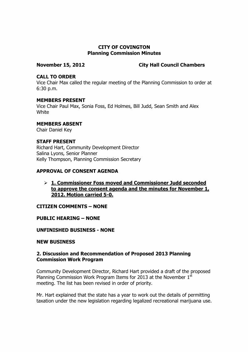
CITY OF COVINGTON Planning Commission Minutes
November 15, 2012 City Hall Council Chambers CALL TO ORDER Vice Chair Max called the regular meeting of the Planning Commission to order at 6:30 p.m. MEMBERS PRESENT Vice Chair Paul Max, Sonia Foss, Ed Holmes, Bill Judd, Sean Smith and Alex White MEMBERS ABSENT Chair Daniel Key STAFF PRESENT Richard Hart, Community Development Director Salina Lyons, Senior Planner Kelly Thompson, Planning Commission Secretary APPROVAL OF CONSENT AGENDA
� 1. Commissioner Foss moved and Commissioner Judd seconded to approve the consent agenda and the minutes for November 1, 2012. Motion carried 5-0.
CITIZEN COMMENTS – NONE PUBLIC HEARING – NONE UNFINISHED BUSINESS - NONE NEW BUSINESS 2. Discussion and Recommendation of Proposed 2013 Planning Commission Work Program Community Development Director, Richard Hart provided a draft of the proposed Planning Commission Work Program Items for 2013 at the November 1st
meeting. The list has been revised in order of priority. Mr. Hart explained that the state has a year to work out the details of permitting taxation under the new legislation regarding legalized recreational marijuana use.

Items 1-5 of Attachment A of the proposed Planning Commission Work Program are legal requirements or city council directives. A study session with the city council has been set for Tuesday, January 8, 2013. The record is noted to show that Alex White arrived at 6:37. Commissioner Foss inquired about the Northern Gateway Study. Mr. Hart explained that the City was unsuccessful in getting the County to adjust the UGA boundaries for “Northern Notch” portion of the Northern Gateway. It is unknown whether the county will revisit the issue in the next year or two, or wait until the next 4 year cycle. Staff is hoping to get started on phase II of the Northern Gateway study for the Hawk gravel pit in the first part of next year. There will be extensive public involvement and the Planning Commission will be involved with hearings, discussions and public meetings. The Planning Commission reached consensus on the order of the 2013 Work Program Items:
1. Comprehensive Plan and Development Regulation Docket for 2013
2. Northern Gateway Study Project Management, Subarea Plan Preparation and Public Process
3. Shoreline Development Regulation codification in CMC with Standards and Permit Process
4. Sign Code Changes for Civic, Government and Non-Profit Signs 5. Medical Marijuana, Collective Gardens and Dispensary
Moratorium Extension/Code Changes 6. Preliminary Work on GMA Required 2015 Comprehensive Plan
Update 7. SEPA Threshold Changes – Increasing the Number of Lots in a
Preliminary Plat 8. Clearing and Grading Ordinance Changes 9. Revision of Definition Sections in Zoning Code – Title 14 & 18 10. Fire Impact Fee Changes Working with Kent Regional Fire
Authority
� Commissioner Smith moved and Commissioner Holmes seconded to approve the 2013 Planning Commission Work Program. Motion carried 6-0.
ATTENDANCE VOTE –
� Commissioner Judd moved and Commissioner Foss seconded to excuse Chair Key. Motion carried 6-0.
PUBLIC COMMENT- NONE COMMENTS AND COMMUNICATIONS FROM STAFF Mr. Hart shared that this is the last Planning Commission for the year and we will be back the 1st Thursday in January 4th, 2013. ADJOURN The November 15, 2012 Planning Commission Meeting adjourned at 6:51 p.m. Respectfully submitted,
_____________________________________________
Kelly Thompson, Planning Commission Secretary

SE 256TH ST
180T
H AV
E SE
SE 261ST ST
SE 262ND PL
191S
T PL S
E
200T
H AV
E SE
173R
D AV
E SE
SE 244TH ST
193R
D PL
SE
SE 244TH PL
FRONTAGE RD
SE 262ND ST
SE 246TH ST17
7TH
PL S
E
SE 259TH ST
SE 260TH ST
185T
H PL S
E
186TH PL SE
184T
H AV
E SE18
3RD
AVE S
E
175T
H WA
Y SE
SE 247TH ST
199T
H AVE
SE
SE 257TH ST
179T
H PL
SE
176T
H AV
E SE
176T
H PL
SE
SE 260TH PL
SE 18
4TH
PL
SE 259TH PL
183R
D PL
SE
195T
H PL S
E
192N
D PL
SE
184T
H PL S
E
SE 263R
D PL
192N
D AV
E SE
196T
H AV
E SE
178T
H PL
SE
175TH PL SE
181S
T PL S
E
208T
H AV
E SE
197T
H AV
E SE
185TH LOOP SE
196T
H PL
SE
SE 245TH PL
SE 246TH PL
SE 247TH PL
SE TIMBERLANE BLVD
SE 241ST PL
SE 261ST CT
202N
D AVE
SE
SE 261ST PL
193R
D AV
E SE
SE 243RD ST
190T
H PL
SE
SE 263RD CT
183RD CT SE
187 T
H PL S
E
SE 258TH PL
SE 242ND ST
SE 241ST ST
201S
T CT S
E
180T
H PL
SE
187TH CT SE
SE 244TH LN
SE 245TH CT
201S
T PL S
E
SE 264TH ST
SE WAX RD
SE 260TH PL
190T
H PL
SE176T
H AV
E SE
SE 260TH PL
201ST AVE SE
184T
H PL
SE
SE 258TH ST
SE 262ND ST
SE 263RD ST SE 264TH ST
SE 260TH ST
SE 262ND ST
188TH AVE SE
SR 18
184T
H AV
E SE
SE 260TH ST
SE 259TH PL
SE 259TH ST
SE 257TH ST
SE 259TH PL
SE 263RD ST
185T
H PL
SE
189T
H AV
E SE
SE 258TH STSE 258TH ST
SE 259TH PLSE 260TH ST
206T
H AV
E SE
196T
H AVE
SE
SE 262ND ST
SE 261ST PL
188T
H AV
E SE
SE 261ST ST
175T
H AV
E SE
193R
D PL
SESE 262ND ST
SE 244TH PL
SE 243RD ST
185T
H PL
SE
183R
D AVE
SE
172ND AVE SE
SE 260TH PL19
2ND
PL S
E
203R
D AVE
SE
189T
H PL
SE
174T
H AVE
SE
SE 260TH CT
198TH PL SE
SE 263RD ST
SE 263RD PL
174TH PL SE
185TH AVE SE
SE 261ST CT
SE TIMBERLANE BLVD
SE 260TH ST
180T
H AV
E SE
.1 inch = 700 feet
Northern Gateway Annexation Area
Created By: Shawn Buck 1/12/2012
Sub-Area Plan Study Boundary
City Limits
Streams/Creeks
Surface Water
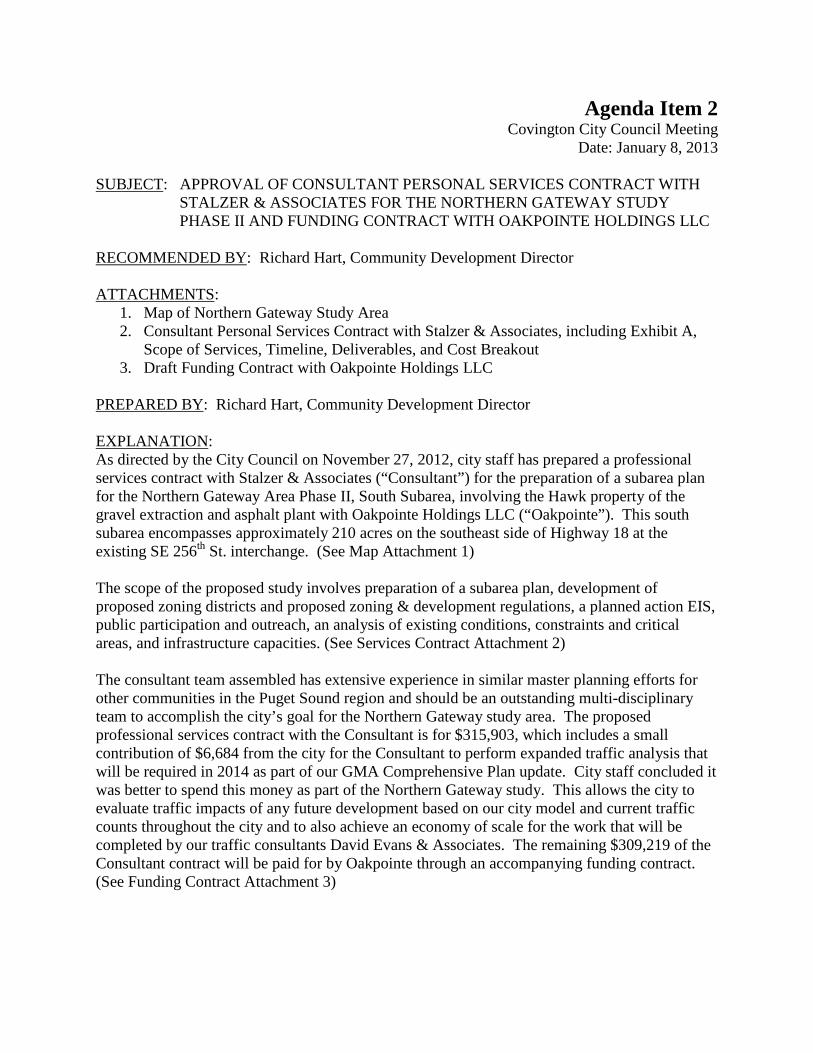
Agenda Item 2 Covington City Council Meeting Date: January 8, 2013 SUBJECT: APPROVAL OF CONSULTANT PERSONAL SERVICES CONTRACT WITH
STALZER & ASSOCIATES FOR THE NORTHERN GATEWAY STUDY PHASE II AND FUNDING CONTRACT WITH OAKPOINTE HOLDINGS LLC
RECOMMENDED BY: Richard Hart, Community Development Director ATTACHMENTS:
1. Map of Northern Gateway Study Area 2. Consultant Personal Services Contract with Stalzer & Associates, including Exhibit A,
Scope of Services, Timeline, Deliverables, and Cost Breakout 3. Draft Funding Contract with Oakpointe Holdings LLC
PREPARED BY: Richard Hart, Community Development Director EXPLANATION: As directed by the City Council on November 27, 2012, city staff has prepared a professional services contract with Stalzer & Associates (“Consultant”) for the preparation of a subarea plan for the Northern Gateway Area Phase II, South Subarea, involving the Hawk property of the gravel extraction and asphalt plant with Oakpointe Holdings LLC (“Oakpointe”). This south subarea encompasses approximately 210 acres on the southeast side of Highway 18 at the existing SE 256th St. interchange. (See Map Attachment 1) The scope of the proposed study involves preparation of a subarea plan, development of proposed zoning districts and proposed zoning & development regulations, a planned action EIS, public participation and outreach, an analysis of existing conditions, constraints and critical areas, and infrastructure capacities. (See Services Contract Attachment 2) The consultant team assembled has extensive experience in similar master planning efforts for other communities in the Puget Sound region and should be an outstanding multi-disciplinary team to accomplish the city’s goal for the Northern Gateway study area. The proposed professional services contract with the Consultant is for $315,903, which includes a small contribution of $6,684 from the city for the Consultant to perform expanded traffic analysis that will be required in 2014 as part of our GMA Comprehensive Plan update. City staff concluded it was better to spend this money as part of the Northern Gateway study. This allows the city to evaluate traffic impacts of any future development based on our city model and current traffic counts throughout the city and to also achieve an economy of scale for the work that will be completed by our traffic consultants David Evans & Associates. The remaining $309,219 of the Consultant contract will be paid for by Oakpointe through an accompanying funding contract. (See Funding Contract Attachment 3)

City staff seeks Council review and approval of the professional services contract with the Consultant to complete Phase II of the Northern Gateway area study. The timetable for completion of Phase II is approximately twelve months with the final report submitted to the city council for review by December 31, 2013. The repayment to the city of contract funds by Oakpointe is spread over eighteen months, through June, 2014, with Oakpointe paying an appropriate interest rate and administrative costs for payment made beyond the twelve month performance period of the contract. This interest rate will be the current rate of the Local Government Investment Pool (LGIP) Gross Earnings Rate at the time of billing each month, plus 6.0% of the amount delayed for payment beyond the twelve month performance period, to cover city administrative costs. Currently the LGIP rate is .18%, but it fluctuates month to month. ALTERNATIVES:
1. Request additional information or input from staff on recommended consultant scope of work, time schedules, and/or funding costs and sources.
FISCAL IMPACT: The city is contributing $6,684 for the Consultant to conduct an expanded transportation analysis as part of this contract. Funds for this expanded transportation analysis will come from the professional services line item in the Community Development Department. The remaining $309,219 will be paid for by Oakpointe. Oakpointe has requested that their repayment to the city for the costs of the contract be spread over eighteen months rather than twelve months of the contract performance. The City is recommending that Oakpointe be allowed to repay a portion of the contract funds during the following year in 2014, with Oakpointe being charged an appropriate interest rate and administrative costs for amounts paid beyond the twelve month performance period of the contract. CITY COUNCIL ACTION: _____Ordinance Resolution __X____Motion Other
Councilmember ______________moves, Councilmember _____________ seconds, to authorize the City Manager to execute a professional services agreement in the amount of $315,903 between the City of Covington and Stalzer & Associates to prepare Phase II of the Northern Gateway Study & Analysis for the South Subarea involving the Hawk Property Gravel Extraction Site. Councilmember ______________moves, Councilmember _____________ seconds, to authorize the City Manager to execute an agreement between the City of Covington and Oakpointe Holdings LLC, totaling $309,219 as payment for Phase II of the Northern Gateway Study & Analysis for the South Subarea involving the Hawk Property Gravel Extraction Site.
REVIEWED BY: City Manager City Attorney Finance Director
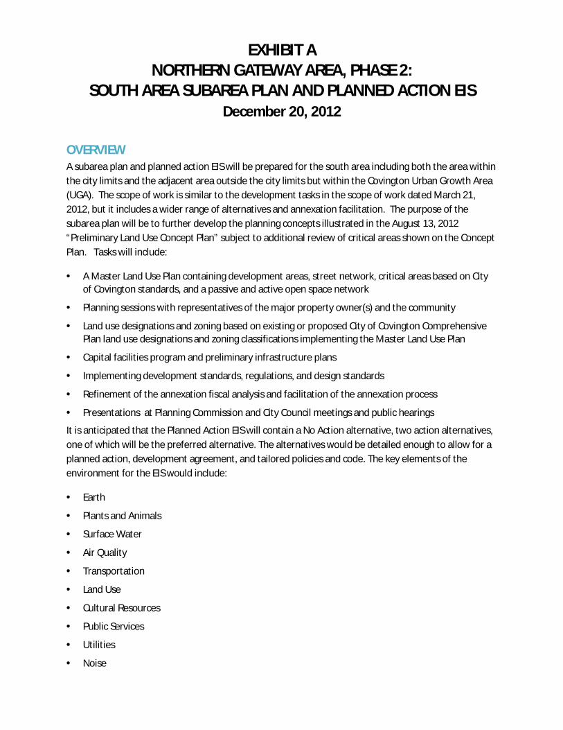
EXHIBIT A NORTHERN GATEWAY AREA, PHASE 2:
SOUTH AREA SUBAREA PLAN AND PLANNED ACTION EIS December 20, 2012
OVERVIEW A subarea plan and planned action EIS will be prepared for the south area including both the area within the city limits and the adjacent area outside the city limits but within the Covington Urban Growth Area (UGA). The scope of work is similar to the development tasks in the scope of work dated March 21, 2012, but it includes a wider range of alternatives and annexation facilitation. The purpose of the subarea plan will be to further develop the planning concepts illustrated in the August 13, 2012 “Preliminary Land Use Concept Plan” subject to additional review of critical areas shown on the Concept Plan. Tasks will include:
· A Master Land Use Plan containing development areas, street network, critical areas based on City of Covington standards, and a passive and active open space network
· Planning sessions with representatives of the major property owner(s) and the community
· Land use designations and zoning based on existing or proposed City of Covington Comprehensive Plan land use designations and zoning classifications implementing the Master Land Use Plan
· Capital facilities program and preliminary infrastructure plans
· Implementing development standards, regulations, and design standards
· Refinement of the annexation fiscal analysis and facilitation of the annexation process
· Presentations at Planning Commission and City Council meetings and public hearings
It is anticipated that the Planned Action EIS will contain a No Action alternative, two action alternatives, one of which will be the preferred alternative. The alternatives would be detailed enough to allow for a planned action, development agreement, and tailored policies and code. The key elements of the environment for the EIS would include:
· Earth
· Plants and Animals
· Surface Water
· Air Quality
· Transportation
· Land Use
· Cultural Resources
· Public Services
· Utilities
· Noise

Northern Gateway Area South Area Stalzer and Associates Project Team Page 2 of 6 Phase 2 Scope of Work December 20, 2012
METHODS AND ASSUMPTIONS
Subarea Plan The Subarea Plan will contain:
· Vision, Goals, Objectives, and Policy Framework
· Land Use, Circulation, and Open Space Concepts
· Zoning Map and Regulations, Design Guidelines, and other Development Standards as appropriate
· Capital Facilities Plan
Wherever possible, the subarea plan will use or build upon the structure of existing applicable Covington development standards and regulations. A zoning map will be prepared reflecting the proposed zoning classifications. The design guidelines will be unique to this subarea and clearly differentiate between the desired character of the South Study Area and that of downtown Covington. The design guidelines will be based on key planning principles that relate to the community vision as well as best practices for urban planning.
The subarea plan will also include a draft capital facilities plan based upon the City’s budget and 6-year Capital Improvement Program as well as project lists developed with Draft EIS alternatives. The project team will compile cost and revenue information from the City and special districts. The final capital facilities plan will be based on the preferred alternative. It should be noted that cost estimates for parks and transportation improvements are not included in the present scope.
Planned Action EIS General Approach: The Existing Conditions Assessment for all topics covered in the Phase 1 Northern Gateway Study will be incorporated into the Affected Environment section of the Draft EIS.
Earth: The project team will use the City’s Critical Area Ordinance maps and the Natural Resource Conservation Service maps to characterize existing soil types, especially steep slopes, unstable soils, and highly erodible soils. The existing reclamation plan for the Lakeside gravel mine will be reviewed to characterize how post-reclamation soil conditions will affect the suitability for future land uses at the current mine site. Relevant City building code regulations for erosion control and soil stability will be summarized and a range of options presented for how the City could implement special geotechnical standards for project-level permitting.
Plants and Animals and Surface Water: The technical analysis for each section will include a description of existing conditions, assessment of the significant adverse impacts (direct, indirect and cumulative), evaluation of the potential mitigation measures for each of the alternatives, and discussion of regulatory implications and permit requirements. Up to three report figures will be included.
Air Quality: Existing air quality conditions and regulations relevant to the proposal will be summarized including Puget Sound Clean Air Agency regulations for stationary sources and construction fugitive dust and future requirements for Transportation Conformity determinations for roadway improvements. To evaluate potential impacts to regional air quality the City’s forecasts for population growth and regional

Northern Gateway Area South Area Stalzer and Associates Project Team Page 3 of 6 Phase 2 Scope of Work December 20, 2012
vehicle miles traveled (VMT) will be compared to regional Puget Sound forecasts developed by the Puget Sound Regional Council (the City will provide the population and VMT data used for this analysis). To evaluate greenhouse gas (GHG) emissions, city-provided land use forecasts will be used to estimate existing GHG emissions and future GHG emissions for each alternative, using the King County GHG spreadsheet. The “Build Carbon Neutral” calculator will be used to forecast soil-carbon GHG emissions caused by removing existing vegetation from the study area. A comprehensive list of relevant GHG reduction measures the City could consider as part of project-level environmental permitting will be presented.
Transportation: A transportation analysis will be prepared combining a technical analysis and DEA transportation modeling.
· No Action Alternative: The project team will work with City staff to develop the appropriate future citywide land use to be analyzed for 2031 No Action conditions. The land use will be provided to the City’s transportation consultant (DEA) who will model it using the City’s travel demand forecasting model. This scope assumes that DEA will post-process the model data and provide the forecasted 2031 PM peak hour volumes in Synchro files. This task also assumes that DEA will provide the model results for the City’s arterial links to support concurrency analysis. The project team will evaluate future level of service at citywide intersections, and coordinate with City staff and the City’s traffic consultant to identify locations where improvements would be needed under No Action conditions (without the proposed Subarea Plan). This task assumes that only the PM peak hour would be evaluated. It also assumes that 47 citywide intersections would be evaluated (45 intersections already defined in the City’s concurrency program plus the two SE 256th Street/SR 18 ramp intersections), with up to 10 intersections warranting more detailed analysis to identify projects to address potential deficiencies. This task does not include development of cost estimates for additional capacity improvement projects that are identified; it is assumed that DEA would be retained to develop cost estimates, consistent with the City’s standard methods, if needed.
· DEIS Action Alternatives – The project team will evaluate two Action alternatives for the DEIS, using the following methods.
o Land Use Assessment – This task assumes time to participate in the workshop to develop the land use alternatives and to coordinate with the project team on the transportation aspects of the DEIS land use alternatives as they are developed.
o Trip Generation – Once the land use has been defined for each alternative, we will project the trips generated by build-out of the land use that has been defined for each alternative, using equations, rates, and methods defined in the Institute of Transportation Engineers (ITE) Trip Generation and travel mode data compiled by the Puget Sound Regional Council (PSRC). Trip generation analysis will take into account the potential for internal trips (trips between uses within the project sites), pass-by trips, and diverted-linked trips.
o Vehicle Trip Distribution and Assignment – The projected trip generation data for each DEIS alternative will be provided to the City’s transportation consultant (DEA) who will input the trips into the City’s travel demand forecasting model to project the assignment of project-generated trips on the City street system. Any new major roads that are anticipated to be built at the project site could also be added to the modeled scenarios. This scope assumes that DEA will post-process the model data and provide the forecasted 2031 PM peak hour volumes in Synchro files, as well as the model results for the City’s arterial links to support concurrency analysis.
Northern Gateway Area South Area Stalzer and Associates Project Team Page 4 of 6 Phase 2 Scope of Work December 20, 2012
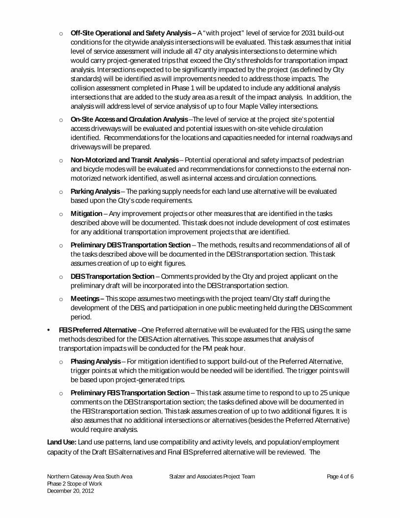
o Off-Site Operational and Safety Analysis – A “with project” level of service for 2031 build-out conditions for the citywide analysis intersections will be evaluated. This task assumes that initial level of service assessment will include all 47 city analysis intersections to determine which would carry project-generated trips that exceed the City’s thresholds for transportation impact analysis. Intersections expected to be significantly impacted by the project (as defined by City standards) will be identified as will improvements needed to address those impacts. The collision assessment completed in Phase 1 will be updated to include any additional analysis intersections that are added to the study area as a result of the impact analysis. In addition, the analysis will address level of service analysis of up to four Maple Valley intersections.
o On-Site Access and Circulation Analysis –The level of service at the project site’s potential access driveways will be evaluated and potential issues with on-site vehicle circulation identified. Recommendations for the locations and capacities needed for internal roadways and driveways will be prepared.
o Non-Motorized and Transit Analysis – Potential operational and safety impacts of pedestrian and bicycle modes will be evaluated and recommendations for connections to the external non-motorized network identified, as well as internal access and circulation connections.
o Parking Analysis – The parking supply needs for each land use alternative will be evaluated based upon the City’s code requirements.
o Mitigation – Any improvement projects or other measures that are identified in the tasks described above will be documented. This task does not include development of cost estimates for any additional transportation improvement projects that are identified.
o Preliminary DEIS Transportation Section – The methods, results and recommendations of all of the tasks described above will be documented in the DEIS transportation section. This task assumes creation of up to eight figures.
o DEIS Transportation Section – Comments provided by the City and project applicant on the preliminary draft will be incorporated into the DEIS transportation section.
o Meetings – This scope assumes two meetings with the project team/City staff during the development of the DEIS, and participation in one public meeting held during the DEIS comment period.
· FEIS Preferred Alternative –One Preferred alternative will be evaluated for the FEIS, using the same methods described for the DEIS Action alternatives. This scope assumes that analysis of transportation impacts will be conducted for the PM peak hour.
o Phasing Analysis – For mitigation identified to support build-out of the Preferred Alternative, trigger points at which the mitigation would be needed will be identified. The trigger points will be based upon project-generated trips.
o Preliminary FEIS Transportation Section – This task assume time to respond to up to 25 unique comments on the DEIS transportation section; the tasks defined above will be documented in the FEIS transportation section. This task assumes creation of up to two additional figures. It is also assumes that no additional intersections or alternatives (besides the Preferred Alternative) would require analysis.
Land Use: Land use patterns, land use compatibility and activity levels, and population/employment capacity of the Draft EIS alternatives and Final EIS preferred alternative will be reviewed. The

Northern Gateway Area South Area Stalzer and Associates Project Team Page 5 of 6 Phase 2 Scope of Work December 20, 2012
relationship of the Subarea Plan to the City’s Comprehensive Plan and other functional plans will be identified, as will policy or code provisions that serve as mitigation measures.
Cultural Resources: Existing conditions and potential future conditions will be addressed based on the area redeveloping and compliance with local, state, and federal regulations. A literature search will be documented. If needed, limited locations will be reviewed in the field at a reconnaissance level. There will be no shovel probing or excavation associated with this analysis. Contact will be made with local tribes in conjunction with the City, to help identify any Traditional Cultural Properties located within the project area. Information gathered from the site visit and tribal consultation will be included in the EIS.
Public Services: Existing levels of service, estimated needs and demand for service, and projected levels of service under each alternative for the range of services that could be altered as a result of each studied alternative will be reviewed. To the extent feasible the analysis will be based on available plans and population-based estimates of demand. Efforts will be coordinated with city staff and service providers to craft mitigation language. The analysis will be heavily coordinated with the Capital Facilities Plan as it contains similar information about levels of service and planned improvements.
Utilities: A capacity analysis and identification of deficiencies and other issues for one no action, two alternatives, and one preferred alternative will be prepared. The analysis will include: a narrative of issues regarding sewer, water, and storm facilities to serve the alternatives; an order-of-magnitude estimate of costs of providing sewer, water and storm services for the action alternatives and preferred plan (to support the capital facility plan); and maps of the necessary facilities by alternative.
Noise: The existing noise environment and key existing noise sources in the study area (no baseline noise monitoring is proposed) will be qualitatively characterized. Relevant state and local regulations that will minimize future noise impacts caused by future development will be cited. Published sources will be used to estimate future increases in day-night noise levels (Ldn) based on forecast future land use population density. For the future No Action alternative, the potential noise impacts caused by continued gravel mining will be evaluated. The Traffic Noise Model (TNM) lookup model will be used to develop a general spatial trend for future noise levels near up to three key roadways affecting the study area. Additionally, the noise review will be coordinated with the team’s wildlife specialists to assess future wildlife impacts.
Annexation Fiscal Analysis and Facilitation of the Annexation Process The fiscal analysis completed in Phase 1 will be updated to address the potential growth associated with the action alternatives of the EIS. Advisory support will be provided to the City on the annexation process for the UGA.
Public Meetings and Presentations The Subarea Plan and EIS will be developed in an iterative process, with the following general steps:
· Community Scoping and Alternatives Workshops: EIS scoping and subarea plan visioning will be conducted with the public, including potential imagery and identity for the South Study Area and a hands-on planning exercise with real-world examples of the type and scale of uses and developments contemplated for the subarea
Northern Gateway Area South Area Stalzer and Associates Project Team Page 6 of 6 Phase 2 Scope of Work December 20, 2012
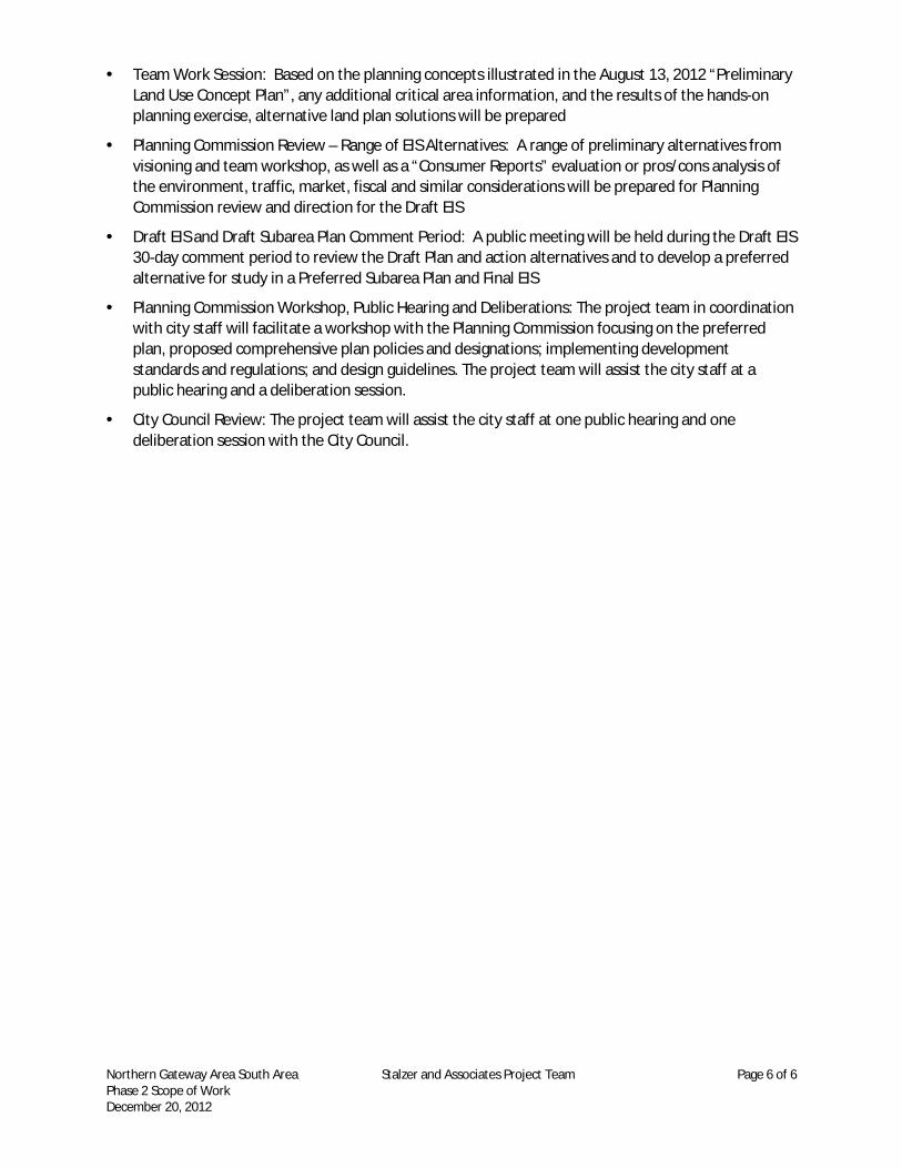
· Team Work Session: Based on the planning concepts illustrated in the August 13, 2012 “Preliminary Land Use Concept Plan”, any additional critical area information, and the results of the hands-on planning exercise, alternative land plan solutions will be prepared
· Planning Commission Review – Range of EIS Alternatives: A range of preliminary alternatives from visioning and team workshop, as well as a “Consumer Reports” evaluation or pros/cons analysis of the environment, traffic, market, fiscal and similar considerations will be prepared for Planning Commission review and direction for the Draft EIS
· Draft EIS and Draft Subarea Plan Comment Period: A public meeting will be held during the Draft EIS 30-day comment period to review the Draft Plan and action alternatives and to develop a preferred alternative for study in a Preferred Subarea Plan and Final EIS
· Planning Commission Workshop, Public Hearing and Deliberations: The project team in coordination with city staff will facilitate a workshop with the Planning Commission focusing on the preferred plan, proposed comprehensive plan policies and designations; implementing development standards and regulations; and design guidelines. The project team will assist the city staff at a public hearing and a deliberation session.
· City Council Review: The project team will assist the city staff at one public hearing and one deliberation session with the City Council.

South Area (Mine Site) Budget
Task Estimate per Task
Task 0: Environmental Reconnaissance & Reclamation Plan Review - Existing Critical Areas
Wetland Reconnaissance Fieldwork (Former mine site, ~200 ac.) $4,520
Wetland Reconnaissance Sketch and Report $2,380
Subtotal $6,900
Task 1: Subarea Plan
Kickoff Meeting with City and Developer $2,157
Charette with City and Developer $12,547
Community Workshop $10,372
Meeting with City and Developer re: two alternative plans $8,391
Planning Commission Workshop $3,537
Refinement of Alternatives $9,594
Land Use Designations and Zoning $11,601
Design Guidelines $13,601
Meeting with City and Developer $1,847
Subarea Plan $2,781
Capital Facilities Program $12,384
Subtotal $88,811
Task 2: Planned Action EIS*
Scoping $10,734
Preliminary Draft EIS $126,937
Draft EIS $17,856
Preliminary Final EIS $27,010
Final EIS $11,858
Subtotal $194,397
Task 3: Annexation and Fiscal Analysis$6,132
Subtotal $6,132
Task 4: Public Meetings
Planning Commission $4,011
City Council $2,437
Subtotal $6,448
Task 5: Project Management
Coordination and Administration $6,531
Subtotal $6,531
Cost $309,219
Subtotal Consultant Cost $309,219
Project Expenses @ ~2% of project budget +$500 for traffic counts $6,684Estimated Project Total $315,903
*Note: Includes traffic analysis beyond the project site to address intersections elsewhere in the City and model study area (e.g. Maple Valley).
Town Center Vision & Goals and Oakpointe Northern Gateway Urban Village Vision
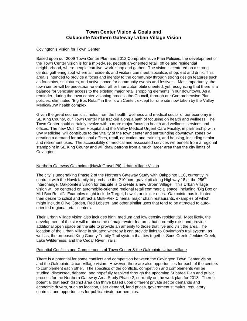
Covington’s Vision for Town Center Based upon our 2009 Town Center Plan and 2012 Comprehensive Plan Policies, the development of the Town Center vision is for a mixed-use, pedestrian-oriented retail, office and residential neighborhood, where people can live, work, shop and gather. The vision is centered on a strong central gathering spot where all residents and visitors can meet, socialize, shop, eat and drink. This area is intended to provide a focus and identity to the community through strong design features such as fountains, sculptures, and active space for community events and festivals. Most importantly, the town center will be pedestrian-oriented rather than automobile oriented, yet recognizing that there is a balance for vehicular access to the existing major retail shopping elements in our downtown. As a reminder, during the town center visioning process the Council, through our Comprehensive Plan policies, eliminated “Big Box Retail” in the Town Center, except for one site now taken by the Valley Medical/UW health complex. Given the great economic stimulus from the health, wellness and medical sector of our economy in SE King County, our Town Center has tracked along a path of focusing on health and wellness. The Town Center could certainly evolve with a more major focus on health and wellness services and offices. The new Multi-Care Hospital and the Valley Medical Urgent Care Facility, in partnership with UW Medicine, will contribute to the vitality of the town center and surrounding downtown zones by creating a demand for additional offices, retail, education and training, and housing, including senior and retirement uses. The accessibility of medical and associated services will benefit from a regional standpoint in SE King County and will draw patrons from a much larger area than the city limits of Covington.
Northern Gateway Oakpointe (Hawk Gravel Pit) Urban Village Vision The city is undertaking Phase 2 of the Northern Gateway Study with Oakpointe LLC, currently in contract with the Hawk family to purchase the 210 acre gravel pit along Highway 18 at the 256th Interchange. Oakpointe’s vision for this site is to create a new Urban Village. This Urban Village vision will be centered on automobile-oriented regional retail commercial space, including “Big Box or Mid-Box Retail”. Examples might include Target, Lowe’s or similar uses. Oakpointe has indicated their desire to solicit and attract a Multi-Plex Cinema, major chain restaurants, examples of which might include Olive Garden, Red Lobster, and other similar uses that tend to be attracted to auto-oriented regional retail centers. Their Urban Village vision also includes high, medium and low density residential. Most likely, the development of the site will retain some of major water features that currently exist and provide additional open space on the site to provide an amenity to those that live and visit the area. The location of the Urban Village in situated whereby it can provide links to Covington’s trail system, as well as, the proposed King County Tri-city Trail system that ties together Soos Creek, Jenkins Creek, Lake Wilderness, and the Cedar River Trails. Potential Conflicts and Complements of Town Center & the Oakpointe Urban Village There is a potential for some conflicts and competition between the Covington Town Center vision and the Oakpointe Urban Village vision. However, there are also opportunities for each of the centers to complement each other. The specifics of the conflicts, competition and complements will be studied, discussed, debated, and hopefully resolved through the upcoming Subarea Plan and public process for the Northern Gateway Area Study Phase 2, currently on the work plan for 2013. There is potential that each distinct area can thrive based upon different private sector demands and economic drivers, such as location, user demand, land prices, government stimulus, regulatory controls, and opportunities for public/private partnerships.

The Town Center currently has an opportunity to focus on providing health, wellness, governmental, education/training, and office/service uses. The employment opportunities and living wage incomes derived from these types of centers can help promote the existing economic retail shopping base and future supporting uses. Restaurants of the small boutique nature tend to gravitate to such pedestrian-friendly town centers. Building a strong senior living or residential retirement component adjacent to the health and wellness services, and providing connections to current multifamily uses in the downtown, will also contribute to the vitality of the Covington Town Center. In short, the Town Center should retain itself as the major identity and focal point for the city by providing a truly pedestrian-friendly working and shopping environment and further linking to the Jenkins Creek and Soos Creek Trail system that boarder the downtown on the east and west. The Oakpointe Urban Village, on the other hand, could focus on regional retail services and be more automobile-oriented with key access to Highway 18 drawing users and shoppers from all of SE King County. The high traffic and parking demands that come from this type of urban village may be more manageable at this location than in the existing Town Center along Kent Kangley. The key to success in both areas is to make sure that neither detracts from their respective visions, and most importantly, that Covington does not lose its ability to create an identity as stated in the Town Center Vision of our Comprehensive Plan. Viability of Multiple Urban Village Concepts in Other Communities Many communities have multiple village concepts within their boundaries. Bellevue has seen these unfold in the Crossroads Area, Old Bellevue and of course Bellevue Square/Lincoln Center. A smaller scale example is the multiple villages approach identified in Issaquah. They have a new Urban Village on the Issaquah Highlands based upon a health care service component, high, medium and low density residential, and a strong retail shopping component. Issaquah also has a vision for an additional historic Downtown Issaquah Urban Village that incorporates governmental services, historic buildings, community theaters, the library, residential uses, and eating and drinking establishments, as well as major community events. Issaquah’s long-term 20 year vision also calls for increased heights and densities in their downtown urban Village over time with redevelopment and infill. The community has now even developed a vision for a third Urban Village around the Rowley properties at I-90 and Highway 900. That development will also be a mixed-use concept with residential, office, and regional retail with a strong pedestrian-friendly internal circulation component, yet with major auto-oriented access from I-90. While Issaquah’s population is double that of Covington, it does lend credence that several urban villages can exist in a community with different economic drivers. The key to Covington’s discussion of our Town Center, the proposed Oakpointe Urban Village, and how the city allocates resources and capital improvements, is to make sure we have a clear vision of our goals and direction and to develop priorities for spending of limited resources any public/private partnerships. The city does not want the strong efforts of the past to be lost or our current and future efforts to be diluted.

Covington: unmatched quality of life
Memo To: Planning Commission From: Salina Lyons, Principal Planner CC: Richard Hart, Community Development Director Ann Mueller, Senior Planner Date: February 7, 2013 Re: Developer’s Agreements Overview
The purpose of this memo is to provide you an overview of a proposed code amendment allowing a process for Developer Agreements for new development in our downtown, specifically the Town Center. What is a developer’s agreement? Development agreements are contracts negotiated between a developer and a local jurisdiction to specify the terms by which a proposed project moves forward. Development agreements are often used to resolve or mitigate site-specific issues that are not well addressed by standard development regulations. Developer agreements are most often applied to large, complex or unique projects. The intent is to evaluate the project comprehensively (e.g. land, allowed land uses, infrastructure needs, city vision) and formalize an arrangement in which the developer provides certain public benefits beyond what is already required (e.g., additional park space, infrastructure investments) in exchange for certain concessions by the jurisdiction regarding the regulatory and design requirements (e.g. site and design flexibility). It’s important to note that developer agreements are not a mechanism for a property owner or developer to circumvent zoning requirements or to disregard the city’s vision and comprehensive plan. Developer agreements are voluntary for both parties, but once made, they are binding on the parties and their successors. Agreements are negotiated with final approval by the city council. Any development agreement the local government enters into must be consistent with the City’s development regulations. The agreement must be comprehensive and specific on the intent and connection of the public benefit to the development.

l Page 2
Mitigation measures may be included that assure the project does not have impacts on neighboring properties or community infrastructure. The agreement may clarify how the project will be phased, the required timing of public improvements, the developer's contribution toward funding system-wide improvements, and other conditions. The agreement can also facilitate enforcement of requirements, since it’s a contract that details the obligations of the developer and local jurisdiction.
Negotiating the agreement may require intensive efforts on the part of local government staff, as well as elected officials. Local jurisdictions must hold a public hearing prior to approving a development agreement and may only impose impact fees, dedications, mitigation measures, and standards as authorized by other laws. What is the benefit of a developer’s agreement? Development agreements are attractive to developers because they secure approvals at the outset of a project and assure that multi-phased projects will not be subject to regulations adopted after an initial application is approved. Such agreements are mutually beneficial because the jurisdiction can specify the inclusion of public benefits and provide an additional measure to ensure consistency of developments with the city’s vision and policies.
What is the legal basis for developer agreements? The Local Project Review Act (Ch. 36.70B, RCW), enacted in 1995, provides specific authority and direction for development agreements. Local jurisdictions can adopt an ordinance under this provision for the use of development agreements in all or specific areas of the city. Why is Covington considering using a developer agreement process? Covington is focused on encouraging development in the downtown, specifically the Town Center. Many of the remaining larger parcels are located in the Town Center zone, such as Ashton’s 7 acre site and the school districts’ 20 acre site. The city has met with several large development companies regarding the ability to develop these parcels. The feedback has been that the overall vision is good, but the development regulations, applied directly, may impose a limitation on a developer’s ability to be creative and think outside of the box or to make modifications that are not allowed under the zoning and design guidelines, specifically on the larger remaining parcels. That’s not to say our vision and adopted regulations for the downtown are onerous or prohibiting development, as they may work very well on the smaller average-sized sites. The developer agreement process becomes another tool in the city tool box for allowing a site to be developed. A developer has the option to design a site under the current provisions and that may be adequate; however, if they are looking at the site similar to a subarea plan, then a developer agreement may be the most effective way to process the development proposal. Again, this is not a process for developer’s to circumvent requirements; but rather an opportunity to work with the city to ensure any deviations from the zoning regulations result in added public benefits and achieves the overall design and vision for the area. An example of a deviation to the downtown code requirements may be a reduction in the numerical standards (e.g. parking standards, percentage of retail for mixed use, dimensional standards) within the Town Center. The key to the developer agreement is to create balance with public benefits and not to allow a complete waiver of important development standards.
l Page 3
It essentially allows the city a level of participation in the development of the site, within the RCW’s, even though they are not the land holder. Are there modifications to the comprehensive plan required for adopting a developer agreement ordinance? One of the specific zoning regulations we have identified that could be modified through a developer’s agreement is the requirement to provide 60 percent ground floor retail in mixed use buildings in the Town Center. Through a developer agreement process, this provision could be modified to 30 percent on certain streets, if other benefits were provided to the city. A comprehensive zoning code amendment and change in the land use policy was proposed and adopted last year in the city’s Comprehensive Plan and Zoning Regulations. LUP 2.4 Encourage residential uses in the Town Center Focus Are at more urban densities, greater than 24 units per acre, making efficient use of prime land, supporting transit friendly and pedestrian-oriented retail and encouraging inclusion of residential uses in new mixed use projects with ground floor retail, restaurant and or/ personal services.
This policy is fairly broad and shouldn’t prohibit the city from allowing modifications through a developer’s agreement. This policy also supports the new tax exemption ordinance, which requires ground floor retail as part of the program in the town center focus area. The Economic Development Element and Downtown Element have policies that support implementing alternative review processes to help with economic development, and also criteria to consider when evaluating deviations from the design and development standards in the downtown zones.
It is staff’s opinion that we do not need to modify any comprehensive plan policy to support a developer’s agreement ordinance. Any proposed code amendment would be added to the work plan and could be accomplished this year outside of the annual docket process.
What developments in our region have been completed under a development agreement? As mentioned above, developer agreements are generally used on larger complex projects with quite a bit of success. The City of Issaquah used the developer agreement process for the development of the Issaquah Highlands and TALUS. Redmond Ridge was developed under a developer agreement, and the City of Duvall used the process to achieve their affordability housing targets. Bellevue uses them often to implement their subarea redevelopment plans for their target growth areas. The City of Kenmore entered into a development agreement with a development company to develop 9.6 acres in their downtown. This project is still in process, and serves as a good guideline for development agreements used for downtown developments. In addition to applying a developer agreement process to the Covington’s Town Center, the city envisions using the process in the Northern Gateway area (Hawk Property) to implement the subarea plan.