01. Create Raster 02. Classify on scale of 0-10 03. Combine Rasters 04. Compute Stats Create Map 01....
4
01. Create Raster 02. Classify on scale of 0- 10 03. Combine Rasters 04. Compute Stats Create Map 01. Create Raster 02. Classify on scale of 0-10 03. Combine Rasters 04. Compute Stats Create Map
-
Upload
charles-perkins -
Category
Documents
-
view
219 -
download
2
Transcript of 01. Create Raster 02. Classify on scale of 0-10 03. Combine Rasters 04. Compute Stats Create Map 01....

01. Create Raster
02. Classify on scale of 0-10
03. Combine Rasters
04. Compute Stats Create Map
01. Create Raster
02. Classify on scale of 0-10
03. Combine Rasters
04. Compute Stats Create Map

01. Create Raster
02. Classify on scale of 0-10
03. Combine Rasters
04. Compute Stats Create Map

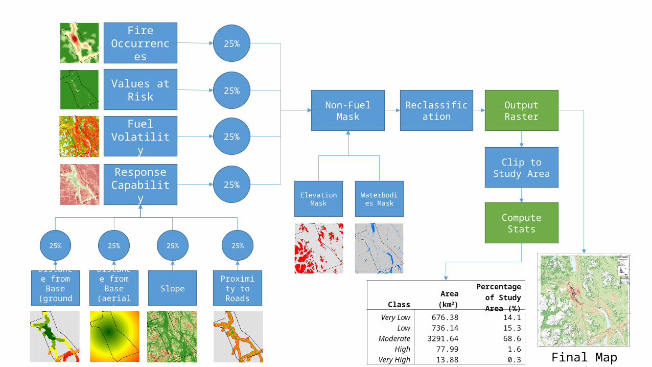
Fire Occurrences
Values at Risk
Fuel Volatility
Response Capability
Non-Fuel Mask
25%
25%
25%
25%
Reclassification
Distance from Base (ground)
Distance from Base
(aerial)Slope Proximity
to Roads
25%25%25%25%
Output Raster
Elevation Mask
Waterbodies Mask
Clip to Study Area
Compute Stats
Final Map Product
Class Area (km2)Percentage of
Study Area (%)Very Low 676.38 14.1
Low 736.14 15.3Moderate 3291.64 68.6
High 77.99 1.6Very High 13.88 0.3