· STA. TK OF MAINE YORK, ss. SUPERIOR COURT CIVIL ACTION DOCKET NO. RE-09-111 ROBERT F. ALMEDKR...
90
STA. TK OF MAINE YORK, ss. SUPERIOR COURT CIVIL ACTION DOCKET NO. RE-09-111 ROBERT F. ALMEDKR and VIRGINIA S. ALMKDER, et al. , ) ) ) ) Plaintiffs, ) ) V. ) ) TOWN OF KENNKBUNKPORT and ) ALL PERSONS WHO ARK ) UNASCERTAINED, ) ) Defendants. ) ) JOINT MEMORANDUM OF LAW IN OPPOSITION TO DEFENDANT TOWN OF KENNKBUNKPORT'S MOTION FOR SUMMARY JUDGMENT (Title to Real Estate Involved) Plaintiffs/counterclaim defendants Terrence O' Connor, Joan Leahy, and Janice M. Fleming, through their counsel Christopher Pazar, Esq. , plaintiffs/counterclaim defendants' Robert Almeder, et al. , and parties in interest represented by Sidney St. F. Thaxter, Esq. and the law firm Curtis Thaxter LLC (collectively "Plaintiffs" ) submit this joint memorandum of law in opposition to defendant Town of Kennebunkport's (the "Town" ) motion for summary judgment. I. Introduction. This Court's job in deciding the Town's motion for summary judgment ("Town's MSJ") is extremely simple. The Town rests its entire case on an assertion that a document executed in 1684 by Thomas Danforth, then President of the Province of "Mayne" (the "Danforth Document" ) served to transfer title to the entire land mass of the Town of Kennebunkport to the Town itself notwithstanding that the land located in the Town had been held by private parties ' Plaintiffs/counterclaim defendants include all property owners identified in plaintiffs' complaint for declaratory judgment and quiet title, plaintiffs' first amendment to complaint, and Mark E. Celi and William E. Brennan, Jr. , Trustees of The Celi Kennebunkport Real Estate Trust No. 1; Susan Flynn; William D. Forrest; Nancie M. Julian; Donna K. Lencki, Trustee of the Donna Lencki Revocable Trust of 1993; and Goose Rocks Beach Holdings, LLC, and their successors in interest. David and Jennifer Eaton; Susan K. Lewis, Trustee of the Amended and Restated Susan K. Lewis Residence Trust; Paley Family Homes, LLC; and Heather Vicenzi, Trustee of the George A. Vicenzi Trust.
Transcript of · STA. TK OF MAINE YORK, ss. SUPERIOR COURT CIVIL ACTION DOCKET NO. RE-09-111 ROBERT F. ALMEDKR...
STA. TK OF MAINE YORK, ss.
SUPERIOR COURT CIVIL ACTION DOCKET NO. RE-09-111
ROBERT F. ALMEDKR and VIRGINIA S. ALMKDER, et al. ,
) ) ) )
Plaintiffs, ) )
V. ) )
TOWN OF KENNKBUNKPORT and ) ALL PERSONS WHO ARK ) UNASCERTAINED, )
) Defendants. )
)
JOINT MEMORANDUM OF LAW IN OPPOSITION TO DEFENDANT TOWN
OF KENNKBUNKPORT'S MOTION FOR SUMMARY JUDGMENT
(Title to Real Estate Involved)
Plaintiffs/counterclaim defendants Terrence O' Connor, Joan Leahy, and Janice M.
Fleming, through their counsel Christopher Pazar, Esq. , plaintiffs/counterclaim defendants'
Robert Almeder, et al. , and parties in interest represented by Sidney St. F. Thaxter, Esq. and the
law firm Curtis Thaxter LLC (collectively "Plaintiffs" ) submit this joint memorandum of law in
opposition to defendant Town of Kennebunkport's (the "Town" ) motion for summary judgment.
I. Introduction.
This Court's job in deciding the Town's motion for summary judgment ("Town's MSJ")
is extremely simple. The Town rests its entire case on an assertion that a document executed in
1684 by Thomas Danforth, then President of the Province of "Mayne" (the "Danforth
Document" ) served to transfer title to the entire land mass of the Town of Kennebunkport to the
Town itself notwithstanding that the land located in the Town had been held by private parties
' Plaintiffs/counterclaim defendants include all property owners identified in plaintiffs' complaint for declaratory judgment and quiet title, plaintiffs' first amendment to complaint, and Mark E. Celi and William E. Brennan, Jr. , Trustees of The Celi Kennebunkport Real Estate Trust No. 1; Susan Flynn; William D. Forrest; Nancie M. Julian; Donna K. Lencki, Trustee of the Donna Lencki Revocable Trust of 1993; and Goose Rocks Beach Holdings, LLC, and their successors in interest.
David and Jennifer Eaton; Susan K. Lewis, Trustee of the Amended and Restated Susan K. Lewis Residence Trust; Paley Family Homes, LLC; and Heather Vicenzi, Trustee of the George A. Vicenzi Trust.

since the early 1600s and notwithstanding the fact that the language of the Danforth Document
makes clear that the document only served to confirtn the titles already held by those private
parties. As a matter of law, this document did not transfer title to the Town and if this Court so
holds it may avoid all the rest of the Town's wild and extensive arguments that it only makes in
order to try to make sense of its core assertion of title under the Danforth Document. Because its
core assertion is false, all of the Town's arguments flowing out of that core assertion also make
no sense. Unfortunately, in order to properly respond to the Town's MSJ, Plaintiffs have had to
expend a great deal of time and paper refuting each and every one of the Town's arguments, but
we want to be clear at the outset that, as will be shown below, the Town never got title to Goose
P ocks Beach because as a matte r of laxxr the Danfnrth Document did not transfer anv title tn thr 3
Town. If the court so holds, it does not even need to address the Town's other fabricated
arguments.
Indeed, the Tov, n's motion for summary judgment is extremely unusual because at no
time prior to the filing of this action did the Town, or anyone on its behalf, claim that the Town
owned Goose Rocks Beach or any part of it other than the single lot the Town was given as a
charitable gift. Indeed, the Town's Comprehensive Plan from 1996 (see Section IX) makes it
very clear that the Town has always acknowledged that Goose Rocks Beach was privately
owned. See Plaintiffs' Joint Statement of Material Facts (" Joint SMF") $ 82. The Town,
responding to a legal challenge from Plaintiff Gray's family unequivocally acknowledged
through counsel that the Grays had title of their lot to the low water. Joint SMF $ 84. As
recently as 2005 in a letter from Amy Tchao, its counsel in this case, the Town acknowledged
that it does not own the beach. Joint SMF II
85.
' The term "Goose Rocks Beach" will be used herein to refer to all of that land lying seaward of the currently existing man-made sea wall including the dry sand beach and the intertidal zone.

Under increasing pressure from commercial interests, the Town began looking at ways to
open up the beach to more public uses. As the Town and the Chamber of Commerce began to
roll out their plan to increase public uses of the beach after 2005, they eventually refused to
enforce trespass laws and Town officials began telling the police that the whole of Goose Rocks
Beach was open to the public. Faced with this dilemma, the Plaintiffs brought this action to
protect their property rights which could be eroded and annulled with time if they did not act.
Confronted with the Plaintiffs' Complaint, the Town for the first time in its history
conjured up a claim in Count I of their Counterclaim to ownership of Goose Rocks Beach in the
Town. The Town's title claim, as well as its other claims, appear to be a copy or cut and paste of
the claims raised and lost bra the Town of +elis in Eaton v Town of wells Maine Siinerior
Court, York County, Docket No. RE-97-203. Joint SMF $ 86 . The Town's Count I states that it
claims fee title by virtue of either a decree from King Charles II or other apparently as yet
unknown grants. There was no mention in the Town's Counterclaim of the 1684 document
executed by Thomas Danforth on which its motion for summary judgment is now based. Indeed,
the first time there was any mention of the Danforth Document was some ten months later, after
the Plaintiffs' Complaint was filed and when the document was presented to Plaintiffs' counsel
as the apparent basis for the Town's claim to title.
The Danforth Document, on its face and as supported by historical records, clearly
dictates that the document was intended to confirm to the individual inhabitants of Cape Porpus
(now Kennebunkport) that Massachusetts would not interfere with the title to their respective
Compare Town of Kennebunkport Counterclaim, Count I, Docket No. RE-10-111 with Town of Wells Counterclaim, Count I, Docket No. RE-97-203. See Joint SMF at Tab 6. When compared, it is apparent that the Town in this case did an absolute cut and paste from the Town of Wells' counterclaim and, especially with respect to its title claim in this case, failed to address the Rule 11 consideration as to where there is good ground to support such a claim. It is apparent that the Town in this case did not even discover the Danforth Document, that is the basis of its claim, and develop its story until almost ten months after the Plaintiffs' Complaint was filed.
land holdings. It states clearly that Thomas Danforth, then President of the Province of "Mayne"
("Danforth"), had been "authorized and impowered to make Legal confirmation" of title to the
land and properties held by the inhabitants of the Town by virtue of prior grants. By execution
of the document, Danforth simply affirmed that the land owners in Cape Porpus were not going
to be ousted by Massachusetts claiming under a competing grant and that Massachusetts would
not charge exorbitant fees to the land owners in order to avoid an interference with their titles.
Danforth never granted or conveyed anything to the Town.
The Plaintiffs in this action claim titles that stretch all the way back to a royal grant. The
Town does not dispute the actual chain of title that Plaintiffs hold. The Town simply asserts an
illogic al theorv that the Danforth Document which ronfirmed already existinv titles effectively
plucked the entire land mass of the Town of Kennebunkport out of the hands of the rightful
owners, gave it to the Town itself which then held it for a number of years and then magically
conveyed it back into the hands of those same original owners by virtue of some notations in the
Town Clerk records that contain no granting language. It is a far-fetched theory indeed.
The Town's fabricated argument goes as follows: the Danforth Document was an all
inclusive transfer of title to the entire land mass of the Town to the Town. ' The Town then had
to come up with some reason why it does not continue to hold title to the entire Town even
though there are no actual out conveyances from the Town of the entire land mass of the Town.
To explain this rather large hole in their story, the Town's expert developed a unique rewrite of
history without any foundation or expertise to do so. He claims that certain notations in the
Town's records which on their face are clearly the results of Town lay outs of properties and
As an aside, this is a rather bold claim and might cause some current residents of Kennebunkport to wonder about whether the Town would try to attack their own titles.

which were based on already existing titles are actual conveyances. Not one of the Lay Outs in 6
the Town Clerk records contain even a shred of the granting language that would be required to
show that these Lay Outs effectuated a transfer of title. If anything, the Lay Outs indicate that
there was a service provided by the Town, whereby the Town would send its surveyor out to
properties at the request of the owner, to survey the property based on the language in the
property owner's existing deed. To claim that these Lay Outs effectuated the transfer of property
is a convenient but positively incredible excuse for the lack of any real out conveyances from the
Town after it purportedly received clear title to the entire town.
Having gotten to the point in this elaborate revision of the Colonial history of ownership
jn the Town the Tosprn's expert hwas r onfronted hwjth the conundrum o f showinfr that fhe Town
still owns Goose Rocks Beach but not the upland areas. Thus, the Town's expert attempts to use
the language in the Lay Outs, referred to above, claiming that those so-called "conveyances"
only conveyed to a "sea wall" or "sea bank" which it claims lies somewhere landward of the
high water mark (whereas the Danforth Document conveyed the entire Town down to the low
water mark to the Town). The Town's expert then attempts to rewrite the geological history in
the 17'" century of the beach by creating a bank along a road which somehow separated the
beach from the upland. He even goes as far as to opine that the beach has been subject to
accretion since 1684 so that, even if the Town never actually owned the sandy beach, it does now
because it has essentially risen out of the sea. It is important to recall, that this expert's only
qualiftcations are as a ~surve or, not as a title attorney qualitied to opine as to the legal effect of
documents to transfer title, and certainly not as a geologist qualified to opine as to the geological
The Town refers to these notations as "Out-Conveyances" but they will be referred to herein as "Lay Outs. "

history of Goose Rocks Beach. As we will document below, this far-fetched rewrite of the
history and geology of the area is based not on facts but on supposition, guess, and storytelling.
As Plaintiffs progress through this opposition of the Town's motion, it should become
apparent to the court that first, this is an argument based on wishes and desires not on the facts or
the law. Second, this is entirely inappropriate for the court to grant summary judgment because
the argument's entire alleged factual foundation is disputed.
It should be noted that Plaintiffs would normally have responded to this motion asking
the court as part of their reply to grant them summary judgment. They have not done so for two
reasons. First, the Town has constructed a very complicated story as to why it owns the beach,
presumablri hotline that no one involved in the case is astute enough to take its armament anart
PIaintiffs are using this opposition to demonstrate that the Town's claim is a mere fabrication.
That demonstration is entirely separate and has no relation to the Plaintiffs' sources of title which
go back hundreds of years and can be asserted in a straightforward and simple motion for
summary judgment. Therefore, it is more appropriate for Plaintiffs to generate a separate motion
for summary judgment with regard to their claims to title of the beach.
Thus, two affirmative motions for summary judgment are being filed concurrently
herewith, one by Plaintiffs/Counterclaim defendants Terrence O' Connor, Joan Leahy, and Janice
Fleming and one by the remaining Plaintiffs/Counterclaim defendants. In these motions,
Plaintiffs will simply show their recorded chains of title to Goose Rocks Beach to the low water
mark which date back up to 250 years and can be presumed under the applicable law, see
Crooker v. Pendleton, to date back to the James I Charter of New England. The Town, because
it never had the title to Goose Rocks Beach, has no standing to challenge the Plaintiffs' title.
II. Factual Back ound.

On November 3, 1620, James I of England granted the New England Charter to the
Council at Plymouth, successors to the Plymouth Company. Joint SMF $ 10, The New England
Charter authorized a grant of much of Maine to Ferdinando Gorges (" Gorges" ) which grant was
carried out in 1622. Joint SMF $ 10. On April 3, 1639 after some disputes regarding land
ownership, Gorges obtained from Charles I the so-called "Gorges Patent, " a competing grant.
Joint SMF $ 51.
On April 7, 1643, Alexander Rigby ("Rigby") purchased the Lygonia Patent, a
subdivision of the Gorges grant which had been authorized under The New England Charter
which had predated the later Gorges Patent from Charles II. Joint SMF $ 10. By means of
recorded and presumed deeds from Rigby's agent, George Cleave, Goose Rocks Beach was
conveyed into private ownership in the late 1640s and early 1650s. Joint SMF $$ 11-14. By
1653 Morgan Howell (" Howell" ), Roger Willine ("Willine"), Joseph Bowles ("Bowles"),
Gregory Jeffreys ("Jeffreys") and John Bush (" Bush" ) owned the fee title to what is today known
as Goose Rocks Beach. Joint SMF $ 11. Original settlers Howell and Jeffreys derived their
titles from Alexander Rigby and it can be presumed that Willine, Bush and Bowles similarly
obtained their titles from the same source. Joint SMF $$ 12-14.
When the Massachusetts Bay Colony attempted to assert control over the Province of
Maine in 1653, it confirmed the validity of the grants coming out of the James I Charter and
Alexander Rigby in exchange for the agreement by the inhabitants of Maine to subject
themselves to it as a governing body. Joint SMF $$ 47-49. These prior grants were again
confirmed by the Charter of William and Mary in 1691 when the original Massachusetts Bay
Colony Charter was cancelled and the Plymouth Colony Charter was no longer in effect. Joint
SMF $$ 58-62.
After the attempted takeover by the Massachusetts Bay Colony in 1653, and prior to 1691
when the Massachusetts Bay Colony Charter was cancelled, the Massachusetts Bay Colony, the
Crown and the assignees of various patent holders disputed the political governance of the
Province of Maine, including Cape Porpus. Joint SMF $$ 47-49. In 1678 the Massachusetts Bay
Colony once again asserted political control over the Province or Maine when it purchased the
Gorges Patent. Joint SMF $ 50. As a grantee in a conveyance of land, the Massachusetts Bay
Colony did not and could not extinguish the previous land titles of the individual settlers which
had originated with the earlier James I Charter and the Lygonia Patent.
The Massachusetts Bay Colony, as it had done in 1653 when it first attempted to wrestle
noijtjca1 control over the territory recocrnj red and con fjrmed the Iegjtjmacv of nrjor land titles as
follows. In 1681, Massachusetts Bay Colony appointed Thomas Danforth to "confirm the
rightful possession of landholders. " Joint SMF $ 52. Pursuant to this authority, Danforth issued
a number of identical form confirmatory documents to individual trustees on behalf of the
individuals of a number of towns. Joint SMF $$ 52, 53; see also Affidavit of J, Gordon Scannell,
Jr. ("Scannell Aff. "), attached thereto at Tab 1A, $ 7. One of those confirmatory documents was
the Danforth Document, which confirmed that the then-inhabitants of Cape Porpus that held
prior valid land grants at that time had good title to their lands. Joint SMF $$ 53-55. The
document was granted to three private trustees on behalf of those inhabitants of Cape Porpus that
had prior valid land grants. This is the document that the Town erroneously claims transferred
title of the entire land mass of Kennebunkport to the Town as a corporate body.
In 1720, after the Town of Cape Porpus had become completely depopulated due to
Indian wars, the Town proprietors convened to try to deal with the fact that many people were
wrongly challenging the land of the original settlors and their successors. Joint SMF $ 63. The
Town voted to state that the ancient titles of the original settlors and their successors were valid,
that the Town confirmed said titles and that if a person came forward with a valid deed or a valid
title based on possession that the Town would "lay out" that person's land (the "1720 Vote" ).
Joint SMF $ 63-64; see Exhibit 23 to Affidavit of Steve N. Ross (" Ross Aff. ") at Tab 4.
In May of 1720, pursuant to the 1720 Vote, a Town surveyor upon being presented with
John Downing's valid prior title based on a grant from John Miller, laid out his land and
recorded the description in the Town Clerk's records (the "Downing Lay Out"). Joint SMF $$
68, 71. There are no Plaintiffs who derive their title from Downing. Joint SMF $$ 72, 75. In
1727, pursuant to the 1720 Vote, the Town surveyor upon being presented with Gregory
Jeffrexrs' vaiid prior title based on ~ants from Alexander Rigby Iajd out his land and recorded
the description in the Town Clerk's records (the "Jeffreys Lay Out"). Joint SMF $$ 68, 70. In
1777, pursuant to the 1720 Vote, a Town surveyor upon being presented with John Emmons'
valid prior title based on a grant from Humphrey Dearing, laid out his land and recorded the
description in the Town Clerk's records (the "Emmons Lay Out"). Joint SMF $$ 68, 73. All the
Plaintiffs derive their ancient title from the original settlors of Goose Rocks Beach. Joint SMF $
75.
The Lay Outs contain no granting language and are not conveyances of real estate. Joint
SMF $ 68. The Town argues that the Lay Outs are valid conveyances of the Town's title
received by virtue of the Danforth Document. It claims that the descriptions contained in the
Lay Outs describe the land only to some line landward of the highwater mark and that, therefore,
the Town retained the beach. Curiously, after 1684 there appears no document to reference or
incorporate this "so called 1684 deed. " Joint SMF $$ 4, 46, 56. Apparently, it became an instant
dead letter.
Plaintiffs hold undisputed modern title to Goose Rocks Beach to the low water mark.
Joint SMF $$ 1-2. The Town has admitted that Plaintiffs' titles reach back as far as 1720, 1727
or 1777 depending on the property. See Exhibit 3 to Yarumian Aff.
III. Standard for Summar Jud ent.
Summary judgment cannot be granted when the record evinces genuine issues concerning
any material fact. M. R. Civ. P. 56. Summary judgment is viewed in the light most favorable to
the non-moving party to determine whether there is a genuine issue of material fact. Hutz v.
Alden, 2011 ME 27, $ 12, 12 A. 3d 1174, 1178; Chalet Susse Int'I Inc. v. Mobile Oil Co . 597
A. 2d 1350, 1352 (Me. 1991). "An issue is genuine if there is sufficient evidence supporting the
claimed factual dispute fo renuire a choice between the parties di fferino versions of the truth at
trial. A fact is material when it has the potential to affect the outcome of the suit. " Prescott v.
State Tax Assessor 721 A. 2d 169, 172 (Me. 1998) (citations and quotations omitted). When the
parties' statements of material fact and affidavits require the court to choose between competing
truths, even when a party's chances of success at trial are small and one party's version of the
material facts appears more persuasive and credible, summary judgment is not appropriate.
Arrow Fastener Co. Inc, v. Wrabacon Inc. , 2007 ME 34, $$ 16-19, 917 A. 2d 123, 126-27.
"If a party submits an unnecessarily long, repetitive, or otherwise convoluted statement of
material facts that fails to achieve the Rule's requirement of a "separate, short, and concise"
statement, the court has the discretion to disregard the statement and deny the motion for
summary judgment solely on that basis. " Stanle v. Hancock Count Com'rs 864 A. 2d 169,
179 (Me. 2004) (191 statements held unnecessarily long). Based alone on the convoluted nature
and length of the Town's statement of material fact (306 statements including subparts), this
Court should deny the motion.
10

If there are no genuine issues of material fact, the court decides the motion for summary
judgment by reference to the applicable law. Ma no v. Town of Free ort 486 A. 2d 137,
141 (Me. 1985).
Because genuine issues of material fact exist and because the Town's application of the
law to even their disputed facts is erroneous, the court should deny the Town's motion for
summary judgment.
IV. Averment.
A. Material facts are in dis ute.
At the outset, Plaintiffs would like to draw the court's attention to the fact that virtually
all of the facts that are material to the Town s clainl io title to Coose Roc Beach are dlspu e
by Plaintiffs. See Plaintiffs' responses to Town's 306 (including subparts) statements of material
facts set forth in Joint Opposition to Defendant Town of Kennebunkport's Statement of Material
Facts (" Joint OSMF"). There are many purely factual assertions made by the Town that are
material and are disputed by Plaintiffs. However, many of the assertions made by the Town can
be viewed as either factual assertions or legal conclusions and often appear to be mixed
questions of law and fact. See Town of Kennebunkport Statement of Undisputed Material Facts
("Town's SMF") $$ 1-114(f). The bulk of this Joint Opposition addresses the Town's erroneous
legal conclusions but the court should also be aware that to the extent certain assertions made by
the Town are factual assertions, they are in dispute.
Plaintiffs dis ute the Town's assertion that the Danforth Document is a deed and transferred title to the entire land mass of the town to the Town.
In particular, Plaintiffs dispute the fact asserted by the Town that the Danforth Document
granted any title to the Town. Joint OSMF $$ 36. The Town gives no legal analysis to support
its conclusion that this Danforth Document transferred title to the Town and instead relies on its
11

expert who is not competent to opine on the validity or efficacy of a real estate document and
who is simply a surveyor. This surveyor makes the bold assertion that "[t]he Town is a complete
predecessor in title for each deed described in Paragraphs 3-28 [the Plaintiffs' deeds] by way of
the 1684 Deed. " Town's SMF $ 36. Plaintiffs' expert, J. Gordon Scannell, Jr. , Esq. , an expert
on real estate law, opines that the Danforth Document did not pass any title to the Town. Joint
OSMF $ 36, See Scannell Aff. $ 6 (Tab 1A to Joint SMF). Because the Town's entire case rests
on title having passed to it under the Danforth Document, the fact that the Plaintiffs have a good
basis to dispute this fact means that this court cannot grant summary judgment to the Town.
2. The Plaintiffs dis ute the Town's assertion that the La Outs are
Another highly material fact asserted by the Town is that the Lay Outs/"out-
conveyances" contained in the Town Clerk Records actually conveyed property out of the Town
and into the hands of the persons, who, coincidentally, already owned the property. Town's
SMF $5 43, 72, 83. Although the Town simply uses its surveyor's affidavit to assert that these
Lay Outs which contain no granting language actually transferred property, Plaintiffs, by
contrast, have the opinion of an expert real estate attorney stating that these documents did not
transfer any title. Joint OSMF $$ 43, 72, 83; Joint SMF $ 68. Therefore, Plaintiffs have a good
basis to dispute this material fact.
3. Plaintiffs dis ute factual assertions which are material to the uestion of whether the La Outs described land that included the intertidal zone.
In construing a deed, "[w]hat are the boundaries is a question of law, and where the
boundaries are is a question of fact. " Hod don v. Cam bell, 411 A. 2d 667, 672 (Me. 1980)
(quoting Liebler v. Abbott, 388 A. 2d 520, 521 (1978) quoting Rusha v. Little Me. , 309 A. 2d
" Citing to the Affidavit of Robert Yarumian II, PLS ("Aff. Yarumian") $ 41 in support of the Town's Statement of Undisputed Material Facts.
12

867, 869 (1973)). Therefore the legal definition of a term — such as "sea bank" — contained in a
deed will be a question of law, but the actual physical location of a monument referred to in a
deed will be a question of fact.
Although the Plaintiffs dispute the Town's analysis of the legal definition of certain
words used in the Lay Outs as will be shown below, Plaintiffs also dispute the Town's factual
assertion with regard to the geography of Goose Rocks Beach in the late 17' and early 16'
centuries and how these assertions impacts where certain monuments referred to in the Lay Outs
are located on the face of the earth at the current time. Joint OSMF' $$ 30, 74, 75, 76, 77, 100,
106. These factual assertions are material to the Town's argument that it retained the intertidal
zone and even some o f the land landward o f the high water mark when it allegedly conveved out
the property described in the Lay Outs.
Although it is unnecessary to discuss at length each and every example of disputed fact
put forward by the Town to bolster its argument, Plaintiffs will address the Town's arguments in
a general way,
As stated above, the Town argues that the Lay Outs describe land that runs only to some
point landward of the high water mark, leaving the Town with title to the modern dry sand beach
and the intertidal zone. The monuments referred to in the Lay Outs are "sea wall" with respect
to the Emmons Lay Out, the "brook" and "marsh" with respect to the Downing Notation and the
"Little River" and the "sea shore" with respect to the Jeffreys Lay Out.
Therefore, if the Lay Outs are deeds (which, as Plaintiffs will show below, they are not),
these monuments would have to be located on the face of the earth at the time of their execution
in order to determine what land was within the bounds described therein. In order to do so it
would be necessary for this Court to enter into a major fact-finding inquiry. The Town puts
13

forward many disputed facts in support of its argument, including that, as a matter of physical
geography, at the time of the execution of the Lay Outs, there was a strip of land located
landward of the high water mark that constituted a "sea wall" or a "sea bank. " SMF $$ 73-74.
This fact is disputed by the Plaintiffs. Joint OSMF $$ 73-74. The Town also argues that there
was a public road located on Goose Rocks Beach — a fact which Plaintiffs vigorously dispute.
Joint OSMF $ 100. It claims that due to the alleged existence of this road, and the fact that, as
the Town alleges, a town would never place a public road on the intertidal zone but would rather
place it on the dry sandy beach, that this somehow supports its argument that a "sea wall" and a
"sea bank" is a monument located landward of the high water mark. All of these factual
allegations are disputed by Plaintiffs
The Town makes other numerous factual allegations in support of its construction of the
Lay Outs. It is not necessary to cite all of them but we would like to draw the court's attention to
the fact that the Town actually goes so far as to claim, by virtue of a surveyor's affidavit with no
training in historical geology, that Goose Rocks Beach has been subject to accretion over the last
few hundred years. Town's SMF $$ 33-34, 77. The Town seems to imply that even if it only
had title to the intertidal zone and not the so-called "sea bank", because of the accretion since the
17'" century it now owns the entire sandy beach which has arisen out of the ocean. The Plaintiffs
dispute this factual allegation. Joint OSMF $$ 33-34, 77.
As this Court should readily appreciate, these types of factually-based arguments, for
which the Town does not even present sufficient evidence are not appropriate in a motion for
summary judgment and should be disregarded. Because virtually all of the facts that are material
to the Town's assertion to fee title to Goose Rocks Beach are in dispute, this Court must deny the
Town's motion for summary judgment on that basis alone.
14

B. The Town's entire case is based on the erroneous le al conclusion that the Danforth Document effectuated a transfer of all of the ro ert located in Kennebunk ort to the Town.
As stated above, this is a simple case. The Danforth Document did not transfer any title
to the Town, therefore the Town's MS J must be denied because the Town acquired no ownership
interest in Goose Rocks Beach. The Town indeed does rest its entire claim to title on a
document executed by Thomas Danforth then President of the Province of "Mayne" in 1684—
the Danforth Document. The Town cites no law for the proposition that the Danforth Document
was effective to transfer title to the entire land mass constituting Kennebunkport to the Town of
Kennebunkport and provides no legal analysis for such a claim. The Town simply relies on a
surveyor's affidavit for the proposition that "[t]he Town is a complete predecessor in title for
each deed described in Paragraphs 8-40 [the Plaintiffs' deeds] by way of the 1684 Deed. "
Town's SMF 't| 36 (Yarumian Aff. $ 41).
Although the Town puts forward its assertion that the Town received a grant of the entire
land mass of the town by virtue of the Danforth Document as a factual assertion, the
interpretation of a deed is a question of law. Bennett v. Trac, 1999 ME 165, $ 7, 740 A. 2d 571,
. d», . 'bbl . b
Town's legal conclusion that the Danforth Document effectuated any transfer of title or any
removal of title from the ancient title holders in the Town is simply incorrect.
The lan a e of the Danforth Document and its historical context demonstrate that the document did not effectuate a transfer of title but rather was a confirmation b Massachusetts that it would not interfere with existin titles to real estate in Maine.
In construing a deed, the courts "are to give effect, if possible, to the intention of the
parties, so far as it can be ascertained in accordance with legal canons of interpretation. [The
courts] are to give effect to the expressed, rather than the surmised, intent. . . and to consider all
15
the words of the grant in the light of the circumstances and conditions attending the transaction. "
Sar ent v. Coolid e, 399 A. 2d 1333, 1344 (Me. 1979) (quoting McLellan v. McFadden, 114 Me.
242, 246-247, 95 A. 1025, 1028 (1915)). A court construing the language in a deed must give
the words their "general and ordinary" meaning. Rhoda v. Fitz atrick, 655 A. 2d 357, 360 (Me.
construe the language of the deed by looking only within the "four corners" of the instrument. f, . d«, ():. II
8, 783 A. 2d 637, 640. If the language of the deed is unambiguous, then the court must construe
the deed without considering extrinsic evidence of the intent of the parties. Id.
The Town in its memorandum of law in support of its motion for summar~ ~udgment
simply makes the bald assertion through its unqualified expert/surveyor that the Danforth
Document transferred title of the entire Town of Cape Porpus to the Town itself and does not
even attempt to provide any historical context for this document or any legal analysis of the
language. The actual language of the document as well as its historical context show clearly that
the document was intended to allow Massachusetts to confirm to the people of Maine that it
would not interfere with their individual titles to their individual parcels of real estate and that
any claims that Massachusetts might have to any individual parcels by virtue of its purchase of a
land grant from Ferdinand Gorges was being confirmed to those individual owners. Three
named individuals were appointed as trustees for the purpose of carrying out this confirmation.
This was necessary because the actual individuals receiving the confirmation were the numerous
owners of real estate located in Cape Porpus, Maine and it was therefore difficult, if not
impossible, to list them all. The Town of Kennebunkport as a corporate body did not receive
16

anything — neither a grant of land nor a confirmation of an already existing title. See Town's
SMF, Exhibit 4 to Yarumian Aff.
The historical context makes clear that the Danforth Document did not effectuate a transfer of ro ert
Although a court must look first to the actual language of the Danforth Document to
determine the intent of the parties it is helpful to understand the historical context. Plaintiffs
derive their titles from The New England Charter, granted by James I, November 3, 1620 to the
Council at Plymouth in the county of Devon, successors to Plymouth Company. Joint SMF $ 10.
Colonel Rigby, a predecessor in title to Plaintiffs who derived his title from the James I Charter
via Ferdinando Gorges, deeded the land at issue in this case to Howell, Jeffreys, Bush, Willine,
and Bowles of Goose Rocks Beach in 1653. Joint SMF $$ 9-14. The validity of the grants
coming out of the James I Charter was later confirmed in 1653 by the Massachusetts Bay Colony
when it made a power play and convinced the inhabitants of Maine to subject themselves to it as
a governing body. Joint SMF $ $ 47-49. These prior grants were again confirmed by the Charter
of William and Mary in 1691 when the original Massachusetts Bay Colony charter was cancelled
and the Plymouth Colony Charter was no longer in effect. Joint SMF $ $ 58-62.
There were other charters given by which various parties claimed title to the Province of
Maine, notably, the Charter of the Province of Maine granted by Charles I on April 3, 1639 to Sir
Ferdinando Gorges after the Charter of James I from which Plaintiffs derive title. Joint SMF $
51. In 1677 after the Massachusetts Bay Colony had already confirmed the existing prior titles
coming out of the James I grant, it acquired the Gorges grant. Joint SMF $$ 50-55. In those
days it had sometimes been a troubling practice of colonial governments to make settlors pay
high fees to simply be able to remain on their land which they had already received by virtue of a
prior grant. Joint SMF $$ 50-55. The inhabitants of Maine were quite concerned that the
acquisition of the Gorges grant by Massachusetts would give Massachusetts some control over
them.
As a response to these fears, in 1681, the General Court of Massachusetts empowered
Thomas Danforth, then the President of the Province of Maine "to make legal confirmation to the
inhabitants respectively of their just proprieties in the lands there. . . and to further grant that
they, making their annual acknowledgement of the right of the chief proprietor to the soil and
government, shall then be acquitted and discharged from any further subsidies to the chief
proprietor, further than shall be necessary and orderly levied, for their own protection and
governance. " Joint SMF II 52; Exhibit 8 to Scannell Aff. (Tab 1A).
Thjs grant o f authority empowered Dan forth to con fjrm to the jnhabjtants of Maine that j f
an individual had good title under a prior grant, his title would remain good and would not be
challenged. Joint SMF II/ 52-53, 55. Further Danforth was empowered to confirm the fact that
only the typical taxes would be imposed and that no "further subsidies" — meaning further fees—
would be imposed upon him through the much-hated practice of challenging titles and then
confirming them upon payment of a high fee. See Joint SMF at Exhibit 8 to Scannell Aff. (Tab
1A).
This is the historical context within which the Danforth Document, which expressly
references this grant of authority to Danforth by Massachusetts must be viewed.
b. The lan a e of the Danforth Document indicates clearl that it did not effectuate a transfer of ro ert much less a transfer of ro ert to the Town.
The lan a e of the Danforth Document indicates clearl that it was a confirmation of the titles held b the inhabitants of Ca e Po us b virtue of rior ants.
18

The language of the Danforth Document makes clear that the document simply acted to
confirm the individual titles of the colonists that such colonists already held by virtue of prior
grants, to confirm that the individual colonists were not going to be challenged in their titles by
resort to an argument based on a competing grant, and that so long as they paid their usual and
customary taxes, no further fees would be imposed upon them. See Joint SMF at Exhibit 7 to
Scannell Aff. (Tab 1A).
The Danforth Document states in relevant part,
This Indenture made . . . Between Thomas Danforth, Esq". . . . on the One Part and John Barrett Sen' John Burrington and John Badson Trustees on the Behalf and for the sole use and benefit of the Inhabitants of the Town of Cape Porpus. . . That whereas the above named Thomas Danforth by the Governour & Company of the Massachusetts Colony in New England the Now Lord Proprietors of the above named Province of Mayne at a General Assembly held att Boston on the Eleventh Day of May 1681 is fully Authorized & impowered to make Legal confirmation unto the Inhabitants of the above s Province of Mayne all their Lands or proprieties to them justly appertaining. . . .
Id. Here the Danforth Document references the 1681 grant of authority to Danforth to confirm
the titles already held by the inhabitants of Maine as detailed above.
Further, when the Danforth Document states that Danforth is "[ajuthorized and
impowered to make Legal confirmation. . . of all their Lands or proprieties to them justly
appertaining„" land 'ustl a ertainin to the inhabitants means the land that the inhabitants
already held by virtue of a prior valid (justly held) grant. Id.
The Danforth Document goes on to recite as follows:
Now Know all men by these Presents that the s Thomas Danforth pursuant to the Trust in him reposed & Power to him given as abovesaid by & on Behalf of the Governour & Company of the Massachusetts Colony afores Hath given granted & confirmed. . . unto the above named [Barrett, Burrington and Badsonj Trustees [on behalf of the inhabitants of the Town] All that Tract or parcell of Land within the Township of Cape Porpus in said Province according to the Bounds & Limitts of the s Township to them formerly granted by S" Ferdinando Gorges Knight or
19
by any of his Agents or by the General assembly of the Massachusetts [Bay Colony7. . . .
Id. Here the Danforth Document is stating that Danforth is confirming those existing titles to the
town held by the inhabitants of the Town, referencing prior grants as well as the well-known
confirmation of existing titles effectuated by the Massachusetts Bay Colony in 1653 (see above)
which confirmed the titles held by Plaintiffs' predecessors in title. Joint SMF $$ 47-49.
The Danforth Document goes on to recite further that:
And the above named Thomas Danforth, for and on the Behalf of the Govern' R Company of the Massachusetts Colony. . . . doth further covenant promise k, grant to 8c with the above-named [Barrett, Burrington k Badson]. . . shall . . hereafter peaceably 8c quietly have hold occupie possess & enjoy all the above given 4 granted Premisses without the Let Denyall or contradiction of the Governour & Compan~ of the Massachusetts Colony . .
See Joint SMF at Exhibit 7 to Scannell Aff. (Tab 1A). Here Danforth is simply promising that
Massachusetts will not interfere with the prior titles held by the inhabitants of Cape Porpus.
Joint SMF $$ 52-55, This is further evidence that the purpose of the Danforth Document was to
quell fears that Massachusetts would come in and claim superior title to the titles already held by
the inhabitants of the Town of Cape Porpus. Therefore, the purpose of the Danforth Document
was as shown above and did not effectuate a transfer of title to the entire land mass of Cape
Porpus to the Town.
ii. Plaintiffs' inte retation of the Danforth Document is stren hened b the fact that the Document indicates that Danforth at the time of its execution did not own the Town and that Massachusetts on whose behalf Danforth was actin also did not own or claim to own the Town.
It is axiomatic in real estate law that a person can only convey an estate that he owns.
Throughout its brief, the Town simply asserts that it "took title" by virtue of the Danforth
Document, never addressing the question of how Danforth himself acquired title or acquired the
20
authority to transfer title on behalf of another party that held title. A deed must be interpreted by
reference to its language and the four corners of the document as a whole. Rancourt v. Town of
Glenburn, 653 A. 2d at 965. The Danforth Document clearly states that Danforth merely
received the authority to "confirm" titles and did not have any authority to convey property on
behalf of the Massachusetts Bay Colony. See Joint SMF at Exhibit 7 to Scannell Aff. (Tab 1A).
Danforth clearly did not have authorization to convey any title held by Massachusetts nor did
Massachusetts claim to hold title to any land at Goose Rocks Beach. In fact, the entire
circumstances surrounding the execution of the document and the grant of authority that
Danforth received in 1681 indicate clearly that Massachusetts, as a body politic, did not believe
that it held title to the Town and had no intention of asserting anv such ri vht, In fact, any such
claim that Danforth was authorized to transfer property on behalf of Massachusetts would not
make sense because as we have seen above, in 1653, the Massachusetts Bay Colony explicitly
confirmed the already existing titles in the Province of Maine when it stated "[tjhat every
inhabitant shall have and enjoy all their just properties, titles and interests in the house and lands
which they do possess, whiter by grant of towns, possession, or of the former general court. "
Joint SMF $$ 47-49.
iii. The descri tion of the ro ert at issue in the Danforth Document confirms Plaintiffs' inte retation of the Danforth Document,
A deed must adequately describe land in order to effectuate a transfer. Cowan k,
Scannell, Maine Real Estate Law and Practice ) 7. 1 (2007). The only language in the Danforth
Document that can be construed as a description of land is as follows: "Land within the
Township of Cape Porpus in said Province according to the Bounds k, Limitts of the s
Township to them the inhabitants formerl anted by S" Ferdinando Gorges Knight or by any
of his Agents or by the General Assembly of the Massachusetts. " See Joint SMF at Exhibit 7 to
Scannell Aff. {Tab 1A) (emphasis added). This description of the land at issue in this document
only makes sense in light of Plaintiffs' interpretation — that this was a document which simply
confirmed titles that were already held by virtue of prior grants.
In the alternative, if the Town's story is to be believed and the Danforth Document
actually transferred land described therein to the Town, then the only property that is being
described is property that was "to them formerly granted. " The Town is claiming it is the
grantee of this document and therefore, under its own theory, the Town is what is meant by
"them" in that phrase. It follows that the only property the Town could have received by virtue
of this Danforth Document is property that was formerly granted to the Town. Naturally, the
Town has not been able to come up with anv prior grant to jitsel f that predates the Danforth
Document. However, in order to win summary judgment on this or its case on the merits, it
would have to do just that.
C. Plaintiffs' inte retation of the Danforth Document is stren hened b the fact that the Town itself voted to confirm ancient titles in 1720 and stated that it did not hold title to Plaintiffs' ro erties durin the time eriod in which the current Town officials claim it held title.
No deeds from the three named individuals in the Danforth Document or from the Town
acting under the Danforth Document have been found in a diligent search of the Registry
records. Joint SMF $$ 4, 5, 44-46, 56. This is problematic for the Town's argument because, for
its story to hold together, the Town will have to somehow show that the Town deeded out the
entire town to the predecessors in title to the current inhabitants of Kennebunkport. Plaintiffs
will show below the knots that the Town has twisted itself into in order for it to come up with a
theory as to how this out conveyance occurred. The Town asserts that it transferred title back out
of the Town by a series of lay outs which it calls "out-conveyances" of property contained in the
Town Clerk's records dating 1720, 1724 and 1777. Town's SMF $$ 43, 72, 83. These Lay Outs

are analogous to the tax maps of the present day and simply constitute the Town's understanding
of the boundaries of the land ownership within the Town. Joint SMF $ 68 and attached Scannell
Aff. $ 10 {Tab I A}.
The Lay Outs will be analyzed below to show that they are not conveyances of property.
However, before doing so, it is very instructive to note that the Town itself, in 1720, voted that
any inhabitant that had good title to their property by virtue of grants dating back to before 1681
(and therefore titles existing prior to the Danforth Document) would not be disturbed in its title
bythe Town. Joint SMF $/63-65. The Town also, aspartofthe vote of1720, setup aprocess
by which it would record the metes and bounds of property that the owner of which could show a
prior valid grant Joint SMF $$ 64-67 This process was necessarv because prior to the
reincorporation as Arundel, the Town of Cape Porpus had come under repeated Indian attack.
Joint SMF f[ 63. As a result, the Town had become completely de-populated and records lost. Id.
In the early 18' century, the settlers of the Town of Cape Porpus returned to repopulate the town
and the Town fathers voted as follows.
In consequence of the loss of the Cape Porpus records, several claimed lands to which they were not entitled; and others had great difficulty in establishing their titles to land which was absolutely their own. To obviate these troubles they passed the following vote. "Wharas Dilligent search and enquiry has been made for the ancient Records of the town, and nothing of them are to be found, whare several are of a vote passed and the affirmative given, that the sucksesors of the Ancient Settlers belonging to this town, should have all our Right and Title or interest that we have unto the several settlements or sales of land, or ancient grants and possessions which was sould or conveyed or granted and possessions which sould or conveyed or granted att or before the year 1681: Even to as many as can make it appear either by deed, grant, or by sufficient witness, or any other lawful conveyance from the ancient possessors of this town, and are to be laid out according to the common course or custom of other lots.
Joint SMF $$ 63-64.
23

As can be seen from the above vote, the Town fathers stated with great clarity that any
titles that existed prior to 1681 were valid and they did so in March of 1720 immediately
preceeding the period during which the Town claims that it conveyed out the property at issue to
other parties (note that the earliest Lay Out cited by the Town — the Downing Lay Out was
performed in May of 1720, immediately on the heels of the 1720 Vote). Therefore the Town
itself has admitted in a contemporaneous document that it did not hold title to Plaintiffs'
ro erties durin the eriod that it now claims it held title to those ro erties. The existence of
this historical document completely destroys the Town's argument that it held title to Goose
Rocks Beach during this time. The existence of this document makes the Town's arguments
reoardjng how the Town deeded the property out of the Town even more nonsensjca1 as wjil be
shown.
In 1726, the older individual inhabitants of the Town who held land in the Town at the
time were recognized in their individual capacities as the "proprieters" of the remaining common
and undivided lands in the Town (the "1726 Vote" ). Joint SMF $ 65. By means of the 1726
Vote the Town recognized that all of the common and undivided land in the town was not owned
by the Town but was rather owned by the individual landowners. Joint SMF $ 66.
The case of Eaton v. Town of Wells 2000 ME 176, 760 A. 2d 232 is very analogous to
the case faced by the court at this time and the decision therein is instructive. In that case, the
Town of Wells came up with a similar story as to why it owned the beach in the Town. The
Town introduced a document which it claimed transferred fee title of the beach to it during a
period when the Town records indicated that the Town was largely owned by private parties. Id.
$ 18. The trial court, with the approval of the Law Court, looked at the records of a 1715-16
town meeting in which the Town acknowledged that the lands of the town were held by private
24
individuals and that even the common lands in the town were held by the proprieters and not by
the town as a corporate body. Id. This town action was precisely analogous to the 1726 Vote in
the present matter. In this case we also have the 1720 Vote in which the Town acknowledged
that prior grants were valid.
When asked to determine whether the document at issue in Eaton transferred title to the
Town of Wells, "the trial court looked to the above-referenced 1715-16 town meeting and
'conclude[d] that as a matter of law the interest which the Town of Wells obtained in 1720 under
these instruments was not intended to be nor was it a fee interest in the land described by the
instruments. '" Id. As the trial court noted, by 1720, significant portions of the Town were
alread~ owned by lnd1vlduais which the Town acknowledged and thus the intent of the parties
to the deed could not have been to convey to the Town the same properties. Therefore, the court
did not err in concluding as a matter of law that the 1720 deed did not transfer title to the Town. "
Id.
Similarly in this case, the Town records all indicate that the Town itself knew that Goose
Rocks Beach was privately owned. To read the Danforth Document as transfering title of the
entire land mass of the town to the Town itself in light of the existing Town records is simply
preposterous. In Eaton the Law Court has approved the use of these exact types of town records
to provide evidence of the intent of the parties to the documents concerned.
D. The Town makes further erroneous le al conclusions in an attem t to cause their fabricated stor to make some sense.
1. The so-called "out conve ances" referenced in the Town's Memorandum of Law arenot transfers of ro ert but are notations in thetown clerk record and reflect a la out done b a town surve or at the re uest of the
25

After erroneously asserting that it took title to the land mass located within the bounds of
the town, the Town has to explain how, at the present time, it can possibly be that the Town no
longer owns most of the land mass allegedly conveyed to it under the Danforth Document, given
the fact that the title records do not show that the Town ever conveyed the property at issue out.
Indeed no record shows any reference to any action taken under the Danforth Document. This is
because the document was only intended as a confirmation of existing titles and was not intended
to interupt the title chain.
In order to make its story hold together, the Town asserts that there were three total "out
conveyances" of the properties owned by the Plaintiffs during the 1700s. See Town's SMF $$
43, 72, 83. The three "out conveyances" are in substantially the same form and are simpi~
notations in the records of the Town Clerk of Arundel (later Kennebunkport) and are clearly
made pursuant to the process created by the Town vote of 1720 quoted above.
Under Maine law no estate in lands "can be granted, assigned or surrendered unless by
some writing signed by the grantor or maker or his attorney. " 33 M. R. S. ( 162. The writing has
to contain some words of grant or conveyance to effectuate a transfer of title. "The cardinal rule
in the interpretation and construction of deeds, as in the case of any contract, is to seek to
ascertain the intention of the parties. " Caltho e v. Abrahamson 441 A. 2d 284, 286 (Me. 1982).
The current statutes of Maine indicate that historically, very specific granting language was
required to effectuate a transfer of title. The Maine Legislature, in the 1960s ameliorated the
harsh common law on this topic with a statute that remains in place today which states that, "[i]n
a conveyance of real estate the word 'grant' or the word 'convey' shall be a sufficient word of
conveyance without the use of the words 'give, grant, bargain, sell and convey. '" 33 M. R. S. )
771. However, this liberalizing of the law only applies to instruments executed after January 1,

1968. Id. If there is no mention of property passing hands or any type of grant, then, as a matter
of the intent of the parties, the document cannot have intended a conveyance.
a. The Emmons La Out.
One of the Lay Outs cited by the Town is the 1777 lay out of the property of John
Emmons. If the Town had quoted the entire Emmons Lay Out in its brief, it would be
immediately evident to anyone with a passing familiarity with real estate conveyance that this
Emmons Lay Out is not a "conveyance. "
Following is the entire text of the Emmons Lay Out as found in the Town's exhibits to its
document supporting its brief and Statements of Undisputed Material Facts:
By the request o f John Fmmons I have surveyed and laid out fifteen acres of 1and on [and under] Town Commons. . . Bounded as Followeth Beginning at a Pitch Pine Tree marked on four sides then South west Eighty five Rods to a Pitch Pine tree marked on four sides standing By the marsh of Rich Downing which he Bought of Thomas Huff then South East to the sea wall then South East by the sea wall Eighty five Rods then for %est to the Bounds mentioned By virtue of a Grant granted to Humphrey Dearing in the year 1730 as %ill appear by the Town Record . . . March 20' 1777 Gideon . . . Survayer. Recorded in arundel Town Book April . . 1777 . . . Benny Downing Town Clerk.
See Town's SMF at Exhibit 5 to Yarumian Aff.
As is amply evident from the text quoted above, there is no granting language whatsoever
contained in the Emmons Lay Out nor is there any indication that the person executing the
Emmons Lay Out — the Town Clerk — had any intention of transferring property or any authority
to transfer property. Nor is there any evidence from the Emmons Lay Out that the Town Clerk
was simply recording a prior transfer of property. The Emmons Lay Out simply reflects the
practice referred to in the 1720 Vote. In a time when the Registry system of recording titles was
not yet fully utilized or as comprehensive as it is in the present day, where many records had
been lost and when there were wrongful parties trying to take property from the rightful owners,
27

property owners could go to the Town officials carrying their deeds or other evidence of the prior
grant and request that the Town "lay out" their property. See Joint SMF $$ 63-74.
The Emmons Lay Out itself recites the fact that Mr. Emmons owned his property by
virtue of a prior grant from Humphrey Dearing and that Mr. Emmons himself requested the lay
out. For the Town to claim that the Emmons Lay Out is essentially a deed which transferred
property is frankly somewhat embarrassing.
b. The Jeffre s La Out.
The treatment of the Jeffreys Lay Out is even more astonishing than the Town's
treatment of the Emmons Lay Out. The principal problem for the Town in the case of the
Je ffre~r& Lay Out, i~ the fact tlMt the Ief&eyc I ay Out even more clearly le fel epee& the pr101 grant
into Jeffreys. Never in any of these records is there any reference to the Danforth Document or
the Town having title. As noted above, the reference to the prior grant in these lay outs is due to
the fact that the Town was simply providing a service to landowners in the Town by having a
surveyor review the landowners' deeds and lay out the land in the Town records. Whereas the
Emmons Lay Out simply stated the property surveyed was held by Emmons "by virtue of a
Grant granted to Humphrey Dearing" which grant has now been lost to the sands of time, the
Jeffreys Lay Out is even more explicit in its reference to a prior grant, the document for which
has survived. The Jeffreys Lay Out states as follows:
By virtue of a deed from George Cleves unto Rich More of Cape porpus of four hundred acres of land and marsh situating and lying In the Township of Cape Porpus and also two hundred acres from said Cleves to Gregory Jeffreys on the South west side of s 400 acres as will more fully appear by deeds and also ten acres of marsh I underwritten have Survaied and Run and laid out unto Sam Avery and Jacob Wildes as attorneys to John Jeffrey son of Gregory Jeffreys the said land is buting and bouding as followeth. . .
See Town's SMF at Exhibit 7 (Jeffreys Lay Out) to Yarumian Aff.
George Cleave was the agent for Colonel Rigby the original recipient of the Lygonia
Grant. See Joint SMF at Ross Aff, Exhibit 11 (Deed from Cleave (Rigby) to Jeffreys)(Tab 4).
As it turns out the deeds from Cleave to More and from Cleave to Jeffreys survive. See Joint
SMF at Ross Aff. , Exhibits 11, 13, 14 (Tab 4). As a result of these references to the prior grants
contained in the Jeffreys Lay Out and the fact that those prior grants survive, the Town is again
in a quandary trying to make its fabricated story make sense.
The Town's nonsensical solution is to argue that actually the two deeds from Cleave were
not deeds at all, but rather were "leases" and that the Town, by virtue of the Jeffreys Lay Out,
was simply converting Jeffreys' leasehold interest into a fee ownership. See Town's SMF $'II 40,
41 42. Plaintiffs vigorouslv dispute the Town's characterization of these deeds as leases and
indeed the Law Court in Hill v. Lord, 48 Me. 83, 93 (1861), already ruled against the Town on
this issue. See Joint SMF II 14.
As with all of the other relevant instruments in this case, the Town does not actually
quote the language of the deeds in its brief, preferring to bury the language in exhibits and
characterize its legal conclusions as facts by presenting them in a surveyor's affidavit. To find
the actual language of the two Cleave deeds to determine their legal effect, it is necessary to drill
down through the Town's statements of material fact, into the Yarumian affidavit, and finally to
the documents themselves.
As it turns out, the Cleave deeds contain actual granting language:
These p'sents shall witnesse ye I george Cleave Gentalma: agent: agent for Colonell Rygby p'sident, k proprieter for ye province of Lygonia, . . . have given grated & Confirmed, k, by these p'sents do grant 8c confirme vnto Rich More of Cape Porpus 100 acres of Land together in the village of cape porpus, by the bounds herein expressed.
The language of the other Cleave deeds referenced in the Jeffreys Lay Out has substantially similar language.
29

Joint SMF II 14. The documents also contain words of inheritance and covenants of warranty.
So now we have documents recorded in the Registry of Deeds which contain granting
language but which the Town says is not a deed. On the other hand we have notations in the
Town Clerk's records which contain no granting language whatsoever but are claimed by the
Town to be deeds.
The Town states that the Cleave deeds are not deeds at all because they contain language
concerning payments to be made and they argue, therefore, these documents are leases. This
language was common at that time and simply provided taxing authority to the colonial
governments. Joint SMF /[ 14; see also Scannell Aff. $ 5 attached thereto (Tab 1A). During this
colonial period the rental fee was not an indicia of a lease nor did it affect the conveyance as a
fee title transfer. Hill v. Lord, 48 Me. 83, 89 (1861).
In fact, the Danforth Document itself, which the Town claims is an actual deed
transferring property contains the exact same t e of lan a e. ~Com are Danforth Document to
Exhibit 11 to Ross Aff. (attached at Tab 4 to Joint SMF). Additionally these documents had no
other lease terms or provisions. Therefore, if these documents are leases, then by the Town's
own argument, the Danforth Document is also a lease and the Town's entire argument again is
rendered null.
The Downin La Out.
As with the other two Lay Outs referenced by the Town, the Downing Lay Out contains
no granting language. The language of the Downing Lay Out is entirely consistent with the
actual Town history and the 1720 Vote as laid out above. The Downing Lay Out begins as
follows:
Arundel May 4th 1720 Then we whose names are under written Laid ought to Capt John Downing in the Right of John Miller late of Cape Porpus
30

See Town's SMF at Exhibit 43 to Yarumian Aff. As with the other Lay Outs, the Town records
recite the basis on which Downing claims his title — a prior grant from John Miller. Once again,
this is clearly not a deed from the Town to John Downing but rather a record of a service
provided by the Town when it reviewed a person's existing title and laid out the person' s
property on the face of the earth based on the description contained in the prior grant.
2. Other Bizarre and Misleadin Ar ments.
There are further bizarre and misleading arguments made by the Town in its brief many
of which would seem to rise to the level of a Rule 11 violation. Plaintiffs will only put forward
one example here. As will be shown, the Town's arguments with respect to the Emmons Lay
Out become even stranger after its initial assertion that the Emmons Lay Out was an actual
conveyance of property from the Town to John Emmons.
It is important for the Town's argument that a second parcel of land that passed under the
will of Eliakim Emmons, the son of John Emmons, have been part of the land described in the
Emmons Lay Out. This is because the Town argues that the Emmons Lay Out only conveyed
land to a line located above the sandy beach. The Town wants to be able to make this argument
with respect to all of the land conveyed under Eliakim Emmons' will because all of that land is at
issue in this case. As a result, the Town's so-called expert, a land surveyor, states that the
property described in the Emmons Lay Out consists of two parcels subsequently conveyed under
the will of Eliakim Emmons, son of John Emmons. See Town's SMF $ 44 and Exhibit 1 to
Yarumian Aff. After reciting the description in the Emmons Lay Out but conveniently leaving
out the part of the description that recites the fact that it was describing a fiAeen acre parcel of
land, Mr. Yarumian immediately thereafter states that the Emmons Lay Out described the two
parcels later passing under Eliakim Emmons will. Then he quotes the descriptions of the two
31
parcels of land passing under Eliakim Emmons' will. Lo and behold, the first parcel passing
under that will was described as containing fifteen acres and the second parcel was described as
containing ~tweet acres. As seen above, the Emmons Lay Ont clearly describes a parcel fifteen
acres in size. How a description of a fifteen acre parcel can be read to include two parcels that
are later described, one containing fifteen acres and the other containing twenty acres stretches
the imagination. You don't have to be an expert of any kind to realize that this simply does not
add up — 15 plus 20 does not equal 15.
It is interesting to note that the Town in its memorandum at least tried to avoid stating
categorically that the Emmons Lay Out describes the entire 35 acres of land described in Eliakim
Emmons will, rather stating in one place in the brief that "[i]t is possible that there was an
additional unrecorded conveyance from the Town into John Emmons sometime before 1817 but
it is more likely that the source of title for the entire 35 acres is the single recorded 1777
Emmons Out-Conveyance. " Town's brief at p. 9. The Town, in an effort to shore up its
argument that there could have been another conveyance to Emmons from the Town with a
similar description, states that in 1780 the Town Proprieters voted to establish a committee to
search the land records to see what land there was in the town that was not formerly granted out
and that they then met and voted to lot out the common land. The Town then states that "[i]t is
possible that lohn Emmons settled with this Committee over his claim to lohn Emmons Parcel 2
based on the 1777 Emmons Out-Conveyance. " Town's MOL at p. 13 (emphasis added). None
of this makes any sense as even the Town itself is stating that this committee was established in
But note that on page 12 of the Town's brief, the Town states "the John Emmons Parcel 2 [the 20 acre parcelj is located within the 1777 Emmons Out-Conveyance as indicated on the Parcel Map. " The Town then cites to its statement of material facts which in turn cites to the Town's expert's affidavit which as we have seen is utterly without foundation. Just because the expert drew a map placing the 20 acre parcel within the so-called "Emmons Out-Conveyance" does not make it so and the Plaintiffs vigorously dispute these alleged facts. This kind of misinformation and misleading tactics are scattered throughout the Town's brief and probably rise to the level of a Rule 11 violation.
32

order to find out if there was land located in the Town that was not already owned by someone
and, as can be seen from the Emmons Lay Out itself, the land described therein was already
owned by Emmons by virtue of a grant to Humphrey Dearing. Emmons was not a random
person who showed up at the Town's doorstep requesting that land be transferred to him. He had
prior title. Joint SMF 5$ 23-28. A motion for summary judgment cannot be granted based on
facts that are stated to be "possible" by their proponents and which are vigorously disputed by
the other party to the lawsuit.
D. Even if the Town is correct that the Danforth Document transferred title to the Town and the notations transferred title back out of the Town the Town's conclusion is le all erroneous therefore the Town cannot be anted summa ud ent on its title claim.
The Town's entire argument rests on the fact that the Danforth Document conveyed fee
title to the entire land mass of the town to the Town and that the parcels in question in this
litigation were then conveyed out of the Town to private parties by virtue of surveyors' notations
in the town clerk's records. As we have seen above these arguments are completely without
merit. Therefore it is arguably unnecessary to analyze the next piece of Town's argument which
is that the Lay Outs only conveyed the uplands and that the Town thereby retained the beach to
some line landward of the high water mark. For political reasons, the Town needs this argument
to explain why it doesn't own Plaintiffs' homes. However, we feel it is necessary to briefly
address this portion of the Town's argument and why it fails.
To make the case that the Town currently holds title to Goose Rocks Beach, the Town
has to construe language contained in the descriptions in the Lay Outs and must convince this
Court that those descriptions only described land landward of the high water mark. The Town
does this by quoting certain calls in the Lay Outs and coming up with a fabricated story as to
why those calls referenced some line that the Town says was landward of the high water mark.
33
As stated above, the Town rests much of its argument on factual assertions that it cannot prove
regarding the geology of Goose Rocks Beach in the late 17'" century and early to mid 18'
century and the existence of a road which with the Town cannot prove. We must remember that
in the 17'" century this was a sand dune with rivers on both ends and tidal salt marsh behind.
Therefore, its argument cannot succeed under a motion for summary judgment because material
facts are in dispute. Furthermore, the Town's legal analysis of the language of the Lay Outs is
not supported by the applicable law.
The Law Court has held that the use of a tidal river or cove as a monument means that the
monument is located at the low water mark. Britton v. De artment of Conservation, 2009 ME
60 $ 6 974 A, 2d 303 306 (" The court correcti~ interpreted the Brjttons' 1999 deed which
defines their property as extending 'to the York River, ' as providing conclusive proof that the
Brittons own to the low-water mark. ").
The Law Court has repeatedly cited the Colonial Ordinance for the proposition that "the
owner of the upland adjoining tide water prima facie owns to low-water mark, and does so in fact
unless the presumption is rebutted by proof to the contrary. Britton v. Donnell, 2011 ME 16, $
7, 12 A. 3d 39, 42; Dunton v. Parker, 97 Me. 461, 54 A. 1115, 1118 (1903) (citing Snow v. Mt.
Desert Island Real Estate Com an, 84 Me. 14, 24 A. 429 (Me. 1891)). Nonetheless, the court
has also stated that it is possible for a conveyor of shorefront property to separate the intertidal
zone from the upland. Dunton v. Parker, 97 Me. 461, 54 A. 1115, 1118 (1903).
The Law Court has repeatedly held that the term "shore" or "sea shore" means the
intertidal zone — that land that is washed by the sea and is between the low water mark and the
high water mark. Littlefield v. Littlefield 28 Me. 180, 184 (1848) (citing Storer v. Freeman 6
Mass. 435, 439 (Mass. 1810)). In so holding, the Law Court has said that a call by the sea shore
34
could mean either the low water mark or the high ~ater mark and that other calls in the deed
could indicate which of the two lines was intended. Dunton v. Parker, 54 A. 1115, 1118 (Me.
1903); Snow v. Mt. Desert Island Real Estate Co. , 24 A. 429, 430 (Me. 1891) (" In a
conveyance, when a line of shore is used as an abuttal, unexplained by circumstances, it may be
ambiguous, leaving it doubtful whether the sea side or the land side of the shore is intended.
When both terms are used, 'the sea, ' or 'shore, ' and used to designate one boundary, it appears
quite clear that they were intended to describe that side of the beach on which the sea coincides
with it, and therefore to include the beach to low-water mark. The owner of the upland adjoining
tide water prima facie owns to low-water mark, and does so in fact unless the presumption is
rebutted by proof" to the contrary. ")
When a call along the sea shore began at a point on a cove, the Law Court found that the
beginning point was necessarily at the low water mark and that therefore the call along the sea
shore was meant to be along the low water mark and that the property conveyed therefore
included the intertidal zone. Dunton v. Parker, 54 A. 1115, 1118 (Me. 1903).
In the cases in which the Law Court has stated that the call by the sea shore was intended
to mean the high water mark, the starting point of the call was at a point on the upland with the
call running "to the sea shore. " Because the term "to" is a word of exclusion, the Law Court has
held in those cases that the grantor meant to exclude the intertidal zone. S nder v. Haa en, 679
A. 2d 510, 514-515 (Me. 1996); Snow v. Mt. Desert Island Real Estate Com an, 84 Me. 17, 24.
A. 429 (Me. 1891). However, the Law Court has clearly stated that it "does not by any means
follow &om the mere fact that the shore of land adjoining tide waters is made a boundary, or that
the boundary is 'by the shore, ' that it is by high-water mark. The space between high and low
water mark, properly called the 'shore, ' is frequently of many rods in width; it has an outer or

seaward side, and an inner or upland side; and, nothing else appearing, a boundary by the shore
may be as well intended to mean the one as the other. " Dunton v. Parker, 54 A. 1115, 1118 (Me.
1903).
The fact that at the time when the deed was executed the intertidal zone or the flats was
not considered to be of any value unless annexed to the uplands can indicate that the parties to a
deed intended to convey the intertidal zone along with the uplands. Snow v. Mt. Desert Island
Real Estate Co. , 24 A. 429, 430 (Me. 1891) (" In the case before us, the deed was given in 1867,
when there was no natural separableness between the upland and its attendant shore, even if there
be now. Nothing appears in the case showing any motive or reason for a separation. Nothing
appears sho, ", ing the beach at that date to be of any value apart from the upland, of any value to
reserve in granting the upland, either by reason of wharves or wiers thereon, or by reason of any
other opportunity for separate occupation or quasi cultivation like those farreaching shores and
beaches in the western part of the state, which in themselves are often more valuable than the
upland. ").
The Jeffreys Lay Out describes land that runs to the "sea shore" and to the "Little River. "
See Town's SMF at Exhibit 7 to Yarumian Aff. The Emmons Lay Out describes land that is
bounded by the "sea wall. " See Town's SMF at Exhibit 5 to Yarumian Aff. The Downing Lay
Out references a "marsh" and a "brook" with later owners in the chain of title referencing the
"sea wall. " See Town's SMF at Exhibit 6 to Yarumian Aff.
1. The Jeffre s La Out.
First, with regard to the Jeffreys Lay Out, the description contained therein is as follows:
buting and bouding as followeth beginning at the north east corner at the point of ye grove of pine trees near the lott ajoining to the Little River and thence marked tree on four sides and &om thence south west two hundred 8c fourty Rods and there marked a pitch pine tree and from the sea shore on a north west Course on
36
boath sides 400 Rods which Compleats the whole of 600 acres, the ten acres of marsh lies on ye south west side of s 600 acres of Sand Between the little River and the north west side and the pines on the South east side beginning at the north east end on the South west side of sd 600 acres and Running on a South Course 118 Rods as will appear by a marked tree and stakes sat in the marsh.
See Town's SMF at Exhibit 7 to Yarumian Aff.
In the Emmons Lay Out there is a general description of all of the land as lying "between
the Little River" on the north west side and the pines on the South east side. As will be seen on
any map of Goose Rocks Beach the Little River is a tidal river. This means conclusively that the
land described in the Emmons Lay Out ran to the low water mark.
Further, when the Emmons Lay Out refers to the sea shore it talks about the land running
"fmm the sea shore. " See Town's SMF at Exhibit 5 to Yarumian Aff. Just as "to" is a word of
exclusion, "from" is necessarily a word of inclusion. If the land runs from the sea shore, it
necessarily includes the shore which has been definitively defined by the Law Court as being the
intertidal zone. Therefore, the Emmons Lay Out describes land that includes the intertidal zone.
2. The Emmons La Out.
The land at issue in the Emmons Lay Out is described as follows:
Buted and Bounded as Followeth Beginning at a Pitch Pine tree marked on four sides then South West Eighty Five Rods to a Pitch Pine tree marketd on four sides standing By the marsh of Rich Downing which he Bought of Thomas Huff then South East to the sea wall then south east by the sea wall Eighty five Rods then for West to the Bounds mentioned.
See Town's SMF at Exhibit 5 to Yarumian Aff.
The Town has asserted that the legal definition of the term sea wall is a "thin strip of
upland" located landward of the high water mark. Our expert opines that the term sea wall as
used in the Emmons Lay Out is synonymous with the term "sea" or "sea bank. " Joint SMF 5 28.
The property description utilizes pitch pine trees as "directional markers" {rather than
37
monuments showing a point to run to and provides that the boundary runs past the pitch pine and
on to the sea wall — meaning the wall of the sea, the actual water). Joint SMF II 28; see also Ross
Aff. $ 69 (Tab 4). Reading the description within its four corners to ascertain the intent of the
parties, this shows an intent to describe land seaward of the upland where the pine trees are
located. Joint SMF II 28; see also Ross Aff. 5 69 (Tab 4). The description comes from an earlier
unrecorded grant to Humphrey Dearing in 1730 so it can be presumed that the language
regarding "Sea Wall" dates at least to that time if not earlier, Joint SMF /$23, 28. Given the
location of the parcel as lying between the Bush and Willine marshes, land which is part of the
contiguous "great marsh", it is consistent that the words "Sea Wall", as used in the description,
refer to and are s nonymous with the term sea or "sea banke. " See Joint SMF at Ross Affidavit
$ 69 (Tab 4).
3. The Downin La Out.
The land at issue in the Downing Lay Out is described as follows:
On ye west Side of ye brook the other hundred and fifty Acres beginning at ye Marsh and Joyning ye sd brook and Eighty poles or rods in breadth then on a Northwest and by west point up ye brook 280 poles or rods.
See Town's SMF at Exhibit 6 to Yarumian Aff.
The Town focuses on the mention of the marsh in the above description and argues that
the marsh was separated from the shore (the intertidal zone) by a thin strip of upland that formed
a natural bank or sea wall. As stated above, we dispute the Town's factual assertions in this
regard. Joint OSMF $ 73. The Plaintiffs also dispute the Town's legal analysis that the term
"marsh" in 1720 meant property landward of the high water mark. As seen in the
O' Connor/Fleming Memorandum of Law in Support of their Motion for Summary Judgment
(" O' Connor/Fleming MOL"), the term "marsh" can be shown by use of contemporaneous deeds
38
to mean land extending to the sea itself. This is because contemporaneous descriptions
frequently described the marsh as lying between either the sea itself or a tidal river and some
other point on the upland. Another problem for the Town with regard to the Downing Lay Out is
that Plaintiffs' deed research shows that no Plaintiff derives their title from Downing. Joint SMF
E. The Town's ar ment that there are ublic trust ri hts in the intertidal zone is a misstatement of the law and is unsu orted b the facts.
As this Court has acknowledged, whether the State or Town like it, the law of ownership
of the intertidal zone and the public easement in the intertidal zone is well settled law as was
confirmed in Bell v. Town of %'elis, 570 A. 2d 509, 517 (Me. 1986) (" Bell I"), and Bell v. Town
of Wells, 557 A. 2d 168, 174 (Me. 1989) (" Bell II"). Indeed the Law Court recently reaffirmed
Bell I and Bell II cases in Britton v. Donnell, 2011 ME 16, $ 7, 12 A. 3d 39, 42 when it stated:
Under the common law [of Maine], the land of the intertidal zone belongs to the owner of the adjacent upland property, subject to certain public rights. Bell II, 557 A. 2d at 173. Matthews v. Treat, 75 Me. 594, 598 (1884). The ownership of 'dt*'"dd 118, 119, 26 A. 1017, 1018 (1892).
The Britton court confirmed that it was the Plaintiffs (upland owners) in that case who owned the
intertidal zone and that such ownership is no different than any other fee title interest.
The Town's argument under the public trust doctrine is that it became the owner of the
entire beach and never relinquished its rights in the intertidal zone. For this argument to carry
the day, the court would first have to find under the Danforth Document that the Town actually
got title to the beach and then the court would have to find that the Lay Outs in the town clerk' s
records, which the Town calls out-conveyances, were indeed deeds. Finally, the court would
further have to find that indeed the beach was a public road in the 17" and early 18'" century.
There are no undisputable facts upon which the court could make such findings.
39
The interest in the intertidal zone by the upland owners in the colonies in the 17'" century
was significant. The Colonial Ordinance of 1641-1647 had its origins in the Body of Liberties
which was enacted into law in 1641 by the General Court of the Massachusetts Colony. Thaxter
Will Bell v. Town of Wells Be Eroded With Time?, 57 Maine Law Review, Vol, 52, No. 1 at p.
120. The Body of Liberties was to the colonists a bill of rights to protect them from the crown.
Id. at 121. The colonists did not want the sovereign to have rights in the intertidal zone and thus
passed the Colonial Ordinance as part of their Body of Liberties. That is why the Body of
Liberties as a whole lot is considered a Bill of Rights or Declaration of Privileges. Id. at 121.
Indeed it has even been analogized by historians to the Magna Carta. Thus, as the law developed
in the coui s of Maine niake cleal, unless a coiltiaiy lrlteiit is shown the conveyaiice of the upland
carries with it the intertidal zone subject only to the public easement of fishing, fowling, and
navigations. Bell I, 570 A. 2d at 516-17; Bell II, 557 A. 2d at 169 n. 3, 170-71.
For the Town to prevail under this claim it would first have to establish clear title to the
upland and then show that it hadn't conveyed away the intertidal zone. As discussed above, the
Town simply fails to prove it ever had title, so there can be no residual rights to the intertidal
zone remaining in the Town. The Town votes that it refers to as "out-conveyances" in any case
confirm the acknowledgements by the Town that no rights were conveyed, retained, or existed in
the Town. Title to Goose Rocks Beach and the intertidal zone was never in the Town and, since
the Colonial Ordinance made clear that the upland owners have since 1642 held title to the
intertidal zone, there is no "jus publicum. "
V. Conclusion.
Wherefore, because genuine issues of material fact exist and because as a matter of law,
even if the Town's facts are taken to be true, the Town loses its claim to title as a matter of law,
40
plaintiffs/counterclaim defendants and parties in interest represented by Curtis Thaxter LLC
jointly request the court deny the Town's motion for summary judgment. This request also
incorporates by reference the arguments and factual assertions made in the motion for summary
judgment filed on behalf of Plaintiffs O' Connor, Leahy and Fleming.
Dated: April 29, 2011 Sidney St. F. Thaxte, Bar No. 1301 David P, Silk, Bar No. 3136 Joanna C. Wyman, Bar No. 9975 CURTIS THAXTER LLC One Canal Plaza / P. O. Box 7320 Portland, Maine 04112-7320 (207) 774-9000 Attorneys for plaintiffs/counterclaim defendants Robert Almeder, et al. and parties in interest
Dated: April 29, 2011 Christopher Pazar, Bar No. 3307 DRUMMOND K DRUMMOND LLP One Monument Way Portland, Maine 04101-4084 (207) 774-0317
Attorneys for plaintiffs/counterclaim defendants Terrence O' Connor, Joan Leahy, and Janice M. Fleming
41

STATE OF MAINE YORK, ss.
SUPERIOR COURT CIVIL ACTION DOCKET NO. RE-09-111
ROBERT F. ALMKDER and VIRGINIA S. ALMEDKR, et al. ,
V.
Plaintiffs, JOINT OPPOSITION TO DEFENDANT TOWN OF KENNKBUNKPORT'S STATEMENT OF UNDISPUTED
MATERIAL FACTS TOWN OF KENNEBUNKPORT and ALL PERSONS WHO ARK UNASCERTAINED, (Title to Real Estate Involved)
Defendants.
Pursuant to Rule 56(h)(2) of the Maine Rules of Civil Procedure, plaintiffs/ counterclaim
defendants Terrence O' Connor, Joan Leahy, and Janice M. Fleming, through their counsel
Christopher Pazar, Esq. , plaintiffs/counterclaim defendants' Robert Almeder, et al. and parties in
interest represented by Sidney St. F, Thaxter, Esq. and the law firm of Curtis Thaxter LLC
(collectively "Plaintiffs" ) submit this Joint Opposition statement to the Town of
Kennebunkport's (" Town" ) Statement of Undisputed Material Facts and, in support of Plaintiffs'
opposition to the Town's motion for summary judgment, as follows:
I. 0 osin Statement
1. Admitted.
' Plaintiffs/counterclaim defendants include all property owner identified in plaintiffs' complaint for declaratory judgment and quiet title, plaintiffs' first amendment to complaint, and joinders of Lorraine C. Celi, Trustee of The Celi Kennebunkport Real Estate Trust No. 1; Susan Flynn; William D. Forrest; Nancie M. Julian; Donna K. Lencki, Trustee of the Donna Lencki Revocable Trust of 1993; and Goose Rocks Beach Holdings, LLC.
David and Jennifer Eaton; Susan K. Lewis, Trustee of the Amended and Restated Susan K. Lewis Residence Trust; Paley Family Homes, LLC; and Heather Vicenzi, Trustee of the George A. Vicenzi Trust.
2. Qualified. Plaintiffs admit Defendant Town claims title to Goose Rocks Beach by virtue
of the Danforth Document but denies the Danforth Document conveys any title to the
Defendant Town. Affidavit of J. Gordon Scannell ("Scannell Aff. ") II 6.
Denied. Plaintiffs deny that the Danforth Document conveys title to the "Goose
Rocks Beach Sand Portion", or that it is accurately depicted on the Parcel Map of
Maine Boundary Consultants (" Parcel Map") attached as Exhibit 1 to the Town's
Yarumian Affidavit. Scannell Aff. $ 6; Affidavit of Steve N. Ross (" Ross Aff. ")
$'II 78-83; Affidavit of Johann Buisman ("Buisman Aff. ") II 8 and Exh. 2.
Denied. Plaintiffs deny that Exhibit 2 to the Town's Yarumian Affidavit is
accurate or correct or that the Parcel Map of Maine Boundary Consultants
(" Parcel Map") attached as Exhibit 1 to the Town's Yarumian Affidavit is
accurate or correct. Ross Aff. $$ 78-83; Buisman Aff. $ 8 and Exh. 2.
Denied. Plaintiffs do admit that the Danforth Document is an authentic document
but deny that it is a deed. Scannell Aff. $ 6.
d. Denied. The Danforth Document is not in Plaintiffs' chains of title. Ross Aff. II'II
78-83. See also responses above — document is not a deed.
3. Admitted.
Admitted.
Denied. The Parcel map does not accurately depict the Sherman Lot. Ross Aff. $
103; Buissman Aff. $ 8 and Exh. 2.

Qualified, The October 6, 1999 deed is in the Sherman chain of title but the chain
of title is not accurately depicted in Exhibit 3 attached to the Yarumian Affidavit.
Ross Aff. $ 103; Scannell-Title Aff. II 5.
4. Admitted.
a. Admitted.
b. Denied. The Parcel map does not accurately depict the Almeder Lot. Ross Aff. $
103; Buisman Aff. II 8 and Exh. 2.
c. Qualified. The June 5, 2009 deed is in the Almeder chain of title but the chain of
title is not accurately depicted in Exhibit 3 attached to the Yarumian Affidavit.
Ross Aff. $ 103; Scannell-Title Aff. II 6,
5. Admitted.
Admitted.
Denied. The Parcel map does not accurately depict the Coughlin Lot. Ross Aff, $
103; Buisman Aff. $8 and Exh. 2.
Qualified. The May 6, 1983 deed is in the Coughlin chain of title but the chain of
title is not accurately depicted in Exhibit 3 attached to the Yarumian Affidavit.
Ross Aff, $ 103; Scannell-Title Aff. II 7.
6. Admitted.
a, Admitted.
b. Denied. The Parcel map does not accurately depict the Goose Rocks Beach
Holdings lots. Ross Aff. II 103; Buisman Aff. II 8 and Exh. 2.
Qualified. The December 15, 2006 and December 18, 2006 deeds are in the
Goose Rocks Beach Holdings LLC's chain of title but the chain title is not
accurately depicted in Exhibit 3 attached to the Yarumian Affidavit. Ross Aff. g
103; Scannell-Title Aff. $ 7.
7. Admitted.
a. Admitted.
b. Denied. The Parcel map does not accurately depict the Hayes Lot. Ross Aff. $
103; Buisman Aff. $ 8 and Exh. 2.
c. Qualified. The March 15, 2002 deed is in the Hayes chain of title but the chain of
title is not accurately depicted. in Exhibit 3 attached to the Yarumian A ffidavit.
Ross Aff. II 103.
Admitted.
a, Admitted.
b. Denied. The Parcel map does not accurately depict the Paley Lot, Ross Aff. II
103; Buisman Aff, $ 8 and Exh. 2.
c. Qualified. The September, 2008 deed is in the Paley chain of title but the chain of
title is not accurately depicted in Exhibit 3 attached to the Yarumian Affidavit.
Ross Aff. II 103; Scannell-Title Aff. $ 10.
9. Admitted.
a. Admitted.
b. Denied, The Parcel map does not accurately depict the Flynn lot. Ross Aff. II
103; Buisman Aff. II 8 and Exh. 2.
c. Qualified. The January 26, 1972 deed is in the Flynn chain of title but the chain
of title is not accurately depicted in Exhibit 3 attached to the Yarumian Affidavit.
Ross Aff. II 103; Scannell-Title Aff. II 10,
10. Admitted.
a. Admitted.
b. Denied. The Parcel map does not accurately depict the Twombly lot. Ross Aff. II
103; Buisman Aff. $ 8 and Exh. 2.
c. Qualified. The October 7, 2008 deed is in the Twombly chain of title but the
chain of title is not accurately depicted in Exhibit 3 attached to the Yarumian
Affidavit, Ross Aff. $ 104; Scannell-Title Aff. $ 12.
11. Admitted.
a. Admitted.
b. Denied. The Parcel map does not accurately depict the Gerrish Lot. Ross Aff. $
104; Buisman Aff. II 8 and Exh. 2,
c. Qualified. The September 26, 1968 deed is in the Gerrish chain of title but the
chain of title is not accurately depicted in Exhibit 3 attached to the Yarumian
Affidavit. Ross Aff. II 104; Scannell-Title Aff. $ 13.
12, Admitted.
a. Admitted,
b. Denied. The Parcel map does not accurately depict the Vandervoorn Lot, Ross
Aff. II 104; Buisman Aff. 'j[ 8 and Exh. 2.
Qualified. The July 6, 2009 deed is in the Vandervoorn chain of title but the
chain of title is not accurately depicted in Exhibit 3 attached to the Yarumian
Affidavit. Ross Aff. II 104; Scannell-Title Aff. I 14.
13. Admitted.
a. Admitted.
b. Denied. The Parcel map does not accurately depict the Gray Lot. Ross Aff, II
104; Buisman Aff. $ 8 and Exh. 2,
c. Qualified. The October 31, 2005 deed is in the Gray chain of title but the chain of
title is not accurately depicted in Exhibit 3 attached to the Yarumian Affidavit,
Ross Aff. II 104. Scanne!1-Title Aff. II 15.
14. Admitted.
a. Admitted.
b. Denied. The Parcel map does not accurately depict the Rice Lot. Ross Aff. II
104; Buisman Aff. II 8 and Exh. 2.
c. Qualified. The July 29, 1996 deed is in the Rice chain of title but the chain of title
is not accurately depicted in Exhibit 3 attached to the Yarumian Affidavit. Ross
Aff. II 104; Scannell-Title Aff, $ 16.
15. Admitted.
a. Admitted.
b. Denied. The Parcel map does not accurately depict the O' Connor Lot. Ross Aff.
$ 104; Buisman Aff. 5 8 and Exh. 2.
c. Qualified. The July 31, 2003 deed is in the O' Connor chain of title but the chain
of title is not accurately depicted in Exhibit 3 attached to the Yarumian Affidavit.
Ross Aff. Ij 104; Scannell-Title Aff. II 17.
16. Admitted.
a. Admitted.
b. Denied. The Parcel map does not accurately depict the Zagoren Lot. Ross Aff. II
106; Buisman Aff. II 8 and Exh. 2.
Qualified. The December 20, 1991 deed is in the Zagoren chain of title but the
chain of title is not accurately depicted in Exhibit 3 attached to the Yarumian
Affidavit. Ross Aff. $ 106; Scannell-Title Aff. II 18
17. Admitted.
a, Admitted.
b. Denied. The Parcel map does not accurately depict the Nickerson Lot. Ross Aff.
'II 107; Buisman Aff. $ 8 and Exh. 2.
c. Qualified. The June 25, 1987 deed is in the Nickerson chain of title but the chain
of title is not accurately depicted in Exhibit 3 attached to the Yarumian Affidavit,
Ross Aff. $ 107.
18. Admitted.
a. Admitted.
b. Denied. The Parcel map does not accurately depict the Gallant Lot. Ross Aff. $
107; Buisrnan Aff. II 8 and Exh. 2.
Qualified. August 25, 1997 deed is in the Gallant chain of title but the chain of
title is not accurately depicted in Exhibit 3 attached to the Yarumian Affidavit.
Ross Aff, $ 107; Scannell-Title Aff. $ 19.
19. Admitted.
a. Admitted.
b. Denied. The Parcel map does not accurately depict the Hastings Lot. Ross Aff. II
107; Buisman Aff. II 8 and Exh, 2.
Qualified. The August 25, 2006 deed is in the Hastings chain of title but the chain
of title is not accurately depicted in Exhibit 3 attached to the Yarumian Affidavit.
R~s~ w P' $ 107 Sc~nnell-T~c1e P f& 'II 20
20. Admitted.
a. Admitted.
Denied. The Parcel map does not accurately depict the Kinney Lot. Ross Aff. Ij
107; Buisman Aff. II 8 and Exh. 2.
Qualified. The October 6, 1999 deed is in the Kinney chain of title but the chain
of title is not accurately depicted in Exhibit 3 attached to the Yarumian Affidavit.
Ross Aff. II 107; Scannell-Title Aff. II 21.
21. Admitted.
a. Admitted.
b. Denied. The Parcel map does not accurately depict the Fleming Lot. Ross Aff. II
107; Buisman Aff. II 8 and Exh. 2.
c. Qualified. The November 10, 2003 deed is in the Fleming chain of title but the
chain of title is not accurately depicted in Exhibit 3 attached to the Yarumian
Affidavit. Ross Aff. II 107; Scannell-Title Aff. Ij 22.
22. Admitted.
a. Admitted.
b. Denied. The Parcel map does not accurately depict the Raines Lot. Ross Aff. II
107; Buisman Aff. $ 8 and Exh. 2.
Qualified. The June 10, 2004 deed is in the Raines chain of title but the chain of
title is not accurately depicted in Exhibit 3 attached to the Yarumian Affidavit.
Ross Aff. $ 107; Scannell-Title Aff. $ 25.
23. Admitted.
a. Admitted.
b. Denied. The Parcel map does not accurately depict the Josselyn-Rose Lot. Ross
Aff. 5 107; Buisman Aff. $ 8 and Exh. 2.
Qualified. The March 12, 2009 deed is in the Josselyn-Rose chain of title but the
chain of title is not accurately depicted in Exhibit 3 attached to the Yarumian
Affidavit. Ross Aff. II 107; Scanell-Title Aff. II 26.
24. Admitted.
a. Admitted.
b. Denied. The Parcel map does not accurately depict the Sandifer Lot. Ross Aff. II
107; Buisman Aff, $ 8 and Exh. 2.
Qualified. The August 31, 2005 deed is in the Sandifer chain of title but the chain
of title is not accurately depicted in Exhibit 3 attached to the Yarumian Affidavit.
Ross Aff. II 107; Scannell-Title Aff. $ 27.
25. Admitted.
a. Admitted.
b. Denied. The Parcel map does not accurately depict the Lencki Lot. Ross Aff. $
107; Buisman Aff. II 8 and Exh. 2.
Qualified. The October 5, 2006 deed is in the Lencki chain of title but the chain
of title is not accurately depicted in Exhibit 3 attached to the Yarumian Affidavit.
Ross Aff. II 107; Scannell-Title Aff. $ 28,
26. Admitted.
a. Admitted,
b. Denied. The Parcel map does not accurately depict the DeMallie Lot. Ross Aff. $
107; Buisman Aff. $ 8 and Exh. 2.
Qualified. The November 12, 2002 deed is in the DeMallie chain of title but the
chain of title is not accurately depicted in Exhibit 3 attached to the Yarumian
Affidavit. Ross Aff. $ 107; Scannell Aff. $ 29.
27. Admitted,
Admitted.
b. Denied. The Parcel map does not accurately depict the Scribner Lot. Ross Aff, II
107; Buisman Aff. 'II 8 and Exh. 2.
10
c. Qualified. The July 30, 2004 deed is in the Scribner chain of title but the chain of
title is not accurately depicted in Exhibit 3 attached to the Yarumian Affidavit.
Ross Aff, tt 107; Scannell-Title Aff. tt 30.
28. Admitted.
a. Admitted.
b. Denied. The Parcel map does not accurately depict the Asplundh Lot. Ross Aff.
tt 107; Buisman Aff. tt 8 and Exh. 2.
c. Qualified. The January 15, 1973 deed is in the Asplundh chain of title but the
chain of title is not accurately depicted in Exhibit 3 attached to the Yarumian
AffKlavlt. Ross Aff. It 107; Scanneli-Title Aff, $ 31,
THE REAI PROPERTY IN DISPUTE
29. Admitted.
30. Qualified. Plaintiffs admit that "Sea Shore" is a term used to describe the intertidal zone;
Plaintiffs deny that the "Sea Bank" or "Sea Wall" is a term used to describe the High Dry
Sand portion of Goose Rocks Beach. Buisman Aff. tt'll 5, 6, 9-13; Scannell-Title Aff. tttt
5-33, Yarumian is not competent or qualified to opine as to the legal import of these
words especially as they are historically and legally of importance in the case.
31. Denied. The "Residential Upland is not all of the land above the margin of the "Sea
Bank". Buisman Aff. $$ 5, 6, 9-13; Scannell-Title Aff. tt'Il 5-33. Yarumian is not
competent or qualified to opine as to the import of these words especially as they are
historically and legally of importance in this case.
11

32. Denied. The "Sea Bank" does not lie adjacent to the Residential Upland. Buisman Aff.
$$ 5, 6, 9-13; Scannell-Title Aff. $$ 5-33. Yarumian is not competent or qualified to
opine as to the import of these words especially as they are historically and legally of
importance in this case.
33. Denied. Buisrnan Aff. 5$ 5, 6, 9-13. Yarumian is not competent or qualified to opine as
to the import of these words especially as they are historically and legally of importance
in this case.
34. Denied. Buisman Aff. $ 13. Yarumian is not competent or qualified to opine as to the
import of these words especially as they are historically and legally of importance in this
35. Denied. Buisman Aff. $ 13.
THE CHAIN OF TITLE
36. Denied. Scannell Aff. $ 6.
37. Denied. Ross Aff. $$ 102-107.
38. Denied. Ross Aff. $$ 6-107.
a. Denied. Buismann Aff. $ 8 and Exh. 2.
39. Denied. Ross Aff. $$ 102-107; Scannell Aff. $ 5.
40. Denied. The document is a deed of fee title, not a lease. Ross Aff. $ 12; Scannell Aff. $
a, Qualified. Exhibit8isacopyofthe1647Moore Deed, RossAff. $12; Scannell
12

b. Denied. Parcel Map Exhibit 1 is not an accurate depiction of Exhibit 8. Ross Aff.
'II'II 102-107; Buisman Aff. II 8 and Exh. 2.
41. Denied. Ross Aff. $ 12; Scannell Aff. $ 5.
a. Qualified. Exhibit 9 is a copy of the 1648 Deed. Ross Aff. II 12; Scannell Aff. II
b. Denied, Parcel Map Exhibit 1 is not an accurate depiction of Exhibit 9. Buisman
Aff. II 8 and Exh. 2.
42. Denied. The document is a deed of fee title not a lease. Ross Aff. II 12; Scannell Aff. II
a. Qualified. Exhibit 10 is a copy of the 1651 Jeffrey Deed. Ross Aff. II 12;
Scannell Aff. $$ 4, 5.
b. Denied. Parcel Map Exhibit 1 is not an accurate depiction of Exhibit 10. Ross
Aff. II 12; Buisman Aff. $ 8 and Exh. 2.
43. Denied, The document cited is not an out conveyance by the Town. Ross Aff, 5 93;
Scannell Aff. II 10. Any Statement contained herein which requires a response by
Plaintiffs where the document is referred to as an "Out-Conveyance" is further denied or
qualified by this response throughout
a. Qualified. Exhibit 5 is a true copy of Kennebunkport Clerk Records, Volume 1,
Page 246 but Plaintiffs deny that it is an out conveyance by the Town. Ross Aff.
'Ij 93; Scannell Aff. $ 10.
b. Denied. Parcel Map Exhibit 1 is not an accurate depiction of Exhibit 5. Ross Aff.
'II 93; Buisman Aff. II 8 and Exh. 2.
13

c. Qualified. The language cited is a portion of the language stated in Exhibit 5 at
Kennebunkport Clerk Records, Volume 1, Page 246. Ross Aff. II 93, 95; Scannell
Aff. 'II 10.
d, Admitted.
e. Admitted.
f. Denied. The document is not a deed or conveyance and is not within Plaintiffs'
chains of title. Ross Aff. II 93; Scannell Aff. $ 10.
44. Denied. Ross Aff, $ 93; Scannell Aff. II 10.
a. Admitted.
b. Denied. Buisn an Aff. $ 8; Exh. 2.
c. Admitted.
d. Denied. Ross Aff. $$ 30-37, 102-107.
45. Qualified. Plaintiffs admit the 'John Emmons Parcel 1' consists of approximately 15
acres more or less and has a frontage on the ocean of approximately 1400 feet more or
less. Plaintiffs deny that Yarumian Exhibits 1 and or 2 accurately depict the lot. Ross
Aff. II'II 30-37; Buisman Aff. $ 8 and Exh. 2.
46. Qualified. Plaintiffs admit the 'John Emmons Parcel 2' consists of approximately 20
acres more or less and has a frontage on the ocean of approximately 1162 feet more or
less. Plaintiffs deny that Yarumian Exhibits 1 and or 2 accurately depict the lot. Ross
Aff. II) 30-37; Buisman Aff. II 8 and Exh. 2.
47. Denied. Ross Aff. II 30-37; Scannell Aff. fI 10.

48. Denied. John Emmons did not obtain title to either of his parcels 1 or 2 from the Town
by means of the 1777 survey of his land. Plaintiffs admit there was an unrecorded deed
but that it did not come from the Town. Ross Aff. II/ 30-37; Scannell Aff. II 10.
49. Denied. Ross Aff. II'II 30-37, 93; Scannell Aff. II 10.
a. Admitted.
b. Qualified. Deed speaks for itself.
50. Denied. Ross Aff. II'II 30-37; Scannell Aff. II 10.
51. Admitted.
52. Admitted.
53. Admitted.
a. Admitted.
b. Admitted.
54. Admitted.
a, Admitted.
b. Admitted,
55. Admitted.
a. Admitted.
b. Denied. Buisman Aff, II/ 5, 9.
56. Admitted.
Admitted.
b. Denied. Buisman Aff. II/ 5, 9.
57. Admitted.
15

Admitted,
Denied. Buisman Aff. $$ 5, 9.
58. Admitted.
a. Admitted.
b. Admitted.
59. Admitted.
60. Denied. Deeds speak for themselves and Yarumian is not competent and has no
foundation to say more.
a. Admitted.
61. Denied. Buisman Aff. $$ 5, 9.
62. Admitted.
a. Admitted.
b. Admitted.
63. Admitted.
64. Denied. Ross Aff. $$ 30-32.
a. Admitted.
b. Admitted.
c. Denied. Ross Aff, $$ 30-32.
65. Admitted.
66. Qualified. The 1925 Ivory Emmons Subdivision is recorded in York County Registry of
Deeds Plan Book 10, Page 36.
a. Admitted.

b. Denied. Buisman Aff. $$ 5, 9.
c. Qualified. The 1925 Ivory Emmons Subdivision is located within Plaintiffs'
chains of title. Plaintiffs' deny Exhibit 3 is an accurate representation of
Plaintiffs' chains of title. Buisman Aff. $$ 5, 9.
67. Admitted.
a. Admitted.
b. Denied. Buisman Aff. $ 19.
c. Denied. Buisman Aff, $ 8 and Exh. 2.
68. Qualified, Plaintiffs admit the John Emmons Parcel 1 and the 1905 Emmons-Piper
Subdivision are within the chains of title of the following Plaintiffs: Sherman, Almeder,
and Coughlin. Plaintiffs deny The 1777 Emmons so-called Out-Conveyance is within the
Plaintiffs' chains of title and that Exhibits 1, 2 k, 3 are an accurate representation of
Plaintiffs' chains of title or land. Ross Aff, $ 93; Scannell Aff. $ 10.
69. Qualified. Plaintiffs admit the John Emmons Parcel 2 and the 1925 Ivory Emmons
Subdivision are within the chains of title of the following Plaintiffs: GRB Holdings 1,
Hayes, Paley, and Flynn, Plaintiffs deny the 1777 so-called Emmons Out-Conveyance is
within the Plaintiffs' chains of title and that Exhibits 1, 2 k, 3 are an accurate
representation of Plaintiffs' chain of title or land. Buisman Aff. $ 8 and Exh. 2; Scannell
Aff. $ 10; Ross Aff, $ 93.
70. Qualified. Plaintiffs admit the John Emmons Parcel 2 and the 1924 Piper Subdivision are
within the chains of title of the following Plaintiff: Twombly. Plaintiffs deny the 1777
Emmons so-called Out-Conveyance is within the Plaintiff's chains of title and that
17

Exhibits 1, 2 & 3 are an accurate representation of Plaintiff's chains of title or land. Ross
Aff, II 93; Scannell Aff. $ 10; Buisman Aff. II 8 and Exh, 2.
71. Denied. Buisman Aff. II'II 5, 10, 11; Scannell-Title Aff. II'II 4-33.
72. Denied. The document cited is not an out-conveyance by the Town. Ross Aff. $ 93;
Scannell Aff. $ 8. Any Statement contained herein which requires a response by
Plaintiffs where the document is referred to as an "Out-Conveyance" is further denied or
qualified by this response throughout.
a. Qualified. The document described in Kennebunkport Clerk Records, Volume 1,
Page 28 is attached as Yarumian Exhibit 6. Plaintiffs deny its characterization as
an out-conveyance. Ross Aff. IIq 93; Scannell Aff. II 10.
b. Denied. Ross Aff. II/ 93-101; Scannell Aff. $ 10.
Qualified, The language cited is a portion of the language stated in Exhibit 5 at
Kennebunkport Clerk Records, Volume 1, Page 28 and is not an out conveyance.
Ross Aff. $$ 93-101; Scannell Aff, $ 10.
d, Admitted.
e. Denied. Ross Aff. $'II 93-101; Scannell Aff. $ 10.
73. Denied. Scannell-Title Aff. II'II 4-33; Buisman Aff. $'II 10-13.
74. Denied. Buisman Aff. $$ 10-13.
75. Denied, Ross Aff. II'II 93-101; Scannell Aff. II 10.
76. Denied. Ross Aff. $'II 93-101; Scannell Aff. II 10.
77. Denied. Buisman Aff. II'II 10-13.
78. Admitted.
18

a. Admitted.
b. Denied. Ross Aff. $$ 93-101; Scannell Aff. $ 10,
c. Admitted.
d. Admitted.
e. Admitted.
f. Admitted.
g. Denied. Buisman Aff. II 8 and Exh. 2.
79. Admitted.
a. Admitted.
b. Admttted.
c. Denied. Buisman Aff. $ 5, 9, 10, 11.
d. Denied. Buisman Aff. II 8 and Exh, 2,
80. Admitted.
a, Admitted.
b. Admitted.
c. Denied. Buisman Aff. $'II 5, 9, 10, 11.
d. Denied. Buisman Aff. $ 8 and Exh. 2.
81. Qualified. Plaintiffs admit the 1828 Littlefield deed, the 1881 Porter deed, and the 1883
Piper-Hutchins deed are each within the chains of title to the properties of the following
Plaintiffs: Gerrish, Vandervoorn, Gray, Rice, and O' Connor. Plaintiffs deny the so-called
1720 Downing Out-Conveyance is within the Plaintiffs' chains of title and that Exhibits
19

1, 2 k, 3 are an accurate representation of Plaintiffs' chains of title or land. Ross Aff. II'II
93-101, 102-107; Scannell Aff. $ 10.
82. Denied. Ross Aff, II/ 93-101.
83. Denied. The document cited is not an out-conveyance by the Town. Ross Aff, II/ 93-
101; Scannell Aff. $ 10. Any Statement contained herein which requires a response by
Plaintiffs where the document is referred to as an "Out-Conveyance" is further denied or
qualified by this response throughout.
a. Qualified. The document described in Kennebunkport Clerk Records, Volume 1,
Page 83 is attached as Yarumian Exhibit 7. Plaintiffs deny that it is an out-
conveyance. Ross Aff. II/ 93-101; Scannell Aff. $ 10.
Denied. Ross Aff. $$ 93-101; Scannell Aff. $ 10.
Denied. The language cited is a portion of the language stated in Exhibit 7 at
Kennebunkport Clerk Records, Volume I, Page 83 and is not an out-conveyance,
Ross Aff. $'II 93-101; Scannell Aff. II 10.
d. Admitted.
e. Admitted.
f. Denied. Ross Aff. $$ 93-101; Scannell Aff. II 10.
84. Denied. The 1727 Jeffery so-called Out-Conveyance in not a grant from which any title
passes. Ross Aff. $ 93; Scannell Aff. $ 10.
85. Admitted.
a. Admitted.
20
b. Denied. The inventory also includes an additional 10 acres of marsh. Ross Aff.
86. Admitted.
a. Admitted.
b. Qualified The description is admitted to. However the description also includes
an additional 10 acres of marsh. Ross Aff. II/ 52-69; Yarumian Affidavit Exhibit
30.
c. Denied. Deed description speaks for itself, Ross Aff. $'II 52-69; Buisman Aff. II/
5, 9, 10, 11.
d. Admitted.
e. Qualified. The above is correct however Joanna Jeffrey received an additional 10
acres of Marsh. Plaintiffs deny Exhibit 1, 2 & 3 accurately depict plaintiffs'
chains of title or the land contained in the above conveyance. Ross Aff. $'II 52-69.
Qualified. Plaintiffs admit the "1734 Joseph Jeffery, " "1734 Benjamin Jeffery, "
and "1734 Joanna Jeffery" conveyances are located within Plaintiffs' chains of
title but deny that the Yarumian Exhibit 3 is an accurate depiction of the chains of
title. Ross Aff. II'II 52-69; Buisman Aff. II 8 and Exh. 2.
87. Admitted.
a. Admitted.
b. Admitted.
c. Admitted.
21

d. Qualified. Plaintiffs admit the December 25, 1883 deed is located within
Plaintiffs' chains of title but deny that the Yarumian Exhibit 3 is an accurate
depiction of the chains of title. Buisman Aff. $ 8 and Exh. 2,
88. Admitted.
a. Admitted.
b. Admitted.
c. Admitted.
d. Qualified. Plaintiffs admit the October 3, 1907 deed is located within Plaintiffs'
chains of title but deny that the Yarumian Exhibit 3 is an accurate depiction of the
chains of title. Ross Aff. II/ 80-83; Buisman Aff. $ 8 and Exh. 2.
89. Denied. Buisman Aff. II'II 10, 11, 12.
90, Denied. Buisman Aff. f[$ 10, 11, 13.
91. Admitted,
a. Admitted.
b. Admitted,
c. Admitted.
d. Admitted.
e. Qualified. Plaintiffs admit the October 28, 1802 deed is located within Plaintiffs'
chains of title but deny that the Yarumian Exhibit 3 is an accurate depiction of the
chains of title. Ross Aff. $'I) 80-83; Buisman Aff. II 8 and Exh. 2.
92. Admitted.
a. Admitted.
22

93. Denied. Ross Aff. II'II 52-65; Buisman Aff. $$ 5, 9, 10, 11.
94. Qualified. Plaintiffs admit the 1734 Joseph Jeffery parcel, the 1883 Smith parcel, and the
1907 Hutchins parcel are within the chain of title of the following Plaintiffs: GRB
Holdings 3 and Zagoren. Plaintiffs deny the so-called 1727 Jeffery Out-Conveyance is
within the Plaintiffs' chains of title and that Exhibits 1, 2 k, 3 are an accurate
representation of Plaintiffs' chains of title or land. Ross Aff. $$ 63, 93; Buisman Aff. $ 8
and Ex. 2.
95. Qualified. Plaintiffs admit the 1734 Joseph Jeffery parcel is within the chain of title of
the following Plaintiffs: GRB Holdings 2, Nickerson, Gallant, Hastings, Kinney,
Fleming, Raines, Josselyn-Rose and Sandifer. Plaintiffs deny the 1727 so-called Jeffery
Out-Conveyance is within the Plaintiffs' chains of title and that Exhibits 1, 2 R 3 are an
accurate representation of Plaintiffs' chains of title or land. Ross Aff. $ 93; Buisman Aff.
$ 8 and Ex. 2.
96. Qualified. Plaintiffs admit the 1734 Benjamin Jeffery parcel is within the chain of title of
the following Plaintiff: Lencki. Plaintiffs deny the 1727 so-called Jeffery Out-
Conveyance is within the Plaintiffs' chains of title and that Exhibits 1, 2 & 3 are an
accurate representation of Plaintiffs' chains of title or land. Ross Aff. $ 93; Buisman Aff.
'II 8 and Ex. 2.
97. Qualified. Plaintiffs admit the 1734 Joanna Jeffery parcel, and the 1802 James Jeffery
parcel are within the chains of title of the following Plaintiffs: De Mallie and Scribner.
Plaintiffs deny the 1727 so-called Jeffery Out-Conveyance is within the Plaintiffs' chains
23
of title and that Exhibits 1, 2 k 3 are an accurate representation of Plaintiffs' chains of
title or land. Ross Aff. $ 93; Buisman Aff. $ 8 and Ex. 2.
98. Qualified. Plaintiffs admit the 1734 Joanna Jeffery parcel is within the chain of title of
the following Plaintiff: Asplundh. Plaintiffs deny the 1727 so-called Jeffery Out-
Conveyance is within the Plaintiffs' chains of title and that Exhibits 1, 2 A. 3 are an
accurate representation of Plaintiffs' chains of title or land. Ross Aff. $ 93; Buisman Aff,
$ 8 and Ex. 2.
99. Admitted.
a. Qualified. Document reference speaks for itself.
100. Denied: 100, 100(a}, 100(b) and 100(c}. Plaintiffs object to 100, 100(a}, 100(b) and
100(c). The Town has not established Affiant Robert A. Yarumian II's qualifications as a
Historian. Yarumian Affidavit Exhibit 57. His statements, as contained in his affidavit, with
respect to historical matters are beyond the scope of his expertise and would be inadmissible at
trial. Therefore any such statements should not be considered as evidence in support of the
Town's Motion for Summary Judgment. The quotations &om the various history articles and
books cited are also inadmissible as hearsay. They should not be considered as evidence in
support of the Town's Motion for Summary Judgment.
101. Denied. The Town has not established Affiant Robert A. Yarumian II's qualifications as
a Historian, Yarumian Affidavit Exhibit 57. His statements, as contained in his affidavit,
with respect to historical matters are beyond the scope of his expertise and would be
inadmissible at trial. Therefore any such statements should not be considered as evidence
in support of the Town's Motion for Summary Judgment. The paragraphs cited in his
24

affidavit to support his conclusion, Yarumian Affidavit $$ 2, 100 and 105-107, simply
reiterates what is said in the Statement of Material Fact and is not admissible evidence to
support the statement. They should not be considered as evidence in support of the
Town's Motion for Summary Judgment. Additionally, this is a conclusion which lacks
proper evidentiary foundation or complete historical record.
102. Denied. The Town has not established Affiant Robert A. Yarumian II's qualifications as
a Historian. The statements are hearsay and conjuncture and not admissible. This is a
conclusion that lacks proper foundation or historical support.
103. Denied. The Town has not established Affiant Robert A. Yarumian II's qualifications as
a Historian. Yarumian Affidavit Exhibit 57, His statements, as contained in his affidavit,
with respect to historical matters, such as defining what a "Beach Driver" did and who
paid for the service, are beyond the scope of his expertise and would be inadmissible at
trial. Therefore any such statements should not be considered as evidence in support of
the Town's Motion for Summary Judgment. The paragraphs cited in his affidavit to
support his conclusion simply reiterate what is said in the Statement of Material Fact and
is not admissible evidence to support the statement. They should not be considered as
evidence in support of the Town's Motion for Summary Judgment.
104. Admitted.
105. Admitted.
106. Denied. The Town has not established Affiant Robert A. Yarumian II's qualifications as
a Historian. Yarumian Affidavit Exhibit 57. His statements, as contained in his affidavit,
with respect to historical matters, such as the economic importance of different
25
geographical features, are beyond the scope of his expertise and would be inadmissible at
trial. Therefore any such statements should not be considered as evidence in support of
the Town's Motion for Summary Judgment. The paragraphs cited in his affidavit to
support his conclusion simply reiterate what is said in the Statement of Material Fact and
is not admissible evidence to support the statement. They should not be considered as
evidence in support of the Town's Motion for Summary Judgment. Additionally this
conclusion lacks proper evidentiary foundation or historical support.
107. Admitted.
a. Admitted.
b. Denied, The Town has not established Affiant Robert A. Yarumian II's
qualifications as a Historian. Yarumian Affidavit Exhibit 57, His statements, as
contained in his affidavit, with respect to historical matters, such as the economic
importance of different geographical features, are beyond the scope of his
expertise and would be inadmissible at trial. Therefore any such statements
should not be considered as evidence in support of the Town's Motion for
Summary Judgment. The paragraphs cited in his affidavit to support his
conclusion simply reiterate what is said in the Statement of Material Fact and is
not admissible evidence to support the statement. They should not be considered
as evidence in support of the Town's Motion for Summary Judgment.
Additionally this conclusion lacks proper evidentiary foundation or historical
support.
108. Admitted.
26
a. Admitted.
109. Admitted.
a. Admitted.
110. Admitted.
a. Admitted.
111. Admitted.
a. Admitted.
112. Admitted.
a. Admitted.
a. Admitted.
114. Admitted.
a. Denied. The document is not a conveyance of land. Ross Aff. $ 93; Scannell Aff.
b. Denied. The document is not a conveyance of land. Ross Aff, fI 93; Scannell Aff.
$10,
Denied. The document is not a conveyance of land. Ross Aff. II 93; Scannell Aff.
d. Denied. The document is not a conveyance of land. Ross Aff. II 93; Scannell Aff,
$ 16.
e. Denied. The document is not a conveyance of land from the Town or proprietors.
Ross Aff. II 93; Scannell Aff. $ 10.
27

f. Denied. Ross Aff. $ 93; Scannell Aff. $ 10.
II. Additional Statement of Material Facts
Pursuant to Rule S6(h)(2), as their additional statement of material facts, plaintiffs
incorporate herein by reference as though fully set forth herein, the Plaintiffs and Parties In
Interests' Statement of Undisputed Material Facts (April 29, 2011)("Joint SMF") filed
concurrently herewith and also submitted in support of a separate motion for summary judgment
filed by Plaintiffs.
Dated: April 29, 2011 Sidney St, F. Thax er, Bar No. 1301 David P. Silk, Bar No. 3136 CURTIS THAXTER LLC One Canal Plaza / P. O. Box 7320 Portland, Maine 04112-7320 (207) 774-9000 Attorneys for plaintiffs/counterclaim defendants Robert Almeder, et al. and parties in interest
Dated: April 29, 2011 Christopher Pazar, Bar No. 3307 DRUMMOND R DRUMMOND LLP One Monument Way Portland, Maine 04101-4084 (207) 774-0317
Attorneys for plaintiffs/counterclaim defendants Terrence O' Connor, Joan Leahy, and Janice M. Fleming
28

STATE OF MAINE YORK, ss.
SUPERIOR COURT CIVIL ACTION DOCKET NO. RK-09-111
ROBERT F. ALMKDKR et al. , ) ) )
Plaintiffs, ) )
V. ) )
TOWN OF IMNNKBUNKPORT and ) ALL PERSONS WHO ARK ) UNASCERTAINED, )
) Defendants. )
PLAINTIFFS' MOTION FOR PARTIAL SUMMARY JUDGMENT
(Title to Real Estate Involved)
Plaintiffs Robert F. Almeder, et al. , with the exception of the two plaintiffs represented
by Christopher Pazar, (" Plaintiffs" ) and the Parties In Interest' represented by Sidney St. F.
Thaxter and Curtis Thaxter LLC (" Parties In Interest"}, pursuant to Rules 7 and 56 of the Maine
Rules of Civil Procedure, hereby file their motion for partial summary judgment on Counts I and
II of their Complaint, as to fee simple title only, against the defendant Town of Kennebunkport,
any other defendant, and any persons who are unascertained, not in being, unknown or out of the
State, heirs or legal representatives of such unascertained persons, or such persons as shall
become heirs, devisees or appointees of such unascertained persons who claim a title in
Plaintiffs' Property.
' David and Jennifer Eaton, Susan Lewis as Trustee of the Amended and Restate Susan K. Lewis Residence Trust,
Paley Family Homes, LLC, and Heather Vicenzi as Trustee of the George A. Vicenzi Trust.
Note that the Parties In Interest participate in this Motion for Partial Summary Judgment only to the extent that the
relief requested includes an order stating that the Town of Kennebunkport does not have a fee title interest to Goose
Rocks Beach. The Parties In Interest are not Plaintiffs in this action and as such they are not asking for a holding that
they have a fee title interest to Goose Rocks Beach.

This motion is supported by the accompanying Plaintiffs' Memorandum of Law in
Support of Motion for Summary Judgment, incorporated Plaintiffs' Joint Statement of Material
Facts filed concurrently herewith and all affidavits and exhibits attached thereto.
Plaintiffs join in, adopt, and incorporate by reference as though fully set forth herein, the
motion for summary judgment and memorandum of law filed concurrently herewith by
plaintiffs/counter defendants Terrence O' Connor, Joan Leahey, and Janice Fleming, through
their counsel of record Christopher Pazar.
Dated: April 29, 2011 Sidney St. F. Thaxt r, Bar No. 1301 David P. Silk, Bar No. 3136 Joanna C. %'yman, Bar No. 9975 CURTIS THAXTER LLC One Canal Plaza / P. O. Box 7320 Portland, Maine 04112-7320 (207) 774-9000
Attorneys for plaintiffs/counterclaim defendants Robert Almeder, et al. and parties in interest
NOTICE
Pursuant to Maine Rule of Civil Procedure 7, Enterprise hereby gives notice to all parties in this lawsuit that all materials in opposition to the foregoing motion for summary judgment must be filed no later than 21 days after the filing of the motion, unless another time is set by the court. In addition, any party opposing the motion must comply with the requirements of Rule 56(h) including specific responses to each numbered statement in the statement of material facts in support of the motion for summary judgment, with citations to points in the record or in affidavits filed to support the opposition. Failure to comply with Rule 56(h) in opposing the motion may result in entry of judgment without hearing. Failure to file timely opposition will be deemed a waiver of all objections to the motion, which may be granted without further notice or hearing.
0:3S STLGoose Rocks Beach 49674-100(DRAFTSLMS JU011 04 28 MS J-motion. doc
STATE OF MAINE YORK, ss.
SUPERIOR COURT CIVIL ACTION DOCKET NO. RE-09-111
ROBERT F. ALMEDER et al. , ) ) )
Plaintiffs, ) )
V. ) )
TOWN OF KENNEBUNKPORT and ) ALL PERSONS WHO ARE ) UNASCERTAINED, )
) Defendants. )
PLAINTIFFS' MEMORANDUM OF LAW
IN SUPPORT OF MOTION FOR PARTIAL SUMMARY JUDGMENT
(Title to Real Estate Involved)
In support of their motion for summary judgment, Plaintiffs Robert F. Almeder, et al.
(" Plaintiffs" ) and the Parties-In-Interest represented by Sidney St. F. Thaxter and Curtis Thaxter
LLC (" Parties-In-Interest" ) state as follows:
Introduction.
The Plaintiffs are fee owners of their property as more fully set forth in the Complaint
and the Joint Statement of Material Facts (" Joint SMF") submitted in support of this motion as
well as the motion for summary judgment concurrently filed herewith by plaintiffs/counterclaim
defendants Terrence O' Connor, Joan Leahy, and Janice Fleming (the "O' Connor-Fleming
MSJ"). The issues presented by this motion are quite simple. Plaintiffs and their predecessors in
interest as owners of their land on Goose Rocks Beach have owned their properties and exercised
their rights as fee simple owners to the sea uninterrupted for well over 200 years. During that
time the Town has accepted them as owners, assessed taxes and accepted payment of taxes, and
admitted publicly that Goose Rocks Beach is private property.

The Law Court has made clear in Crooker v. Pendleton, 23 Me. 339 (1843), that property
owners who are in long term possession of real property and who have modern title are entitled
to a presumption of a legal grant and that presumption cannot be defeated by the presentation of
an ancient document such as the 1684 document executed by Thomas Danforth (the "Danforth
Document" ) under which the Town claims title, which is neither a prior grant nor a deed to the
Town.
The Town does not have title, never got title, and cannot prove even a colorable claim to
ancient title under the Danforth Document. This Danforth Document was one of many executed
by Thomas Danforth at the time in order to confirm the titles already held by the inhabitants of
the then-Province of Maine. As the court so aptly stated in Crooker v. Pendleton 23 Me. at 342
"[tjhe object jof the courtj is to quiet ancient possessions, and to promote repose, after such a
lapse of time. . . . " These citizens are entitled to the benefit of a presumption that their titles
cannot be trumped by a questionable document now in the hands of the Town when the Plaintiffs
and their predecessors have enjoyed unmolested title to the sea for over 200 years.
Title companies, attorneys, banks, and businesses all rely on the sanctity of title and the
repose that rests with that title over time. If this Court were to accept the Town's position it
would bring into question all of the titles of Kennebunkport and the numerous other towns that
could claim under almost identical documents executed by Thomas Danforth in the late 1600s.
This action is now appropriate for summary judgment ruling because the facts as to the
Plaintiffs' and their predecessors' long possession and ownership of these properties has been
admitted by the Town, and the court at some point will be forced to address the legal question of
whether the Danforth Document is a deed or grant that trumps Plaintiffs' and Parties-In-
Interests' presumptive title. That decision is a question of interpretation of the Danforth

Document and, as a matter of law, the Danforth Document did not pass title to any property to
the Town of Kennebunkport.
II. Factual Back ound.
Under the Maine Title Standards, a party has good title to their property if a title
examiner can trace the chain back to a warranty deed that is at least 40 years old or a quitclaim
deed that is at least 60 years old. Maine Title Standards, Standard No. 201. J. Gordon Scannell,
Jr. , Esq. , an expert on real estate law and witness for the Plaintiffs, has opined that Plaintiffs have
good and marketable title to their beach front properties down to the low water mark under the
Maine Title Standards. See Plaintiffs' Joint Statement of Material Facts (" Joint SMF") $$ 1-3.
Further, the Town's own expel has produced a title chain for Plaintiffs' properties that shows
that the Town itself agrees that Plaintiffs' titles go back at least to 1720, 1727 or 1777 depending
on the property. See, Town of Kennebunkport's Statement of Undisputed Material Facts (" Town
SMF") g 37' and attached Exhibit 3 to Yarumian Aff. Therefore, it is an undisputed fact that all
of the Plaintiffs in this action have titles that date back at least 234 years. Plaintiffs and their
predecessors in title have been in possession for this lengthy time period to the low water mark,
as acknowledged by the Town's own Comprehensive Plan. Joint SMF II 82.
Plaintiffs' modern and historical title descriptions include all of Goose Rocks Beach
including that portion running from the current man-made sea wall to the Atlantic Ocean. Joint
SMF $ 2. The seaward bounds of the descriptions conveyed into Plaintiffs' chains of title
consistently call for title to the land bounded by the tidal rivers (Batson and Little rivers) on
either side of Goose Rocks Beach, the sea or the ocean itself, the "sea side, " the "sea wall" or the
"sea bank. " See ~e, Joint SMF II18 and Exhibit 3 to Affidavit of Steve N. Ross (" Ross Aff. )
' Note that Plaintiffs dispute the assertion that any of their titles came out of John Downing (see Joint SMF $ 72) but this does not change the fact that the Town agrees that the Plaintiffs have had title for almost 250 years.

attached thereto at Tab 4; Joint SMF $ 34 and Exhibit 9 to Ross Aff. attached thereto at Tab 4.
These terms are self-defined by the pertinent deeds in the chains of title so as to include all of the
land running to the sea, which would include the present day dry sand beach as well as the
intertidal zone. Joint SMF $ 2; see also Ross Aff. $$ 56, 57, 58, 62 attached thereto at Tab 4.
Notwithstanding the foregoing, however, to the extent there is any land lying between the land
conveyed to Plaintiffs' under their chains of titl. e and the low water mark, that land is held in
private ownership and is not held publicly by the Defendant Town of Kennebunkport.
The Town has claimed title to Goose Rocks Beach by virtue of the Danforth Document.
This 1684 document did not transfer title to the beach to the Town, formerly known as Cape
Porpus. Rather, title to the beach passed canto private hands ln the early 1600s by virtue o f deeds
and presumed grants from the then title holder Alexander Rigby ("Rigby") directly and through
George Cleave who was Rigby's agent (the "Rigby Deeds" ), who held the land by virtue of the
Lygonia Patent authorized under the James I Charter of New England. Joint SMF $$ 9, 10, 11,
13, 16, 21, 25, 26, 33, 38, 40. The property continued to pass from private party to private party,
ultimately resting in the Plaintiffs. Joint SMF $$ 9-46. There has never been any conveyance of
the properties held by the Plaintiffs into the Town. Joint SMF $$ 4, 46.
All of the Rigby Deeds have granting clauses, words of inheritance and covenants of
warranty. Joint SMF 5 14; see Exhibits 2, 3, and 4 to Affidavit of J. Gordon Scannell, Jr. , Esq.
("Scannell Aff. ") at Tab 1A attached to Joint SMF; Scannell Aff. $ 4 at Tab 1A to Joint SMF.
The Rigby deeds contained language regarding rents. Id. This language was standard language
included in deeds of that day and allowed the grantors to retain taxing authority. Joint SMF $ 14;
see also Scannell Aff. 5 4 at Tab 1A attached thereto. Indeed, the subsequent heretofore
undisturbed history of the titles bears out the fact that these grants were not of leases but were of
fee simple interests.
The Town has consistently and repeatedly confirmed through public acts that it did not
and does not hold title to Goose Rocks Beach either in the late 1600s to early 1700s or at the
current time. First, in 1720, a vote was taken by the Town during the time period in which the
current Town officials claim the Town was holding title to the beach (the "1720 Vote" ). Joint
SMF $ 63. In the 1720 Vote, the Town affirmed that the titles held by the inhabitants of the
Town that dated back to before 1681 were valid. Joint SMF $$ 63, 34. Plaintiffs' predecessors
in title held title by virtue of grants from Rigby that were given in the early 1600s and the 1720
Vote affirmed those early titles.
Second, the Town's Comprehensive Plan, dating back to 1996, shows that Goose Rocks
Beach is privately owned. Joint SMF $$ 81, 82. Third, the Town in responding to a legal
challenge from the Gray family, unequivocally acknowledged through its counsel that Goose
Rocks Beach was a privately owned beach. Joint SMF )[ 84. Fourth, as recently as 2005 in a
letter from Amy Tchao, its counsel in this case, the Town acknowledged that it does not own the
beach. Joint SMF $ 85. Finally, in a 2010 deposition, the Town's Manager Larry Mead
confirmed that prior to this litigation it was not the Town's position that it owned the fee title to
Goose Rocks Beach. Joint SMF $ 83.
Indeed, if the Town had ever owned the entire Town of Kennebunkport, as it is now
claiming by virtue of the Danforth Document, one should see at least a ~sin le outconveyance
from the Town of property located in the Town pursuant to the Danforth Document in the
Registry of Deeds. The reality is that there are no recorded outconveyances from the Town of
any interest it purportedly received under the Danforth Document. Joint SMF $$ 4, 46. As
extensively discussed in the Plaintiffs' Joint Opposition to the Town's Motion for Summary
Judgment (" Joint Opposition" ) and as has been confirmed by Plaintiffs' real estate law expert J,
Gordon Scannell, Jr. , Esq. , the Town lay outs contained in the Town Clerk's records (the "Lay
Outs" ) are by their own terms unequivocally not conveyances. See Scannell Aff. f) 16 attached at
Tab 1A to Joint SMF; see also discussion in the Joint Opposition at 25-33.
Plaintiffs and their predecessors in interest have been in uninterrupted possession and
have held uninterrupted title to Goose Rocks Beach to the low water mark since the early 1600s.
That title cannot now be upended by the Town in its reliance on an ancient document that did not
purport by its own language to convey any title to the Town.
III, Standard for Summar~ Jud ent.
Summary judgment is appropriate when the record evidences no genuine issue
concerning any material fact such that a party is entitled to judgment as a matter of law. M. R.
Civ. P. 56. It is not an extreme remedy. Curtis v. Porter 2001 ME 158, II 7, 784 A. 2d 18, 21-22.
"It is simply a procedural device for obtaining judicial resolution of those matters that may be
decided without fact-finding. " Id. Of course, the court must draw all reasonable inferences in
favor of the non-movant to determine whether the record supports the conclusion that there is no
genuine issue of material fact and that the moving party is entitled to judgment as a matter of
law. See Cham a e v. Mid-Maine Med. Ctr. , 1998 ME 87, 5 5, 711 A. 2d 842, 844-45. "A fact
is material if it has the potential to affect the outcome of the case under governing law. " I. evine
v. R. B. L. Cal Co . , 2001 ME 77, $4 n. 3, 770 A. 2d 653, 655 n. 3.
Because no genuine issue of material fact exists in this case, and because Plaintiffs are
entitled to judgment as a matter of law, summary judgment is appropriate.
IV. Averment.
A. Plaintiffs Have Modern Title and Presum tive Title to the Low Water Mark Datin Back to the James I Charter Under Crooker v. Pendleton.
Maine law does not permit a party to attempt to interrupt a chain of title that has existed
and been in repose for hundreds of years. The policy behind Maine's presumption of a lost grant
doctrine is specifically tailored to defeat the type of tactics that are being used by the Town of
Kennebunkport today in this case. Under Crooker v. Pendleton, 23 Me. 339 (1843), a party
cannot surface with some ancient document, whether a true grant or not, and claim to interrupt
title that has existed and been in repose and unchallenged for many years. Under the facts in
Crooker the time that had passed in which the defendants had enjoyed modern title and
possession was 63 years. In this case, we have repose in title that has existed for up to 250 years!
The doctrine of the presumption of a lost grant was developed by the courts to remedy the situation where incorporeal hereditaments, to which the statutes of limitation did not apply, had been enjoyed for a long period of time without interruption. Like so many novel doctrines of the law, it had its inception in the fictional form of a so-called presumption of fact to be weighed by the jury under direction, It rapidly developed into a true presumption of law — a rule which, under given conditions, bound the jury to a given verdict. And finally in 1881 the fiction was wholly discarded in England by the House of Lords and the presumption held to be no presumption at all but a positive rule of substantive law. This last step has also been taken by the majority of the courts in this country. Moreover, the doctrine of the presumption of a lost grant has generally been applied in its variations by strict analogy to the rules governing the acquisition of title by adverse possession under the Statute of Limitations, although reaching a result inconsistent with its own logical origin. The final point of similarity between the two doctrines is that fundamentally the same notion of public policy is responsible for them both that ion -continued eaceful en o ent of real ro ert ri hts should not be disturbed.
Note: The Doctrine of the Presum tion of a Lost Grant as A lied A ainst the State, 29 Harv. L.
Rev. 88, 89-90 (1915) (emphasis added) (footnotes omitted). The Law Court adheres to this
doctrine having held that "grants, not now to be found, may be presumed to have existed, from
mere lapse of time, as well against the State, as against individuals. " Crooker v. Pendleton, 23
Me. at 341. In Crooker, the Crookers purchased a certain island in Penobscot Bay from the

States of Massachusetts and Maine in 1829. Id. Apparently many of the Penobscot Bay islands
had passed from the Crown of England into private hands by virtue of the Muscongus Grant but
the island in question, Saddle Island, was not included in that grant. Lazell v. Strawbrid e, 113
Me. 362, 94 A. 115, 115 (1915). Maine and Massachusetts claimed title to Saddle Island by
virtue of a different, later grant from the crown. Id. After the Crookers purchased the island
they discovered that various generations of the Pendleton family had been in possession of
Saddle Island since 1766, a period of 63 years. Crooker v. Pendleton, 23 Me. at 341. The
Pendletons had modern title based on deeds from other Pendletons but did not have a grant from
either Maine or Massachusetts or the Crown. Id.
Even though the Crookers were able to demonstrate ancient title which stretched back to
the Crown of England, the court found title in Charles Pendleton based on the fact that there is a
presumption of an ancient grant to the Pendletons by virtue of the Pendletons having had
possession and modern title since 1776, a period of 63 years. Id. The court explained the
strength of this presumption as follows:
It is not essential that it should appear, beyond a doubt, that a grant had been made. The presumption may be deemed one rather of law than of fact, although it is usual to refer it to the jury to make the inference. The object is to quiet ancient possessions, and to promote repose, after such a lapse of time, as that it may well be deemed difficult, if not impossible, to prove the existence of a regular grant The presumption is bottomed upon the same principle as the statute of limitations, and is analogous to it; and the length of time necessary to establish it is often referred to the limitations prescribed in that statute.
Id, at 342 (citation omitted).
In the case at bar, the Plaintiffs can show good title to Goose Rocks Beach stretching
back to the early to late 1700s, almost 250 years! Again, it should be remembered that the basic
chain of title of Plaintiffs dating all the way back to the early to late 1700s has not been contested
by the Town, See Town's SMF at Exhibit 3 to Yarumian Aff. Some of the Plaintiffs have been

able to show title dating back to Alexander Rigby and the James I Charter. Joint SMF $ 12.
There are some missing grants in the chain to other Plaintiffs because, as the Town has admitted
and as is a matter of historical record, the Town's records were lost or destroyed during the
period of Indian attack in the late 1600s and early 1700s. Joint SMF $$ 13, 63. Under the
presumption of law set forth in Crooker, the Plaintiffs have good title to Goose Rocks Beach and
the Town cannot now attack Plaintiffs' titles based on an alleged ancient grant dating back to
1684.
B. Because the Danforth Document Did Not Transfer Title to the Town the Town Cannot Now Challen e Plaintiffs' Titles to Goose Rocks Beach.
In construing a deed, the courts "are to give effect, if possible, to the intention of the
parties, so far as it can be ascertained in accordance with legal canons of interpretation. [The
courts] are to give effect to the expressed, rather than the surmised, intent. . . and to consider all
the words of the grant in the light of the circumstances and conditions attending the transaction. "
Sar ent v. Coolid e, 399 A. 2d 1333, 1344 (Me. 1979) (quoting McLellan v. McFadden, 114 Me.
242, 246-247, 95 A. 1025, 1028 (1915)). A court construing the language in a deed must give
the words their "general and ordinary" meaning. Rhoda v. Fitz atrick, 655 A. 2d 357, 360 (Me.
*. » I h
construe the language of the deed by looking only within the "four corners" of the instrument.
". II
8, 783 A. 2d 637, 640. If the language of the deed is unambiguous, then the court must construe
the deed without considering extrinsic evidence of the intent of the parties. Id.
As was extensively discussed in the Joint Opposition, the Danforth Document, under
which the Town claims title to Goose Rocks Beach is not a deed and did not transfer any
property to the Town. The arguments and analysis with respect to the Danforth Document that

are set forth in the Joint Opposition are hereby incorporated into this Motion for Summary
Judgment by this reference, as though fully set forth herein, but we will summarize them here.
First, the historical context of the Danforth Document makes clear that Thomas Danforth
was authorized to confirm the titles that were already held by the inhabitants of the Town of
Cape Porpus and he was not authorized to convey any title. Indeed, in 1653, Massachusetts,
before it authorized Danforth to make the confirmation stated in the Danforth Document, stated
that it had no title to the lands in Cape Porpus that for which inhabitants had prior grants and that
all of the existing titles were confirmed. Joint SMF $ 48. In 1681, Massachusetts Bay Colony
appointed Thomas Danforth to "confirm the rightful possession of landholders. " Joint SMF ))
52. That is exactly what Thomas Danforth did with the 1684 document.
Second, the language of the Danforth Document indicates clearly that it did not effectuate
a transfer of property. Joint SMF $ 53, see also Scannell Aff. $ 12 attached to Joint SMF at Tab
1A, The Document sets out the authority for the execution of the document reciting as follows:
whereas the above named Thomas Danforth by the Governour k Company of the Massachusetts Colony in New England the Now Lord Proprietors of the above named Province of Mayne at a General Assembly held att Boston on the Eleventh Day of May 1681 is fully Authorized & impowered to make Legal confirmation unto the Inhabitants of the above s Province of Mayne all their Lands or proprieties to them justly appertaining. . . .
The granting clause of the document includes the word "confirm" indicating that the
document was intended to confirm already existing titles. See Joint SMF at Scannell Aff. $ 12 at
Tab 1A.
This interpretation is strengthened by the fact that the document itself indicates that
Danforth did not own the Town and that Massachusetts, on whose behalf Danforth was acting,
also did not own the Town. Finally, the Danforth Document describes the land at issue as land
"formerl anted" to the inhabitants of the Town. If the document itself states that land at issue
10

in the document has already been transferred to the inhabitants of the Town it is impossible to
understand how the Town could be claiming the document effectuated a new grant of land to the
Town itself.
C. The Town Does Not Have Standin to Challen e Plaintiffs Title to the Intertidal Zone.
"At a minimum, '[s]tanding to sue means that the party, at the commencement of the
litigation, has sufficient personal stake in the controversy to obtain judicial resolution of that
controversy. '" Mort a e Electronic Re istration S stems Inc, v. Saunders 2010 ME 79, $7, 2
A. 3d 289, 293 -294 (2010) (quoting Halfwa House Inc. v. Cit of Portland 670 A. 2d 1377,
1379 (Me. 1996)).
The Town may well argue in its opposition to this motion that Plaintiffs' interpretation of
the deeds in Plaintiffs' chain of title is erroneous, that Plaintiffs' titles or some of them only run
to the high water mark or some point landward of the high water mark. However, the Town does
not have standing to argue this point. As has been shown above and in the Joint Opposition, the
Town does not have and never has held title to the intertidal zone or the dry sandy beach known
as Goose Rocks Beach, See Joint Opposition at 16-24. The Town has no fee title interest in the
Plaintiffs' properties and therefore has no standing to dispute Plaintiffs' fee title property
boundaries as described in their deeds. As to the narrow question presented here, the extent of
Plaintiffs' fee title interest to Goose Rocks Beach, the Town has no standing because it has no
particularized interest in whether the Plaintiffs or some other private party owns the intertidal
zone and the dry sand beach. This is a quiet title action. If there is an argument to be made that
at some point along the chain of title, a grantor retained the beach, then it is that grantor's
argument to make. Service has been made on any such unascertained persons and none have
come forward. See Notice of Filing Affidavit of Legal Publication: Portland Press Herald
11

(October 5, 2010). Therefore, Plaintiffs' claim to the intertidal zone found in its complaint must
stand.
D. Plaintiffs' Modern and Historic Titles Describe Land to the Low Water Mark.
The Town claims that the Lay Outs of Goose Rocks Beach completed in the 1700s
described property that ran only to some point landward of the high water mark, or at the most
ran to the high water mark. As was shown in the Joint Opposition, the applicable law shows that
the land described in the Lay Outs runs to the low water mark.
Notwithstanding the above, the Lay Outs, in fact, are irrelevant because they are not
deeds and as such are not part of anyone's chain of title. What is relevant, are the actual deeds in
Plaintiffs' chains of title, beginning with the earliest deeds which we have. The analysis of the
descriptions contained in the deeds in Plaintiffs' chains of title is extensively set forth in the
O' Connor-Fleming Memorandum of I. aw in support of the O' Connor/Fleming MSJ (the
"O' Connor/Fleming MOI. "). The analysis contained in the O' Connor/Fleming MOL is
incorporated by reference as though fully set forth herein. Suffice it to say that the applicable
deeds in Plaintiffs' chains of title describe land that either runs to the low water mark by a
reference to the actual water of the sea, or describe land that runs to the high water mark. If the
land runs to the high water mark and there is no indication that the parties intended to sever the
intertidal zone from the upland, then the presumption contained in the Colonial Ordinance and
subsequent case law is that the grant is presumed to be of all the land extending down to the low
water mark. Britton v, Donnell, Z011 ME 16, $ 7, 12 A. 3d 39, 4Z; Dunton v. Parker, 97 Me.
461, 54 A. 1115, 1118 (1903); Snow v. Mt. Desert Island Real Estate Co. , 24 A. 429, 430 (Me.
1891). This interpretation of the modern deeds is consistent with the early Rigby Deeds which
12

were executed at a time when there was nothing structurally or geologically present but the
actual sea and the marsh.
E. The Ri b Deeds Are Not Leases.
As a last ditch attempt to discredit Plaintiffs' titles, the Town attempts to argue that the
ancient grants from Alexander Rigby were actually leases and not deeds. In the first place, as is
shown by the affidavit of J. Gordon Scannell, Jr. , Esq. (Tab 1A to Joint SMF), real estate law
expert, and as is treated extensively in the O' Connor-Fleming MOL which is incorporated herein
by reference, the deeds from Rigby's agent, George Cleave, are in fact deeds conveying fee. The
rents were established as a form of taxation to provide for the protection in use and enjoyment of
the granted lands. See Scannell Aff, $ 5 attached to Joint SMF at Tab 1A. In addition, these
deeds all contain absolute grants, words of inheritance and covenants of warranty and, under the
applicable law, are therefore deeds of fee simple interests. Hill v. Lord, 48 Me. 83, 93 (1861)
(" There is a clause in all of these deeds reserving a nominal rent to the original proprietors. But
this cannot affect the title; as they all contain covenants of warranty, and are absolute grants,
with no words of defeasance. "). Furthermore, Crooker v. Pendleton and the doctrine of a lost
grant render this discussion irrelevant for the following reason. Because Plaintiffs are able to
show good title dating back 250 years or more, it is irrelevant whether the Rigby Deeds are
leases or grants because a valid grant will be presumed to have existed under Crooker, whether it
was a grant from Rigby or from another party. The Town cannot now come forward and try to
argue that deeds in Plaintiffs' chains of title are leases, and not outright grants, when the
successors to Rigby have been treating their interest as a fee simple interest and the deeds in the
chain have been of fee simple interests for the past 380 years!
2 It is also instructive to note that one of the Lay Outs which the Town asserts are absolute grants refers to one of the Rigby Deeds as a "deed. " See Town's SMF at Exhibit 7 to Yarumian Aff. Therefore the Town itself has admitted in a roughly contemporaneous document that the Rigby Deeds are deeds.
13

V. Conclusion
Under Crooker v. Pendleton, the Town of Kennebunkport cannot now attempt to insert
itself into a chain of title that has existed for up to 250 years. Any lost deeds in Plaintiffs' chains
of title are presumed to exist under the presumption of law set forth in Crooker because the
Plaintiffs have enjoyed unmolested possession and have modern title to their beach front
properties. The Town of Kennebunkport never received any interest in Goose Rocks Beach
under the Danforth Document because that document served only to confirm the titles that were
already held by Plaintiffs' predecessors in title. Because the Town of Kennebunkport does not
hold any fee title interest in Goose Rocks Beach it does not have standing to challenge Plaintiffs'
fee title interest. Plaintiffs have modern title to their beachfront properties to the low water
mark, For these reasons, the undersigned respectfully request that this court grant summary
judgment in favor of Plaintiffs holding that the Town does not hold fee title to Goose Rocks
Beach and that Plaintiffs hold fee title interest to their properties as described in their deeds to
the low water mark of the Atlantic Ocean.
Dated; April 29, 2011 Sidney St. F. Thaxter, Bar No, 1301 David P. Silk, Bar No. 3136 Joanna C. Wyman, Bar No. 9975 CURTIS THAXTER LLC One Canal Plaza / P, O. Box 7320 Portland, Maine 04112-7320 (207) 774-9000
Attorneys for plaintiffs/counterclaim defendants Robert Almeder, et al. and parties-in-interest
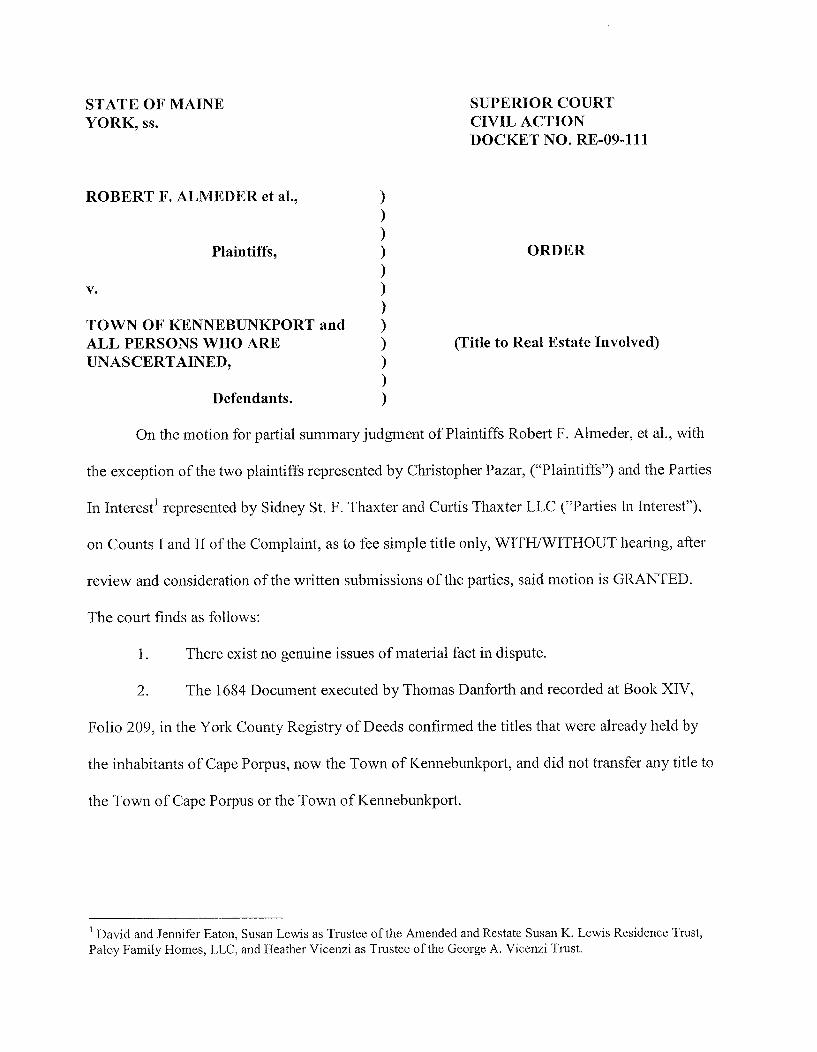
STATE OF MAINE YORK, ss.
SUPERIOR COURT CIVIL ACTION DOCKET NO. RE-09-111
ROBERT F. ALMEDKR et al. ,
Plaintiffs,
TOWN OF KKNNEBUNKPORT and ALL PERSONS WHO ARK UNASCERTAINED,
(Title to Real Estate Involved)
Defendants.
On the motion for partial summary judgment of Plaintiffs Robert F. Almeder, et al. , with
the exception of the two plaintiffs represented by Christopher Pazar, (" Plaintiffs" ) and the Parties
In Interest' represented by Sidney St. F. Thaxter and Curtis Thaxter LLC (" Parties In Interest"},
on Counts I and II of the Complaint, as to fee simple title only, WITH/WITHOUT hearing, after
review and consideration of the written submissions of the parties, said motion is GRANTED.
The court finds as follows;
There exist no genuine issues of material fact in dispute.
2. The 1684 Document executed by Thomas Danforth and recorded at Book XIV,
Folio 209, in the York County Registry of Deeds confirmed the titles that were already held by
the inhabitants of Cape Porpus, now the Town of I&ennebunkport, and did not transfer any title to
the Town of Cape Porpus or the Town of Kennebunkport.
David and Jennifer Eaton, Susan Lewis as Trustee of the Amended and Restate Susan K. Lewis Residence Trust,
Paley Family Homes, LLC, and Heather Vicenzi as Trustee of the George A. Vicenzi Trust.

3. The Town of Kennebunkport does not hold a fee title interest in any portion of
Plaintiffs' properties or Goose Rocks Beach with the exception of land conveyed under a deed at
Book 2209, Page 221.
4. The Town of Kennebunkport does not have standing to challenge Plaintiffs' fee
title interest to Goose Rocks beach.
5. Plaintiffs Carolyn K. Sherman; Robert F. Almeder and Virginia S. Almeder,
Trustees of the Almeder Living Trust; John T. Coughlin and Priscilla M. Coughlin as Trustees of
P. M, C. Realty Trust; Mark E, Celi and William E. Brennan, Jr. , Trustees of the Celi
Kennebunkport Real Estate Trust No. 1; Goose Rocks Beach Holdings, LLC; Susan Jane Flynn;
Steven H. Wilson and Shawn B, McCarthy, Co-Trustees of the Twombly Family Trust; Jule C,
Gerrish; Richard M. Vandervorn, Lawrence W. Vandervoorn and Robert 0, Clemens, Trustees
of the Cornelius J. Vandervoorn Qualified Personal Residence Trust; Eugene R. Gray; Linda M.
Rice; Terrence G. O' Connor and Joan M. Leahey; Beth G. Zagoren; John O. Gallant and Sharon
A. Gallant; Edwina D. Hastings, Trustee of the Edwina D. Hastings Revocable Trust; Deborah J.
Kinney; Janice M. Fleming; William D. Forrest and Nancie M. Julian; Nancie M. Julian; christen
B. Raines; Leslie A. Josselyn-Rose, Trustee of the LAJR Trust; Alice B. Sandifer and Michael J,
Sandifer, Trustees of the Alice B. Sandifer Trust; Donna K. Lencki, Trustee of the Donna K.
Lencki Revocable Trust; Anne E, Robinson, Thomas D. Robinson, II, and Christian Barner,
Successor Trustees of the Louise S. DeMallie Revocable Trust; Eleanor A. Scribner and Robert
H. Scribner, Trustees of the Eleanor A. Scribner Qualified Personal Residence Trust; Christopher
B. Asplundh; Willard Parker Dwelley, Jr. , and W. Parker Dwelley, III and John H, Dwelley, Co-
Trustees of the Joan H. Dwelley Testamentary Trust; J. Liener Temerlin and Karla Sue Temerlin,
Trustees of the Temerlin 1998 Family Trust, and their successors in interest, hold fee title to their

properties at Goose Rock Beach, as described in their respective deeds and the deeds of the
predecessors' in interest, and recorded in the York Registry of Deeds to the low water mark
subject to easements and mortgages of record.
5. For over four (4) years, Plaintiffs and those under whom they claim have been in
uninterrupted possession of Plaintiffs' respective properties.
6. Plaintiffs, aforementioned above, are entitled to judgment as a matter of law on
Count I and II of their Complaint and entry for summary judgment is appropriate against
defendant Town of Kennebunkport and all other defendants and persons who are unascertained,
not in being, unknown or out of the State, heirs or legal representatives of such unascertained
persons, or such persons as shall become heirs, devisees or appointees of such unascertained
persons who claim title interest in Plaintiffs' Property other than persons claiming ownership or
easement by, through, or under an instrument recorded in the York County Registry of Deeds,
but not including the 1684 Danforth Document relied on by the Town of Kennebunkport for its
title.
7. Defendant Town of Kennebunkport and all other defendants and every person
claiming by, through or under them are barred absolutely from claiming a fee simple title interest
in Plaintiffs' respective properties,
8. The Plaintiffs are vested with fee simple title to their respective properties situated
at Goose Rocks Beach free and clear of all claims by the Town of Kennebunkport and all other
defendants or any person claiming by through or under them.
IT IS SO ORDERED that summary judgment is entered in favor of the Plaintiffs Carolyn
K. Sherman; Robert F. Almeder and Virginia S. Almeder, Trustees of the Almeder Living Trust;
John T. Coughlin and Priscilla M. Coughlin as Trustees of P. M. C. Realty Trust; Mark E. Celi

and William E. Brennan, Jr. , Trustees of the Celi Kennebunkport Real Estate Trust No. 1; Goose
Rocks Beach Holdings, LLC; Susan Jane Flynn; Steven H. Wilson and Shawn B. McCarthy, Co-
Trustees of the Twombly Family Trust; Jule C. Gerrish; Richard M. Vandervorn, Lawrence W.
Vandervoorn and Robert O. Clemens, Trustees of the Cornelius J. Vandervoorn Qualified
Personal Residence Trust; Eugene R. Gray; Linda M. Rice; Terrence G. O' Connor and Joan M.
Leahey; Beth G. Zagoren; John O. Gallant and Sharon A. Gallant; Edwina D. Hastings, Trustee
of the Edwina D. Hastings Revocable Trust; Deborah J. Kinney; Janice M. Fleming; William D.
Forrest and Nancie M. Julian; Nancie M. Julian; Kristen B. Raines; Leslie A. Josselyn-Rose,
Trustee of the LAJR Trust; Alice B. Sandifer and Michael J. Sandifer, Trustees of the Alice B.
Sandifer Trust; Donna K. Lencki, Trustee of the Donna K. Lencki Revocable Trust; Anne E.
Robinson, Thomas D. Robinson, II, and Christian Barner, Successor Trustees of the Louise S.
DeMallie Revocable Trust; Eleanor A. Scribner and Robert H. Scribner, Trustees of the Eleanor
A. Scribner Qualified Personal Residence Trust; Christopher B. Asplundh; Willard Parker
Dwelley, Jr. , and W. Parker Dwelley, III and John H. Dwelley, Co-Trustees of the Joan H.
Dwelley Testamentary Trust; J. Liener Temerlin and Karla Sue Temerlin, Trustees of the
Temerlin 1998 Family Trust, and their successors in interest, on their claims of declaratory
judgment and quiet title to their respective properties at Goose Rocks Beach and against the
Town of Kennebunkport and any other defendant and persons who are unascertained, not in
being, unknown or out of the State, heirs or legal representatives of such unascertained persons,
or such persons as shall become heirs, devisees or appointees of such unascertained persons who
claim a fee simple title interest in Plaintiffs' properties at Goose Rocks Beach.
Judgment in this action shall be recorded in the York County Registry of Deeds in within
thirty (30) days after final judgment is entered in this case.

The clerk is directed to incorporate this Order into the docket by reference pursuant to M.
R. Civ. P. 79{a).
Dated: Justice, Superior Court