Objective: Collaborate with the DWR’s Division of Integrated Regional Water Management’s...
11
Land and Water Use Quantification Objective: Collaborate with the DWR’s Division of Integrated Regional Water Management’s Regional Offices to produce land and water use data for the 2013 California Water Plan Update by March 2012
-
Upload
jocelin-jacobs -
Category
Documents
-
view
219 -
download
0
Transcript of Objective: Collaborate with the DWR’s Division of Integrated Regional Water Management’s...

Land and Water Use Quantification
Objective:
Collaborate with the DWR’s Division of Integrated Regional Water Management’s Regional Offices to produce land and water use data for the 2013 California Water Plan Update by March 2012

Is everything coming together the way it should? What else is
needed?
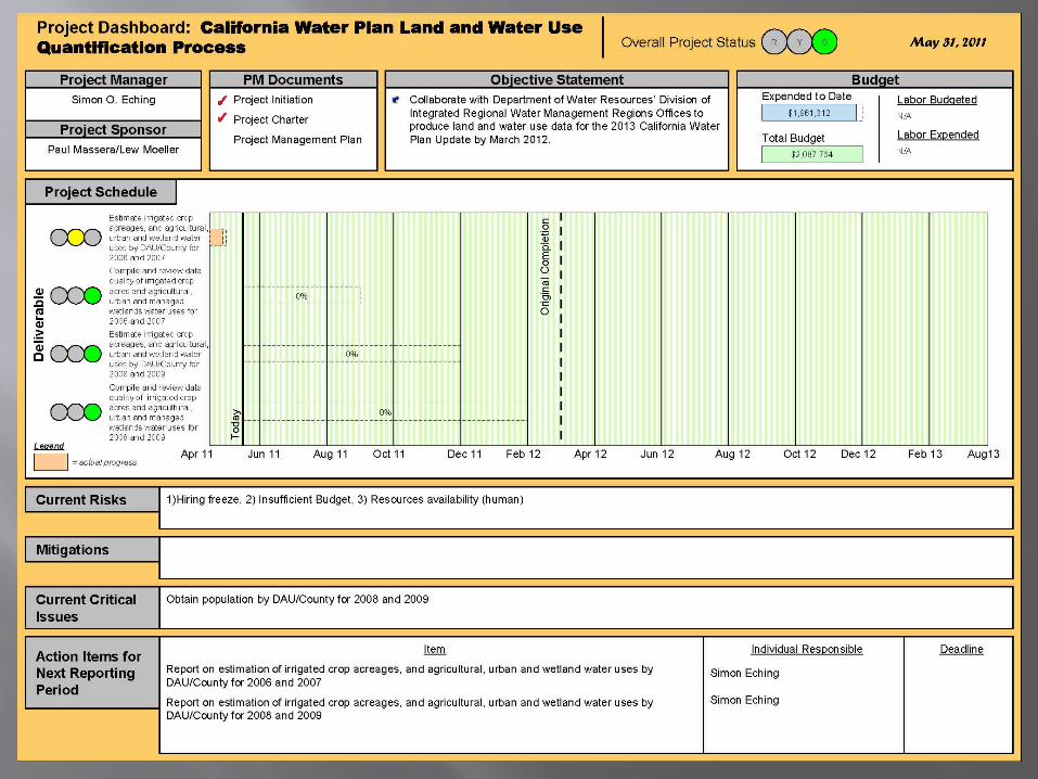
Our Challenges
Insufficient staff, time spent on competing projects
Knowledge transfer Retirements Staff transfers to other units Documentation of processes and sources of
information Budget
FY 2010/11 -- $174,000 reduction

What are the effects on land use surveys?
2006 – Alameda, Kern, Trinity, Del Norte, Humboldt, Lake
2007 – Delta, Tulare, Lassen, Plumas 2008 – Yolo, Western Fresno 2009 – Eastern Fresno, Colusa, El
Dorado, LA Aqueduct Corridor
Blue = completed Yellow = not completed
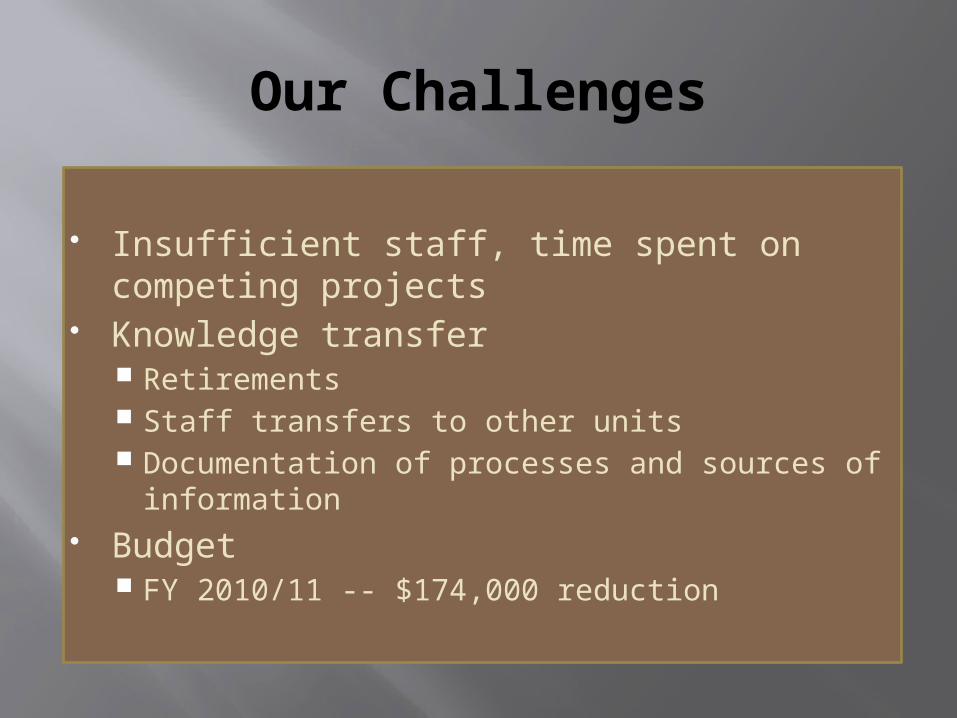
Status of Land Use Survey Data
The optimal completion date for the land use surveys conducted during the years addressed in Water Plan Update 2013 would have been March 2010.
Today, many DWR staff are working diligently to complete these surveys, but competing projects and insufficient staffing have made the process inefficient and prevented us from completing surveys in a timely manner.
Status of Land Use Survey Data
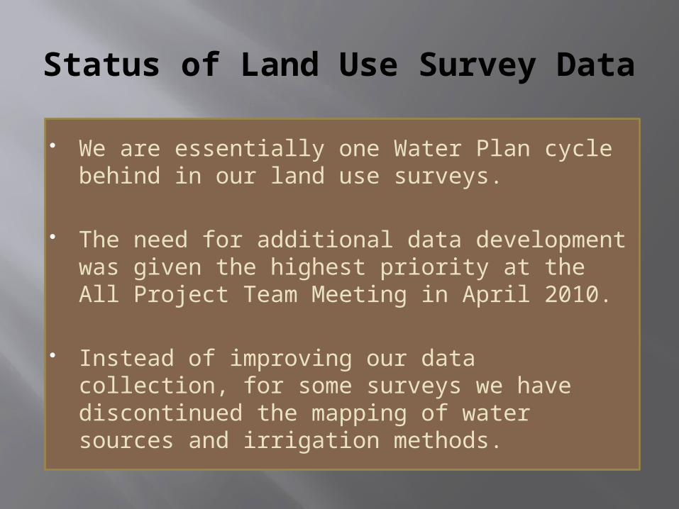
We are essentially one Water Plan cycle behind in our land use surveys.
The need for additional data development was given the highest priority at the All Project Team Meeting in April 2010.
Instead of improving our data collection, for some surveys we have discontinued the mapping of water sources and irrigation methods.
Other Data Needs: Examples
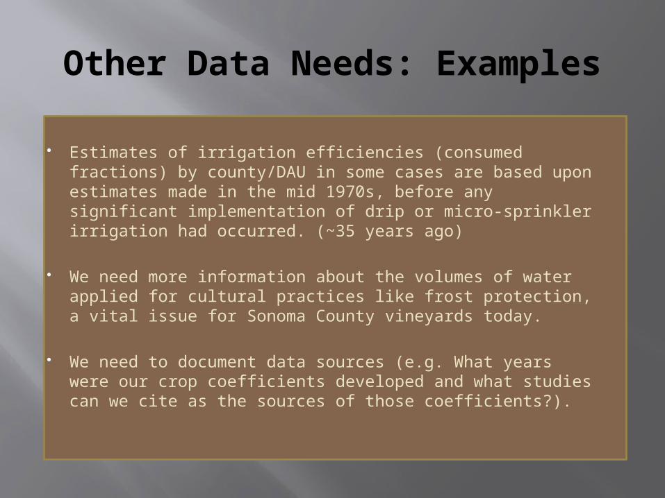
Estimates of irrigation efficiencies (consumed fractions) by county/DAU in some cases are based upon estimates made in the mid 1970s, before any significant implementation of drip or micro-sprinkler irrigation had occurred. (~35 years ago)
We need more information about the volumes of water applied for cultural practices like frost protection, a vital issue for Sonoma County vineyards today.
We need to document data sources (e.g. What years were our crop coefficients developed and what studies can we cite as the sources of those coefficients?).

Succession, Knowledge Transfer and Documentation
Retirements and the loss of staff due to transfers to different jobs will lead to a loss of institutional knowledge unless ongoing efforts are in place to document processes and data sources.
Detailed documentation has been given a low priority.
Newly hired staff will require training by existing staff, which is likely to temporarily slow data development.

What can we do to improve support for data development?
We have talked about staffing needs for land and water use data development for at least 15 years.
A decoupling between data development and water planning is occurring.
Regional planning efforts would benefit from better land and water use data.

Land and water uses are changing in California.
Ground is prepared for rice in the San Joaquin Valley. The Fresno County Agricultural
Commissioner has reported that cotton plantings declined from 213,000 acres in 2005 to 40,940 acres in 2009 .
Thousands of acres of foothill lands have been prepared for the production of permanent crops.