= copy information on slide. Delaware Geographic Alliance University of Delaware Houston, TX;...
16
= copy information on slide
-
Upload
august-hardy -
Category
Documents
-
view
215 -
download
0
Transcript of = copy information on slide. Delaware Geographic Alliance University of Delaware Houston, TX;...

= copy information on slide

Dela
ware
Geog
rap
hic
A
llia
nce
Un
ivers
ity o
f D
ela
ware
Houston, TX; Landsat-7
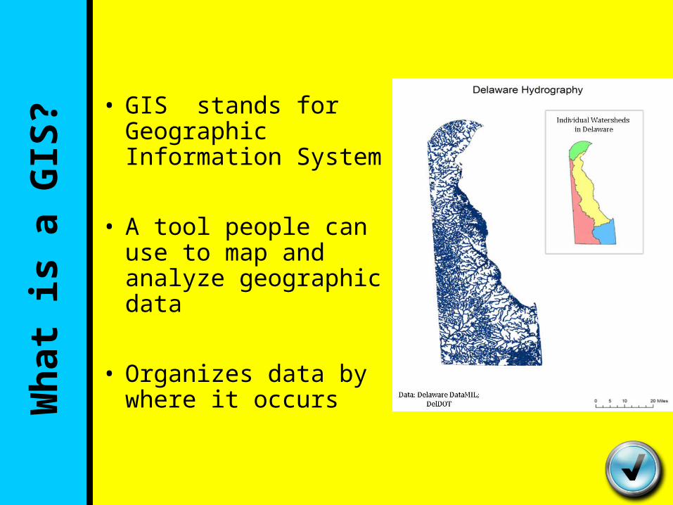
• GIS stands for Geographic Information System
• A tool people can use to map and analyze geographic data
• Organizes data by where it occursWh
at
is a
GIS
?

Wh
y is G
eog
rap
hy
Imp
ort
an
t?• Our activities and decisions involve
location in some way
• Examples: –Where to buy bread on the way home
from work–Where to build new roads or hospitals

Wh
y is G
eog
rap
hy
Imp
ort
an
t?• Relative Location:Where you are in relation to known Landmarks
““I’m in the Wawa parking lot across from I’m in the Wawa parking lot across from Christiana High School on Salem Church Christiana High School on Salem Church road.”road.”
Wh
y is G
eog
rap
hy
Imp
ort
an
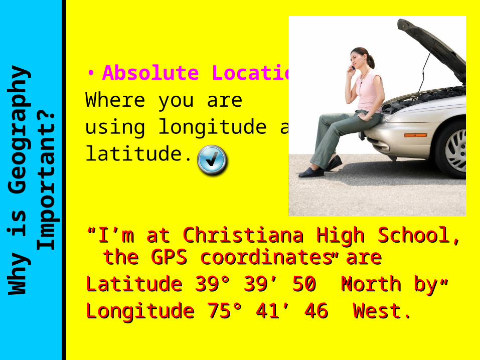
t?• Absolute Location:Where you areusing longitude and latitude.
““I’m at Christiana High School, the GPS I’m at Christiana High School, the GPS coordinates are coordinates are
Latitude 39° 39’ 50” North byLatitude 39° 39’ 50” North byLongitude 75° 41’ 46” West. ”Longitude 75° 41’ 46” West. ”

What is Remote Sensing?• Geographers use pictures taken from satellites and sensors to help solve everyday problems.
• Examples include Examples include aerial imagery, infrared aerial imagery, infrared (IR) and microwave (IR) and microwave sensors, and sonar, but sensors, and sonar, but there are many more!there are many more!
• This is known as remote sensingremote sensing

How
can
we u
se r
em
ote
sen
sin
g?
Some of the ways (but not all!) we can use remote sensing:
• Weather• Land use• Populations of
organisms in the ocean
• Monitoring sea ice

Wh
at
ag
en
cie
s m
igh
t u
se
rem
ote
sen
sin
g? • Weather forecasters
• Foresters• Agriculture• Ocean researchers• Biologists• Polar researchers
Provided by the SeaWiFS Project, NASA/Goddard Space Flight Center, and ORBIMAGE

• This is an aerial picture of the Christiana Mall as it looks today. But it didn’t always look that way!
• One way that remote sensing can be used is in tracking land use changes through time.
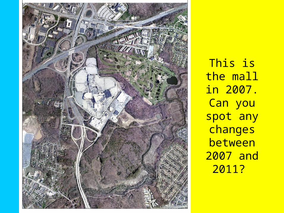
This is the mall in 2007. Can you spot any
changes between 2007
and 2011?

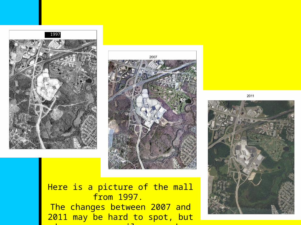
Here is a picture of the mall from 1997. The changes between 2007 and 2011 may
be hard to spot, but changes are easily seen when comparing 1997.
1997

• Remote sensing can also be used to detect vegetation and land types and even natural disasters.
• When using an infrared When using an infrared (IR) sensor, vegetation (IR) sensor, vegetation appears bright red and appears bright red and is easy to spot.is easy to spot.
• IR sensors also allow IR sensors also allow tornado tracks to be tornado tracks to be easily seeneasily seen.
LANDSAT ETM+ IR composite image of
Delaware Inland Bays
Photo from NASA Science News; ASTER sensor

Rem
ote
sen
sin
g a
nd
GIS
to
geth
er
• We can combine remote sensing and GIS together for analysis
• Example: Example: – Looking at bicycle Looking at bicycle
and pedestrian and pedestrian safety in Newarksafety in Newark
http://www.esri.com/data/esri_data/tapestry

Th
ink A
bou
t It
• Differentiate a map from a GIS.